3D object detection is an essential task of LiDAR remote sensing and has attracted much attention in recent years. Currently, the mainstream detection approaches are learning-based, which require a large amount of labeled data to support the training of models and ensure the performance of 3D detectors. However, the cost of annotation is prohibitively expensive. Reducing the reliance on a massive amount of training data with manual annotations is crucial for deploying practical models. Weakly supervised learning methods, which design feature representation mining strategies based on limited annotations, offer a promising approach to address this challenge. However, current weakly supervised learning methods still rely on complete instance-level bounding box annotations, which are undoubtedly time-consuming and labor-intensive. This paper presents SC3D, an innovative label-efficient method requiring only a single coarse click on the bird’s eye view of each LiDAR point cloud frame. A key challenge here is the absence of complete geometric descriptions of the objects from such simple click annotations. To address this issue, our proposed SC3D adopts a progressive pipeline. Initially, we design a mixed pseudo-label generation module that expands limited click annotations into a mixture of bounding box and semantic mask supervision. Next, we propose a mix-supervised teacher model that enables the detector to learn mixed supervision information. Finally, we introduce a mixed-supervised student network that leverages the teacher model’s generalization ability to learn unclicked instances. Experimental results on the widely used nuScenes and KITTI datasets demonstrate that our SC3D with only coarse clicks, which requires only 0.2% annotation cost, achieves state-of-the-art performance compared to weakly-supervised 3D detection methods.
Unsupervised 3D object detection leverages heuristic algorithms to discover potential objects, offering a promising route to reduce annotation costs in autonomous driving. Existing approaches mainly generate pseudo labels and refine them through self-training iterations. However, these pseudo-labels are often incorrect at the beginning of training, resulting in misleading the optimization process. Moreover, effectively filtering and refining them remains a critical challenge. In this paper, we propose $\textbf{OWL}$ for unsupervised 3D object detection by occupancy guided warm-up and large-model priors reasoning. OWL first employs an Occupancy Guided Warm-up (OGW) strategy to initialize the backbone weight with spatial perception capabilities, mitigating the interference of incorrect pseudo-labels on network convergence. Furthermore, OWL introduces an Instance-Cued Reasoning (ICR) module that leverages the prior knowledge of large models to assess pseudo-label quality, enabling precise filtering and refinement. Finally, we design a WAS (Weight-adapted Self-training) strategy to dynamically re-weight pseudo-labels, improving the performance through self-training. Extensive experiments on Waymo Open Dataset (WOD) and KITTI demonstrate that OWL outperforms state-of-the-art unsupervised methods by over 15.0\% mAP, revealing the effectiveness of our method.
Enhancing perception performance via multi-agent collaboration has gained increasing attention in the field of autonomous driving. However, as the number of agents grows, the manual annotation required for training collaborative detectors increases significantly. To tackle this problem, we introduce an unsupervised method that learns to Detect Objects from Multi-Agent LiDAR scans, named DOtA, without using labels from external. DOtA first generates preliminary labels by an initial detector, which is trained by internally shared information of collaborative agents. DOtA then optimizes these preliminary labels by utilizing the physical rule constraints derived from the surrounding area of the object. Building on DOtA, we further propose DOtA++, an enhanced version that improves performance by leveraging composite prior constraints. Beyond physical rule constraints, DOtA++ further uses image data as an auxiliary modality to introduce multi-agent observation consistency constraints, boosting object classification, while also incorporating point cloud geometric distribution constraints to improve structural description. Extensive experiments on widely-used benchmarks demonstrate that DOtA and DOtA++ effectively perceive potential objects in the scene without manual annotations. In particular, DOtA++ shows 10.7% mAP improvement over traditional unsupervised methods on V2X-R dataset.
Reliable navigation and decision-making of autonomous vehicles require both accurate localization and object detection. Traditionally, these two tasks are handled separately, leading to redundant computation and limited cross-task knowledge transfer. This paper proposes TACO, the first Task-Aware COntrastive learning framework, which performs joint LiDAR localization and 3D object detection within a single, unified network. TACO leverages contrastive learning to explicitly decouple and align static geographic features for localization and object-centric features for detection. This bidirectional mutual supervision not only enhances localization robustness in dynamic environments by filtering dynamic noise but also boosts detection accuracy via effective spatial context. Additionally, we propose OxfoLD, the first dataset that provides multi-traversal LiDAR localization ground truth with rich 3D object annotations, thereby supporting task validation across various times and weather conditions. Experimental results demonstrate that TACO achieves state-of-the-art localization accuracy while maintaining competitive detection performance. The code and dataset will be released.
LiDAR-based 3D object detection is crucial for autonomous driving. However, due to the quality deterioration of LiDAR point clouds, it suffers from performance degradation in adverse weather conditions. Fusing LiDAR with the weatherrobust 4D radar sensor is expected to solve this problem; however, it faces challenges of significant differences in terms of data quality and the degree of degradation in adverse weather. To address these issues, we introduce L4DR, a weather-robust 3D object detection method that effectively achieves LiDAR and 4D Radar fusion. Our L4DR proposes Multi-Modal Encoding (MME) and Foreground-Aware Denoising (FAD) modules to reconcile sensor gaps, which is the first exploration of the complementarity of early fusion between LiDAR and 4D radar. Additionally, we design an Inter-Modal and IntraModal ({IM}2) parallel feature extraction backbone coupled with a Multi-Scale Gated Fusion (MSGF) module to counteract the varying degrees of sensor degradation under adverse weather conditions. Experimental evaluation on a VoD dataset with simulated fog proves that L4DR is more adaptable to changing weather conditions. It delivers a significant performance increase under different fog levels, improving the 3D mAP by up to 20.0% over the traditional LiDAR-only approach. Moreover, the results on the K-Radar dataset validate the consistent performance improvement of L4DR in realworld adverse weather conditions.
Recently, learning-based multi-agent cooperative perception has garnered widespread attention. However, the inherent vulnerabilities of neural networks, combined with the risks posed by cooperative communication as a wideopen backdoor, render these systems highly susceptible to adversarial attacks. Existing attack methods lack stealth as they perturb transmitted information indiscriminately, producing numerous false positives that are readily detected by consensus-based defenses. This paper proposes Pretend Benign (PB), a novel stealthy adversarial attack method that exploits vulnerabilities in cooperative perception to enable the attacker to disguise as a benign cooperator. To achieve this, we first introduce the Attack Region Selection (ARS) module, which divides the perception area into subregions based on confidence levels to pinpoint optimal attack locations. Then, we propose Multi-target Adversarial Perturbation Generation (MAPG), which maintains consensus, gain the victim's trust, and thereby reverse the normal cooperative role of perception. To mitigate the latency in adversarial signal generation and communication, we further propose a real-time attack by predicting future information through historical feature flow. Extensive experiments on the OPV2V and V2XSet datasets demonstrate that PB effectively bypasses state-of-the-art defense methods, underscoring its stealth and efficacy.
LiDAR-based 3D object detection and semantic segmentation are critical tasks in 3D scene understanding. Traditional detection and segmentation methods supervise their models through bounding box labels and semantic mask labels. However, these two independent labels inherently contain significant redundancy. This paper aims to eliminate the redundancy by supervising 3D object detection using only semantic labels. However, the challenge arises due to the incomplete geometry structure and boundary ambiguity of point-cloud instances, leading to inaccurate pseudo labels and poor detection results. To address these challenges, we propose a novel method, named Seg2Box. We first introduce a Multi-Frame Multi-Scale Clustering (MFMS-C) module, which leverages the spatio-temporal consistency of point clouds to generate accurate box-level pseudo-labels. Additionally, the Semantic?Guiding Iterative-Mining Self-Training (SGIM-ST) module is proposed to enhance the performance by progressively refining the pseudo-labels and mining the instances without generating pseudo-labels. Experiments on the Waymo Open Dataset and nuScenes Dataset show that our method significantly outperforms other competitive methods by 23.7% and 10.3% in mAP, respectively. The results demonstrate the great label-efficient potential and advancement of our method.
The performance of unsupervised 3D object classification and bounding box regression relies heavily on the quality of initial pseudo-labels. Traditionally, the labels of classification and regression are represented by a single set of candidate boxes generated by motion or geometry heuristics. However, due to the similarity of many objects to the background in shape or lack of motion, the labels often fail to achieve high accuracy in two tasks simultaneously. Using these labels to directly train the network results in decreased detection performance. To address this challenge, we introduce Motal that performs unsupervised 3D object detection by Modality and task-specific know ledge transfer. Motal decouples the pseudo-labels into two sets of candidates, from which Motal discovers classification knowledge by motion and image appearance prior, and discovers box regression knowledge by geometry prior, respectively. Motal finally transfers all knowledge to a single student network by a TMT (Task-specific Masked Training) scheme, attaining high performance in both classification and regression. Motal can greatly enhance various unsupervised methods by about 2 × mAP. For example, on the WOD test set, Motal improves the state-of-the-art CPD by 2 1. 5 6% mAP L1 (from 20.54% to 42.10%) and 1 9. 9 0% mAP L2 (from 18.18% to 38.08%). These achievements highlight the significance of our method.
Accurate perception of UAVs in complex low-altitude environments is critical for airspace security and related intelligent systems. Developing reliable solutions requires large-scale, accurately annotated, and multimodal data. However, real-world UAV data collection faces inherent constraints due to airspace regulations, privacy concerns, and environmental variability, while manual annotation of 3D poses and cross-modal correspondences is time-consuming and costly. To overcome these challenges, we introduce UAV-MM3D, a high-fidelity multimodal synthetic dataset for low-altitude UAV perception and motion understanding. It comprises 400K synchronized frames across diverse scenes (urban areas, suburbs, forests, coastal regions) and weather conditions (clear, cloudy, rainy, foggy), featuring multiple UAV models (micro, small, medium-sized) and five modalities - RGB, IR, LiDAR, Radar, and DVS (Dynamic Vision Sensor). Each frame provides 2D/3D bounding boxes, 6-DoF poses, and instance-level annotations, enabling core tasks related to UAVs such as 3D detection, pose estimation, target tracking, and short-term trajectory forecasting. We further propose LGFusionNet, a LiDAR-guided multimodal fusion baseline, and a dedicated UAV trajectory prediction baseline to facilitate benchmarking. With its controllable simulation environment, comprehensive scenario coverage, and rich annotations, UAV3D offers a public benchmark for advancing 3D perception of UAVs.
3D object detection is an essential scene perception capability for autonomous vehicles. In intelligent transportation systems, autonomous vehicles require minimal inference latency to sense their surroundings in real-time. However, advanced 3D detection methods often suffer from high inference latency. This limits the real-time deployment of 3D detection models in the real world. To address this problem, this paper proposes a fast and deployable 3D object detection method from the LiDAR point cloud for autonomous driving, named Fade3D. Firstly, we propose a Lightweight Input Encoder (LIE) to extract the most critical features from point clouds. Then, we develop a Spatial Feature Enhancement BEV backbone (SFENet) that efficiently encodes geometry features into compact representations. Additionally, we design an IoU-aware Loss Re-weighting (ILR) that enhances performance by shifting more attention to hard samples. Leveraging LIE and SFENet, our approach is independent of point cloud density and number, achieving significant speed advantages in processing large-scale point clouds and being deployment-friendly. Extensive experiments on KITTI and Waymo Open Dataset (WOD) datasets comparing various baseline detectors demonstrate its universality and superiority. Specifically, our method demonstrates impressive real-time inference capabilities, achieving 51.5 Hz on an RTX3090 GPU and 12.4 Hz on a Jetson Orin embedded development board. Code will be available at https://github.com/wayyeah/Fade3D
Recently, sparsely-supervised 3D object detection has gained great attention, achieving performance close to fully-supervised 3D detectors while requiring only a few annotated instances. Nevertheless, these methods suffer challenges when accurate labels are extremely absent. In this paper, we propose a boosting strategy, termed SP3D, explicitly utilizing the cross-modal semantic prompts generated from Large Multimodal Models (LMMs) to boost the 3D detector with robust feature discrimination capability under sparse annotation settings. Specifically, we first develop a Confident Points Semantic Transfer (CPST) module that generates accurate cross-modal semantic prompts through boundary-constrained center cluster selection. Based on these accurate semantic prompts, which we treat as seed points, we introduce a Dynamic Cluster Pseudo-label Generation (DCPG) module to yield pseudo-supervision signals from the geometry shape of multi-scale neighbor points. Additionally, we design a Distribution Shape score (DS score) that chooses high-quality supervision signals for the initial training of the 3D detector. Experiments on the KITTI dataset and Waymo Open Dataset (WOD) have validated that SP3D can enhance the performance of sparsely supervised detectors by a large margin under meager labeling conditions. Moreover, we verified SP3D in the zero-shot setting, where its performance exceeded that of the state-of-the-art methods. The code is available at https://github.com/xmuqimingxia/SP3D.
Traditional 3D object detectors, whether fully-, semi-, or weakly-supervised, rely heavily on extensive human annotations. In contrast, this paper introduces an unsupervised 3D object detector that automatically discerns object patterns without such annotations. To achieve this, we propose a Commonsense Prototype-based Detector (CPD) for unsupervised 3D object detection. CPD first constructs Commonsense Prototypes (CProto) to represent the geometric center and size of objects. It then generates high-quality pseudo-labels and guides detector convergence using size and geometry priors from CProto. Building on CPD, we further introduce CPD++, an enhanced version that improves performance by leveraging motion cues. CPD++ learns localization from stationary objects and recognition from moving objects, facilitating the mutual transfer of localization and recognition knowledge between these two object types. Both CPD and CPD++ outperform existing state-of-the-art unsupervised 3D detectors. Furthermore, when trained on Waymo Open Dataset (WOD) and tested on KITTI, CPD++ achieves 89.25% 3D Average Precision (AP) on the moderate car class at a 0.5 IoU threshold, reaching 95.3% of the performance attained by fully supervised counterparts. These results underscore the significant advancements brought by our method.
3D visual grounding aims to localize the object in 3D point cloud scenes that semantically corresponds to given natural language sentences. It is very critical for roadside infrastructure system to interpret natural languages and localize relevant target objects in complex traffic environments. However, most existing datasets and approaches for 3D visual grounding focus on the indoor and outdoor driving scenes, outdoor monitoring scenarios remain unexplored due to scarcity of paired point cloud-text data captured by roadside infrastructure sensors. In this paper, we introduce a novel task of 3D Visual Grounding for Outdoor Monitoring Scenarios, which enables infrastructure-level understanding of traffic scenes beyond the ego-vehicle perspective. To support this task, we construct MoniRefer, the first real-world large-scale multi-modal dataset for roadside-level 3D visual grounding. The dataset consists of about 136,018 objects with 411,128 natural language expressions collected from multiple complex traffic intersections in the real-world environments. To ensure the quality and accuracy of the dataset, we manually verified all linguistic descriptions and 3D labels for objects. Additionally, we also propose a new end-to-end method, named Moni3DVG, which utilizes the rich appearance information provided by images and geometry and optical information from point cloud for multi-modal feature learning and 3D object localization. Extensive experiments and ablation studies on the proposed benchmarks demonstrate the superiority and effectiveness of our method. Our dataset and code will be released.
Current sparsely-supervised object detection methods largely depend on high threshold settings to derive high-quality pseudo labels from detector predictions. However, hard instances within point clouds frequently display incomplete structures, causing decreased confidence scores in their assigned pseudo-labels. Previous methods inevitably result in inadequate positive supervision for these instances. To address this problem, we propose a novel Hard INsTance Enhanced Detector (HINTED), for sparsely-supervised 3D object detection. Firstly, we design a self-boosting teacher (SBT) model to generate more potential pseudo-labels, enhancing the effectiveness of information transfer. Then, we introduce a mixed-density student (MDS) model to concentrate on hard instances during the training phase, thereby improving detection accuracy. Our extensive experiments on the KITTI dataset validate our method's superior performance. Compared with leading sparsely-supervised methods, HINTED significantly improves the detection performance on hard instances, no-tably outperforming fully-supervised methods in detecting challenging categories like cyclists. HINTED also significantly outperforms the state-of-the-art semi-supervised method on challenging categories. The code is available at https://github.com/xmuqimingxia/HINTED.
This paper introduces HPC-Net, a high-precision and rapidly convergent object detection network.
LiDAR-based outdoor 3D object detection has received widespread attention. However, training 3D detectors from the LiDAR point cloud typically relies on expensive bounding box annotations. This paper presents SC3D, an innovative label-efficient method requiring only a single coarse click on the bird's eye view of the 3D point cloud for each frame. A key challenge here is the absence of complete geometric descriptions of the target objects from such simple click annotations. To address this issue, our proposed SC3D adopts a progressive pipeline. Initially, we design a mixed pseudo-label generation module that expands limited click annotations into a mixture of bounding box and semantic mask supervision. Next, we propose a mix-supervised teacher model, enabling the detector to learn mixed supervision information. Finally, we introduce a mixed-supervised student network that leverages the teacher model's generalization ability to learn unclicked instances.Experimental results on the widely used nuScenes and KITTI datasets demonstrate that our SC3D with only coarse clicks, which requires only 0.2 state-of-the-art performance compared to weakly-supervised 3D detection methods.The code will be made publicly available.
Point cloud data, representing the precise 3D layout of the scene, quickly drives the research of 3D object detection. However, the challenge arises due to the rapid iteration of 3D sensors, which leads to significantly different distributions in point clouds. This, in turn, results in subpar performance of 3D cross-sensor object detection. This paper introduces a Cross Mechanism Dataset, named CMD, to support research tackling this challenge. CMD is the first domain adaptation dataset, comprehensively encompassing diverse mechanical sensors and various scenes for 3D object detection. In terms of sensors, CMD includes 32-beam LiDAR, 128-beam LiDAR, solid-state LiDAR, 4D millimeter-wave radar, and cameras, all of which are well-synchronized and calibrated. Regarding the scenes, CMD consists of 50 sequences collocated from different scenarios, ranging from campuses to highways. Furthermore, we validated the effectiveness of various domain adaptation methods in mitigating sensor-based domain differences. We also proposed a DIG method to reduce domain disparities from the perspectives of Density, Intensity, and Geometry, which effectively bridges the domain gap between different sensors. The experimental results on the CMD dataset show that our proposed DIG method outperforms the state-of-the-art techniques, demonstrating the effectiveness of our baseline method. The dataset and the corresponding code are available at https://github.com/im-djh/CMD.
LiDAR-based 3D object detection models inevitably struggle under rainy conditions due to the degraded and noisy scanning signals. Previous research has attempted to address this by simulating the noise from rain to improve the robustness of detection models. However, significant disparities exist between simulated and actual rain-impacted data points. In this work, we propose a novel rain simulation method, termed DRET, that unifies Dynamics and Rainy Environment Theory to provide a cost-effective means of expanding the available realistic rain data for 3D detection training. Furthermore, we present a Sunny-to-Rainy Knowledge Distillation (SRKD) approach to enhance 3D detection under rainy conditions. Extensive experiments on the Waymo-Open-Dataset show that, when combined with the state-of-the-art DSVT model and other classical 3D detectors, our proposed framework demonstrates significant detection accuracy improvements, without losing efficiency. Remarkably, our framework also improves detection capabilities under sunny conditions, therefore offering a robust solution for 3D detection regardless of whether the weather is rainy or sunny.
The prevalent approaches of unsupervised 3D object detection follow cluster-based pseudo-label generation and iterative self-training processes. However, the challenge arises due to the sparsity of LiDAR scans, which leads to pseudo-labels with erroneous size and position, resulting in subpar detection performance. To tackle this problem, this paper introduces a Commonsense Prototype-based Detector, termed CPD, for unsupervised 3D object detection. CPD first constructs Commonsense Prototype (CProto) characterized by high-quality bounding box and dense points, based on commonsense intuition. Subsequently, CPD refines the low-quality pseudo-labels by leveraging the size prior from CProto. Furthermore, CPD enhances the detection accuracy of sparsely scanned objects by the geometric knowledge from CProto. CPD outperforms state-of-the-art unsupervised 3D detectors on Waymo Open Dataset (WOD), PandaSet, and KITTI datasets by a large margin. Besides, by training CPD on WOD and testing on KITTI, CPD attains 90.85% and 81.01% 3D Average Precision on easy and moderate car classes, respectively. These achievements position CPD in close proximity to fully supervised detectors, highlighting the significance of our method. The code will be available at https://github.com/hailanyi/CPD.
 Chenglu Wen (温程璐)合作论文数Spatial Sensing & Computing Lab, School of Informatics, Xiamen University28
 Cheng Wang (王程)合作论文数Department of Computer Science and Technology, Xiamen University;Institute of Artificial Intelligence, Xiamen University26
 Qiming Xia (夏启明)合作论文数School of Informatics, Xiamen University15
 Xin Li (李昕)合作论文数Section of Visual Computing and Computational Media, College of Performance, Visualization, and Fine Arts, Texas A&M University;Department of Computer Science and Engineering, College of Engineering, Texas A&M University10
 Xun Huang (黄勋)合作论文数Fujian Key Laboratory of Sensing and Computing for Smart Cities, School of Informatics, Xiamen University;School of Information Technology, Xiamen University;Zhongguancun Academy7
 Jinhao Deng合作论文数4
 Yadan Luo合作论文数School of Electrical Engineering and Computer Science, Faculty of Engineering, Architecture and Information Technology, The University of Queensland;Centre for Enterprise AI, Faculty of Engineering, Architecture and Information Technology, The University of Queensland3
 Xiaoliang Fan (范晓亮)合作论文数School of Informatics, Xiamen University3
 Wei Ye合作论文数2Shijia Zhao合作论文数2Jonathan Li合作论文数2
 Shaoshuai Shi合作论文数AI Research, DiDi Autonomous Driving;Max Planck Institute for Informatics2
 Wenkai Han合作论文数Anhui Normal University, Anhui Normal University2
 Wei Li (李伟)合作论文数School of Information and Electronics, Beijing Institute of Technology2
 Yulan Guo (郭裕兰)合作论文数School of Electronics and Communication Engineering, Sun Yat-sen University2
 Leyuan Xing (邢乐园)合作论文数School of Informatics, Xiamen University;Department of Computer Science and Technology, Xiamen University1Dongyu Pan合作论文数1Mingming Wang合作论文数1Xusheng Guo合作论文数1Ziyu Xu合作论文数1Jinlong Wang合作论文数1Maoji Zheng合作论文数1Pufan Zou合作论文数1Jin Fang合作论文数1Hongwei Lin合作论文数1
 Wen Li (李文)合作论文数Fujian Key Laboratory of Sensing and Computing for Smart Cities, Xiamen University;Key Laboratory of Multimedia Trusted Perception and Efficient Computing, Ministry of Education of China, Xiamen University;spAtial Sensing and Computing Lab, Xiamen University1
 Kezheng Xiong (熊恪峥)合作论文数Department of Artificial Intelligence, Xiamen University;Spatial Sensing and Computing Lab, Xiamen University;School of Informatics, Xiamen University1
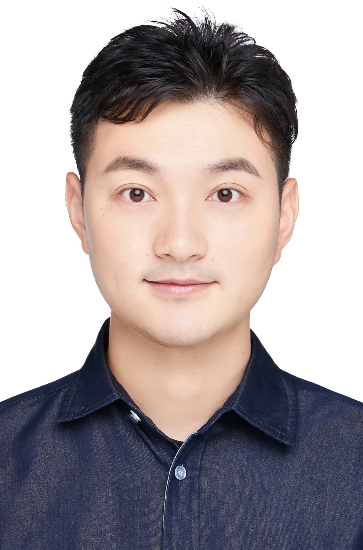 Yan Xia (夏彦)合作论文数School of Artificial Intelligence and Data Science, University of Science and Technology of China1
 Changbin You合作论文数1
 Li Jiang合作论文数School of Data Science, The Chinese University of Hong Kong (Shenzhen)1
 Kyle Gao合作论文数Department of Geography and Environmental Management, University of Waterloo1
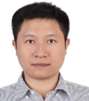 Siqi Shen (沈思淇)合作论文数SpAtial Sensing and Computing Lab, School of Informatics, Xiamen University1Jiashi Zhao合作论文数1
 Junhui Hou (侯軍輝)合作论文数Department of Computer Science, City University of Hong Kong1
 Longbiao Chen (陈龙彪)合作论文数Department of Computer Science, School of Informatics, Xiamen University;Fujian Key Laboratory of Sensing and Computing for Smart City, School of Informatics, Xiamen University1
 Yudi Dai合作论文数Department of Computer Science, ETH Zurich;ETH AI Center, ETH Zurich1
 Ruigang Yang (杨睿刚)合作论文数Global Institute of Future Technology, Shanghai Jiao Tong University1
 Yaowei Wang (王耀威)合作论文数School of Computer Science and Technology, Harbin Institute of Technology (Shenzhen);Network Intelligence Research Department, Pengcheng Laboratory;Visual Intelligence Institute, Pengcheng Laboratory;Institute of Advanced Technology, University of Science and Technology of China1
 Longkun Zou合作论文数School of Computer Science and Engineering, South China University of Technology1Zhen Dong (董振)合作论文数School of Mechanical Engineering, Guangxi University1
 Qing Li (李青)合作论文数State key Laboratory of Marine Environmental Science, Xiamen University1




