Urbanization drives habitat loss and fragmentation, posing serious threats to biodiversity. Butterfly is a key bioindicator taxon for assessing urban ecosystem health. Many studies have investigated the effects of park features and within-park configuration on butterfly diversity separately. However, their relative importance and potential interactions remain poorly understood. We address this issue based on field-based butterfly surveys with landscape pattern metrics, focusing on the urban parks within the fifth Ring Road of Beijing. We found at the park level, park size was positively correlated only with total abundance, showing no significant association with richness or the Shannon-Wiener index. In contrast, the perimeter-area ratio (PARA) showed a significantly negative correlation with both richness and the Shannon-Wiener index. The within-park configuration also significantly affects butterfly diversity. The mean patch size (AREA_AM) was positively correlated with all three diversity indices, and the largest patch index (LPI) was a significant predictor of the Shannon-Wiener index. The comparison of the relative importance showed that PARA had a stronger negative effect on richness and the Shannon-Wiener index than within-park configuration metrics, highlighting the critical role of park shape. For total abundance, park size was the only significant predictor. More importantly, a significant interaction was observed between park size and PARA for the Shannon-Wiener index. More specifically, the negative effect of PARA diminished with the increase of park size, indicating that optimizing park shape is particularly effective for enhancing butterfly diversity in small parks, whereas increasing total habitat area in large parks can buffer the negative effects of irregular shapes. These findings provide important insights on urban park management for biodiversity conservation.
The natural manipulative experimentꎬ by controlling influencing factors appropriately to study changes in the ecosystem under natural conditionsꎬ has become more and more popular with ecologists. This articleꎬ which focused on the experimental design methods of urban ecology ( such as artificial gradientsꎬ natural gradients and urban construction experiments)ꎬ environmental factors ( such as air pollutionꎬ heat islandsꎬ nightlight and surface hardening) and the response of urban ecosystems (such as communitiesꎬ green spacesꎬ green roofs and watersheds)ꎬ reviewed a great number of cases using natural manipulative experiments in urban ecology at home and abroad. It also summarized the characteristics of the natural manipulative experiment of urban ecologyꎬ pointed out that the main problems which should be considered in the urban ecology manipulative experimentꎬ and proposed the main development direction in the future: (1) Manipulative experiments on the compound impact of multiple environmental factorsꎻ (2) Manipulative experiments on the response of the ecosystem structure and functionꎻ (3) Long-term near-natural manipulative experimentsꎻ (4) Large-scale network of manipulative experimentsꎻ (5) Manipulative experiments on the urban ecological restoration and construction. We hope that
稳定同位素技术已被广泛应用于环境领域的鉴定、溯源、CN循环、反应机理等研究,检测样品的采集和前处理方法会直接影响研究结论.综述了目前在环境样品自然丰度的轻稳定同位素研究中,已被认可的样品采集和前处理方法的应用与进展,包括气体及其颗粒物样品、植物样品、沉积物样品、土壤样品、水样、生物样品和地质样品,为进一步提高数据的准确性、可靠性和多样性提供技术支持.
城市植物是城市生物多样性的重要组成部分.城市植物多样性的长期定点监测与研究对保护城市生物多样性具有重要的意义.本文基于2007、2014和2020年对北京城区中的植物物种的三次实地调查结果,整理出北京城区植物物种名录数据集.本数据集包括维管植物物种130科535属1059种.通过对北京城区植物物种的全面摸底调查和长期监测,为城市植物多样性时空格局、植物对城市变化环境的响应等方面的研究提供数据支持.
我国澳门特别行政区是世界上人口密度最高的地区之一,人地关系紧张.随着城市和经济的发展,人类空间与生态空间失调,城市生态和人居环境问题不断加剧.在建设美丽湾区、美丽澳门和人们对美好人居环境需求的背景下,通过划定城市生态保护红线以控制和维持现有重要功能生态空间,保护和改善高敏感生态空间,维护区域生态安全显得尤为重要.基于对澳门陆域生态系统调查,结合城市和自然资源特征,从生态系统服务功能、生态系统敏感性、生物多样性分布以及现有生态保护区四个方面构建了城市生态保护红线划定方法框架,选取并评估水源涵养、雨洪调节、热岛调节、土壤保持、海岸带防护五类调节服务和生态系统服务中的休闲游憩的空间格局,水土流失敏感性和海岸带风暴潮敏感性两种生态敏感性的分布,并综合澳门具有保育价值生物的栖息地分布和现有保护区范围进行了城市生态保护红线的划定.研究结果显示,澳门城市生态保护红线区域总面积6.71km2,占研究区面积的19.79%,覆盖了44%的生态空间、12.4%的海岸线、所有的重要物种栖息地及三分之一的古树名木.依照此生态保护红线研究进一步提出针对各类红线地块的保护和管理措施.研究提出的城市生态保护红线划定思路,可以为其他城市的重要生态空间保护、修复与管理提供参考.
Urban rivers and lakes, in combination with nearby green spaces, provide important habitat for urban birds, but few urban studies have focused on forest and water birds simultaneously along an urban intensity gradient. In this study, we randomly chose 39 rivers and lakes along an urban gradient of Beijing to examine bird community parameters in relation to aquatic and terrestrial habitat conditions, aquatic life data, and water quality data. We selected models with the AICc (corrected Akaike information criterion) method, bivariate linear or generalized linear regressions, and structural equation modeling to determine distribution patterns of avian communities along an urban gradient and bird-environment relationships. We found that both forest and water bird species and individuals peaked at intermediate urbanization intensities, especially for abundance of both forest and water bird and water bird species richness and abundance. We suggest that the differences in the strength of response to urbanization and the similarities in the gradient distribution pattern between forest and water birds should receive more attention in future urbanization gradient studies. Significant correlation ship between species richness of resident water birds, fish foragers, and insectivore-frugivores, abundance of insectivores, insectivore-frugivores (negative), and granivores (positive) and impervious surface proportion within 1-km radius buffer of sampled sites became more evident after coverage of artificial surfaces exceeded a 50% threshold. Regressions showed that distance from the urban center, number of islands in waterbody, and proportion of gross or unarmored shoreline length were significantly and positively related to species richness and abundance of both forest and water birds. The availability of unarmored shoreline is a critical pathway through which urbanization detrimentally impacts avian diversity. Our results demonstrate how the urban intensity gradient affects the relative availability of food resources and habitat, which could provide practical applications for urban landscape planning and avian biodiversity conservation in urban areas.
浮游植物是水生生态系统的主要生产者,其群落结构与水质密切相关.为研究北京市北运河不同水体环境特征,于2018年10月(秋季)和2019年2月(冬季)在北京市北运河设置13个采样点开展浮游植物群落结构和水环境调查,共鉴定出浮游植物7门54属99种.群落结构分析表明,秋季浮游植物物种数(75种)高于冬季(58种),城市河道型水体物种数(78种)>城市湖泊型(59种)>山区河道型(29种).秋季浮游植物密度为916.04×10⁴ cells·L-1,冬季浮游植物密度为220.52× 10⁴ cells· L-1,秋、冬季平均密度为568.28× 10⁴ cells·L-1.空间格局上,城市湖泊型水体浮游植物密度最高,绿藻门和蓝藻门为优势门类;城市河道型水体次之,大部分点位以硅藻门、绿藻门和蓝藻门为优势门类;山区河道型水体最低,硅藻门为主要优势门类.物种优势度和多样性指数分析结果显示,北京市北运河水体中以中富营养型指示物种为优势类群,水质污染类型为β-中污型.典范对应分析(CCA)排序结果表明,Ca和TN是影响秋季北京市北运河浮游植物群落结构的主要环境因子,pH是影响冬季浮游植物群落结构的主要环境因子.
Urban green space is an important refuge of biodiversity in urban areas. Therefore, it is crucial to understand the relationship between the landscape pattern of green spaces and biodiversity to mitigate the negative effects of urbanization. In this study, we collected insects from 45 green patches in Beijing during July 2012 using suction sampling. The green patches were dominated by managed lawns, mixed with scattered trees and shrubs. We examined the effects of landscape pattern on insect species density using hierarchical partitioning analysis and partial least squares regression. The results of the hierarchical partitioning analysis indicated that five explanatory variables, i.e., patch area (with 19.9% independent effects), connectivity (13.9%), distance to nearest patch (13.8%), diversity for patch types (11.0%), and patch shape (8.3%), significantly contributed to insect species density. With the partial least squares regression model, we found species density was negatively related to patch area, shape, connectivity, diversity for patch types and proportion of impervious surface at the significance level of p < 0.05 and positively related to proportion of vegetated land. Regression tree analysis further showed that the highest species density was found in green patches with an area <500 m2. Our results indicated that improvement in habitat quality, such as patch area and connectivity that are typically thought to be important for conservation, did not actually increase species density. However, increasing compactness (low-edge) of patch shape and landscape composition did have the expected effect. Therefore, it is recommended that the composition of the surrounding landscape should be considered simultaneously with planned improvements in local habitat quality.
ABSTRACT This paper reports on the remarkable results we achieved with a novel, inexpensive collecting method, i.e. band-shelter trapping, during a survey conducted in 25 urban parks and greenbelts in the Beijing metropolitan area from April to October during 2007–2009. The trap was made of 3-cm wide, opaque, plastic fiber, wrapped around willow tree trunks (Salix spp.) at a height of 1.5 m height. Traps were checked every two weeks. We collected a total of 45,074 weevils, of which 817 belong to five species unrecorded from China, i.e., Melanapion mandli (Schubert), Asperogronops inaequalis (Boheman), Dorytomus occallescens (Gyllenhal), Ellescus schoenherri (Faust), and Tachyerges pseudostigma (Tempère). Moreover, we collected 43,952 individuals of Melanapion naga (Nakane), Dorytomus alternans Faust, Dorytomus roelofsi Faust, and Dorytomus setosus Zumpt, which are new records for Beijing. The genera Asperogronops Solari and Ellescus Dejean are newly recorded for China. During their seasonal peak, we frequently and abundantly collected D. setosus and D. roelofsi with band-shelter traps, but never by sweeping, beating, or light trapping methods. A review of the biology of these species shows that all have a short active season and prefer shaded tree trunks. Band-shelter traps appear to effectively capture species with these characteristics and underline the importance of collecting methods that take into account the specific life strategy of target species.
As degree of urbanization continues to increase, a better understanding of the relationship between degree of urbanization and level of biodiversity is important for developing strategies to mitigate detrimental impacts of urbanization and to build sustainable cities. Dorytomus Gemar weevils are host specific on Salix L. and Populus L. trees which are commonly used for urban afforesting and greening and abundant in Beijing metropolitan area which can be divided into five concentric zones. We aim to reveal their distribution pattern and identify important determinants of their persistence in those zones. Our results showed that Dorytomus species number and abundance decreased gradually from outskirt to urban center. This pattern could be predicted by built-up ratio within 1–3km, distance to urban centre and to a possible nearest population source in outskirt, but not by hostplant species number and abundance, habitat size and shape measured at habitat scale. The results indicate that (i) there is a negative relationship between degree of urbanization and Dorytomus species persistence in urban areas; (ii) efforts for Dorytomus weevil conservation should not only focus on remnant revegetation, but also be directed to regulate the ratio of built-up area and minimize isolation from nearby occupied patches; and (iii) built-up ratio in inner city should be lower as urban sprawls. To better understand the relationship between urbanization degree and species persistence and to offer realistic suggestions for urban landscape planners, further research involving multiple taxa and the synthesis of the ecological responses of different taxonomical groups are needed.
Beijing, the capital and second largest city of China, expanded in a typical concentric pattern. The urbanized area consists of five concentric zones, which are based on the city’s ring road system. Willow trees ( Salix spp.) are commonly planted and abundant in the city. In this study, we determined the effects of urbanization on willow trunk-dwelling weevils (Coleoptera: Curculionoidea) in a 3-year survey. Our results indicated that species richness and abundance decreased from outskirts to the urban center. It was estimated that within a 30-km limit, species richness and abundance might be reduced by 0.9 species and 59.3% of individuals per 5 km toward urban center. Landscape variables (e.g., the proportion of impervious surface and distance to urban center) explained 59.4% of species richness and 43.9% of species abundance. Local variables (e.g., plant resources and site size) explained only 4.9% of species richness and 4.7% of species abundance. Our results show that there is a negative relationship between urban expansion and weevil diversity. There are several ways in which such detrimental effects on biodiversity could be mitigated: (1) Optimization of urban landscape structures, as well as vegetation planting; (2) increasing connectivity between urban remnants and natural landscapes in the outskirts of the city; and (3) limiting the proportion of impervious surface in inner urban zones.
 Zhiyun Ouyang (欧阳志云)合作论文数Research Center for Eco-Environmental Sciences, Chinese Academy of Sciences6
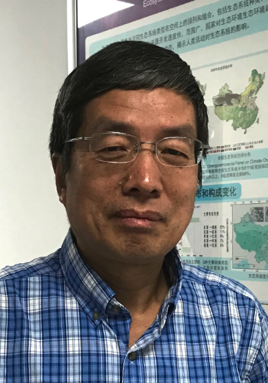 Xiaoke Wang (王效科)合作论文数State Key Laboratory of Regional and Urban Ecology, Research Center for Eco-Environmental Sciences, Chinese Academy of Sciences4
 Weiqi Zhou (周伟奇)合作论文数Research Center for Eco-Environmental Sciences, Chinese Academy of Sciences;State Key Laboratory of Regional and Urban Ecology, Chinese Academy of Sciences4
 Yufen Ren (任玉芬)合作论文数4
 Hongxing Zhang合作论文数3
 Runzhi Zhang (张润志)合作论文数Key Laboratory of Zoological Systematics and Evolution, Institute of Zoology, Chinese Academy of Sciences3
 Fei Lu (逯非)合作论文数Research Center for Eco-Environmental Sciences, Chinese Academy of Sciences;University of Chinese Academy of Sciences3
 Shilin Xie合作论文数2
 Dingcheng Huang (黄鼎成)合作论文数2
 Lixiao Ma合作论文数2Sun Xu合作论文数2
 Yuxiao He合作论文数1
 Yuebo Su合作论文数1
 Baolong Han (韩宝龙)合作论文数Research Center for Eco-Environmental Sciences, Chinese Academy of Sciences;University of Chinese Academy of Sciences1Binbin Huang合作论文数1ZHAO Lu (赵露)合作论文数1Peipei Guo (郭培培)合作论文数1Ling Meng合作论文数1Chao XU (许超)合作论文数1Wenying FANG (方文颖)合作论文数1Nan Meng合作论文数1Si-qi WANG (王思琪)合作论文数1Hui-min FU (傅慧敏)合作论文数1QiaoHuan Wang (王巧环)合作论文数1
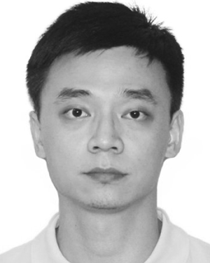 Li Ren合作论文数1
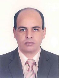 Youssef Mohamed Omar合作论文数Institute of Zoology Chinese Academy of Sciences, Chinese Academy of Sciences1Wang Siqi合作论文数1
 Jonathan Majer合作论文数Faculty of Science and Engineering, Curtin University1
 Yuguo Qian合作论文数1
 Juanjuan Zhao (赵娟娟)合作论文数Southwest University1
 Cheng Gong (龚成)合作论文数University of Chinese Academy of Sciences;Wuhan Institute of Physics and Mathematics, Chinese Academy of Science1
 Yan Zhang (张岩)合作论文数Beijing Institute of Nanoenergy and Nanosystems, Chinese Academy of Sciences1
 Miguel Angel Alonso-Zarazaga合作论文数Departamento de Biodiversidad y Biología Evolutiva;Museo Nacional de Ciencias Naturales;Departamento de Biodiversidad y Biología Evolutiva, Museo Nacional de Ciencias Naturales1
 Jiang-Xiao Qiu合作论文数Research Center for Eco-Environmental Sciences, Chinese Academy of Sciences1
 Lian Pin Koh合作论文数Departments of Biological Sciences & Geography, National University of Singapore;Centre for Nature-based Climate Solutions, National University of Singapore;Ministry of Sustainability and the Environment;Sentosa Development Corporation;Department for Environment, Food and Rural Affairs1




