Determining the recharge sources of adjacent old-working water outlets and their hydraulic connections is essential for zoned pollution control in closed coal mines. This study examined two outlets, S1 and S2, 174 m apart in the Chunjingwa closed coal mine area, Shanxi Province, China. Discharge dynamics, hydrochemistry, hydrogen–oxygen stable isotopes, and a goaf pumping test were combined. During natural monitoring, discharges at S1 and S2 ranged from 1.172–1.958 and 1.012–8.630 m3/h, respectively, with the variation at S2 (7.618 m3/h) being 9.7 times that at S1 (0.786 m3/h). Most contamination indicators had higher median exceedance levels at S2; for SO42−, the median was 14.6 at S2 versus 8.4 at S1. Isotopically, S1 overlapped with ZK2 and ZK3, whereas S2 was distinct. During the 27-day pumping test, S1 discharge fell by about 91%, whereas S2 showed no clear response. The evidence identifies two distinct recharge–discharge systems on opposite sides of F2 at the tested scale. F2 is interpreted as a structural divide, not a uniformly impermeable fault. S1 is regulated mainly by goaf-water storage to the south, whereas S2 is dominated by shallow-catchment, rapid-infiltration recharge to the north. The framework provides a practical alternative to artificial tracer tests for outlet-scale source identification and zoned remediation.
Karst piedmont fault overflow springs are widely developed in structurally controlled, basin-margin settings, where basin-bounding faults obstruct regional groundwater flow. However, the coupled fault blocking, fault conduction, and caprock sealing mechanisms governing their genesis remain insufficiently quantified. This study investigates the Shentou Spring system in Shanxi Province, North China—a typical piedmont fault overflow spring—to develop a three-dimensional genetic model characterised by coupled blocking, conduction, and overflow processes. Integrating borehole datasets, multi-year groundwater level monitoring records, hydrochemical and isotopic measurements, and detailed structural mapping, this study identifies three key controlling mechanisms. First, spatial variations in the throw of the Mayi Fault control fault blocking efficiency, partitioning the fault zone into complete barrier and semi-permeable segments, which underpins the incomplete drainage behaviour of the spring system. Second, the Gengzhuang Fault intersects the high-permeability Qilihe and Yuanzihe groundwater flow zones, acting as the primary conduit that transports groundwater from distant recharge areas to the discharge zone. Third, the Quaternary caprock in the discharge area features a critical thickness threshold of approximately 30 m; confined karst groundwater breaches the overlying caprock and forms spring outlets where caprock thickness falls below this threshold. The proposed tripartite coupled model provides a semi-quantitative framework for interpreting the genesis of piedmont fault overflow springs. In practical terms, it supports the delineation of fault-conduit protection zones and the design of long-term water-quality monitoring networks along fault-controlled flow paths.
Groundwater contamination in industrial parks often involves overlapping inputs of nitrogen, chlorinated solvents, and dissolved salts, making source identification difficult. In this study, 45 shallow groundwater samples from a typical industrial park on the northern margin of the Hohhot Basin were investigated using hydrochemical analysis, PMF, and nitrate dual isotopes coupled with MixSIAR. The results showed pronounced salinity enrichment, high mineralization, elevated ammonium, and chlorinated hydrocarbon contamination. NH4+ exceeded the Chinese groundwater standard in 77.78% of samples, whereas vinyl chloride exceeded the WHO guideline value in all samples. Hydrochemical analysis indicated that groundwater chemistry still retained a water-rock interaction background, but had been significantly overprinted by anthropogenic inputs. PMF resolved six factors and showed that groundwater pollution was mainly controlled by high mineralization, high-ammonium wastewater input, and dissolved inorganic salt enrichment, whereas chlorinated-solvent industrial pollution had strong diagnostic significance. MixSIAR identified industrial wastewater as the largest nitrate contributor under both prior settings, followed by fertilizer-derived nitrification, whereas mountain-front soil background contributed comparatively less. These results indicate that the combined PMF-MixSIAR framework is effective for identifying mixed groundwater contamination in industrial parks.
In recent years,the Nandagang wetland in Hebei Province has been facing a multidimensional water environmental crisis characterized by decreasing water volume,deteriorating water quality,and declining ecological service functions.Analyzing the sources and causes of major ions is crucial for improving the wetland's aquatic ecological environment.Samples of river water,lake water,seawater,and groundwater in the Nandagang wetland,Cangzhou City,Hebei Province,were analyzed.Comprehensive methods,including mathematical statistics,correlation analysis,ion ratios,and the positive matrix factorization(PMF)model,were employed to analyze the hydrochemical characteristics and formation mechanisms of different water bodies.The results indicate:(1)River water,lake water,groundwater,and seawater in the study area are all weakly alkaline Cl-Na type water.(2)The water bodies in the study area are strongly controlled by evaporation and concentration.From inland to coastal areas,the total dissolved solids(TDS)content in river water and groundwater gradually increases,and evaporation intensifies.(3)From the recharge area to the discharge area,the HCO3-/C1-ratio in groundwater gradually decreases.The main ions in shallow groundwater originate from seawater.Evaporation exacerbates groundwater salinization,while cation exchange is a secondary factor.The weakly alkaline hydrochemical environment facilitates ion enrichment.Human activities such as agricultural fertilization in the groundwater recharge area and livestock farming in the groundwater stagnant zone are anthropogenic factors influencing groundwater chemical composition.The main ions in the study area'lake water originate from the northern salt fields,with ecological water replenishment being the secondary source.Petrochemical plants are a potential factor affecting the lake water's chemical composition.The exceedance rates of NO3-concentration standards for river water,lake water,and groundwater samples in the study area were 37.5%,8.3%,and 37.5%,respectively.Key factors causing groundwater exceedance include agricultural fertilization,animal manure,and seawater mixing.It is recommended to control human activities such as agricultural fertilization and aquaculture to reduce the nitrate load in the regional water bodies.The BRIEF REPORT is available for this paper at .
In order to reduce the harm of old kiln water in closed pit coalmine,an optimization study on the removal conditions of high concentration SO42-,Fe3+and Mn2+in the old kiln water by sedimentation method of ettringite[Ca6[Al(OH)6]2(SO4)3·26H2O]was carried out.The effects of initial pH,n(Al3+)/n(SO42-),n(Ca2+)/n(SO42-)on SO42-removal and the residues of Ca2+and Al3+were systematically analyzed by single factor test.The results showed that,under the conditions of initial pH=11.5,n(Al3+)/n(SO42-)=0.8,n(Ca2+)/n(SO42-)=1.5,reaction time of 1 h,the SO42-re-moval rate reached the highest of 81.85%,the romoval rates of Fe3+and Mn2+remained at a high level,and the re-sidual concentrations of Ca2+and Al3+were 18.05 mg/L and 29.96 mg/L,respectively.The Box-Behnken response surface method was used to optimize the process conditions.The model showed that the optimal process conditions were initial pH=11.557,n(Al3+)/n(SO42-)=0.858 and n(Ca2+)/n(SO42-)=1.705.Under these conditions,the actual re-moval rate of SO42-was 85.470%.Meanwhile,the average residual concentration of Al3+and Ca2+was 2.32 mg/L and 29.64 mg/L,respectively.
ABSTRACT The Kuye River Basin is the main coal-producing area in northwest China, and it is also a typical arid and semi-arid area. Under the combined influence of climate change and human activities, the runoff of the basin decreases noticeably. The Mann–Kendall trend test, the Hurst index, cumulative anomaly, and wavelet analysis were used to analyze the runoff evolution characteristics of the Kuye River, and the contributions of climate change and human activities to the runoff reduction were quantitatively separated by the slope-changing ratio of the cumulative quantity. The results showed that the runoff decreased significantly from 1970 to 2020, and there was an obvious abrupt change in 1996, while the change trends in precipitation and evaporation were not significant. The contributions of climate change and human activities to runoff reduction were 22.71 and 77.29%, respectively, and human activities have become the dominant factor in runoff variations. Coal mining and the implementation of soil and water conservation measures are considered to be the main human activities contributing to the reduction in runoff. In particular, mining activities reduce groundwater recharge to rivers, which provides a profound understanding of the effect of human activities in mining areas on runoff variation.
The selection of important factors in machine learning-based susceptibility assessments is crucial to obtain reliable susceptibility results. In this study, metaheuristic optimization and feature selection techniques were applied to identify the most important input parameters for mapping debris flow susceptibility in the southern mountain area of Chengde City in Hebei Province, China, by using machine learning algorithms. In total, 133 historical debris flow records and 16 related factors were selected. The support vector machine (SVM) was first used as the base classifier, and then a hybrid model was introduced by a two-step process. First, the particle swarm optimization (PSO) algorithm was employed to select the SVM model hyperparameters. Second, two feature selection algorithms, namely principal component analysis (PCA) and PSO, were integrated into the PSO-based SVM model, which generated the PCA-PSO-SVM and FS-PSO-SVM models, respectively. Three statistical metrics (accuracy, recall, and specificity) and the area under the receiver operating characteristic curve (AUC) were employed to evaluate and validate the performance of the models. The results indicated that the feature selection-based models exhibited the best performance, followed by the PSO-based SVM and SVM models. Moreover, the performance of the FS-PSO-SVM model was better than that of the PCA-PSO-SVM model, showing the highest AUC, accuracy, recall, and specificity values in both the training and testing processes. It was found that the selection of optimal features is crucial to improving the reliability of debris flow susceptibility assessment results. Moreover, the PSO algorithm was found to be not only an effective tool for hyperparameter optimization, but also a useful feature selection algorithm to improve prediction accuracies of debris flow susceptibility by using machine learning algorithms. The high and very high debris flow susceptibility zone appropriately covers 38.01% of the study area, where debris flow may occur under intensive human activities and heavy rainfall events.
Karst groundwater is the main water source for domestic, industrial, and agricultural needs in Xingtai City, North China. The objective of this study was to comprehensively access changes in the hydrochemical characteristics and evolution of karst groundwater in response to rapid urbanization. Water samples from the late 2010s and the 1970s were compared utilizing statistical analysis, hydrochemical diagrams, and inverse simulation technology. The total dissolved solids (TDS), total hardness (TH), NO3−, and Fe contents were significantly higher in the more recently obtained karst groundwater samples. Further, the dominance of HCO3-Ca-type water decreased, with new types emerging, relative to 1970s karst groundwater. Abnormal TDS, TH, SO42−, NO3−, and Cl− concentrations can be attributed to sewage discharge and fertilizer. Two groundwater discharge areas around the center of Xingtai City and Yangfan Town in the south of the study area were the most significantly affected by human activities. However, inverse modeling indicated that the dissolution of gypsum and halite, as well as cation-exchange processes, occurred in the groundwater paths during both periods. Recent increases in ion concentrations of karst groundwater in the study area have caused carbonate minerals to dissolve, resulting in a further increase of ion concentrations. The hydrochemical response and evolution of karst groundwater requires further study.
Abandoned well pollution is a critical component of global environmental issues and a historical legacy issue of national development. Despite this, the specific mechanisms by which abandoned wells pollute groundwater remain unclear, particularly in the karst regions of Northern China, where no scientifically effective remediation methods exist. To address this gap, this study focuses on Yangquan City in Shanxi Province and employs field investigations, the analytic hierarchy process, high-definition deep-well logging technology, and qualitative analysis to assess the pollution risk of all abandoned wells in the study area, identifying those with high pollution risk. Through the analysis of extensive image and video data for these high-risk wells, we propose a conceptual model of cross-strata channels in abandoned wells and elucidate the mechanisms by which they pollute groundwater. The results show that, from a single-well perspective, the pollution mechanism is cross-strata pollution. From a regional perspective, the pollution mechanisms are hydraulic connectivity and solute migration and transformation. Based on these findings, we present a scientifically effective remediation strategy tailored to the typical characteristics of abandoned wells in the study area, offering a viable solution to the abandoned well pollution problem in Yangquan City. This research not only augments the theoretical framework in the domain of groundwater pollution but also advances sustainable groundwater security and management strategies. Moreover, the study furnishes theoretical foundations and pragmatic solutions for the remediation of abandoned wells in Yangquan City, which are crucial for the sustainability of the groundwater ecosystem.
To clarify the long-term dynamics of groundwater and its response to precipitation in the Heilonggang region, China, variation trends of the monitored groundwater were studied according to the Mann–Kendall statistics. Based on observations from four monitoring wells, the persistence and periodicities of the loose porous aquifers, and the interrelation between precipitation and groundwater levels was examined based on a number of tools including autocorrelation, cross-correlation, spectral analysis, and wavelet transform. The results show that the groundwater levels at W1 and W2 present a downward trend while those at W3 and W4 show an upward trend. The dominant time period increases from 2.1 years (upstream) to 3.7 years (downstream). The time lags between aquifers and rainfall at W1, W2, W3 and W4 are 139.14 ± 59.76 days (2008–2020), 23.27 ± 12.03 days (2005–2014), 145.01 ± 68.00 days (2007–2020), and 59.22 ± 26.14 days (2005–2019), respectively. The lags for the pumping years are 1.2~2.1 times of those during the years without pumping. The recharge ratio overestimated by the water table fluctuation method decreases from 0.32 at W2 to 0.17 at W4, suggesting that the site W2 has a good potentiality for groundwater recharge. This research helps us better understand the local groundwater circulation and provide references for groundwater management.
The Fengfeng mining area is in the transition zone between the North China Plain and the Taihang Mountains, and groundwater is the main source of water supply in the district. Under the combined influence of human activities and natural geological conditions, the quality of different types of groundwater varies greatly, posing a potential threat to the safety of drinking water. In this study, hydrogeochemical processes in different types of groundwater were analyzed using multivariate statistical analysis methods with ion–ratio relationships, and a groundwater quality and health risk assessment model was developed. The research findings show that the main chemical components and TDS in the groundwater have obvious spatial distribution characteristics, i.e., the content of deep karst water (DKW) in the west is significantly lower than that of shallow pore water (SPW) in the east, and the hydrochemical type has changed from HCO3–Ca to SO4–Ca. The chemical components of SPW and DKW are mainly derived from silicates and carbonates, accompanied by weathering dissolution of sulphidic minerals, especially SPW. The chemical components of the groundwater was also influenced by the cation exchange reaction and human activities. The quality of the SPW was significantly worse than that of the DKW, and the nitrates in SPW carry a high non-carcinogenic risk, especially to children. The shallow pore water is not suitable for drinking water. This study can provide guidance on the safety of drinking water in the Fengfeng coal mining area and other areas with intensive industrial, mining, and agricultural activities.
Pingshan County, Hebei was affected by topography, geological structure, ecological environment and other factors,geological disasters such as landslides occurred frequently. Nine evaluation factors including topographic relief, slope, aspect,river network density, fault zone density, stratigraphic lithology, NDVI, land use type and geological disaster point density were selected. The weights of each evaluation factor were calculated by AHP and catastrophe theory, and the combination model of AHP and catastrophe theory was established and applied according to the minimum information entropy weight method. The results of geological disaster risk assessment in Pingshan County based on three methods were compared. The results show that the evaluation results of the combined model have higher accuracy and are in line with the development characteristics of geological disasters in this area. Combined model method combines subjective and objective, considering the influence of factors, the evaluation results are reliable. This study provides a new attempt and method for geological disaster risk assessment in Pingshan County and similar areas.
Ensemble machine learning methods have been widely used for modeling landslide susceptibility, but there has been no uniform ensemble method for this problem. The main objective of this study is to compare popular ensemble machine learning-based models and apply them to landslides susceptibility mapping. The selected models include the random forest (RF), which is a typical bagging ensemble model, and three advanced boosting models, namely, adaptive boosting (AB), gradient boosting decision trees (GBDT), and extreme gradient boosting (XGBoost). This study considers 94 landslide points and 12 affecting factors. The data are divided into a training dataset consisting of 70% of the overall data, and a validation dataset, containing the remaining 30% of the data. The models are evaluated using the area under the receiver operating characteristic curve (AUC) and three common performance metrics: sensitivity, specificity, and accuracy. The results indicate that the four ensemble models have an AUC of more than 0.8, suggesting that they can appropriately and accurately predict landslide susceptibility maps. In particular, the XGBoost model achieves the best performance among all models, having a sensitivity of 92.86, specificity of 90.00, and accuracy of 91.38. Furthermore, the bagging model has a sensitivity of 89.29, specificity of 86.67, and accuracy of 87.93, and it is superior to the GBDT, which achieves a sensitivity of 86.21, specificity of 86.21, and accuracy of 86.21, and the AB, reaching a sensitivity of 82.14, specificity of 80.00, and accuracy of 81.03. The results presented in this study indicate that the advanced ensemble model, the XGBoost model, could be a promising tool for the selection of ensemble models for predicting landslide susceptibility mapping.
The destruction of groundwater resources by coalmining greatly bottlenecks the sustainability of economy and environment in coal-rich areas. The groundwater shortage in such areas is ultimately attributable to coalmining, which changes the spatial structure of regional aquifer, and disrupts the regional groundwater cycle. However, it is a difficult problem to quantify the groundwater flow pattern in mining areas, owing to the strong anisotropy and heterogeneity of the aquifer. This paper takes Luan mining area in Changzhi Basin, northern China's Shanxi Province as the object, which is a typical example of coal fields in northern China. Through theoretical analysis, numerical simulation, and physical simulation, the authors explored the influence of aquifer structure variation on regional groundwater flow field, under the effect of group mining, and modelled and predicted the change of regional groundwater field in a systematic manner. The results show that the mining discharge of groundwater significantly increased; the weak recharge to the two aquifers affected by the working face protected the Quaternary aquifer from depletion; the dropped groundwater table triggered the total recharge and river discharge to groundwater. To the best of our knowledge, this is the first research into the effect of group coalmining on regional groundwater flow field. The research results provide a reference for the sustainable use of groundwater resources, and the conservation of coalmining water.
为了提高盐碱土改良水平,确定科学合理的灌排工程设计方案,建立饱和-非饱和土壤水分运移Modflow-Hydrus耦合模型,对试验区不同情景水平井的排水效果进行模拟分析.结果表明:当地下水位埋深较小时,季节变化对地下水综合补给强度有明显影响,当地下水位埋深大于6 m,不同时段地下水综合补给强度均趋于常数,当地下水位埋深较大时,通过厚层包气带的降水补给均匀;断续排水时单个水平井400 m控制范围内,潜水位显著下降,具有良好的疏干效果,降深与水平井的年抽水强度成正相关;天然环境条件下,区内降水入渗补给和潜水蒸发保持平衡,以试验区中心向外扩展,排水试验有效改善8倍试验区面积范围内降水入渗-潜水蒸发环境,使包气带土壤水分进入饱水带,潜水水位呈下降趋势.研究成果为盐碱土壤改良的水平井施工设计提供理论参考.
地下水动力学课程理论性强,传统的多媒体配合板书讲授式的教学很难调动学生的积极性,并且不利于培养学生的实际操作能力.文章介绍了如何运用计算机技术(如Excel、AquiferTest、MATLAB、数值模拟软件等)开发建设课程素材,并将其融入教学实践中,以激发学生学习热情,锻炼其应用能力,提升其综合素质.
The Jinghui Canal Irrigation District (JCID) is a highly productive agricultural area of Shaanxi province, China. Because of severe water scarcity, implementing water-saving renovation practices for agricultural sustainability is necessary. To determine the influence of different water saving practises on the shallow groundwater system in the JCID, ArcGIS and Processing MODFLOW are used to simulate changes in shallow groundwater in the irrigated farmland in this area. The results show that field water-saving measures can reduce 18.5%-33.4% of well irrigation water, and the control effect on groundwater level drawdown is prominent. The shallow groundwater level s declining rate in some areas is increased, owing to the adjustment of the agricultural planting structure. Moreover, the spatiotemporal distributions of water and soil resources do not reasonably match, which offsets the active impact of water-saving renovation in the mitigation of falling groundwater tables. The groundwater s annual average decline rate has increased from 0.535 m year-1 during 1981-1997 to 0.734 m year-1 during 2000-2014. The groundwater cone of depression shows a continuous expanding tendency. The area in which the groundwater depth is larger than 13 m has increased from 358.56 km2 in September 1997 to 612.92 km2 in September 2014. However, successful agricultural water-saving renovation requires a practical feasibility of water-saving projects, in addition to an appropriate planting structure, strong bearing capacity of farmers, water-saving propaganda, and policy implementation of agricultural subsidy and water resource management.
为了满足国家尤其是河北省经济建设和社会发展的水文与水资源工程专业人才需求,学校以培养复合型人才为目标,加强基础,优化专业,强化实践,凸显创新,积极推进专业建设和教学改革,形成课堂教学、实践教学、第二课堂"三位一体"的多元教学改革模式,取得一批标志性教学成果,有效地提高了人才培养的质量和水平,可供相关类似院校参考借鉴.
Multiple coal mining leads to regional aquifer structure damage, which has seriously affected the regional groundwater circulation and evolution trend and seems to be the root cause of groundwater resource shortage in the coal mining area. With the Lu'an mining area in Changzhi basin as an example and through field investigation, similar material simulation and numerical simulation method, the authors analyzed the damage of aquifer structure and its influence on groundwater circulation. Sand tank simulation test results were compared with the results of numerical simulation, and the results show that the fissure development formed by coal mining is basically restricted to complete bedrock, which causes bending deformation of the water bottom clay rock and forms interlayer drainage area, but this has little damage to Quaternary unconfined aquifer structure; Effective thickness of thinner parts of water-resisting layer leads to the disappearance of unconfined aquifer due to mining fissures cutting waterproof layers; Artificial "headward erosion" caused by coal mining causes the abstraction phenomenon of groundwater between the original isolation groundwater systems, and mine water recharge appropriately increases.
煤炭开采对地下水资源的破坏是限制煤矿区经济与环境可持续发展的主要瓶颈, 煤炭资源开采与水资源保护的矛盾将日益加剧.我国富煤地区主要分布在华北和西北, 仅山西、内蒙古、陕西和新疆四省自治区煤炭查明资源储量就占全国的73.1%,这些富煤地区多是地下水资源相对贫乏的地区, 全国 86 个重点矿区缺水的占 71%, 严重缺水的占40%, 而煤矿开采对地下水资源的严重破坏加剧了矿区的水资源短缺矛盾, 这一问题在能源大省山西尤为突出.究其根本原因, 在于采煤引起含水层结构变化, 造成地下水资源的破坏, 使地下水资源由原来可供开采的优质水源变为被污染的矿坑水而排走, 破坏了地下水的补径排, 破坏了水文下垫面条件, 破坏了地表水循环, 进而影响了区域地下水循环态势.
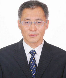 Huanjie Cai (蔡焕杰)合作论文数College of Water Resources and Architectural Engineering, Northwest A&F University14
 Duo Li (李铎)合作论文数6
 Fawang Zhang (张发旺)合作论文数Center for Hydrogeology and Environmental Geology Survey, Chinese Geological Survey6Chaoyue Wang合作论文数4Ai-hua WEI (魏爱华)合作论文数4FangHong Li (李方红)合作论文数4XiaoGang Fu (付晓刚)合作论文数3
 Hongwei Liang (梁宏伟)合作论文数Yangtze River Fisheries Research Institute, Chinese Academy of Fishery Sciences3
 Wenjing Qu合作论文数3Yi Meng (孟毅)合作论文数3Zhi-juan GAO (高志娟)合作论文数2Rui Wang合作论文数2Zhiqiang Zhang合作论文数2Xiaohan Li合作论文数2Bowen Hu (胡博文)合作论文数2Yong-hong TIAN (田永宏)合作论文数2HongChao Me (么红超)合作论文数2HongXing Wang (王宏兴)合作论文数2KaiNing Yu (于开宁)合作论文数2Bin Wang (王滨)合作论文数2
 Zhantao Han (韩占涛)合作论文数Institute of Hydrogeology and Environmental Geology, Chinese Academy of Geological Sciences;Hebei Geo University2
 Xuan Liu合作论文数Dept Elect Comp Engn, New Jersey Inst Technol2Shuangbao Han合作论文数Hydrogeological environmental geological survey Center, China Geological Survey2
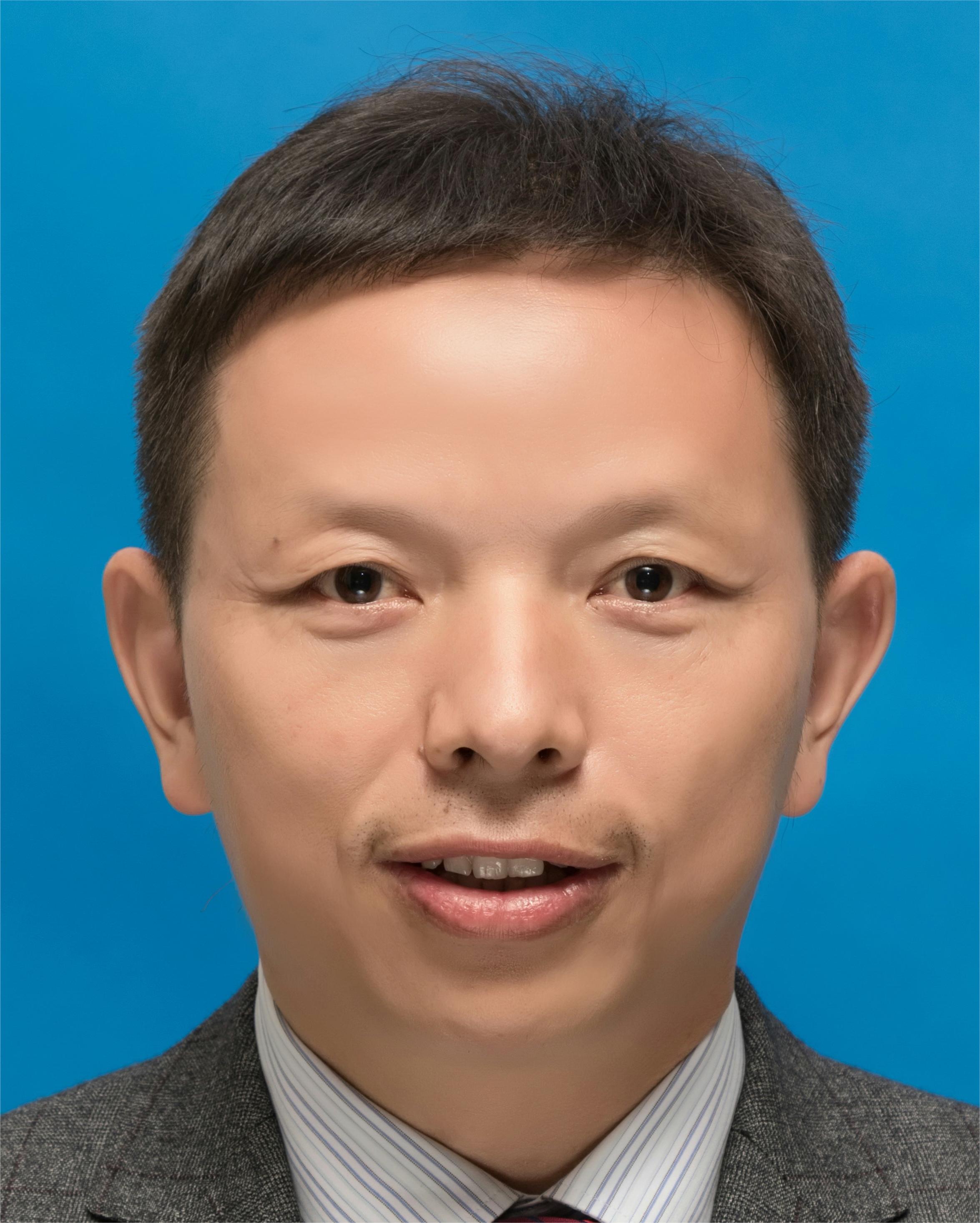 Jiazhong Qian (钱家忠)合作论文数School of Resources and Environmental Engineering, Hefei University of Technology2Fuji Gu (顾福计)合作论文数1Hengxing Zhang (张恒星)合作论文数1Zhijia Miao合作论文数1pengda lian (连鹏达)合作论文数1Yao Hongchao合作论文数1TIAN Dezhi (田德志)合作论文数1YU Wan-lu (余婉露)合作论文数1Liu YANG (杨柳)合作论文数1
 Liu Yaci合作论文数1JI-LIANG ZHU合作论文数1xiaoming liu (刘晓明)合作论文数1Yu Liu合作论文数1Xiaogang Fu合作论文数1Xiu-ming PANG (庞秀明)合作论文数1wanchun chen (陈万春)合作论文数1Wang Xiaoyan (王晓燕)合作论文数1XueLin Song (宋雪琳)合作论文数1HaiXue Li (李海学)合作论文数1HongWei Liang (梁宏伟)合作论文数1Xin Zhang (张鑫)合作论文数1
 Hui Li (李慧)合作论文数School of Civil Engineering, Chang'an University1
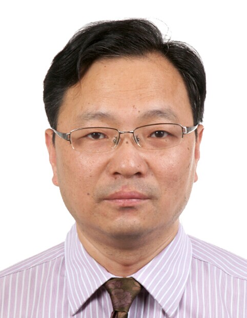 Mouchao Lv (吕谋超)合作论文数Institute of Farmland Irrigation, Chinese Academy of Agricultural Sciences1
 Fengshan Ma (马凤山)合作论文数Institute of Geology and Geophysics, Chinese Academy of Sciences;University of Chinese Academy of Sciences1
 Haijun Zhao (赵海军)合作论文数Institute of Geology and Geophysics, Chinese Academy of Sciences;University of Chinese Academy of Sciences1




