Despite significant advancements in terrestrial navigation driven by the rapid growth of GNSSs, 5G/6G networks, and optical sensor technologies, communication and navigation of marine robots remains a persistent challenge. This paper presents a cooperative navigation scheme for autonomous surface and underwater vehicles. The system utilizes a hybrid radio-acoustic network for precise positioning within a global geodetic reference frame. Additionally, surface vehicles autonomously adjust their courses using information-seeking optimization to actively guide their underwater counter-partners to achieve goals. The proposed system is scalable from a minimal two-vehicle setup to a large-scale maritime robotic swarm. The proposed system is verified with both simulations and real-world experiments.
The Automatic Identification System (AIS) is a maritime radio system that regularly broadcasts vessel data, such as the vessel’s identification, position, course and speed. For modulation, the AIS standard defines Gaussian minimum shift keying (GMSK) as an easy to implement modulation scheme with constant envelope, meaning that a GMSK complex baseband signal carries information solely in its phase. AIS does not use any forward error correction (FEC) mechanism. In this paper we propose to extend GMSK with amplitude modulation, leading to multi-amplitude Gaussian minimum shift keying (MA-GMSK). The additional modulation of the amplitude increases the spectral efficiency so that additional information, i.e., additional bits can be transmitted. We use the increased spectral efficiency to implement FEC, where we transmit the redundancy bits of a systematic channel code via the additional amplitude modulation in the proposed MA-GMSK scheme. With this approach, the proposed MA-GMSK signal can be processed by off-the-shelf AIS receivers, thus demonstrating empirical standard compatibility with the tested receivers. Based on simulations and experimental results, we propose a suitable MA-GMSK modulation parameter setting and evaluate the packet error rate (PER) performance accordingly. To verify standard compatibility, we examine the performance of commercially available AIS receivers fed with MA-GMSK signals. Using the proposed modulation and coding scheme, an advanced MA-GMSK receiver including FEC provides performance improvements up to 3 dB in the required signal-to-noise ratio (SNR) compared to state-of-the art AIS using uncoded GMSK.
Reliable radio communications as well as position, navigation and timing (PNT) are crucial for planetary exploration missions. Prototyping, experiments and analogue missions are vital to increase the technology readiness level (TRL). Software-defined radios (SDRs) are perfectly suited for such tasks due to their flexibility and comparably low implementation effort. With the this paper, we introduce a software architecture for cooperative radio navigation, which can be adapted for different experiments and hardware setups. We showcase three measurements and experiments in analogue environments with distinct requirements. First, we show how accurate time-of-flight (ToF) measurements can be achieved with single-channel SDRs and present radio channel and ranging measurements inside a lava tube. Second, we introduce a coherent multi-channel SDR setup for direction-of-arrival (DoA) estimation and demonstrate cooperative radio navigation of robotic rovers on a volcano. Third, we present a two-channel SDR for hybrid lunar navigation, capable of simultaneously performing ranging with neighboring nodes and receiving satellite navigation signals. We conclude that, with careful setup and calibration, SDRs are well suited to develop flexible and accurate radio navigation systems.
Decades after the World Wars, vast quantities of discarded munitions and unexploded ordnance (UXO) remain submerged in coastal waters worldwide, posing severe risks to marine ecosystems, public health, and maritime operations. While autonomous and remotely operated underwater vehicles provide promising solutions for the UXO detection and recovery of small-scale objects, they fall short when large munitions exceeding 200 kg need to be handled. This paper presents a concept to address this open challenge in the current quest for effective mine countermeasures (MCM). As part of the Waterside project of the German Aerospace Center (DLR), we envision a teleoperation-based concept using a crawler platform equipped with a force-feedback robotic arm and gripper, where the navigation is enabled through a locally set up swarm navigation system. The individual components required for the realization of this concept are presented, each leveraging previous research achievements developed by DLR for space applications. Combining the different fields of expertise in co-operation with industry partners and governmental authorities, the proposed concept promises to enable safe and efficient recovery of large-scale UXOs in shallow waters. A proof-of-concept demonstration is planned to take place in the near future, bringing the technology from the lab to the water. The approach is set up to be extended in the future to increase autonomy features, such that eventually the reliance on large vessels and extensive human presence can be reduced.
Autonomous robotic systems will be the future of planetary exploration missions. For autonomous robotic exploration, reliable pose estimation is required. This can be provided by cooperative radio localization, where radio signals are exchanged among the robots and other mission objects. Range and direction information is obtained by measuring the signal round-trip time (RTT) and direction-of-arrival (DoA), which enables position and orientation estimation of the robots. For the first time, we have demonstrated cooperative radio localization within a space-analogue exploration mission with two robotic rovers on the volcano Mt Etna. With this paper, we share our main lessons learned based on a thorough evaluation of measurement data. Thereby we identify estimation biases as the main error source. We then show how to estimate and compensate these biases during the mission by simultaneous localization and calibration (SLAC). We further investigate the impact of the radio signals reflected on the ground and on mission objects on the ranging accuracy. Then, we demonstrate the benefit of cooperation and the feasibility of single-link localization. In addition, we share tangible ranging and DoA estimation error models based on measurements in a realistic environment.
Exploring lunar lava caves is currently under research spotlight. These caves could serve as ideal shelters for astronauts and instruments, protecting them from dramatic temperature variations and space radiation. However, so far, humans have only limited knowledge about these lunar caves. Robotic swarms are an emerging technology suitable for rapidly exploring large lunar caves. With the ability to optimize trajectories, the swarm can gather spatial-temporal information most efficiently. However the swarm will face persistent challenges in positioning, navigation, timing (PNT), communication and sensing once entering the lava cave. These challenges stem from the lack of infrastructure, the complexity of underground environments and the unpredictable radio propagation conditions.We propose a self-organized radio network, providing multi-hop communications as well as precise time and position references without requiring additional infrastructure such as global navigation satellite systems (GNSSs) or base stations. In addition, the swarm can utilize either extra sensors or communication signals propagating through the network for environmental sensing. At the German Aerospace Center (DLR), we design compact and portable nodes with ultra-wide band (UWB) technology, which can be easily carried and deployed by robots and are thus suitable for proof-of-concept in space-analog missions. In this paper, we provide a comprehensive overview on the design of our UWB swarm navigation system, according to the development steps, namely, designing mission concepts, establishing a self-organized network, conducting measurements, localizing the nodes, and performing radio-based environmental sensing. We also share insights from the first lunar-analog swarm cave navigation mission conducted in the lava cave Cueva de los Naturalistas, Lanzarote, in 2023, where we collected a massive amount of high-quality data, and showcase the plausibility of swarm navigation and sensing in lava caves with preliminary results.
This paper presents an algorithm that exploits multipath propagation for the position estimation of mobile receivers. The proposed method utilizes two pieces of information of this multipath signal component: First the delay and thus the path length restricting possible reflection points to an ellipse. And second the Doppler shift of this multipath component to infer angular information along this ellipse. By exploiting relative Doppler information, obtained from the phase difference between the line-of-sight path and multipath components, the approach eliminates the need for strict synchronization requirements. In contrast to state-of-the-art methods that rely on the concept of static virtual transmitters and assume idealized straight wall geometries, the proposed algorithm directly estimates the positions of reflection points. The direct estimation of reflection points allows simultaneous localization and mapping of environments with arbitrary wall shapes. The feasibility of the approach is demonstrated through simulations incorporating delay and Doppler measurements of multipath components. Results confirm that the method enables accurate estimation of both receiver position and reflection points for a variety of wall geometries, including convex and concave surfaces.
A large number of missions to the Moon is planned in the coming years by both, public and private sectors. A high demand for a Lunar position, navigation and timing (PNT) system exists to aid landing, to support autonomous robotic exploration etc. ESA has proposed a satellite based system for communication and PNT. Furthermore, cooperative radio navigation for users on the Lunar surface, where PNT is provided through radio signals exchanged among robots and other entities, has been suggested. An analysis of the combination of satellite and cooperative navigation for Lunar PNT has not been done yet. In this paper, we provide a first estimation theoretic analysis of joint Lunar satellite and cooperative surface PNT. We derive the Bayesian Cramér-Rao bound (BCRB) and analyze the benefit of cooperation by comparing different cooperation strategies and scenarios, using system parameters from recent studies.
This paper describes a geometric stochastic channel model that is used to analyse maritime communication and navigation services between ships on a dynamic sea-surface. The roughness of the sea surface impacts the propagation by the reflected sea surface and by the changing antenna heights. The impact is noticeable in communications by varying capacity and fluctuations data rates. In navigation the impact is two-fold, first the ranging performance is harmed by the varying received power levels and second by ranging dependent propagation channel models. For broadband systems sub-6 GHz spectrum is currently the focus of emerging maritime 5G networks. Further, we adapted the propagation conditions to the VHF channel propagation conditions to understand the impact in typical VHF systems, such as the AIS or the emerging VDES systems. Furthermore, the movement conditions of the transmitter and receiver on the ship change in all three dimensions depending on the sea state. The data collected from several measurement campaigns in different areas were used to analyse the propagation conditions over the sea by varying the sea surface roughness, the antenna heights and the bandwidths used, as well as the additional propagation conditions over the nearby land. The influence of the changing antenna height on the ship due to the sea conditions affects the reflection and scattering conditions.
This paper focuses on the performance bounds of methods for Gas Source Localization (GSL) that utilize partial differential equations (PDE) for gas dispersion modeling. Specif-ically, Poisson's equation in 2D is used as a simplified gas dispersion model, with the right-hand side modeling a source as a Dirac measure with unknown support. By utilizing the Green's function method for solving the PDE and embedding the solution into the Sparse Bayesian Learning framework, a likelihood function of the source location parameters is formulated. Using the latter the corresponding Cramer-Rao lower bound for the variance of the source location estimate is derived and analyzed. The computed bound not only provides a theoretical quantification of the gas source localization precision but also allows deriving information-seeking criteria for sampling schemes that identify sampling locations with increased information content. The dependency of the bound as well as of the information-seeking criteria on some model parameters are studied with synthetic examples.
The determination of a mobile terminal’s position with high accuracy and ubiquitous coverage is still challenging. Global satellite navigation systems (GNSSs) provide sufficient accuracy in areas with a clear view to the sky. For GNSS-denied environments like indoors, complementary positioning technologies are required. A promising approach is to use the Earth’s magnetic field for positioning. In open areas, the Earth’s magnetic field is almost homogeneous, which makes it possible to determine the orientation of a mobile device using a compass. In more complex environments like indoors, ferromagnetic materials cause distortions of the Earth’s magnetic field. A compass usually fails in such areas. However, these magnetic distortions are location dependent and therefore can be used for positioning. In this paper, we investigate the influence of elementary structures, in particular a sphere and a cylinder, on the achievable accuracy of magnetic positioning methods. In a first step, we analytically calculate the magnetic field around a sphere and a cylinder in an outer homogeneous magnetic field. Assuming a noisy magnetic field sensor, we investigate the achievable positioning accuracy when observing these resulting fields. For our analysis, we calculate the Cramér–Rao lower bound, which is a fundamental lower bound on the variance of an unbiased estimator. The results of our investigations show the dependency of the positioning error variance on the magnetic sensor properties, in particular the sensor noise variance and the material properties, i.e., the relative permeability of the sphere with respect to the cylinder and the location of the sensor relative to the sphere with respect to the cylinder. The insights provided in this work make it possible to evaluate experimental results from a theoretical perspective.
In multipath assisted positioning schemes, the spatial information contained in multipath propagation of wireless radio systems is exploited for localization of a receiver. However, such schemes suffer from a high computational complexity. We have proposed before a fingerprinting localization system based on multipath assisted positioning, where the fingerprinting database is encoded in a deep neural network (DNN). Within this paper, we propose and evaluate a mixture density network approach in our DNN to analyze ambiguities among fingerprints at different locations. We show that our scheme shows a very good positioning performance with an error of around 2m for the most part, while having a low computational complexity in the online stage and a very low effort compared to traditional fingerprinting schemes.
Robotic swarms or portable sensor networks are emerging technologies for sensing physical processes that are spatially distributed- and temporally dynamic, both on Earth and in future Moon/Mars exploration missions. We develop a portable network composed of a multitude of self-organized “sensor eggs”. These eggs are equipped with ultra-wideband (UWB) transceivers, providing precise time and position information without additional infrastructures like Global Navigation Satellite Systems (GNSSs). Each egg is additionally equipped with environmental sensors, for example, a Sulfur dioxide gas sensor to explore volcanic activity. We use a real time decentralized particle filter (DPF) to estimate the a-posteriori probability density functions (PDFs) of the egg positions. These PDFs are then used in a static state binary Bayes filter for estimating the gas sources with potentially complex structures such as cracks on the volcano surface. The proposed sensor network is verified with an in-field experiment at La Fossa volcano on the island of Vulcano, Italy, in 2023.
In recent years, the paradigm of navigation has shifted from pinpointing the location of a single agent to continuously estimating the full kinematic state of networked autonomous agents. In this paper, we propose a kinematics-aware information seeking algorithm for swarm navigation. The algorithm tightly couples state estimation and autonomous control given ranging and kinematic models. With the help of the Fisher information theory, agents generate information seeking command sequences. As an outcome, the swarm continuously optimizes its trajectory so that the agents’ position and orientation uncertainty is actively minimized. The proposed algorithm is verified by large-scale swarm simulations and demonstrated in a space-analogue mission of autonomous swarm navigation on the volcano Mount Etna.
At the Institute of Communications and Navigation of the German Aerospace Center (DLR), we have studied and developed radio-based swarm navigation technologies for a decade. In this paper, we provide a complete solution of ultra-wide band (UWB) localization network for a robotic swarm. This network is organized in a fully decentralized fashion and resilient to clock imperfections, topology changes, packet loss and the hidden node problem. In this network, a multitude of active devices and an arbitrary number of passive devices can exploit the UWB signals for self-localization, i.e. estimating their relative positions and orientations, without sophisticated clock and antenna calibration, which dramatically simplifies the design and manufacturing of such a swarm. Our proposed solution is verified with experiments and was successfully demonstrated in a space-analogue multi-robot surface exploration mission on the volcano Mt. Etna, Sicily, Italy, in July 2022.
Networked robots will play an important role in lunar exploration. Communication is key to enable cooperation among robots for information sharing, and to remotely control robots with lower degree of autonomy from a lander or habitat. Operators and scientists must be able to make sound decisions on communication availability before or during sending robots to regions of interest for exploration. In this work we have a closer look at the communication coverage prediction for lunar exploration. We present an interdisciplinary and modular framework, which exploits terrain information to predict the data rate for exploring robots. Additionally, we create intuitively usable coverage maps for operators and scientists, and show how connectivity can be improved in unstructured environments by using a relay rover. This paper provides an overview of this framework, details on individual framework components, and simulation results for two exemplary exploration scenarios.
Autonomous robotic swarms are envisioned for a variety of applications—for example, space exploration, search and rescue, and disaster management. Important features of a robotic swarm include its ability to share information within the network, to sense spatio-temporal processes such as gas distributions, and to collaboratively enhance its navigation. In environments without infrastructure, the swarm elements can cooperatively estimate their position, e.g., based on the time of flight of exchanged radio signals. Cooperative positioning performance depends on the radio propagation environment. Free-space path loss is commonly used for performance assessment, which is an optimistic assumption. In this work, we investigate the limits to cooperative positioning and ranging based on the time of flight of radio signals over the more realistic two-ray ground reflection channel. We show that we obtain a ranging bias caused by the radio signal component reflected from the ground, and that the ranging error becomes bias-limited. In the positioning domain, we investigate how the ranging bias affects the cooperative positioning performance. As a result, we gain in cooperation, but the achievable positioning performance is significantly worsened by the ranging bias. As a conclusion, the two-ray ground reflection model should be considered to obtain realistic cooperative positioning limits.
As maritime traffic strongly relies on Global Navigation Satellite Systems (GNSS) such as GPS or Galileo, there are efforts to mitigate the risks that come with this reliance. One such effort is the development of VDES R-Mode, which aims to provide a terrestrial contingency system to GNSS that is based on the VHF Data Exchange System (VDES). Terrestrial VDES provides a bandwidth of 100 kHz. To make best use of the available bandwidth, VDES R-Mode can use a signal that is optimized for a high effective bandwidth. This signal however, has a very regular structure that leads to ambiguities that degrade the ranging performance at lower SNRs. We found that this drawback can be mitigated by evaluating the signals of multiple base stations jointly in a direct position estimation approach. To assess the improvement, we applied the Ziv-Zakai Bound and performed simulations. We found that using the direct position estimation approach can significantly lower the SNR at which it is still possible to resolve the ambiguities caused by the regular signal structure.
This paper presents a geometric stochastic channel model designed for analyzing maritime communication and navigation services between moving ships using the C-band or sub-6 GHz spectrum, which aligns with the focus of emerging 5G networks on land. The channel model is validated through channel measurements conducted both on the sea and land. A software tool has been developed to integrate and analyze these measurements, which is included with this publication. The main challenge in developing the channel model for maritime services lies in the dynamic nature of the sea surface, leading to constantly changing reflection conditions due to varying reflectors and scatterers on the water. Additionally, the motion conditions of the transmitter and receiver on ships change in all three dimensions, depending on the sea state. To address these complexities, data from several measurement campaigns in diverse areas were collected. The analysis involved examining the propagation conditions over the sea with variations in sea surface roughness, antenna heights, and used bandwidths. Moreover, additional propagation conditions over nearby land were also taken into account. The study demonstrates that the changing antenna height on the ship, influenced by sea conditions, significantly affects the reflection and scattering conditions. The research aims to develop reliable, high-data rate, and broadband marine communication systems. Therefore, a measurement bandwidth of 120MHz was employed to derive the propagation model. This model not only offers absolute timing information but can also be used for time-based ranging or positioning systems. The proposed geometric stochastic channel model provides valuable insights into the complex maritime communication and navigation environment. By accounting for the continuously evolving sea surface and its impact on antenna height, the model offers a robust framework for studying and optimizing marine communication systems. The availability of a software tool integrating real-world measurements further enhances the usability and practicality of the channel model for future maritime communication research and deployment.
 Ronald Raulefs合作论文数German Aerospace Center;Institute of Communications and Navigation;German Aerospace Center, Institute of Communications and Navigation78
 Stephan Sand合作论文数German Aerosp. Center (DLR),, Inst. of Commun. & Navig.;c;German Aerosp. Center (DLR),, Inst. of Commun. & Navig.52
 Siwei Zhang (张思维)合作论文数39
 Emanuel Staudinger合作论文数Austrian Research Centers37
 Christian Gentner合作论文数Inst. of Commun. & Navig., German Aerosp. Center (DLR), Wessling, Germany;c;Inst. of Commun. & Navig., German Aerosp. Center (DLR), Wessling, Germany|c|36
 Simon Plass合作论文数German Aerospace Center;Institute of Communications and Navigation;German Aerospace Center, Institute of Communications and Navigation30
 Stefan Kaiser合作论文数DoCoMo Communications Laboratories Europe GmbH30
 Christian Mensing合作论文数29
 Thomas Jost合作论文数27
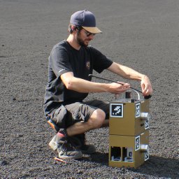 Poehlmann, R.合作论文数22
 Gunther Auer合作论文数DOCOMO Euro-Labs21
 Wei Wang (王威)合作论文数School of Information Engineering, Chang`An University19
 Markus Ulmschneider合作论文数German Aerosp Ctr DLR, Inst Commun & Nav, D-82234 Oberpfaffenhofen, Wessling, Germany16
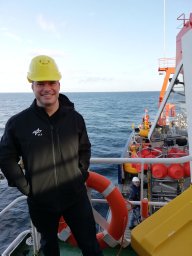 Michael Walter合作论文数16
 Robert Poehlmann合作论文数10
 Peter A. Höher合作论文数Institute of Electrical Engineering and Information Technology, Faculty of Engineering, Christian-Albrechts-Universität zu Kiel10
 Martin Bossert合作论文数Applied Information Theory - TAIT;Institute of Telecommunications and;Ulm University8
 Thomas Wiedemann合作论文数German Aerosp Ctr DLR, Inst Commun & Nav, D-82234 Oberpfaffenhofen, Wessling, Germany6
 Dmitriy Shutin合作论文数German Aerosp Ctr DLR, Inst Commun & Nav6
 Markus Wirsing合作论文数5
 Serkan Ayaz合作论文数Institute of Communications and Navigation, University of Erlangen5steingas alexander合作论文数4
 Fabio Broghammer合作论文数4
 Henk Wymeersch合作论文数Department of Electrical Engineering, Chalmers University of Technology4
 Michael Schnell合作论文数German Aerospace Center4
 Uwe-Carsten Fiebig合作论文数Institute for Communication and Navigation4Chen Zhu (朱宸)合作论文数3
 Martin J. Schuster合作论文数3
 Dirk Slock合作论文数Communication Systems Department, EURECOM3
 Andreas Dömel合作论文数Robotics and Mechatronics Center (RMC),, German Aerospace Center (DLR),3
 Riccardo De Gaudenzi合作论文数European Space Research and Technology Centre, European Space Agency3
 Ingmar Groh合作论文数3
 Jimmy Jessen Nielsen合作论文数Dept Elect Syst, Aalborg Univ3
 George Agapiou合作论文数3
 Armin Wedler合作论文数3
 Na Yi (依那)合作论文数School of Electronics, Peking University3
 Tommy Svensson合作论文数Chalmers University of Technology3
 Joaquim Bastos合作论文数3
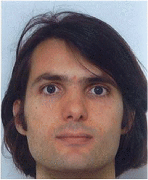 Loïc Brunel合作论文数Communications & Electronics Department, ENST3Hadi Noureddine合作论文数2Mikael Sternad合作论文数2t worz合作论文数2HOEK CORNELIS合作论文数2atilio s gameiro合作论文数2
 Marie-Hélène Hamon合作论文数2
 Alvaro Alvarez合作论文数Cellular Communication Laboratory, Programme of Cellular &Instituto de Ciencias Biomédicas, Universidad de Chile2
 Miguel A. Bellido-Manganell合作论文数German Aerospace Center, Institute of Communications and Navigation, Wessling, Germany2
 Martin Schmidhammer合作论文数German Aerosp Ctr DLR, Inst Commun & Nav2
 Riccardo Giubilato合作论文数CISAS G Colombo, University of Padova Padova2




