Proxy-based reconstructions of the Last Interglacial peak indicate changes in precipitation characteristics in the Levant. These reconstructions suggest that precipitation occurred in brief and intense events, particularly in the region's southern parts. Some studies have offered conflicting paradigms for explaining hydroclimate variability. However, these have yet to be consistently tested in a modeling framework. Indeed, the modeling approach can undoubtedly enhance the combined interpretation of proxy records and our understanding of past hydroclimate processes. We use simulations from the Paleoclimate Model Intercomparison Project 4th phase (PMIP4) to evaluate and reconstruct the precipitation characteristics of the Levant. First, we identify the Alfred Wagner Institute Earth System Model as one that largely resembles proxy reconstructions. Then we use it to understand hydroclimate variability. We examine changes in the frequency, seasonality, and persistence of the Levant's rain-bearing weather types, including Cyprus Lows and Red Sea Troughs. We further decompose the dynamic and thermodynamic contributions to changes in the water balance, comparing the Last Interglacial peak with Pre-Industrial times. Based on differences in daily mean precipitation, we provide evidence that the rain-bearing weather types yielded significantly more precipitation (approximate to+20%) during the Last Interglacial peak. This increase is most evident in the southern Levant, where higher precipitation occurs during Red Sea Trough days, primarily due to thermodynamic changes. Minor differences in the frequency and persistence of these weather types were found. Our research offers insights into historical hydroclimate changes in the Levant, broadening our understanding of future climate impacts driven by natural variability.
Environmental and biological factors influence the trace element composition (element / Ca) of planktic foraminifer shells. Consequently, the element / Ca measured in these shells (tests) are utilized as proxies to reconstruct past oceanic and climatic conditions. As single shell analyses are increasingly used in paleoceanographic research it is important to understand how proxy systematics change between species, individuals of the same species in a given population, and among chambers of a single individual during its life cycle. Here we present a time series of the chemical composition of planktic foraminifers retrieved using sediment traps between June 2014 and June 2015 at the northern part of the Gulf of Aqaba (aka Gulf of Eilat). Laser ablation ICP-MS element / Ca measurements were performed on single shells and chambers of Globigerinoides ruber albus and Turborotalita clarkei, collected monthly from five water depths (120, 220, 350, 450, and 570 m). Sediment trap samples were paired with corresponding data on water column hydrography and chemistry. Pooled means of measured element / Ca display species-specific and element-specific behavior, with generally higher values for T. clarkei phenotypes (“big” and “encrusted”) in comparison to G. ruber albus. Some element / Ca values measured in water column specimens, such as Al / Ca, vary significantly from core-top specimens. A unique finding is a prominent increase in element / Ca around March-April 2015, during maximum water column mixing, mostly apparent in T. clarkei and to a lesser extent in G. ruber albus. This spring element / Ca increase is observed in most measured elements and is further associated with an increase in inter-chamber variability (ICV). Inter-chamber element / Ca patterns show element enrichment/depletion in the most recently precipitated (final, F0) chamber in comparison to the older chambers (penultimate (F-1), antepenultimate (F-2), etc.). Element/Ca in F0 may also be less sensitive to surrounding environmental conditions. For example, the Mg / Ca of the F-1 and F-2 chambers of G. ruber albus display a positive relationship with mixed layer temperatures while F0 does not. To overcome this effect, we suggest using pooled means from non-F0 fractions as environmental records and paleo proxies. These results highlight the complexity of proxy systematics that arise from the variability in element / Ca measured among different species and between chambers, caused by ecological conditions and other processes in the water column including physical, chemical, and biological effects.
Abstract. While permafrost is considered a permanently frozen soil, it often demonstrates evidence for internal processes, including fluid migration. Here, we present data of the chemical composition, Ra, Th, and Ac isotopes of saline permafrost from three closely-retrieved cores drilled at Adventdalen, a fjord Valley in central Svalbard, which provides evidence for a fingering style intra-permafrost fluid flow. Ground ice of the different cores differs markedly in their salinity and composition. In one core, which has a composition similar to seawater, the long to short-lived isotope ratios, (226Ra/223Ra)AR and (226Ra/224Ra)AR, are relatively low, being similar to parent isotope activity ratios (230Th/227Ac and 230Th/228Th, respectively) on grain surfaces (CEC fraction). Ground ice of the two other cores, which are less saline and have Na/Cl and SO4/Cl ratios higher than seawater, demonstrates much higher Ra isotope ratios, closer to parent ratios in the bulk sediment. It is suggested that the different isotope ratios are due to different residence times, and that the parameter controlling the isotope ratios is radium diffusion from inside the grains. While ground ice in the less saline cores was formed during permafrost formation (10–9 ka), ground ice average residence time in the more saline core is shorter, <<2,000 years, which did not allow a significant diffusion of the long-lived 226Ra from inside the grains. The latter is probably the result of a Late Holocene intrusion of saline fluids, arriving from a low-Th or high water:rock ratio basement rock. This highlights the internal dynamics of saline permafrost, which may affect its resilience to the ongoing global warming.
Anthropogenic activities and industrial growth significantly impact the marine environment, particularly in coastal areas where human activities intersect with the ocean, often leading to anthropogenic elemental enrichments. Monitoring geochemical signals in seawater, however, is challenging logistically and analytically. As an alternative, calcitic tests of benthic foraminifera provide a nature-based, readily available tool for monitoring environmental signals. This study aimed to demonstrate the applicability of shallow-water large benthic foraminifera as recorders of fine-scale coastal elemental variability, including elements derived from anthropogenic sources. The study focuses on the short coastline of the Gulf of Aqaba-Eilat, which exhibits high diversity in both anthropogenic levels and sources, making it an ideal case study. We report whole-test (ICP-MS) element-to‑calcium ratios in living specimens of the three most common LBF taxa: miliolids (Peneroplis pertusus, soritids) and rotaliids (Amphistegina), collected seasonally from six sites representing urbanized, industrial, and nature reserve areas along the 12-km Israeli coast. Miliolids consistently exhibit elevated El/Ca values and clearer spatial and temporal trends than rotaliids, highlighting their higher sensitivity as environmental recorders. Pb, Zn, and Cd ratios distinguish polluted from relatively clean sites, while Mn enrichment likely reflects freshwater input. Rare-earth elements exhibit a north-to-south enrichment gradient, a distinct seasonal pattern, and a positive gadolinium anomaly, which may reflect anthropogenic inputs from the city of Eilat. Overall, these findings demonstrate that elemental records of miliolid taxa are very effective bioindicators of localized and seasonal geochemical signals in coastal marine environments, offering a practical, nature-based approach to monitoring anthropogenic impacts.
The termination of the Holocene Humid Period between 6-5 kyrs ago is relatively well-documented in Africa. By contrast, outside of Africa the spatial extent of this termination, the rate of change (gradual vs. abrupt) and the timing of this termination remain obscure. To assess whether such a termination occurred in Asia and to characterize the spatial and temporal evolution of this termination, we constructed lake-level histories of five closed-basin lakes, four of which are located along a north-south transect in East Asia (Lakes Khukh, Dali, Daihai and Chenghai from 50ᵒN to 25ᵒN) and the fifth is the Dead Sea in western Asia (33ᵒN). A closed-basin lake has no outlet, and therefore its size varies as a function of precipitation and evaporation. Distinct shoreline deposits form at the lake’s margin and are physical relict imprints of past lake-levels. These lake-level histories provide a powerful, first order, quantitative record of past water availability. For each lake, we developed a detailed lake-area history based on numerous radiocarbon, Optical Stimulated Luminescence and U/Th disequilibrium ages. All five lakes show that substantial changes in lake-level (up to 60 m) and surface area (of up to six times that of modern area) occurred throughout the Holocene. The results indicate that in East Asia wet conditions were initiated during the Bølling-Allerød and weakened and dried during the Younger-Dryas. The onset of the Holocene Humid Period, at 11.5 kyrs, was rapid, with the lakes rising to their high-stands within a half millennium. In western Asia, the lake-level rise most likely occurred later, at ~10 kyrs. During the Holocene Humid Period the lakes were significantly larger than the modern lakes. The wet conditions in northeast Asia and western Asia prevailed until 6 kyrs, when the lakes dried out abruptly, within a few decades, and have not been restored to their pre-6 kyrs sizes since. In South China, the rapid drying occurred earlier, at ca. 8 kyrs. All five lakes show a substantial dry period between 6 – 4 kyrs. In northeast Asia the dry conditions prevail until today. However, in both South China and western Asia the lakes rose at 3 kyrs and remained mostly high until recently. Our findings from the five Asian closed-basin lakes show that during the early Holocene, Asia was scattered with lakes that were much larger than today and that an abrupt onset and abrupt termination of the Holocene humid period occurred across Asia. We use the lake-level histories to quantify regional water availability, to discuss the migration of rain-belts in Asia, speleothem oxygen isotopes and pollen records, and the ability of transient climate models to capture the magnitude, extent and rapidness of these wet conditions and hydroclimatic transitions.
Calcifying foraminifera from the orders Rotaliida and Miliolida are widely used as geochemical proxies for recording paleoceanographic conditions, while agglutinated foraminifera are often overlooked since their tests are mostly composed of foreign particles. This study investigated the geochemical properties of Textularia agglutinans, a cosmopolitan agglutinated benthic species from the order Textulariida which has an exceptional inner calcareous test and is evolutionarily basal to Rotaliida. This study confirms the evolutionary link between textulariids and rotaliids based on their geochemistry and establishes T. agglutinans as a geochemical recorder of marine environments. Specimens from the Mediterranean coast of Israel were analyzed using laser ablation ICP-MS and compared to whole-test ICP-MS measurements of rotaliid and miliolid taxa from the same location. An Mg/Ca temperature calibration was established by LA-ICP-MS analyses of cultured specimens at 15, 17, 20, and 25 °C. Results show that T. agglutinans is a mid-Mg species (~19 to ~60 mmol/mol), with an Mg/Ca temperature correlation similar to high-Mg species. Its Pb, Zn, and Mn/Ca ratios are variable, generally overlapping with rotaliids and significantly lower than miliolids. Notably, T. agglutinans exhibits significantly higher Sr/Ca ratios (3.2 to 4.7 mmol/mol) compared to most foraminifera. Raman analyses reveal that the inner wall comprises a mix of aragonite and calcite, explaining these elevated Sr/Ca ratios. Rotaliida are the most prolific group of calcifying foraminifera. Our findings suggest that rotaliid tests evolved from an agglutinated textulariid ancestor with an inner aragonitic wall, a hypothesis that is further supported by the close phylogenetic relationship of the two groups.
Coral reefs, known for their remarkable diversity, serve a pivotal function in modulating the global oceanic carbon cycle and act as natural barriers that protect coastlines from erosion and storm surges by dissipating wave energy. Despite their importance, their sensitivity to temperature fluctuations, sea-level shifts and anthropogenic changes in the future is highly unknown. In this study, we create a comprehensive documentation of coral growth, sedimentology and ecology spanning the middle to late Holocene in the Gulf of Eilat/Aqaba, northern Red Sea. We then integrate these findings with a reconstruction of the area's environmental conditions over time. The findings reveal a noticeable hiatus of reef growth between 4400 and 1000 years BP (Before Present; "present" being defined as 1950), aligning well with comparable observations made across various locations in the Southern Hemisphere. The coral diversity and abundance along the cores display surprisingly similar patterns before and after the hiatus. This implies that the distinctive coral community thriving during the initial growth phase reappeared nearly 4000 years later, presumably sourced from the deeper reefs. The results are evaluated in the context of a potential sea-level drop and the resilience of coral communities to perturbations of this magnitude. We conclude that the hiatus at this site is due to a combination of factors, including tectonic activity and glacio-eustatic sea-level changes. Our research highlights the critical importance of understanding and managing coral reef ecosystems' responses to sea-level fluctuations to mitigate future impacts on these vulnerable environments.
Continental margins support marine primary productivity by transferring nutrients and micro-nutrients (trace metals) from the coast to the oceans. Yet, the mechanisms governing the delivery of trace metals across the land-sea continuum, and how they vary temporally, are still poorly constrained. Here, we report high spatial resolution depth profiles of dissolved trace metals (Al, Mn, Fe, Co, Ni, Cu, Zn, Cd, and Pb), rare earth elements (REEs), nutrients (PO4, TON, and SiOH4) and Pb isotopes from two transect cruises in the oligotrophic eastern Mediterranean Sea. Varying anthropogenic inputs resulted in inter-cruise variations in Zn and Pb concentrations and Pb isotopes. In contrast, low temporal variability was registered for PO4, SiOH4, Cu, and Co. The isotopic composition of Pb in the eastern Mediterranean Sea (Pb-206/Pb-207 = 1.161-1.173 and Pb-208/Pb-206 = 2.085-2.101) is controlled by advected Atlantic surface water and anthropogenic inputs delivered via continental runoff (terrestrial) or atmospheric shuttles. The deep-water inventory of Pb is partially controlled by historical anthropogenic sources. An enrichment in Zn and Cd (81 and 17 %, respectively) and a 50 % depletion in Pb relative to open-waters was observed in Intermediate Levantine Waters, in tandem with terrestrial Pb isotopic signatures, light REE depletion (shale-normalized Nd/Yb < 0.22) and a strong Ce anomaly (Ce/Ce* < 0.20). These are driven by intermediate nepheloid layers from the margins, which act as both a source and a sink for trace metals through release and scavenging, evident 300-500 km away from the shore. This study highlights the dynamic role of continental margins in modulating terrestrial and anthropogenic inputs to the oceans.
Jara‐Muñoz et al. report a new set of U‐Th and 14 C dates obtained from stromatolites scattered along the western slopes of the Dead Sea escarpment and use them to establish a new lake‐level curve for part of the last glacial cycle. This curve is fundamentally different from previous reconstructions (Bartov et al., 2002, 2003; Hazan et al., 2005; Lisker et al., 2009; Machlus et al., 2000; Torfstein, Goldstein, Stein, & Enzel, 2013) and is characterized by very significant vertical uncertainties, which in practice, ignore the millennial‐timescale resolution of Lake Lisan dynamics that has been widely discussed before (Bartov et al., 2003; Haase‐Schramm et al., 2004; Torfstein, Goldstein, Stein, & Enzel, 2013), with important implications for understanding regional hydroclimate regimes and linkage to global climate engines. The differences between the new and previous lake‐level reconstructions warrant a critical evaluation of the new findings. We argue that rather than strengthening and refining the existing body of observations, the new data have been used separately, resulting in a misleading record.
A highly resolved time series of dissolved major element (calcium, strontium, magnesium, and lithium) concentrations in the north Gulf of Aqaba, Red Sea, reveals variability in major cation concentrations beyond analytic uncertainties. This variability is composed of an interannual component that is most important for calcium, and a short-term daily-timescale component that is most important for lithium. As evident from covariation in calcium, potential alkalinity, and Sr/Ca, the calcium carbonate cycle of the Gulf of Aqaba is dominated by coral calcification, and there was an increase in calcification rates between 2017 and 2018. Variability in lithium concentrations, and larger changes in magnesium concentrations than expected from magnesium distribution coefficients in carbonate minerals, suggest an active cycle of aluminosilicate mineral dissolution, and precipitation of secondary silicate minerals.
Atmospheric dust plays a key role in shaping global climate by affecting the radiative budget, modulating precipitation, and serving as an important source of limiting nutrients to the oceans. At present, the primary source of atmospheric dust in the world is the Sahara-Arabia Desert Belt (SADB). However, the mineralogical constituents of dust are highly variable and can be divided into several phases. Moreover, the chemistry of these phases changes from source to sink, over unknown time periods, due to chemical and physical weathering. Here, we report (U-234/U-238) ratios and trace element concentrations in five sequentially leached phases of 18 dust samples collected in the Gulf of Aqaba, northern Red Sea, between 2013 and 2019. The sampling site is located between the Sahara and the Arabia Deserts, and exposed to frequent dust storms, whose source is identified through air mass back trajectories. The sequential leaching steps, successfully extracted the water labile, Ca-carbonates, FeMn oxides, Mg-carbonates and silicate phases. The geochemical fingerprint and (U-234/U-238) ratios are used to identify sources and interaction between samples and phases. This is the first report of the uranium isotopic composition of atmospheric dust from the eastern SADB. Coupled with trace element abundances, we characterize the end member compositions of each mineral phase, their provenance and transport time (i.e., comminution age). The latter spans over the last similar to 200 kyrs for most samples, and longer (350-410 kyrs) for samples from the northern Arabian Peninsula. These results emphasize the fundamentally different sources and histories of dust across the SADB.
The isotopic composition of barium (δ138Ba) has emerged as a powerful tracer of deep-ocean circulation, water mass provenance, and the oceanic Ba cycle. Although the δ138Ba of water masses is primarily controlled by the balance between pelagic barite precipitation and Ba resupply from ocean circulation, questions remain regarding the isotopic offset associated with pelagic barite formation and how the resultant Ba isotope compositions are transmitted through the water column to marine sediments. To address these questions, we conducted a time series study of dissolved, particulate, and sedimentary Ba chemistry in the Gulf of Aqaba (GOA), in the northern Red Sea, from January 2015 to April 2016. These data span significant seasonal changes in hydrography, primary productivity, and aerosol deposition, revealing three principal findings. First, the dissolved Ba chemistry of the GOA is vertically uniform across the time series, largely reflecting water mass advection from the Red Sea, with mean dissolved Ba concentrations of 47.9 ± 4.7 nmol kg−1 and mean δ138Ba = +0.55‰ ± 0.07‰ (±2 SD, n = 18). Second, despite significant variations in particulate matter composition and flux, the δ138Ba of sinking particulate Ba maintained a consistent isotope composition across different depths and over time at +0.09‰ ± 0.06‰ (n = 26). Consequently, these data imply a consistent Ba isotope offset of −0.46‰ ± 0.10‰ (±2 SD) between sinking particulates and seawater. This offset is similar to those determined in previous studies and indicates that it applies to particulates formed across diverse environmental conditions. Third, barite-containing sediment samples deposited in the GOA exhibit δ138Ba = +0.34‰ ± 0.03‰, which is offset by approximately +0.2‰ relative to sinking particles. While the specific mechanism driving this offset remains unresolved, our results highlight the importance of performing site-specific proxy validations and exercising careful site selection when applying novel paleoceanographic proxies.
Israel is located in the southern sector of the LevantLevant, spanning the climatic transition between the hyperarid Sahara Desert in the south and the moderate Mediterranean climate in the north. Past changes in the locus of this climatic transition zone have been recorded at numerous sites in Israel and its surroundings, reflecting major Quaternary climateQuaternary climate changes that have impacted regional fauna, flora, and hominid migration patterns, and influenced the cultural history of this region. Importantly, two uniquely resolved, continuous and long records—the Dead Sea sediments and concomitant cave deposits—serve as globally prominent archives of subtropical continental climate, which together with numerous additional regional climate reconstructions provide a highly detailed record of Quaternary climateQuaternary climate change in the Levant. In this chapter, the main archives and observations that provide the basis for regional climate reconstruction are described, and used to provide an overview of climate patterns in the southern LevantLevant throughout the Quaternary.
The Early Epipaleolithic (EEP) of the Southern Levant, roughly dated to 25-18 ka BP, is characterized by microlithic industries with highly variable synchronic and geographic techno-typological characteristics, the chronology of which remains poorly understood.Here, we present the results from excavations at Idan VII, a well-preserved site amongst a cluster of newly discovered EEP occurrences in the hyper-arid Arava Valley, Israel. The finds are embedded within the Late Pleistocene Lisan Formation lacustrine sediments, an extensively studied paleo-hydroclimatic archive in the Rift Valley. This unique situation enables contextualization of the archaeological finds within the detailed paleo-climatic chronology.The data presented include the stratigraphy (geomorphology and micro-geoarchaeology), relative (related to paleo-lake curve) and absolute (radiocarbon and U–Th) chronology, and archaeological (lithics, faunal and botanical) remains. The results demonstrate that the Idan EEP occurrences are situated within a localized relatively short-lived paleo-wetland area adjacent to Lake Lisan, during or immediately after the extremely cool and locally dry Heinrich Event 2 (H2), ca. 24 ka BP.The results are critically examined with respect to available radiocarbon dates from EEP archaeological sites in the Southern Levant. These, together with the geomorphological evidence, indicate that the Idan VII assemblage, while superficially resembling the so-called ‘Late Kebaran’ industry, actually significantly predates its most pertinent techno-typological analogs, highlighting the necessity of re-evaluating the “Kebaran complex”. Rather, it is coeval with the local, but unrelated ‘Masraqan’ and ‘Nebekian’ industries at the very onset of the EEP, demonstrating the high degree of Last Glacial Maximum hunter-gatherer cultural diversity then present in the Levant.In contextualizing the results within the Northern Hemisphere chrono-climatic framework, we conclude that within the Southern Levant, the H2 provides a solid chrono-climatic anchor for the appearance of fully-fledged backed bladelets microlithic industries, which probably reflects a technological change in composite projectile hunting gear that occurred during the EEP.
Submarine canyons serve as important sediment transport conduits from littoral zones to the deep sea, with strong impacts on the sedimentation patterns in marginal areas of the ocean. Here, we present a study of the geological history and the recent activity of the Nahariya submarine canyon, the longest of a system of ~15 small blind canyons located in the eastern Mediterranean Sea, offshore Israel. Two piston cores retrieved from the middle and outlet of the canyon, at 650 m and 915 m water depth, respectively, were the focus of a multi-proxy study aiming to characterize sediment transport and deposition along the canyon during the Last Glacial and up to the present. Both cores reveal a sequence of homogenous sediment of late last glacial age, which are capped by an unconformity overlying by fine laminated sediment dated to the last ~200 years. Thus, the deglacial and most of the Holocene intervals are absent from the record. Evidence for down canyon sediment transport are abundant and include a 70 cm interval of mud clasts with disordered glacial ages that appears immediately below the hiatus, as well as broken calcareous shells of dead benthic foraminiferal species of shallow marine habitats, which are abundant throughout both cores. Similarly, shelf-derived living benthic foraminiferal species were found in the core-tops, indicating that active sediment transport persists along this canyon today. We conclude that the history of Nahariya submarine canyon includes a period of sediment accumulation that lasted until the last deglaciation. Thereafter, the canyon was dominated by an erosive regime that persisted throughout the Holocene. Sediment accumulation resumed ~200 years ago. We suggest that the recent resumption of sediment-accumulation is a result of anthropogenic amplification of on-land soil erosion accompanied by a wet period that persisted in the region and enhanced land to sea sediment transport.
 Moti Stein合作论文数Fredy and Nadine Herrmann Institute of Earth Sciences, The Hebrew University of Jerusalem23
 Tal Benaltabet合作论文数Fredy & Nadine Herrmann Inst Earth Sci, Hebrew Univ Jerusalem15
 Steven L. Goldstein合作论文数Department of Earth and Environmental Sciences, Columbia University;Lamont-Doherty Earth Observatory, Columbia Climate School, Columbia University15
 Yehouda Enzel合作论文数Institute of Earth Sciences, The Hebrew University of Jerusalem14Gil Lapid合作论文数13
 Nicolas Waldmann合作论文数Department of Earth Science, University of Bergen, Allegt 41, 5007 Bergen, Norway11
 Yehoshua Kolodny合作论文数Fredy and Nadine Herrmann Institute of Earth Sciences, The Hebrew University of Jerusalem;Faculty of Science, The Hebrew University of Jerusalem8
 Gerald H. Haug合作论文数Department of Climate Geochemistry, Max Planck Institute for Chemistry;Department of Earth Sciences, ETH Zurich8
 Hai Xu (徐海)合作论文数School of Earth System Science, Tianjin University7Ahuva Almogi-Labin合作论文数Geological Survey of Israel7
 Abramovich Sigal合作论文数Department of Earth and Environmental Sciences, הפקולטה למדעי הטבע, Ben-Gurion University of the Negev6Ittai Gavrieli合作论文数Geological Survey of Israel6
 Yonatan Goldsmith合作论文数The Fredy & Nadine Herrmann Institute of Earth Sciences, The Hebrew University of Jerusalem6
 Stephanie S. Kienast合作论文数Dalhousie University, Dalhousie University6Kang’en Zhou合作论文数5
 Natalie Chernihovsky合作论文数5Yunping Song合作论文数5
 Jianghu Lan (蓝江湖)合作论文数Institute of Earth Environment, Chinese Academy of Sciences5Schiebel Ralf合作论文数Max Planck Inst Chem, Hahn Meitner Weg 1, D-55128 Mainz, Germany5
 Liangcheng Tan (谭亮成)合作论文数Institute of Earth Environment, Chinese Academy of Sciences;University of Chinese Academy of Sciences5Amotz Agnon合作论文数Institute of Earth Sciences;Hebrew University;Institute of Earth Sciences, Hebrew University5Hiroyuki Kitagawa合作论文数Graduate School of Environmental Studies, Nagoya University5
 Daniel Ariztegui合作论文数5
 Nadya Teutsch合作论文数Swiss Federal Institute for Environmental Science and Technology (EAWAG), Überlandstrasse 133, 8600 Dübendorf, Switzerland5
 Barak Herut合作论文数Israel Oceanographic and Limnological Research;University of Haifa5
 Achim Brauer合作论文数4
 Yochanan Kushnir合作论文数Lamont-Doherty Earth Observatory, Columbia Climate School, Columbia University4
 Ulrike Weis合作论文数Max Planck Inst Chem, D-55020 Mainz, Germany4
 Zvi Ben-Avraham合作论文数Department of Geophysics and Planetary Sciences, School of the Environment and Earth Sciences, Tel Aviv University4
 Yishai Weinstein合作论文数Scripps Institution of Oceanography, University of California4
 B. Stoll合作论文数Max-Planck-Institut für Chemie4
 Alexandra Turchyn合作论文数Department of Earth Sciences, University of Cambridge4Ronen Alkalay合作论文数3Tim Steffens合作论文数3
 Danna Titelboim合作论文数Ben Gurion Univ Negev3
 Jin Zhang (张进)合作论文数School of Instrument Science and Opto-Electronics Engineering, Hefei University of Technology3
 Sidney Rasbury Hemming合作论文数Department of Earth and Environmental Sciences, Lamont-Doherty Earth Observatory, Columbia University3
 Adina Paytan合作论文数Institute of Marine Sciences, University of California, Santa Cruz;Departments of Earth and Planetary Sciences, University of California, Santa Cruz;Department of Ocean Sciences, University of California, Santa Cruz3
 Emi Ito合作论文数Department of Geology and Geophysics, University of Minnesota3
 Yigal Erel合作论文数Institute of Earth Sciences, The Hebrew University3
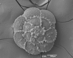 Sarit Ashckenazi-Polivoda合作论文数Geological Survey of Israel3
 Eric Achterberg合作论文数Chemical Oceanography Unit, Geomar Helmholtz Centre for Ocean Research Kiel;Division of Marine Biogeochemistry, Geomar Helmholtz Centre for Ocean Research Kiel;University of Kiel3
 Boaz Lazar合作论文数The Fredy & Nadine Herrmann Institute of Earth Sciences, The Hebrew University of Jerusalem3
 Klaus Jochum合作论文数Max-Planck-Institut für Chemie3
 Yael Kiro合作论文数Geological Survey of Israel3Naomi Moshe合作论文数2
 Yonathan Shaked合作论文数2Fangyuan Lin合作论文数2Xiqian Wang合作论文数2




