NW Türkiye is uniquely positioned between climatic influences from the North Atlantic, Mediterranean and Eurasia. Variability in climate systems through the Late Holocene is thought to have influenced major historical transitions, such as the ‘Bronze Age Collapse’, and during periods including the ‘Roman Climate Anomaly’ and the ‘Little Ice Age’. The region is noteworthy considering its geographical and historical significance over the last 4,000 years as a landscape for Ancient Greece Colonisation, the Roman Byzantine and Ottoman Empires and proximity to the common focal-point of modern-day Istanbul (Byzantium, Constantinople) which received much of its water from the cave’s locality. With the Eastern Mediterranean a hotspot for agricultural drought (Dabanlı et. al; 2017), which has impacted societies historically, the region warrants the study of spatio-temporal human-climate interactions.Given the scarcity of sub-decadal palaeoclimate records regionally, and heterogeneity of Eastern Mediterranean climate generally (Jacobson et. al; 2021), stalagmite U-1 from Uzuntarla cave in Thrace helps fill this gap. Speleothem U-1 was dated using a combination of U/Th and 14C dates. The chronology is further refined by aligning distinct growth-shifts with well-dated and strong historical earthquakes. Using the combined evidence of calcite fabric and growth laminae changes, stable isotope (δ13C, δ18O), trace elements (Mg/Ca, Sr/Ca, P/Ca) and fluid-inclusion analysis, we find that U-1 is highly sensitive to changes in cold-season regional precipitation, seasonality and temperature. For example, increases in δ13C often coincide with narrowing of growth-laminae and increased Sr/Ca suggesting a unified influence by reduced drip-rate during poor recharge conditions. Effective infiltration is between Oct:Mar, making δ18O a combined indicator for Fall:Winter:Spring seasonality balance and temperature. Initial fluid inclusion temperature estimates are promising with work ongoing, however other factors are worth discussing such as aeolian oceanic Mg inputs. Initial results, often complimenting other regional palaeoclimate records, paints a picture of dynamic changes in climate over the last 3,900 years BP spanning key historical transitions. Speleothem U-1 describes a large shift in aquifer-recharge and seasonality preceding the Bronze Age Collapse impacting SW Asia around 1190 BCE. Recharge then peaks anomalously in 650-690 BCE during the Homeric Minimum, coinciding with the Greek Colonisation and Byzantium’s founding ~667 BCE. The acclaimed Roman Climate Anomaly (150 BCE-200 CE) is without wet-anomalies but stable for U-1, with later evidence of aridification. Wetter and stable conditions follow during 200-600 CE, a period encompassing defining historical events including the establishment of Constantinople as a powerhouse of the East Roman Empire and major infrastructure development including aqueduct expansion into Thrace. The Medieval Climate Anomaly (950-1250 CE) is defined by wet conditions during 760-1100 CE transitioning into lower aquifer recharge between 1100-1220 CE. Finally, the Little Ice Age (1400-1700 CE) shows highly variable conditions, but generally transitions from a wetter and colder period to lower aquifer recharge between 1220 and 1760 CE. REFERENCESDabanlı et. al; 2017. Long-term spatio-temporal drought variability in Turkey. Journal of Hydrology, 552, pp.779-792.Jacobson et. al; 2021. Heterogenous late Holocene climate in the Eastern Mediterranean—the Kocain Cave record from SW Turkey. Geophysical Research Letters, 48(20), p.e2021GL094733.
Understanding past hydroclimate dynamics of the Eastern Mediterranean is crucial for predicting future climate impacts. However, the 'Marmara Transition Zone' in northwest Turkiye, a region of significant societal transformation, lacks high-resolution pre-industrial climate records. Continuous paleoclimate reconstructions are critical to reveal the nature and pattern of Late Holocene hydroclimatic changes and extremes, and to study their impacts on societies. Here, we present a precisely dated and sub-decadal resolution speleothem record from Uzuntarla cave, located near to Istanbul (historically Byzantium and Constantinople), that shows sensitivity to cold-season rainfall amount and seasonality for the Late Holocene. Prior to 2005 CE, stalagmite U-1 reveals two periods of high multidecadal variability of cold-seasonal rainfall in similar to 1900-400 BCE and similar to 690-1900 CE, separated by a relatively stable phase. This variability aligns with the rise and fall of Byzantine agrarian productivity between similar to 350 and 1250 CE, while the most pronounced aridification anomaly in similar to 1210-1170 BCE coincides with the collapse of the Hittite Empire (c. similar to 1200 BCE), partly linked to regional famine and drought. Our findings indicate that the transition from the Late Bronze Age to the Iron Age in the Marmara Transition Zone was marked by a pronounced shift in the regional climate regime. Namely, that a previously warmer and more stable 'Mediterranean-style' climate shifted toward cooler conditions characterised by increased rainfall variability, and a greater influence of moisture sourced from the Black Sea. Therefore, we suggest that cold-seasonal rains played a critical role in shaping human-climate interactions, power dynamics, and social stability in the Eastern Mediterranean during the Late Holocene. This record offers valuable context for understanding how hydroclimate variability influenced past societies, highlighting the importance of climate as a driver in historical societal resilience and collapse.
The Tramelan-2 borehole (Canton Bern, Switzerland) continuously cored a 275.60 m sequence of Palaeogene to Neogene sediments, providing a rare opportunity for sedimentological analysis of the Jura Molasse. Lithostratigraphy, sedimentary facies and heavy minerals allow correlation with the classical Swiss Molasse. Evidence for clastic input from Alpine and non-Alpine sources is consistent with deposition at the northern feather edge of the Molasse Basin. Grey sandstones at the base of the succession are tentatively interpreted as fluvial facies of the Lower Freshwater Molasse (USM). These are overlain by erosively-based conglomerates, interpreted as winnowed storm lags of locally-derived clasts and distantly-sourced Alpine material at the transgressive base of the Upper Marine Molasse (OMM). Above this, a range of plane-laminated and cross-bedded bioclastic sandstones are interpreted as the deposits of a meso- or macrotidal flat or estuarine complex. Facies evolution in the upper OMM records a series of stacked regressive cycles within an overall upward trend of reducing current energy, reflecting a transition from offshore to nearshore shallow marine environments. The unconformably overlying Upper Freshwater Molasse (OSM) passes upwards from micaceous siltstones and marls into a series of freshwater carbonates, dominated by lacustrine limestones which are arranged in repeated regressive cycles, each capped by organic-rich horizons. The middle part of the carbonate interval comprises palustrine limestones with pedogenetic fabrics recording periodic subaerial exposure. Stable isotope signatures from the palustrine facies reflect subaerial pedogenetic overprint, while the lacustrine carbonates record cyclical variations in δ 13 C which may reflect increases in organic material during progressive lake fill and/or an increased influence of aquifer waters during flooding events. The Jura Molasse onlapped a Mesozoic carbonate pediment hosting a regional karst system which remained active at least until the Burdigalian transgression on footwall highs bounding the Delémont Basin, and locally into the Langhian near Tramelan. This configuration controlled subsequent deposition of OSM carbonates which onlapped erosional and potentially early tectonic relief, and were deposited in groundwater-fed seasonal lacustrine/palustrine environments, where the karstic aquifer controls on seasonal hydrology appear to have been comparable to Caribbean freshwater carbonate wetland systems today.
<p>The fluctuating climatic conditions of the Saharo-Arabian desert belt are increasingly important for both palaeoclimatic and palaeoanthropological debates. Currently, Saharo-Arabia acts as a vast biogeographic barrier between the Afrotropical and Palaearctic realms. On orbital timescales, northward incursions of the African (ASM) and Indian (ISM) Summer Monsoons activated fluvio-lacustrine systems and led to the formation of grassland habitats. The formation of these habitats has been considered a crucial factor in&#160;<em>Homo sapiens&#160;</em>dispersals into the Saharo-Arabian deserts and beyond. The so-called &#8220;northern route&#8221; favours a terrestrial dispersal through green palaeohydrological corridors. However, a maritime &#8220;southern route&#8221; during the sea-level low-stand of Glacial Termination-II (T-II) has also been proposed. The precise phasing between the onset of wetter conditions and rising sea-levels may thus be a crucial factor for testing these alternative hypotheses. Here, we present a precisely dated high-resolution (<100 yrs) stalagmite record from Mukalla Cave, Yemen, at a key location on the &#8220;southern route&#8221;. Wetter conditions in Southern Arabia prevailed from ~127.7 to ~121.1 ka BP and occurred when sea-levels were already higher than at present, revealing a phase-lag of several thousand-years between sea-level rise and the onset of pluvial conditions. This lag is likely related to the colder conditions of Heinrich Stadial-11, which supressed the interhemispheric pressure gradient and the ASM and ISM throughout T-II despite rising insolation. &#948;<sup>18</sup>O<sub>ca</sub>&#160;values indicate rainfall intensity during the ~127.7 to ~121.1 ka BP interval 1) followed low-latitude insolation, and 2) was the greatest in the last 130,000 years. &#160;Additionally, a mixed C3/C4 grassland environment, as revealed by stalagmite &#948;<sup>13</sup>C<sub>ca</sub>&#160;values, was present in the now desert interior of Yemen. Combined with archaeological evidence, we discuss the potential implications our results have for&#160;<em>H. sapiens</em>&#160;biogeographical shifts and dispersal processes across Saharo-Arabia during early MIS 5.</p><p>&#160;</p>
Homo sapiens dispersals out of Africa are often linked to intensifications of the African and Indian Summer Monsoons. Current models advocate that dispersals along the "southern-route" into Arabia occurred during Glacial Termination-II (T-II), when lower sea-level and reduced Bab-al-Mandab width increased the likelihood of crossing. The precise phasing between sea-level and monsoon precipitation is thus key to assess the likelihood of a successful crossing or the behavioural and technological capacities that facilitated crossing. Based on a precisely-dated stalagmite record from Yemen, we reveal a distinct phase-lag of several thousand years between sea-level rise and major monsoon intensification. Pluvial conditions in Southern Arabia during MIS 5e lasted from similar to 127.7 to similar to 121.1 ka BP and occurred when sealevels were already higher than at present. Based on our observations, we propose three models for the dispersal of H. sapiens which all have pertinent implications for our understanding of human technological and behavioural capacities during MIS 5e. (C) 2022 Elsevier Ltd. All rights reserved.
The source and seasonality of rainfall in southern Arabia during the early‐ to mid‐Holocene and preceding humid periods are controversial because fossil lacustrine sediments provide solely indirect information on the amount of rainfall. Hydrogen and oxygen isotope measurements on fluid inclusion water trapped in Holocene and Pleistocene stalagmites from Hoti Cave in Northern Oman are direct indicators of the isotopic composition of paleoprecipitation. Isotope values of fluid inclusions formed during peak interglacial periods plot along monsoonal water lines and are indicative of a southern monsoonal moisture source. The last monsoon‐dominated period lasting from ∼10,100 to 6,300 years before present was terminated within a few decades in southeastern Arabia. The subsequent reduction in rainfall amount and change from predominantly summer to predominantly winter rainfall had a profound impact on human communities living in this area and triggered migration from inland to coastal areas where resources were more abundant.
In Arabia, the first half of the sixth century CE was marked by the demise of Himyar, the dominant power in Arabia until 525 CE. Important social and political changes followed, which promoted the disintegration of the major Arabian polities. Here, we present hydroclimate records from around Southern Arabia, including a new high-resolution stalagmite record from northern Oman. These records clearly indicate unprecedented droughts during the sixth century CE, with the most severe aridity persisting between ~500 and 530 CE. We suggest that such droughts undermined the resilience of Himyar and thereby contributed to the societal changes from which Islam emerged.
In this study, the dead carbon fraction (DCF) variations in stalagmite M1-5 from Socotra Island in the western Arabian Sea were investigated through a new set of high-precision U-series and radiocarbon (14C) dates. The data reveal an extreme case of very high and also climate-dependent DCF. For M1-5, an average DCF of 56.2±3.4 % is observed between 27 and 18 kyr BP. Such high DCF values indicate a high influence of aged soil organic matter (SOM) and nearly completely closed-system carbonate dissolution conditions. Towards the end of the last glacial period, decreasing Mg∕Ca ratios suggest an increase in precipitation which caused a marked change in the soil carbon cycling as indicated by sharply decreasing DCF. This is in contrast to the relation of soil infiltration and DCF as seen in stalagmites from temperate zones. For Socotra Island, which is influenced by the East African–Indian monsoon, we propose that more humid conditions and enhanced net infiltration after the Last Glacial Maximum (LGM) led to dense vegetation and thus lowered the DCF by increasing 14CO2 input into the soil zone. At the onset of the Younger Dryas (YD) a sudden change in DCF towards much higher, and extremely variable, values is observed. Our study highlights the dramatic variability of soil carbon cycling processes and vegetation feedback on Socotra Island manifested in stalagmite DCF on both long-term trends and sub-centennial timescales, thus providing evidence for climate influence on stalagmite radiocarbon. This is of particular relevance for speleothem studies that aim to reconstruct past atmospheric 14C (e.g., for the purposes of 14C calibration), as these would rely on largely climate-independent soil carbon cycling above the cave.
Past climates and environments experienced by the Saharo-Arabian desert belt are of prime importance for palaeoclimatic and palaeoanthropological research. On orbital timescales transformations of the desert into a grassland landscape in response to higher precipitation provided "windows of opportunity" for hominin dispersal from Africa into Eurasia. On long timescales, palaeoenvironmental reconstructions for the region are predominantly derived from marine sediments and available terrestrial records from the Arabian Peninsula are limited to 450 ka before present (BP). Here, we present a new stalagmite-based palaeoclimate record from Mukalla Cave in Yemen which extends back to similar to 1.1 million years BP or Marine Isotope Stage (MIS) 31, as determined by Uranium-lead dating. Stalagmite Y99 grew only during peak interglacial periods and warm substages back to similar to 1.1 Ma. Stalagmite calcite oxygen isotope (delta O-18) values show that every past interglacial humid period was wetter than the Holocene, a period in which large lakes formed in the now arid areas of southern Arabia. Carbon isotope (delta C-13) values indicate habitable grassland environments developed during these pluvial periods. A total of 21 pluvial periods with precipitation of more than 300 mm yr(-1) occurred since similar to 1.1 Ma and thus numerous opportunities for hominin dispersals occurred throughout the Pleistocene. New determinations of hydrogen (delta D-Fl) and oxygen (delta O-18(Fl)) isotopes in stalagmite fluid inclusion water demonstrates that enhanced precipitation in Southern Arabia was brought by the African and Indian Summer Monsoons. When combined with sub-annual calcite analysis of delta O-18 and delta C-13, these data reveal a distinct wet (summer) and dry (winter) seasonality. (C) 2019 Elsevier Ltd. All rights reserved.
The ~5.5 km sized Jabal Rayah ring structure located at 28°39′N/37°12′E in Saudi Arabia has been classified as a possible complex impact structure located in flat‐lying Paleozoic clastic sediments. Previous, detailed mapping showed that erosional processes led to a relief inversion, with displaced, folded, and faulted blocks of Silurian to Early Devonian strata, interpreted to form a ring syncline, now forming a topographically outstanding, 150 m high ring crest. The drainage toward the center of the structure seems controlled by a set of radial faults. This central part is eroded to the level of the surrounding plateau and partially covered with gravel. Analysis of 28 Qusaiba Formation sandstones showed that at the present outcrop level, the sediments seem devoid of shock features. Measurement of fold axes in the central part of the structure shows radially outward plunging fold axes, becoming steeper toward the center, and also fold axes of other orientation, and folded folds. This fold axis pattern is interpreted as an upward‐pointing, kilometer‐sized sheath fold. Assuming an impact scenario and using the present size of the structure, the minimum central structural uplift is estimated at ~500 m, which is consistent with Qusaiba Formation occupying the center of the ring structure.
Enzel et al. (2015) reassess sedimentary records of Early to Mid-Holocene lake sites in Arabia based on a reinterpretation of published multiproxy data and a qualitative analysis of satellite imagery. The authors conclude that these sites represent palaeo-wetland environments rather than palaeolakes and that the majority of the Arabian Peninsula experienced no or, if at all, only a very minor increase of rainfall at that time mainly due to eastward expansion of the East African Summer Monsoon. We disagree with their reassessment and identify several cases where unequivocal evidence for early Late Pleistocene and Early to Mid-Holocene perennial lake environments in Arabia, lasting for centuries to millennia, was neglected by Enzel et al. (2015). Here we summarize findings which indicate the presence of lakes from the sites of Jubbah, Tayma, Mundafan (all Saudi Arabia), Wahalah, Awafi (both UAE), and the Wahiba Sands (Oman), supported by evidence including occurrence of barnacle colonies in living position, remnant bioclastic shoreline deposits, undisturbed varve formation, shallowing-up lacustrine sequences, various aquatic freshwater, brackish and saline micro- and macrofossils, such as ichnofaunal remains, which are the result of prolonged field-based research. While the precise depth, hydrology and ecology of these water bodies is still not entirely resolved, their perennial nature is indicative of a markedly increased precipitation regime, which, in combination with more abundant groundwater and increased spring outflow in terminal basins fed by charged aquifers, was sufficient to overcome evaporative losses. The palaeolakes' influence on sustaining prehistoric populations is corroborated by the presence of rich archaeological evidence.
Enzel et al. (2015) reassess sedimentary records of Early to Mid-Holocene lake sites in Arabia based on a reinterpretation of published multiproxy data and a qualitative analysis of satellite imagery. The authors conclude that these sites represent palaeo-wetland environments rather than palaeolakes and that the majority of the Arabian Peninsula experienced no or, if at all, only a very minor increase of rainfall at that time mainly due to eastward expansion of the East African Summer Monsoon. We disagree with their reassessment and identify several cases where unequivocal evidence for early Late Pleistocene and Early to Mid-Holocene perennial lake environments in Arabia, lasting for centuries to millennia, was neglected by Enzel et al. (2015). Here we summarize findings which indicate the presence of lakes from the sites of Jubbah, Tayma, Mundafan (all Saudi Arabia), Wahalah, Awafi (both UAE), and the …
The Wadi ad Dawasir fluvial system in central Saudi Arabia is investigated using remote sensing and sedimentology, in combination with bio-proxy analyses (molluscs and ostracods). Age control is provided by radiocarbon as well as luminescence dating, using both quartz and feldspar grains. It is shown that the fluvial system was active from the Asir Mountains across the partially sand-covered interior of the Arabian Peninsula to the Arabian Gulf during the Holocene humid period. Sedimentology and faunal analysis reveal the presence of perennial streams and a permanent freshwater lake in the distal reach of the Dawasir system that are synchronous with fluvial accumulation in the headwaters of its major tributary, Wadi Tathlith. The increased runoff during the Holocene led to a re-activation of streams that largely followed pre-existing Late Pleistocene courses and eroded into older sediments. The absence of Holocene lakes in most of the Rub' al-Khali implies that trans-Arabian rivers were mainly fed by precipitation in the Asir Mountains. Monsoonal rainfall was apparently stronger there as well as in the northern, south-eastern and southern part of the Arabian Peninsula (southern Yemen and Oman), but it apparently did not directly affect the interior during the Holocene. The palaeoenvironmental reconstruction shows a narrow trans-Arabian green freshwater corridor as the result of phases of sustained flow lasting up to several centuries. The permanent availability of water and subsistence for wildlife provided a favourable environment for human occupation as documented by Neolithic stone tools that are found all along Wadi ad Dawasir.
ABSTRACT The Al Shomou Silicilyte Member (Athel Formation) in the South Oman Salt Basin shares many of the characteristics of a light, tight-oil (LTO) reservoir: it is a prolific source rock mature for light oil, it produces light oil from a very tight matrix and reservoir, and hydraulic fracking technology is required to produce the oil. What is intriguing about the Al Shomou Silicilyte, and different from other LTO reservoirs, is its position related to the Precambrian/Cambrian Boundary (PCB) and the fact that it is a ‘laminated chert’ rather than a shale. In an integrated diagenetic study we applied microstructural analyses (SEM, BSE) combined with state-of-the-art stable isotope and trace element analysis of the silicilyte matrix and fractures. Fluid inclusion microthermometry was applied to record the salinity and minimum trapping temperatures. The microstructural investigations reveal a fine lamination of the silicilyte matrix with a mean lamina thickness of ca. 20 μm consisting of predominantly organic matter-rich and finely crystalline quartz-rich layers, respectively. Authigenic, micron-sized idiomorphic quartz crystals are the main matrix components of the silicilyte. Other diagenetic phases are pyrite, apatite, dolomite, magnesite and barite cements. Porosity values based on neutron density logs and core plug data indicate porosity in the silicilyte ranges from less than 2% to almost to 40%. The majority of the pore space in the silicilyte is related to (primary) inter-crystalline pores, with locally important oversized secondary pores. Pore casts of the silica matrix show that pores are extremely irregular in three dimensions, and are generally interconnected by a complex web or meshwork of fine elongate pore throats. Mercury injection capillary data are in line with the microstructural observations suggesting two populations of pore throats, with an effective average modal diameter of 0.4 μm. The acquired geochemical data support the interpretation that the primary source of the silica is the ambient seawater rather than hydrothermal or biogenic. A maximum temperature of ca. 45°C for the formation of microcrystalline quartz in the silicilyte is good evidence that the lithification and crystallization of quartz occurred in the first 5 Ma after deposition. Several phases of brittle fracturing and mineralization occurred in response to salt tectonics during burial. The sequences of fracture-filling mineral phases (dolomite - layered chalcedony – quartz – apatite - magnesite I+II - barite – halite) indicates a complex fluid evolution after silicilyte lithification. Primary, all-liquid fluid inclusions in the fracture-filling quartz are good evidence of growth beginning at low temperatures, i.e. ≤ 50ºC. Continuous precipitation during increasing temperature and burial is documented by primary two-phase fluid inclusions in quartz cements that show brines at 50°C and first hydrocarbons at ca. 70°C. The absolute timing of each mineral phase can be constrained based on U-Pb geochronometry, and basin modelling. Secondary fluid inclusions in quartz, magnesite and barite indicate reactivation of the fracture system after peak burial temperature during the major cooling event, i.e. uplift, between 450 and 310 Ma. A number of first-order trends in porosity and reservoir-quality distribution are observed which are strongly related to the diagenetic and fluid history of the reservoir: the early in-situ generation of hydrocarbons and overpressure development arrests diagenesis and preserves matrix porosity. Chemical compaction by pressure dissolution in the flank areas could be a valid hypothesis to explain the porosity variations in the silicilitye slabs resulting in lower porosity and poorer connectivity on the flanks of the reservoir. Most of the hydrocarbon storage and production comes from intervals characterized by preserved micropores, not hydrocarbon storage in a fracture system. The absence of oil expulsion results in present-day high oil saturations. The main diagenetic modifications of the silicilyte occurred and were completed relatively early in its history, i.e. before 300 Ma. An instrumental factor for preserving matrix porosity is the difficulty for a given slab to evacuate all the fluids (water and hydrocarbons), or in other words, the very good sealing capacity of the salt embedding the slab.
Shallow lakes and sabkha deposits are evidence of past periods of higher groundwater table than today, and hence reflect increased humidity in the Rub' al-Khali, the large desert in the southern part of the Arabian Peninsula. Reported here are the observations made during four expeditions into this remote area in combination with luminescence dating constraining the age of the deposits. The results presented extend the spatial coverage of evidence and show that most of the deposits correlate to MIS 5 (ca. 130–70ka) and the Early/Mid Holocene (ca. 11–5.5ka). A single sample points towards potentially more humid conditions during the transition MIS 4/3 (ca. 65–55ka). The presence of the mussel Unio in some of the deposits attributed to MIS 5 is indirect evidence for the presence of fish in the lakes, which must have supported a rich and diverse fauna (and probably also flora). Together with other evidence, this demonstrates that a number of small persistent lakes were spread across the Rub' al-Khali for at least some of the time. These lakes would not only have been a potential source of freshwater but could also have provided an additional and easy accessible food source via the fish for humans migrating through the area. The presented palaeoenvironmental data underlines that parts of MIS 5 represent a time window of opportunity for a potential expansion of modern humans across Arabia.
We have investigated the Ash Shutbah circular structure in central Saudi Arabia (21 degrees 37N 45 degrees 39E) using satellite imagery, field mapping, thin-section petrography, and X-ray diffraction of collected samples. The approximately 2.1km sized structure located in flat-lying Jurassic Tuwaiq Mountain Limestone has been nearly peneplained by erosional processes. Satellite and structural data show a central area consisting of Dhruma Formation sandstones with steep bedding and tight folds plunging radially outward. Open folding occurs in displaced, younger Tuwaiq Mountain Limestone Formation blocks surrounding the central area, but is absent outside the circular structure. An approximately 60cm thick, unique folded and disrupted orthoquartzitic sandstone marker bed occurring in the central area of the structure is found 140m deeper in undisturbed escarpment outcrops located a few hundred meters west of the structure. With exception of a possible concave shatter cone found in the orthoquartzite of the central area, other diagnostic shock features are lacking. Some quartz-rich sandstones from the central area show pervasive fracturing of quartz grains with common concussion fractures. This deformation was followed by an event of quartz dissolution and calcite precipitation consistent with local sea- or groundwater heating. The combination of central stratigraphic uplift of 140m, concussion features in discolored sandstone, outward-dipping concentric folds in the central area, deformation restricted to the rocks of the ring structure, a complex circular structure of 2.1km diameter that appears broadly consistent with what one would expect from an impact structure in sedimentary targets, and a possible shatter cone all point to an impact origin of the Ash Shutbah structure. In fact, the Ash Shutbah structure appears to be a textbook example of an eroded, complex impact crater located in flat-lying sedimentary rocks, where the undisturbed stratigraphic section can be studied in escarpment outcrops in the vicinity of the structure.
Four stalagmites covering the last 7.0 ka were sampled on Socotra, an island in the northern Indian Ocean to investigate the evolution of the northeast Indian Ocean Monsoon (IOM) since the mid Holocene. On Socotra, rain is delivered at the start of the southwest IOM in May-June and at the start of the northeast IOM from September to December. The Haggeher Mountains act as a barrier forcing precipitation brought by the northeast winds to fall preferentially on the eastern side of the island, where the studied caves are located. delta O-18 and delta C-13 and Mg/Ca and Sr/Ca signals in the stalagmites reflect precipitation amounts brought by the northeast winds. For stalagmite STM6, this amount effect is amplified by kinetic effects during calcite deposition. Combined interpretation of the stalagmites' signals suggest a weakening of the northeast precipitation between 6.0 and 3.8 ka. After 3.8 ka precipitation intensities remain constant with two superimposed drier periods, between 0 and 0.6 ka and from 2.2 to 3.8 ka. No link can be established with Greenland ice cores and with the summer IOM variability.In contrast to the stable northeast rainy season suggested by the records in this study, speleothem records from western Socotra indicate a wettening of the southwest rainy season on Socotra after 4.4 ka. The local wettening of western Socotra could relate to a more southerly path (more over the Indian Ocean) taken by the southwest winds. Stalagmite STM5, sampled at the fringe between both rain areas displays intermediate delta O-18 values. After 6.2 ka, similar precipitation changes are seen between eastern Socotra and northern Oman indicating that both regions are affected similarly by the monsoon. Different palaeoclimatologic records from the Arabian Peninsula currently located outside the ITCZ migration pathway display an abrupt drying around 6 ka due to their disconnection from the southwest rain influence. Records that are nowadays still receiving rain by the southwest winds, suggest a more gradual drying reflecting the weakening of the southwest monsoon. (c) 2013 Elsevier Ltd. All rights reserved.
Volume 11th Swiss Geoscience Meeting Lausanne, 15th – 16th November 2013 4. Cycles and Events in Earth History
An organic-rich laminated chert (silicilyte) consisting of up to 90% microcrystalline quartz that formed at the Precambrian-Cambrian boundary acts as a light-oil reservoir in the subsurface of the South Oman Salt Basin, Sultanate of Oman. Fully encased in salt domes, it was first discovered during the 1990's hydrocarbon exploration activities of Petroleum Development Oman. Because of the economic significance and the unconventional reservoir characteristics, there is great interest in understanding the origin of the laminated chert, its source of silica and mode of precipitation in an anoxic, sulphur-rich, stagnant and highly saline basin.The homogeneous distribution and high values of stable Si isotope composition (avg. delta Si-30 = 0.83 +/- 0.28) coupled with a low molar Ge/Si ratio (<0.25 x 10(-6)) of the microcrystalline matrix quartz clearly reveal dissolved silica in the seawater as the Si source, whereas hydrothermal or biogenic (e.g. sponge-derived) silica can be excluded.Silica precipitation from seawater was likely the result of a dramatic increase in salinity in response to salt dissolution atop and adjacent to the edges of transtensional depressions on the deep basin floor, thus markedly reducing the solubility of amorphous silica in these brine-filled seawater depressions. This saturation triggered the formation of silica-gel, which accumulated at the basin floor forming a soft silica-rich layer on bacterial mats giving rise to a laminated sediment. The mean number of laminae is ca. 32 per year suggesting that layering is non-annual and controlled by processes such as fluctuations in nutrient supply, lunar driven re-mixing or diagenetic segregation.The transformation of the silica-gel to microcrystalline quartz occurred below 45 degrees C indicating a less than -4.5 parts per thousand delta O-18 composition of the pore-water during microcrystalline quartz formation. (c) 2012 Elsevier Ltd. All rights reserved.
Present climate in the Nafud desert of northern Saudi Arabia is hyper-arid and moisture brought by north-westerly winds scarcely reaches the region. The existence of abundant palaeolake sediments provides evidence for a considerably wetter climate in the past. However, the existing chronological framework of these deposits is solely based on radiocarbon dating of questionable reliability, due to potential post-depositional contamination with younger C-14. By using luminescence dating, we show that the lake deposits were not formed between 40 and 20 ka as suggested previously, but approximately ca 410 ka, 320 ka, 200 ka, 125 ka, and 100 ka ago. All of these humid phases are in good agreement with those recorded in lake sediments and speleothems from southern Arabia. Surprisingly, no Holocene lake deposits were identified. Geological characteristics of the deposits and diatom analysis suggest that a single, perennial lake covered the entire south-western Nafud ca 320 ka ago. In contrast, lakes of the 200 ka, 125 ka, and 100 ka humid intervals were smaller and restricted to interdune depressions of a preexisting dune relief. The concurrent occurrence of humid phases in the Nafud, southern Arabia and the eastern Mediterranean suggests that moisture in northern Arabia originated either from the Mediterranean due to more frequent frontal depression systems or from stronger Indian monsoon circulation, respectively. However, based on previously published climate model simulations and palaecolimate evidence from central Arabia and the Negev desert, we argue that humid climate conditions in the Nafud were probably caused by a stronger African monsoon and a distinct change in zonal atmospheric circulation. (C) 2013 Elsevier Ltd. All rights reserved.
 Dominik Fleitmann合作论文数Inst Geol Sci, Univ Bern45
 Stephen J. Burns合作论文数Department of Earth, Geographic, and Climate Sciences, College of Natural Sciences, University of Massachusetts Amherst41
 Augusto Mangini合作论文数20
 Jan Kramers合作论文数University of Johannesburg19
 Manfred Mudelsee合作论文数Research Department, Climate Risk Analysis18Karl Ramseyer合作论文数15
 Frank Preusser合作论文数Institute of Earth and Environmental Sciences, University of Freiburg;Faculty of Environment and Natural Resources, University of Freiburg13Tjerk Peters合作论文数12
 Hai Cheng (程海)合作论文数Institute of Global Environmental Change, Xi'an Jiaotong University;School of Human Settlements and Civil Engineering, Xi'an Jiaotong University10U. Neff合作论文数9
 Richard Lawrence Edwards (艾思本)合作论文数Department of Geology and Geophysics,University of Minnesota8
 Fritz Schlunegger合作论文数Institute of Geological Sciences, Faculty of Science, University of Bern8
 Raymond S. Bradley (Ray Bradley)合作论文数Department of Geosciences, College of Natural Sciences, University of Massachusetts Amherst7
 Doug Burbank合作论文数Department of Earth Science, University of California, Santa Barbara6M. Hauser合作论文数6
 Abdulkarim Al-Subbary合作论文数Faculty of Science, University of Sana’a6
 Philip Allen合作论文数Department of Earth Science & Engineering, Imperial College London5Thomas Rosenberg合作论文数5
 Rossana Martini合作论文数Department of Geology and Palaeontology, University of Geneva5
 Ingo Blechschmidt合作论文数Institut für Geologie;Universität Bern;Institut für Geologie, Universität Bern5khalid alwagdani合作论文数4JE AMTHOR合作论文数4L Zaninetti合作论文数4
 Stefan Schröder合作论文数The University of Manchester4Dirk Radies合作论文数Geologisches Institut, RWTH Aachen University4
 H.Niklaus Waber合作论文数4
 Edwin Gnos合作论文数Museum d’Histoire Naturelle, 1 Route de Malagnou, 1211 Geneve 6, Switzerland4
 Joachim Amthor合作论文数Petroleum Development Oman4
 Beda Hofmann合作论文数Institute of Geological Sciences, University of Bern;Natural History Museum Bern, University of Bern4M Mange合作论文数3Samuel L. Nicholson合作论文数3Abdulaziz A. Al-Solami合作论文数3Constanze E Weyhenmeyer合作论文数3B. Engesser合作论文数3mahmoud alshanti合作论文数3O Kempf合作论文数3
 Rob Hosfield合作论文数Department of Archaeology, University of Reading3
 John Grotzinger合作论文数Division of Geological and Planetary Sciences, California Institute of Technology3
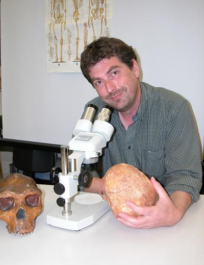 Alistair Pike合作论文数Department of Archaeology,University of Southampton3
 Daniel Vachard合作论文数UMR 8014 du CNRS, Université des Sciences et Technologies de Lille3Leopold Krystyn合作论文数3
 Paulian Dumitrica合作论文数3W. Leu合作论文数3
 Okan Tuysuz合作论文数Avrasya Yer Bilimleri Enstitüsü3Siddiq N. Habibullah合作论文数2Mohammed Halawani合作论文数2Ayman Mahjub合作论文数2
 Elisa Hofmeister合作论文数2
 Matthew J Jacobson合作论文数Dept Archaeol, Univ Reading2




