Recent palaeoanthropological discoveries in China indicate that eastern Asia had an important role in the evolutionary history of the genus Homo over the past 2 million years. New taxonomic proposals have been made to re-group archaic human fossils, including those considered to be Denisovans, as Homo juluensis and Homo longi. The hypothesis that the affinities of Yunxian 2, dated to about 1 million years ago, also infer an early divergence of the Homo sapiens lineage further underscores China's pivotal role in global evolutionary narratives. Here we explore key biological and cultural evidence emerging from the Chinese record and its evolutionary implications, raising questions about the relationships between 'transitional' clades and their differing adaptive capabilities. Rather than an evolutionary cul-de-sac, China now appears as a dynamic evolutionary crossroad where multiple Homo lineages may have arisen, interacted and adapted to shifting environments. The growing fossil and genetic evidence point to a diversity of populations whose demographic history and gene flow exchange helped to shape the broader mosaic of our species.
Technological innovations in Africa and western Europe in the later part of the Middle Pleistocene signal the behavioural complexity of hominin populations. Yet, at the same time, it has long been believed that hominin technologies in Eastern Asia lack signs of innovation and sophistication. Here, we report on technological innovations occurring at Xigou, in the Danjiangkou Reservoir Region, central China, dating to ~160,000–72,000 years ago. Technological, typological, and functional analyses reveal the presence of advanced technological behaviours spanning over a 90,000-year period. The Xigou hominins used core-on-flake and discoid methods to effectively obtain small dimensional flakes to manufacture a diverse range of tool forms. The identification of the hafted tools provides the earliest evidence for composite tools in Eastern Asia, to our knowledge. Technological innovations revealed at Xigou and other contemporary sites in China correspond with increasing evidence for Late Quaternary hominin morphological variability, including larger brain sizes, such as demonstrated at Lingjing (Xuchang) in central China. The complex technological advancements recorded at Xigou indicate that hominins developed adaptive strategies that enhanced their survivability across fluctuating environments of the late Middle Pleistocene and middle Late Pleistocene in Eastern Asia. Stone tools illustrate behavioural complexities in Middle Pleistocene hominin populations. Here, the authors present small dimensional flakes and hafted tools from Xigou, central China, dated to ~160–72 thousand years ago that demonstrate early, complex technological advancements.
The Fertile Crescent region, spanning from the upper Euphrates to the head of the Gulf of Aqaba, witnessed the earliest transition in the world from hunting and gathering wild foods to farming domesticates. Natufian Epipalaeolithic and Pre-Pottery Neolithic (PPN) communities in this region created distinctive stone tools across the Pleistocene-Holocene transition. Here we present archaeological evidence from the site of Sahout, demonstrating that communities using material culture characteristic of the Natufian and PPN were also present hundreds of kilometres south of the Fertile Crescent, in the much more arid interior of the Arabian Peninsula. Repeated occurrence of distinctive stone tools from 13.5 to 8.7 thousand years ago indicates intimate links to the Levant; showing both the far greater scale of these cultural connections than previously known, and the capacity of Natufian and PPN tool makers to subsist in marginal environments. Obsidian sourcing shows long-distance movement further southward into Arabia. At Sahout, PPN tools are associated with a regional rock art tradition of naturalistic life-sized camel engravings, which overlie representations of curvaceous women. The material culture of these communities suggests that long-term survival in relatively arid environments was based on a combination of local adaptation and a network of long-distance connections.
The gathering and use of ochre is a common behavior documented among Late Pleistocene human populations across the globe. Yet ochre use in the Paleolithic archaeological record of China remains poorly understood. Here we report on 36 pieces of ochre and 21 lithic artifacts with ochre residues from the archaeological deposits in Fodongdi Cave, Yunnan Province. These ochre finds, recovered from a succession of well-dated stratigraphic layers, offer an opportunity to discuss ochre use during the terminal Pleistocene in southwest China between 18,400 and 14,000 cal BP. We characterized the ochre assemblage using a combination of optical microscopy, thin section analysis, portable X-ray fluorescence, laser-induced breakdown and Raman spectrographic techniques, alongside scanning electron microscopy (with energy-dispersive X-ray spectroscopy). Results indicate at least three petrographic and chemically distinct groups of locally available ochre were used (presumably as red pigments). The ochre assemblage contains 27 pieces with clear anthropogenic modification including microstriations within grooves, parallel striations with polish, as well as smoothed areas with microstriations and luster. Use-wear traces and ochre residues on processing tools indicates that ochre was ground on grindstones and rubbed on soft materials, with quartzite pebbles used to process ochre before the pebbles were themselves flaked (used for tool stone). The Fodongdi Cave study provides novel information for southern China, suggesting the selection of local ochre sources, their processing directly onto grindstones and by rubbing against soft surfaces such as hide or human skin at the site, and the collection and use of different proportions of (local) ochres during the terminal Pleistocene.
Abstract South Asia is central to debates on early human dispersals, particularly the Out of Africa model and Eurasian colonization. Studies of M haplogroups have been used to support both Northern and Southern route hypotheses, but current archaeological and genetic evidence in the region remains contradictory. In the present work, we find that in addition to haplogroup M lineages, a few R lineages exhibit ancient, locally rooted variation, with R30 being one of the widespread haplogroup of R lineages across South Asia. To better understand South Asian demographic history, we investigated the phylogeographic distribution of haplogroup R30, an indigenous lineage. We used 190 complete modern and ancient sequences from diverse mainland and island populations including incorporation of 44 newly generated sequences which enabled the refinement of the R30 phylogeny and the identification of a novel basal lineage, R30c. Bayesian and ρ-based age estimates suggest that R30 originated in the Indian subcontinent ~50 kya. Early diversification likely occurred in Northern India, giving rise to R30b (~44 kya), while R30a and R30c differentiated primarily in Southern India. Several subclades of haplogroup R30 exhibit strong signatures of founder effects, particularly among the language isolate Vedda of Sri Lanka, Uru Kurumban of Southern India, and the populations of the Lakshadweep archipelago. Bayesian skyline analyses indicate long-term demographic stability followed by rapid lineage expansion ~20 kya and more recent declines consistent with localised drift and relatively recent founder events. The presence of early-diverging R30 lineages in Thailand and Indonesia further supports long-term connections between South and Southeast Asia. Overall, archaeological and genetic evidence point towards the multiple migrations for South Asia colonizations.
Climate variability, especially monsoonal rainfall, has significantly shaped habitable areas for human populations in South Asia in the past just as it does today. Instances of climate-driven social disruptions and population movements are evident worldwide, as evidenced for example in the Classic Maya and the Indus Valley Civilization (IVC). However, climate change can manifest in very different ways in terms of vegetation and fire regimes, with important implications for regional environmental histories as well as socio-political patterns. As such, it is essential to develop a comprehensive understanding of the intricate interplay between climate, vegetation, fire, and archaeological evidence relating to changes in settlement patterns and continuities. Insights derived from such studies offer a foundation to explore and comprehend present and future human-environment interactions. Here we present multi-proxy time-series datasets derived from a 2.25-meter geological trench known as ‘Jankipura,’ located within the semi-arid Thar Desert. Jankipura, located near Didwana Lake, holds prehistoric importance, being surrounded by major archaeological sites in the Thar Desert. It is also a part of the Didwana Palaeolithic Complex, surrounded by the IVC, Jodhpura-Ganeshwar, and Ahar-Banas cultural regions. The chronology of the Jankipura trench is constructed based on four 14C AMS dates ranging from 183 to 4656 cal yr. BP, aligning with the Mature phase of the IVC – a period characterized by population migration and a severe reduction in settlement density. Our analysis encompasses measurements of sediment total organic and bulk carbon isotope (d13Cbulk) composition, alongside examinations of plant-wax molecular distributions (n-alkanes and fatty acids). Additionally, we analyzed the δ13C and δ2H values of long-chain n-alkanes (C27, C29, C31, and C33) and fatty acids (C26, C28, C30, and C32) extracted from the sediment samples. Our study also involved the assessment of macro-charcoal concentrations (>125 µm, differentiating grass from wood) to reconstruct the climate-vegetation-fire relationships during and after a major period of disruption of the IVC. The findings highlight an dry phase between 4656 and 2932 cal yr. BP, characterized by a mixed C3-C4 vegetational landscape with limited fire episodes. A significant fire episode took place during the period from 2932 to 1960 cal yr. BP, suggesting dry conditions supported by abundant C4 vegetation. Between 1960 and 183 cal yr. BP, three minor fire events occurred amid fluctuating rainfall conditions and a landscape dominated by mixed C3-C4 vegetation. The identified macro-charcoal predominantly comprised woody fragments over grass fragments. Notably, an increasing trend in isotope values, reaching its peak in macro-charcoal, is observed between 183 cal yr. BP and the present, signifying increased aridity compared to the mature phase of the IVC. Although the study is based on a single trench, our observation of a weak relationship between vegetation and fire suggests that the reconstructed fire events may have originated from anthropogenic activities. This sheds light on the significance of vegetation, especially the utilization of wood, during the Mature phase of the IVC. We recommend generating more records from this region to better comprehend the spatio-temporal interaction of the IVC population with the environment.
Stable carbon isotope (δ13C) analysis of soil organic matter (SOM) from archaeological contexts is widely employed as a proxy for palaeovegetation and palaeoenvironmental reconstruction. However, the reliability of δ13CSOM as a palaeovegetation proxy is influenced by issues of physico-chemical diagenesis and isotopic fractionation, prompting increased interest in source-specific biomarker approaches. In this study, we present a case study from the Palaeolithic site of Jwalapuram (India), where plant-wax biomarker data indicate the degradation of plant-derived lipids, raising concerns about the reliability of δ13CSOM as a palaeovegetation proxy in this context. To further investigate SOM degradation, topsoil samples from central Andhra Pradesh were analyzed, revealing variable levels of SOM preservation across the region, strongly correlated with sedimentary and vegetation contexts. Our research highlights the importance of integrating source-specific proxies, such as plant-wax biomarkers, with bulk proxies such as δ13CSOM to mitigate preservation biases and ensure the integrity of palaeovegetation reconstructions.
Drylands cover almost half of Earth’s land surfaces, supporting ~30% of the world’s population. The International Panel on Climate Change predicts increasing aridification and expansion of drylands over the course of this century. As we approach new climate states without societal precedent, Earth’s geological past may offer the best tool to understand hydroclimate change under previously, allowing us to elucidate responses to external forcing. Paleo-records from previously warm and high-CO2 periods in Earth’s past, such as the mid-Pliocene (~3 Ma), point towards higher humidity in many dryland regions. Here, we examine desert speleothems from the hyper-arid desert in central Arabia, part of the largest near-continuous chain of drylands in the world, stretching from north-western Africa to the northern China, to elucidate substantial and recurrent humid phases over the past 8 million years. Independent quantitative paleo-thermometers suggest that mean annual air temperatures in central Arabia were approximately between 1 to 5 °C warmer than today. The analyses of the isotopic composition (δ18O and δ2H) of speleothem fluid inclusion waters, representing ‘fossil rainwater’, reveal an aridification trend in Arabia from the Late Miocene to Late Pleistocene during Earth’s transition from a largely ‘ice-free’ northern hemisphere to an ‘ice-age’ world. Together, our data provide evidence for recurrent discrete wetter intervals during past warmer periods, such as the Pliocene. Data-model comparisons allow us to assess the agreement between our paleoclimate data and climate model output using the HadCM3 isotope-enabled model simulations during past ‘warmer worlds’ – namely the mid-Piacenzian warm period (3.264 to 3.025 Ma). To assess the hydroclimate response to external forcing, we examine model output from a series of sensitivity experiments with different orbital configurations allowing us to postulate the mechanisms responsible for the occurrence of humid episodes in the Arabian desert, with potential implications for other dryland regions at similar latitudes. Together, our approach unveils the long-term controls on Arabian hydroclimate and may provide crucial insights into the future variability.
Understanding the nature and tempo of global environmental responses to the ∼74,000 BP (∼74 ka) Toba volcanic super-eruption is based primarily on historical analogies and climate models that lack ground-truthing in regions distal to eruptions. Here, we report the first proxy-based terrestrial record of the immediate environmental impact of the Younger Toba Tuff (YTT) eruption on the hominin-occupied ecosystem in peninsular India, spanning six annual monsoonal cycles directly following the YTT event. We present a multiproxy paleoclimate dataset from Jwalapuram in southern India, featuring a geochemical characterization of multiple YTT tephra and hardpan layers, complemented by detailed stratigraphic observations, sedimentological insights, and stable carbon isotope data. Taken together, these multiple lines of evidence show a progressive trend of tephra weathering and strong evapotranspiration in the immediate aftermath of the YTT, suggesting multiannual regional warming. Our results underline the complex responses of regional environments to the Toba super-eruption, which extend beyond a simple widespread "volcanic winter."
Lithic miniaturization is a key adaptive and technological feature of human populations and one of the key cultural hallmarks in the Late Pleistocene of Eastern Asia. In northern China this form of stone tool technology is well represented, including by microblade technology. Lithic miniaturization has been identified in South China, though this technological feature has received little research attention in comparison to the north. Here, we examine three miniaturized lithic assemblages in South China, ranging from the terminal Pleistocene to middle Holocene. To examine technological variations in lithic miniaturization, the three assemblages were subject to comparative quantitative analyses, including principal component analysis (PCA), K-means clustering and the Zingg system. The three sites were found to exhibit varied temporal and geographic patterns of lithic miniaturization across South China, potentially related to fluctuating climatic conditions and changes in population dynamics since the Late Pleistocene.
Dated archaeological sites are absent in northern Arabia between the Last Glacial Maximum (LGM) and 10,000 years ago (ka), signifying potential population abandonment prior to the onset of the Holocene humid period. Here we present evidence that playas became established in the Nefud desert of northern Arabia between ~16 and ~13 ka, the earliest reported presence of surface water following the hyper-aridity of the LGM. These fresh water sources facilitated human expansions into arid landscapes as shown by new excavations of stratified archaeological sites dating to between 12.8 and 11.4 ka. During the Pleistocene-Holocene transition, human populations exploited a network of seasonal water bodies - marking locations and access routes with monumental rock engravings of camels, ibex, wild equids, gazelles, and aurochs. These communities made distinctive stone tool types showing ongoing connections to the late Epipalaeolithic and Pre-Pottery Neolithic populations of the Levant.
The adaptive shift that favored stone tool-assisted behavior in hominins began by 3.3 million years ago. However, evidence from early archaeological sites indicates relatively short-distance stone transport dynamics similar to behaviors observed in nonhuman primates. Here we report selective raw material transport over longer distances than expected at least 2.6 million years ago. Hominins at Nyayanga, Kenya, manufactured Oldowan tools primarily from diverse nonlocal stones, pushing back the date for expanded raw material transport by over half a million years. Nonlocal cobbles were transported up to 13 kilometers for on-site reduction, resulting in assemblage patterns inconsistent with accumulations formed by repeated short-distance transport events. These findings demonstrate that early toolmakers moved stones over substantial distances, possibly in anticipation of food processing needs, representing the earliest archaeologically visible signal for the incorporation of lithic technology into landscape-scale foraging repertoires.
The hydroclimate change in the hot and arid Arabian Desert under anthropogenic global warming is a subject of ongoing discussions. Climate models project rising mean annual temperatures coupled with decreasing precipitation averaged over Saudi Arabia with regional variance (Almazroui, 2020). Stable isotope analysis on a combined speleothem record from central Arabia revealed recurring local humid periods during globally warmer intervals over the past ~8 million years (Markowska et al., in review). The speleothem record showed a long-term drying trend towards present, which may potentially be controlled by temperature change. The present study aims to reconstruct mean annual air temperatures (MAATs) of central Arabia during humid periods. These temperatures provide valuable benchmark data for past and future climate models in a region where terrestrial climate archives are scarce. Recent advances in speleothem-based paleothermometry facilitate extracting robust MAATs. We present data from several independent paleothermometers: Fluid inclusion isotopes (de Graaf et al., 2020), TEX86 (Meckler et al., 2021; Wassenburg et al., 2021), fluid inclusion microthermometry (Krüger et al., 2011), and dual clumped isotopes (Bajnai et al., 2020). These reconstructions show that recurrent wet intervals during the Miocene to Pleistocene in the Arabian Peninsula occurred at warmer than modern MAATs. We note, however, that temperature is not the only driver of humidity in the Arabian Peninsula and that both dry and humid periods likely existed under a warmer than today’s climate. Therefore, these observations cannot directly be interpreted as indicator that anthropogenic global warming will lead to future wet conditions in Saudi Arabia. Overall, we provide novel quantitative paleoclimate parameters that can inform climate model experiments leading to improved predictions for future climate scenarios.
The spread of food production in sub-Saharan Africa involved multi-directional dispersals of domesticated plant and animal species, often associated with major migrations. The Lake Victoria Basin of eastern Africa was likely an important crossroads in this process, hosting interactions between diverse populations with hunter-gatherer, mobile pastoralist, and farming lifeways in the Holocene. Recent discovery of a large assemblage of ancient domesticated plant remains at Kakapel Rockshelter in the Chelelemuk Hills of Busia County, western Kenya have provided new insights into the timing for when different domesticated crops were adopted within this key region. Here, we expand on the archaeological and cultural context for these findings by reporting results of field excavations, regional surveys, radiocarbon dating, and artifact analyses for deposits recovered from Kakapel Rockshelter dating over the last 9,000 years. Multiple occupational episodes with distinct cultural and technological traits are apparent including Early Holocene foragers, Early Iron Age agropastoralists, and multiple Later Iron Age populations. Agropastoralism first appears here by c. 2400 BP, but it is not until the introduction of sorghum and finger millet after c. 1200 BP in association with arrivals of new groups with Nilotic ancestry that we document the shift to a higher density of sites and longer-term settlement in the region.
The Saharo-Arabian Desert is one of the largest biogeographical barriers on Earth, impeding dispersals between Africa and Eurasia, including movements of past hominins. Recent research suggests that this barrier has been in place since at least 11 million years ago 1 . In contrast, fossil evidence from the late Miocene epoch and the Pleistocene epoch suggests the episodic presence within the Saharo-Arabian Desert interior of water-dependent fauna (for example, crocodiles, equids, hippopotamids and proboscideans) 2–6 , sustained by rivers and lakes 7,8 that are largely absent from today’s arid landscape. Although numerous humid phases occurred in southern Arabia during the past 1.1 million years 9 , little is known about Arabia’s palaeoclimate before this time. Here, based on a climatic record from desert speleothems, we show recurrent humid intervals in the central Arabian interior over the past 8 million years. Precipitation during humid intervals decreased and became more variable over time, as the monsoon’s influence weakened, coinciding with enhanced Northern Hemisphere polar ice cover during the Pleistocene. Wetter conditions likely facilitated mammalian dispersals between Africa and Eurasia, with Arabia acting as a key crossroads for continental-scale biogeographic exchanges.
Abundant geomorphological, biological, and isotopic records show that Arabia repeatedly underwent significant climate-driven environmental changes during late Quaternary humid periods. Precisely mapping how the enhancement and expansion of the African Monsoon during these humid periods have affected landscape evolution and human occupation dynamics in Arabia remains a scientific challenge. Here we reconstruct an ancient water-sculpted landscape consisting of lake and river deposits, coupled with a large outlet valley in the Rub' al Khali Desert of Saudi Arabia. During the peak of the Holocene Humid Period or before, intense rainfall reactivated alluvial floodplains and filled a ~1100 km² topographic depression, which eventually breached, carving a deep ~150 km-long valley. Coupling geologic reconstructions with transient Earth system model simulations shows that this hydrological activity was linked to higher seasonal precipitation punctuated by repeated heavy events. Analysis of lacustrine and fluvial sedimentary deposits implies sediment routing across distances of up to 1000 km from the Asir Mountains. Our results indicate that such intense flooding challenges the conventional view of simple, weak, and linear landscape stabilization following increased rainfall in Arabia. Our findings highlight the crucial role of an enhanced African Monsoon in driving rapid landscape transformations in the Arabian Desert.
Questions about when early members of the genus Homo adapted to extreme environments like deserts and rainforests have traditionally focused on Homo sapiens. Here, we present multidisciplinary evidence from Engaji Nanyori in Tanzania's Oldupai Gorge, revealing that Homo erectus thrived in hyperarid landscapes one million years ago. Using biogeochemical analyses, precise chronometric dating, palaeoclimate simulations, biome modeling, fire history reconstructions, palaeobotanical studies, faunal assemblages, and archeological evidence, we reconstruct an environment dominated by semidesert shrubland. Despite these challenges, Homo erectus repeatedly occupied fluvial landscapes, leveraging water sources and ecological focal points to mitigate risk. These findings suggest archaic humans possessed an ecological flexibility previously attributed only to later hominins. This adaptability likely facilitated the expansion of Homo erectus into the arid regions of Africa and Eurasia, redefining their role as ecological generalists thriving in some of the most challenging landscapes of the Middle Pleistocene.
 Nicole Boivin合作论文数Max Planck Institute of Geoanthropology;The University of Queensland;University of Calgary99
 Huw S. Groucutt合作论文数Res Lab Archaeol & Hist Art, Univ Oxford74
 Ceri Shipton合作论文数Institute of Archaeology, Faculty of Social & Historical Sciences, University College London62
 Breeze Paul合作论文数Dept Geog, Kings Coll London52
 Patrick Roberts合作论文数School of Archaeology, University of Oxford;School of Archaeology, University of Oxford48
 Abdullah M. Alsharekh合作论文数Department of Archaeology and Museology, King Saud University47
 Nick Drake合作论文数Department of Geography, School of Global Affairs, Faculty of Social Science & Public Policy, King’s College London44
 James Blinkhorn合作论文数Laboratoire de la Préhistoire à l’Actuel: Culture, Environnement et Anthropologie, Université Bordeaux 1;Laboratoire de la Préhistoire à l’Actuel: Culture, Environnement et Anthropologie, Université Bordeaux 139
 Ravi Korisettar合作论文数Department of History and Archaeology, Karnatak University35
 Ash Parton合作论文数Regent's Park College, University of Oxford;Research Laboratory for Archaeology & the History of Art, University of Oxford;Oxford Brookes University33
 Eleanor M L Scerri合作论文数PACEA, Université de Bordeaux30
 J. Richard Jennings合作论文数Department of Psychiatry, University of Pittsburgh26
 Peter Ditchfield合作论文数Department of Geology, University of Bristol24
 Shixia Yang (杨石霞)合作论文数Institute of Vertebrate Paleontology and Paleoanthropology, Chinese Academy of Sciences;University of Chinese Academy of Sciences23
 Mathew Stewart合作论文数Max Planck Inst Chem Ecol, Extreme Events Res Grp, Hans Knoll Str 8, D-07745 Jena, Germany21
 Alison Crowther合作论文数School of Social Science, Faculty of Humanities and Social Sciences, The University of Queensland21
 Al-Omari Abdulaziz合作论文数20
 Tom S. White合作论文数Department of Zoology, University of Cambridge, Downing Street, Cambridge CB2 3EJ, UK19
 Dorian Fuller合作论文数Institute of Archaeology, University College London;Institute of Archaeology Gordon Square, University College London19
 Maria Guagnin合作论文数18laine clarkbalzan合作论文数17
 Chenglong Deng (邓成龙)合作论文数State Key Laboratory of Lithospheric Evolution, Institute of Geology and Geophysics, Chinese Academy of Sciences;Paleomagnetism and Geochronology Laboratory, Institute of Geology and Geophysics, Chinese Academy of Sciences17Jianping Yue (岳健平)合作论文数School of History, Anhui University17
 Michael Haslam合作论文数Historic Environment Scotland;OTO17
 Christopher Clarkson合作论文数School of Social Science, Faculty of Humanities and Social Sciences, University of Queensland, Australia.16
 Adrian G. Parker合作论文数School of Social Sciences and Law, Oxford Brookes University16
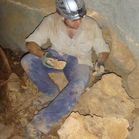 Julien Louys合作论文数School of Biological and Earth Sciences, Liverpool John Moores University16Remy Crassard合作论文数Maison de l'Orient et de la Méditerranée, CNRS15
 Emmanuel Ndiema合作论文数Natl Museums Kenya, Dept Earth Sci, Nairobi, Kenya13
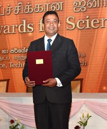 Oshan Wedage合作论文数Department of Archaeology, Sir Marcus Fernando Mawatha13
 Simon J. Armitage合作论文数Oxford University Centre for the Environment12
 Julio Mercader合作论文数Department of Anthropology, George Washington University11
 Noel Amano合作论文数Department of Coevolution of Land Use and Urbanization, Max Planck Institute of Geoanthropology11K. Paddayya合作论文数10
 Katerina Douka合作论文数School of Archaeology, University of Oxford10Jinu Koshy合作论文数Department of History and Archaeology;Karnatak University;Department of History and Archaeology, Karnatak University10Sacha Jones合作论文数10dennis knepper合作论文数9
 Nimal Perera合作论文数9
 Yamei Hou (侯亚梅)合作论文数Institute of Vertebrate Paleontology and Paleoanthropology, Chinese Academy of Sciences9Siran U. Deraniyagala合作论文数9Muhammad Zahir合作论文数8Mary E. Prendergast合作论文数8
 Monika Markowska合作论文数1] Connected Waters Initiative Research Centre, National Centre for Groundwater Research and Training8Sebastian F M Breitenbach合作论文数ETH Zurich, ETH Zürich8
 Bora Janardhana合作论文数Department of Archaeology and Ancient History, Karnatak University8Denis Scholz合作论文数Forschungsstelle Radiometrie, Heidelberger Akademie der Wissenschaften8Ian Candy合作论文数8
 Julia Lee Thorp合作论文数School of Archaeology, Oxford University8




