Water distribution system models have long been widely used for design and planning purposes. Their application for supporting real-time operational decisions has been also gaining increasing interest over the past decade. Accurate end-user nodal demands are critical to the reliability of hydraulic simulations for real-time decision support. Conventionally, nodal demands are set to a handful of periodically updated ensembles of demand patterns, which cannot represent the vast heterogeneity and volatility of demands. With advances in metering technology, consumption data with unprecedentedly high temporal and spatial resolutions are available to water utilities on a real-time basis. A framework is developed here to create a dynamic demand assignment hydraulic model, in which consumption data are assigned to nodes to update the water network model with the streaming data from the data center and without interruption of the hydraulic simulation run. The developed framework is cloud-based and scalable, making it suitable for water distribution systems of all sizes. The framework modifies the core EPANET engine to directly assign updated demands in order to overcome current software limitations. The model is applied and demonstrated using a real-world case study in the US. The results show the importance of the real-time demand assignment for the reliability of hydraulic models for making real-time operational decisions and the realization of digital twins of water infrastructure systems.
Streaming data can provide a timely understanding of the state of infrastructure networks to enable real-time monitoring and control. However, erroneous data is also inevitable and, if not identified and isolated effectively, may results in erroneous decisions and adverse consequences. This study leverages intra-and inter-similarity structures from monitoring stations for data validation in infrastructure networks. First, validation rules are developed to estimate similarity of new data from an individual sensing station to its routine patterns and flag suspicious data streams. Second, an unsupervised learning model is applied to identify clusters of stations that exhibit similar streaming data and test for cross-similarity to estimate the likelihood of the flagged data stream being invalid. The proposed model is demonstrated using steaming data collected from a real water distribution system. Preliminary results have revealed how a sensor's readings diverge from its historical patterns when a sensor fault occurs, and have discovered the presence of clusters of sensor stations with significant cross-similarity for boosting data validation performance.
This paper presents a practical methodology for the flexible reconfiguration of existing water distribution infrastructure, which is adaptive to the water utility constraints and facilitates in operational management for pressure and water loss control. The network topology is reconfigured into a star-like topology, where the center node is a connected subset of transmission mains, that provides connection to water sources, and the nodes are the subsystems that are connected to the sources through the center node. In the proposed approach, the system is first decomposed into the main and subsystems based on graph theory methods and then the network reconfiguration problem is approximated as a single-objective linear programming problem, which is efficiently solved using a standard solver. The performance and resiliency of the original and reconfigured systems are evaluated through direct and surrogate measures. The methodology is demonstrated using two large-scale water distribution systems, showing the flexibility of the proposed approach. The results highlight the benefits and disadvantages of network decentralization.
Water distribution systems (WDS) are complex pipe networks with looped and branching topologies that often comprise of thousands of links and nodes. This work presents a generic framework for improved analysis and management of WDS by partitioning the system into smaller (almost) independent sub-systems with balanced loads and minimal number of interconnections. This paper compares the performance of three classes of unsupervised learning algorithms from graph theory for practical sub-zoning of WDS: (1) Graph clustering – a bottom-up algorithm for clustering n objects with respect to a similarity function, (2) Community structure – a bottom-up algorithm based on network modularity property, which is a measure of the quality of network partition to clusters versus randomly generated graph with respect to the same nodal degree, and (3) Graph partitioning – a flat partitioning algorithm for dividing a network with n nodes into k clusters, such that the total weight of edges crossing between clusters is minimized and the loads of all the clusters are balanced. The algorithms are adapted to WDS to provide a decision support tool for water utilities. The proposed methods are applied and results are demonstrated for a large-scale water distribution system serving heavily populated areas in Singapore.
This paper presents a generic framework for improved analysis and management of water distribution systems that reduces the size of full-scale water distribution system (WDS) by partitioning the system into smaller sub-zones. The problem is to divide a WDS into balanced sub-zones (in terms of weights defined by the user, e.g., number of nodes, demand, and population) such that the number of inter-connecting edges is minimized. An unsupervised learning algorithm for graph partitioning adopted from graph theory is applied and tested for practical sub-zoning of WDS. Graph partitioning a flat partitioning algorithm for dividing a network with n nodes into k clusters, such that the total weight of edges crossing between clusters is minimized and the loads of all the clusters are balanced. The key contribution of the work is applicative dynamic, versatile, and computationally fast scheme for WDS sub-zoning. Results are demonstrated on a large water distribution system serving heavily populated areas in Singapore.
Water distribution systems (WDS) are complex pipe networks with looped and branching topologies that often comprise thousands to tens of thousands of links and nodes. This work presents a generic framework for improved analysis and management of WDS by partitioning the system into smaller (almost) independent sub-systems with balanced loads and minimal number of interconnections. This paper compares the performance of three classes of unsupervised learning algorithms from graph theory for practical sub-zoning of WDS: (1) Global clustering – a bottom-up algorithm for clustering n objects with respect to a similarity function, (2) Community structure – a bottom-up algorithm based on the property of network modularity, which is a measure of the quality of network partition to clusters versus randomly generated graph with respect to the same nodal degree, and (3) Graph partitioning – a flat partitioning algorithm for dividing a network with n nodes into k clusters, such that the total weight of edges crossing between clusters is minimized and the loads of all the clusters are balanced. The algorithms are adapted to WDS to provide a practical decision support tool for water utilities. Visual qualitative and quantitative measures are proposed to evaluate models' performance. The three methods are applied for two large-scale water distribution systems serving heavily populated areas in Singapore.
In this paper we present techniques for detecting and locating transient pipe burst events in water distribution systems. The proposed method uses multiscale wavelet analysis of high rate pressure data recorded to detect transient events. Both wavelet coefficients and Lipschitz exponents provide additional information about the nature of the signal feature detected and can be used for feature classification. A local search method is proposed to estimate accurately the arrival time of the pressure transient associated with a pipe burst event. We also propose a graph-based localization algorithm which uses the arrival times of the pressure transient at different measurement points within the water distribution system to determine the actual location (or source) of the pipe burst. The detection and localization performance of these algorithms is validated through leak-off experiments performed on the WaterWiSe@SG wireless sensor network test bed, deployed on the drinking water distribution system in Singapore. Based on these experiments, the average localization error is 37.5 m. We also present a systematic analysis of the sources of localization error and show that even with significant errors in wave speed estimation and time synchronization the localization error is around 56 m.
Water distribution systems comprise labyrinthine networks of pipes, often in poor states of repair, that are buried beneath our city streets and relatively inaccessible. Engineers who manage these systems need reliable data to understand and detect water losses due to leaks or burst events, anomalies in the control of water quality and the impacts of operational activities (such as pipe isolation, maintenance or repair) on water supply to customers. Water Wise is a platform that manages and analyses data from a network of wireless sensor nodes, continuously monitoring hydraulic, acoustic and water quality parameters. Water Wise supports many applications including rolling predictions of water demand and hydraulic state, online detection of events such as pipe bursts, and data mining for identification of longer-term trends. This paper illustrates the advantage of the Water Wise platform in resolving operational decisions.
This paper describes the implementation of a real-time hydraulic model of a water distribution system in Singapore. This on-line system is based on the Integration of real-time hydraulic data with hydraulic computer simulation models and statistical prediction tools. To facilitate this implementation, a network of wireless sensor nodes continuously sample hydraulic data such as pressure and flow rate, transmitting it to cloud-based servers for processing and archiving. Then, data streams from the sensor nodes are integrated into an on-line hydraulic modeling subsystem that is responsible for on-line estimation and prediction of the water distribution system's hydraulic state for a rolling planning horizon of 24 hours ahead. This online hydraulic model is one of the components of the WaterWiSe (Wierless Water Sentinel) platform which is an end-to-end integrated hardware and software system for monitoring, analyzing, and modeling urban water distribution systems in real-time.
As aging water distribution infrastructures encounter failures with increasing frequency, there is a real need for integrated, on-line decision-support systems based on continuous in-network monitoring of hydraulic and water quality parameters. Such systems will form the basis of a Smart Water Grid, allowing water utilities to improve optimization of system operation, manage leakage control more effectively, and reduce the duration and disruption of repairs and maintenance. WaterWiSe is an integrated, end-to-end platform for real-time monitoring of water distribution systems that addresses these needs. This paper describes how WaterWiSe’s sensing and software platforms have helped improve the operational efficiency of the water supply system in downtown Singapore.
This paper describes the development of [email protected] SG, a wireless sensor network to enable real-time monitoring of a water distribution network in Singapore. The overall project is directed towards three main goals: 1) the application of a low cost wireless sensor network for high data rate, on-line monitoring of hydraulic parameters within a large urban water distribution system; 2) the development of systems to enable remote detection of leaks and prediction of pipe burst events; 3) the integrated monitoring of hydraulic and water quality parameters. In this paper we will describe the current state of the [email protected] testbed, and report on experimentation we have performed with respect to leak detection and localization. Furthermore, we describe how we have assimilated real time pressure and flow measurements from the sensor network into hydraulic models that are used to improve state estimation for the network. Finally, we discuss the future plans for the project.
This paper presents an on-line hydraulic model of an urban water distribution system in Singapore. The proposed method starts with identifying demand zones (i.e., clusters of water consumers) within the complex topology of the urban water supply system. The demand zone identification method implements optimization tools and graph algorithms to partition the system into homogenous clusters. Thereafter, an on-line Predictor-Corrector (PC) procedure is employed for forecasting future water demands of each zone. A statistical data-driven algorithm is applied to estimate future hydraulic states and an evolutionary optimization technique is used to correct these predictions with near real-time monitoring data provided by the [email protected] (Water Wireless Sentinel at Singapore) wireless sensor network. The calibration problem is solved using a modified Least Squares (LS) fit method in which the objective function is the minimization of the residuals between predicted and measured pressure and flow rates at several system locations, with the decision variables being the hourly variations in the zones/ clusters water demands.
Near real-time continuous monitoring systems have been proposed as a promising approach for enhancing drinking water utilities detect and respond efficiently to threats on water distribution systems. Water quality sensors are aimed at revealing contamination intrusions, while hydraulic pressure and flow sensors are utilized for estimating the hydraulic system state. To date optimization models for placing sensors in water distribution systems are targeting separately water quality and hydraulic sensor network goals. Deploying two independent sensor networks within one distribution system is expensive to install and maintain. It might thus be beneficial to consider mutual sensor locations having dual hydraulic and water quality monitoring capabilities (i.e. sensor nodes which collect both hydraulic and water quality data at the same locations). In this study a multi-objective sensor network placement model for conjunctive monitoring of hydraulic and water quality data is developed and demonstrated using the multi-objective non-dominated sorted genetic algorithm NSGA II methodology. Two water distribution systems of increasing complexity are explored showing tradeoffs between hydraulic and water quality sensor location objectives. The proposed method provides a new tool for sensor placements.
This article details the design, implementation, and deployment of the Wireless Water Sentinel project in Singapore, an integrated, end‐to‐end system featuring node‐level acquisition and transmission of data as well as server‐based archiving, processing, and visualization of data. The system provides real‐time hydraulic and water quality measurements that complement the existing supervisory control and data acquisition system and facilitates on‐line hydraulic modeling and support for operational decisions. The network has been used in a real‐world test bed to examine burst and leak detection approaches using pressure and acoustic data. The implementation of real‐time, in‐network monitoring has shown great potential to improve operational efficiency of the day‐to‐day running of large urban water distribution systems. As water infrastructure worldwide continues to age, becoming increasingly prone to costly breaks and interruptions in service, this type of monitoring and analysis can help ensure continued delivery of an essential resource.
This study presents a methodology for the inclusion of hydraulics uncertainty in contamination source identification. Current research normally considers the system hydraulics as deterministic and the water quality sensors as ideal. In reality however only a small portion of the hydraulic data is known and most likely only Boolean sensor information of a contamination existence. There is a need to incorporate these considerations in contamination source identification models and to explore their influence on the modelling ability to correctly detect the characteristics of a contamination intrusion. This problem is addressed in this manuscript. The proposed method is based on a previous contamination source detection model developed by the authors which is further embedded in a statistical framework for quantifying the uncertainty of a contamination source detection outcome. The methodology is demonstrated on three example applications of increasing complexity through base runs and sensitivity analyses.
A new approach for monitoring a water distribution system involving Virtual Sensors is presented. In this approach, wireless sensor nodes are permanently deployed within the distribution system, providing continuous, on-line hydraulic data that can be assimilated into hydraulic models. In addition, temporary nodes are deployed for short periods (one week) around the distribution network. A Virtual Sensor is implemented using a data imputation technique called Gaussian Process Regression, which combines the historical data collected by the temporary node with correlated data from a subset of permanent sensor nodes. Use of spatially-correlated data accounts for new trends in the data that do not appear in the historical data collected by the temporary node. An increase in the number of sensors (a combination of real and virtual) is important for reducing the ill-conditioned state of the hydraulic model calibration procedure. The technique is demonstrated as a proof-of-concept using data collected from the [email protected] testbed in Singapore, and is shown to predict pressure data trends with an accuracy of 0.76 PSI RMSE after a six-week test.
This paper describes and demonstrates an efficient method for online hydraulic state estimation in urban water networks. The proposed method employs an online predictor-corrector (PC) procedure for forecasting future water demands. A statistical data-driven algorithm (M5 Model-Trees algorithm) is applied to estimate future water demands, and an evolutionary optimization technique (genetic algorithms) is used to correct these predictions with online monitoring data. The calibration problem is solved using a modified least-squares (LS) fit method (Huber function) in which the objective function is the minimization of the residuals between predicted and measured pressure at several system locations, with the decision variables being the hourly variations in water demands. To meet the computational efficiency requirements of real-time hydraulic state estimation for prototype urban networks that typically comprise tens of thousands of links and nodes, a reduced model is introduced using a water system-aggregation technique. The reduced model achieves a high-fidelity representation for the hydraulic performance of the complete network, but greatly simplifies the computation of the PC loop and facilitates the implementation of the online model. The proposed methodology is demonstrated on a prototypical municipal water-distribution system. DOI: 10.1061/(ASCE)WR.1943-5452.0000113. (C) 2011 American Society of Civil Engineers.
Biofouling development on nanofiltration membranes treating tertiary effluents was studied at low (5bar) and high (25bar) pressures at different feedwater concentrations, temperatures and lengths of operation. The bacterial community profile composing the biofouling layer was characterized. Most of the bacterial species identified were Gram-negative, with Proteobacteria (approximately equally divided between β, α and γ subdivisions) and Bacteroidetes being the prevalent groups. At high-pressure, scaling was the primary source of fouling whereas at low-pressure, biofouling was dominant. For these conditions, an empirical approach to forecasting the contribution of biofouling resistance to total resistance was derived based on the resistance in series theory. This approach showed that biofouling becomes a dominating factor after approximately 20L of permeate volume has been produced. A data-driven modeling algorithm for forecasting the reduction in permeate flux due to biofouling was also established. The reduction in permeate flux rates was related to the development of a fouling layer on the membrane. Pressure, total organic carbon, pH and conductivity of the feedwater were the most influential parameters. These results are novel in the area of model tree algorithms as they apply to forecasting the development of biofouling on membranes.
 Avi Ostfeld合作论文数Faculty of Civil and Environmental Engineering, Technion - Israel Institute of Technology24
 Andrew Whittle合作论文数Department of Civil and Environmental Engineering, School of Engineering, Massachusetts Institute of Technology21
 Mudasser Iqbal合作论文数TeamSolve12
 Lina Perelman合作论文数7
 Seshan Srirangarajan合作论文数Cork Institute of Technology5
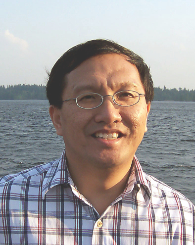 Hock Beng Lim合作论文数Centre for Smart Systems, Singapore University of Technology and Design5
 Lewis Girod合作论文数Cambridge Mobile Telematics4
 Lina Sela合作论文数Department of Civil, Architectural and Environmental Engineering, Cockrell School of Engineering, University of Texas at Austin3Amin Rasekh合作论文数3Kai-Juan Wong合作论文数University of Edinburgh, Edinburgh, United Kingdom3
 M. Ehsan Shafiee合作论文数Texas A&M University3Christopher Choi合作论文数2
 Lu Xing合作论文数2
 Michael F Allen合作论文数Department of Microbiology & Plant Pathology, University of California, Riverside;Department of Biology, University of California, Riverside;Center for Conservation Biology, University of California, Riverside2Cheng Fu合作论文数Intelligent Systems Centre
Nanyang Technological University2
Michael F Allen合作论文数Department of Microbiology & Plant Pathology, University of California, Riverside;Department of Biology, University of California, Riverside;Center for Conservation Biology, University of California, Riverside2Cheng Fu合作论文数Intelligent Systems Centre
Nanyang Technological University2 Kevin E. Lansey (Kevin Lansey)合作论文数Department of Hydrology and Water Resources, University of Arizona;Department of Civil Engineering and Engineering Mechanics, College of Engineering, The University of Arizona2
 Daniel James Goldsmith合作论文数2Jinhui Huang合作论文数1member asce合作论文数1Larissa Kautsky合作论文数1Francesco di Pierro合作论文数1yuri mayorchik合作论文数1William James合作论文数1
 Carlos Guestrin合作论文数Computer Science Department, Stanford University;Visual Layer;Virtue AI1
 Zoran Kapelan合作论文数Department of Water Management, Faculty of Civil Engineering and Geosciences, Delft University of Technology1Tubaltzev A合作论文数1
 Marios Polycarpou合作论文数Department of Electrical and Computer Engineering, University of Cyprus;KIOS Research and Innovation Center of Excellence, University of Cyprus1
 Jianhua Xu (徐建华)合作论文数School of Government, Peking University1Gary B. Trachtman合作论文数1
 Dragan Savic合作论文数KWR Watercycle Research Institute;Centre for Water Systems, University of Exeter1Marco Propato合作论文数1
 Mitchell J. Small (Mitchell Small)合作论文数Departments of Civil & Environmental Engineering, College of Engineering, Carnegie Mellon University;Department of Environmental and Occupational Health, Graduate School of Public Health, University of Pittsburgh1
 Andreas Krause合作论文数Learning & Adaptive Systems Group, Machine Learning Institute, Department of Computer Science, ETH Zurich;Swiss Data Science Center;Max Planck Institute for Intelligent Systems;AI Center, ETH Zurich;LatticeFlow1
 Olivier Piller合作论文数1
 Jean-Paul Watson合作论文数Sandia National Laboratories1
 Brian Barkdoll合作论文数1
 Shannon L. Isovitsch Parks合作论文数1R. G. Austin合作论文数1
 Talha Obaid合作论文数1
 Santosh R. Ghimire合作论文数1
 Elad Salomons合作论文数OptiWater1
 Zheng Yi Wu合作论文数1
 Ed McBean合作论文数School of Engineering, University of Guelph1
 William E. Hart (William Hart)合作论文数Sandia National Laboratories1
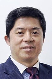 Soon-Thiam Khu合作论文数School of Engineering, Computer Science and Mathematics, University of Exeter1
 James G. Uber合作论文数Department of Civil and Environmental Engineering, The University of Cincinnati1Carlos G. Dosoretz合作论文数Technological Center1
 Jonathan W. Berry合作论文数Sandia National Laboratories1
 Jure Leskovec合作论文数Department of Computer Science, Stanford University1




