The significant expansion of offshore wind farms (OWF) is a core element of the world's decarbonisation strategy. However, in the urgency to meet Net Zero, care must be exercised to avoid exchanging one environmental crisis for another. A primary aim of this paper is to set out a methodology roadmap to ensure that future marine management and renewable energy policy is sustainable and evidence based. Marine ecosystems are complex, and the current lack of understanding makes it difficult to predict the effects of introducing thousands of wind turbines and extracting hundreds of gigawatts of wind energy that would have otherwise influenced our shelf seas ecosystems. It is difficult to predict the subsequent wider ecosystem effects of the combined changes in spatial use, such as displacement of fisheries out of OWF, along with possible attraction of fish into OWF developments. Therefore, to proceed with any reasonable level of certainty, we need to be able to rapidly estimate the safe upper limit of whole ecosystem effects of OWF. As an example, this perspective paper sets out the challenges which OWF pose to fishing industries within the context of existing nature conservation policies. We propose modelling approaches that can incorporate both the ecological effects of large‐scale fisheries displacements as well as ecosystem level changes to fish populations from OWF developments. The ecosystem models can also predict the effects on future trends of fish populations within climate change forecasts. Practical implication . To improve decision making when balancing environmental and socio‐economic benefits and trade‐offs, we then propose methods that use Marine Net Gain, which is a conservation approach that ensures human activities in marine environments result in a measurable net positive impact on biodiversity. The focus is on the United Kingdom and North Sea; however, the proposed roadmap holds the capability to be transferable to other shelf sea systems with similar types and levels of pressures. This perspective provides a methodology roadmap that considers the link between, and the need for, both food and energy security from our oceans and provides a route to increased certainty in our current choices for the long‐term sustainable use of our oceans.
Environmental interactions of marine renewable energy developments vary from fine-scale direct (e.g. potential collision) to indirect wide-scale hydrodynamic changes altering oceanographic features. Current UK Environmental Impact Assessment (EIA) and associated Habitats Regulations Appraisal (HRA) guidelines have limited focus on underlying processes affecting distribution and movements (hence vulnerability) of top predators. This study integrates multi-trophic ship survey (active acoustics and observer data) with an upward-facing seabed platform and 3-dimensional hydrodynamic model as a process-driven framework to investigate predator-prey linkages between seabirds and fish schools. Observer-only data highlighted the need to measure physical drivers of variance in species abundances and distributions. Active acoustics indicated that in situ (preferable to modelled) data were needed to identify temporal changes in hydrodynamics to predict prey and consequently top predator presence. Revising methods to identify key habitats and environmental covariates within current regulatory frameworks will enable more robust and transferable EIA and HRA processes and outputs, and at larger scales for cumulative and strategic-level assessments, enabling future modelling of ecosystem impacts from both climate change and renewable energy extraction.
This study provides insights into the mechanisms of drag generation on fish-shaped bodies in turbulent open-channel flows. We conducted a set of experiments with rigid 3D-printed models of rainbow trout (Oncorhynchus mykiss), recording velocities upstream and downstream of a model along with drag force. For a range of fish Reynolds numbers, we have (1) assessed mean values of drag and drag coefficients, and (2) investigated drag force fluctuations and their link with upstream undisturbed turbulence. Correlation functions confirm a direct link between upstream velocity fluctuations and drag force fluctuations, although other mechanisms contributing to drag force fluctuations are likely and remain to be studied further. Insights into the hydrodynamics of fish-shaped bodies may lead to improvements in the design of fish passageways.
The significant expansion of offshore wind farms (OWFs) is a core element of the UK’s decarbonisation strategy. However, in the urgency to meet Net Zero, care must be exercised to avoid exchanging one environmental crisis for another. The PELAgIO (Physics to Ecosystem Level Assessment of Impacts of Offshore Wind) project proposes to inform current and emerging marine policy and management to deliver Net Gain and help achieve Good Environmental Status (GES) using an integrated and co-developed approach to measure, model and understand critical drivers and dependencies of marine ecosystems within a region containing existing and future planned OWFs. Part of the PELAgIO project uses state of the art numerical models combined with observations at the SSE Seagreen wind farm site in a seasonally stratified area of the North Sea (Firth of Forth) to assess the impact of OWFs on water column stratification, mixing and fluxes of nutrients, oxygen and chlorophyll. Observations consisted of a ship-base survey during spring-summer 2023, as well as two gliders which were equipped with sensors to measure temperature, conductivity, turbulence microstructure, dissolved oxygen and chlorophyll fluorescence. Preliminary analysis of the results from the PELAgIO field campaign indicated that the OWF area plays host to significant internal wave activity, evidenced by considerable vertical movement of the thermocline. Additionally the gliders captured an important extreme event in the June 2023 marine heatwave where surface layer temperatures in the Firth of Forth exceeded 16°C, highlighting the need for models to help elucidate natural variability, climate-driven and OWF-driven changes to stratification from one another. Here we show preliminary model and observation results of stratification, nutrient and oxygen fluxes from the Seagreen OWF in the PELAgIO project, and discuss this in terms of impacts to the subsurface chlorophyll maximum. We also outline spatial and temporal gaps in our observations we need to overcome to investigate impacts of OWFs effectively, and discuss how we will attempt to resolve these in the PELAgIO 2024 spring-summer field campaign.
Tidal stream environments are important areas of marine habitat for the development of marine renewable energy (MRE) sources and as foraging hotspots for megafaunal species (seabirds and marine mammals). Hydrodynamic features can promote prey availability and foraging efficiency that influences megafaunal foraging success and behaviour, with the potential for animal interactions with MRE devices. Uncrewed aerial vehicles (UAVs) offer a novel tool for the fine-scale data collection of surface turbulence features and animals, which is not possible through other techniques, to provide information on the potential environmental impacts of anthropogenic developments. However, large imagery datasets are time-consuming to manually review and analyse. This study demonstrates an experimental methodology for the automated detection of turbulence features within UAV imagery. A deep learning architecture, specifically a Faster R-CNN model, was used to autonomously detect kolk-boils within UAV imagery of a tidal stream environment. The model was trained on pre-existing, labelled images of kolk-boils that were pre-treated using a suite of image enhancement techniques based on the environmental conditions present within each image. A 75-epoch model variant provided the highest average recall and precision values; however, it appeared to be limited by sub-optimal detections of false positive values. Although further development is required, including the creation of standardised image data pools, increased model benchmarking and the advancement of tailored pre-processing techniques, this work demonstrates the viability of utilising deep learning to automate the detection of surface turbulence features within a tidal stream environment.
Crowded seas are becoming a pressing management problem with the increased development of offshore renewable energy (ORE) to combat climate change. Marine ecosystems are complex and varied; therefore, we need new tools to help rapidly increase our understanding of how they are likely to change with both climate and anthropogenic changes. This study uses a pragmatic data‐driven Bayesian network approach to capture the patterns of ecosystem complexity and reveal trends of ecosystem drivers (i.e. indicators) important to ecosystem functioning across space and over time. The ecosystem approach assessed physical and biological indicators and their influence on population (abundance/productivity) trends in four regions with contrasting habitats of the North Sea within the last 30 years (1990–2019). What‐if scenarios were conducted to examine species/functional group responses to physical (temperature and stratification) representing climate and large‐scale ORE development effects, as well as anthropogenic (fishing) changes. Clear patterns were revealed, including temporal trends of the dynamic nature of bottom‐up effects driven by physical change versus top‐down effects driven by fishing across trophic levels and habitat types. All four regions are influenced by both effects; however, the dominance of effects was dependent on region: Shetland and Orkney (bottom‐up driven), southern North Sea (top‐down driven). In general, regions with stronger bottom‐up effects showed increasing population trends whereas those with stronger top‐down effects, decreasing trends. Our findings also suggest that some species are much better indicators of either bottom‐up (e.g. zooplankton), top‐down effects (e.g. fish) or both (e.g. grey seal), but the strength of indicator is dependent on habitat type. The habitat‐specific results provide better understanding of what type of ecosystem change they are indicating (physical or biophysical) and therefore indicators that assess both ecosystem status and resilience, ensuring a more strategic and integrated evaluation of trade‐offs for future sustainable management of our shallow seas.
Methods that supplement optical instruments with bait, such as baited remote underwater video (BRUV), are used worldwide to detect and quantify marine life. Optical instruments only detect targets within visible range, such that BRUVs may underestimate fishes in light‐limited habitats, especially fishes that respond to the bait at ranges beyond visibility. Alternatively, light‐independent instruments (e.g., imaging sonars) can detect and quantify fishes regardless of visibility. This study presents the first application of a baited imaging sonar (BISON), deployed to survey fishes around a small, shallow artificial habitat in a turbid embayment in southern Florida. To establish the influence of bait on fish detection, BISON trials were alternately conducted alongside deployments of an unbaited control, with a high‐definition camera integrated to ascertain visibility and inform species composition. For fishes of two size classes, larger (> 30 cm) and smaller (10–30 cm), maximum density (MaxD) and range of detection were quantified. Although the densities of larger and smaller fishes quantified by the BISON and unbaited control did not differ, over 55% of larger fishes were detected at ranges beyond maximum visibility, with asymptotes in fish density on the BISON identified at 15–20 min and 5–10 min for larger and smaller fishes, respectively. Overall, this study demonstrates the potential of BISONs as both a complementary and alternative method to BRUVs for quantifying fishes, especially in habitats of limited visibility. Future applications of BISONs in other habitats will further demonstrate its value as a tool to detect and enumerate aquatic assemblages.
Primary production dynamics are strongly associated with vertical density profiles in shelf waters. Variations in the vertical structure of the pycnocline in stratified shelf waters are likely to affect nutrient fluxes and hence the vertical distribution and production rate of phytoplankton. To understand the effects of physical changes on primary production, identifying the linkage between water column density and Chlorophyll a (Chl a ) profiles is essential. Here, the vertical distributions of density features describing three different portions of the pycnocline (the top, centre, and bottom) were compared to the vertical distribution of Chl a to provide auxiliary variables to estimate Chl a in shelf waters. The proximity of density features with deep Chl a maximum (DCM) was tested using the Spearman correlation, linear regression, and a major axis regression over 15 years in a shelf sea region (the northern North Sea) that exhibits stratified water columns. Out of 1237 observations, 78 % reported DCM above the bottom mixed layer depth (BMLD: depth between the bottom of the pycnocline and the mixed layer underneath) with an average distance of 2.74 +/- 5.21 m from each other. BMLD acts as a vertical boundary above which subsurface Chl a maxima are mostly found in shelf seas (depth <= 115 m). Overall, DCMs were correlated with the halfway pycnocline depth (HPD) ( rho S = 0.56) which, combined with BMLD, were better predictors of the locations of DCMs than surface mixed layer indicators and the maximum squared buoyancy frequency. These results suggest a significant contribution of deep mixing processes in defining the vertical distribution of subsurface production in stratified waters and indicate BMLD as a potential indicator of the Chl a spatiotemporal variability in shelf seas. An analytical approach integrating the threshold and the maximum angle method is proposed to extrapolate BMLD, the surface mixed layer, and DCM from in situ vertical samples.
Tidal energy is a rapidly developing area of the marine renewable energy sector that requires converters to be placed within areas of fast current speeds to be commercially viable. Tidal environments are also utilised by marine fauna (marine mammals, seabirds and fish) for foraging purposes, with usage patterns observed at fine spatiotemporal scales (seconds and metres). An overlap between tidal developments and fauna creates uncertainty regarding the environmental impact of converters. Due to the limited number of tidal energy converters in operation, there is inadequate knowledge of marine megafaunal usage of tidal stream environments, especially the collection of fine-scale empirical evidence required to inform on and predict potential environmental effects. This review details the suitability of using multirotor unmanned aerial vehicles within tidal stream environments as a tool for capturing fine-scale biophysical interactions. This includes presenting the advantages and disadvantages of use, highlighting complementary image processing and automation techniques, and showcasing the limited current examples of usage within tidal stream environments. These considerations help to demonstrate the appropriateness of unmanned aerial vehicles, alongside applicable image processing, for use as a survey tool to further quantify the potential environmental impacts of marine renewable energy developments.
With the rapid expansion of offshore windfarms (OWFs) globally, there is an urgent need to assess and predict effects on marine species, habitats, and ecosystem functioning. Doing so at shelf-wide scale while simultaneously accounting for the concurrent influence of climate change will require dynamic, multitrophic, multiscalar, ecosystem-centric approaches. However, as such studies and the study system itself (shelf seas) are complex, we propose to structure future environmental research according to the investigative cycle framework. This will allow the formulation and testing of specific hypotheses built on ecological theory, thereby streamlining the process, and allowing adaptability in the face of technological advancements (e.g. floating offshore wind) and shifting socio-economic and political climates. We outline a strategy by which to accelerate our understanding of environmental effects of OWF development on shelf seas, which is illustrated throughout by a North Sea case study. Priorities for future studies include ascertaining the extent to which OWFs may change levels of primary production; whether wind energy extraction will have knock-on effects on biophysical ecosystem drivers; whether pelagic fishes mediate changes in top predator distributions over space and time; and how any effects observed at localized levels will scale and interact with climate change and fisheries displacement effects.
Unmanned Aerial Vehicles (UAVs), or drones, offer the ability to collect cost-effective fine-scale imagery that is suitable for the capture of concurrent hydrodynamic and faunal data within tidal stream environments. This is a necessary stage of information gathering to inform tidal energy device design, advise control and maintenance strategies and better inform environmental consenting processes. For this study a total of sixty-three UAV surveys were undertaken within the Inner Sound of the Pentland Firth, Scotland, UK, over two 4-day periods in 2016 and 2018. The aims of this data collection effort were to characterise bathymetrically driven hydrodynamic features, comprising of kolk-boil distribution, presence, and area, as well as marine life such as seabird distributions, presence, and orientation relative to the flow. To achieve this, a method to extract quantifiable metrics from UAV imagery was required. This paper details the processes and methodology to create a graphical user interface (GUI) to provide these outputs rather than examining specific results. It includes an explanation of the criteria that the GUI needed to meet to be able to process the imagery, a description of the workflow and an explanation of the sub-routines required such as image registration and calibration. The outputs of the GUI, and their relevance to tidal energy developments, are also discussed. Finally, this paper details future work incorporating computer vision techniques to improve the accuracy, reliability, and processing speed of the GUI.
To alleviate climate change consequences, the UK government is pioneering offshore renewable energy de-velopments at an ever-increasing pace. The North Sea is a dynamic ecosystem with strong bottom-up/top-down natural and anthropogenic drivers facing rapid climate change impacts. To ensure the compatibility of such large-scale developments with nature conservation obligations, regulatory processes set out that all effects need to be evaluated through cumulative impact assessments (CIA). However, by excluding climate change impacts and bottom-up effects of renewable developments, the CIA lacks spatio-temporal baselines linking oceanic ecosystem indicators to population dynamics, leading to uncertain predictions at population levels. CIA is currently required in Europe under the Strategic Environmental Assessment and the Marine Strategy Framework Directive (MSFD), suggesting that these two policy areas should be more closely aligned. This study presents an overview of the current CIA policy framework, enabling an ecosystem-based approach linking lower ecosystem components to top-predator populations using the UK as a case study. At the UK level, CIA requirements mirror the EU ones under the Marine and Coastal Access Act, the UK Marine Policy Statement, and the UK National Policy Statement. Firstly, we show how CIA and MSFD requirements are integrated into the UK licensing and maritime planning frameworks. Secondly, we provide policy pathways embedding the MSFD as a baseline for CIAs with European and UK regulations. Thirdly, we propose a framework encompassing a shared monitoring effort, an ecosystem modelling approach connected with two existing online databases supported with funds from Contracts for Difference. This integrated approach will enable a holistic and pragmatic ecosystem-based framework for more accurate and rapid methods for producing CIAs for offshore renewable energy developments.
Offshore Renewable Energy (ORE), comprising marine (wave and tidal energy), and offshore wind, has the potential to supply large amounts of 'green' sustainable energy, reducing CO2 emissions. The main obstacles to deployment so far are technical challenges and cost. However, there are also concerns about how harnessing offshore energy can affect the local habitats and marine life, as well as introducing far-field and long-term changes in the physical environment of the sea, which may combine with climate change in unforeseen ways to affect marine ecosystems. The precautionary principle, combined with the requirement for monitoring, introduces obstacles (and costs) which have so far prevented the deployment of offshore renewable energy on a large scale. Here we discuss the physical changes that may occur and the impacts these may have on habitats, species and ecosystems. We explore the possible environmental impacts of offshore wind and marine energy deployment and the options for mitigation of these. This information can assist planners, regulators and developers of offshore energy systems. Some examples of existing and proposed deployments are provided (mainly focusing on the UK), in order to illustrate discussion of the environmental issues. We identify the need for better understanding of the environmental impacts at a population and ecosystem level and identify a way forward to improve the environmental consenting process.
There is about to be an abrupt step-change in the use of coastal seas around the globe, specifically by the addition of large-scale offshore renewable energy (ORE) developments to combat climate change. Developing this sustainable energy supply will require trade-offs between both direct and indirect environmental effects, as well as spatial conflicts with marine uses like shipping, fishing, and recreation. However, the nexus between drivers, such as changes in the bio-physical environment from the introduction of structures and extraction of energy, and the consequent impacts on ecosystem services delivery and natural capital assets is poorly understood and rarely considered through a whole ecosystem perspective. Future marine planning needs to assess these changes as part of national policy level assessments but also to inform practitioners about the benefits and trade-offs between different uses of natural resources when making decisions to balance environmental and energy sustainability and socio-economic impacts. To address this shortfall, we propose an ecosystem-based natural capital evaluation framework that builds on a dynamic Bayesian modelling approach which accounts for the multiplicity of interactions between physical (e.g. bottom temperature), biological (e.g. net primary production) indicators and anthropogenic marine use (i.e. fishing) and their changes across space and over time. The proposed assessment framework measures ecosystem change, changes in ecosystem goods and services and changes in socio-economic value in response to ORE deployment scenarios as well as climate change, to provide objective information for decision processes seeking to integrate new uses into our marine ecosystems. Such a framework has the potential of exploring the likely outcomes in the same metrics (both ecological and socio-economic) from alternative management and climate scenarios, such that objective judgements and decisions can be made, as to how to balance the benefits and trade-offs between a range of marine uses to deliver long-term environmental sustainability, economic benefits, and social welfare.
Abstract. Primary production dynamics are strongly associated with vertical density profiles, which dictate the depth of stratification and mixed layers. Climate change and artificial structures (e.g. windfarms) are likely to modify the strength of stratification and vertical distribution of nutrient fluxes, especially in shelf seas where fine scale processes are important drivers, affecting the vertical distribution of phytoplankton. To understand the effect of physical changes on primary production, identifying the linkage between density and phytoplankton profiles is essential. Here, the ecological relevance of eight density layers (DLs) obtained by multiple methods that define three different portions of the pycnocline (above, centre, below) was evaluated to identify a valuable proxy for subsurface Chlorophyll-a (Chl-a mg m-3) concentrations. The associations of subsurface Chl-a with surface and deep mixing were investigated by hypothesizing the occurrence at the same depth of any DL and the maximum Chl-a layer (DMC) using Spearman correlation, linear regression, and a Major Axis analysis. Out of 1237 observations of the water column exhibiting a pycnocline, 78 % reported DMCs above the bottom mixed layer depth (BMLD). This suggests that the BMLD is a boundary trapping Chl-a in shallow waters (≤ 120 m). BMLD constantly described Chl-a vertical distribution despite surface mixing indicators, suggesting a significant contribution of deep mixing processes in supporting subsurface production under specific conditions (e.g. prolonged stratification, tidal cycle, and bathymetry). Using BMLD for defining subsurface Chl-a could be a valuable tool for understanding the spatiotemporal variability of Chl-a in shelf seas, representing a potential variable for ecological assessments.
Understanding spatiotemporally varying animal distributions can inform ecological understanding of species' behavior (e.g., foraging and predator/prey interactions) and support development of management and conservation measures. Data from an array of echolocation-click detectors (C-PODs) were analyzed using Bayesian spatiotemporal modeling to investigate spatial and temporal variation in occurrence and foraging activity of harbor porpoises (Phocoena phocoena) and how this variation was influenced by daylight and presence of bottlenose dolphins (Tursiops truncatus). The probability of occurrence of porpoises was highest on an offshore sandbank, where the proportion of detections with foraging clicks was relatively low. The porpoises' overall distribution shifted throughout the summer and autumn, likely influenced by seasonal prey availability. Probability of porpoise occurrence was lowest in areas close to the coast, where dolphin detections were highest and declined prior to dolphin detection, leading potentially to avoidance of spatiotemporal overlap between porpoises and dolphins. Increased understanding of porpoises' seasonal distribution, key foraging areas, and their relationship with competitors can shed light on management options and potential interactions with offshore industries.
To arrive at a sustainable future we need offshore renewables to succeed, and to do so we need to work together. There have been ecological showstoppers in the past and there will be again in the future unless we can co-design devices, array layouts and site locations of multiple very large-scale developments such that cumulative ecological effects can be assessed and conflicts with ecological laws, local communities and fishing industries be minimized. In order to effectively spatially manage our marine habitats, weigh-up ecological trade-offs and avoid/adapt to the worst effects of climate change, we need all those involved to understand, at some degree of detail, how our marine ecosystems function such that impact mitigation efforts can start at the design stage of devices and developments. This paper outlines a straightforward way to convey the most important environmental issues that are concerning renewables developments, as well as in the context of climate change, and at the scales of individuals and ecosystems. It covers a range of suggestions for the design of data collection, analysis and modelling frameworks to deal with these concerns and finishes with suggestions for potential avenues for future collaboration between ecological and engineering sciences.
Tidal stream environments exhibit fast current flows and unique turbulent features occurring at fine spatio-temporal scales (metres and seconds). There is now global recognition of the importance of tidal stream environments for marine megafauna. Such areas are also key to the development of marine renewable energy due to the reliable and predictable nature of tidally driven flows. Bed-derived turbulent features, such as kolk-boils, transport organic material to the surface and may increase the availability of prey species (fish) for foraging marine megafauna (seabirds and marine mammals). Quantification of animal association and interactions with turbulent features is required to understand potential environmental impacts of tidal energy developments in these sites. Downward-facing unmanned aerial vehicle (UAV) imagery was collected within the Pentland Firth, UK. Resulting imagery was used to quantify the density distribution of pursuit-diving seabirds, called auks (of the family Alcidae), distribution in comparison relation to concurrent surface imagery of kolk-boils and, analyse evaluate spatial relationships with individual kolk-boil features, and quantify body orientation relative to the water flow. Although variability was present, auk density distribution was generally correlated with that of kolk-boils throughout the study area; however, spatial analysis highlighted an overall trend of finer-scale dispersion between individual auks and kolk-boils. Auk orientation on the surface was primarily observed across the flow throughout ebb and flood tidal phases. These results suggest that auks may be associating with kolk-boil peripheries. Similarly, it may be energetically beneficial to orientate across the flow while maintaining observation of current flow or searching for shallow prey species and potential threats in the environment. This work demonstrates that UAV imagery was appropriate for quantification of fine-scale biophysical interactions. It allowed for concurrent measurement of hydrodynamic and predator metrics in a challenging environment and provided novel insights not possible to collect by conventional survey methodology. This technique can increase the evidence base for assessment of potential impacts of marine renewable energy extraction on key marine species.
Driven by the necessity to decarbonize energy sources, many countries are targeting tidal stream environments for power generation. However, these areas can act as foraging hotspots for marine top predators, such as seabirds. Thus, it is important to understand the ecological interactions influencing predator behavior and distribution in these areas, to determine the potential ecological implications of marine renewable devices. This study used concurrent observations of foraging seabirds, physical hydrodynamics, and prey presence across a tidal stream environment, before and after the installation of a commercial turbine array close to the island of Stroma, Scotland. There were three main findings: First, benthic foraging seabirds showed a clear preference for certain sections around Stroma where sandeels were detected, while pelagic foraging seabirds were seen all around Stroma. Second, there was a positive effect of water velocity on the number of pelagic foragers and common guillemots. Third, there was a positive effect of the presence of fish schools on the number of pelagic seabirds and common guillemots, in both the same and the previous transects. Thus, it is possible that seabirds target areas of predictable food sources during periods where prey might be easily accessed (e.g., periods of fast flows). Given the difference in the distribution between seabird categories, it is likely that marine renewable devices will impact each category differently. We conclude that any impact on sandbank locations, sandeels preferred habitat, due to the presence of tidal turbines is likely to alter the distribution of benthic foraging seabirds. For pelagic foraging seabirds and common guillemot, changes in prey presence and accessibility (depth and level of aggregation/disaggregation) will have a stronger effect on seabird presence. This study highlights the need to include concurrent physical and biological data when assessing the ecological impacts of tidal turbines.
 Benjamin Williamson合作论文数Inst. of Biol. & Environ. Sci., Univ. of Aberdeen;c;Inst. of Biol. & Environ. Sci., Univ. of Aberdeen37
 James J. Waggitt合作论文数School of Ocean Sciences, Bangor University23
 Paul S. Bell合作论文数Proudman Oceanographic Laboratory;Joseph Proudman Building;Proudman Oceanographic Laboratory16
 Jonathan Sharples合作论文数School of Ocean and Earth Science Empress Dock, Southampton University15
 Philippe Blondel合作论文数Department of Physics, University of Bath14
 Shaun Fraser合作论文数Shetland UHI13
 Sarah Wanless合作论文数11
 Neda Trifonova合作论文数Sch Biol Sci, Univ Aberdeen9
 Peter Wright合作论文数Ecology and Conservation Group, Marine Scotland Science9
 Vladimir Nikora合作论文数School of Engineering, University of Aberdeen9
 Eric Armstrong合作论文数Univ Evry, Université Paris-Saclay8
 Francis Daunt合作论文数Centre for Ecology & Hydrology Bush Estate8
 Michela De Dominicis合作论文数Istituto Nazionale di Geofisica e Vulcanologia, Sezione di Bologna, Italy8
 Jacqueline F. Tweddle合作论文数8
 Rory B O'Hara Murray合作论文数Scottish Govt, Marine Scotland Sci7
 Laura D. Williamson合作论文数Ocean Sci Consulting Ltd, Dunbar, Scotland7Thomas Cornulier合作论文数Centre d'Études Biologiques de Chizé7
 Judith Wolf合作论文数Proudman Oceanographic Laboratory7
 Morgane Declerck合作论文数6Jared Wilson合作论文数6
 Arianna Zampollo合作论文数Gaia Res Inst Onlus6
 Jason Mcilvenny合作论文数6Ian M. Davies合作论文数5
 James D Chapman合作论文数5
 James Slingsby合作论文数Environm Res Inst, Univ Highlands & Isl UHI5
 Andronikos Kafas合作论文数School of Biological Sciences, University of Aberdeen5
 Ana Couto合作论文数5
 Ricardo Torres合作论文数Plymouth Marine Lab5
 Graham J. Pierce合作论文数Instituto de Investigaciones Marinas, Consejo Superior de Investigaciones Cientificas5
 Oliver N Ross合作论文数Department of Biological Sciences, University of Essex5
 Louise T. Kregting合作论文数Department of Botany, University of Otago5
 Janine B. Illian合作论文数Department of Mathematical Sciences;University of Abertay;Department of Mathematical Sciences, University of Abertay5
 Pierre W Cazenave合作论文数5
 Ian G Davies合作论文数4g peters合作论文数4
 Justin Travis合作论文数Institute of Biological and Environmental Sciences, University of Aberdeen;School of Biological Sciences, University of Aberdeen4
 Marianna Chimienti合作论文数School of Biological Sciences, University of Aberdeen4
 Kate L Brookes合作论文数4
 Gudrun Marteinsdottir合作论文数Marine Research Institute4
 J. van der Kooij合作论文数4
 Cornelis Jan Camphuysen合作论文数Netherlands Institute for Sea Research4
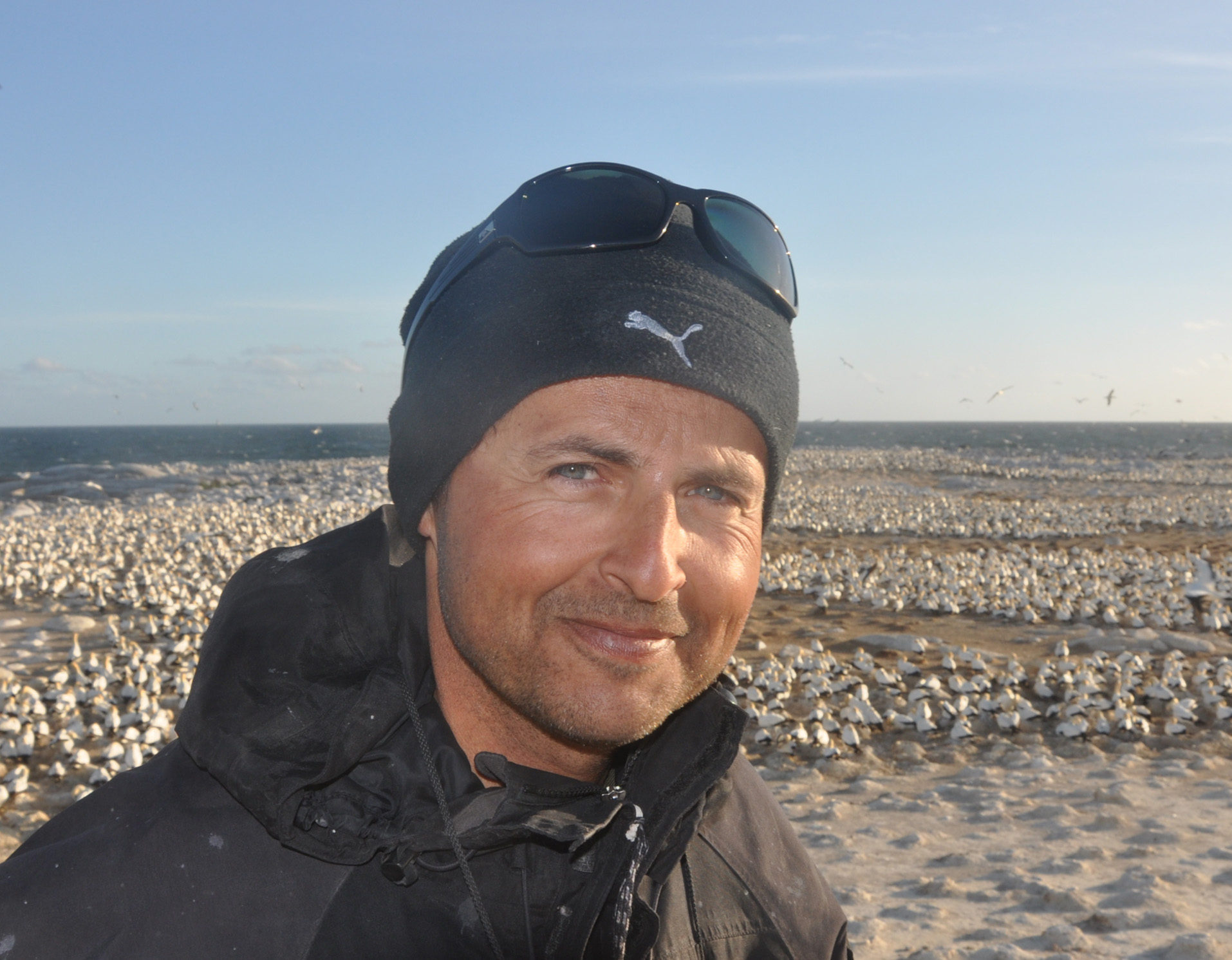 David Gremillet合作论文数FitzPatrick Institute of African Ornithology, University of Cape Town;Center of Excellence at the FitzPatrick Institute, University of Cape Town;Centre D’Ecologie Fonctionnelle Et Evolutive, Universite De Montpellier4
 Dina Sadykova合作论文数Centre for Ecological and Evolutionary Synthesis (CEES),, University of Oslo4Marion Yanez合作论文数3
 Alexander Sadykov合作论文数Sch Biol Sci, Queens Univ Belfast3
 Angus C.W. Creech合作论文数Inst Energy Syst, Univ Edinburgh3
 Ian Ashton合作论文数Department of Engineering, University of Exeter3
 David McCann合作论文数Nat. Oceanogr. Centre;c;Nat. Oceanogr. Centre3
 Alejandro Gallego合作论文数3




