Moreton Bay (the Bay) is a 1,494km2, semi-enclosed, embayment located in sub-tropical Southeast Queensland, Australia. The Bay provides significant environmental, cultural and economic values and ecosystem services to a growing population, which are threatened by accelerated catchment derived anthropogenic fine sediment and associated particulate nutrient pollution. We use benthic penetrometer, texture survey and laboratory analyses to quantify the accumulation of 220Mt – 277Mt of anthropogenic, terrigenous-derived, fine sediment in the Bay. We confirm that our estimates of fine sediment accumulation are consistent with observed catchment erosion and highlight the profound changes in benthic habitat condition that has resulted from mudification of the Bay. The ongoing supply and accumulation of fine sediment to the Bay has doubled the areal extent of mud (>50% mud) facies, while reducing the extent of clean sand (<1% mud) facies 93% from 30% of the Bay to 2%. We highlight that the severity of the fine sediment pollution threat is significantly understated due to the reliance of formal reporting on suspended solids concentration data from event samplers that are known to underestimate exported catchment loads; and recommend these data no longer be used to provide quantitative load estimates in the absence of corroborating measured data. Lastly, we show that cycles of deterioration and improvement of the aquatic ecosystem health of Western Moreton Bay are correlated respectively with floods that deliver large fine sediment loads and the inter-flood baseflow periods whereby a component of fine sediments is resuspended and relocated in the Central Bay.
Low-permeability layer (LPL), formed by natural deposit or artificial reclamation and commonly found below the intertidal zone of coastal groundwater system, can retard the ingress of seawater and contaminants, and shorten the travel time of the land-sourced contaminant to the marine environment compared with a homogenous sandy coastal aquifer. However, there is limited understanding on how an intertidal LPL, a condition occurred in a coastal aquifer at Moreton Bay, Australia, influences the groundwater and contaminant transport across the shallow beach aquifer system. We characterized the aquifer hydrological parameters, monitored the in situ groundwater heads, and constructed a 2-D numerical model to analyses the cross-shore hydrological processes in this stratified system. The calibrated model suggests that in the lower aquifer, the inland-source fresh groundwater flowed horizontally towards the sea, upwelled along the freshwater-saltwater interface, and exited the aquifer at the shore below the LPL. Whereas in the upper aquifer, the tidally driven seawater circulation formed a barrier that prevented fresh groundwater from horizontal transport and discharge to the beach above the LPL, thereby directing its leakage to the lower aquifer. A contaminant represented by a conservative tracer was 'released' the upper aquifer in the model and results showed that the spreading extent of the contaminant plume, the maximum rate of contaminant discharge to the ocean, and its plume length decreased compared with a simulation case in a homogenous sandy aquifer. Sensitivity analysis was also conducted to investigate the characteristics of the LPL, including its continuity and hydraulic conductivity, which were found to vary along the beach at Moreton Bay. The result shows that with a lower hydraulic conductivity and continuous layer of LPL reduced the groundwater exchange and contaminant transport between upper and lower aquifer. The findings from the combined field and modelling investigations on the impact of an intertidal LPL on coastal aquifer systems highlight its significant implications to alter the groundwater and mass transport across the land-ocean interface. The intertidal low-permeability layer (LPL) could affect the groundwater dynamics and restrict the development of salt fingers in coastal aquifers. The presence of the LPL could reduce peak flux of the land-derived conservative contaminant across the aquifer-ocean interface with increased travel time in the aquifer, only when the contaminant could move across the layer. The form of the LPL outcrop reduced the exchange between the groundwater and seawater; however, the net flux across the shoreline remained similar. image
Oceanic forcing due to tides and waves results in complex and dynamic pore water flows in intertidal groundwater systems. In the presence of fresh groundwater discharge these flows are further complicated by variable density effects. The recirculation of seawater through these systems significantly influences the fate and fluxes of subsurface terrestrial contaminants discharging to coastal waters. As a result, understanding the dynamics and variability of the flow, transport and reaction processes in intertidal groundwater systems is crucial for accurate predictions of chemical loading to the receiving coastal ecosystem. Measurements of pore water flows and chemistry in the intertidal region are difficult due to the various forces acting on the system, each of which operate over a wide range of spatial and temporal scales. In this paper we provide a review of monitoring techniques that are applicable to sandy intertidal groundwater systems. In particular we focus on relatively inexpensive equipment, based on commercially available pressure transducers and water quality probes, which have been successfully employed to collect simultaneous hydrodynamic and chemical data. Results from two recent field investigations are presented to illustrate the range of measurements which can be obtained.
<p>Real-time monitoring networks are increasingly prevalent in supporting the management of environmental systems as the technology for live data collection becomes more accessible. Additionally, ecosystem and water resource pressures have persisted and intensified under climate pressures and an expanding anthropogenic footprint. The way in which models and data are fused in the day-to-day management of water resources operations, as well as for long-term planning and investment, has been a critical field of research. An adaptive real-time monitoring-integrated learning modelling approach was developed and applied to improve the understanding of the mixing dynamics in a water supply reservoir in Queensland, Australia. This was accomplished through the combination of sequentially linked catchment and reservoir models with in situ real-time measurements of temperature and flow along with meteorological forecasts from an Australian numerical weather model, to produce short-term water quality forecasts. An adaptive learning catchment model was developed and linked for each inflow arm of the reservoir using the Australian Water Balance Model. This framework enabled automated online communication to researchers and managers around the current performance of the inflow predictions and the confidence expected in the current forecasts. Moreover, this live learning catchment model was coupled with a real-time adaptive three-dimensional hydrodynamic model of the reservoir iteratively training using data from the deployed real-time temperature monitoring system. A prototype internet-connected remotely operable autonomous surface vessel was deployed with a winching system for conducting dynamic water quality profiling operations under the guidance of waypoints guidance generated from the real-time adaptive modelling forecasts. Data collected by ASV was subsequently provided back to the modelling system in real-time. The complete system facilitated the online adaptive forecasting of mixing dynamics in the reservoir and the automated identification of features of interest for water quality profiling, as well as dynamically monitoring the areas potentially most valuable for model learning development to improve system-wide understanding and forecast certainty through addition into the live dataset for ongoing training and evaluation. Evidence was found in support of a rolling iterative calibration procedure for increasing model skill sensitivity to different processes occurring over temporal and spatial scales across both catchment and receiving water models. Dynamically guided spatial monitoring generated from maximum predicted areas of variation and parameter sensitivity in the real-time adaptive receiving water model demonstrated that monitoring of the receiving water inflow arms during inflow events was necessary during inflow events to train the model on the strongest signal of the driving force of changes in the receiving water environment. Overall, the uncertainty in rainfall events from both forecasted and observed sources cascading with the uncertainty in catchment simulations with only static indirect monitoring of flow (ungauged at any of the inflow arms to the reservoir) was found to be the most significant hindrance to the utility of the applied real-time adaptive modelling framework. The application of an adaptive computer vision-based stream gauging approach was then trialled on one of the ungauged inflow arms in order to supplement this gap.</p>
Numerical models of lakes and reservoirs have been widely applied to provide quantitative forecasts of pathogen occurrence and persistence in source water to inform quantitative microbial risk assessment (QMRA). There is an emerging need in the water supply industry for a set of best practice modelling guidelines, supporting consistent and repeatable use of lake modelling approaches that could be used to provide quality assurance to water authorities and regulators. To aid in the development of these guidelines, we conducted a literature review to summarise common modelling steps from existing water modelling guidelines as the basis for best practice guidelines for lake modelling. We also report on the results of a workshop, expert interviews, and online surveys that identify common challenges and requirements for each step. The summarised lake modelling steps and key requirements pave the way to complete the development of best practice guidelines for lake modelling to inform QMRA.
•PFOS transport in the coastal aquifer with salting-out effect considered is numerically studied.•With salting-out effect included, PFOS injected from inland tends to be intercepted by the upper saline plume and discharges from aquifer with the tide-induced saltwater circulation.•Salting-out reduces both peak discharge rate and plume dispersion of the land-derived contaminants
Estuaries make an important contribution to the global greenhouse gas budget. Yet modeling predictions of carbon dioxide (CO 2 ) and methane (CH 4 ) emissions from estuaries remain highly uncertain due to both simplified assumptions about the underpinning hydrologic and biologic processes and inadequate data availability to uniquely define parameters related to CO 2 and CH 4 processes. This study presents a modeling framework to quantify the sensitivity and uncertainty of predicted CO 2 and CH 4 concentrations and emissions, which is demonstrated through application to a subtropical urban estuary (Brisbane River, Australia). A 3D hydrodynamic‐biogeochemical model was constructed, and calibrated using the model‐independent Parameter ESTimation software (PEST) with field data sets that captured strong gradients of CO 2 and CH 4 concentrations and emissions along the estuary. The approach refined uncertainty in the estimation of whole‐estuary annual emissions, and enabled us to assess the sensitivity and uncertainty of CO 2 and CH 4 dynamics. Estuarine CO 2 concentrations were most sensitive to uncertainty in riverine inputs, whereas estuarine CH 4 concentrations were most sensitive to sediment production and pelagic oxidation. Over the modeled year, variance in the daily fluctuations in carbon emissions from this case‐study spanned the full range of emission rates reported for estuaries around the world, highlighting that spatially or temporally limited sampling regimes could significantly bias estuarine greenhouse gas emission estimates. The combination of targeted field campaigns with the modeling approach presented in this study can help to improve carbon budgeting in estuaries, reduce uncertainty in emission estimates, and support management strategies to reduce or offset estuary greenhouse gas emissions.
The nuisance raphidophyte Gonyostomum semen (Ehrenberg) Diesing blooms in lakes and is known to produce a mucilage which can cause human skin irritation. Parameters such as water temperature, iron and high dissolved organic matter loads are shown to be important drivers in temperate regions. However, the causes of blooms in warmer latitudes are less well understood. Over a 6 mo study period, we used field monitoring and a nutrient addition experiment within a water reservoir to examine the role of nutrients in promoting G. semen growth. Early in the study, an inflow event delivered nutrients which increased dissolved inorganic nitrogen (DIN) concentrations 2-fold and filterable reactive phosphorus (FRP = phosphate) 4-fold. This event shifted the phytoplankton community from a mixed community to one dominated by G. semen. Two months after the inflow event, the effect of nutrients in promoting G. semen was confirmed with a nutrient addition experiment. Total biovolumes of this species across the study were strongly predicted by FRP and nitrate + nitrite concentrations. G. semen biovolumes also decreased as ratios of total nitrogen (TN):total phosphorus (TP) and DIN:FRP increased, highlighting the importance of P inputs. The stable isotope tracer 15 N-nitrate was also used to trace N through the G. semen-dominated phytoplankton community. The tracer rapidly cycled through the G. semen-dominated phytoplankton community in 1-2 d, settled and remineralized, providing an ongoing source of DIN for maintaining blooms. Overall, the results highlight the importance of FRP, and to a lesser extent nitrate, in promoting blooms of this nuisance species.
A numerical investigation of near-field brine discharge dynamics is reported for the Gold Coast Desalination Plant offshore inclined multiport brine diffuser. Quasi-steady computational fluid dynamics simulations were performed using the Reynolds Averaged Navier Stokes equations with a k-omega Shear Stress Transport turbulence closure scheme. Simulations used an iterative mesh domain with length of 400 m, width of 200 m, and average depth of 24.2 m. Longshore crossflow conditions were examined with a current velocities range of 0.03-0.26 m/s. The alternating port orientation of the diffuser resulted in simultaneous co- and counterflowing discharges. Impact distance, impact dilution, and terminal rise locations were compared against the existing literature, and dimensionless empirical equations were fitted as functions of the current speed. Transverse spread and resulting salinity increases were also assessed against field measurements. For the first time, the areal extent of seafloor salinity increase is examined, with the quasi-quiescent regime holistically presenting the worst-case conditions. Plume trajectory, dilution, areal salinity intensity, and plume dispersion after impact each reflect distinct variations between jet- and crossflow-dictated regimes at a threshold value of urF approximate to 0.8 (ur = ambient to jet velocity ratio; F = jet densimetric Froude number). This behavior depends on the presence of the arrested upstream sublayer that, in turn, has consequences for the application of empirical models to multiport discharges under low-crossflow regimes. This study demonstrates significant advancements over existing empirical and integral modeling methods, with strong application potential for designers, plant operators, and regulators. (c) 2019 American Society of Civil Engineers.
Global biophysical data are increasingly accessible due to improvements in remote sensing and open datasets. These datasets can be of particular value in remote and data-poor environments to enable estimates of water quality impacts from catchment land clearing. Given the resources required to collect field observations and calibrate detailed process-based models, global datasets are often the only sources available to parameterise simple models however the comparative use of these data sources in process-based models is relatively unexplored. This study compares the widely applied models of Integrated Valuation of Ecosystem Services and Trade-offs and Soil and Water Assessment Tool (SWAT) to a tropical catchment in the Solomon Islands using globally available data. These uncalibrated models are contrasted with a SWAT model calibrated with measured streamflow and turbidity in the catchment and meteorologically forced by data from a nearby weather station. These catchment models were coupled with models of sedimentation to examine deposition rates in the coastal lagoon adjacent to the catchment. Model validation using measured coastal sedimentation rates demonstrated that simpler modelling approaches (one-dimensional basin sedimentation and two-dimensional sediment extent modelling) were marginally better than more complex approaches (three-dimensional Delft3D) in data-poor conditions. However, investment in local catchment observations significantly improved the accuracy of simulation outputs. This insight can guide decisions about model complexity, data-richness and investment in local environmental monitoring in these challenging environments.
Environmental awareness and ethical moral reasoning are important aspects of the engineering profession. Yet, engineering programmes have been struggling to teach these topics and measure the effectiveness of these educational interventions. In this study, we tested the effectiveness of two independent measures of environmental awareness and moral reasoning. We conducted pre-and post-test in two groups (experimental and control). Our sample was 84 students in the control group and 152 students in the experimental group. Data were collected with a survey. Results suggest the instruments were effective in measuring changes in scores, although they presented some limitations. Based on our results, we discuss implications for education practice and policy.
Detailed spatiotemporal analyses of near-field outfall dynamics are reported for an inclined brine multiport diffuser discharging into a dynamic open-coastal embayment. Three-dimensional variations in near-field discharge dynamics were captured using near-continuous in-situ monitoring of physicochemical properties in parallel with measurements of dissolved oxygen and ambient hydrodynamic conditions. Temporal analyses were conducted using principal component analysis and concentration-duration-frequency methods to show near-field salinity variations are generally localized to within 30 m of the diffuser and are highly sensitive to ambient crossflow dynamics. Periods of low near-bed velocities and high-velocity shear corresponded to the lowest return and boundary brine dilutions with instantaneous near-bed salinity increases of up to 1.5 g/kg and dissolved oxygen (DO) reductions up to 1.9 mg/L measured immediately downstream of the diffuser. Both trajectory and dilution demonstrated strong correlation with near-bed crossflow magnitude and were assessed against laboratory-based empirical models. Measured dilutions were well approximated by models that accommodate crossflow; however, trajectory properties were generally overpredicted. The quantitative characterization of temporal plume dynamics within an unsteady coastal setting provides valuable insights into the applicability of existing modeling approaches and regulatory assessment. Improvements to monitoring strategies are also proposed.
Tides and seasonally varying inland freshwater input, with different fluctuation periods, are important factors affecting flow and salt transport in coastal unconfined aquifers. These processes affect submarine groundwater discharge (SGD) and associated chemical transport to the sea. While the individual effects of these forcings have previously been studied, here we conducted physical experiments and numerical simulations to evaluate the interactions between varying inland freshwater input and tidal oscillations. Varying inland freshwater input was shown to induce significant water exchange across the aquifer-sea interface as the saltwater wedge shifted landward and seaward over the fluctuation cycle. Tidal oscillations led to seawater circulations through the intertidal zone that also enhanced the density-driven circulation, resulting in a significant increase in the total SGD. The combination of the tide and varying inland freshwater input, however, decreased the SGD components driven by the separate forcings (e.g., tides and density). Tides restricted the landward and seaward movement of the saltwater wedge in response to the varying inland freshwater input in addition to reducing the time delay between the varying freshwater input signal and landward-seaward movement in the saltwater wedge interface. This study revealed the nonlinear interaction between tidal fluctuations and varying inland freshwater input will help to improve our understanding of SGD, seawater intrusion, and chemical transport in coastal unconfined aquifers.
• Concise review of the recent advances in numerical modelling of lakes and reservoirs. • Coverage of model development, modelling methods and socio-economic perspectives. • Discussion of ways forward for the aquatic ecosystem modelling community.
An experimental investigation into the behavior of inclined dense jets in the presence of regular surface waves is presented. Discharge dynamics from a single diffuser port are systematically considered under various wave scenarios, for counter-propagating wave-discharge regimes. High resolution, two-dimensional spatiotemporal measurements of discharge dynamics were obtained in a laboratory flume using a light attenuation system. The time-averaged data are presented in dimensionless form as a functions of the newly defined wave-Froude number, w u F ( w u = horizontal wave-amplitude velocity to jet velocity ratio; F = jet densimetric Froude number). Experimental results revealed distinct variations between dischargeand wave-governed regimes. Under low wave-induced velocities, the jet behavior was similar to a quiescent discharge regime however under large orbital wave-forcing conditions deflections over the ascending jet phase and spiral flow paths occurred, causing significant reductions in both the trajectory and dilution. For w u F > ~0.5, trajectory properties are wavegoverned, while reductions in dilution result for w u F > ~1.0. The decay of both trajectory and dilution entities arise due to the complex interactions of cyclic deflection over the jet ascent phase, arrested flow development, re-entrainment and emergence of the self-Coanda effect. These outcomes have implications for the design and operation of desalination outfalls in coastal environments.
Lagrangian field data in tidal shallow waters are rare, but valuable for the understanding of the spatiotemporal structure of flow and particle transport. The response of drifters to the wind and water flow in tidal shallow water was examined using correlation, spectral, and coherence analyses. Under moderate wind conditions (0-4 m /s), floating drifter motions in bounded sheltered water are affected by wind through low-frequency induced wind current rather than direct wind drag, when only a small portion of the drifter is unsubmerged. The field validation of both high- and low-resolution drifters with surface measured velocity from a fixed acoustic Doppler current profiler is good in the streamwise direction. The correlation between the drifter and fixed instrument velocities is low in the cross-stream direction due to strong spatial variability of the flow field. The evaluation shows that drifters are applicable to studying the flow dynamics of tidal water bodies in relation to small-scale processes.
Rates of fluvial sediment discharge are notoriously difficult to quantify, particularly during major flood events. Measurements are typically undertaken using event stations requiring large capital investment, and the high cost tends to reduce the spatial coverage of monitoring sites. This study aimed to characterise the near-bed suspended sediment dynamics during a major flood event using a low-cost approach. Monitoring nodes consisted of a total suspended sediment (TSS) logger, a single stage sampler, and a time-lapse camera for a total cost of less than US$420. Seven nodes were deployed across an elevation gradient on the stream bank of Laidley Creek, Queensland, Australia, and two of these nodes successfully characterised the near-bed suspended sediment dynamics across a major flood event. Near-bed TSS concentrations were closely related to stream flow, with the contribution of suspended bed material dominating the total suspended load during peak flows. Observed TSS concentrations were orders of magnitude higher than historical monitoring data for this site collected using the State government event station. This difference was attributed to the event station pump inlet screening the suspended bed material prior to sample collection. The 'first flush' phenomenon was detected and attributed to a local resuspension of muddy crusts immediately upstream of the study site. This low-cost approach will provide an important addition to the existing monitoring of fluvial sediment discharge during flood events.
A field experiment was conducted at an inclined multiport brine diffuser in an open-coastal embayment for plant operating capacities ranging 33-100%. A three-dimensional array of conductivity and temperature sensors captured high-resolution brine plume dynamics. Ambient velocity and wave characteristics were also measured. Measured localized outfall salinity concentrations did not exceed background levels by more than 1.09g/kg, whereas deviations from time-averaged ambient salinity ranged from -4.30 to 2.83g/kg over the 14-day sampling period. Plume trajectory and dilution were compared with commonly applied laboratory-based empirical methods. Although there was general agreement in time-averaged distributions for the 100% plant operation case, the effects of ambient hydrodynamic processes on plume dynamics were dominant. The results have implications for the application of empirical models in the design, regulation, and management of these outfalls.
With the growing adoption of Seawater Reverse Osmosis desalination technologies, there is a concurrent increase in the production of dense, hypersaline by-products. To minimize environmental impact to benthic biota, these wastes are commonly disposed via submerged diffuser systems in dynamic coastal environments. Traditional diffuser design approaches have relied on empirical techniques derived from smallscale laboratory experiments. This approach has provided a sound basis for preliminary design and regulatory approval of these systems. In practice the coastal receiving environment differs from the idealistic laboratory environments from which empirical scaling functions were derived. With the recent advances in computational power and development of computational fluid dynamics (CFD) approaches, it is now feasible to utilize CFDbased analysis to examine the dynamics of dense brine plumes under conditions representative of in-situ field practices. For the first time, this study details a high-resolution three-dimensional laboratory-scale numerical simulation of an inclined dense jet diffuser subject to ambient crossflow. The quasi-steady CFD simulations were performed using the Reynolds averaged Navier-Stokes equations with a k-ω shear stress transport turbulence closure scheme. The study compliments existing laboratory studies by assessing CFD simulation results against empirical scaling approaches. Quantitative assessment of diffuser performance with regard to trajectory and dilution for an array of dynamic-crossflow based regimes is presented. Results show strong agreement with existing small-scale laboratory experiments, with significant potential for upscaling to field-scale applications. Simulated dynamic ambient regimes show the influence of crossflow upon jet trajectory, dilution and lower boundary concentration is significant. The effect of flow structure and the subsequent influence on jet dynamics is discussed. This model poses as an effective strategy for future design of brine outfall systems, with strong potential for application in water quality management for both plant operators and regulators.
 Alistair Grinham合作论文数School of Civil Engineering, Faculty of Engineering, Architecture and Information Technology, The University of Queensland50
 Simon Albert合作论文数School of Civil Engineering, Faculty of Engineering, Architecture and Information Technology, The University of Queensland21
 David Lockington合作论文数School of Civil Engineering, Faculty of Engineering, Architecture and Information Technology, The University of Queensland14
 James white Udy合作论文数Centre for Marine Studies, University of Queensland13Michael E. Bartkow合作论文数12
 Ling Li (李凌)合作论文数Eco-Environmental Research Laboratory, School of Engineering, Westlake University11d gale合作论文数8
 Clare Robinson合作论文数Department of Earth and Environmental Sciences, School of Natural Sciences, Faculty of Science and Engineering, The University of Manchester8
 Paul Fisher合作论文数Seqwater;School of Civil Engineering, University of Queensland8r laursen合作论文数7c kvennefors合作论文数7
 Mitchell J. Baum合作论文数7n cutts合作论文数6
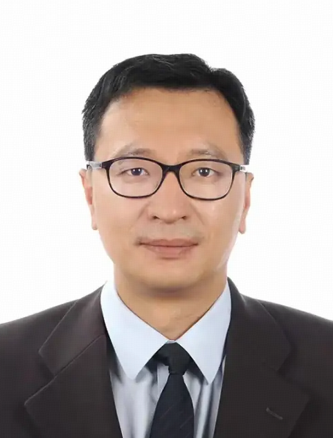 Pei Xin (辛沛)合作论文数Jiangsu University of Science and Technology5
 Matthew Dunbabin合作论文数School of Electrical Engineering & Robotics, Faculty of Engineering, Queensland University of Technology;Biopixel Robotics;GFB Robotics Pty Ltd5
 Andrew Olds合作论文数Australian Rivers Institute - Coast and Estuaries and School of Environment, Griffith University4WoeiKeong Kuan合作论文数University of Queensland, The University of Queensland4
 Kirsten Abernethy合作论文数4myknee sirikolo合作论文数3kiel aranani合作论文数3
 Timothy James Green合作论文数3
 David Callaghan合作论文数School of Civil Engineering, Faculty of Engineering, Architecture and Information Technology, The University of Queensland3
 Liggins Libby合作论文数School of Biological Sciences, Victoria University of Wellington3
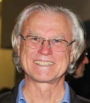 Norman C Duke合作论文数Centre for Tropical Water and Aquatic Ecosystem Research, James Cook University3
 Guangqiu Jin (金光球)合作论文数College of Water Conservancy and Hydropower Engineering, Hohai University3
 Olga Pantos合作论文数Centre for Marine Sciences, University of Queensland3
 Chris Roelfsema合作论文数School of Earth and Environmental Sciences,University of Queensland3
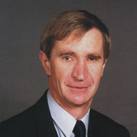 John McKenzie合作论文数Faculty of Science, University of Melbourne3Claudine Watoto合作论文数3
 John C. Bythell合作论文数Department of Marine Sciences and Coastal Management, University of Newcastle3
 Charles James Lemckert合作论文数Griffith School of Engineering, Griffith University3
 Eran Brokovich合作论文数Institute for Marine Sciences3j oeta合作论文数2
 Congrui Li合作论文数2
 Nicholas Hutley合作论文数Sch Civil Engn, Univ Queensland2
 Nathaniel Deering合作论文数Sch Civil Engn, Univ Queensland2b knowles合作论文数2
 Chenming Zhang合作论文数School of Civil Engineering, Faculty of Engineering, Architecture and Information Technology, The University of Queensland2
 Michele Burford合作论文数School of Environment and Science, Griffith University;Australian Rivers Institute, Griffith University2
 John Church合作论文数Climate Change Research Centre, University of New South Wales2
 Maxwell Paul合作论文数School of Chemical Engineering, University of Queensland;Healthy Waterways;School of Chemical Engineering, University of Queensland2
 Katrin Sturm合作论文数2
 Leon Javier X合作论文数Global Change Institute, The University of Queensland;School of Geography, Planning and Environmental Management, The University of Queensland;The University of Queensland, The University of Queensland2
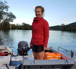 Naomi S. Wells合作论文数2
 Hubert Chanson合作论文数School of Civil Engineering, Faculty of Engineering, Architecture and Information Technology, The University of Queensland2
 Tony Robert Weber合作论文数Department of Physics;University of California at San Diego;Department of Physics, University of California at San Diego2
 Rupak Aryal合作论文数Incredibly Pure Pty Ltd2H. Carey合作论文数2
 Matthew R. Hipsey合作论文数Sch Earth & Environm, Univ Western Australia2




