The World Meteorological Organization (WMO) World Weather Research Programme (WWRP) High-Impact Weather (HIWeather) research project was designed to increase the effectiveness of forecasts and warnings of high-impact weather. In achieving this, it created a global momentum toward a growing partnership between the social and physical sciences in the weather enterprise, building a community of researchers and practitioners who understand the importance of working across disciplines and are passionate about the value of warnings in reducing the impact of weather-related hazards. Through its promotion of "Warning Chain Thinking" within the Warning Value Cycle, it focused attention on the whole warning system, from monitoring and forecasting through communication and response, emphasizing the role of partnerships among disciplines, organizations, decision-makers, and the public. It brought together a wide body of research from multiple disciplines involved in making warnings more effective, in a series of publications which are increasingly used in education, training, and operations. In doing so, it helped bridge gaps between weather information providers, emergency managers, and humanitarian organizations on a global scale. It has provided a community and a body of evidence as a foundation for the United Nations Early Warnings for All initiative and for the next generation of warnings research. SIGNIFICANCE STATEMENT: The article highlights the importance of considering the high-impact weather forecasting and warning chain as an integrated whole, involving a range of actors from different organizations and disciplines. Three strands of science motivated this work: the need for progress in translating weather hazards into impacts; evidence to underpin the appropriate introduction of impact-based forecasts and warnings; and addressing the gap between the science of community response, espoused by humanitarian organizations, and the science of weather information production, exemplified by national weather services.
The World Meteorological Organization (WMO) has called for more meaningful warnings to help reduce the impacts of weather-related events. Impact-based forecasts and warnings (IBFW) are being developed by forecasting agencies globally to meet this call. However, there are many challenges facing those implementing such systems. The WMO World Weather Research Programme High Impact Weather project sought to understand the future direction of research on IBFW systems. This research involved a virtual workshop series in late 2022 with over 350 international registrants to identify and analyse challenges that people are facing in developing IBFW systems, and potential solutions.We found that challenges relate to ten themes, in addition to defining the measures of success of an IBFW system Examples of key research gaps are to develop evaluation methods to explore the value of multi-hazard IBFW, in terms of collating data at appropriate scales, and including avoided losses, behavioural responses, and unconventional observations. We need to explore the value of using quantitative approaches in comparison to more efficient qualitative approaches, as well as of dynamic exposure and vulnerability data sets, and tailored warnings. We must investigate how to effectively communicate uncertainty and explore the governance of underpinning data.Further research on these topics will assist with the successful implementation of more meaningful warnings globally, whilst considering the feasibility and effectiveness of the efforts involved. This is our contribution to reducing the impacts of future hazards, at a time where climate-related events are expected to increase in severity.
AbstractIn this chapter, we examine the ways that warning providers connect and collaborate with knowledge sources to produce effective warnings. We first look at the range of actors who produce warnings in the public and private sectors, the sources of information they draw on to comprehend the nature of the hazard, its impacts and the implications for those exposed and the process of drawing that information together to produce a warning. We consider the wide range of experts who connect hazard data with impact data to create tools for assessing the impacts of predicted hazards on people, buildings, infrastructure and business. Then we look at the diverse ways in which these tools need to take account of the way their outputs will feed into warnings and of the nature of partnerships that can facilitate this. The chapter includes examples of impact prediction in sport, health impacts of wildfires in Australia, a framework for impact prediction in New Zealand, and communication of impacts through social media in the UK.
Cloud-to-ground lightning is a common and dangerous natural atmospheric hazard in southern Canada. Previous research conducted by the author and colleagues, using data from 1994 to 2003, estimated that lightning directly or indirectly kills 9–10 people and injures 92–164 more each year in Canada. Repeating the analysis using data from the same government agency and media sources for the 2002–2017 period, the author found that lightning-related mortality decreased to 2–3 deaths per year, roughly 0.08 deaths per million population. An average of 180 lightning-related injuries each year (5.3 per million population) was estimated for the same period, slightly greater than the maximum documented in the 1994–2003 analysis. About half of the drop in mortality between periods may be attributed to the reduction in reported deaths associated with lightning-ignited municipal fires since 2000. The remainder may be due to a combination of greater availability and use of communication technology, faster emergency response and medical treatment, and increased public awareness of lightning hazards and safety. Further research is required to explain why lightning-related injury rates have remained stable; better understand the interaction of technological, behavioral and other factors; and to determine the efficacy of past and potential future safety interventions.
AbstractEmergency department visitation data were analyzed using a matched-pair, retrospective cohort method to estimate the effects of winter storms on fall-related injury risks for a midsized urb...
Past research has shown that winter precipitation is an important environmental factor that increases the frequency of motor vehicle collisions that cause personal injury and property damage. Questions remain about the magnitude of winter storm effects on collision occurrence, changes in risk over time, and the role of driver behaviour in conjunction with other factors (e.g., winter maintenance by road authorities) as it affects exposure and sensitivity to hazardous conditions. In response, a matched-pair, retrospective cohort method was used to estimate injury and non-injury collision risks for a mid-sized urban community based on a new definition of winter storm events that, relative to previous studies, captures a greater portion of time during which drivers respond to hazardous weather and road surface conditions. Winter storm definition criteria were applied to weather radar imagery and traditional surface station observations in a unique manner to classify and characterize a set of 196 variable-length storm events in terms of precipitation type and amount, visibility, temperature profile, presence of government-issued warnings, location, and temporal factors. Injury and non-injury collisions increased by 66 and 137 percent, respectively, during winter storms relative to dry weather conditions. Although these increases were higher than findings from similar studies of winter precipitation events conducted over the same timeframe (i.e., 2002-2016), they were found to have declined by a statistically significant amount over the course of the study period and disproportionately to collisions in general. Understanding why this is occurring, and then attributing improvements to specific winter road safety interventions and behavioural adjustments, is a key focus for future research and for informing future risk-mitigating investments.
>Despite advances in forecasting and emergency preparedness,weather related disasters continue to cost many lives, to displace populations and to cause wide-spread damage. Therefore, High Impact Weather Project (HIWeather), a 10-year research project
The value of weather and climate information, at any timescale, is a function of the availability, comprehensibility, and usability of the information so that decisions and actions can be taken in response to uncertain future events. The uncertainties and available skill of sub-seasonal to seasonal (S2S) forecasts have the potential to make communication and dissemination of these forecasts more challenging, particularly in scenarios where decisions are critical to life and well-being or have significant economic impact on the users. Engagement with user communities, therefore, is essential to ensure that these forecasts provide their anticipated value and to prevent misconceptions or disparities between user expectations and the available science. This chapter describes the current state of the literature on S2S application in a range of sectors (agriculture, energy and water, disaster risk reduction (DRR), and health) and the readily available public products and services. Gaps and trends in current S2S application research are identified, and descriptions of best practice examples are synthesized to provide a set of guiding principles for S2S forecast communication, dissemination, and user engagement.
THORPEX was a 10-yr international research program designed to accelerate the rate of improvement in the accuracy of predictions of high-impact weather.
The Year of Polar Prediction (YOPP) has the mission to enable a significant improvement in environmental prediction capabilities for the polar regions and beyond, by coordinating a period of intensive observing, modelling, prediction, verification, user- engagement and education activities. The YOPP Core Phase will be from mid-2017 to mid-2019, flanked by a Preparation Phase and a Consolidation Phase. YOPP is a key component of the World Meteorological Organization – World Weather Research Programme (WMO-WWRP) Polar Prediction Project (PPP). The objectives of YOPP are to: 1. Improve the existing polar observing system (better coverage, higher-quality observations); 2. Gather additional observations through field programmes aimed at improving understanding of key polar processes; 3. Develop improved representation of key polar processes in coupled (and uncoupled) models used for prediction; 4. Develop improved (coupled) data assimilation systems accounting for challenges in the polar regions such as sparseness of observational data; 5. Explore the predictability of the atmosphere-cryosphere-ocean system, with a focus on sea ice, on time scales from days to seasons; 6. Improve understanding of linkages between polar regions and lower latitudes and assess skill of models representing these linkages; 7. Improve verification of polar weather and environmental predictions to obtain better quantitative knowledge on model performance, and on the skill, especially for user-relevant parameters; 8. Demonstrate the benefits of using predictive information for a spectrum of user types and services; 9. Provide training opportunities to generate a sound knowledge base (and its transfer across generations) on polar prediction related issues. The PPP Steering Group provides endorsement for projects that contribute to YOPP to enhance coordination, visibility, communication, and networking. This White Paper is based largely on the much more comprehensive YOPP Implementation Plan (WWRP/PPP No. 3 – 2014), but has an emphasis on Arctic observations.
AbstractThe polar regions have been attracting more and more attention in recent years, fueled by the perceptible impacts of anthropogenic climate change. Polar climate change provides new opportunities, such as shorter shipping routes between Europe and East Asia, but also new risks such as the potential for industrial accidents or emergencies in ice-covered seas. Here, it is argued that environmental prediction systems for the polar regions are less developed than elsewhere. There are many reasons for this situation, including the polar regions being (historically) lower priority, with fewer in situ observations, and with numerous local physical processes that are less well represented by models. By contrasting the relative importance of different physical processes in polar and lower latitudes, the need for a dedicated polar prediction effort is illustrated. Research priorities are identified that will help to advance environmental polar prediction capabilities. Examples include an improvement of the p...
What: A total of 80 experts from 20 different countries met to assess recent progress in, and new directions for, our understanding of the mechanisms governing polar lower-latitude linkages and their role in weather and climate prediction including services.
The Year of Polar Prediction (YOPP) is planned for mid-2017 to mid-2019, centred on 2018. Its goal is to enable a significant improvement in environmental prediction capabilities for the polar regions and beyond, by coordinating a period of intensive observing, modelling, prediction, verification, user-engagement and education activities. With a focus on time scales from hours to a season, YOPP is a major initiative of the World Meteorological Organization’s World Weather Research Programme (WWRP) and a key component of the Polar Prediction Project (PPP). YOPP is being planned and coordinated by the PPP Steering Group together with representatives from partners and other initiatives, including the World Climate Research Programme’s Polar Climate Predictability Initiative (PCPI). The objectives of YOPP are to: 1. Improve the existing polar observing system (enhanced coverage, higher-quality observations). 2. Gather additional observations through field programmes aimed at improving understanding of key polar processes. 3. Develop improved representation of key polar processes in (un)coupled models used for prediction. 4. Develop improved (coupled) data assimilation systems accounting for challenges in the polar regions such as sparseness of observational data. 5. Explore the predictability of the atmosphere-cryosphere-ocean system, with a focus on sea ice, on time scales from hours to a season. 6. Improve understanding of linkages between polar regions and lower latitudes, assess skill of models representing these linkages, and determine the impact of improved polar prediction on forecast skill in lower latitudes. 7. Improve verification of polar weather and environmental predictions to obtain better quantitative knowledge on model performance, and on the skill, especially for user- relevant parameters. 8. Identify various stakeholders and establish their decisionmaking needs with respect to weather, climate, ice, and related environmental services. 9. Assess the costs and benefits of using predictive information for a spectrum of users and services. 10. Provide training opportunities to generate a sound knowledge base (and its transfer across generations) on polar prediction related issues. YOPP is implemented in three distinct phases. During the YOPP Preparation Phase (2013 through to mid-2017) this Implementation Plan was developed, which includes key outcomes of consultations with partners at the YOPP Summit in July 2015. Plans will be further developed and refined through focused international workshops. There will be engagement with stakeholders and arrangement of funding, coordination of observations and modelling activities, and preparatory research. During the YOPP Core Phase (mid-2017 to mid-2019), four elements will be staged: intensive observing periods for both hemispheres, a complementary intensive modelling and prediction period, a period of enhanced monitoring of forecast use in decisionmaking including verification, and a special educational effort. Finally, during the YOPP Consolidation Phase (mid-2019 to 2022) the legacy of data, science and publications will be organized. The WWRP-PPP Steering Group provides endorsement throughout the YOPP phases for projects that contribute to YOPP. This process facilitates coordination and enhances visibility, communication, and networking.
In response to a growing interest in the Arctic in recent years, the number of real-time short-medium range sea ice prediction systems has been increasing, and now includes several systems covering the full Arctic Ocean, for example: the Arctic Cap Nowcast/Forecast System (ACNFS; Posey et al., 2010), Towards an Operational Prediction system for the North Atlantic European coastal Zones (TOPAZ; Bertino and Lisaeter, 2008), and the Canadian Centre for Marine and Environmental Prediction’s Global Ice Ocean Prediction System (GIOPS; Smith et al., 2015) and Regional Ice Prediction System (RIPS; Lemieux et al., 2015; Buehner et al., 2013). In addition, numerous ice-ocean hindcasts1 and reanalyses have been made and intercompared through the Arctic Ocean Model Intercomparison Project (AOMIP; Johnson et al., 2007) and the CLIVAR Global Synthesis and Observations Panel (GSOP) Ocean Reanalysis Intercomparison Project (ORA-IP; Balmaseda et al., 2015). Despite this significant effort, it is difficult to ascertain the true skill of these prediction systems and their primary sources of error, as reliable observations are limited and verification techniques tend to vary from one group to another. As a result, the potential benefits of sea ice prediction for various user groups (e.g. national ice services, marine transportation and resource exploitation, coupling with numerical weather prediction) have been hindered by uncertainty regarding the skillfulness of predictions and how best to use them. An intercomparison of sea ice fields from existing systems by the GODAE Oceanview Intercomparison and Validation Task Team (www.godae.org) has been initiated, although a larger coordinated international effort is needed. The upcoming Year of Polar Prediction (YOPP) aims to address these challenges in the context of a broader initiative toward improved polar environmental predictions for both hemispheres.
Increased economic, transportation and research activities in polar regions are leading to more demands for sustained and improved availability of predictive weather and climate information to support decision-making. However, partly as a result of a strong emphasis of previous international efforts on lower and middle latitudes, many gaps in weather, sub-seasonal and seasonal forecasting in polar regions hamper reliable decision making in the Arctic, Antarctic and beyond. In order to advance polar prediction capabilities, therefore, the WWRP Polar Prediction Project (PPP), has been established as one of three THORPEX legacy activities. The aim of PPP, a ten-year endeavor (2013—2022), is to “Promote cooperative international research enabling development of improved weather and environmental prediction services for the polar regions, on time scales from hours to seasonal.” In order to achieve its goals, PPP will enhance international and interdisciplinary collaboration through the development of strong linkages with related initiatives; strengthen linkages between academia, research institutions and operational forecasting centres; promote interactions and communication between research and stakeholders; and foster education and outreach. Flagship research activities of PPP include sea ice prediction, polar-lower latitude linkages and the Year of Polar Prediction (YOPP), an intensive observational and modelling period centred around the period mid-2017 to mid-2019.
This study explores driver adaptation to inclement weather at two temporal scales. The first part of the paper asks whether drivers become acclimatized to weather conditions. This issue is addressed using data for 23 Canadian cities, based on the relationship between exposure to rain, heavy rain, snow, heavy snow, and icy pavement conditions vis-a-vis the risk of collision. The results do not provide strong evidence that drivers become acclimatized to local weather patterns, which underscores the need to look at driver adaptations on shorter time scales with a view to identifying situations or driver groups where risks are particularly elevated. The second part of the paper focuses on the issue of speed - both from the perspective of posted speed limits, and also in terms of driving speeds. The focus is narrowed to one part of Canada and to winter-weather conditions. The risk analysis confirms that days with snow, freezing rain, or other frozen forms of precipitation have elevated collision rates; and it provides evidence that relative risk is higher in rural areas than in nearby cities. The analysis also suggests that collision rates increase as the posted speed limit increases. These findings further highlight the importance of driving speed in weather-related collision occurrence, and that driving above posted speed limits occurs even during inclement weather. Crown Copyright (C) 2012 Published by Elsevier Ltd. All rights reserved.
The elevated risk of collision while driving during precipitation has been well documented by the road safety community, with heavy rainfall events of particular concern. As the climate warms in the coming century, altered precipitation patterns are likely. The current study builds on the extensive literature on weather-related driving risks and draws on the climate change impact literature in order to explore the implications of climate change for road safety. It presents both an approach for conducting such analyses, as well as empirical estimates of the direction and magnitude of change in road safety for the highly urbanized Greater Vancouver metropolitan region on Canada’s west coast. The signal that emerges from the analysis is that projections of greater rainfall frequency are expected to translate into higher collision counts by the mid 2050s. The greatest adverse safety impact is likely to be concentrated on moderate to heavy rainfall days (≥ 10 mm), which are associated with more highly elevated risks today. This suggests that particular attention should be paid to future changes in the frequency and intensity of extreme rainfall events.
Energy extraction, production, and transmission systems are highly sensitive to states of the natural environment such as temperature, wind speed, and even ice cover. Forecasts of such state variables are termed environmental predictions. How much value can such environmental predictions provide to the operator of a given energy system? This paper presents three illustrative Canadian case studies, selected to provide a good cross section across sectors, forecast types, and decision time scales, to provide insights into this important question.
INTRODUCTION:Police records are the most common source of data used to estimate motor-vehicle collision risks, understand causal or contributing factors, and evaluate the efficacy of interventions. The literature notes concerns about this information citing discrepancies between police reports and other sources of injury occurrence and severity data. The primary objective of the analysis was to assess the adequacy of police reports for an examination of weather-related injury collision risk. METHOD:Analyses of relative risk were carried out using both police records and comprehensive insurance claim data for Winnipeg, Canada over the period 1999-2001. RESULTS AND CONCLUSIONS:Both data sets yielded very similar results-precipitation substantially increases the risk of injury collision (police records: RR 1.76, CI 1.55-2.00; insurance: RR 1.80, CI 1.62-1.99) and risk of injury (police records, RR 1.74, CI 1.55-1.96; insurance, RR 1.69, CI 1.55-1.85) relative to corresponding dry weather control periods. Both rainfall and snowfall were associated with large increases in collisions and injuries. IMPACT ON INDUSTRY:While relative risks are almost identical, over 64% more injury collisions and 74% more injuries were identified using the insurance data, which is an important difference for evaluating absolute risk and exposure.
 Jean Andrey合作论文数Department of Geography;University of Waterloo;Meteorological Service of Canada;Department of Geography, University of Waterloo24
 Susan Tighe合作论文数Department of Civil Engineering, Faculty of Engineering, McMaster University13
 stefanie klebe合作论文数7
 Gregory C Smith合作论文数Rech Previs Numer Environm, Environm & Changement Climat Canada7
 Daniel Scott合作论文数Department of Geography and Environmental Management, Faculty of Environment, University of Waterloo;Waterloo Climate Institute, University of Waterloo7
 Peter Bauer合作论文数Max-Planck Institute for Meteorology7
 Thomas S. Jung合作论文数European Centre for Medium-Range Weather Forecasts7
 David Bromwich合作论文数Department of Geography, College of Arts and Sciences, The Ohio State University;Byrd Polar and Climate Research Center, The Ohio State University7
 Neil Gordon合作论文数7
 Ian Renfrew合作论文数School of Environmental Sciences, University of East Anglia;Centre for Ocean and Atmospheric Sciences, University of East Anglia7
 Helge F Goessling合作论文数Department for Crop and Animal Sciences, Humboldt-Universität zu Berlin7
 Carl T. Haas合作论文数Department of Civil and Environmental Engineering, University of Waterloo6
 Mikhail Tolstykh合作论文数6Ken Huen合作论文数6
 Matthieu Chevallier合作论文数Centre National de Recherches Météorologiques;Unite mixte de recherche 3589 Météo-France/CNRS;CNRS, Centre National de Recherches Météorologiques6
 Trond Iversen合作论文数Department of Geophysics, The Faculty of Mathematics and Natural Sciences, University of Oslo6Kelsey Spring合作论文数6
 Pertti Nurmi合作论文数6
 Gunilla Svensson合作论文数Department of Meteorology, Stockholm University6alexander p makshtas合作论文数5
 Jennifer Yessis合作论文数5Day Jonathan F合作论文数5
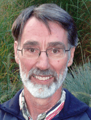 Chris Fairall合作论文数Physical Science Division, Earth Systems Research Laboratory, National Oceanic and Atmospheric Administration;Physical Sciences Laboratory, National Oceanic and Atmospheric Administration5
 Qinghua Yang (杨清华)合作论文数School of Atmospheric Sciences, Sun Yat-Sen University;Southern Marine Science and Engineering Guangdong Laboratory (Zhuhai)5Jun Inoue合作论文数5
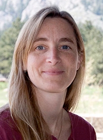 Marika Holland合作论文数Climate & Global Dynamics Lab, National Center for Atmospheric Research5Max S. Perchanok合作论文数5Dan Unrau合作论文数5Jeff Suggett合作论文数4Laurel Pentelow合作论文数4
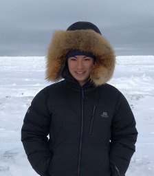 Alice Bradley合作论文数Dartmouth Coll4Brenda Jones合作论文数4Peter Chen合作论文数4
 François Massonnet合作论文数Catholic Univ Louvain, Earth & Life Inst, Georges Lemaitre Ctr Earth & Climate Res, Louvain La Neuve, Belgium4
 Alexander Brenning合作论文数Department of Geography, Friedrich Schiller University Jena4
 Brian Golding合作论文数Department of Biology, McMaster University4
 Sarah Baiz合作论文数4
 Barbara Casati合作论文数4
 Francisco J Doblas Reyes合作论文数Department of Earth Sciences, Barcelona Supercomputing Center;Catalan Institution for Research and Advanced Studies4
 Randall Dole合作论文数3Gita Ljubicic合作论文数3
 Phil A. Reid合作论文数Inst Marine & Antarctic Studies, Univ Tasmania3
 Joanne Robbins合作论文数Department of Weather Science, Met Office3Hambly Derrick合作论文数3
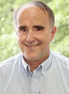 Don Perovich合作论文数Thayer School of Engineering, Dartmouth College3
 Andrea Taylor合作论文数Business School, Leeds University;School of Earth and Environment, University of Leeds;Leeds University Business School, University of Leeds3
 Harold Edward Brooks (Harold E. Brooks)合作论文数National Weather Center, National Severe Storms Laboratory, National Oceanic and Atmospheric Administration;School of Meteorology, University of Oklahoma3
 Denis Kirchhoff合作论文数3
 Daniela Liggett合作论文数3




