In the Roman city of Vienne (France), the archaeoseismological observations revealed a series of disorders, repairs, and reconstructions characteristic of ground movements: at the temple of Augustus and Livia, in the Roman Forum. These observations have led archaeologists to focus more on a rich array of archaeological evidence. This includes the interpretation of the two states of construction of the temple of Augustus and Livia, as well as those that we have on the forum: – the temporary stopping of the construction of a large horrea located on the edge of the Rhône; – the renovation of the urban plan and the development of the construction of large urban residences. These observations made it possible to formulate the hypothesis that it was likely an earthquake that had caused the almost total destruction of the city, leading to the reconstruction and transformation of most monuments and houses. We have sought to extend these observations to buildings from the mediaeval period. Thus, we have observed characteristic disorders and reconstructions on the church and cloister of Saint André le Bas, at the cathedral church of Saint-Maurice, and finally at the Château de la Bâtie, built by the counts of Albon in the middle of the twelfth century. We could compare our hypotheses with the findings formulated by geologists on the existence of a possible zone of tectonic disturbances in the lower valley of the river La Gère, possibly originating from an ‘orphan’ fault. We believe that the activation of this rift would have taken place at the beginning of the Roman imperial era, possibly in the sixth century AD, if one believes a testimony of Sidoine Apollinaire, and again in the course of the fourteenth century? To verify these hypotheses, once again, archaeologists and archaeoseismologists will try to converge their respective research.
A Testamentary Inscription from Philia, in the Nome of Karditsa (Thessaly) An inscribed plaque, which was brought in September 1988 by an inhabitant of Philia, a village of the municipality of Sophades, to the authorities of the 13th Ephorate of Prehistoric and Classical Antiquities of Volos in charge of the department of Karditsa, bears 22 lines of a text of which only the left half is preserved. This is a testamentary donation probably made in favor of a young woman called Eukrateia. The text gives to tutors instructions according to different situations that could occur in the life of this person until her marriage. Two other persons are also mentioned, who could have taken part in the donation. This proved to be a donation of money, probably deposited in the sanctuary of Athena Itonia at Philia.
The Church of the Transfiguration (Khumarzham) in Garni occupies a privileged position in the center of the village of Garni, a few hundred meters from the fortress and the ancient temple that retain the curiosity of tourists. Our observations show that this building presents obvious traces of destruction and reconstruction resulting from a succession of events related to transformations in its destination and to environmental constraints, in particular successive earthquakes likely caused by the Garni fault. The confrontation of these destructive and reconstructive sequences with those that have been recognized on many other monuments of the region helps to precise the seismic history of modern Armenia.
The results of the observations made during our 2003-2013 missions in Armenia are described here:I. Several seismic events, unknown in the written sources and the latest catalogs, were identified: A) At Erebuni, in the Ararat plain, an earthquake ruined the temple of Khaldi at the end of the Urartu period and led to the abandonment and the transformation of the quarter where it had been established, probably around the end of the 7th c. BC; B) At Benjamin, in northwestern Armenia, an earthquake caused important damage to parts of the Hellenistic settlement, in particular on the tower-porch at the east; the traces of repairs indicate that this event dates to the same period; C) The study of the bridge at Garni and the church of the village, southeast of Yerevan, have revealed a seismic event that occurred at least earlier than the earthquake of 1679, the only one mentioned in the texts, which is used as a reference for all the destruction dates in the region.II. The observations made of the traditional rural constructions called "hazarashen" have not only enabled the dating of this building tradition to at least as early as the Hellenistic period (4th c. BC); they have also enabled identification of the lozenge-shaped deformation in these structures as a characteristic effect of the disturbances caused by the earthquake, a deformation resulting from and accompanied by compression or extension of the walls according to their position in relation to the direction of the ground motion. (C) 2015 Elsevier Ltd and INQUA. All rights reserved.
Longtemps considérée comme une période perturbée, l’Antiquité tardive apparaît aujourd’hui comme une époque riche de changements et d’influences mêlées, induisant des problématiques d’études multiples. Ces particularités se traduisent notamment par des spécificités dans les traitements funéraires. Afin de les restituer au mieux, une étude à la fois biologique, topographique, archéologique et historique s’impose. Les recherches récentes menées sur le site de la place de l’Égalité (Sainte-Colombe, Rhône) illustrent cette approche pluridisciplinaire. L’échantillon de population adulte issu des fouilles du site révèle un profil démographique anormal, où les sujets jeunes et les sujets féminins sont fortement sous-représentés. L’examen des données issues de la fouille nous a permis d’identifier une organisation de l’espace funéraire en groupes de sépultures distincts, au nombre de six, et une volonté de faciliter l’implantation de ces groupes dans les zones libres de vestiges antérieurs. L’étude simultanée de ces différents types de données nous permet d’approcher le fonctionnement de la nécropole et la population inhumante, et converge vers l’hypothèse de Collèges à vocation funéraire, directement hérités de la tradition romaine. Fonctionnant durant les IVe et Ve siècles, cette occupation funéraire cesse avant la fin du Ve siècle, peut-être à la faveur de l’installation à proximité d’un monastère de femmes, qui aurait entraîné, comme nombre d’autres établissements nouvellement fondés, le déplacement du lieu de sépultures, dans un contexte chronologique plus tardif où l’Église chrétienne est devenue dominante.
Pliny the Elder (first century A.D.) mentioned that the Thessalian magnetite from Magnesia in ancient Greece was second in quality after the Ethiopic. This magnetite should be related with the origin of the Homeric Magnetes of the eighth century B.C. who lived around Ossa mountain in central Greece. A new euhedral magnetite occurrence derived from the Kampitsios area at the north-western slopes of Mavrovouni mountain in “Amyrikon Pedion”, probably shows that this region should have been connected with the origin of the Homeric Magnetes. The magnetites under study are found as porphyroblasts in the talc schists. They are almost pure with rare inclusions, mainly ilmenite, rutile, pseudorutile and a PbO phase. The alteration of magnetite to hematite is restricted only along the fissures and cracks as well as along the rims, forming very thin films of a few micrometres in thickness. Microprobe analyses showed that the magnetites are almost pure and they contain only traces of Cr 2 O 3 (1.01–3.41%). The high-quality magnetites of Kampitsios could be probably related with those mentioned by Pliny, and they should be related with the origin of the Homeric Magnetes of the eighth century B.C. who lived around Ossa mountain in Thessaly.
The development of past civilizations and the foundation of towns have always been strictly linked to the availability of water. In this paper, we analyse more than 2000 years of evolution of Yperia Krini spring in Thessaly (Greece), by investigating possible variations in terms of water discharge. In particular, the integrated analysis of geological, hydrological, hydrogeological and historical data relative to the spring, called by Sophocles a 'gift of God and source of life', allowed us to understand the role played by both climatic variations and anthropogenic activities on the behaviour and the characteristics of the local underground water resources within the Thessalian plain.
A small votive monument published in 2001 by P. Chrysostomou in the Bulletin of the Benaki Museum has a dedication to the godess En(n)odia, which is designated as Κορουταρρα. The texte is probably from Thessaly: this is actually the region where the cult of En(n)dia is attested most. We suggest an interpretation of the epithet as a femenine agent noun (with the suffix -ταρρα, which is already attested in Thessaly) of the lexeme underlying κόρος “sasiety” (*“nourishment”, “growth”: orh1-o-), cf. Att. korevnnumi “satiate”: the epithet Κορουταρρα goes thus back to *korō-t(e)ra- “who makes grow”, more precisely “who provides with nourishment/growth”, corresponding to *κορω- of the type στeϕανω- “crown” (i.e. *“provide with a crown”).This interpretation leads to the characterisation of Ennodia as a Thessalian kourotrophic divinity, as thi is the case, in the same region, for Artemis, Brimo, Hekate Leukathea, Pasikrata, as well as for Apollo, especially in the sanctuary consecrated to him in Pagasae, which is now known thanks to recent excavations by archaelogists of the University of Thessaly.
Northern Thessaly may represent an important seismic gap within the broader Aegean Region, with major faults bordering the ESE–WNW trending Late Pleistocene–Holocene Tyrnavos Basin. In order to obtain information about the characteristics of past earthquakes and improve our knowledge on the seismic potential of the investigated area, historical and archaeological observations are analysed and compared with the results of palaeoseismological trenches excavated across one of the major bordering structures, the Tyrnavos Fault. The former data clearly document (i) a strong seismic activity affecting the area during the last 2–3 ka and (ii) the occurrence of recent earthquakes not included in the seismic catalogues. Also, the sedimentological, structural and chronological data (TL, OSL and AMS) obtained from the palaeoseismological trenches indicate Late Pleistocene to Holocene morphogenic activity of the Tyrnavos Fault, characterised by vertical co-seismic displacements of 20–40 cm and possible return periods of a few thousands of years. Advantages and limitations in using historical and archaeoseismological data are discussed, as well as the problems arising from analysing low slip-rate faults.
Among the epigraphical documents found at Larisa in recent years, two of the city's decrees have a particular interest. The first, a proxenia decree for a Mytilinian, that can be dated to the earliest years of the 2nd c. BC, is in a dialect and reflects the relations that were established before the engagement of the Second Macedonian War and were renewed, for the admission of the Asclepieia of Mytilini, between the Thessalian Confederation and the cities that composed it on the one hand and the Mytilinians on the other. This casts new light on a well-known document, the Mytilini decree for the Thessalian Confederation IG XII SuppL, 3, and supplements the history of the relations between the two parties, which were prolonged up to the period of Augustus, as we know from the fragments of decrees in honour of the Mytilenian Potamon, son of Lesbonax. The second Larisa decree, which was voted for two citizens of Chalkis in Euboea and which is in koine, should be placed more than a century later, towards 70 BC; it shows the procedure by which a foreigner who had received the proxenia of the Thessalian Confederation could acquire, at his request, citizenship in a member city of this Confederation.
Athanasios Tziafalias και Bruno Helly Δύο ανέκδοτα ψηφίσματα από τη Λάρισα σ. 377-420 Ανάμεσα στις επιγραφικές μαρτυρίες που ανακαλύφθηκαν τα τελευταία χρόνια στη Λάρισα συγκαταλέγονται και δύο ψηφίσματα της πόλης αυτής, που παρουσιάζουν ιδιαίτερο ενδιαφέρον. Το πρώτο από αυτά είναι ένα προξενικό ψήφισμα, γραμμένο σε διάλεκτο, που αφορά έναν Μυτιληναίο και χρονολογείται στις αρχές του 2ου αιώνα π.Χ. Αντικατοπτρίζει τις σχέσεις που δημιουργήθηκαν πριν από την έναρξη του Δεύτερου Μακεδονικού Πολέμου και ανανεώθηκαν, στο πλαίσιο της αποδοχής των Ασκληπιείων της Μυτιλήνης, μεταξύ, αφενός του Κοινού των Θεσσαλών και των πόλεων που το αποτελούσαν και αφετέρου των Μυτιληναίων. Αυτό μας επιτρέπει να δούμε κάτω από νέο πρίσμα ένα πολύ γνωστό έγγραφο, το ψήφισμα της Μυτιλήνης για το Κοινό των Θεσσαλών IG XII Suppl., 3 και να εμπλουτίσουμε την ιστορία των σχέσεων μεταξύ των δύο μερών, σχέσεις οι οποίες διατηρήθηκαν έως την εποχή του Αυγούστου, όπως γνωρίζουμε από τμήματα ψηφισμάτων προς τιμήν του Μυτιληναίου Ποταμώνα, γιου του Λεσβώνακτος. Το δεύτερο ψήφισμα από τη Λάρισα, γραμμένο στην κοινή, αφορούσε δυο πολίτες από τη Χαλκίδα, στην Εύβοια, και θα πρέπει να τοποθετηθεί χρονολογικά πάνω από έναν αιώνα αργότερα, γύρω στο 70 π. Χ.· καταδεικνύει τη διαδικασία σύμφωνα με την οποία ένας ξένος, που είχε την προξενία από το Κοινό των Θεσσαλών, μπορούσε να αποκτήσει, ύστερα από αίτημά του, την ιδιότητα του πολίτη μιας πόλης-μέλους αυτού του Κοινού.
Le décret IG IX 2, 103, qui ne nous est connu que par une transcription imprimée publiée par un érudit voliote du siècle dernier, Zosimas Esphigménitis, est, à n'en pas douter, un décret de la Confédération thessalienne et il atteste clairement qu'au moment où il a été pris, les cités de Mélitaia en Achaïe Phthiotide et d'Héracleia Trachinia, capitale des Oitaiens, appartenaient à la Confédération thessalienne. Il doit dater du IIe siècle av. J.-C, mais la disparition de la pierre laisse peu de chance de préciser davantage. Ce que l'on sait de l'histoire de Mélitaia et d'Héracleia conduit à identifier deux périodes au cours desquelles ces deux cités ont pu se retrouver ensemble sous l'autorité des Thessaliens : soit pendant quelques années, entre 190 et 184 av. J.-C, soit à partir de 146 ; toutefois il paraît plus probable de placer le document dans la seconde moitié du IIe siècle, ce qui permet d'avancer l'hypothèse qu'Héracleia est devenue thessalienne bien avant l'époque d'Auguste, contrairement à l'opinion reçue. L'intégration de cette cité à l'ensemble thessalien a dû intervenir dès 146 av. J.-C. Le décret IG 103 semble indiquer qu'il a été nécessaire de régler un ou des différends qui opposaient Héracleia et Mélitaia, dans le cadre fédéral, en faisant appel à des arbitres que l'on a demandés à Démétrias, une cité non thessalienne mais assez proche pour avoir des relations avec chacune des parties et connaître leur situation. Les trois stratèges de la ville ont été chargés de constituer un tribunal et le fait d'avoir sollicité à cette occasion les citoyens les plus en vue de Démétrias dit assez l'importance qu'on attachait à cette affaire.
Dans toute l'Europe méditerranéenne, la région de l'Egée constitue, à n'en pas douter, le secteur où la sismicité est la plus importante, aussi bien en termes d'intensité que de fréquence des événements telluriques. On sait aussi que la région de l'Egée est celle pour laquelle nous disposons des témoignages répartis sur la plus longue durée — plus de 2 500 ans — puisque le plus ancien d'entre eux est relatif au tremblement de terre de Sparte en 550 av. J.-C. Si l'on considère, d'autre part, que chaque année des milliers de secousses sismiques sont enregistrées, on peut facilement estimer que, sur la durée des vingt-cinq derniers siècles, cette zone a été frappée par des centaines de milliers d'événements. Cependant, la durée de ce long intervalle de temps comme cette énorme quantité de tremblements de terre se heurtent à une autre considération : le nombre des événements ayant touché la population est relativement faible et seul un nombre extrêmement réduit d'entre eux a été enregistré et décrit. Il existe en effet une bonne documentation pour environ cinq cents événements modérés ou destructeurs ; mais parmi ceux-là, seul un tout petit nombre a donné lieu à une information sur d'éventuelles ruptures de la surface terrestre et, qui plus est, l'information sur ces ruptures ne les associe pas clairement dans tous les cas à des structures tectoniques {Le. des failles) bien identifiées. En d'autres termes, eu égard au nombre global d'événements sismiques, très rares sont les cas où nous pouvons associer un tremblement de terre à une structure sismogénique.
 Alain Rideaud合作论文数5
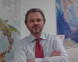 Riccardo Caputo合作论文数Department of Geology and Geophysics, University of Basilicata3Benoît Helly合作论文数2Gaëlle Granier合作论文数2Athanasios Tziafalias合作论文数2Michel Signoli合作论文数faculté de médecine de Marseille, université de la Méditerranée2François Fichet de Clairfontaine合作论文数1B. Bizot合作论文数1Stéphane Deschamps合作论文数1D. Rapti-Caputo合作论文数1Bruno Bizot合作论文数1José L. Ramón合作论文数Department of Physics, Systems Engineering and Signal Theory, University of Alicante1
 Gerassimos A. Papadopoulos合作论文数Institute of Geodynamics;National Observatory of Athens;Institute of Geodynamics, National Observatory of Athens1
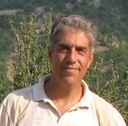 Panagiotis Voudouris合作论文数Dept . of Geology;University of Athens;Dept . of Geology, University of Athens1Antonio Oliveto合作论文数1
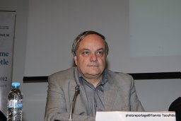 Spyros B Pavlides合作论文数Department of Geology, Aristotle University of Thessaloniki1
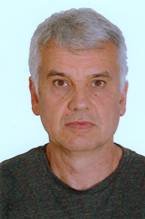 Vasilios Melfos合作论文数Department of Mineralogy, Petrology, Economic Geology, Aristotle University of Thessaloniki1




