Perceived stress plays an important role in student performance during examinations. There has been substantial research on how examinations impact students' emotional experiences in diverse academic contexts in connection to validity, reliability, and equity of assessment. The potential of some exams to produce increased anxiety in a portion of students has been recognized as a serious threat to these three assessment attributes. In light of this, the need for further studies on the impact of perceived stress on student performance is critical with the recent rise in interest in oral examinations as an assessment tool for large undergraduate courses. This paper reports on the perceived stress associated with written examinations and oral examinations in the same courses. Building on our prior frameworks for conducting oral examinations, we assess student perceived stress associated with written and oral examinations based on self-reported surveys from over 450 students. Methods to reduce the negative impact of stress on students in the context of oral examinations were implemented. Our results show that perceived stress for oral assessments are consistently lower than written exams for both performance-based credit and participation-based credit courses. Other contributing influences such as language proficiency were found not to significantly affect perceived stress level using Kruskal-Wallis analysis. In this work we also investigated the relationships between student background, gender, GPA and perceived stress during written and oral assessments. Overall, our work provides a strong case for oral examinations as a form of assessment in large undergraduate classrooms by addressing concerns surrounding student perceived stress levels caused by oral examinations.
This project aims to enhance students' learning in foundational engineering courses through oral exams based on the research conducted at the University of California San Diego. The adaptive dialogic nature of oral exams provides instructors an opportunity to better understand students' thought processes, thus holding promise for improving both assessments of conceptual mastery and students' learning attitudes and strategies. However, the issues of oral exam reliability, validity, and scalability have not been fully addressed. As with any assessment format, careful design is needed to maximize the benefits of oral exams to student learning and minimize the potential concerns. Compared to traditional written exams, oral exams have a unique design space, which involves a large range of parameters, including the type of oral assessment questions, grading criteria, how oral exams are administered, how questions are communicated and presented to the students, how feedback were provided, and other logistical perspectives such as weight of oral exam in overall course grade, frequency of oral assessment, etc. In order to address the scalability for high enrollment classes, key elements of the project are the involvement of the entire instructional team (instructors and teaching assistants). Thus the project will create a new training program to prepare faculty and teaching assistants to administer oral exams that include considerations of issues such as bias and students with disabilities. The purpose of this study is to create a framework to integrate oral exams in core undergraduate engineering courses, complementing existing assessment strategies by (1) creating a guideline to optimize the oral exam design parameters for the best students learning outcomes; and (2) Create a new training program to prepare faculty and teaching assistants to administer oral exams. The project will implement an iterative design strategy using an evidence-based approach of evaluation. The effectiveness of the oral exams will be evaluated by tracking student improvements on conceptual questions across consecutive oral exams in a single course, as well as across other courses. Since its start in January 2021, the project is well underway. In this poster, we will present a summary of the results from year 1: (1) exploration of the oral exam design parameters, and its impact in students' engagement and perception of oral exams towards learning; (2) the effectiveness of the newly developed instructor and teaching assistants training programs (3) The development of the evaluation instruments to gauge the project success; (4) instructors and teaching assistants experience and perceptions.
Problem-solving is one of the most important skills to develop in today's globally competitive workforce and remains an essential aspect to a diversity of professions and disciplines. Building on the rich literature found on problem-solving, this paper reports on the implementation of a curriculum that applies known strategies and heuristics to develop broadly applicable problem-solving skills in high school students. The curriculum covers existing problem identification and solution development tools including Izakawa fishbone diagrams, Duncker diagrams, statement restatement, vertical thinking, cross fertilization, Kepner-Tregoe analysis, and more. Our pedagogical approach blends active learning frameworks (hands-on projects, case studies, exercises) with self-regulated learning environments (via scaffolding, metacognition). We have successfully deployed the full curriculum in eleven classrooms across five high schools. Students apply their problem-solving abilities through hands-on projects embedded throughout the curriculum. Results from 254 student surveys showed interest and engagement with the course content. Overall, this paper provides a skills-focused approach to outreach, preparation, and participation of students towards engineering and technical fields with the goal of meeting the skill requirements and labor demands of the global workforce.
Depth cameras are increasingly used in research and industry in underwater settings. However, cameras that have been calibrated in air are notably inaccurate in depth measurements when placed underwater, and little research has been done to explore pre-existing depth calibration methodologies and their effectiveness in underwater environments. We used four methods of calibration on a low-cost, commercial depth camera both in and out of water. For each of these methods, we compared the predicted distance and length of objects from the camera with manually measured values to get an indication of depth and length accuracy. Our findings indicate that the standard methods of calibration in air are largely ineffective for underwater calibration and that custom calibration techniques are necessary to achieve higher accuracy.
While studies have shown that oral exams are a valuable method of assessment, their use has been limited due to concerns about scalability, examiner bias and student anxiety. This paper presents preliminary results on incorporating oral exams into two large undergraduate engineering courses, examining the potential viability of these assessment strategies. This work was done when the courses were offered remotely due to COVID-19, but the results offer valuable insights that could carry over to in-person instruction as well.
Passive acoustic monitoring (PAM) involves deploying audio recorders across a natural environment over a long period of time to collect large quantities of audio data. To parse through this data, researchers have worked with automated annotation techniques stemming from Digital Signal Processing and Machine Learning to identify key species calls and judge a region’s biodiversity. To apply and evaluate those techniques, one must acquire strongly labeled data that marks the exact temporal location of audio events in the data, as opposed to weakly labeled data which only labels the presence of an audio event across a clip.Pyrenote was designed to fit the demand for strong manual labels in PAM data. Based on Audino, an open-source, web-based, and easy-to-deploy audio annotation tool, Pyrenote displays a spectrogram for audio annotation, stores labels in a database, and optimizes the labeling process through simplifying the user interface to produce high-quality annotations in a short time frame. This paper documents Pyrenote’s functionality, how the challenge informed the design of the system, and how it compares to other labeling systems.
The acoustic signature of a natural soundscape can reveal consequences of climate change on biodiversity. Hardware costs, human labor time, and expertise dedicated to labeling audio are im-pediments to conducting acoustic surveys across a representative portion of an ecosystem. These barriers are quickly eroding away with the advent of low-cost, easy to use, open source hardware and the expansion of the machine learning field providing pre-trained neural networks to test on re-trieved acoustic data. One consistent challenge in passive acoustic monitoring (PAM) is a lack of re-liability from neural networks on audio recordings collected in the field that contain crucial biodiversity information that otherwise show promising results from publicly available training and test sets. To demonstrate this challenge, we tested a hybrid recurrent neural network (RNN) and convolutional neural network (CNN) binary classifier trained for bird presence/absence on two Peruvian bird audiosets. The RNN achieved an area under the receiver operating characteristics (AUROC) of 95% on a dataset collected from Xeno-canto and Google’s AudioSet ontology in contrast to 65% across a stratified random sample of field recordings collected from the Madre de Dios region of the Peruvian Amazon. In an attempt to alleviate this discrepancy, we applied various audio data augmentation techniques in the network’s training process which led to an AUROC of 77% across the field recordings.
This work-in-progress paper presents an innovative practice of using oral exams to maintain academic integrity and promote student engagement in large-enrollment engineering courses during remote instruction. With the abrupt and widespread transition to distance learning and assessment brought on by the COVID-19 pandemic, there has been a registered upsurge in academic integrity violations globally. To address the challenge of compromised integrity, in the winter quarter of 2021 we have implemented oral exams across six mostly high-enrollment mechanical and electrical engineering undergraduate courses. We present our oral exam design parameters in each of the courses and discuss how oral exams relate to academic integrity, student engagement, stress, and implicit bias. We also address the challenge of scalability, as most of our oral exams were implemented in large classes, where academic integrity and student-instructor disconnection have generally gotten disproportionately worse during remote learning. Our survey results indicate that oral exams have positively contributed to academic integrity in our courses. Based on our preliminary study and experiences, we expect oral exams can be effectively leveraged to hinder cheating and foster academic honesty in students, even when in-person instruction and assessment resumes.
Radio telemetry is a commonly used technique in conservation biology and ecology, particularly for studying the movement and range of individuals and populations. Traditionally, most radio telemetry work is done using handheld directional antennae and either direction‐finding and homing techniques or radio‐triangulation techniques. Over the past couple of decades, efforts have been made to utilize unmanned aerial vehicles to make radio‐telemetry tracking more efficient, or cover more area. However, many of these approaches are complex and have not been rigorously field‐tested. To provide scientists with reliable quality tracking data, tracking systems need to be rigorously tested and characterized. In this paper, we present a novel, drone‐based, radio‐telemetry tracking method for tracking the broad‐scale movement paths of animals over multiple days and its implementation and deployment under field conditions. During a 2‐week field period in the Cayman Islands, we demonstrated this system's ability to localize multiple targets simultaneously, in daily 10 min tracking sessions over a period of 2 weeks, generating more precise estimates than comparable efforts using manual triangulation techniques.
Collective and distributed decision-making has long been a topic of interest in animal research since it is a complex process in many nonhuman animal species. Long-lived social mammals that interact within societies have much in common with humans. Within these particular societies, individuals and their connections within their social network have a critical impact on group-level behavior. This is particularly true of nonhuman primates. In this paper, we examine tracking of baboon troop movements using a combination of human observers and computer vision techniques to aid in the study of the group-level behaviors that impact troop movement and collective decision-making.
Mangrove forests are rich in biodiversity and are a large contributor to carbon sequestration critical in the fight against climate change. However, they are currently under threat from anthropogenic activities, so monitoring their health, extent, and productivity is vital to our ability to protect these important ecosystems. Traditionally, lower resolution satellite imagery or high resolution unmanned air vehicle (UAV) imagery has been used independently to monitor mangrove extent, both offering helpful features to predict mangrove extent. To take advantage of both of these data sources, we propose the use of a hybrid neural network, which combines a Convolutional Neural Network (CNN) feature extractor with a Multilayer-Perceptron (MLP), to accurately detect mangrove areas using both medium resolution satellite and high resolution drone imagery. We present a comparison of our novel Hybrid CNN with algorithms previously applied to mangrove image classification on a data set we collected of dwarf mangroves from consumer UAVs in Baja California Sur, Mexico, and show a 95% intersection over union (IOU) score for mangrove image classification, outperforming all our baselines.
Access to accurate depth information is important for a wide variety of oceanographic science applications. For example, it is crucial in the creation of 3D models. Currently, divers are manually measuring the depth by using dive watches, but this method is inconsistent because of variable depth readings caused by changing wave heights and human errors. To combat these problems, we created the Depth-Sensor Enclosed Application (D-SEA) to automatically collect and average pressure data while displaying the calculated depth readings underwater. To use D-SEA, the user places it on top of the area of study to measure and gather the underwater depth readings over time. We are working on an affordable, waterproof prototype with a display that is readable underwater, an automatic transition between on and off states when submerged in seawater, and automatic data logging onto an SD card. From testing the recent prototype, results show that D-SEA lasted for weeks in the sleep state and days in the wake state while under depths of 4.40 meters.
Groups of coordinated underwater vehicles or sensors are powerful tools for monitoring the ocean. A requirement of many coordinated surveys is to determine a spatial reference between each node in a swarm. This work considers the self-localization of a swarm of independently moving vehicles using acoustic noise from a dominating incoherent source recorded by a single hydrophone onboard each vehicle. This method provides an inexpensive and infrastructure-free spatial reference between vehicles. Movement between the vehicles changes the swarm geometry and a self-localization estimate must be generated from data collected on short time scales. This challenges past self-localization approaches for acoustic arrays. To overcome this challenge, the proposed self-localization algorithm jointly estimates the vehicle geometry and the directionality of the ambient noise field, without prior knowledge of either estimate. To demonstrate this method, experimental results are provided when a boat is the main dominating source. The results demonstrate the ability to both estimate the direction of arrival of the boat and the relative positions of the vehicles in the swarm. The approach in this paper is not limited to moving vessels. Simulations are provided to examine three different factors that affect the proposed solution: inter-vehicle motion, vehicle geometry, and the azimuthal variance of the noise field.
There is increasing interest in deploying swarms of underwater vehicles for marine surveys. One of the main challenges when designing these systems is coming up with an appropriate way to localize each vehicle in relation to one another. This paper considers the self-localization of a deforming swarm of subsurface floating vehicles using impulsive sources of opportunity, such as the sounds of snapping shrimp that are present in warm coastal waters. Impulsive sound sources provide high intensity, broadband signals that facilitate accurate arrival time detections across each vehicle. This makes them useful references for a self-localization solution. However, the similarity between different signals presents a significant correspondence problem, which must be solved to provide accurate estimates of the changing geometry of the swarm. A geometric solution to this correspondence problem is shown and an optimization procedure is proposed to track the geometry of a swarm as it changes. The method is verified using a swarm of 17 self-ballasting subsurface floats that independently drifted with currents off of the coast of San Diego, California. The changing geometry of the floats was estimated using both an acoustic localization system and the proposed approach. The two estimates show good agreement, validating our method. We believe that this new localization strategy is useful for high endurance, low power, and multi-vehicle surveys.
In the past years, Wireless Sensor Networks (WSNs) have gained increasing attention from both the users and researchers. It is used in various fields which include environmental, healthcare, military and other commercial applications. Sensor nodes are battery powered so energy constraints on nodes are very strict. When battery gets discharged, sensor node will get disconnected from remaining network. This results in link failure and data loss. In some applications battery replacement is also not possible. Hence energy efficient techniques should be designed which will enhance lifetime of network and accurate data transfer. In this paper, different sources of energy dissipation are listed followed by energy efficient techniques to enhance lifetime of the network.
Clock synchronization is important when considering a swarm of underwater vehicles. Unfortunately, accurate clocks are expensive, and acoustic communication is power intensive, preventing large numbers of vehicles from being deployed for long periods of time. We propose a technique where vehicles achieve relative synchronization by leveraging sounds already present in the underwater environment. This provides a synchronization method that does not rely on expensive clocks, communication, or additional infrastructure. We demonstrate that our technique accurately tracks clock offsets between vehicles during an at sea deployment.
Measuring the ever-changing 3-dimensional (3D) motions of the ocean requires simultaneous sampling at multiple locations. In particular, sampling the complex, nonlinear dynamics associated with submesoscales (<1-10 km) requires new technologies and approaches. Here we introduce the Mini-Autonomous Underwater Explorer (M-AUE), deployed as a swarm of 16 independent vehicles whose 3D trajectories are measured near-continuously, underwater. As the vehicles drift with the ambient flow or execute preprogrammed vertical behaviours, the simultaneous measurements at multiple, known locations resolve the details of the flow within the swarm. We describe the design, construction, control and underwater navigation of the M-AUE. A field programme in the coastal ocean using a swarm of these robots programmed with a depth-holding behaviour provides a unique test of a physical-biological interaction leading to plankton patch formation in internal waves. The performance of the M-AUE vehicles illustrates their novel capability for measuring submesoscale dynamics.
The designing of an antenna is a critical area for the present wireless communication system. It is important to maintain an agreement amongst gain, bandwidth, return loss and VSWR characteristics of antenna. In this paper an exclusive design concept for the circular patch antenna is introduced. Initially a circular microstrip patch antenna is designed and the performance of this new design is enhanced after applying different types of slotted perturbations in one half of antenna. The antenna performance is transformed from single band to multiband by employing 'Y' shape slotted structures. The proposed antenna represents quad band behavior at resonant frequencies 2. 44 GHz, 6. 48 GHz, 7 GHz and 8. 25 GHz with a good value of return loss of -12. 29 dB, -16. 48 dB, -15 dB and -27. 81 dB respectively. This design also represents VSWR between the specified range of 1 to 2 for the said resonant frequencies with an acceptable value of gain in dB. The antenna is designed and simulated with FEM based electromagnetic field solver. The proposed antenna design is suitable for WLAN, Radio astronomy, Passive sensors and Point to Point defense system wireless applications. The proposed antenna is analyzed for proper coaxial feed location using radial basis function neural networks. The results obtained using RBF neural networks are in a
Abstract Archaeological tunneling is a standard excavation strategy in Mesoamerica. The ancient Maya built new structures atop older ones that were no longer deemed usable, whether for logistical or ideological reasons. This means that as archaeologists excavate horizontal tunnels into ancient Maya structures, they are essentially moving back in time. As earlier constructions are encountered, these tunnels may deviate in many directions in order to document architectural remains. The resultant excavations often become intricate labyrinths, extending dozens of meters. Traditional forms of archaeological documentation, such as photographs, plan views, and profile drawings, are limited in their ability to convey the complexity of tunnel excavations. Terrestrial Lidar (light detection and ranging) instruments are able to generate precise 3D models of tunnel excavations. This article presents the results of a model created with a Faro™ Focus 3D 120 Scanner of tunneling excavations at the site of El Zotz, Guatemala. The lidar data document the excavations inside a large mortuary pyramid, including intricately decorated architecture from an Early Classic (A.D. 300–600) platform buried within the present form of the structure. Increased collaboration between archaeologists and scholars with technical expertise maximizes the effectiveness of 3D models, as does presenting digital results in tandem with traditional forms of documentation.
The use of radio collars is a common method wildlife biologists use to study behavior patterns in animals. Tracking a radio collar from the ground is time consuming and arduous. This task becomes more difficult as the size and output power decreases to accommodate animals as small as an iguana. Our solution is to fly a low cost Unmanned Aerial System equipped with a sensitive receiver chain to locate several transponders at once. The challenge is that the system needs to be low cost and be able to detect the transponder within a range of tens of feet. Initial ground tests indicate that the system was able to detect a collar 70 feet away for under $100.
 Mani Srivastava合作论文数Networked & Embedded Systems Laboratory, University of California, Los Angeles;Electrical and Computer Engineering Department, Samueli School of Engineering, University of California, Los Angeles;Amazon32
 Ryan Kastner合作论文数Department of Computer Science and Engineering, University of California San Diego;Cycuity22
 Diba Mirza合作论文数University of California, San Diego17
 Alex Phan合作论文数Univ Calif San Diego13
 Huihui Qi合作论文数Department of Mechanical and Aerospace Engineering, Jacobs School of Engineering, University of California, San Diego13
 Marko Lubarda合作论文数Department of Mechanical and Aerospace Engineering, Jacobs School of Engineering, University of California, San Diego12
 Saharnaz Baghdadchi合作论文数12
 Saurabh Ganeriwal合作论文数12
 Naughton Perry合作论文数9
 Vijay Raghunathan合作论文数Embedded Systems Laboratory, School of Electrical and Computer Engineering, Purdue University9
 Jules S. Jaffe合作论文数Physical Lab, Marine;Scripps Institution of Oceanography;Marine Physical Lab, Scripps Institution of Oceanography9
 Maziar Ghazinejad合作论文数8
 Carolyn Sandoval合作论文数University of California7
 Nathan Delson合作论文数Department of Mechanical and Aerospace Engineering, Jacobs School of Engineering, University of Cali7
 Marc Engels合作论文数Belgium National Fund for Scientific Research7
 Paul L. D. Roberts合作论文数7Periklis Liaskovitis合作论文数6
 Eric Lo合作论文数5
 Feng Lu合作论文数5
 Francky Catthoor合作论文数Assiocated Division ESAT-INSYS, Integrated Systems, Department of Electrical Engineering, Catholic University of Leuven;IMEC5V. Tsiatsis合作论文数5Albert Lin合作论文数Sch Law, Univ Calif Davis4
 Zachary Barnes合作论文数4
 Sujit Dey合作论文数Institute for the Global Entrepreneur, University of California, San Diego;Center for Wireless Communications, University of California, San Diego;Department of Electrical and Computer Engineering, Jacobs School of Engineering, University of California, San Diego;Mobile Systems Design Lab, Jacobs School of Engineering, University of California, San Diego;Rady School of Management, University of California, San Diego;CIPRA.ai;igrenEnergi, Inc.4
 Sachin Adlakha合作论文数Indian Institute of Technology, Delhi4
 Philippe Roux合作论文数Institut des Sciences de la Terre, University Grenoble Alpes4
 Shoubhik Mukhopadhyay合作论文数4Sabrina Trinh合作论文数3Nathan T. Hui合作论文数3
 Mia Minnes合作论文数Department of Computer Science and Engineering, Jacobs School of Engineering, University of California, San Diego3
 Sarah Newman合作论文数Department of Anthropology, The University of Chicago3
 Liesbet Van der Perre合作论文数Department of Electrical Engineering, Faculty of Engineering Technology, KU Leuven;Lund University3
 Gautam Kulkarni合作论文数Electrical Engineering Department;Science Department, Computer;University of California , Los Angeles;Computer Science Department, University of California , Los Angeles3
 Bert Gyselinckx合作论文数IMEC-NL3
 Rajesh K. Gupta合作论文数Microelectronic Embedded Systems Laboratory, Department of Computer Science and Engineering, University of California, San Diego3
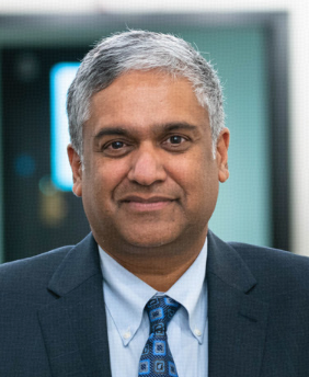 Anantha Chandrakasan合作论文数Department of Electrical Engineering and Computer Science, School of Engineering, Massachusetts Institute of Technology3Ian Ingram合作论文数2Erika Joun合作论文数2Riley Yeakle合作论文数2Christopher L. Crutchfield合作论文数Univ Calif San Diego2
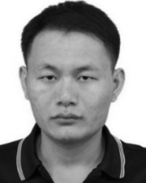 Jinwang Yi合作论文数2
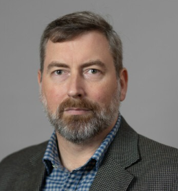 Thomas Garrison合作论文数Department of Anthropology, College of Liberal Arts, University of Texas at Austin2
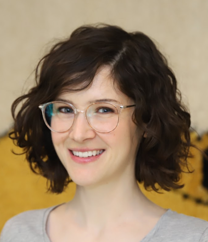 Celeste Pilegard合作论文数Department of Psychology, Division of Social Sciences, University of California2Josephine Relaford-Doyle合作论文数2
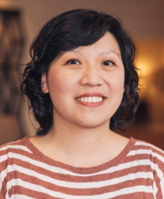 Alice Wang合作论文数Erik Jonsson School of Engineering and Computer Science, The University of Texas at Dallas2
 Jacob Ayers合作论文数Department of Neuroscience,;Center for Translational Research in Neurodegenerative Disease, and;Department of Neuroscience, Center for Translational Research in Neurodegenerative Disease, and2
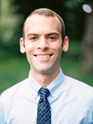 Dustin Richmond合作论文数Department of Computer Science and Engineering, University of California San Diego2
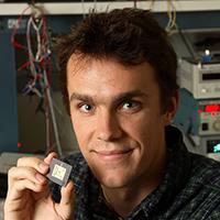 Benton H. Calhoun合作论文数Department of Electrical and Computer Engineering, School of Engineering and Applied Science, University of Virginia2Paul Lettieri合作论文数2




