Faced with accelerating sea level rise and changing ocean storm conditions, coastal communities require comprehensive assessments of climate-driven hazard impacts to inform adaptation measures. Previous studies have focused on flooding but rarely on other climate-related coastal hazards, such as subsidence, beach erosion and groundwater. Here, we project societal exposure to multiple hazards along the Southeast Atlantic coast of the United States. Assuming 1 m of sea level rise, more than 70
Pervasive and sustained coral diseases contribute to the systemic degradation of reef ecosystems, however, to date an understanding of the physicochemical controls on a coral disease event is still largely lacking. Water circulation and residence times and submarine groundwater discharge all determine the degree to which reef organisms are exposed to the variable chemistry of overlying waters; understanding these physical controls is thus necessary to interpret spatial patterns in coral health. The recent discovery of coral Black Band Disease at Mākua Reef on Kauaʻi, Hawaiʻi prompted an investigation into the physicochemical drivers and geomorphic controls of reef water circulation, and the temporally variable nutrient fluxes derived from submarine groundwater discharge. Results reveal localized stagnant water parcels at Mākua Reef where groundwater-derived high nutrient loading and low salinities act in concert as stressors to coralline health – and where Black Band Disease was uniquely identified. The observed high nutrient levels during low tide conditions are likely associated with nearby upstream cesspools and drain fields. Information obtained using such a multidisciplinary approach has direct value for successful management of coastal aquifers and the health and sustainability of adjacent nearshore coral reef ecosystems.
The El Niño-Southern Oscillation is the dominant mode of interannual climate variability across the Pacific Ocean basin, with influence on the global climate. The two end members of the cycle, El Niño and La Niña, force anomalous oceanographic conditions and coastal response along the Pacific margin, exposing many heavily populated regions to increased coastal flooding and erosion hazards. However, a quantitative record of coastal impacts is spatially limited and temporally restricted to only the most recent events. Here we report on the oceanographic forcing and coastal response of the 2015–2016 El Niño, one of the strongest of the last 145 years. We show that winter wave energy equalled or exceeded measured historical maxima across the US West Coast, corresponding to anomalously large beach erosion across the region. Shorelines in many areas retreated beyond previously measured landward extremes, particularly along the sediment-starved California coast.
Study region: The study region spans coastal California, USA, and focuses on three primary sites: Arcata, Stinson Beach, and Malibu Lagoon.Study focus: 1m and 2m sea-level rise (SLR) projections were used to assess vulnerability to SLR-driven groundwater emergence and shoaling at select low-lying, coastal sites in California. Separate and combined inundation scenarios for SLR and groundwater emergence were developed using digital elevation models of study site topography and groundwater surfaces constructed from well data or published groundwater level contours.New hydrological insights for the region: SLR impacts are a serious concern in coastal California which has a long (1800 km) and populous coastline. Information on the possible importance of SLR-driven groundwater inundation in California is limited. In this study, the potential for SLR-driven groundwater inundation at three sites (Arcata, Stinson Beach, and Malibu Lagoon) was investigated under 1 m and 2 m SLR scenarios. These sites provide insight into the vulnerability of Northern California coastal plains, coastal developments built on beach sand or sand spits, and developed areas around coastal lagoons associated with seasonal streams and berms. Northern California coastal plains with abundant shallow groundwater likely will see significant and widespread groundwater emergence, while impacts along the much drier central and southern California coast may be less severe due to the absence of shallow groundwater in many areas. Vulnerability analysis is hampered by the lack of data on shallow coastal aquifers, which commonly are not studied because they are not suitable for domestic or agricultural use. Shallow saline aquifers may be present in many areas along coastal California, which would dramatically increase vulnerability to SLR -driven groundwater emergence and shoaling. Improved understanding of the extent and response of California coastal aquifers to SLR will help in preparing for mitigation and adaptation. Published by Elsevier B.V.
The nearshore bathymetric evolution of a high-energy beach at the mouth of San Francisco Bay, California (USA), was tracked before, during, and after the powerful El Nino winter of 2009-10 to quantify alongshore bar formation and migration as well as the magnitude and alongshore variability of cross-shore transport. The observed deep-water winter wave energy was among the highest ever recorded in Northern California, peaking during a 7 day period in the middle of January 2010 with a mean deep-water significant wave height (Hs) of 5.5 m, and a maximum Hs= 9 m. The extreme forcing during the study period resulted in local bed level changes that approached 5 m, cross-shore bar migration of > 250 m, ~3 m alongshore trough deepening, and a net gain of ~1.6 million m of sediment to the nearshore profile over the 7 km alongshore extent of the survey area, leaving beach sand levels severely depleted. The morphological evolution observed during this El Nino winter may serve as a proxy for future coastal response to climate change if current trends of increased storminess continue for the U.S. West Coast.
Tidal wetlands provide valuable habitat, are an important source of primary productivity, and can help to protect the shoreline from erosion by attenuating approaching waves. These functions are threatened by the loss of tidal marshes, whether due to erosion, sea-level rise, or land-use practices. Erosion protection by wetlands is expected to vary geographically, because wave attenuation in marshes depends on vegetation type, density, and height and wave attenuation over mudflats depends on slope and sediment properties. In macrotidal northern European marshes, a 50 percent reduction in wave height within tens of meters of vegetated salt marsh has been observed. This study was designed to evaluate the role of mudflats and marshes in attenuating waves at a site in San Francisco Bay. In prehistoric times, the shoreline of San Francisco Bay was ringed with tidal wetlands, with mudflats at lower elevations and marshes above. Most of the marshes around the Bay emerged 2,000-4,000 years ago, after the rate of sea-level rise slowed to approximately 1 mm/year. Approximately 80 percent of the acreage of tidal marsh and 40 percent of the acreage of tidal mudflats in San Francisco Bay have been lost to filling and draining since 1800. Tidal wetlands are particularly susceptible to impacts from sea-level rise because the vegetation at each elevation is adapted to a specific tidal-inundation regime. The maintenance of suitable marsh-plain elevations depends on a supply of sediment that can keep up with the rate of sea-level rise. Sea-level rise, which according to recent projections may reach 75 to 190 cm by the year 2100, poses a significant threat to wetlands in San Francisco Bay, where landward migration is frequently impossible due to urbanization of the adjacent landscape. In this study, we collected data in Corte Madera Bay and Marsh to determine whether, and to what degree, waves are attenuated as they transit the Bay and, during high tides, the marsh. Corte Madera Bay was selected as a study site because of its exposure to wind waves, as well as its history of shoreline erosion and marsh restoration and monitoring. Data were collected in the winter of 2010, along a cross-shore transect extending from offshore of the subtidal mudflats into the tidal marsh. This study forms part of the Innovative Wetland Adaptation in the Lower Corte Madera Creek Watershed Project initiated by the Bay Conservation and Development Commission (BCDC) (http://www.bcdc.ca.gov/planning/climate_change/WetlandAdapt.shtml). Objectives- This study was designed to address the following questions: * What are the characteristics of waves and currents in the study area, and how do they vary over time? * Do wave heights or orbital velocities decrease, or wave periods change, as waves pass over the mudflats? * Do wave heights decrease, or wave periods change, as waves pass over the marsh?
We investigated the driving forces of sediment dynamics at the shoals in South San Francisco Bay. Two stations were deployed along a line perpendicular to a 14 m deep channel, 1000 and 2000 m from the middle of the channel. Station depths were 2.59 and 2.19 m below mean lower low water, respectively. We used acoustic Doppler velocimeters for the simultaneous determination of current velocities, turbulence, sediment concentration and fluxes. Maximum current shear velocities were 0.015 m s(-1) at the station further from the channel (closer to the shore) and 0.02 m s(-1) at the station closer to the channel. Peak wave-induced shear velocities exceeded 0.015 m s(-1) at both stations. Maximum sediment concentrations were around 30 g m(-3) during calm periods (root mean square wave height <0.15 m). During wavy periods, sediment concentrations increased to 100 g m(-3) and sediment fluxes were 5 times higher than in calm conditions (0.02 g m(-2) s(-1) versus >0.10 g m(-2) s(-1)) at the station further from the channel 0.36 m above the bed. Closer to the channel, sediment concentrations and vertical fluxes due to wind wave resuspension were persistently lower (maximum concentrations around 50 g m(-3) and maximum fluxes around 0.04 g m(-2) s(-1)). Most resuspension events occurred during flood tides that followed wave events during low water. Although wave motions are able to resuspend sediment into the wave boundary layer at low tide, the observed large increases in sediment fluxes are due to the nonlinear interaction of wind waves and the tidal currents.
The United States Geological Survey (USGS) Multi-Hazards Demonstration Project (MHDP) is preparing a new emergency-preparedness scenario, called ARkStorm, to address massive U.S. West Coast storms analogous to those that devastated California in 1861–62. Storms of this magnitude are projected to become more frequent and intense as a result of climate change. The MHDP has assembled experts from the National Oceanic and Atmospheric Administration (NOAA), USGS, Scripps Institute of Oceanography, the State of California, California Geological Survey, the University of Colorado, the National Center for Atmospheric Research, and other organizations to design the large, but scientifically plausible, hypothetical storm scenario that would provide emergency responders, resource managers, and the public a realistic assessment of what is historically possible. The ARkStorm is patterned after the 1861–1862 historical events but uses modern modeling methods and data from large storms in 1969 and 1986. The ARkStorm draws heat and moisture from the tropical Pacific, forming Atmospheric Rivers (ARs) that grow in size, gain speed, and, with a ferocity equal to hurricanes, slam into the U.S. West Coast for several weeks. Using sophisticated weather models and expert analysis, precipitation, snowlines, wind, and pressure data the modelers will characterize the resulting floods, landslides, and coastal erosion and inundation. These hazards will then be translated into the infrastructural, environmental, agricultural, social, and economic impacts. Consideration will be given to catastrophic disruptions to water supplies resulting from impacts on groundwater pumping, seawater intrusion, water supply degradation, and land subsidence. Possible climate-change forces that could exacerbate the problems will also be evaluated. In contrast to the recent U.S. East and Gulf Coast hurricanes, only recently have scientific and technological advances documented the ferocity and strength of possible future West Coast storms. A task of ARkStorm is to elevate the visibility of the very real threats to human life, property, and ecosystems posed by extreme storms on the U.S. West Coast. This enhanced visibility will help increase the preparedness of the emergency management community and the public to such storms. ARkStorm is scheduled to be completed by September 2010 and will be the basis of a statewide emergency response drill, Golden Guardian, led by the California Emergency Management Agency in 2011.
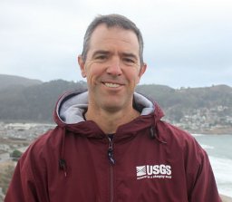 Patrick L. Barnard合作论文数United States Geological Survey, Pacific Science Center8
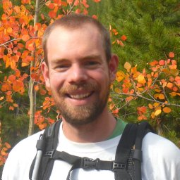 Kevin M. Befus合作论文数Department of Geology and Environmental Science, Wheaton College4
 Peter W. Swarzenski合作论文数U. S. Geological Survey4
 Peter Ruggiero合作论文数Department of Ecology4
 George M. Kaminsky合作论文数Department of Ecology4Alex Snyder合作论文数3
 Nathan J. Wood合作论文数Dept . of Geosciences;Oregon State Univ;Dept . of Geosciences, Oregon State Univ3Jonathan C. Allan合作论文数3
 Bonnie Ludka合作论文数Institution of Oceanography, Lowell Observatory Scripps3
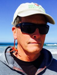 David M. Hubbard合作论文数Marine Science Institute, University of California3Weiner, Heather M.合作论文数2
 Diana Mccandless合作论文数2Maya Hayden合作论文数2
 Nicholas Cohn合作论文数Oregon State Univ, Coll Earth Ocean & Atmospher Sci, Corvallis, OR 97331 USA2
 Timu Gallien合作论文数Civil and Environmental Engineering Department, School of Engineering, University of California, Los Angeles2
 Jeanne Jones合作论文数2Maarten Van Ormondt合作论文数2
 Kingsley O Odigie合作论文数Justice Studies Department, San Jose State University2
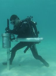 Jeff E. Hansen合作论文数Pacific Coastal and Marine Science Center, University of California,2Jessica R. Lacy合作论文数2Suzanne C. Perry合作论文数1
 Cordell D. Johnson合作论文数1Laura Gabel合作论文数1Juliette Finzi Hart合作论文数1Jamie Jones合作论文数1
 Leonard O. Ohenhen合作论文数Dept Geosci, Virginia Tech1
 Tim Leijnse合作论文数Deltares1Andrea O'Neill合作论文数1
 Norberto C. Nadal Caraballo合作论文数Engineer Research and Development Center, U.S. Army Corps of Engineers1
 Christopher John Wills合作论文数Calif Geol Survey1Andrew W. Stevens合作论文数1anne wein合作论文数1
 Kilian Vos合作论文数Water Res Lab, UNSW Sydney1
 Kees Nederhoff合作论文数Deltares USA1
 Dylan L. Anderson合作论文数Oregon State Univ, Coll Engn, Corvallis, OR 97331 USA1
 Ferdinand K. J. Oberle合作论文数U.S. Geological Survey, Pacific Coastal and Marine Science Center1
 Katherine A. Serafin合作论文数Oregon State Univ, Coll Earth Ocean & Atmospher Sci, Corvallis, OR 97331 USA1Mark Stacey合作论文数Department of Civil and Environmental Engineering, University of California, Berkeley1Runyon Christina M合作论文数1Michael D. Dettinger (Michael Dettinger)合作论文数Department of Geography, Mackay School of Geosciences and Engineering, University of Nevada, Reno1Kevin Hsu合作论文数1
 Peter N. Adams合作论文数University of Florida1Jodi L. Eshleman合作论文数1Renee K. Takesue合作论文数1
 Jonathan Adam Warrick合作论文数USGS Coastal and Marine Geology Program1Andreas Brand合作论文数1Amy E. Draut合作论文数1Amaia Ruiz De Alegria-Arzaburu合作论文数1
 E. Elias合作论文数1




