Accurate characterization of riverbed substrate from remote sensing imagery is essential for applications in fluvial geomorphology, habitat modeling, and river management. While recent advances in computer vision, particularly deep learning, have improved sediment mapping capabilities, their reliance on large annotated datasets and computational resources limits their broader applicability. This study presents a scalable workflow for categorical substrate classification using ultra-high-resolution aerial RGB orthoimagery in clear-water river environments. The approach integrates spectral information with statistical and structural texture descriptors derived from Gray-Level Co-occurrence Matrices (GLCM) and Local Binary Patterns (LBP), combined within a Random Forest classification framework. The methodology is structured as a semi-automated, five-stage workflow: (1) expert-based ground-truth substrate annotation; (2) feature set generation; (3) spatially aware model optimization; (4) full-domain classification; and (5) design-based validation for independent accuracy assessment. Model performance is evaluated using spatially aware cross-validation and design-based probability sampling to account for spatial autocorrelation and provide unbiased accuracy estimates. The method was applied in four geomorphologically distinct alpine river reaches, achieving design-based overall accuracy ranging from 70% to 88%. These results demonstrate that RGB-based approaches can achieve reliable reach-scale categorical substrate classification when combined with appropriate feature representation and rigorous validation strategies. However, limitations remain for visually similar or transitional substrate classes, particularly fine sediments such as sand and clay, which are difficult to distinguish consistently even during manual annotation. The workflow is implemented using open-source tools and is applicable to clear-water conditions where the riverbed remains optically visible.
The ecological effects of sediment flushings from artificial reservoirs have been widely documented, but the underlying sediment dynamics are less well known. We investigated sediment dynamics associated with a long flushing event divided into two periods (2 and 1 week) in an Alpine river, each followed by a clear water release ('washing') from the reservoir. Suspended sediment dynamics were investigated at the event and annual time scale, and at the river segment (similar to 1000 channel widths) and reach (similar to 100 channel widths or less) spatial scales. Analysis of suspended sediment concentration (SSC) and streamflow time series from 5 in situ calibrated optical turbidity sensors reveals a downstream decrease in the total passing sediment fluxes, a spatial trend that is paralleled by the theoretical suspended sediment transport capacity, allowing for the estimation of the deposited fine sediment volume in different reaches. Washing events result in variable effects among reaches, with some experiencing net sediment entrainment and others net deposition. Out of 16 quantified sediment fluxes, 5 were statistically significant with p < 0.05, with an average uncertainty of 23% in fine sediment flux quantification. Georeferenced analysis of coloured gravel-cobble plots before and after the two flushing events revealed partial reach-scale mobility of the coarse bed surface material, particularly in the geomorphic units located at lower elevations and more exposed to higher flows (edges of side bars nearby riffles or rapids), while local fine sediment deposition was observed at less exposed units, such as side channels or point bars in river bends. Grain size distributions of surface sediment taken in the same locations before and 1 month after the flushing reveal a clear shift towards a finer sediment composition, which is partially retrieved also 1 year after the event. Event-averaged SSC values during the flushing are considerably higher compared to natural flood events in such a regulated river, with SSC-streamflow relations being highly irregular and event-dependent, especially during the flushing. The work shows the relevance of multi-scale (time and space) investigation of sediment dynamics for planning and monitoring sediment flushing from artificial reservoirs.
The use of eco-hydraulic physical habitat models at the meso-scale for river management and restoration design has grown in recent years. Consolidated approaches mostly rely on extensive field data collection to describe species- and life stage-relevant environmental characteristics to assess habitat suitability. This restricts their applicability to smaller wadable rivers and short reaches representative of the hydro-morphological conditions of the longer section. It also makes their use challenging in rivers subject to limited flow variability or when channel morphology changes during the data collection period. To address these limitations, complementary approaches involving remote sensing and hydraulic modeling are increasingly used alongside field methods. However, a review of the potential offered by these rapidly evolving methods is lacking, with the related gap in the availability of unified, integrated mesohabitat modeling frameworks. Here, we comprehensively review the state-of-the-art of a wide set of remote sensing-based techniques and methods used to process outputs of 2D hydraulic models for mesoscale habitat modeling in the wet channel, with a focus on gravel-bed rivers. Based on that, we conceptualize a general and flexible 5-step framework for integrating these complementary methods into mesoscale habitat assessment and illustrate its application with reference to the Aurino River (NE Italy). The outcomes of the literature review provide an overview of the present potential and limitations of the examined techniques, supporting the choice of which specific methods can be effectively adopted within each framework step given the specific conditions of the river of interest for a certain application.
Diese Studie kombiniert funktionale Habitatdynamik mit Larvendrift- und Populationsdynamikmodellen, um Renaturierungsmaßnahmen an einem Abschnitt des unteren Inn in Bayern zu bewerten. Das verbesserte Angebot an Laich- und Aufwuchshabitaten für kieslaichende Arten führt zu einem prognostizierten Anstieg der Rekrutierung je Art um durchschnittlich 14,9 Individuen/ha (7,3 Döbel/ha bis 27,3 Äschen/ha). Allerdings bleibt die Habitatverfügbarkeit limitiert, und aufgrund fehlender funktionaler Konnektivität sind nur 33
Accurate estimation of sediment size and substrate classes in fluvial remote sensing is pivotal for habitat modeling and hydrodynamic applications. While recent advancements have adopted computer vision based approaches (i.e. deep learning), the complexity of setting up these algorithms, along with the requirement of dedicated hardware, and the lack of readily available tools, hinder their wider adoption. This study presents a novel, user-friendly two-step tool tailored for precise substrate class estimation in clear-water river environments from ultra high-resolution orthoimagery, typically coming from UAVs. Leveraging image texture properties (evaluated with the co-occurrence matrix), image color channels (typically Red, Blue, and Green bands) and machine learning classificators (i.e. Random Forest, Support Vector Machine), the proposed methodology is able to accurately identify substrate classes ranging from fine sediments (e.g. sand and lime), various size gravel and cobbles, and boulders, both submerged (wet) and above water. It is a 2-step methodology that involves (a) manual labeling of homogeneous substrate class patches within any Geographic Information System (GIS) platform, followed by (b) streamlined data input. Validation across three reaches of gravel-bed rivers —Aurino, Piave, and Brenta rivers in NE Italy— with differing sizes and morphologies, and substrate ranging from fine sediments to boulders, yielded F1 scores of 0.86, 0.97, and 0.938, respectively. Some challenges still arise when classifying substrate in areas where visibility and light conditions are significantly altered, such as in very deep water, within tree canopy shadows, or due to strong sun reflections. Finally, this tool enables easy and accurate substrate class estimations in riverine environments, offering a significant contribution to fluvial studies and applications.
In-stream habitat enhancement is widely used to improve ecological conditions in rivers, often prioritizing key fish life stages such as spawning and juvenile development. However, no standard approaches exist to predict their effects on fish recruitment and populations. Here, we use a spatially-explicit population dynamics model that integrates functional habitat dynamics to assess the impact of two rehabilitation measures in a hydropower-impacted section of the Inn River (SE Germany) on the recruitment potential of four rheophilic and lithophilic fish species — grayling, nase, barbel, and chub. Rehabilitation measures implemented included the construction of a bypass channel and an island side-channel system to improve both longitudinal connectivity and habitat conditions. In addition, we analyzed two alternatives, which would enhance functional availability of nursery habitats from actual 33.2% to 66.8% and 95.3%, respectively. The results suggest that the improved habitat conditions will yield on average additional 14.9 individuals/ha (5.6 kg/ha) of the target species. However, the limited accessibility of usable nursery habitat constitutes a significant recruitment bottleneck for all species. In the alternative scenarios, the increase of functional connectivity will result in average densities of 17.9 and 25.8 individuals/ha, respectively. However, potential further improvements are species-specific, because of distinct population responses to spawning-to-nursery habitat ratios, with density changes varying between -11.7% for grayling and +172.6% for chub. This study not only demonstrates the applicability of the modeling approach for assessing and planning rehabilitation measures but also emphasizes the importance of considering habitat ratios and their functional connectivity to optimize recruitment potential.
In-stream habitat models at the meso-scale are increasingly used to quantify the effects of hydro-morphological pressures in rivers. The spatial distributions of water depth and velocity represent key attributes of physical habitat. Choosing between field surveys, hydraulic modeling or their integration is made depending on available tools, technical skills, budget and time. However, the sensitivity to such choices of estimated habitat conditions suitable for biological organisms, such as fish, is poorly known.In this study, three commonly used approaches in hydraulic-habitat modeling were compared and tested on a mountain stream, the Mareta River (NE Italy). Two approaches were based on 2D hydraulic modeling, calculated on computational meshes with varying resolution and quality: (1) high-resolution meshes derived from topographical data obtained from Airborne Bathymetric LiDAR; (2) a mesh extrapolated from topographical cross-sectional profiles. The third approach (3) was based on in-stream surveys. From these, suitable channel-area for two fish species, the marble trout (juvenile and adult), and the European bullhead (adult), were estimated.Results showed that decreasing mesh resolution and quality affects the simulated water depth and velocity distributions, both in terms of their average and their standard deviation. The largest differences were found for the in-stream survey-based results. Morphologically complex unit types, such as steps, rapids and pools were more sensitive than simpler mesohabitats, such as glides and riffles. The most sensitive hydro-morphological unit types to the chosen approach were backwaters, glides being the least sensitive, also in terms of their suitability as mesohabitats. Despite that, a key finding is that errors are minimized when deriving habitat - streamflow rating curves at the reach scale, for which all approaches were largely able to reproduce the main characteristics of the curve, i.e. maxima, minima and inflection points.
El Mapeo Ecopolítico es una metodología experimental que busca mapear encuentros amorosos y desastrosos entre humanos y su entorno más que humano. Esta metodología, primeramente acuñada por un grupo transdisciplinario de artistas e investigadores en el sur de Chile, se desarrolla a través de sesiones de mapeo colectivo utilizando un enfoque ecopolítico con el fin de rastrear las relaciones de poder entre diferentes especies. En este informe de investigación expandimos acerca de nuestras aproximaciones a esta metodología a partir de tres escalas y territorios diferentes: Cuenca del Biobío (Chile), la Ciudad de Berlín (Alemania) y Europa (Continente). Cada caso presentó un fuerte componente de comunicación ambiental, que terminó en la producción de mapas ilustrados. El enfoque metodológico que aquí se propone es a la vez íntimo, político y situado. El mapa se propone no como un supuesto artefacto políticamente neutral, sino como una herramienta para la educación ambiental, la comunicación y el activismo. Ofrecemos el concepto y enfoque, esperando que esta metodología pueda ser practicada y desarrollada por otros humanos, aliados en la producción de parentescos tentaculares.
Integration of remote sensing and 2D hydraulic modelling offers the potential for broader applicability of habitat modelling at the meso-scale, extending applications to larger nonwadeable streams, and allowing to survey longer river stretches.We present an example of the application of a methodological framework for meso-scale habitat suitability modelling, on a reach of the gravel-bed Aurino River (NE Italy).The framework implements the following main steps: remote sensing-based acquisition of the topo-bathymetry and a high-resolution orthophoto; 2D hydraulic modelling coupled with an unsupervised algorithm to map hydro-morphologically defined units; semi-automated mapping of substrate and refugia; and finally, the estimation of meso-scale habitat suitabilities for a target species or community.
In the framework of water resources planning and management, the MesoHABSIM (MesoHABitat Simulation Model) approach demonstrated high potential to assess suitable environmental conditions for freshwater fish species. In the present study, the transferability capabilities of mesohabitat suitability criteria were evaluated in nine streams across Northern Italy. In particular, the Random Forest (RF) technique was used to calibrate and validate suitability criteria for adult and juvenile life stages of brown trout (Salmo trutta), marble trout (Salmo marmoratus), bullhead (Cottus gobio) Italian barbel (Barbus plebejus), and Italian vairone (Telestes muticellus). Presence/absence binary models were calibrated at the mesohabitat scale (i.e., the geomorphic unit scale) using field data collected in reference sites, selected for their natural hydro -morphological conditions and habitat characteristics. Model transferability tests were performed in streams located in different regions within the distribution area of the fish and not included in the model calibration dataset. Predictive capacities of the models were very good in terms of accuracy (ranging from 75% to 82%) and true skill statistic (ranging from 52% to 75%). The high predictive performances can be related to (i) the use of an ecologically relevant spatial resolution (mesohabitat) to predict fish presence, (H) a robust and adequate hydro-morphological characterization of the analyzed geomorphic units, and (iii) the large number of mesohabitat descriptors provided by the MesoHABSIM approach. Results showed that mesohabitat suitability criteria based on RF can be considered transferable among streams located in different regions of Northern Italy, especially when river channels are characterized by similar hydro-morphological characteristics.
Application of mesoscale habitat models in gravel-bed rivers is increasingly common for a variety of purposes, from ecological flow design, impact assessment and conservation programmes. Integration with 2D hydraulic modelling offers the potential for broader applicability of mesoscale habitat models, extending applications to larger streams and nonwadable flow conditions, when on-the-ground and in-stream surveys are challenging or even prohibitive. In this work, a novel fully unsupervised procedure that allows the segmentation of the river channel area at a given flow condition at a scale that is consistent with the mesoscale is presented. Further, it defines an objective methodology to choose segmentation parameters and thus an optimal segmentation, based on intrinsic spatial properties of the resulting regions. Segmentation parameters are objectively selected by minimising a Global Score, which is based on three metrics representing intrasegment homogeneity, intersegment heterogeneity and an optimal range of segment numbers based on an empirically defined mesoscale. Applications of the model are tested on two reaches of the multithread Mareta and meandering Aurino Rivers in South Tyrol (NE, Italy). Model outcomes are compared with ground mesohabitat surveys, and habitat suitability is then assessed for three fish species (marble trout, grayling and European bullhead). A high level of agreement is found when comparing model- and survey-based habitat suitability estimates, with an overall value of R2=0.91$$ {R}<^>2=0.91 $$. The proposed approach shows potential for application of the mesohabitat concept for large gravel-bed rivers and nonwadable flow conditions. By allowing habitat estimates at flow ranges that could not be surveyed in-stream, the approach facilitates applicability of mesoscale habitat models to nonwadable conditions and large streams. The workflow is river-independent and fully unsupervised, as it does not require calibration or subjective choices of segmentation parameters. Significance statement Quantifying suitable habitat for riverine fauna is increasingly used for ecological flows assessment, with the use of mesoscale habitat modelling approaches becoming more common in the past few decades. Existing mesoscale habitat modelling approaches often rely on field surveys, which, however, become prohibitive at nonwadable flow conditions and in large streams. Here we develop and test against field data a fully unsupervised approach able to extract mesohabitats and their hydraulic characteristics from the outputs of 2D hydraulic models. Compared with existing approaches, our approach allows an automated segmentation of the wetted reach into mesoscale units through the implementation of an unsupervised optimality step in which optimal segmentation parameters are defined, and a final mesohabitat mosaic is selected. The methodology makes it easier to expand the applicability of mesoscale habitat modelling to a broader range of river sizes and conditions.
Restoration of spawning and juvenile habitats is often used to restore fish abundances in rivers, although often with unclear results. To study the effects of habitat limitations on the common barbel (Barbus barbus), a riverine litophilic cyprinid fish, an age-structured population model was developed. Using a Bayesian modeling approach, spawning and fry (0+ juvenile) habitat availability was integrated in the model in a spatially explicit way. Using Beverton-Holt and Ricker recruitment models, density dependence was incorporated in the spawning process and the recruitment of 0+ juveniles. Model parameters and their uncertainty ranges were obtained from reviewing the existing literature. The uncertainty of the processes was intrinsically accounted for by the inherently probabilistic nature of the Bayesian model. By testing various scenarios of habitat availabilities for the barbel, we hypothesize that improvement of the fish stock will be reached only at a well specified ratio of spawning to fry habitat. Model simulations revealed substantial abundance improvements at rather equal amounts of about 10% cover of both habitats, while even substantial improvements of either spawning or fry habitats only will result in little or no increase of abundance. Higher ratios of spawning to fry habitat were found to lower population recovery times. This work provides a tool that serves the assessment and comparison of river restoration scenarios as well as benchmarking rehabilitation targets in the planning phase. When targeting restoration of fish stocks, focusing only on one key life stage or process (such as spawning), without considering potential bottlenecks in other stages, can result in little to no improvement.
One challenge in collaborating with citizen scientists is to keep them motivated to continuously collect data in the long-term. The Home River Bioblitz event overcomes this roadblock by engaging hundreds of citizens around the world in one single day. In general, a bioblitz is a communal citizen-science effort to record a wide variety of species at a specific location within a certain timeframe. This single-day commitment enables large-spatial resolution data to be collected. The Home River Bioblitz was created by the River Collective, National Geographic, Bestias del sur Salvaje, and iNaturalist as part of the citizen science program supported by the National Geographic Society. The first event took place on September 20th, 2020 on 43 rivers located in 24 countries around the world. Over 500 participants from five continents used the iNaturalist app to log 5245 observations and 1772 species of flora and fauna, with at least 14 species under IUCN status, contributing to the Global Biodiversity Information Facility repository. This method of low-temporal and high-spatial data collection is used to identify new species, IUCN red list species, local endemic species, and invasive species. Not only does this event engage citizen-scientists to contribute to biodiversity findings, but it also connects people to their local environments by having them zoom into details they normally pass by. By celebrating the diversity of rivers and meeting the people around them, we were able to bring communities closer to knowing the species of their local rivers and raise awareness about the importance of free-flowing and healthy rivers around the world. An online post-event was dedicated to sharing these local river species and the scientific impact of certain observations with the participants. This event also opens up the possibility to collect other types of short term, large-spatial data around river ecosystems. In the next edition of the Home River Bioblitz, we would like to encourage the participants to collect hydro-morphological and water quality data by using open-access and low-cost citizen science tools, such as the Discharge app and the Waterrangers kit. The Home River Bioblitz event will not only be used to engage and educate participants on their local rivers, but the biodiversity and potentially chemico-physical and hydro-morphological data that will be collected could serve to develop time-series to help assess temporal variations and stressors.
In recent times, habitat models at the meso-scale have become widely accepted techniques to quantify the impact of hydro-morphological pressures on rivers. However, several limitations limit a broader applicability of such models: 1) field-based mesohabitat mapping is difficult in large nonwadable streams; 2) obtaining a reliable habitat-streamflow rating can be a highly time-consuming process, since it requires field mapping over many discharges; 3) the role of event-scale and medium term river morphodynamics, a crucial source of habitat variability, is mostly not accounted for. In this work we present the FHARMOR project, which aims at overcoming the above limitations, by exploring the application of complementary techniques to ground field measurements of mesohabitats, namely hydro-morpho-dynamic modeling and remote sensing techniques. This is tested on a suite of case studies featuring a gradient of hydro-morphological characteristics and channel size, located in the central-north Italian Alpine area, i.e. the Mareit/Mareta, the Ahr/Aurino and the Eisack/Isarco rivers. The expected outcomes from the FHARMOR project are: 1) a quantitative, comprehensive methodological framework able to effectively quantify fish habitat dynamics in Alpine river systems of different size and over long reaches; 2) future scenarios development of habitat availability in Alpine rivers in response to sediment management and river restoration.
 Guido Zolezzi合作论文数9
 Paolo Vezza合作论文数Dipartimento di Idraulica, Trasporti ed Infrastrutture Civili, Politecnico di Torino5
 Katharina Baumgartner合作论文数4
 Christian Wolter合作论文数Leibniz Inst Freshwater Ecol & Inland Fisheries4
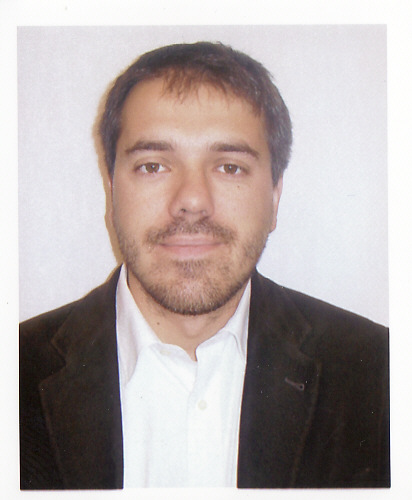 Andrea Andreoli合作论文数Dept Forestry & Environm Management, Univ Concepcion4
 Robert Klar合作论文数2
 Mauro Carolli合作论文数Environment and Natural Resources Area, IASMA Research and Innovation Centre2
 Markus Aufleger合作论文数2
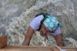 Francesco Comiti合作论文数Dipartimento Territorio e Sistemi Agro Forestali;Università degli studi di Padova;Dipartimento Territorio e Sistemi Agro Forestali, Università degli studi di Padova2
 Cristian Toro合作论文数1Bastian Gygli合作论文数1
 Franziska Walther合作论文数1Paolo Lo Conte合作论文数1Ross Donihue合作论文数1Maike Brinksma合作论文数1d i stefan jocham合作论文数1Daniel Romo合作论文数1Alejandro Ponce de León合作论文数1Giovanni Negro合作论文数Dept Environm Land & Infrastruct Engn, Politecn Torino1
 Antonia Lara合作论文数Ctr Res Social Sci & Youth CISJU, Catholic Univ Silva Henriquez1
 Giulia Stradiotti合作论文数1
 Di Frank Steinbacher合作论文数1Ramona Baran合作论文数1
 Giuseppe Roberto Pisaturo合作论文数Faculty of Science and Technology, Free University of Bozen-Bolzano1
 Vittoria Scorpio合作论文数Department of Chemical and Geological Sciences, University of Modena and Reggio Emilia Modena1
 Sebastiano Piccolroaz合作论文数Phys Aquat Syst Lab APHYS Margaretha Kamprad Chai, Ecole Polytech Fed Laussane1
 Luca Demarchi合作论文数Institute of Geodesy and Geoinformatics, Wrocław University of Environmental and Life Sciences1
 Emilio Politti合作论文数Environmental Consulting Klagenfurt1Walter Bertoldi合作论文数Dipartimento di Ingegneria;Civile e Ambientale;Università degli Studi di Trento;Dipartimento di Ingegneria|Civile e Ambientale, Università degli Studi di Trento1
 Martina Bussettini合作论文数Agency for Environmental Protection and Technical Services1
 Piotr Parasiewicz合作论文数Piotr Parasiewicz is a research1
 Stefano Fenoglio合作论文数Dipartimento di Scienze;Università del Piemonte Orientale;Dipartimento di Scienze, Università del Piemonte Orientale1
 Maurizio Righetti合作论文数Department of Civil and Environmental Engineering, University of Trento1
 Luigi Fraccarollo合作论文数CUDAM and Department of Civil and Environmental Engineering, University of Trento1




