Loess–paleosol sequences in southern Tajikistan offer a valuable yet underexplored archive for reconstructing early human–environment interactions across Central Asia. Building on our previous investigations of geochemical and sedimentary proxies, here we make an overview based on lipid biomarkers, bulk stable carbon isotopes, and archaeological data from multiple localities of the Khovaling Loess Plateau on understanding ecological and anthropogenic signals spanning the Early Paleolithic. Our combined geochemical and archaeological data reveal repeated fire use, vegetation modification, and strategic occupation of ecotonal river valley environments by early humans dating back more than 500 ka. Notably, variations in lipid biomarkers and bulk carbon isotopic signatures across the studied loess sites in the vicinity of Obi-Mazar River underscore the spatial complexity of land-use strategies and highlight the ecological flexibility of Early Paleolithic populations. These findings position the Khovaling Loess Plateau as a key region for understanding long-term human adaptability and environmental shaping during early human dispersal through Central Asia.
This study presents a multi-proxy investigation of loess-paleosol sequences from the Khovaling Loess Plateau (KLP) in Southern Tajikistan to explore long-term human-environment interactions during the Middle Pleistocene. This region has been the focus of numerous archaeological projects since Soviet times, as it contains evidence of some of the oldest (similar to 0.9 Ma) hominin occupations in Central Asia and is one of the key regions connecting eastern Asia to centers of hominin evolution that lie to the west. Previous archaeological expeditions have discovered rich collections of stone tools from alternating non-pedogenically modified loess and paleosol sequences at the archaeological sites of Karatau, Lakhuti, Obi-Mazar, and Kuldura. We analyzed lipid biomarkers such as n-alkanes, polycyclic aromatic hydrocarbons (PAHs), together with newly generated stable isotopes (delta C-13, delta N-15), magnetic susceptibility, and archaeological assemblages from three sites: Obi-Mazar/Lakhuti (on-site), and non-artifact-bearing strata from Kuldara (near-site) and Khonako-II (off-site), focusing on pedocomplexes (PCs) 4, 5, and 6 and their intercalated loess layers. High odd-over-even predominance (OEP) and average chain lengths (ACL) suggest that soil organic matter is predominantly derived from higher-order terrestrial plants, with better preservation in paleosols compared to loess layers. The inverse correlations of delta C-13 with TOC and C/N reflect organic matter degradation, while elevated delta N-15 in paleosols suggests enhanced nitrogen cycling under warmer and drier conditions. Magnetic susceptibility and delta C-13 trends reveal a progressive shift toward open grassland ecosystems since similar to 0.8 Ma, with intensified pedogenesis during interglacial stages MIS 11, 13, and 15. The spatial distribution of PAH concentrations and lithic artifact densities further highlights human-environment interactions in the KLP locality. Obi-Mazar exhibits abundant lithic materials and high PAH levels, indicating repeated occupation and frequent burning in a resource-rich riverine setting. Kuldara exhibits moderate PAHs but minimal artifacts, whereas Khonako-II records only a minimal level of signals, reflecting a decrease in human impact with distance from the water source. Together, these findings demonstrate that Early Paleolithic hominins preferentially occupied ecologically stable, pedogenically developed zones during interglacial phases, contributing to localized fire regimes and shaping their landscapes. This study provides a refined paleoenvironmental framework for understanding hominin adaptations in Central Asia during the Middle Pleistocene.
Abstract Central Asia represents a key region for our understanding of early human dispersal patterns, because it served as a migration corridor that linked the Levant and southern Caucasus with Northeast Asia. However, no Early Palaeolithic sites in Central Asia are anchored with reliable age constraints, including the thick loess-palaeosol sections in Tajikistan that recorded early human activities and environmental changes over multiple glacial-interglacial cycles. This lack of absolute age constraints is presently a key factor limiting our understanding of the early human occupation history of this region. Here, we provide a comprehensive description and an absolute chronological framework for the Early Palaeolithic Karatau Culture; defined by the rich lithic assemblages found in palaeosols in the Khovaling Loess Plateau, Tajikistan. Age constraints are provided through multi-method analysis of three loess-palaeosol sections in the Khovaling Loess Plateau, combining luminescence ages, cosmogenic 26 Al- 10 Be concentrations, and magnetostratigraphic boundaries into a probabilistic inverse age-depth model. This model shows that the Karatau Culture flourished with the onset of Marine Isotope Stage 15, thrived during Marine Isotope Stage 13 and 11, but disappeared around onset of Marine Isotope Stage 10. We frame the archaeological occupations within local and regional ecological settings to better understand the drivers of Pleistocene human migrations in Central Asia.
Here, we present the first soil isotopic record in association with Paleolithic occupations in the Khovaling Loess Plateau of Southern Tajikistan, Central Asia. This region has been the focus of numerous archaeological projects since Soviet times as it contains evidence of some of the oldest (~0.9 Ma) hominin occupations in Central Asia and is one of the key regions connecting eastern Asia to centers of hominin evolution that lie to the west. Previous archaeological surveys discovered rich collections of lithic artifacts concentrated in pedocomplexes (PCs) 4, 5, and 6 formed in eolian deposits corresponding to Marine Isotope Stages (MIS) 11 (364\_427 ka), MIS 13 (474\_528 ka), and MIS 15 (563_621 ka), respectively, from many loess-paleosol locales, such as Karatau, Lakhuti, Obi-Mazar, and others. Here, we use the soil organic matter stable carbon ([Delta]13C) and nitrogen ([Delta]15N) together with soil total organic carbon (TOC) and total nitrogen (TN) contents at four distinct landscape aspects relative to archaeological materials: on-site, sparse on-site, near-site, and off-site based archaeological findings in Khovaling loess record. Our results reveal that on-site locations are characterized by elevated [Delta]15N values and depleted [Delta]13C values indicating intensive human occupation and reliance on C3 vegetation, indicative of cooler and wetter climate conditions. These findings are corroborated by the high concentrations of lithic artifacts at these locations, suggesting repeated episodes of human activity and possible landscape management compared to other locations. In contrast, near-site and off-site locations exhibit lower [Delta]15N values and higher [Delta]13C values with fewer or no lithic artifacts indicating less intensive human use and a shift towards more grassier vegetation and more open land cover conditions. This study highlights the significant role of early humans in shaping their environments, contributing to a deeper understanding of subsistence strategies and environmental adaptations during the Middle Pleistocene. Our findings highlight the importance of integrating isotopic data with archaeological evidence to reconstruct past human impacts on the landscape. ### Competing Interest Statement The authors have declared no competing interest.
Recent analysis of sediments recovered in 1991 at the sites of Cubalel and Siwré in the Middle Senegal River Valley have revealed new insights into the context of mound formation beginning ca. 1900 cal BP. In this study, we utilized stable isotopes (δ13C, δ15N) from Soil Organic Matter (SOM) and applied a Bayesian deposition model to radiocarbon dates to understand differences in the duration and nature of settlement between the two sites compared to nearby sterile levee deposits. The median calibrated radiocarbon ages dating the aggradation of sediments associated with Phase IB pottery at Siwré 2S occurs between ca. 1650 and 1490 cal BP in a generally stepwise fashion. However, previously identified Phase IIIA ceramic-bearing occupation at the Cubalel C1 mound occurs between ca. 1400 and 1370 cal BP within stratigraphically separated, but temporally indistinguishable contexts applying a Bayesian framework. The results indicate earlier phases of settlement at Siwré were longer in duration than the later occupations at Cubalel, yet isotopic indicators of vegetation cover remain relatively constant with a mix of C3 and C4 vegetation as the source of the SOM. Increases in δ15N from mound sediments at Cubalel C1 are interpreted as reflecting an increasing reliance on animal husbandry and sedentism, which is also indicated in the archaeological record. The data provide deep understandings of past pastoral systems combined with ecological data, which can be built upon in future studies.
The loess-paleosol sequences of Khovaling, southern Tajikistan preserve signatures of prehistoric human settlement during the Early Paleolithic. Archaeological finds excavated from Early Paleolithic sites located adjacent to the Obi-Mazar River indicate this part of Central Asia served as an early hominin migration corridor between Africa and destinations further east. The region has been reinvestigated by the "Timing and ecology of the Human Occupation of Central Asia" (THOCA) project since 2021, and > 2000 lithic artifacts have been recovered in pedocomplexes (PCs) 4, 5, and 6 with ages spanning similar to 600-400 thousand years before present (ka). This is the first study to analyze novel biomarkers preserved in the loess-paleosol samples collected from on-site, near-site, and off-site contexts on the Khovaling Loess Plateau (KLP) to study early human occupation in Central Asia. Average chain length (ACL) of straight chain alkanes (n-alkanes) and wood/grass proxies reveal wetter climates with more trees during interglacial periods and drier climates with more grass vegetation during glacial periods. High abundances of total polycyclic aromatic hydrocarbons (PAHs) and high molecular weight PAHs (HMW PAHs) were also found during the interglacial periods of Marine Isotope Stages (MIS) 11, 13, and 15 suggesting landscape-scale fires occurred during similar to 600-400 ka. Based on our results in conjunction with lithic artifacts excavated from Early Paleolithic sites in Khovaling, Tajikistan, we suggest early hominin occupation and existence of pyrotechnology among early groups of hominins in this territory.
Forest growth and development is a highly studied phenomenon in which humans have proven to be influential in shaping structure and composition. Delineating the long-term processes of human-environment interactions is crucial for understanding the history and trajectory of landscape formation and vegetation development. Yet, extensive knowledge of the ecological impacts of Stone Age anthropogenic activity is still lacking, particularly from Fennoscandian sites. A sediment core from South Mesna lake from the interior Scandinavian Peninsula was extracted to investigate the long-term evolutionary effects of human-environment interactions following deglaciation (c. 10,500 cal. BP) and initial colonization of the region. Analysis of the core involved microscopic/trace analytical methods, including geochemical analysis, stable isotope analysis, fecal biomarker analysis, and pollen analysis. The combined evidence demonstrates that anthropogenic impacts are prominent shapers of the ecological trajectory and landscape development of the region since the Early Neolithic (c. 5900 cal. BP), which has left a footprint on modern-day land cover. ### Competing Interest Statement The authors have declared no competing interest.
We reconstruct palaeoenvironmental conditions with multi-proxy records from loess-palaeosol settings in Tajikistan, Central Asia. Landscape conditions in this area are poorly characterised, ambiguous, and difficult to determine, which confounds models of human dispersal out of Africa. This region has been the focus of Russian-Tajik archaeological projects since the 1970s, as it contains evidence of some of the earliest (~600-400 ka) hominin occupations in Central Asia and has yielded numerous Lower Palaeolithic artifacts. In the present study, fire and vegetation biomarkers and stable isotopes have been used to reconstruct fire and vegetation histories in loess-palaeosol samples of early Palaeolithic sites in the vicinities of the Obi-Mazar River in the Khovaling district of southern Tajikistan. Samples from four loess-palaeosol documented profiles were analysed for linear chain alkanes (n-alkanes) and polycyclic aromatic hydrocarbons (PAHs) together with soil stable isotopes (δ13C, δ15N). The fluctuations in the values of n-alkane derived indices showed vegetation changes in concert with glacial-interglacial variability. The δ13C values fell between -20‰ and -25‰ (vs. PDB) and revealed mixed input of C3 and C4 plant organic matter into loess-palaeosol sediments, while δ15N values varied between 3.5‰ and 6.5‰ (vs. AIR) indicating high litter content and tree abundance. The fluctuations in total PAH abundance and increased low to high molecular weight ratio values revealed fire activity and lower temperature burning events during interglacial periods relative to glacial periods. Moreover, the strong positive correlation between PAHs and deposits that hosted the densest artifact assemblages signals early hominin use of fire in the catchment during MIS 11, 13, and 15. Therefore, our study demonstrates substantial hominin influences on the environment dating to over 500 ka indicating human-ecological processes far predate the modern era.
We report new geochronologic and paleoenvironmental data for Mnaraeka 01, a prehistoric site located in the Kilwa district of coastal Tanzania. The oldest trace of human activity at the site comes from a context dated to 71 f 6 thousand years ago (ka) where flaked stones but techno-typologically non-diagnostic were uncovered. Stratigraphic units dated to 43.9 f 2.4 ka and 41.8 f 2.1 ka have revealed stone artifacts broadly characteristic of the Middle Stone Age (MSA) while a context dated to 10.0 f 0.6 ka has produced artifacts referrable to the Later Stone Age (LSA). Eight soil samples from the site subject to stable carbon and nitrogen isotope analyses reflect grassy-woodland habitat during the settlement episodes with delta 13C values ranging from-19.3%o to-27.8%o (vs. VPDB). The results demonstrate the persistence of coastal woodland vegetation and human foraging populations in coastal East Africa during the onset of the cold Marine Isotope Stage (MIS) 4, between the cold spells of Heinrich Events 4 and 5, and during the Holocene Climatic Optimum. Our study shows that the Stone Age archaeology of coastal Tanzania has the potential to shed light on the role of coastal ecozones as potential refugia for human populations during variable climate conditions of the late Quaternary. Furthermore, the emergent datasets from Mnaraeka 01 open a window into the deep human history preserved in the Kilwa basin.
Finding biomarkers preserved in loess-paleosol sequences is challenging and rarely undertaken in the archaeological studies that occur in these settings. Here, we investigate the preservation of n-alkanes and PAHs collected in association with "Loessic Paleolithic" sites (archaeological sites entrained in fine-grained eolian sediments dating to the Paleolithic era 700,000 to 70,000 years ago) in the Khovaling region of southern Tajikistan. This region has been subject to archaeological inquiry since Soviet research projects in the 1970s found evidence of hominin occupations from Lower and Middle Paleolithic stone tool assemblages in excavations. Questions about the timing and ecological circumstances of putative ancient migrations into the region have prompted new geoarchaeological research at the sites of Lakhuti-IV, Obi-Mazar, Kuldara, and Khonako-II to constrain landscape evolutionary histories better using vegetation (straight-chain [n-]alkanes) and fire (polycyclic aromatic hydrocarbon [PAH]) biomarkers. We collected sediment samples from on-, sparse on-, near-, and off-site contexts relative to known archaeological sites for biomarker extraction and identification. The homologous series of nalkanes ranging from nC15-nC33 are identified and quantified, in which the long-chain length of n-alkanes (nC27nC33) has shown odd-over-even predominance. We found the abundance of PAH compounds with two to five rings in the sedimentary organic matter, in which PAH compounds with four or more rings have shown the highest abundance. The short (<= nC21) and mid-chain (nC22-nC26) n-alkanes have shown a positive correlation with PAH abundance from study sites. This is likely the result of the combustion of terrestrial plant matter on the landscape at elevated temperatures (>= 400 degrees C).
Hydroclimatic change in the Asian interior plays a key role in regulating regional environmental sustainability, water security, and human-nature relationships. However, the influence of the summer monsoon and westerly circulation on the evolution of hydroclimate over the arid Asian interior remains controversial. Here we present newly collected hydroclimate proxies from loess in the Asian interior, together with transient model simulations, to address the coevolution of monsoon-induced extreme rainfall and significant westerly-affected drying during the mid-Holocene. Our results suggest that a drier mid-Holocene in the southern Tarim Basin was associated with a poleward displacement of the westerly jet due to relatively warm boreal summer temperatures in the mid-latitudes. Strengthened water vapor fluxes associated with the boreal summer monsoon facilitated extreme rainfall events and enhanced mountain erosion. Our proxy-model comparison reveals a drier westerly regime superimposed with strengthened rainfall over the Asian interior during the warm mid-Holocene. Our findings suggest that more summer flash rainstorm events are likely to occur in a warmer world, with enhanced drying in the hyper-arid Asian interior. Mid-Holocene dry climate in the Asian interior was associated with the poleward displacement of the westerly jet due to warm boreal summer temperatures at mid-latitudes, according to hydroclimate, radiocarbon and paleoclimate data and transient model simulations.
The Roman military camp at Hermeskeil (Germany) is the only securely dated temporary camp from the time of the Gallic Wars (58-51 BC). Two distinct phases of use have been identified, each lasting between two and six weeks. Despite the short period of use, the up to 15,000 soldiers who occupied the camp left behind some waste, which would most likely have been deposited in pits. So far, however, only one pit has been discovered. The excavated pit was almost devoid of identifiable archaeological materials. Given the shape and stratigraphy, with alternating dark organic layers and overlying soil material, we hypothesised that the pit was used as a latrine. Using multi-element analysis, we were able to distinguish between the geological background and the anthropogenic pit fill. High concentrations of organic carbon, phosphorus and nitrogen, as well as zinc, calcium and lead, show that the pit was used for waste disposal. Following Delta 5-sterol, stanol and bile acid analyses, we found signatures related to the presence of herbivore (horse, ruminant) and omnivore (pig, human) faeces. The exclusive use of the pit as a latrine could be ruled out, as human faecal indicators were only found in one pit layer. We also found evidence of coinjection of faeces and undigested animal and plant tissues. The plant material recovered may have been used to cover the faeces. The presence of animal tissues was indicative of the disposal of slaughterhouse waste (stuffed intestines) generated during food preparation. Our study points the way for future investigations, as archaeological information can be found even in pits without macroscopic finds.
Landscapes are formed by long-term interactions between the underlying geology and climatic, edaphic and biotic factors, including human activity. The Kasitu Valley in the Mzimba District of northern Malawi includes the Kasitu River and its adjacent floodplains and uplands, and it has been a location of sustained human occupation since at least 16 thousand years ago (ka) based on archaeological excavations from rockshelters. We trace the changing ecology and geomorphology of the region through soil stable isotopes (δ 13 C, δ 15 N), microcharcoal and fossil pollen analysed from alluvial terraces dated by Optically Stimulated Luminescence, and wetland auger cores and archaeological sites dated by radiocarbon. Our results suggest that the region was primarily covered in mosaic forest at ca. 22.5 ka. Middle and Late Holocene samples (6.0–0.5 ka) show an increasingly open, herbaceous landscape over time with an inflection toward more abundant C4 vegetation after 2 ka. Significant upland erosion and terrace formation is also evidenced since 2 ka alongside high concentrations of microcharcoal, suggesting more intensive use of fire. Faecal biomarkers simultaneously indicate higher numbers of humans living adjacent to the archaeological site of Hora 1, which may be indicative of an overall population increase associated with the arrival of Iron Age agropastoralists. More recently, the introduction of exogenous commercial taxa such as Pinus sp. are correlated with regional afforestation in our proxy record. These results show increasing stepwise human impacts on the local environment, with deforestation and maintenance of open landscapes correlated with the regional introduction and intensification of agriculture during the Late Holocene.
Carbon (delta C-13), nitrogen (delta N-15), and strontium (Sr-87/86) isotope analyses have been applied widely over the past four decades to reconstruct human and animal dietary and mobility patterns. Sulfur (delta S-34) has recently shown great promise to further enhance isotope analyses of the geologic and hydrologic contexts in which organic material formed. For this case study we applied this suite of multi-isotopic analyses to a dataset of 45 animal bones and teeth from the urban Viking Age town of Birka located in present-day Sweden. This research falls in line with previous studies as a potential way to bridge the understanding of relationships between centers and hinterlands by tracing socioeconomic networks of subsistence and food provisioning utilizing the animal economy as a proxy. The utilization of delta S-34 values enables terrestrial, marine and freshwater food niches to be disentangled when delta C-13 and delta N-15 values may be overlapping between each of the niches. The incorporation of five Sr-87/86 samples further allowed us to carefully interpret the movement of animals across the landscape. We identified cattle potentially originating > 180 km from Birka during the earliest stages of occupation (early 8th century CE), while pigs and ovicaprids were more locally reared, indicating the dimensions of the early market economy in the Viking period was complex and multifaceted.
The Swahili word ‘kitambo’, which refers to occurrences in the past that are understood to be at least indirectly connected to the speaker, can be used to describe experimental museology through digital cultural heritage. There is a need to improve access and enhance conservation goals within African cultural heritage institutions, and the National Museums of Kenya (NMK) has been developing innovative technologies and communication tools with the Kenya Heritage Resource Information System (KEHRIS). This paper will discuss Digital Kitambo—a pilot project completed at NMK from 2013 – 2019 to create the spatially integrated database KEHRIS, digitise 10,000 artefacts and specimens from the archaeology and palaeontology collections, and develop digital learning programmes to engage a wider audience. Qualitative research methodology included participant observation, qualitative interviews and focus groups with museum staff as well as focus groups with primary and secondary teachers to develop curricula for local schools. This paper traces the evolution of Digital Kitambo from its inception and reflects on both the successes and shortcomings of the initiative with particular attention to its goals of decolonising the museum’s collections and contributing to new national narratives by engaging the public through digital initiatives.
The Amazon Basin currently hosts the world’s largest pool of terrestrial biodiversity and prior to European colonization of the Americas there were large human communities living in parkland ecosystems. We examine the formation of archaeological sites in the northeast sector of the Caxiuanã National Forest (CNF) using light stable isotopes of nitrogen and carbon, total carbon and nitrogen and Optically Stimulated Luminescence to characterize long-term human landscape management practices. Previous research in the CNF has documented differences in pH, calcium, total organic carbon (TOC) and nitrogen (TN) between terra preta and terra marrom contexts as well as different forest structures based on remote sensing analysis. Therefore, we adopt a comparative approach, examining the formation processes of on-site (terra preta), near-site (terra marrom) and offsite (latosol) contexts. TOC and TN values obtained in our study augment and support previous research demonstrating significantly higher on-site values relative to near-site and off-site. However, the stable isotopes (δ13C, δ15N) assayed from terra preta, terra marrom and latosols show statistically overlapping values, indicating the persistence of closed canopy in off-site and near-site contexts and the use of this canopy in the formation of on-site soils (terra preta). Our results corroborate the hypothesis that closed canopy ecosystems and human settlements persisted in the Amazon for thousands of years and formed the foundation of the region’s rich biodiversity.
 Jessica Thompson合作论文数Department of Anthropology, Yale University14
 Steven Forman合作论文数Department of Geosciences, Baylor University11
 Elizabeth Gomani-Chindebvu合作论文数9Menno Welling合作论文数8Jeong-Heon Choi合作论文数Ochang Center, Korea Basic Science Institute8Aljasil Chirakkal合作论文数7
 Flora Schilt合作论文数FCHS, Univ Algarve6Jangsuk Kim合作论文数6
 Mackay Alex合作论文数School of Earth and Environmental Sciences, University of Wollongong6Potiphar Kaliba合作论文数5Junkyu Kim合作论文数5Jungyu Choi合作论文数5Nightingale Sheila合作论文数Graduate Center, City University of New York5
 Julio Mercader合作论文数Department of Anthropology, George Washington University5
 Redzhep Kurbanov合作论文数4
 Susan M. Mentzer合作论文数School of Anthropology, University of Arizona;Institute for Archaeological Sciences, Eberhard Karls University of Tübingen;University of Arizona, Eberhard Karls University of Tübingen4
 Sarah Ivory合作论文数Brown University4
 Andrew S. Cohen合作论文数4
 Jan-Pieter Buylaert合作论文数Department of Physics, Technical University of Denmark4
 Sabine Fiedler合作论文数4
 Scott Maceachern合作论文数Department of Sociology;Bowdoin College;Department of Sociology, Bowdoin College4
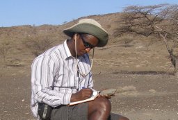 Amanuel Beyin合作论文数Interdepartmental Doctoral;Program in Anthropological Sciences;State University of New York;Program in Anthropological Sciences, State University of New York4Jago Jonathan Birk合作论文数4Jacob Davis合作论文数3christopher bloszies合作论文数3Jong-Taik Choi合作论文数3
 Carol Lang合作论文数3
 Peixian Shu合作论文数3Yongje Oh合作论文数3
 Michael Kyle Woodson合作论文数3Christopher E. Miller合作论文数Institute for Archaeological Sciences, University of Tübingen;Institute for Archaeological Sciences, University of Tübingen3Jiwon Yang合作论文数3
 Jaeyong Lee合作论文数Department of Statistics, Seoul National Unviversity3
 Chang Ho Hyun合作论文数3
 Gábor Újvári合作论文数Institute for Psychology, Hungarian Academy of Sciences3
 Chuntaek Seong合作论文数3Sung-Mo Ahn合作论文数3J. Ramon Arrowsmith合作论文数2Jago J Birk合作论文数2Ji-Young Park合作论文数2seonho choi合作论文数2Fredrick Mapemba合作论文数2
 Oris Malijani合作论文数2
 Davie Simengwa合作论文数2
 Marie José Gaillard Lemdahl合作论文数Department of Biology and Environmental Science, Faculty of Health and Life Sciences, Linnaeus University2
 J. Andrew Darling合作论文数2
 Emmanuel Ndiema合作论文数Natl Museums Kenya, Dept Earth Sci, Nairobi, Kenya2Helena Pinto Lima合作论文数2Siobhán Clarke合作论文数Univ Calgary, Dept Anthropol & Archaeol, Calgary, AB, Canada2




