The study of the Earth as a system is being adopted widely by geoscientists. Numerical models and simulations are providing the capability to rapidly test hypotheses and make forecasts of complex geophysical behavior. International efforts are seeking to integrate existing and emerging Earth observation systems into a global network, with enhanced data distribution, models, and decision support tools. Remote sensing is poised to fulfil the increasing need for a synoptic framework. However, the desire to improve the connection between scientific research and societal benefits has not been matched with resources and tools required to bridge the gap between research and applications. Natural hazards research and disaster management are a prime example. Here, we present a conceptual case for how interferometric synthetic aperture radar (InSAR) data could make a definitive contribution to understanding earthquake processes while simultaneously supporting policy- and decision-making. InSAR measurements derived from time series of radar observations from Earth orbit uniquely can provide geographically comprehensive maps of surface deformation. Observing system simulations are suggested to evaluate the potential contributions of a future system. Simulations would adopt an open seismic hazard analysis (SHA) framework, OpenSHA, recognizing the need for more physics-based modeling and computational infrastructure. SHA is employed by the HAZUS-MH earthquake module to estimate losses. InSAR measurements of strain accumulation would provide event magnitude recurrence bounds for probabilistic SHA, while coseismic InSAR measurements would add constraints on fault rupture models for deterministic approaches. Moreover, interferograms would be incorporated graphically as proxy seismic risk maps for planning and mitigation
Demonstration of a spaceborne system to image seismic surface waves dynamically (i.e. coseismically) would be the early steps of a future operational capability for monitoring earthquakes and discriminating clandestine underground nuclear tests. Complementing the global network of seismic instruments, such system would enable unprecedented global mapping of the velocity structure of the Earth's crust, thereby improving hypocentral location, understanding of rupture dynamics and wave propagation effects, and source characterization. Seismic wave measurement requirements include lower bounds on detectability of events and wave amplitude accuracy for different levels of analysis, such as source characterization and crustal tomography, with 10-100 mum wave amplitude resolution for waves nominally traveling 5 km/s, an upper frequency bound based on earthquake surface displacement spectra, and minimum horizontal resolution (1-5 km) and areal coverage. Advanced radar technologies are keys to demonstrating a pre-operational system leading to a high MEO (10,400 km orbit altitude) constellation for continuous surveillance.
Today most operational Earth observing satellites reside in low Earth orbits (LEO) at less than 1,000 km altitude, and in geostationary Earth orbits (GEO) at ~35,800 km altitude. These orbits have been the venues of choice for observations, albeit for very different reasons. LEO provides high spatial resolution with low temporal resolution while GEO provides for low spatial resolution, but high temporal resolution. NOAA utilizes both venues for their environmental satellites. The NOAA Polar-orbiting Operational Environmental Satellites (POES) reside in LEO Sun synchronous orbits at approximately 830 km in altitude, as do the Defense Meteorological Satellite Program (DMSP) satellites of the Department of Defense. In the near future the POES and DMSP satellites will be merged into a new satellite system referred to as the National Polar-orbiting Operational Environmental Satellite System (NPOESS). The NOAA Geostationary Operational Environmental Satellite (GOES) system, as the name specifies, resides at the other preferred observational venue of GEO. The Jet Propulsion Laboratory (JPL), under contract to NOAA, has been studying the characteristics of medium Earth orbits (MEO), at altitudes between 1000 and 35,800 km, as an observation venue to answer the question as to whether MEO might capture the attributes of the two traditional venues. This on-going study initially focused on determining the optimal altitude for MEO observations, through numerous trade studies involving altitude, instrument complexity, coverage, radiation environment, data temporality, revisit time, data rates, downlink requirements and other parameters including cost and launch complexity. Once the optimal altitude of 10,400 km had been determined the study proceeded to explore single through multiple MEO satellite constellation performance capabilities using two instrument types, a visible through infrared (IR) imager and IR sounder as the satellites' payload. The MEO performance capabilities were compared to comparable LEO and GEO satellite constellation capabilities. This portion of the study concluded that indeed for global coverage a constellation of satellites operating in the MEO venue could capture the attributes of those operating in the LEO and GEO venues. Three 8-satellite constellations configurations - Walker, ICO, and Equatorial-Polar (EP) - then were studied to develop more constellation coverage statistics including robustness to individual satellite failure. That study phase concluded that the EP constellation was superior to both the ICO and Walker configurations. The study is presently examining if, and to what extent, the equatorial portion of the EP constellation might provide substantive supplemental data to that collected by the NPOESS and GOES satellite constellations.
Low Earth orbits (LEO) and Geostationary Earth orbits (GEO) orbits have traditionally been the venues of choice for observations, albeit for very different reasons. LEO provides high spatial resolution with low temporal resolution while GEO provides for low spatial resolution, but high temporal resolution. NOAA utilizes both venues for their environmental satellites. The NOAA Polar-orbiting Operational Environmental Satellites (POES) reside in LEO Sun synchronous orbits at approximately 830 km in altitude, as do the Defense Meteorological Satellite Program (DMSP) satellites of the Department of Defense. In the near future the POES and DMSP satellites will be merged into a new satellite system referred to as the National Polar- orbiting Operational Environmental Satellite System (NPOESS). The NOAA Geostationary Operational Environmental Satellite (GOES) system, as the name specifies, resides at the other preferred observational venue of GEO. The Jet Propulsion Laboratory (JPL), under contract to NOAA, has been studying the characteristics of medium Earth orbits (MEO), at altitudes between 1000 and 35,800 km, as an observation venue to answer the question as to whether MEO might capture the attributes of the two traditional venues. This on-going study initially focused on determining the optimal altitude for MEO observations, through numerous trade studies involving altitude, instrument complexity, coverage, radiation environment, coverage, spatial and temporal resolution, revisit time, data rates, data latency, downlink requirements and other parameters including cost and launch complexity. Once the optimal altitude of 10,400 km had been determined, the study proceeded to explore single and multiple MEO satellite constellation performance capabilities using two instrument types, a visible through infrared (IR) imager and IR sounder as the satellites' payload. MEO performance capabilities were compared to comparable LEO and GEO satellite constellation capabilities. This portion of the study concluded that indeed for global coverage a constellation of satellites operating in the MEO venue could capture the attributes of those operating in the LEO and GEO venues. Three 8-satellite constellations configurations - Walker, ICO, and Equatorial-Polar (EP) - then were studied to develop more constellation coverage statistics including robustness to individual satellite failure. That study phase concluded that the EP constellation was superior to both the ICO and Walker configurations.
A lifecycle risk management decision-support tool developed for NASA space systems is used to assess and visualize risks in a research and applications program. This paper presents the first demonstration and assessment of the tool for balancing programmatic risk. The case study NASA program has a principal goal of developing geospatial information products for a broad user base. Selecting optimal combinations of risk controls, such as planning activities and assessments, plus research and applications projects, performs the risk balancing. Marginal benefits are measured in terms of residual risk. Relative differences in risk impact and control effectiveness provide indications of program integration across science, technology and applications. Results are preliminary. Sensitivity analysis confirms that at formulation, prioritization and coordination with stakeholder agencies are mitigations yielding greatest marginal benefit towards requirements attainment. At implementation, establishing project performance characteristics yields the greatest marginal benefit. The framework helps strategy design, execution, integration and prioritization.
Satellite remote sensing is providing a systematic, synoptic framework for advancing scientific knowledge of the Earth as a complex system of geophysical phenomena that, directly and through interacting processes, often lead to natural hazards. Improved and integrated measurements along with numerical modeling are enabling a greater understanding of where and when a particular hazard event is most likely to occur and result in significant socioeconomic impact. Geospatial information products derived from this research increasingly are addressing the operational requirements of decision support systems used by policy makers, emergency managers and responders from international and federal to regional, state and local jurisdictions. This forms the basis for comprehensive risk assessments and better-informed mitigation planning, disaster assessment and response prioritization. Space-based geodetic measurements of the solid Earth with the Global Positioning System, for example, combined with ground-based seismological measurements, are yielding the principal data for modeling lithospheric processes and for accurately estimating the distribution of potentially damaging strong ground motions which is critical for earthquake engineering applications. Moreover, integrated with interferometric synthetic aperture radar, these measurements provide spatially continuous observations of deformation with sub-centimeter accuracy. Seismic and in situ monitoring, geodetic measurements, high-resolution digital elevation models (e.g. from InSAR, Lidar and digital photogrammetry) and imaging spectroscopy (e.g. using ASTER, MODIS and Hyperion) are contributing significantly to volcanic hazard risk assessment, with the potential to aid land use planning in developing countries where the impact of volcanic hazards to populations and lifelines is continually increasing. Remotely sensed data play an integral role in reconstructing the recent history of the land surface and in predicting hazards due to flood and landslide events. Satellite data are addressing diverse observational requirements that are imposed by the need for surface, subsurface and hydrologic characterization, including the delineation of flood and landslide zones for risk assessments. Short- and long-term sea-level change and the impact of ocean-atmosphere processes on the coastal land environment, through flooding, erosion and storm surge for example, define further requirements for hazard monitoring and mitigation planning. The continued development and application of a broad spectrum of satellite remote sensing systems and attendant data management infrastructure will contribute needed baseline and time series data, as part of an integrated global observation strategy that includes airborne and in situ measurements of the solid Earth. Multi-hazard modeling capabilities, in turn, will result in more accurate forecasting and visualizations for improving the decision support tools and systems used by the international disaster management community.
The development of a suborbital or spaceborne system to monitor seismic surface waves poses an intriguing prospect for advancing the state of seismology. This capability would enable an unprecedented global mapping of the velocity structure of the Earth's crust, event source location and characterization, and greatly improved understanding of earthquake rupture dynamics and wave propagation effects. Seismic wave measurement requirements include lower bounds on detectability of earthquakes and wave amplitude accuracy for different levels of analysis, such as source characterization and crustal tomography, with 10-100 mum wave amplitude resolution for waves nominally traveling 5 km/s, an upper frequency bound based on earthquake surface displacement spectra, and minimum horizontal resolution (1-5 km) and aerial coverage. The technological challenges to developing any such system are at this stage enormous. However, preliminary architectural concepts suggest feasibility in a far-term horizon while fostering collaboration on meeting scientific and operational challenges
A concept study was undertaken to demonstrate how strategic valuation of a micro-sun sensor development could impact decision-making and planning during maturation of technology from proof-of-concept through validation and demonstration. A workflow of activities that retire risk and ensure technology infusion into a targeted system also prescribes a pseudo-decision tree from which comparison of discounted cash flow (DCF) with compound real options valuation is performed to evaluate the strategic value of the maturation phase. The intent is to identify areas where financial modeling may improve decision-making for integration with technology risk assessment, infusion planning, probabilistic cost estimation, schedule uncertainties and program-level decision tree analysis. DCF and option values expectedly are dominated by assumptions and uncertainty. Nonetheless, the latter preliminarily yields a project value distribution that can exceed DCF by up to $40,000 though typically is below $10,000 for this relatively small $800,000 technology development effort over two years.
The development of a suborbital or spaceborne system to monitor seismic waves poses an intriguing prospect for advancing the state of seismology. This capability would enable an unprecedented global mapping of the velocity structure of the earth's crust, understanding of earthquake rupture dynamics and wave propagation effects, and event source location, characterization and discrimination that are critical for both fundamental earthquake research and nuclear non-proliferation applications. As part of an ongoing collaboration between LLNL and JPL, an advanced mission concept study assessed architectural considerations and operational and data delivery requirements, extending two prior studies by each organization--a radar-based satellite system (JPL) for earthquake hazard assessment and a feasibility study of space- or UAV-based laser seismometer systems (LLNL) for seismic event monitoring. Seismic wave measurement requirements include lower bounds on detectability of specific seismic sources of interest and wave amplitude accuracy for different levels of analysis, such as source characterization, discrimination and tomography, with a 100 {micro}m wave amplitude resolution for waves nominally traveling 5 km/s, an upper frequency bound based on explosion and earthquake surface displacement spectra, and minimum horizontal resolution (1-5 km) and areal coverage, in general and for targeted observations. For a radar system, corresponding engineering and operationalmore » factors include: Radar frequency (dictated by required wave amplitude measurement accuracy and maximizing ranging, Doppler or interferometric sensitivity), time sampling (maximum seismic wave frequency and velocity), and overall system considerations such as mass, power and data rate. Technical challenges include characterization of, and compensation for, phase distortion resulting from atmospheric and ionospheric perturbations and turbulence, and effects of ground scattering characteristics and seismic ground motion on phase coherence over interferometric time intervals. Since the temporal sampling requirement may be finer than that possible for a high-altitude sensor to traverse a synthetic aperture length, a geostationary, real-aperture Ka-band system or constellation for equatorial and moderate-latitude global coverage is one option considered. The short wavelength would maximize interferometric sensitivity to small surface displacements and minimize required antenna area. Engineering issues include the design and deployment of a large ({approx} 100m) fixed aperture antenna; and fast electronic beam steering (entire aperture within nominal 1 s interferometric interval) with high-efficiency integrated transmit/receive modules. For a suborbital system, platform instability is an issue whereas at high earth orbit signal-to-noise and attendant power requirements dominate. Data delivery requirements include large-volume data storage and transmission; development of real-time, on-board event detection and processing algorithms, and data management structures for these very large data sets. A far-term roadmap would comprise a proof-of-concept demonstration using a laser or radar system mounted on a stratospheric balloon or UAV to image seismic wavefields from planned events (e.g. large mine blasts and/or purpose-designed explosions) and earthquake targets of opportunity. The technological challenges to developing any such seismic monitoring system, whether laser- or radar-based, are at this stage enormous. However, these concept studies suggest the long-term feasibility of such a system and drive the development of enabling technologies while fostering collaboration on meeting scientific and operational challenges of agencies such as NASA, DOE and DoD.« less
The MCEER research team is attempting to use Synthetic Aperature Radar (SAR) technology in combination with digital elevation models (DEM) to create building inventories for highly urbanized areas. If successful, these techniques could revolutionize the way in which structural inventory data are compiled for large cities. One particular application that is especially relevant to the MCEER program is the development of building inventory data for loss estimation modeling. Current methods of inventory development are often expensive to apply, can result in incomplete datasets, and are generally not standardized. Because of these shortcomings, these methods are employed only periodically, thus rendering the data static during its application. We intend to explore the use of airborne SAR data, along with other remotely sensed data, to construct building inventories for loss estimation modeling. In our study, we have two specific research objectives:
Tectonically regionalized variations in the temperature of the upper 400 km of the Earth's mantle are estimated from analysis of global seismic travel-time data cataloged by the International Seismological Centre (ISC). Seismic parameter profiles are determined from estimates of P and S velocities obtained by tau inversion. Summary phase diagrams for the olivine and pyroxene-garnet subsystems are constructed in conjunction with a thermodynamic potential formulation that allows self-consistent determination of density, bulk modulus and adiabats throughout the pressure and temperature regimes of the mantle. Perturbations in estimated seismic parameters are expressed in terms of variations in temperature using the model temperature derivatives of the bulk modulus and density at a given temperature and pressure. Confidence bounds on the velocity estimates are used to place corresponding bounds on the constructed seismic parameters. A simple differential relationship is solved iteratively to obtain a temperature variation for a given variation in seismic parameter. This approach allows the estimation of a range of seismically determined temperature variations by employing a given compositional model. Results indicate that whereas the P and S velocity variations in the upper mantle are consistent with the tectonic regionalization, variations in VpVs ratios are irregular. This leads to unstable estimates of the seismic parameters and thus estimates of mean temperature anomalies, typically within 600°C of the weighted mean, that are inconsistent with the regionalized seismic data. A comparison of two compositional models is used to show the trade-off with estimated temperature variations. A refined regionalization and analysis of a larger ISC data set are suggested to stabilize the S velocity inversion, reduce statistical uncertainties on the seismic parameters, and thus improve constraints on estimated temperature variations.
A Sagnac interferometric based strain sensor has the potential to measure strain of less than 100 microns over distances of 10 km or more. By incorporating these strain sensors into telecommunication grade fiber otic cable it would be possible to monitor earth movement to high accuracy over very long links at low cost on a continual basis. This technique would be extremely complementary to systems based on the Global Positioning Satellite and Satellite based radar imaging. The potential exists for incorporating the system directly into the local, regional, and national fiber optic telecommunication infrastructure, which would for the first time allow widespread data on earth movement to be obtained. This information would be useful in studying precursory deformation related to earthquake and volcanic activity, landslides, movement of land due to river outflows, and other earth movement features that directly impact the environment. This system could be used to reduce risks in hazardous waste site areas, to monitor strain o power and telecommunication lines, to monitor potential damage due to earth movement of utilities and buildings, and the movement of oil platforms at sea due to river outflows reducing oil spillage risks.
This chapter reviews the fundamental relationships between a seismic source and the resulting surface deformation and methods for inverting geodetic and seismic data simultaneously through the characterization of static and kinematic displacements, respectively. The spatial and temporal distributions of strain accumulation and release involved in various tectonic and earthquake processes can be inferred from high-precision geodetic measurements of the corresponding crustal deformation at the Earth's surface. Also the differences between seismic slip estimates and geodetic estimates of tectonic slip were discussed. Geodetic measurements undertaken at all phases of an earthquake cycle can be incorporated in earthquake source parameterizations, geometrical fault models, and rheological models of fault zone behavior consistent with laboratory studies of rock samples, in order to characterize the strain accumulation and release process in the seismic source region. Seismology and space-based geodesy can benefit mutually by recognizing the measurement limitations and requirements imposed by each other for addressing geophysical problems. Thus, scientific results that exploit the broader measurement response will be possible, yielding better constraints, smaller uncertainties, and improved models.
 Timothy Dixon合作论文数School of Geosciences, College of Arts & Sciences, University of South Florida;Geodesy Lab, College of Arts & Sciences, University of South Florida6
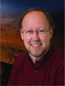 W. Bruce Banerdt合作论文数4
 Lane R. Johnson合作论文数4William Foxall合作论文数3J. Paul Dauphin合作论文数3Diane L. Evans合作论文数Jet Propulsion Laboratory, California Institute of Technology3Kenneth L. Tanaka合作论文数United States Geological Survey’s3
 Stephen Lichten合作论文数Jet Propulsion Laboratory;California Institute of Technology3scott a stephens合作论文数2andrew j gerber合作论文数2Schultz, C.合作论文数2
 Geoffrey Blewitt合作论文数Nevada Geodetic Laboratory, Department of Physics, College of Science, University of Nevada2
 R. Stephen Saunders合作论文数Jea Prcp sian Laborctorr2Craig A. Schultz合作论文数2
 Andrea Donnellan合作论文数Jet Propulsion Laboratory, Pasadena, CA, USA2Timothy H Dixon合作论文数2Ronald G. Blom合作论文数2d senske合作论文数1ronald g blom合作论文数1Donald H. Ebbeler合作论文数1
 William Kaiser合作论文数Electrical Engineering Department, University of California at Los Angeles1
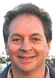 Victor Zlotnicki合作论文数Jet Propulsion Laboratory, California Institute of Technology1
 Paul Lundgren合作论文数Department of Geological Sciences, Northwestern University1
 Elric W. Saaski合作论文数Research International1
 Arthur J. Rodgers合作论文数Geophysics and Global Security Division;Lawrence Livermore National Laboratory;Geophysics and Global Security Division, Lawrence Livermore National Laboratory1
 Eric Udd合作论文数Columbia Gorge Research1
 J. Ita合作论文数1
 G. Gonzalez合作论文数Institut Català d’Investigació Química1
 Fumiko Tajima合作论文数Berkeley Seismological Laboratory, University of California at Berkeley1
 Ellen R. Stofan合作论文数1Shyam N. Bajpai合作论文数1
 Matthew P Golombek合作论文数1
 Thomas Herring合作论文数Earth Resources Laboratory, Department of Earth, Atmospheric, and Planetary Sciences, Massachusetts Institute of Technology1Earnest D. Paylor合作论文数1Matthew P. Golombek合作论文数1David A. Senske合作论文数1Gerald J. Dittberner合作论文数1
 Suzanne Smrekar合作论文数Jet Propulsion Laboratory, NASA;California Institute of Technology1
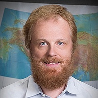 Eric J. Fielding合作论文数Science Division, NASA Jet Propulsion Laboratory;Jet Propulsion Laboratory, California Institute of Technology1G. E. Ness合作论文数1




