The NASA Jet Propulsion Laboratory (JPL) is a national research facility that carries out cuttingedge earth science missions. JPL developed the first U.S. Earth-orbiting science spacecraft and is a pioneer in the use of remote sensing for science of the oceans, atmosphere, and solid earth. Explorer I was the first U.S. Earth-orbiting spacecraft. It followed the Soviet Sputniks 1 and 2 but carried James Van Allen's Geiger counter, which upended space physics with the discovery of the radiation belts now named for him [1]. Explorer I also carried a micrometeoroid detector. JPL developed atmospheric temperature instruments for the Nimbus series of weather satellites, built microwave and infrared instruments to help gain an understanding of stratospheric ozone depletion, ocean circulation, and surface winds, and flew Seasat, which carried the first civilian synthetic aperture radar. This article gives a general overview of recent, current, and near-future earth science missions led by JPL, highlighting a few of the many measurements that are transforming our understanding of the processes governing the Earth's atmosphere, oceans, land surfaces, and climate.
The National Research Councilï¿¿ï¿¿ï¿¿s Decadal Survey for Earth Science identified the Deformation, Ecosystem Structure, and Dynamics of Ice (DESDynI) mission among the highest priorities for new NASA Earth missions. DESDynI consists of an L-band Synthetic Aperture Radar configured for repeat-pass interferometric observations (InSAR), and a nadir pointing lidar suitable for vegetation canopy structure characterization. In response, analyses are underway to evaluate efficient combinations of science objectives and mission/instrument scenarios. The InSAR component can be satisfied by a traditional phased array deployable aperture as flown in space on SeaSAT, JERS-1, and ALOS. Alternatively, the SAR can be designed as an offset-fed reflector, capitalizing on large commercial mesh reflector antenna and transmit/receive modules developed for the NASA UAVSAR airborne radar. This InSAR system satisfies key science objectives and addresses several shortcomings of existing InSAR capable satellites. To reduce temporal decorrelation, L-band (24 cm wavelength) is used. A 340 km wide-swath scanSAR mode with 8 (or 12) day repeat enhances study of ice dynamics, pre/post earthquake deformation, volcano monitoring, and other dynamic phenomena. Fully polarimetric capability allows wide-area extension of key parameters of the vegetation canopy, such as biomass and land cover change, firmly anchored through the fine detail provided by the lidar in globally distributed profiles. Similarly polarimetric InSAR measurements allow further refinement of canopy structure in appropriate canopies. Key challenges involve scheduling and observational strategy to optimize overlapping observational requirements of various science communities served. This paper focuses on the InSAR technology and observational trades that affect the science return, in combination with and distinct from the lidar.
The study of the Earth as a system is being adopted widely by geoscientists. Numerical models and simulations are providing the capability to rapidly test hypotheses and make forecasts of complex geophysical behavior. International efforts are seeking to integrate existing and emerging Earth observation systems into a global network, with enhanced data distribution, models, and decision support tools. Remote sensing is poised to fulfil the increasing need for a synoptic framework. However, the desire to improve the connection between scientific research and societal benefits has not been matched with resources and tools required to bridge the gap between research and applications. Natural hazards research and disaster management are a prime example. Here, we present a conceptual case for how interferometric synthetic aperture radar (InSAR) data could make a definitive contribution to understanding earthquake processes while simultaneously supporting policy- and decision-making. InSAR measurements derived from time series of radar observations from Earth orbit uniquely can provide geographically comprehensive maps of surface deformation. Observing system simulations are suggested to evaluate the potential contributions of a future system. Simulations would adopt an open seismic hazard analysis (SHA) framework, OpenSHA, recognizing the need for more physics-based modeling and computational infrastructure. SHA is employed by the HAZUS-MH earthquake module to estimate losses. InSAR measurements of strain accumulation would provide event magnitude recurrence bounds for probabilistic SHA, while coseismic InSAR measurements would add constraints on fault rupture models for deterministic approaches. Moreover, interferograms would be incorporated graphically as proxy seismic risk maps for planning and mitigation
The spaceborne imaging radar-C, X-band synthetic aperture radar (SIR-C/X-SAR) missions have resulted in important scientific discoveries and provided new insights into Earth system processes. Analyses of SIR-C/X-SAR engineering-mode data have also led to new measurement and mission concepts. The multifrequency, multipolarisation capability provided by SIR-C/X-SAR is unsurpassed from a spaceborne system, making the data set valuable for algorithm development and assessment of optimal imaging parameters more than a decade after the missions were flown.
High resolution thermal surveys will be acquired to quantify the thermal balance of several active, changing volcanoes which are difficult to monitor for change. Maps of the heat flow on these volcanoes will help in understanding the internal processes changing their surfaces. Correlation of heat flow with volcano deformation and seismicity will help in the understanding of this active region. Remote sensing of composition and biology of warm, bare areas will allow a better understanding of these extreme ecosystems. The thermal survey s and ancillary compositional and biological mapping will be used to focus searches on Mars for similar environments.Mars is a polar desert, much like Antarctica, and one of the few places on Mars where life could exist is in a thermal anomaly like the bare, warm ground areas on the Antarctic volcanoes. We will study the factors making these areas habitable and hone the remote sensing techniques that may be used to detect these features on Mars. Warm areas on Mars (as on the Antarctic volcanoes) are especially hospitable to humans as well, making their discovery on Mars of primary importance for human occupation.
Satellite remote sensing is providing a systematic, synoptic framework for advancing scientific knowledge of the Earth as a complex system of geophysical phenomena that, directly and through interacting processes, often lead to natural hazards. Improved and integrated measurements along with numerical modeling are enabling a greater understanding of where and when a particular hazard event is most likely to occur and result in significant socioeconomic impact. Geospatial information products derived from this research increasingly are addressing the operational requirements of decision support systems used by policy makers, emergency managers and responders from international and federal to regional, state and local jurisdictions. This forms the basis for comprehensive risk assessments and better-informed mitigation planning, disaster assessment and response prioritization. Space-based geodetic measurements of the solid Earth with the Global Positioning System, for example, combined with ground-based seismological measurements, are yielding the principal data for modeling lithospheric processes and for accurately estimating the distribution of potentially damaging strong ground motions which is critical for earthquake engineering applications. Moreover, integrated with interferometric synthetic aperture radar, these measurements provide spatially continuous observations of deformation with sub-centimeter accuracy. Seismic and in situ monitoring, geodetic measurements, high-resolution digital elevation models (e.g. from InSAR, Lidar and digital photogrammetry) and imaging spectroscopy (e.g. using ASTER, MODIS and Hyperion) are contributing significantly to volcanic hazard risk assessment, with the potential to aid land use planning in developing countries where the impact of volcanic hazards to populations and lifelines is continually increasing. Remotely sensed data play an integral role in reconstructing the recent history of the land surface and in predicting hazards due to flood and landslide events. Satellite data are addressing diverse observational requirements that are imposed by the need for surface, subsurface and hydrologic characterization, including the delineation of flood and landslide zones for risk assessments. Short- and long-term sea-level change and the impact of ocean-atmosphere processes on the coastal land environment, through flooding, erosion and storm surge for example, define further requirements for hazard monitoring and mitigation planning. The continued development and application of a broad spectrum of satellite remote sensing systems and attendant data management infrastructure will contribute needed baseline and time series data, as part of an integrated global observation strategy that includes airborne and in situ measurements of the solid Earth. Multi-hazard modeling capabilities, in turn, will result in more accurate forecasting and visualizations for improving the decision support tools and systems used by the international disaster management community.
Thousands of scientific publications and dozens of textbooks include data from instruments derived from NASA's Seasat. The Seasat mission was launched on June 26, 1978, on an Atlas-Agena rocket from Vandenberg Air Force Base. It was the first Earth-orbiting satellite to carry four complementary microwave experiments—the Radar Altimeter (ALT) to measure ocean surface topography by measuring spacecraft altitude above the ocean surface; the Seasat-A Satellite Scatterometer (SASS), to measure wind speed and direction over the ocean; the Scanning Multichannel Microwave Radiometer (SMMR) to measure surface wind speed, ocean surface temperature, atmospheric water vapor content, rain rate, and ice coverage; and the Synthetic Aperture Radar (SAR), to image the ocean surface, polar ice caps, and coastal regions. While originally designed for remote sensing of the Earth's oceans, the legacy of Seasat has had a profound impact in many other areas including solid earth science, hydrology, ecology and planetary science.
What are the most important challenges facing solid Earth science today and over the next two decades? And what is the best approach for NASA, in partnership with other agencies, to address those challenges? A new report, Living on a Restless Planet, provides a blueprint for answering these questions. The top priority for a new spacecraft mission in the area of solid Earth science over the next 5 years, according to this report, is a satellite dedicated to Interferometric Synthetic Aperture Radar (InSAR). At the request of NASA, the Solid Earth Science Working Group (SESWG) developed a strategy for the highest priority objectives in solid Earth science for the space agency over the next 25 years. The strategy addresses six challenges that are of fundamental scientific importance, have strong implications for society, and are amenable to substantial progress through a concerted series of scientific observations from space.
A group of volcanoes northeast of Aksayqin Lake, in the western Kunlun Mountains, China, have been identified on multifrequency, multipolarization spaceborne imaging radar-C/X-band synthetic aperture radar (SIR-C/X-SAR) images. Field observations made on the volcanic morphology and terrain features are described in this paper. Analysis of single-band, single-polarization radar backscatter coefficients (σ°) shows that LHV best discriminates the two types of lava flows (pahoehoe and aa lavas), alluvium, and bedrock. The factors affecting the radar backscatter coefficient also are analyzed. Finally, this paper presents KAr isotopic ages of volcanic samples collected in the field and discusses the volcanism in the area.
An accurate description of the surface elevation of the Earth is of fundamental importance to many branches of Earth science. Continental topographic data are required for studies of hydrology, ecology, glaciology, geomorphology, and atmospheric circulation. For example, in hydrologic and terrestrial ecosystem studies, topography exerts significant control on intercepted solar radiation, water runoff and subsurface water inventory, microclimate, vegetation type and distribution, and soil development. The topography of the polar ice caps and mountain glaciers directly reflects ice‐flow dynamics and is closely linked to global climate and sea level change.
Significant deficiencies in the quality of today's topographic data severely limit scientific applications. Very few available data sets meet the stringent requirements of 10–30 m for global digital topography and 5 m or better vertical accuracy, and existing satellite systems are unlikely to fulfill these requirements. The Joint Topographic Science Working Group, appointed by NASA and the Italian Space Agency, concluded that radar interferometry coupled with a laser altimeter would be the most promising approach for improving data quality. By providing its own illumination at a wavelength Ion g enough to (e.g., λ = 25 cm) to penetrate clouds and rain, the interferometer would provide a global, uniform high‐quality topographic data set. One mission under study, TOPSAT, is well positioned to fill this niche and promises to pave the way toward a more standardized and precise topographic database. TOPSAT would be an international mission, designed to make use of recent technology advances in such programs as NASA's New Millennium. It could be ready to launch by the end of this decade.
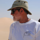 Tom G Farr合作论文数Jet Propulsion Laboratory, California Institute of Technology11
 Charles Elachi合作论文数Division of Geological and Planetary Sciences, California Institute of Technology5
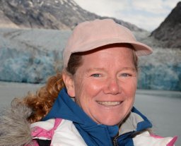 Andrea Donnellan合作论文数Jet Propulsion Laboratory, Pasadena, CA, USA4
 Linda Godwin合作论文数3
 Howard Zebker合作论文数Departments of Geophysics, Stanford University;Department of Electrical Engineering, Stanford University3
 Paul A. Rosen合作论文数Jet Propulsion Laboratory, California Institute of Technology3
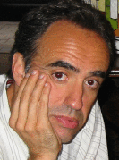 David M. Tralli合作论文数Center for Computational Seismology, University of California3
 Jason J. Hyon合作论文数2van Zyl, J.J.合作论文数2
 Timothy Dixon合作论文数School of Geosciences, College of Arts & Sciences, University of South Florida;Geodesy Lab, College of Arts & Sciences, University of South Florida2
 Sergio Vetrella合作论文数2
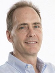 Duane Waliser合作论文数Department of Atmospheric and Oceanic Sciences, University of California, Los Angeles;Joint Institute for Regional Earth System Science and Engineering, University of California, Los Angeles;Earth Science and Technology Directorate, Jet Propulsion Laboratory, California Institute of Technology;Science Division, Jet Propulsion Laboratory, California Institute of Technology2
 Dean B. Gesch合作论文数Data Center2Stephen J. Edberg合作论文数2Milton O. Smith合作论文数2Earnest D. Paylor合作论文数2j b cimino合作论文数2Jack L. Bufton合作论文数2James E. Graf合作论文数2M. C. Malin合作论文数1Cl Werner合作论文数1P. L. Blake合作论文数1ronald g blom合作论文数1LR SCHENCK合作论文数1
 Jean-Bernard Minster合作论文数Institute of Geophysics and Planetary Physics, University of California, San Diego;Scripps Institution of Oceanography, University of California, San Diego1Benjamin Holt合作论文数1
 Raymond Jeanloz合作论文数Department of Earth & Planetary Science, University of California, Berkeley;Hoover Institution, Stanford University1
 Huadong Guo (郭华东)合作论文数International Research Center of Big Data for Sustainable Development Goals;Aerospace Information Research Institute, Chinese Academy of Sciences;University of Chinese Academy of Sciences1
 Jingjuan Liao (廖静娟)合作论文数Aerospace Information Research Institute, Chinese Academy of Sciences;University of Chinese Academy of Sciences1Jones Thomas D合作论文数1
 Alan D. Chave合作论文数Deep Submergence Laboratory, Department of Applied Ocean Physics and Engineering, Woods Hole Oceanographic Institution1Ford, J.P.合作论文数1Burnette, C.F.合作论文数1Petroy, S.B.合作论文数1
 Eni G. Njoku合作论文数Jet Propulsion Laboratory1
 Chenxi Wang (王晨曦)合作论文数School of Materials Science and Engineering, Harbin Institute of Technology1
 Mary Lou Zoback合作论文数Department of Geophysics, Stanford University1
 Donald Turcotte合作论文数Department of Earth and Planetary Sciences, University of California, Davis1
 Doug Burbank合作论文数Department of Earth Science, University of California, Santa Barbara1
 W. Timothy Liu合作论文数Jet Propulsion Laboratory1
 Benjamin Fong Chao (趙丰)合作论文数Institute of Earth Sciences, Academia Sinica1
 Raymond E. Arvidson合作论文数Department of Earth, Environmental, and Planetary Sciences, College of Arts & Sciences, Washington University in St. Louis;NASA1
 Alan R. Gillespie合作论文数W. M. Keck Remote Sensing and Planetary Sciences Laboratory, Department of Earth and Space Sciences, University of Washington1
 Sean C. Solomon合作论文数Lamont-Doherty Earth Observatory, Columbia Climate School, Columbia University1
 Ronald Greeley合作论文数Ronald Greeley Center for Planetary Studies, Arizona State University;School of Earth and Space Exploration, Arizona State University1
 Jeremy Bloxham合作论文数Department of Earth and Planetary Sciences, Faculty of Arts and Sciences, Harvard University1
 Nicholas Lancaster合作论文数Division of Earth and Ecosystem Sciences, Desert Research Institute1James E. Conel合作论文数1John F. Mccauley合作论文数1




