Earthquake early warning (EEW) is an application of seismological science that can give people, as well as mechanical and electrical systems, up to tens of seconds to take protective actions before peak earthquake shaking arrives at a location. Since 2006, the U.S. Geological Survey has been working in collaboration with several partners to develop EEW for the United States. The goal is to create and operate an EEW system, called ShakeAlert, for the highest risk areas of the United States, starting with the West Coast states of California, Oregon, and Washington. In early 2016, the Production Prototype v.1.0 was established for California; then, in early 2017, v.1.2 was established for the West Coast, with earthquake notifications being distributed to a group of beta users in California, Oregon, and Washington. The new ShakeAlert Production Prototype was an outgrowth from an earlier demonstration EEW system that began sending test notifications to selected users in California in January 2012. ShakeAlert leverages the considerable physical, technical, and organizational earthquake monitoring infrastructure of the Advanced National Seismic System, a nationwide federation of cooperating seismic networks. When fully implemented, the ShakeAlert system may reduce damage and injury caused by large earthquakes, improve the nation’s resilience, and speed recovery.
We determine frequency-dependent attenuation 1/Q(f) for the Hispaniola region using direct S and Lg waves over five distinct passbands from 0.5 to 16 Hz. Data consist of 832 high-quality vertical and horizontal component waveforms recorded on short-period and broadband seismometers from the devastating 12 January 2010 M 7.0 Haiti earthquake and the rich sequence of aftershocks. For the distance range 250-700 km, we estimate an average frequency-dependent Q(f) = 224(+/-27)f(0.64(+/-0.073)) using horizontal components of motion and note that Q(f) estimated with Lg at regional distances is very consistent across vertical and horizontal components. We also determine a Q(f) = 142(+/-21)f(0.71(+/-0.11)) for direct S waves at local distances, <= 100 km. The strong attenuation observed on both vertical and horizontal components of motion is consistent with expectations for a tectonically active region.
Waveform analysis of aftershocks of the Mw7.0 Haiti earthquake of 12 January 2010 reveals amplification of ground motions at sites within the Cul de Sac valley in which Port-au-Prince is situated. Relative to ground motions recorded at a hard-rock reference site, peak acceleration values are amplified by a factor of approximately 1.8 at sites on low-lying Mio-Pliocene deposits in central Port-au-Prince and by a factor of approximately 2.5–3 on a steep foothill ridge in the southern Port-au-Prince metropolitan region. The observed amplitude, predominant periods, variability, and polarization of amplification are consistent with predicted topographic amplification by a steep, narrow ridge. A swath of unusually high damage in this region corresponds with the extent of the ridge where high weak-motion amplifications are observed. We use ASTER (Advanced Spaceborne Thermal Emission and Reflection Radiometer) imagery to map local geomorphology, including characterization of both near-surface and of small-scale topographic structures that correspond to zones of inferred amplification.
Microzonation maps use local geological conditions to characterize seismic hazard, but do not generally consider topography. Ground motions during the Haiti earthquake are found to have been significantly amplified along a high topographic ridge, which caused substantial structural damage, indicating that topography can play an important role in seismic hazard.
Research Article| November 01, 2008 Preliminary Report on the 29 July 2008 Mw 5.4 Chino Hills, Eastern Los Angeles Basin, California, Earthquake Sequence Egill Hauksson; Egill Hauksson California Institute of Technology, Seismological Laboratory, MC 252-21 Pasadena, California 91125 U.S.A. hauksson@gps.caltech.edu (E.H.) 1California Institute of Technology Search for other works by this author on: GSW Google Scholar Karen Felzer; Karen Felzer California Institute of Technology, Seismological Laboratory, MC 252-21 Pasadena, California 91125 U.S.A. hauksson@gps.caltech.edu (E.H.) 2U.S. Geological Survey Search for other works by this author on: GSW Google Scholar Doug Given; Doug Given California Institute of Technology, Seismological Laboratory, MC 252-21 Pasadena, California 91125 U.S.A. hauksson@gps.caltech.edu (E.H.) 2U.S. Geological Survey Search for other works by this author on: GSW Google Scholar Michal Giveon; Michal Giveon California Institute of Technology, Seismological Laboratory, MC 252-21 Pasadena, California 91125 U.S.A. hauksson@gps.caltech.edu (E.H.) 1California Institute of Technology Search for other works by this author on: GSW Google Scholar Susan Hough; Susan Hough California Institute of Technology, Seismological Laboratory, MC 252-21 Pasadena, California 91125 U.S.A. hauksson@gps.caltech.edu (E.H.) 2U.S. Geological Survey Search for other works by this author on: GSW Google Scholar Kate Hutton; Kate Hutton California Institute of Technology, Seismological Laboratory, MC 252-21 Pasadena, California 91125 U.S.A. hauksson@gps.caltech.edu (E.H.) 1California Institute of Technology Search for other works by this author on: GSW Google Scholar Hiroo Kanamori; Hiroo Kanamori California Institute of Technology, Seismological Laboratory, MC 252-21 Pasadena, California 91125 U.S.A. hauksson@gps.caltech.edu (E.H.) 1California Institute of Technology Search for other works by this author on: GSW Google Scholar Volkan Sevilgen; Volkan Sevilgen California Institute of Technology, Seismological Laboratory, MC 252-21 Pasadena, California 91125 U.S.A. hauksson@gps.caltech.edu (E.H.) 2U.S. Geological Survey Search for other works by this author on: GSW Google Scholar Shengji Wei; Shengji Wei California Institute of Technology, Seismological Laboratory, MC 252-21 Pasadena, California 91125 U.S.A. hauksson@gps.caltech.edu (E.H.) 1California Institute of Technology Search for other works by this author on: GSW Google Scholar Alan Yong Alan Yong California Institute of Technology, Seismological Laboratory, MC 252-21 Pasadena, California 91125 U.S.A. hauksson@gps.caltech.edu (E.H.) 2U.S. Geological Survey Search for other works by this author on: GSW Google Scholar Author and Article Information Egill Hauksson 1California Institute of Technology California Institute of Technology, Seismological Laboratory, MC 252-21 Pasadena, California 91125 U.S.A. hauksson@gps.caltech.edu (E.H.) Karen Felzer 2U.S. Geological Survey California Institute of Technology, Seismological Laboratory, MC 252-21 Pasadena, California 91125 U.S.A. hauksson@gps.caltech.edu (E.H.) Doug Given 2U.S. Geological Survey California Institute of Technology, Seismological Laboratory, MC 252-21 Pasadena, California 91125 U.S.A. hauksson@gps.caltech.edu (E.H.) Michal Giveon 1California Institute of Technology California Institute of Technology, Seismological Laboratory, MC 252-21 Pasadena, California 91125 U.S.A. hauksson@gps.caltech.edu (E.H.) Susan Hough 2U.S. Geological Survey California Institute of Technology, Seismological Laboratory, MC 252-21 Pasadena, California 91125 U.S.A. hauksson@gps.caltech.edu (E.H.) Kate Hutton 1California Institute of Technology California Institute of Technology, Seismological Laboratory, MC 252-21 Pasadena, California 91125 U.S.A. hauksson@gps.caltech.edu (E.H.) Hiroo Kanamori 1California Institute of Technology California Institute of Technology, Seismological Laboratory, MC 252-21 Pasadena, California 91125 U.S.A. hauksson@gps.caltech.edu (E.H.) Volkan Sevilgen 2U.S. Geological Survey California Institute of Technology, Seismological Laboratory, MC 252-21 Pasadena, California 91125 U.S.A. hauksson@gps.caltech.edu (E.H.) Shengji Wei 1California Institute of Technology California Institute of Technology, Seismological Laboratory, MC 252-21 Pasadena, California 91125 U.S.A. hauksson@gps.caltech.edu (E.H.) Alan Yong 2U.S. Geological Survey California Institute of Technology, Seismological Laboratory, MC 252-21 Pasadena, California 91125 U.S.A. hauksson@gps.caltech.edu (E.H.) Publisher: Seismological Society of America First Online: 09 Mar 2017 Online ISSN: 1938-2057 Print ISSN: 0895-0695 © 2008 by the Seismological Society of America Seismological Research Letters (2008) 79 (6): 855–866. https://doi.org/10.1785/gssrl.79.6.855 Article history First Online: 09 Mar 2017 Cite View This Citation Add to Citation Manager Share Icon Share Facebook Twitter LinkedIn MailTo Tools Icon Tools Get Permissions Search Site Citation Egill Hauksson, Karen Felzer, Doug Given, Michal Giveon, Susan Hough, Kate Hutton, Hiroo Kanamori, Volkan Sevilgen, Shengji Wei, Alan Yong; Preliminary Report on the 29 July 2008 Mw 5.4 Chino Hills, Eastern Los Angeles Basin, California, Earthquake Sequence. Seismological Research Letters 2008;; 79 (6): 855–866. doi: https://doi.org/10.1785/gssrl.79.6.855 Download citation file: Ris (Zotero) Refmanager EasyBib Bookends Mendeley Papers EndNote RefWorks BibTex toolbar search Search Dropdown Menu toolbar search search input Search input auto suggest filter your search All ContentBy SocietySeismological Research Letters Search Advanced Search The 29 July 2008 Mw 5.4 Chino Hills earthquake was the largest event to occur within the greater Los Angeles metropolitan region since the Mw 6.7 1994 Northridge earthquake. The earthquake was widely felt in a metropolitan region with a population of more than 10 million people and was recorded by hundreds of broadband and strong-motion instruments. In this report we present preliminary analysis of the event and discuss its significance within the seismotectonic framework of the northern Los Angeles basin as revealed by previous moderate earthquakes. The Chino Hills mainshock-aftershock sequence began at a depth of about 15 km... You do not have access to this content, please speak to your institutional administrator if you feel you should have access.
Research Article| May 01, 2006 Southern California Seismic Network Update Kate Hutton; Kate Hutton Seismological Laboratory California Institute of Technology Pasadena, CA 91106 (K.H., E.H., J.C., J.F., A.G., N.S.) kate@gps.caltech.edu Search for other works by this author on: GSW Google Scholar Egill Hauksson; Egill Hauksson Seismological Laboratory California Institute of Technology Pasadena, CA 91106 (K.H., E.H., J.C., J.F., A.G., N.S.) kate@gps.caltech.edu Search for other works by this author on: GSW Google Scholar John Clinton; John Clinton Seismological Laboratory California Institute of Technology Pasadena, CA 91106 (K.H., E.H., J.C., J.F., A.G., N.S.) kate@gps.caltech.edu Search for other works by this author on: GSW Google Scholar Joseph Franck; Joseph Franck Seismological Laboratory California Institute of Technology Pasadena, CA 91106 (K.H., E.H., J.C., J.F., A.G., N.S.) kate@gps.caltech.edu Search for other works by this author on: GSW Google Scholar Anthony Guarino; Anthony Guarino Seismological Laboratory California Institute of Technology Pasadena, CA 91106 (K.H., E.H., J.C., J.F., A.G., N.S.) kate@gps.caltech.edu Search for other works by this author on: GSW Google Scholar Nick Scheckel; Nick Scheckel Seismological Laboratory California Institute of Technology Pasadena, CA 91106 (K.H., E.H., J.C., J.F., A.G., N.S.) kate@gps.caltech.edu Search for other works by this author on: GSW Google Scholar Doug Given; Doug Given Pasadena Field Office U.S. Geological Survey 525 S. Wilson Avenue Pasadena, CA 91106 (D.G., A.Y.) Search for other works by this author on: GSW Google Scholar Alan Yong Alan Yong Pasadena Field Office U.S. Geological Survey 525 S. Wilson Avenue Pasadena, CA 91106 (D.G., A.Y.) Search for other works by this author on: GSW Google Scholar Author and Article Information Kate Hutton Seismological Laboratory California Institute of Technology Pasadena, CA 91106 (K.H., E.H., J.C., J.F., A.G., N.S.) kate@gps.caltech.edu Egill Hauksson Seismological Laboratory California Institute of Technology Pasadena, CA 91106 (K.H., E.H., J.C., J.F., A.G., N.S.) kate@gps.caltech.edu John Clinton Seismological Laboratory California Institute of Technology Pasadena, CA 91106 (K.H., E.H., J.C., J.F., A.G., N.S.) kate@gps.caltech.edu Joseph Franck Seismological Laboratory California Institute of Technology Pasadena, CA 91106 (K.H., E.H., J.C., J.F., A.G., N.S.) kate@gps.caltech.edu Anthony Guarino Seismological Laboratory California Institute of Technology Pasadena, CA 91106 (K.H., E.H., J.C., J.F., A.G., N.S.) kate@gps.caltech.edu Nick Scheckel Seismological Laboratory California Institute of Technology Pasadena, CA 91106 (K.H., E.H., J.C., J.F., A.G., N.S.) kate@gps.caltech.edu Doug Given Pasadena Field Office U.S. Geological Survey 525 S. Wilson Avenue Pasadena, CA 91106 (D.G., A.Y.) Alan Yong Pasadena Field Office U.S. Geological Survey 525 S. Wilson Avenue Pasadena, CA 91106 (D.G., A.Y.) Publisher: Seismological Society of America First Online: 09 Mar 2017 Online Issn: 1938-2057 Print Issn: 0895-0695 © 2006 by the Seismological Society of America Seismological Research Letters (2006) 77 (3): 389–395. https://doi.org/10.1785/gssrl.77.3.389 Article history First Online: 09 Mar 2017 Cite View This Citation Add to Citation Manager Share Icon Share Facebook Twitter LinkedIn MailTo Tools Icon Tools Get Permissions Search Site Citation Kate Hutton, Egill Hauksson, John Clinton, Joseph Franck, Anthony Guarino, Nick Scheckel, Doug Given, Alan Yong; Southern California Seismic Network Update. Seismological Research Letters 2006;; 77 (3): 389–395. doi: https://doi.org/10.1785/gssrl.77.3.389 Download citation file: Ris (Zotero) Refmanager EasyBib Bookends Mendeley Papers EndNote RefWorks BibTex toolbar search Search Dropdown Menu toolbar search search input Search input auto suggest filter your search All ContentBy SocietySeismological Research Letters Search Advanced Search The authoritative region of the Southern California Seismic Network (SCSN) extends across southern California, from the U.S./Mexico international border to Coalinga and Owens Valley in central California (Figure 1). This area contains almost 20 million inhabitants, including two of the ten largest cities in the United States (Los Angeles and San Diego) and the two largest harbors (Los Angeles and Long Beach) in the nation. SCSN also reports on earthquakes in Baja California, which could potentially cause damage in the U.S. More than fifty earthquakes (not including aftershocks) are felt each year, and an average of 1.5 events... You do not have access to this content, please speak to your institutional administrator if you feel you should have access.
The California Institute of Technology (Caltech), the United States Geological Survey (USGS), and the California Department of Conservation, Division of Mines and Geology (CDMG) are completing the implementation of TriNet, a modern seismic information system for southern California. TriNet consists of two elements, the Caltech-USGS element and the CDMG element (Mori et al., 1998). The Caltech-USGS element (Caltech-USGS TriNet) concentrates on rapid notification and archiving of data for seismological applications, while the CDMG element is focused on the needs of engineering users (Hauksson et al., 2002). All three. TriNet agencies are working toward facilitating emergency response and long-term mitigation of earthquake hazards in cooperation with other agencies. The technical development of Caltech-USGS TriNet is sufficiently different from the CDMG element of TriNet to warrant a separate description. This paper provides a technical overview of the design principles of Caltech-USGS TriNet. These principles were based on a document that stated the scientific requirements of TriNet (Jones et al., 1997). We also describe the implementation of these principles using modern technology. The implementation consisted of station deployments, establishing communications links, and developing and implementing new hardware and software for data processing and information distribution. Thus, the Caltech-USGS TriNet is an integrated project extending across many disciplines, using basic ground-motion data and seismological algorithms to generate in near real-time a sophisticated earthquake knowledge base following earthquakes in southern California. Caltech-USGS TriNet applies advanced technology to record both small and large earthquakes on scale. The latest generation of broadband and strong-motion sensors with 24-bit digitizers is used to acquire high-fidelity ground-motion data. Real-time communication is a requirement to facilitate rapid processing and notification about seismicity for emergency management. The data acquisition systems are designed to ensure redundancy and automated processing of data. To accomplish automation, high-speed computers and advanced software form the inner workings of the Caltech-USGS TriNet system. Adopting the commercial database Oracle is an important foundation of our data management system. The automated flow of data into an accessible data center and the automatic population of the database is part of our new seismic network design and is an essential feature of Caltech-USGS TriNet. The TriNet real-time systems and database have been operating online for more than two years, processing real-time data currently from more than 375 stations, or more than 1,200 high sample-rate data channels. Many of these capabilities were tested in the 1999 M_w 7.1 Hector Mine earthquake. New postprocessing and catalog-generation approaches have also been implemented in 2001. Caltech-USGS TriNet is one of the first U.S. regional seismic networks that uses digital technology on a scale of 200 or more stations, with both broadband and strongmotion sensors. In comparison, the IRIS Global Seismic Network consists of 108 stations, with plans for a total of 150 stations (Hutt and Bolton, 1999). Previous digital networks, such as TERRAscope (Kanamori et al., 1997) and the Berkeley Digital Seismic Network (BDSN) (Gee et aL, 1996), have been smaller than TriNet, with about 20 stations each. TriNet also benefits from the experience of other seismic networks around the world. The K-Net in Japan is another example of large-scale deployment of a digital network, although it is focused on strong motions (Kinoshita, 1998). Extensive developments of strong-motion networks in Taiwan and associated near-real-time processing of data employ somewhat different technology but have similar goals for information products following large earthquakes (Teng et al., 1997).
The M_w 7.1 Hector Mine, California, earthquake occurred at 9:46 GMT on 16 October 1999. The event caused minimal damage because it was located in a remote, sparsely populated part of the Mojave Desert, approximately 47 miles east-southeast of Barstow, with epicentral coordinates 34.59°N 116.27°W and a hypocentral depth of 5 ± 3 km. Twelve foreshocks, M 1.9-3.8, preceded the mainshock during the previous twelve hours. All of these events were located close to the hypocenter of the mainshock.
 Susan E. Hough (Susan Hough)合作论文数United States Geological Survey7
 Egill Hauksson合作论文数Geophysics, Division of Geological and Planetary Sciences, California Institute of Technology5
 Alan Yong合作论文数United States Geological Survey5Kate Hutton (K.Hutton)合作论文数5
 Hiroo Kanamori合作论文数Division of Geological and Planetary Sciences, California Institute of Technology4Mark Meremonte合作论文数4dieuseul anglade合作论文数3
 David Wald合作论文数Department of the Interior, United States Geological Survey3
 Thomas H. Heaton (Thomas Heaton)合作论文数Division of Geological and Planetary Sciences, California Institute of Technology3J. Zebulon Maharrey合作论文数2jean robert altidor合作论文数2Claude Prepetit合作论文数2john altidor合作论文数2
 Aron Jeffrey Meltzner合作论文数Asian School of the Environment, Nanyang Technological University2
 Lupei Zhu (朱露培)合作论文数Department of Earth and Atmospheric Sciences, School of Science and Engineering, Saint Louis University2
 Philip James Maechling合作论文数Earthquake Center;University of Southern California;Earthquake Center, University of Southern California2
 Mark Simons合作论文数Seismological Laboratory, Division of Geological and Planetary Sciences, California Institute of Technology2
 William Ellsworth合作论文数School of Earth, Energy & Environmental Sciences, Stanford University2
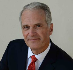 Kenneth W. Hudnut合作论文数US Geol Survey2Harley M. Benz合作论文数2A. Shakal合作论文数1Patrick Small合作论文数1Stephen Guiwits合作论文数1Ivan Henson合作论文数1Katrin Hafner合作论文数1Robert Busby合作论文数1Daniel J. Ponti合作论文数1klaus stark合作论文数1saintlouis mildor合作论文数1M. Guillard Janvier合作论文数1r bhadha合作论文数1Lisa A. Wald合作论文数1lucy jones合作论文数1
 James D. Goltz合作论文数1
 Nick Scheckel合作论文数Seismological Laboratory, Division of Geological and Planetary Sciences, California Institute of Technology1
 Shengji Wei合作论文数Asian School of the Environment, Nanyang Technological University1
 Volkan Sevilgen合作论文数Seismicity.net1
 Stephen James Thompson合作论文数Schering Plough1S. Schwarz合作论文数1
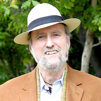 Walter D. Mooney合作论文数United States Geological Survey1K. Hafner合作论文数1Anthony Shakal合作论文数1
 Arthur Frankel合作论文数Lamont-Doherty Geological Observatory;Department of Geological Sciences;Columbia University;Department of Geological Sciences, Columbia University1C. Dietel合作论文数1J. Behr合作论文数1
 Daniel E. Mcnamara合作论文数US Geol Survey1Jascha Polet合作论文数Institute for Crustal Studies, University of California1K. Felzer合作论文数1
 Jeanne L. Hardebeck (Jeanne Hardebeck)合作论文数United States Geological Survey1




