Crustal seismic-velocity models and datasets play a key role in regional 3D numerical earthquake ground-motion simulation, full waveform tomography, and modern physics-based probabilistic earthquake-hazard analysis, as well as in other related fields, including geophysics and earthquake engineering. Most of these models and datasets, often collectively identified as Community Velocity Models (CVMs), synthesize information from multiple sources and are delivered to users in variable formats, including computer applications that allow for interactive querying of material properties, namely P-and S-wave velocities and density.. Computational users often require massive and repetitive access to velocity models and datasets, and such access is often unpractical and difficult due to a lack of standardized methods and procedures. To overcome these issues and to facilitate access by the community to these models, the Southern California Earthquake Center developed the Unified CVM (UCVM) software framework, an open-source collection of tools that enables users to access one or more seismic-velocity models, while providing a standard query interface. Here, we describe the research challenges that motivated the development of UCVM, its software design, development approach, and basic capabilities, as well as a few examples of seismic-modeling applications that use UCVM.
Three-dimensional (3D) seismic velocity models provide foundational data for ground motion simulations that calculate the propagation of earthquake waves through the Earth. The Southern California Earthquake Center (SCEC) has developed the Unified Community Velocity Model (UCVM) package for both Linux and OS X. This unique framework provides a cohesive way for querying and visualizing 3D models. UCVM v14. 3.0, supports many Southern California velocity models including CVM-S4, CVM-H 11.9. 1, and CVM-S4. 26. The last model was derived from 26 full-3D tomographic iterations on CVM-S4. Recently, UCVM has been used to deliver a prototype of a new 3D model of central California (CCA) also based on full-3D tomographic inversions. UCVM was used to provide initial plots of this model and will be used to deliver CCA to users when the model is publicly released. Visualizing models is also …
CyberShake, as part of the Southern California Earthquake Center's (SCEC) Community Modeling Environment, is developing a methodology that explicitly incorporates deterministic source and wave propagation effects within seismic hazard calculations through the use of physics-based 3D ground motion simulations. To calculate a waveform-based seismic hazard estimate for a site of interest, we begin with Uniform California Earthquake Rupture Forecast, Version 2.0 (UCERF2.0) and identify all ruptures within 200 km of the site of interest. We convert the UCERF2.0 rupture definition into multiple rupture variations with differing hypocenter locations and slip distributions, resulting in about 415,000 rupture variations per site. Strain Green Tensors are calculated for the site of interest using the SCEC Community Velocity Model, Version 4 (CVM4), and then, using reciprocity, we calculate synthetic seismograms for each rupture variation. Peak intensity measures are then extracted from these synthetics and combined with the original rupture probabilities to produce probabilistic seismic hazard curves for the site. Being explicitly site-based, CyberShake directly samples the ground motion variability at that site over many earthquake cycles (i.e., rupture scenarios) and alleviates the need for the ergodic assumption that is implicitly included in traditional empirically based calculations. Thus far, we have simulated ruptures at over 200 sites in the Los Angeles region for ground shaking periods of 2 s and longer, providing the basis for the first generation CyberShake hazard maps. Our results indicate that the combination of rupture directivity and basin response effects can lead to an increase in the hazard level for some sites, relative to that given by a conventional Ground Motion Prediction Equation (GMPE). Additionally, and perhaps more importantly, we find that the physics-based hazard results are much more sensitive to the assumed magnitude-area relations and magnitude uncertainty estimates used in the definition of the ruptures than is found in the traditional GMPE approach. This reinforces the need for continued development of a better understanding of earthquake source characterization and the constitutive relations that govern the earthquake rupture process.
Scientific workflows are a common computational model for performing scientific simulations. They may include many jobs, many scientific codes, and many file dependencies. Since scientific workflow applications may include both high-performance computing (HPC) and high-throughput computing (HTC) jobs, meaningful performance metrics are difficult to define, as neither traditional HPC metrics nor HTC metrics fully capture the extent of the application. We describe and propose the use of alternative metrics to accurately capture the scale of scientific workflows and quantify their efficiency. In this paper, we present several specific practical scientific workflow performance metrics and discuss these metrics in the context of a large-scale scientific workflow application, the Southern California Earthquake Center CyberShake 1.0 Map calculation. Our metrics reflect both computational performance, such as floating-point operations and file access, and workflow performance, such as job and task scheduling and execution. We break down performance into three levels of granularity: the task, the workflow, and the application levels, presenting a complete view of application performance. We show how our proposed metrics can be used to compare multiple invocations of the same application, as well as executions of heterogeneous applications, quantifying the amount of work performed and the efficiency of the work. Finally, we analyze CyberShake using our proposed metrics to determine potential application optimizations.
Petascale simulations are needed to understand the rupture and wave dynamics of the largest earthquakes at shaking frequencies required to engineer safe structures (> 1 Hz). Toward this goal, we have developed a highly scalable, parallel application (AWP-ODC) that has achieved “M8”: a full dynamical simulation of a magnitude-8 earthquake on the southern San Andreas fault up to 2 Hz. M8 was calculated using a uniform mesh of 436 billion 40-m 3 cubes to represent the three-dimensional crustal structure of Southern California, in a 800 km by 400 km area, home to over 20 million people. This production run producing 360 sec of wave propagation sustained 220 Tflop/s for 24 hours on NCCS Jaguar using 223,074 cores. As the largest-ever earthquake simulation, M8 opens new territory for earthquake science and engineering - the physics-based modeling of the largest seismic hazards with the goal of reducing their potential for loss of life and property.
The California Institute of Technology (Caltech), the United States Geological Survey (USGS), and the California Department of Conservation, Division of Mines and Geology (CDMG) are completing the implementation of TriNet, a modern seismic information system for southern California. TriNet consists of two elements, the Caltech-USGS element and the CDMG element (Mori et al., 1998). The Caltech-USGS element (Caltech-USGS TriNet) concentrates on rapid notification and archiving of data for seismological applications, while the CDMG element is focused on the needs of engineering users (Hauksson et al., 2002). All three. TriNet agencies are working toward facilitating emergency response and long-term mitigation of earthquake hazards in cooperation with other agencies. The technical development of Caltech-USGS TriNet is sufficiently different from the CDMG element of TriNet to warrant a separate description. This paper provides a technical overview of the design principles of Caltech-USGS TriNet. These principles were based on a document that stated the scientific requirements of TriNet (Jones et al., 1997). We also describe the implementation of these principles using modern technology. The implementation consisted of station deployments, establishing communications links, and developing and implementing new hardware and software for data processing and information distribution. Thus, the Caltech-USGS TriNet is an integrated project extending across many disciplines, using basic ground-motion data and seismological algorithms to generate in near real-time a sophisticated earthquake knowledge base following earthquakes in southern California. Caltech-USGS TriNet applies advanced technology to record both small and large earthquakes on scale. The latest generation of broadband and strong-motion sensors with 24-bit digitizers is used to acquire high-fidelity ground-motion data. Real-time communication is a requirement to facilitate rapid processing and notification about seismicity for emergency management. The data acquisition systems are designed to ensure redundancy and automated processing of data. To accomplish automation, high-speed computers and advanced software form the inner workings of the Caltech-USGS TriNet system. Adopting the commercial database Oracle is an important foundation of our data management system. The automated flow of data into an accessible data center and the automatic population of the database is part of our new seismic network design and is an essential feature of Caltech-USGS TriNet. The TriNet real-time systems and database have been operating online for more than two years, processing real-time data currently from more than 375 stations, or more than 1,200 high sample-rate data channels. Many of these capabilities were tested in the 1999 M_w 7.1 Hector Mine earthquake. New postprocessing and catalog-generation approaches have also been implemented in 2001. Caltech-USGS TriNet is one of the first U.S. regional seismic networks that uses digital technology on a scale of 200 or more stations, with both broadband and strongmotion sensors. In comparison, the IRIS Global Seismic Network consists of 108 stations, with plans for a total of 150 stations (Hutt and Bolton, 1999). Previous digital networks, such as TERRAscope (Kanamori et al., 1997) and the Berkeley Digital Seismic Network (BDSN) (Gee et aL, 1996), have been smaller than TriNet, with about 20 stations each. TriNet also benefits from the experience of other seismic networks around the world. The K-Net in Japan is another example of large-scale deployment of a digital network, although it is focused on strong motions (Kinoshita, 1998). Extensive developments of strong-motion networks in Taiwan and associated near-real-time processing of data employ somewhat different technology but have similar goals for information products following large earthquakes (Teng et al., 1997).
 Philip James Maechling合作论文数Earthquake Center;University of Southern California;Earthquake Center, University of Southern California8
 Tom Jordan合作论文数Department of Earth Sciences, College of Letters, Arts and Sciences, University of Southern California7
 Scott Callaghan合作论文数4
 Kevin Milner合作论文数University of Southern California4
 Robert W. Graves合作论文数U.S. Geological Survey3Gaurang Mehta合作论文数Advanced Systems Division of the Information Sciences Institute,University of Southern California3Karan Vahi合作论文数Information Sciences Institute, USC, Marina del Rey, CA
abstract references index terms collaborative colleagues3
Robert W. Graves合作论文数U.S. Geological Survey3Gaurang Mehta合作论文数Advanced Systems Division of the Information Sciences Institute,University of Southern California3Karan Vahi合作论文数Information Sciences Institute, USC, Marina del Rey, CA
abstract references index terms collaborative colleagues3 Ewa Deelman合作论文数Information Sciences Institute, Thomas Lord Department of Computer Science, Viterbi School of Engineering, University of Southern California;CI Compass3
 Gideon Juve合作论文数University of Southern California3
 Kim Bak Olsen (Kim Olsen)合作论文数Dept of Geological Sciences, San Diego State University3S. Callaghan合作论文数2David Gill合作论文数2
 Hume E. Field合作论文数School of Veterinary Science, The University of Queensland2David A. Okaya合作论文数Department of Earth Sciences;University of Southern California;Department of Earth Sciences, University of Southern California2
 Ricardo Taborda合作论文数Carnegie Mellon University2Geoffrey P. Ely合作论文数2Robert Busby合作论文数1
 James D. Goltz合作论文数1Christine Goulet合作论文数Civil and Environmental Engineering Department, School of Engineering, University of California, Los Angeles1
 Christopher A. Brooks合作论文数School of Information, University of Michigan, Ann Arbor1
 Hiroo Kanamori合作论文数Division of Geological and Planetary Sciences, California Institute of Technology1Jun Zhou合作论文数1
 Dan Gunter合作论文数1
 John H. Shaw合作论文数Department of Earth and Planetary Sciences, Harvard University/School of Engineering and Applied Sciences, Harvard University1
 Carl F Kesselman合作论文数Daniel J Epstein Department of Industrial and Systems Engineering, Viterbi School of Engineering, University of Southern California;Biomedical Data Center, Information Sciences Institute, University of Southern California1
 Steven M. Day合作论文数Department of Geological Sciences, San Diego State University1K. Hafner合作论文数1
 David Wald合作论文数Department of the Interior, United States Geological Survey1
 Keith Beattie合作论文数1Jascha Polet合作论文数Institute for Crustal Studies, University of California1G. Ely合作论文数1
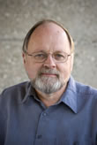 Egill Hauksson合作论文数Geophysics, Division of Geological and Planetary Sciences, California Institute of Technology1John Levesque合作论文数1
 Daniel Roten合作论文数Institute of Geophysics1Yifeng Cui合作论文数1
 Thomas H. Heaton (Thomas Heaton)合作论文数Division of Geological and Planetary Sciences, California Institute of Technology1Doug Given合作论文数1Andreas Plesch合作论文数1
 Edward H. Field合作论文数Southern California Earthquake Center, University of Southern California1
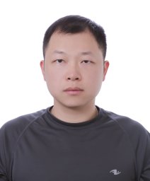 En-Jui Lee合作论文数Department of Geology and Geophysics, University of Wyoming1
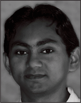 Amit Chourasia合作论文数San Diego Supercomputer Center1
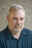 Robert W. Clayton合作论文数Geophysics, Division of Geological and Planetary Sciences, California Institute of Technology1Kwangyoon Lee合作论文数University of California1Kate Hutton (K.Hutton)合作论文数1
 Po Chen合作论文数1
 Dhabaleswar Panda合作论文数Department of Computer Science and Engineering, College of Engineering, The Ohio State University1Lucile M. Jones合作论文数Department of Earth and Planetary Sciences;Massachusetts Institute of Technology;Department of Earth and Planetary Sciences, Massachusetts Institute of Technology1




