Mit dem Forschungsprojekt SmartAQnet wird ein smarter Weg zur raumlichen Bestimmung von Feinstaub untersucht und am Modellstandort Augsburg erprobt. Forschungsansatz ist die Erfassung und Zusammenfuhrung unterschiedlicher Qualitaten von Feinstaubmesswerten mit Fernerkundungsdaten. Feinstaubmesswerte konnen hierbei von Jedermann (z. B. mit Ultra-Low-Cost-Sensoren) bis hin zu offiziellen Messnetzen (mit hochpraziser Messtechnik) in die Datenarchitektur eingespeist werden. Eine neuartige Internet-of-Things-Analyseplattform soll Daten zur Anwendung sowohl fur Planer als auch fur den Burger bieten, welche der nachhaltigen Gesundheitsvorsorge dienen konnen (z. B. App fur eine luftqualitatsbezogene Navigation).
With 69% of the world's population predicted to live in cities by 2050, modification to local climates, in particular Urban Heat Islands (UHIs), have become a well studied phenomenon. However, few studies have considered how horizontal winds modify the spatial pattern in a process named Urban Heat Advection (UHA) and this is most likely due to a lack of highly spatially resolved observational data. For the first time, this study separates the two‐dimensional advection‐induced UHI component, including its pattern and magnitude, from the locally heated UHI component using a unique dataset of urban canopy temperatures from 29 weather stations (3 km resolution) recorded over 20 months in Birmingham, United Kingdom. The results show that the mean contribution of UHA to the warming of areas downwind of the city can be up to 1.2 °C. Using the inverse Normalized Difference Vegetation Index as a proxy for urban fraction, an upwind distance at which the urban fraction has the strongest correlation with UHA was demonstrated to be between 4 and 12 km. Overall, these findings suggest that urban planning and risk management needs to additionally consider UHA. However, more fundamentally, it highlights the importance of careful interpretation of long‐ term meteorological records taken near cities when they are used to assess global warming.
There is a paucity of urban meteorological observations worldwide, hindering progress in understanding and mitigating urban meteorological hazards and extremes. High quality urban datasets are required to monitor the impacts of climatological events, whilst providing data for evaluation of numerical models. The Birmingham Urban Climate Laboratory was established as an exemplar network to meet this demand for urban canopy layer observations. It comprises of an array of 84 wireless air temperature sensors nested within a coarser array of 24 automatic weather stations, with observations available between June 2012 and December 2014. data routinely underwent quality control, follows the ISO 8601 naming format and benefits from extensive site metadata. The data have been used to investigate the structure of the urban heat island in Birmingham and its associated societal and infrastructural impacts. The network is now being repurposed into a testbed for the assessment of crowd-sourced and satellite data, but the original dataset is now available for further analysis, and an open invitation is extended for its academic use.
The Birmingham Urban Climate Laboratory (BUCL) is a near-real-time, high-resolution urban meteorological network (UMN) of automatic weather stations and inexpensive, nonstandard air temperature sensors. The network has recently been implemented with an initial focus on monitoring urban heat, infrastructure, and health applications. A number of UMNs exist worldwide; however, BUCL is novel in its density, the low-cost nature of the sensors, and the use of proprietary Wi-Fi networks. This paper provides an overview of the logistical aspects of implementing a UMN test bed at such a density, including selecting appropriate urban sites; testing and calibrating low-cost, nonstandard equipment; implementing strict quality-assurance/quality-control mechanisms (including metadata); and utilizing preexisting Wi-Fi networks to transmit data. Also included are visualizations of data collected by the network, including data from the July 2013 U.K. heatwave as well as highlighting potential applications. The paper is an open invitation to use the facility as a test bed for evaluating models and/or other nonstandard observation techniques such as those generated via crowdsourcing techniques.
One of the key findings of the recent International Urban Energy Balance Models Comparison Project (PILPSurban) was that models do not capture the magnitude and temporal variability of the latent heat flux relative to observations. This is despite many of the schemes including a vegetation component, which is typically represented by separate vegetation tiles or, in a limited number of models, explicitly within the urban scheme. The inability to reproduce the latent heat flux suggests that many schemes do not accurately represent urban vegetation and do not account for the impact of urban surfaces on vegetation physiology. PILPS-urban did however suggest that there was an advantage in using an integrated vegetation scheme as the range in performances of models using the separate tile was larger. This raises the following question; can we improve model accuracy of urban moisture fluxes by including vegetation explicitly within an urban land surface scheme? To address this question an integrated vegetation scheme is being developed for the Met Office – Reading Urban Surface Exchange Scheme (MORUSES) to explicitly include vegetation in the form of urban trees and natural surfaces (e.g. grass). The new vegetation scheme will be tested within a 2D infinitely long street canyon, with the aim of improving urban weather forecasts and to provide a tool to test the mitigation of extreme heat events through urban greening. This study presents the theory and initial results for the first aspect of the new scheme, radiative exchange within a vegetated urban street canyon. An analytical method was developed and applied to determine the view factors for calculation of the longwave radiation budget between the surfaces within a nonturbulent street canyon, with a range of aspect ratios, containing a representation of an urban street tree. Unlike previous methods for modelling radiative exchange, which often assume that the wall and road surface have the same equilibrium temperature, this work investigates the non-trivial radiative exchange problem of vegetated (tree and grass) and urban surfaces that are likely not to be in equilibrium due to the impact of vegetation physiology on canopy temperature.
URBAN METABOLISM: THE METEOROLOGICAL VIEW Meteorologists are most interested in understanding how energy in the form of radiation and heat influences the urban climate and how this energy is transported, transformed and stored (e.g. in urban building structures). They also are interested in the effects of precipitation on cities, how storm water runoff is changed and how much water is emitted into the atmosphere through evapotranspiration. In addition, they want to know how much cities worldwide contribute to climate change through their emissions to the global carbon cycle. For meteorologists to address the challenges of sustainable cities and urban planning, information on the distribution and flows of energy, water and carbon in typical urban systems have to be known.
A wide range of environmental applications would benefit from a dense network of air temperature observations. However, with limitations of costs, existing siting guidelines, and risk of damage, new methods are required to gain a high-resolution understanding of spatiotemporal patterns of temperature for agricultural and urban meteorological phenomena such as the urban heat island. With the launch of a new generation of low-cost sensors, it is possible to deploy a network to monitor air temperature at finer spatial resolutions. This study investigates the Aginova Sentinel Micro (ASM) sensor with a custom radiation shield (together less than USD$150) that can provide secure near-real-time air temperature data to a server utilizing existing (or user deployed) Wi-Fi networks. This makes it ideally suited for deployment where wireless communications readily exist, notably urban areas. Assessment of the performance of the ASM relative to traceable standards in a water bath and atmospheric chamber show it to have good measurement accuracy with mean errors <+/- 0.22 degrees C between -25 degrees and 30 degrees C, with a time constant in ambient air of 110 +/- 15 s. Subsequent field tests also showed the ASM (in the custom shield) had excellent performance (RMSE = 0.13 degrees C) over a range of meteorological conditions relative to a traceable operational Met Office platinum resistance thermometer. These results indicate that the ASM and radiation shield are more than fit for purpose for dense network deployment in environmental monitoring applications at relatively low cost compared to existing observation techniques.
The Internet of Things literally means ‘things’ (e.g. sensors and other smart devices) which are connected to the internet. Although this may seem insignificant, ‘things’ represent a new, and increasingly, critical infrastructure requiring their own dedicated technological ecosystem. As an industry, Winter Road Maintenance has been adept with coping with technological change, with the various data streams historically managed by bureaus and, more recently, sophisticated decision support systems. However, how well equipped is the industry to cope with the imminent inundation of additional data and information from new devices? This is a now inevitable challenge as the costs of sensors, communications and power dramatically start to fall. Indeed, since 2008, the number of ‘things’ has outnumbered users online and this trend will continue as our cities and roads become smarter and increasingly automated – it is estimated that there will be 20 billion things online by 2020. This paper describes the establishment of a winter maintenance demonstration corridor and corresponding IoT hub within a wider meteorological testbed in Birmingham, UK.
With the growing number and significance of urban meteorological networks (UMNs) across the world, it is becoming critical to establish a standard metadata protocol. Indeed, a review of existing UMNs indicate large variations in the quality, quantity, and availability of metadata containing technical information (i.e., equipment, communication methods) and network practices (i.e., quality assurance/quality control and data management procedures). Without such metadata, the utility of UMNs is greatly compromised. There is a need to bring together the currently disparate sets of guidelines to ensure informed and well-documented future deployments. This should significantly improve the quality, and therefore the applicability, of the high-resolution data available from such networks. Here, the first metadata protocol for UMNs is proposed, drawing on current recommendations for urban climate stations and identified best practice in existing networks.
The heterogeneous nature of urban environments means that atmospheric research ideally requires a dense network of sensors to adequately resolve the local climate. With recent advances in sensor technology, a number of urban meteorological networks now exist with a range of research or operational objectives. This article reviews and assesses the current status of urban meteorological networks, by examining the fundamental scientific and logistical issues related to these networks. The article concludes by making recommendations for future deployments based on the challenges encountered by existing networks, including the need for better reporting and documentation of network characteristics, standardized approaches and guidelines, along with the need to overcome financial barriers via collaborative relationships in order to establish the long-term urban networks essential for advancing urban climate research. Copyright (c) 2013 Royal Meteorological Society
Urban land surface schemes have been developed to model the distinct features of the urban surface and the associated energy exchange processes. These models have been developed for a range of purposes and make different assumptions related to the inclusion and representation of the relevant processes. Here, the first results of Phase 2 from an international comparison project to evaluate 32 urban land surface schemes are presented. This is the first large‐scale systematic evaluation of these models. In four stages, participants were given increasingly detailed information about an urban site for which urban fluxes were directly observed. At each stage, each group returned their models' calculated surface energy balance fluxes. Wide variations are evident in the performance of the models for individual fluxes. No individual model performs best for all fluxes. Providing additional information about the surface generally results in better performance. However, there is clear evidence that poor choice of parameter values can cause a large drop in performance for models that otherwise perform well. As many models do not perform well across all fluxes, there is need for caution in their application, and users should be aware of the implications for applications and decision making. Copyright © 2010 Royal Meteorological Society
Recent developments to the Local-scale Urban Meteorological Parameterization Scheme (LUMPS), a simple model able to simulate the urban energy balance, are presented. The major development is the coupling of LUMPS to the Net All-Wave Radiation Parameterization (NARP). Other enhancements include that the model now accounts for the changing availability of water at the surface, seasonal variations of active vegetation, and the anthropogenic heat flux, while maintaining the need for only commonly available meteorological observations and basic surface characteristics. The incoming component of the longwave radiation (L down arrow) in NARP is improved through a simple relation derived using cloud cover observations from a ceilometer collected in central London, England. The new L down arrow formulation is evaluated with two independent multiyear datasets (Lodz, Poland, and Baltimore, Maryland) and compared with alternatives that include the original NARP and a simpler one using the National Climatic Data Center cloud observation database as input. The performance for the surface energy balance fluxes is assessed using a 2-yr dataset (Lodz). Results have an overall RMSE <34 W m(-2) for all surface energy balance fluxes over the 2-yr period when using L down arrow as forcing, and RMSE < 43 W m(-2) for all seasons in 2002 with all other options implemented to model L down arrow.
A large number of urban surface energy balance models now exist with different assumptions about the important features of the surface and exchange processes that need to be incorporated. To date, no comparison of these models has been conducted; in contrast, models for natural surfaces have been compared extensively as part of the Project for Intercomparison of Land-surface Parameterization Schemes. Here, the methods and first results from an extensive international comparison of 33 models are presented. The aim of the comparison overall is to understand the complexity required to model energy and water exchanges in urban areas. The degree of complexity included in the models is outlined and impacts on model performance are discussed. During the comparison there have been significant developments in the models with resulting improvements in performance (root-mean-square error falling by up to two-thirds). Evaluation is based on a dataset containing net all-wave radiation, sensible heat, and latent heat flux observations for an industrial area in Vancouver, British Columbia, Canada. The aim of the comparison is twofold: to identify those modeling approaches that minimize the errors in the simulated fluxes of the urban energy balance and to determine the degree of model complexity required for accurate simulations. There is evidence that some classes of models perform better for individual fluxes but no model performs best or worst for all fluxes. In general, the simpler models perform as well as the more complex models based on all statistical measures. Generally the schemes have best overall capability to model net all-wave radiation and least capability to model latent heat flux.
 Sue Grimmond合作论文数Department of Meteorology, School of Mathematical & Physical Sciences, University of Reading13
 Catherine Louise Muller合作论文数Sch Geog Earth & Environm Sci, Univ Birmingham9
 Lee Chapman合作论文数School of Geography, Earth and Environmental Sciences, College of Life and Environmental Sciences, University of Birmingham9
 Xiaoming Cai合作论文数School of Geography, Earth and Environmental Sciences, University of Birmingham8
 Till Riedel合作论文数Karlsruhe Institute of Technology5
 Stefan Emeis合作论文数Institute of Meteorology and Climate Research, Atmospheric Environmental Research (IMK-IFU), Karlsruhe Institute of Technology5
 Matthias Budde合作论文数Disy Informationssysteme GmbH5
 Elliott Warren合作论文数4
 Andreas Philipp合作论文数university of augsburg4
 Klaus Schaefer合作论文数4
 Stefan Hinterreiter合作论文数3
 Michael Beigl合作论文数Institute of Telematics, Karlsruhe Institute of Technology;Smart Data Solution Center Baden-Wuerttemberg, Institute of Technology3
 Gerard Johannes Steeneveld (Gert Jan Steeneveld)合作论文数Division of Meteorology and Air Quality, Department of Environmental Sciences, Wageningen University3
 S. I. Bohnenstengel合作论文数Department of Meteorology, University of Reading3
 Josef Cyrys合作论文数Institute of Epidemiology, Helmholtz Zentrum München Deutsches Forschungszentrum für Gesundheit und Umwelt3
 Jurgen Schnelle-Kreis合作论文数3
 Janet F Barlow合作论文数Department of Meteorology;University of Reading;Department of Meteorology, University of Reading3
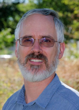 Valéry Masson合作论文数Centre National de Recherches Meteorologiques, Meteo France3
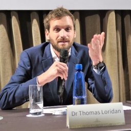 Thomas Loridan合作论文数Earth Sciences Department, Barcelona Supercomputing Center – Centro Nacional de Supercomputación (BSC-CNS),3A. Dandou合作论文数2Johannes Riesterer合作论文数2Marcus Hank合作论文数2Johanna Redelstein合作论文数2Thomas Gratza合作论文数2
 Sang-Hyun Lee合作论文数2Volker Ziegler合作论文数2
 Ning Zhang (张宁)合作论文数School of Atmospheric Sciences, Nanjing University2Hiroaki Kondo合作论文数2T. Kawai合作论文数2
 Fei Chen (陈飞)合作论文数Division of Environment and Sustainability, The Hong Kong University of Science and Technology2Young-Hee Ryu合作论文数School of Earth;Environmental Sciences;Seoul National University;School of Earth, Seoul National University2
 G. Pigeon合作论文数CNRM Centre National de Recherches Météorologiques(CNRM),Toulouse,France2
 Marcel Köpke合作论文数TECO, Karlsruhe Institute of Technology2
 A. Porson合作论文数MetOffice@Reading, Department of Meteorology, University of Reading, Reading, UK2
 James A. Voogt合作论文数Department of Geography;University of Western Ontario;Department of Geography, University of Western Ontario2
 Rafiq Hamdi合作论文数Research Department, Royal Meteorological Institute of Belgium2Roland Vogt合作论文数Institute of Meteorology, Climatology and Remote Sensing, University of Basel2
 Erik Lundtang Petersen合作论文数technical university of denmark2Francisco Salamanca合作论文数Department of Environment;Center for Research on Energy;Environment and Technology;Department of Environment|Center for Research on Energy|Environment and Technology2
 Jong-Jin Baik合作论文数School of Earth and Environmental Sciences, Seoul National University2
 Stephen E. Belcher (Stephen Belcher)合作论文数Met Office2
 Emma Ferranti合作论文数School of Engineering, College of Engineering and Physical Sciences, University of Birmingham2Yoichi Kawamoto合作论文数Graduate School of Engineering;University of Tokyo;Graduate School of Engineering, University of Tokyo2
 Matthew Blackett合作论文数Environmental Monitoring and Modelling Research Group, King's College London2
 Keith Oleson合作论文数Climate and Global Dynamics Division, National Center for Atmospheric Research2
 Shiguang Miao (苗世光)合作论文数Institute of Urban Meteorology, China Meteorological Administration, Beijing2B. Offerle合作论文数Göteborg University;,University of Houston2
 Thomas Smith合作论文数Department of Geography and Environment, London School of Economics and Political Science2
 Eric Scott Krayenhoff合作论文数Department of Geography, University of British Columbia2




