Unambiguous identification of past episodes of ice sheet thinning below the modern surface and grounding line retreat inboard of present requires recovery and exposure dating of subglacial bedrock. Such efforts are needed to understand the significance and potential future reversibility of ongoing and projected change in Antarctica. Here we evaluate the suitability for subglacial bedrock drilling of sites in the Hudson Mountains, which are located in the Amundsen Sea sector of West Antarctica. We use an ice sheet model and field data – geological observations, glaciological observations and bedrock samples from nunataks, and ground-penetrating radar from subglacial ridges – to rate each site against four key criteria: (i) presence of ridges extending below the ice sheet, (ii) likelihood of increased exposure of those ridges if the grounding line was inboard of present, (iii) suitability of bedrock for drilling and geochemical analysis, and (iv) accessibility for aircraft and drilling operations. Our results demonstrate that although no site in the Hudson Mountains is perfect for this study when assessed against all criteria, the accessibility, N–S orientation and basaltic bedrock lithology of Winkie Nunatak's southernmost ridge (74.86° S, 99.77° W) make it a feasible site both for drilling and subsequent cosmogenic nuclide analysis. Furthermore, the ridge is strewn with glacial erratics at all elevations, providing valuable constraints on its early Holocene deglacial history. Based on our experiences during this study, we conclude with a series of recommendations for assessing site suitability for future bedrock drilling campaigns. We emphasise the importance of consulting a range of expertise prior to drilling and ensuring that sufficient field reconnaissance is undertaken (including obtaining detailed grids of radar survey data and bedrock samples).
There is currently a debate about the timing and drivers of former glacier behaviour and climate change in the tropical Andes. Using 10Be dating we determined the ages of 21 boulders on moraines in the Santa Cruz Valley, Peru (∼10°S, altitudes ~ 4100 to ~ 4300 m a.s.l.). Former glacier extent is marked by a suite of nested outer lateral and terminal moraines. These moraines are dated to 11.1 ka, 11.6 ka, 11.8 ka and 12.0 ka, falling within the Younger Dryas Chronozone (YDC; ∼12.9–11.6 ka). Nine 10Be samples from the Lake Arhuaycocha catchment document a period of glacier thinning and lateral contraction between 12.0 ka and 11.8 ka. Reconstructed glacier Equilibrium Line Altitudes (ELA) at 11.0 to 12.0 ka with an area–altitude balance ratio (AABR) of 1.00-2.50 are between 4675 and 4835 m a.s.l. for the Arhuaycocha glacier, between 4692 and 4832 m a.s.l. for the Taullicocha glacier and between 4800 and 4940 m a.s.l. for the Artizon glacier. These values represent a depression of 300–400 m in elevation compared to contemporary values for the ELA. We infer that the glacier advances at this time were driven by increased precipitation and that these changes were most likely a response to seasonal changes in the position of the ITCZ.
Cosmogenic nuclide exposure dating is an important technique for reconstructing glacial histories. Many of the most commonly applied cosmogenic nuclides are extracted from the mineral quartz, meaning sampling of felsic (silica-rich) rock is often preferred to sampling of mafic (silica-poor) rock for exposure dating studies. Fieldwork in remote regions such as Antarctica is subject to time constraints and considerable logistical challenges, making efficient sample recovery critical to successful research efforts. Remote sensing offers an effective way to map the geology of large areas prior to fieldwork and expedite the sampling process. In this study, we assess the viability of multispectral remote sensing to distinguish felsic from mafic rock outcrops at visible-near infrared (VNIR) and shortwave infrared (SWIR) wavelengths using both the Advanced Spaceborne Thermal Emission and Reflection Radiometer (ASTER) and very high-resolution Worldview-3 (WV-3) imagery. We applied a combination of spectral mapping and ground truth from spectral measurements of 17 rock samples from Mount Murphy in the Amundsen Sea sector of West Antarctica. Using this approach, we identified four dominant rock types which we used as a basis for felsic–mafic differentiation: felsic granites and gneisses, and mafic basalts and fragmental hydrovolcanic rocks. Supervised classification results indicate WV-3 performs well at differentiating felsic and mafic rock types and that ASTER, while coarser, could also achieve satisfactory results and be used in concert with more targeted WV-3 image acquisitions. Finally, we present a revised felsic–mafic geological map for Mt Murphy. Overall, our results highlight the potential of spectral mapping for preliminary reconnaissance when planning future cosmogenic nuclide sampling campaigns in remote, unvisited areas of the polar regions.
Rock outcrops protruding above the ice surface in Antarctica (nunataks) can provide direct geologic evidence for past ice sheet fluctuations through the measurement of concentrations of cosmogenic nuclides that accumulate in their surfaces once the rock is exposed. Felsic lithologies, which are typically pale in colour and dominated by quartz, feldspars, and micas, are suitable for exposure age dating since quartz is the often-preferred target mineral for extraction of the rare cosmogenic isotopes which make deglacial reconstructions possible. The geology of rock outcrops in Antarctica are, however, often sparsely mapped and many exposures are challenging to access due to both their remoteness and the extreme conditions typically encountered on the continent. Satellite based spectral mapping offers an effective way to characterise the geology of large areas of exposed rock rapidly and safely in regions where it is logistically very challenging and expensive to conduct fieldwork. Remote sensing therefore offers a valuable method for preliminary characterisation of an area’s suitability for eventual targeted retrieval of cosmogenic nuclide samples. Previous studies found that the Thermal Infra-Red (TIR) sensor onboard the Advanced Spaceborne Thermal Emission and Reflection Radiometer (ASTER) is very effective at discriminating rock types by their silica content, but spectral mapping of smaller felsic rock outcrops in Antarctica has been constrained by its low spatial resolution (90 m). Here we assess the potential of multispectral remote sensing using both ASTER and very high-resolution Worldview-3 (WV-3) imagery to distinguish felsic from mafic rock outcrops at visible-near infrared (VNIR) and shortwave infrared (SWIR) wavelengths. At Mount Murphy, a remote site in West Antarctica more than 1,600 kilometres from both the US Antarctic Program’s McMurdo Station and the British Antarctic Survey’s Rothera Research Station, we identify four dominant rock types from our spectral mapping: granites, gneisses, basalt and fragmental hydrovolcanic rocks (hyaloclastite). Image derived spectral profiles of these four rock types were used as input for spectral classification and lithological mapping of the Mount Murphy site. Supervised classification results indicate that WV-3 performs well at differentiating felsic from mafic rock types and that ASTER imagery, while coarser in resolution, can also achieve satisfactory results, and could therefore be used in concert with more targeted WV-3 image acquisitions. We also demonstrate that separation of mafic (fragmental) hydrovolcanic and basalt rock types can be achieved at VNIR-SWIR wavelengths, a result that will be useful for future spectral mapping of volcanic rocks on other planets. We used spectral mapping and supervised classification results to produce a new geologic map of Mt Murphy. Overall, our results demonstrate the potential of spectral mapping and classification using WV-3 and ASTER datasets to identify and characterise suitable sites for future cosmogenic nuclide sampling campaigns.
Following rapid ice thinning in the mid-Holocene, Pope Glacier (adjacent to Thwaites Glacier in the Amundsen Sea sector) was at least 30-35 m thinner than present for at least 3 kyr in the mid- to Late Holocene. The timing of the end of this ice lowstand and subsequent rethickening of ice to near its present configuration is poorly constrained. We present five paired 10Be and 26Al cosmogenic nuclide exposure ages that provide constraints on the timing of this ice sheet readvance. The ages are sourced from samples collected from a moraine
The Oregon Cascades had 35 named glaciers on seven volcanos in the 1980s, with 34 of those glaciers remaining by 2000. Here we document the glaciers that fall into the Global Glacier Casualty List categories based on five years of field observations of these 34 glaciers. Five glaciers have disappeared, four have almost disappeared, and eight are critically endangered. Thus, half of the Oregon Cascade named glaciers have disappeared, almost disappeared, or reached critically endangered status in the 21st century. Between 1980 and 2024, the May-October ablation season of the Oregon Cascade region warmed at ~0.3°C per decade, with a 2020-24 mean temperature ~1.7°C warmer than the 1975-84 mean. In contrast, there was no significant trend in November-April accumulation season precipitation. Given the significant rise in melt-season temperature, we attribute ongoing glacier disappearance in the Oregon Cascades to the warming climate.
The Mojave section of the San Andreas fault is the closest section to the megacity of greater Los Angeles. A major issue for the population is that the life-threatening hazard estimate of a future rare, large earthquake on this fault section is highly uncertain and untested at timescales and ground motions beyond limited historical recordings. Of relevance to this issue is that the nearby precariously balanced rocks at Lovejoy Buttes have survived these ground motions, despite the past tens of thousands of years of San Andreas fault earthquakes. Therefore, the fragility and age of these precariously balanced rocks provide crucial ground-motion constraints over the timescales of rare, large San Andreas fault earthquakes. We rigorously validate and update an earthquake hazard model for the Mojave section of the San Andreas fault using the independent observational data of precariously balanced rock survival at Lovejoy Buttes. The joint probability of survival of all five studied precariously balanced rocks was used to validate the hazard estimates and reweight the estimates using new Bayesian updating methods to deliver an improved, precariously balanced rock-informed earthquake hazard estimate. At an annual frequency of exceedance of 1 x 10(-4) yr(-1), equivalent to a mean return period of 10,000 yr, the precariously balanced rock survival data significantly reduced the mean hazard ground-motion estimate by 65% and the 5th-95th fractile uncertainty range by 72%. The magnitude of this inconsistency provides striking evidence for the need to reevaluate both the source and ground-motion components of our earthquake hazard model for the southern San Andreas fault.
Abstract. Unambiguous identification of past episodes of ice sheet thinning below the modern surface and grounding line retreat inboard of present requires recovery and exposure dating of subglacial bedrock. Such efforts are needed to understand the significance and potential future reversibility of ongoing and projected change in Antarctica. Here we evaluate the suitability for subglacial bedrock recovery drilling of sites in the Hudson Mountains, in the Amundsen Sea sector of West Antarctica. We use an ice sheet model and field data − geological observations, glaciological observations and bedrock samples from nunataks, and ground-penetrating radar from subglacial ridges − to rate each site against four key criteria: i) presence of ridges extending below the ice sheet, ii) likelihood of increased exposure of those ridges if the grounding line was inboard of present, iii) suitability of bedrock for drilling and geochemical analysis, and iv) accessibility for aircraft and drilling operations. Our results demonstrate that although no site in the Hudson Mountains is perfect for this study when assessed against all criteria, Winkie Nunatak (74.86° S / 99.77° W) is suitable. The accessibility, N-S orientation and basaltic bedrock lithology of its southernmost ridge make the nunatak a feasible site both for drilling and subsequent cosmogenic nuclide analysis. Furthermore, it is strewn with erratic cobbles at all elevations, providing constraints on the earlier Holocene deglacial history and time at which the ice sheet surface reached its present elevation. Such information is necessary for determining the maximum duration over which any Holocene grounding line readvance could have occurred.
Abstract. Cosmogenic-nuclide surface exposure ages provide empirical data for testing the accuracy of models simulating the timing and pace of ice sheet response to a warming climate. Increasing emphasis is being placed on obtaining exposure ages that both accurately constrain Holocene deglaciation and are precise enough to capture ice sheet change at the sub-millennial scale. However, the accuracy of Holocene deglacial chronologies can be compromised by nuclide inheritance when measuring longer-lived nuclides, such as 10Be. Short-lived in situ-produced 14C is unique because it is largely insensitive to nuclide inheritance pre-dating the last glacial maximum (LGM), and when combined with longer-lived nuclides can be used to constrain complex ice sheet histories over Holocene timescales. Here, we present new in situ 14C exposure ages from Mt Murphy, West Antarctica. Many of the new in situ 14C ages are inconsistent with published 10Be ages, suggesting samples collected from the same elevation above the modern ice were exposed at different times. We investigate potential explanations for such conflicting exposure histories by analysing paired 14C-10Be data of Holocene age presently archived in the informal cosmogenic-nuclide exposure-age database (ICE-D, https://version2.ice-d.org/). Our analysis reveal that neither geologic sources of uncertainty due to variations in geologic setting nor modelled scenarios of subsurface nuclide production explain conflicting paired 14C-10Be exposure ages observed at Mt Murphy. Furthermore, we observe that repeat in situ 14C concentrations measured in 15 of 31 samples do not replicate within their nominal 6 % (2σ) analytical uncertainty and identify ~ 2 kyr of excess unquantified scatter from Mt Murphy in situ 14C exposure ages. Taken together, these results suggest analytical uncertainty for in situ 14C measurements may currently be underestimated. We provide recommendations for improving measurement precision that will benefit future Holocene deglaciation studies including analysis and publication of more replicate measurements, and the continuation of efforts to quantify and minimise sources of scatter in blank measurements.
Abstract. As part of the southern Cascades, Mt. Hood is the tallest and most glaciated peak in Oregon, U.S.A. Despite alpine glaciers being one the clearest indicators of human-caused climate change, the 21st century behavior of glaciers on Mt. Hood has not been directly documented. Here we directly measure changes in Mt. Hood’s glacier extents from 2003 to 2023 and find dramatic retreat of all glaciers, with one glacier disappearing, another two nearing this status, and a third retreating towards this status. The seven largest glaciers on the volcano lost ~2.8 km2, or ~40 % of their area in the 21st century. Comparison to historic records of glacier area back to 1907 shows that this 21st-century retreat is unprecedented with respect to the previous century and has outpaced modeled glacier changes. The rate of retreat over the last 23 years is more than double the fastest rate documented in the last century from 1907 to 1946. We demonstrate that this century-scale retreat strongly correlates with regional 30-year-average climate warming of ~1.1 ºC since the early 1900s, but not with regional changes in precipitation. We conclude that Mt. Hood’s glaciers are retreating in response to a warming climate and that this recession has accelerated in the 21st century, with attendant consequences for water resources.
AbstractConstraining past West Antarctic Ice Sheet (WAIS) change helps validate numerical models simulating future ice sheet dynamics. Following rapid deglaciation during the mid‐Holocene, ice near Thwaites Glacier was ∼35 m thinner than present; however, the timing of ice regrowth to its present configuration remains unknown. To fill this knowledge gap, we present cosmogenic nuclide exposure ages of cobbles from the surface of a moraine situated between Thwaites and Pope glaciers. We infer that the moraine formed and stabilized in the Late Holocene (∼1.4 ka) when a small glacier thickened. We also present a novel reconstruction of WAIS volume constrained by sea‐level data, which demonstrates that moraine formation coincided with a large‐scale WAIS readvance. Our new geologic constraints will help inform models of the solid Earth response to surface mass loading, improving our understanding of ice sheet dynamics in a vulnerable part of WAIS.
As part of the southern Cascades, Mt. Hood is the tallest and most glacierized peak in Oregon, USA. Despite alpine glaciers being one the clearest indicators of human-caused climate change, the 21st century behavior of glaciers on Mt. Hood has not been directly documented at the ground level. Here we directly measure changes in the extents of Mt. Hood's glaciers from 2003 to 2023 and find dramatic retreat of all glaciers, with one glacier ceasing to flow (joining another glacier that ceased flowing before 2003) and another three glaciers retreating towards this status. By 2023, Mt. Hood glaciers had lost similar to 17 % of their 2015-2016 area and similar to 39 % of their 1981 area. The rate of area loss from 2015-2016 to 2023 (similar to 2.10 % yr-1) was similar to 2.6 times faster than the rate from 1981 to 2015-2016 (similar to 0.81 % yr-1). The seven largest glaciers on the volcano lost similar to 25 % of their area between 2000 and 2023. Comparison to historic records of glacier area back to 1907 shows that this 21st century retreat is unprecedented relative to the previous century. The rate of area loss over the last 23 years (similar to 1.07 % yr-1) was similar to 1.9 times faster than the fastest rate documented in the last century from 1907 to 1946 (similar to 0.56 % yr-1) and similar to 3.5 times faster than the 20th century average (similar to 0.31 % yr-1). This unprecedented rate of retreat corresponds to regional summer warmth reaching 1.7-1.8 degrees C (2013-2023 average) relative to the early 1900s, but not with regional changes in winter precipitation. We conclude that Mt. Hood's glaciers are retreating in response to a warming climate and that this recession has accelerated in the 21st century.
During the last deglaciation, collapse of the saddle between the North American Cordilleran and Laurentide ice sheets led to rapid ice-sheet mass loss and separation, with meltwater discharge contributing to deglacial sea-level rise. We directly date ice-sheet separation at the end of the saddle collapse using 64 Be-10 exposure ages along an similar to 1200-km transect of the ice-sheet suture zone. Collapse began in the south by 15.4 +/- 0.4 ka and ended by 13.8 +/- 0.1 ka at similar to 56 degrees N. Ice-sheet model simulations consistent with the Be-10 ages find that the saddle collapse contributed 6.2-7.2 m to global mean sea-level rise from similar to 15.5 ka to similar to 14.0 ka, or approximately one third of global mean sea-level rise over this period. We determine 3.1-3.6 m of the saddle collapse meltwater was released during Meltwater Pulse 1A similar to 14.6-14.3 ka, constituting 20-40% of this meltwater pulse's volume. Because the separation of the Cordilleran and Laurentide ice sheets occurred over 1-2 millennia, the associated release of meltwater during the saddle collapse supplied a smaller contribution to the magnitude of Meltwater Pulse 1A than has been recently proposed.
Large-scale geological structures have controlled the long-term development of the bed and thus the flow of the West Antarctic Ice Sheet (WAIS). However, complete ice cover has obscured the age and exact positions of faults and geological boundaries beneath Thwaites Glacier and Pine Island Glacier, two major WAIS outlets in the Amundsen Sea sector. Here, we characterize the only rock outcrop between these two glaciers, which was exposed by the retreat of slow-flowing coastal ice in the early 2010s to form the new Sif Island. The island comprises granite, zircon U-Pb dated to similar to 177-174 Ma and characterized by initial epsilon(Nd), Sr-87/Sr-86 and epsilon(Hf) isotope compositions of -2.3, 0.7061 and -1.3, respectively. These characteristics resemble Thurston Island/Antarctic Peninsula crustal block rocks, strongly suggesting that the Sif Island granite belongs to this province and placing the crustal block's boundary with the Marie Byrd Land province under Thwaites Glacier or its eastern shear margin. Low-temperature thermochronological data reveal that the granite underwent rapid cooling following emplacement, rapidly cooled again at similar to 100-90 Ma and then remained close to the Earth's surface until present. These data help date vertical displacement across the major tectonic structure beneath Pine Island Glacier to the Late Cretaceous.
Abstract. Cosmogenic-nuclide concentrations in subglacial bedrock cores show that the West Antarctic Ice Sheet (WAIS) at a site between Thwaites and Pope glaciers was at least 35 m thinner than present in the past several thousand years and then subsequently thickened. This is important because of concern that present thinning and grounding line retreat at these and nearby glaciers in the Amundsen Sea Embayment may irreversibly lead to deglaciation of significant portions of the WAIS, with decimeter- to meter-scale sea level rise within decades to centuries. A past episode of ice sheet thinning that took place in a similar, although not identical, climate was not irreversible. We propose that the past thinning–thickening cycle was due to a glacioisostatic rebound feedback, similar to that invoked as a possible stabilizing mechanism for current grounding line retreat, in which isostatic uplift caused by Early Holocene thinning led to relative sea level fall favoring grounding line advance.
We welcome the matters arising commentary by Dickson et al. in response to our paper "Sea-level rise will likely accelerate rock coast cliff retreat rates" published in Nature Communications in November 2022 1 .In their commentary, Dickson et al. highlight that the exploratory model that we used represents rock coast processes in a highly abstract manner.Further, they emphasise that the complex interaction of hydrodynamics, geology, and geomorphic processes is likely to mean that rock coast response to anthropogenic sea-level rise will not be consistent or uniform across highly varied environments.We agree with their observations, but emphasise that our results highlight the potential for rock coasts to be more sensitive to sea-level rise than previously identified, which motivates continued research endeavours to further our understanding of the complexities of rock coast erosion.The exploratory model used in our study was developed by Matsumoto et al. 2 and coupled with a cosmogenic radionuclide production model, in collaboration, by Hurst et al. 3 .It is the first processbased model used to interpret cosmogenic radionuclide concentrations at the coast and quantify long-term coastal cliff retreat rates.Optimisation of this process-based model has improved our understanding of rock coast behaviour by quantifying transient cliff retreat rates over millennial timescales using evidence from multiple empirical datasets 1,4,5 .Despite the advances made with the application of this model, Dickson et al. have highlighted the highly abstracted process representation required by the model, which is appropriate for exploratory modelling of rock coast behaviour, but suggest the model capability is limited at site-specific spatial scales and over decadal time scales.Indeed, we have used this model beyond its initial exploratory intentions by applying it to try and mirror the topography and cosmogenic radionuclide concentrations at specific coastal locations.The timescale over which cosmogenic radionuclides accumulate appreciable concentrations in a rock coast setting is centuries to millennia, and a process-based model of the topographic development of a cliff and shore platform needs to be highly abstract in order to be tractable over these timescales.The commentary by Dickson et al. highlights gaps in our ability to represent hydrodynamic and morphodynamic processes across the range of timescales needed to anticipate rock coast response to sea-level rise.As such, Dickson et al. have valid
All the fragility, fragility age, and hazard validation results in color for each precariously balanced rock, and all the input and output cosmogenic-nuclide exposure dating data.
Pine Island Glacier, West Antarctica, is the largest Antarctic contributor to global sealevel rise and is vulnerable to rapid retreat, yet our knowledge of its deglacial history since the Last Glacial Maximum is based largely on marine sediments that record a retreat history ending in the early Holocene. Using a suite of 10Be exposure ages from onshore glacial deposits directly adjacent to Pine Island Glacier, we show that this major glacier thinned rapidly in the early to mid-Holocene. Our results indicate that Pine Island Glacier was at least 690 m thicker than present prior to ca. 8 ka. We infer that the rapid thinning detected at the site farthest downstream records the arrival and stabilization of the retreating grounding line at that site by 8-6 ka. By combining our exposure ages and the marine record, we extend knowledge of Pine Island Glacier retreat both spatially and temporally: to 50 km from the modern grounding line and to the mid-Holocene, providing a data set that is important for future numerical ice-sheet model validation.
The white chalk cliffs on the south coast of England are one of the most iconic coastlines in the world. Rock coasts located in a weak lithology, such as chalk, are likely to be most vulnerable to climate-change-triggered accelerations in cliff retreat rates. In order to make future forecasts of cliff retreat rates as a response to climate change, we need to look beyond individual erosion events to quantify the long-term trends in cliff retreat rates. Exposure dating of shore platforms using cosmogenic radionuclide analysis and numerical modelling allows us to study past cliff retreat rates across the Late Holocene for these chalk coastlines. Here, we conduct a multi-objective optimisation of a coastal evolution model to both high-precision topographic data and Be-10 concentrations at four chalk rock coast sites to reveal a link between cliff retreat rates and the rate of sea-level rise. Furthermore, our results strengthen evidence for a recent acceleration in cliff retreat rates at the chalk cliffs on the south coast of England. Our optimised model results suggest that the relatively rapid historical cliff retreat rates observed at these sites spanning the last 150 years last occurred between 5300 and 6800 years ago when the rate of relative sea-level rise was a factor of 5-9 times more rapid than during the recent observable record. However, results for these chalk sites also indicate that current process-based models of rock coast development are overlooking key processes that were not previously identified at sandstone rock coast sites. Interpretation of results suggest that beaches, cliff debris and heterogenous lithology play an important but poorly understood role in the long-term evolution of these chalk rock coast sites. Despite these limitations, our results reveal significant differences in intertidal weathering rates between sandstone and chalk rock coast sites, which helps to inform the long-standing debate of "wave versus weathering" as the primary control on shore platform development. At the sandstone sites, subaerial weathering has been negligible during the Holocene. In contrast, for the chalk sites, intertidal weathering plays an active role in the long-term development of the shore platform and cliff system. Overall, our results demonstrate how an abstract, process-based model, when optimised with a rigorous optimisation routine, can not only capture long-term trends in transient cliff retreat rates but also distinguish key erosion processes active in millennial-scale rock coast evolution at real-world sites with contrasting rock types.
Significance The Ice-Free Corridor (IFC) has long played a key role in hypotheses about the peopling of the Americas. Earlier assessments of its age suggested that the IFC was available for a Clovis-first migration, but subsequent developments now suggest a pre-Clovis occupation of the Americas that occurred before the opening of the IFC, thus supporting a Pacific coastal migration route instead. However, large uncertainties in existing ages from the IFC cannot preclude its availability as a route for the first migrations. Resolving this debate over migration route is important for addressing the questions of when and how the first Americans arrived. We report cosmogenic nuclide exposure ages that show that the final opening of the IFC occurred well after pre-Clovis occupation.
 Paul Bierman合作论文数Rubenstein School of Environment and Natural Resources, The University of Vermont74
 Klaus M. Wilcken合作论文数Scottish Universities Environmental Research Centre31
 Robert Finkel合作论文数Center for Accelerator Mass Spectrometry, Lawrence Livermore National Laboratory;Earth and Planetary Science Department, University of California, Berkeley29
 Lee B. Corbett合作论文数20
 Greg Balco合作论文数Berkeley Geochronology Center19
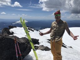 Anders E. Carlson合作论文数Department of Geoscience and Center for Climatic Research, University of Wisconsin-Madison15Joanne S. Johnson合作论文数British Antarctic Survey, Natural Environment Research Council15
 Eric Portenga合作论文数School of Geographical and Earth Sciences, University of Glasgow14
 Hurst Martin D合作论文数School of Geosciences, University of Edinburgh13
 Marc William Caffee合作论文数Department of Physics and Astronomy, Purdue University13Thomas K. Rockwell合作论文数Department of Geological Sciences;San Diego State University11Veronica Sosa Gonzalez合作论文数9
 Keir Nichols合作论文数Dept Earth & Environm Sci, Tulane Univ9
 Joerg M. Schaefer合作论文数Geochemistry, Lamont-Doherty Earth Observatory9S.P.H.T. Freeman合作论文数9
 John Woodward合作论文数Biotechnology Unit, The University of Leeds9
 Ryan A Venturelli合作论文数Dept Geol & Geol Engn, Colorado Sch Mines8
 Keith Fifield合作论文数Department of Nuclear Physics, Research School of Physics, College of Science, The Australian National University8
 Alexander Whittaker合作论文数Department of Earth Science and Engineering, Faculty of Engineering, Imperial College London8Brent M. Goehring合作论文数Geochemistry, Lamont-Doherty Earth Observatory8Devin McPhillips合作论文数7
 kelsey winsor合作论文数Sch Earth & Sustainabil, No Arizona Univ7
 Yarrow Axford合作论文数Department of Earth and Planetary Sciences, Weinberg College of Arts and Sciences, Northwestern University7
 Doug Burbank合作论文数Department of Earth Science, University of California, Santa Barbara7
 Colin Amos合作论文数Department of Earth Science;University of California , Santa Barbara;Department of Earth Science, University of California , Santa Barbara7
 Joseph A. Graly合作论文数Department of Geology, University of Vermont7Brenda Hall合作论文数Department of Earth and Climate Sciences, School of Earth and Climate Sciences, University of Maine;Climate Change Institute, University of Maine7Benjamin D. DeJong合作论文数6Alexander J. Seal合作论文数6Thomas B. Neilson合作论文数6
 Gareth Roberts合作论文数Department of Earth Science and Engineering, Faculty of Engineering, Imperial College London6
 Amanda Henck Schmidt合作论文数Department of Geology, Oberlin College6Thomas a Brown合作论文数6
 Ari Matmon合作论文数The Institute of Earth Sciences, Hebrew University of Jerusalem6
 William Amidon合作论文数Department of Geology, Middlebury College6
 William B. Ouimet合作论文数Department of Geology, Amherst College6
 Didier L Bourles合作论文数5
 Jonathan Adams合作论文数5Jennifer R. Shadrick合作论文数5
 Anna H. Rood合作论文数5
 Seth W Campbell合作论文数Sch Earth & Climate Sci, Univ Maine5thomas e woodruff合作论文数Purdue Univ, PRIME Lab, W Lafayette, IN 47907 USA5Stephen Tims合作论文数Department of Nuclear Physics, Research School of Physics, College of Science, The Australian National University5
 Alex Hughes合作论文数Institut de Physique du Globe de Paris5
 Eric Kirby合作论文数Department of Earth, Marine and Environmental Sciences, College of Arts and Sciences, The University of North Carolina at Chapel Hill5
 David J. A. Barrell合作论文数GNS Science5Lucas J. Reusser合作论文数5
 Cathy J. Busby合作论文数Department of Earth Science;University of California , Santa Barbara;Department of Earth Science, University of California , Santa Barbara5
 Jason Briner合作论文数Department of Geology, College of Arts and Sciences, University at Buffalo5




