Every year, millions of hectares burn across Siberia, driven by a combination of warming temperatures, regional drought and human-caused ignitions. Dendrochronology provides a long-term context to evaluate recent trends in fire activity and interpret the relative influence of humans and climate drivers on fire regimes. We developed a 400 year record of fire-scarred trees from 17 sites in pine-dominated forests located southeast of Lake Baikal. Site-level mean fire return intervals (MFIs) ranged from 4 to 27 years for all fires and 8 to 35 years for widespread fires within sites. Sites with the lowest MFI values were located within 1 km of agricultural fields in grassland valleys, suggesting that agricultural burning influenced MFIs at nearby sites. Fire frequency varied over the record, with significantly high values around 1790, from 1865 to 1880, 1948 to 1955 and 1995 to 2005. The increased fire activity corresponded with migration waves to the region and major socio-economic change connected with the establishment and breakdown of the Soviet Union. At broader scales, superposed epoch analysis showed that synchronous fire years were associated with regional drought and precipitation deficits. Wet conditions for 2–3 years prior to the event year were also significant, suggesting that increased moisture promoted growth of understory fine fuels to support more extensive fires across the study area. Although fire frequencies increased during the 20th century, fire–climate relationships weakened, suggesting increased human-caused ignitions may override regional climate drivers. Our dataset presents a continuous record of frequent surface fires over the past 400 years, providing a valuable opportunity to compare dendrochronology-based reconstructions with satellite and documentary records.
Recently, year‐to‐year swings in California winter precipitation extremes have resulted in drought, wildfires, and floods causing billions of dollars in damage. These recent precipitation swings represent an increasing trend in variability of California's hydroclimate over the past decades. Here, we put this trend in a longer‐term context using tree‐ring‐based precipitation, streamflow, and snow water equivalent reconstructions. We show that the statewide rise in hydroclimate variability in the 20th century is driven by an increasing trend in the magnitude of wet extremes. A prior period of strong variability in the 16th century, in contrast, is related to an increasing trend in the magnitude of dry extremes. Our results are consistent with climate model simulations that suggest an increasingly volatile future for California's hydroclimate and highlight the importance of collaboration between scientists and water resource managers to incorporate this increased variability into their decision‐making and planning, acknowledging higher risks for compound events.
Fire regimes in North American forests are diverse and modern fire records are often too short to capture important patterns, trends, feedbacks, and drivers of variability. Tree-ring fire scars provide valuable perspectives on fire regimes, including centuries-long records of fire year, season, frequency, severity, and size. Here, we introduce the newly compiled North American tree-ring fire-scar network (NAFSN), which contains 2562 sites, >37,000 fire-scarred trees, and covers large parts of North America. We investigate the NAFSN in terms of geography, sample depth, vegetation, topography, climate, and human land use. Fire scars are found in most ecoregions, from boreal forests in northern Alaska and Canada to subtropical forests in southern Florida and Mexico. The network includes 91 tree species, but is dominated by gymnosperms in the genus Pinus. Fire scars are found from sea level to >4000-m elevation and across a range of topographic settings that vary by ecoregion. Multiple regions are densely sampled (e.g., >1000 fire-scarred trees), enabling new spatial analyses such as reconstructions of area burned. To demonstrate the potential of the network, we compared the climate space of the NAFSN to those of modern fires and forests; the NAFSN spans a climate space largely representative of the forested areas in North America, with notable gaps in warmer tropical climates. Modern fires are burning in similar climate spaces as historical fires, but disproportionately in warmer regions compared to the historical record, possibly related to under-sampling of warm subtropical forests or supporting observations of changing fire regimes. The historical influence of Indigenous and non-Indigenous human land use on fire regimes varies in space and time. A 20th century fire deficit associated with human activities is evident in many regions, yet fire regimes characterized by frequent surface fires are still active in some areas (e.g., Mexico and the southeastern United States). These analyses provide a foundation and framework for future studies using the hundreds of thousands of annually- to sub-annually-resolved tree-ring records of fire spanning centuries, which will further advance our understanding of the interactions among fire, climate, topography, vegetation, and humans across North America.
Fire is a powerful ecological and evolutionary force that regulates organismal traits, population sizes, species interactions, community composition, carbon and nutrient cycling and ecosystem function. It also presents a rapidly growing societal challenge, due to both increasingly destructive wildfires and fire exclusion in fire-dependent ecosystems. As an ecological process, fire integrates complex feedbacks among biological, social and geophysical processes, requiring coordination across several fields and scales of study. Here, we describe the diversity of ways in which fire operates as a fundamental ecological and evolutionary process on Earth. We explore research priorities in six categories of fire ecology: (a) characteristics of fire regimes, (b) changing fire regimes, (c) fire effects on above-ground ecology, (d) fire effects on below-ground ecology, (e) fire behaviour and (f) fire ecology modelling. We identify three emergent themes: the need to study fire across temporal scales, to assess the mechanisms underlying a variety of ecological feedbacks involving fire and to improve representation of fire in a range of modelling contexts. Synthesis: As fire regimes and our relationships with fire continue to change, prioritizing these research areas will facilitate understanding of the ecological causes and consequences of future fires and rethinking fire management alternatives.
The impact of drought on water resources in arid and semiarid regions can be buffered by water supplies from different source regions. Simultaneous drought in all major source regions - or perfect drought - poses the most serious challenge to water management. We examine perfect droughts relevant to Southern California (SoCal) water resources with instrumental records and tree-ring reconstructions for the Sacramento and Colorado Rivers, and SoCal. Perfect droughts have occurred five times since 1906, lasting two to three years, except for the most recent event, 2012-2015. This number and duration of perfect droughts is not unusual in the context of the past six centuries. The modern period stands out for the relatively even distribution of perfect droughts and lacks the clusters of perfect drought documented in prior centuries. In comparison, perfect droughts of the 12th Century were both longer (up to nine years) and more widespread. Perfect droughts of the 20th and 21st Centuries have occurred under different oceanic/atmospheric patterns, zonal and meridional flow, and ENSO or non-ENSO conditions. Multidecadal coherence across the three regions exists, but it has varied over the past six centuries, resulting in irregular intervals of perfect drought. Although the causes of perfect droughts are not clear, given the long-term natural variability along with projected changes in climate, it is reasonable to expect more frequent and longer perfect droughts in the future.
In recent decades, warming temperatures and severe drought have contributed to large and severe wildfires in the south-western United States. To put current wildfires in a long-term context, we reconstructed fire events with alluvial stratigraphy methods in south-western Colorado, and compared with paleoclimate records over the late Holocene. The chronology of 32 fire-related sedimentation events from six tributary basins was established using 48 radiocarbon dates. Based on deposit characteristics, we found episodes of increased high-severity fire for 2750–2350 cal yr BP (800–400 BCE); 1400–1175 cal yr BP (550–775 CE); 1050–700 cal yr BP (900–1250 CE); and 525–250 cal yr BP (1425–1700 CE). There were peaks in low-severity fires in 2350–2000 cal yr BP (400–50 BCE) and 300–70 cal yr BP (1650–1880 CE). Two of the four episodes of high-severity fire corresponded with multi-decadal droughts, including clusters of extreme drought years. The most recent fire episode was preceded by wetter conditions and decreased frequency of extreme drought years, which facilitated the build-up of fuel loads. However, previous high-severity episodes were not consistently preceded by wetter conditions. Steep slopes and overall rugged terrain were also likely contributing factors to fuel accumulation and high-severity fires. A recent wildfire followed a fire-free interval of greater than 120 years and likely contained more extensive areas of high-severity burned area than fire events over the late Holocene.
In ponderosa pine and mixed conifer ecosystems of the Southwestern US, regional-scale climate tends to synchronize fire years among study sites and increase fire extent or severity within a forest. At landscape scales (1-100 km(2)), fire frequency and severity may also be influenced by local-scale differences in elevation and aspect, including fire barriers in rugged terrain. This study examines local-scale and regional controls of past fire regimes in three tributary watersheds of the San Juan Mountains of southwestern Colorado. In each watershed, we sampled fire-scarred trees and tree age structure and identified fire years and cohorts of post-fire tree recruitment. Fire frequency varied by aspect, and we observed the largest differences between the north- and south-facing aspects in the two largest basins. Fire severity was also different by aspect, with low-severity fire regimes on south-facing slopes and mixed-severity fire on north-facing slopes. The majority of fire years were unique, single-basin fires, indicating a lack of synchrony of fire years among basins, which we attributed to fire barriers and rugged terrain. We conducted Superposed Epoch Analysis (SEA) on two groups of fire years, to show average climate conditions before and during fire years. The first group were unique single-basin fires (n = 27) and the second group included all years when synchronous fire burned in two or three basins (n = 15). Both groups had significantly dry Palmer Drought Severity Index (PDSI) values during the fire year (p < 0.01), while the second group also showed significantly wet conditions for two years prior to the fire year (p < 0.01). Steep topography and fire barriers likely reduced the influence of regional climatic on the frequency and timing of fires for individual basins, though fires still burned during years of regional drought. Rugged terrain also contributed to asynchronous fire years among basins and longer fire return intervals compared with other ponderosa pine and mixed conifer forests in the region. (C) 2015 Elsevier B.V. All rights reserved.
We used tree-ring and alluvial sediment methods to reconstruct past fire regimes for a mixed conifer forest within a 1 km2 drainage basin which was severely burned by a wildfire near Durango, Colorado. Post-fire debris flow events incised the valley-filling alluvial sediments in the lower basin, and created exposures of fire-related of deposits of late-Holocene age. Tree-ring and alluvial sediment fire history records were created separately, and then compared and integrated to create a ~ 3000 year record of past fire activity. The tree-ring record showed that from AD 1679 to 1879, there were frequent surface fires, while patches of high-severity fire occurred during widespread fire years. The alluvial record showed that a low- to moderate-and mixed-severity fire regime has likely been dominant over the past ~ 2600 calibrated calendar years before present, as shown by locally episodic deposition of charcoal-rich, fine-grained sediments. Radiocarbon dating suggested that in two stratigraphic sections, there was rapid deposition of several fine-grained sediment layers. One of these episodes occurred during the Medieval Climatic Anomaly (AD 900—1300). A charcoal-rich debris flow deposit in the oldest exposed part of the stratigraphic record dated to ~ 2600 calibrated calendar years before present. This event was potentially equivalent in magnitude to the debris-flow events following the recent wildfire in the study area, and is evidence of a high-severity fire that burned a large proportion of the study basin. The timing of this event coincides with a period of less frequent, yet more severe wildfires in a nearby lake sediment record, and is associated with the end of a Neoglacial period of cooler and wetter temperatures.
Explorative wood anatomical analysis was conducted on a Castanea sativa stand in southern Switzerland, where a moderate-intensity surface fire burned in April 1997. Cross-sections were sampled at multiple heights from 20 scarred shoots, 20 apparently intact shoots, along with cores taken from 20 reference trees outside the fire area. Thin sections were prepared from uphill and downhill locations on the circumference for up to 5 years preceding and following the event year. The thin sections were visually observed in order to identify a response to the known fire event preserved in the wood anatomical structure. Anatomical features were observed at the uphill and downhill locations on both scarred and intact (unscarred) cross-sections, and they occurred in a subset of the observed samples. The features observed in both scarred and intact cross-sections were an apparent increase in vessel density and a decrease in lumen area of the second row of earlywood vessels, along with tyloses formation in the first row of earlywood vessels. Furthermore, the scarred region exhibited a zone of delayed cambial death following the fire, and the onset of woundwood was often initiated later in the season or the following year. Using the type of features and their location around the circumference, we inferred that the observed features may have formed in response to local heating of the cambium, and likely formed in response to canopy damage.
This field trip guide focuses on mass wasting following the 2002 Missionary Ridge fire near Durango, Colorado. We prepared this guide to accompany a May 4, 2006, field trip during the second Roy J. Shlemon Specialty Conference, which was held in Durango, Colorado, May 3-5. The conference, entitled Mass Wasting in Disturbed Watersheds, was sponsored by the Association of Environmental & Engineering Geologists (AEG) and the AEG Foundation. The objective of this Shlemon Conference was to bring together practitioners and researchers to define the current state of practice and identify unresolved problems with regard to the prediction and mitigation of mass wasting in disturbed watersheds. The one-day field trip begins and ends in Durango. Many of the field trip stops are at debris-flow fans around the periphery of the burn area, but one stop examines landslide activity in the burn area that initiated during spring 2005 snowmelt within a dormant, deep-seated landslide, as well as an erosion/debris-flow mitigation effort in a drainage basin above Lemon Reservoir. Also provided are descriptions of the Missionary Ridge fire, the geologic and climatic setting of the field-trip area, and the general effects of wildfire on watersheds.
This report presents a compilation of data on the erosive response, debris-flow initiation processes, basin morphology, burn severity, event-triggering rainfall, rock type, and soils for 608 basins recently burned by 53 fires located throughout the Western United States. The data presented here are a combination of those collected during our own field research and those reported in the literature. In some cases, data from a Geographic Information System (GIS) and Digital Elevation Models (DEMs) were used to supplement the data from the primary source. Due to gaps in the information available, not all parameters are characterized for all basins. This database provides a resource for researchers and land managers interested in examining relations between the runoff response of recently burned basins and their morphology, burn severity, soils and rock type, and triggering rainfall. The purpose of this compilation is to provide a single resource for future studies addressing problems associated with wildfire-related erosion. For example, data in this compilation have been used to develop a model for debris flow probability from recently burned basins using logistic multiple regression analysis (Cannon and others, 2004). This database provides a convenient starting point for other studies. For additional information on estimated post-fire runoff peak discharges and debris-flow volumes, see Gartner and others (2004).
In this study we examine factors that pertain to the generation of debris flows from a basin recently burned by wildfire. Throughout the summer 2000 thunderstorm season, we monitored rain gauges, channel cross-sections, hillslope transects, and nine sediment-runoff traps deployed in a steep, 0.15 km(2) basin burned by the May 2000 Cerro Grande fire in New Mexico. Debris flows were triggered in the monitored basin during a rainstorm on July 16, 2000, in response to a maximum 30 min rainfall intensity of 31 mm h(-1) (return period of approximately 2 years). Eleven other storms occurred before and after the July storm these storms resulted in significant runoff, but did not generate debris flows.The debris flows generated by the July 16 storm initiated on a broad, open hillslope as levee-lined rills, The levees were composed of gravel- and cobble-sized material supported by an abundant fine-grained matrix. Debris-flow deposits were observed only on the hillslopes and in the first and second-order drainages of the monitored basin. No significant amounts of channel incision were measured following the passage of the debris flows, indicating that most of the material in the flows originated from the hillslopes.Sediment-runoff concentrations of between 0.23 and 0.81 kg 1(-1) (with a mean of 0.42 kg 1(-1)) were measured from the hillslope traps following the debris-flow-producing storm, These concentrations, however, were not unique to the July 16 storm. The materials entrained by the July 16 storm contained a higher proportion of silt- plus clay-sized materials in the <2 mm fraction than the materials collected from storms that produced comparable sediment-runoff concentrations but not debris flows. The difference in materials demonstrates the critical role of the availability of fine-grained wood ash mantling the hillslopes in the runoff-dominated generation of post-wildfire debris flows. The highest sediment-runoff concentrations, again not unique to debris-flow production, were produced from maximum 30 min rainfall intensities greater than 20 mm h(-1). Copyright (C) 2001 John Wiley & Sons, Ltd.
 Thomas W. Swetnam合作论文数Laboratory of Tree-Ring Research, College of Science, University of Arizona5
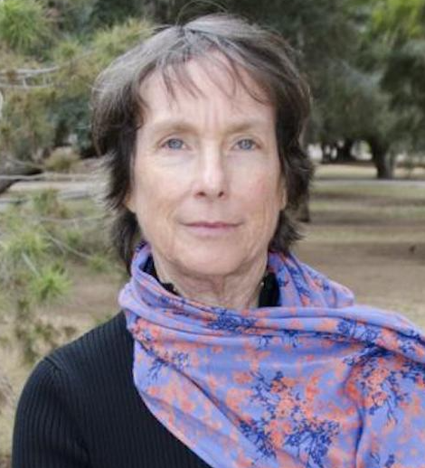 Connie Woodhouse合作论文数School of Geography and Development, The University of Arizona4
 Dave Meko合作论文数Laboratory of Tree-Ring Research, College of Science, University of Arizona4
 Susan H. Cannon合作论文数4Christopher H. Baisan合作论文数3
 Philip A. Pearthree合作论文数Department of Geosciences, College of Science, The University of Arizona;Arizona Geological Survey, College of Science, The University of Arizona3Joseph E. Gartner合作论文数U. S. Geological Survey3
 Valerie Trouet合作论文数Department of Hydrology & Atmospheric Sciences, College of Science, The University of Arizona;Laboratory of Tree Ring Research, The University of Arizona2Christopher H. Guiterman合作论文数2
 Lori Daniels合作论文数Department of Forest & Conservation Sciences, Faculty of Forestry, The University of British Columbia2
 William J. Platt合作论文数2
 Jill Onken合作论文数2
 Rosemary L. Sherriff合作论文数Department of Geography;University of Colorado Boulder;Department of Geography, University of Colorado Boulder2
 Mario Parise合作论文数National Research Council, Institute of Research for the Geo-hydrological Protection;Department of Earth and Environmental Sciences, University Aldo Moro2Joseph P. Cook合作论文数2Alan Tepley合作论文数2S. Yoshi Maezumi合作论文数1Alan H. Rea合作论文数1Kevin G. Smith合作论文数1Christopher D. O’Connor合作论文数1SH Cannon合作论文数1Keith Lombardo合作论文数1Manuel K. Lopez合作论文数1Charles Parrett合作论文数1Yegor K. Kisilyakhov合作论文数1Sergey G. Andreev合作论文数1Alexander A. Ayurzhanaev合作论文数1
 Lauren F. Howard合作论文数1Micah R. Schmidt合作论文数1Matthew J. Trebesch合作论文数1Wendy S. Gross合作论文数1d zamorareyes合作论文数1
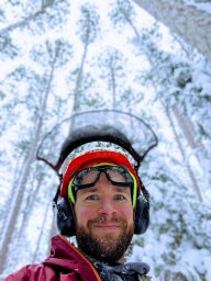 Lane B Johnson合作论文数Cloquet Forestry Ctr, Univ Minnesota1
 Liam O. Mueller合作论文数Dept Mol Biol, Univ Calif San Diego1
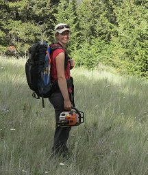 Jill E. Harvey合作论文数Dept Nat Resource Sci, Thompson Rivers Univ1
 Kira M. Hoffman合作论文数Department of Forest and Conservation Sciences, University of British Columbia1
 Denyse A. Dawe合作论文数Natural Resources Canada1Alexis H. Arizpe合作论文数Gregor Mendel Institute, Austrian Academy of Sciences1
 Ichchha Thapa合作论文数Department of Earth and Environmental Systems, Indiana State University1E A Batotsyrenov合作论文数1
 Rebecca E. Hewitt合作论文数1
 Hang Li合作论文数1
 Lauren Stachowiak合作论文数Dendrochronol & Spatial Anal Lab, Eastern Washington Univ1
 Anthony C. Caprio合作论文数1
 Ellie Broadman合作论文数School of Earth and Sustainability, Northern Arizona University, Flagstaff, Arizona, 86011, USA1
 Monica T. Rother合作论文数Dept Environm Sci, Univ North Carolina Wilmington1
 David Gervais合作论文数1
 Alicia Azpeleta合作论文数School of Forestry, Northern Arizona University1
 Raphael D. Chavardes合作论文数Univ Quebec Abitibi Temiscamingue, NSERC UQAT UQAM Ind Chair Sustainable Forest Mana, Rouyn Noranda, PQ, Canada1




