The northwestern coast of Sal Island (Cape Verde Archipelago) is characterized by a rocky shoreline that is regularly impacted by Atlantic swells exceeding 4 m in height and 20 s in period. Yet, the only significant geomorphic expression of wave action is an extensive boulder ridge situated atop a rocky cliff, up to 80-100 m inland and between 10 and 15 m above present sea level. The presence of meter-scale boulders within this ridge raises a key question: is it actively shaped by modern storm waves, or is it a relic of paleo storms, impacting the shoreline during an interglacial period when sea level was significantly higher than today? To test this hypothesis, we apply a multidisciplinary approach combining satellite and drone imagery, topographic analysis, hydrodynamic modelling, and empirical boulder transport thresholds. Our results show that under current conditions, storm waves do not reach the ridge and cannot generate sufficient flow to mobilize its largest boulders. However, under modeled higher sea-level scenarios exceeding +5 m, wave runup reaches the ridge, and flow velocities are sufficient to initiate boulder transport by sliding and overturning. We therefore conclude that the ridge is a relict feature, most likely emplaced during Marine Isotope Stage 5e, when relative sea level in Sal Island was 5-7 m higher than today.
Geomorphological mapping is a powerful tool for reconstructing the evolution of landscapes inhabited by human communities since prehistory. We present high-resolution (1:1000) geomorphological mapping of the Balzi Rossi archaeological area (Liguro-Proven & ccedil;al coast, NW Italy), an outstanding site for European prehistory which has been inhabited since the Middle Pleistocene. The map was produced by combining different types of remote sensing data, complimented with field survey. Both surface and submerged landforms are included from 70 m a.s.l. to the depth of ca. 10 m. All elevations were referenced to a tidal datum. The study area comprises a tectonically formed vertical cliff where karst dissolution along faults and fractures created several caves and rock shelters that were later settled by Middle and Upper Palaeolithic human groups. During the Pleistocene, the area experienced significant climatic shifts from interglacial to glacial conditions. Our work will aid archaeologists to unravel the responses of our ancestors to climatic and environmental changes.
Extreme marine events determine different landform imprints, such as out-of-size deposits like coastal boulders with several tons in weight. These extreme marine events are usually connected to storms and tsunamis. Storms and tsunamis are characterized by a high-energy content, which is reflected in wave flow and wave height able to move the boulders. Several coastal boulders have been detected in Aruba, Bonaire, and Curacao (ABC) islands, overlying the marine terrace deposits that surround the seaward side of these islands. In this work, morpho-topographical surveys were performed on these coastal boulders in order to simulate the most probable events that caused their displacements. Unmanned Aerial Vehicle and close-range photogrammetry were used to reconstruct the volume and shape of boulders with their immersive scenario. Volume and shape of coastal boulders have been used to estimate the energy content able to determine their displacement. Furthermore, boulder samples were collected in order to assess their density and to obtain chronological constraints of the extreme marine events by applying U/Th and radiocarbon dating. Numerical models in Delft3D were applied to simulate the scenarios that could be responsible for the boulder movements. The results showed that the biggest boulders are located on Bonaire Island, located in the eastern part of the ABC archipelago, and were influenced by higher energy content than the Aruba and Curacao islands. This energy content could be related to three possible scenarios simulated in Delft3D: 1) a tsunami scenario connected to Venezuela earthquakes, 2) a Hurricane scenario impacting from the western side of the ABC archipelago, 3) a combination of multiple events (tsunami and storms) that caused differential boulders movement in the past.
The Panama Bight eco-region along the Pacific coast of central and South America is considered to have one of the best-preserved mangrove ecosystems in the American continent. The regional climate, with rainfall easily reaching 5–8 m every year and weak wind conditions, contribute to the exceptionally tall mangroves along the southern Colombian and northern Ecuadorian Pacific coasts (Nariño Department and Esmeraldas Province areas). Here we evaluate the use of different methods (ground-based measurements, drone imagery and radar data [Shuttle Radar Topography mission-SRTM and TanDEM-X]) to characterize the structure of the tallest of these forests. In November 2019, three mangrove sites with canopy heights between 50 and 60 m, previously identified with SRTM data, were sampled close to the town of Guapi, Colombia. In addition to in situ field measurements of trees, we conducted airborne drone surveys in order to generate georeferenced orthomosaics and digital surface models (DSMs). We found that the extensive mangrove forests in this area of the Colombian Pacific are almost entirely composed of Rhizophora spp. trees. The tallest mangrove tree measured in the three plots was 57 m. With ca. 900 drone photographs, three orthomosaics (2 cm pixel –1 resolution) and digital surface models (3.5 cm pixel –1 ) with average area of 4,0 ha were generated. The field-measured canopy heights were used to validate the drone-derived and radar-derived data, confirming these mangrove forests as the tallest in the Americas. The drone-derived orthomosaics showed significant patches of the Golden Leather Fern, Acrostichum aureum , an opportunistic species that can be associated to mangrove degradation, indicating that the mangrove forests investigated here may be threatened from increased selective logging requiring improvements and effective implementation of the current mangrove management plans in Colombia. The techniques used here are highly complementary and may represent the three tiers for carbon reporting, whereby the drone-derived canopy height maps, calibrated with local in situ measurements, provides cheap but reliable Tier 3 estimates of carbon stocks at the project level.
Large coastal boulders are ubiquitous geomorphological features that are emplaced along coasts by extreme marine events such as storms, hurricanes, and tsunamis. Many large coastal boulders have been identified on emergent fossil coral reefs on the windward sides of the Aruba, Bonaire, and Cura & ccedil;ao (ABC) islands in the Leeward Antilles of the Caribbean. Here, structure-from-motion/multi-view stereo techniques were used to map boulder sizes at several coastal sites in the ABC Islands as well as construct digital terrain models of the surrounding areas. Chronological constraints on boulder transport were established through the radiocarbon dating of the vermetids and coral colonies that comprised boulders located along a ridge on Aruba Island. A suite of hydrodynamic models was used to empirically derive the required flow thresholds for boulder displacement to determine whether tsunamis or hurricanes were responsible for detaching and transporting these boulders. Our results suggest that multiple tsunamis, most likely triggered by the El Pilar fault, located near the Venezuelan coast, were the cause of boulder detachment and transport in this region during the Holocene, between 4000 and 500 years BP.
Extreme atmospheric-marine events, known as medicanes (short for “Mediterranean hurricanes”), have affected the Mediterranean basin in recent years, resulting in extensive coastal flooding and storm surges, and have occasionally been responsible for several casualties. Considering that the development mechanism of these events is similar to tropical cyclones, it is plausible that these phenomena are strongly affected by sea surface temperatures (SSTs) during their development period (winter and autumn seasons). In this study, we compared satellite data and the numerical reanalysis of SSTs from 1969 to 2023 with in situ data from dataloggers installed at different depths off the coast of southeastern Sicily as well as from data available on Argo floats on the Mediterranean basin. A spectral analysis was performed using a continuous wavelet transform (CWT) for each SST time series to highlight the changes in SSTs prior to the occurrence of Mediterranean Hurricanes as well as the energy content of the various frequencies of the SST signal. The results revealed that decreases in SST occurred prior to the formation of each Mediterranean hurricane, and that this thermal drop phenomenon was not observed in intense extra-tropical systems. The spectral analyses revealed that high CWT coefficients representing high SST energy contents were observed before the occurrence of a Mediterranean hurricane. This information may provide a useful fingerprint for distinguishing Mediterranean hurricanes from common seasonal storms at the onset of these events.
Mapping shallow-water bathymetry and morphology represents a technical challenge. In fact, acoustic surveys are limited by water depths reachable by boat, and airborne surveys have high costs. Photogrammetric approaches (either via drone or from the sea surface) have opened up the possibility to perform shallow-water surveys easily and at accessible costs. This work presents a simple, low-cost, and highly portable platform that allows gathering sequential photos and echosounder depth values of shallow-water sites (up to 5 m depth). The photos are then analysed in conjunction with photogrammetric techniques to obtain digital bathymetric models and orthomosaics of the seafloor. The workflow was tested on four repeated surveys of the same area in the Western Mediterranean and allowed obtaining digital bathymetric models with centimetric average accuracy and precision and root mean square errors within a few decimetres. The platform presented in this work can be employed to obtain first-order bathymetric products, enabling the contextual establishment of the depth accuracy of the final products.
Abstract Relic coastal landforms (fossil corals, cemented intertidal deposits, or erosive features carved onto rock coasts) serve as sea‐level index points (SLIPs), that are widely used to reconstruct past sea‐level changes. Traditional SLIP‐based sea‐level reconstructions face challenges in capturing continuous sea‐level variability and dating erosional SLIPs, such as tidal notches. Here, we propose a novel approach to such challenges. We use a numerical model of cliff erosion embedded within a Monte Carlo simulation to investigate the most likely sea‐level scenarios responsible for shaping one of the best‐preserved tidal notches of Last Interglacial age in Sardinia, Italy. Results align with Glacial Isostatic Adjustment model predictions, indicating that synchronized or out‐of‐sync ice‐volume shifts in Antarctic and Greenland ice sheets can reproduce the notch morphology, with sea level confidently peaking at 6 m and only under a higher than present erosion regime. This new approach yields insight into sea‐level trends during the Last Interglacial.
Mangrove forests provide valuable ecosystem services to coastal communities across tropical and subtropical regions. Current anthropogenic stressors threaten these ecosystems and urge researchers to create improved monitoring methods for better environmental management. Recent efforts that have focused on automatically quantifying the above-ground biomass using image analysis have found some success on high resolution imagery of mangrove forests that have sparse vegetation. In this study, we focus on stands of mangrove forests with dense vegetation consisting of the endemic Pelliciera rhizophorae and the more widespread Rhizophora mangle mangrove species located in the remote Utría National Park in the Colombian Pacific coast. Our developed workflow used consumer-grade Unoccupied Aerial System (UAS) imagery of the mangrove forests, from which large orthophoto mosaics and digital surface models are built. We apply convolutional neural networks (CNNs) for instance segmentation to accurately delineate (33% instance average precision) individual tree canopies for the Pelliciera rhizophorae species. We also apply CNNs for semantic segmentation to accurately identify (97% precision and 87% recall) the area coverage of the Rhizophora mangle mangrove tree species as well as the area coverage of surrounding mud and water land-cover classes. We provide a novel algorithm for merging predicted instance segmentation tiles of trees to recover tree shapes and sizes in overlapping border regions of tiles. Using the automatically segmented ground areas we interpolate their height from the digital surface model to generate a digital elevation model, significantly reducing the effort for ground pixel selection. Finally, we calculate a canopy height model from the digital surface and elevation models and combine it with the inventory of Pelliciera rhizophorae trees to derive the height of each individual mangrove tree. The resulting inventory of a mangrove forest, with individual P. rhizophorae tree height information, as well as crown shape and size descriptions, enables the use of allometric equations to calculate important monitoring metrics, such as above-ground biomass and carbon stocks.
Low-altitude high-resolution aerial photographs allow for the reconstruction of structural properties of shallow coral reefs and the quantification of their topographic complexity. This study shows the scope and limitations of two-media (air/water) Structure from Motion—Multi-View Stereo reconstruction method using drone aerial photographs to reconstruct coral height. We apply this method in nine different sites covering a total area of about 7000 m 2 , and we examine the suitability of the method to obtain topographic complexity estimates (i.e., seafloor rugosity). A simple refraction correction and survey design allowed reaching a root mean square error of 0.1 m for the generated digital models of the seafloor (without the refraction correction the root mean square error was 0.2 m). We find that the complexity of the seafloor extracted from the drone digital models is slightly underestimated compared to the one measured with a traditional in situ survey method.
Sea-level rise represents a severe hazard for populations living within low-elevation coastal zones and is already largely affecting coastal communities worldwide. As sea level continues to rise following unabated greenhouse gas emissions, the exposure of coastal communities to inundation and erosion will increase exponentially. These impacts will be further magnified under extreme storm conditions. In this paper, we focus on one of the most valuable coastal real estate markets globally (Palm Beach, FL). We use XBeach, an open-source hydro and morphodynamic model, to assess the impact of a major tropical cyclone (Hurricane Matthew, 2016) under three different sea-level scenarios. The first scenario (modern sea level) serves as a baseline against which other model runs are evaluated. The other two runs use different 2100 sea-level projections, localized to the study site: (i) IPCC RCP 8.5 (0.83 m by 2100) and (ii) same as (i), but including enhanced Antarctic ice loss (1.62 m by 2100). Our results show that the effective doubling of future sea level under heightened Antarctic ice loss amplifies flow velocity and wave height, leading to a 46% increase in eroded beach volume and the overtopping of coastal protection structures. This further exacerbates the vulnerability of coastal properties on the island, leading to significant increases in parcel inundation.
Reconstructing the topography of shallow underwater environments using Structure-from-Motion – Multi View Stereo (SfM-MVS) techniques applied to aerial imagery from Unmanned Aerial Vehicles (UAVs) is a challenging problem, as it involves non-linear distortions caused by water refraction. This study presents an experiment with aerial photographs collected with a consumer-grade UAV on the shallow-water reef of Fuvahmulah, the Maldives. Under conditions of rising tide, we surveyed the same portion of the reef in ten successive flights. For each flight, we used SfM-MVS to reconstruct the Digital Elevation Model (DEM) of the reef, and used the flight at low tide (where the reef is almost entirely dry) to compare the performance of DEM reconstruction under higher water levels. Our results show that differences with the reference DEM increase with increasing depth, but are substantially larger if no underwater ground control points are taken into account in the processing. Correcting our imagery with algorithms that account for refraction did not improve the overall accuracy of reconstruction. We conclude that reconstructing shallow-water reefs (less than 1 m depth) with consumer-grade SfM-MVSs and SfM-MVS is possible, but its precision is limited and strongly correlated with water depth. The best results are achieved when ground control points were placed both above and underwater and no refraction correction is used in our processing.
Supplementary dataset to Structural characteristics of the tallest mangrove forests of the American continent: a comparison of ground-based, drone and radar measurements@font-face {font-family:"Cambria Math"; panose-1:2 4 5 3 5 4 6 3 2 4; mso-font-charset:0; mso-generic-font-family:roman; mso-font-pitch:variable; mso-font-signature:-536870145 1107305727 0 0 415 0;}@font-face {font-family:Calibri; panose-1:2 15 5 2 2 2 4 3 2 4; mso-font-charset:0; mso-generic-font-family:swiss; mso-font-pitch:variable; mso-font-signature:-536859905 -1073732485 9 0 511 0;}p.MsoNormal, li.MsoNormal, div.MsoNormal {mso-style-unhide:no; mso-style-qformat:yes; mso-style-parent:""; margin-top:6.0pt; margin-right:0cm; margin-bottom:12.0pt; margin-left:0cm; mso-pagination:widow-orphan; font-size:12.0pt; mso-bidi-font-size:11.0pt; font-family:"Times New Roman",serif; mso-fareast-font-family:Calibri; mso-fareast-theme-font:minor-latin; mso-bidi-font-family:"Times New Roman"; mso-bidi-theme-font:minor-bidi; mso-ansi-language:EN-US; mso-fareast-language:EN-US;}p.MsoSubtitle, li.MsoSubtitle, div.MsoSubtitle {mso-style-priority:11; mso-style-unhide:no; mso-style-qformat:yes; mso-style-link:"Subtitle Char"; mso-style-next:Normal; margin-top:6.0pt; margin-right:0cm; margin-bottom:8.0pt; margin-left:0cm; mso-pagination:widow-orphan; font-size:11.0pt; font-family:"Calibri",sans-serif; mso-ascii-font-family:Calibri; mso-ascii-theme-font:minor-latin; mso-fareast-font-family:"Times New Roman"; mso-fareast-theme-font:minor-fareast; mso-hansi-font-family:Calibri; mso-hansi-theme-font:minor-latin; mso-bidi-font-family:"Times New Roman"; mso-bidi-theme-font:minor-bidi; color:#5A5A5A; mso-themecolor:text1; mso-themetint:165; letter-spacing:.75pt; mso-ansi-language:EN-US; mso-fareast-language:EN-US;}p.AuthorList, li.AuthorList, div.AuthorList {mso-style-name:"Author List\,Keywords\,Abstract"; mso-style-priority:1; mso-style-unhide:no; mso-style-qformat:yes; mso-style-parent:Subtitle; mso-style-next:Normal; margin-top:12.0pt; margin-right:0cm; margin-bottom:12.0pt; margin-left:0cm; mso-pagination:widow-orphan; font-size:12.0pt; font-family:"Times New Roman",serif; mso-fareast-font-family:Calibri; mso-fareast-theme-font:minor-latin; mso-ansi-language:EN-US; mso-fareast-language:EN-US; font-weight:bold; mso-bidi-font-weight:normal;}span.SubtitleChar {mso-style-name:"Subtitle Char"; mso-style-priority:11; mso-style-unhide:no; mso-style-locked:yes; mso-style-link:Subtitle; font-family:"Calibri",sans-serif; mso-ascii-font-family:Calibri; mso-ascii-theme-font:minor-latin; mso-fareast-font-family:"Times New Roman"; mso-fareast-theme-font:minor-fareast; mso-hansi-font-family:Calibri; mso-hansi-theme-font:minor-latin; color:#5A5A5A; mso-themecolor:text1; mso-themetint:165; letter-spacing:.75pt;}.MsoChpDefault {mso-style-type:export-only; mso-default-props:yes; font-size:11.0pt; mso-ansi-font-size:11.0pt; mso-bidi-font-size:11.0pt; font-family:"Cambria",serif; mso-ascii-font-family:Cambria; mso-ascii-theme-font:major-latin; mso-fareast-font-family:Calibri; mso-fareast-theme-font:minor-latin; mso-hansi-font-family:Cambria; mso-hansi-theme-font:major-latin; mso-bidi-font-family:"Times New Roman"; mso-bidi-theme-font:minor-bidi; mso-ansi-language:EN-US; mso-fareast-language:EN-US;}.MsoPapDefault {mso-style-type:export-only; margin-bottom:10.0pt; line-height:115%;}div.WordSection1 {page:WordSection1;}, by Castellanos-Galindo et al. (in review) Front. For. Glob. Change
Detailed geological field mapping is essential for the study of Relative Sea Level (RSL) indicators, that are in turn the only direct proxies to assess paleo sea level changes and long-term land movements. In the last decades, traditional mapping methods started to be complemented by small Remotely Piloted Aircraft Systems (RPAS, a.ka.a. drones) and high-resolution remote sensing datasets.In this contribution, we show the results of geological mapping in the island of Curaçao (Netherlands Antilles). Here, we mapped a staircase sequence of coral reef terraces. In particular, we used TerraceM-2 Maptools (a Matlab® interface for mapping marine terraces) to extract wide-scale marine terrace elevations from TanDEM-X Digital Elevation Models (DEMs) (German Aerospace Center, DLR and Airbus). We detail the elevation information available for each single terrace with RPAS data processed with Agisoft Metashape, that allows obtaining as final products DEMs and orthophotos of selected sites at the inner margin of reef terraces. We then use land-based photogrammetry coupled with traditional facies analysis to identify geological discontinuities on the lower terrace.The facies analysis allowed to precisely map the unconformity between the Hato (MIS 5.5) and Cortalein (MIS 7) Units (as identified by Muhs et al., 2012). The top of the Hato Unit forms the so-called “Curaçao Lower Terrace”. The top of the Hato Unit, extending few kilometres from the coast, has been mapped with both TanDEM-X and RPAS data up to the paleo-cliff of the Middle Terrace (formerly attributed to MIS 11), where a well-defined notch is preserved. We attribute this notch to the maximum sea ingression during MIS 5e. We compare its elevation with the RSL predicted by Glacio-Isostatic Adjustment (GIA) models.We discuss the new data and models for Curaçao in terms of long-term tectonic uplift and eustatic sea level.Reference: Muhs DR, Pandolfi JM, Simmons KR, Schumann RR (2012) Sea-level history of past interglacial periods from uranium-series dating of corals, Curaçao, Leeward Antilles islands. Quat Res 78:157–169. doi: 10.1016/j.yqres.2012.05.008Acknowledgments: TanDEM-X digital elevation data is used with permission within the Project DEM GEOL1210 (A. Rovere / M.E. Raymo). The fieldwork for this work was funded by the Helmholtz Exzellenznetzwerks “The Polar System and its Effects on the Ocean Floor (POSY)”. The authors acknowledge also the ZMT, the Center for Tropical Marine Ecology, and the DAAD, the German Academic Exchange Service.
Beaches are characterized by high morphodynamic activity, and high-frequency measurements are needed to understand their states and rates of change. Ideally, beach survey methods should be at once accurate, rapid and low-cost. Recently, unmanned aerial systems (drones) have been increasingly utilized to measure beach topography. In this paper, we present a review of the state of art in drones and photogrammetry for beach surveys and the respective achieved measurement quality (where reported). We then show how drones with a minimal configuration and a low-cost setup can meet the high accuracy and rapidity required for beach surveys. To test a minimal drone and ground control point configuration, we used consumer-grade equipment to perform the same flight path with different cameras and at different altitudes. We then used photogrammetry to produce digital elevation models of the beach. Using a GNSS-RTK system, we collected 2950 independent control points to evaluate the accuracy of the digital elevation models. Results show that, once a few potential sources of uncertainties in the final digital elevation model are taken into account, the average RMSE(z) of the digital elevation models was ~5 cm, with a survey efficiency of ca. 3 m 2 min −1 . Digital elevation models taken at different times were used to calculate the before–after sediment budget following a storm that hit a sandy coast in Sylt Island at the German North Sea coast.
Extreme low tides that expose corals to air are damaging for coral reefs. The best developed coral reef of the continental Colombian Pacific was exposed at spring tide during consecutive days in 2019. Consumer-grade drone imagery revealed the extent of the area affected. These corals have high conservation and research value.
Unmanned aerial vehicles (UAVs) have the potential to be an important tool providing low-cost but sufficiently precise mapping products to support environmental management. In this study, we present possible applications of UAVs to map and monitor three representative coastal tropical habitats: mangroves, rocky shores and coral reefs. We conducted UAVs surveys in a Marine Protected Area (MPA) of the tropical eastern Pacific region to investigate the suitability and usefulness of using this tool in a remote area for a variety of management and monitoring purposes. For mangrove ecosystems, we evaluated the potential of UAV-derived data to estimate canopy cover. On an intertidal rocky shore, we evaluated the potential of UAVs to obtain a detailed relative topographic position index that can be used to correlate the distribution patterns of resident and transient fauna. Finally, we compared the standard diver-based coral reef mapping approach used at the MPA with the use of a map produced with the UAV. Our results suggest that the use of UAVs by conservation practitioners in MPAs with diverse habitats, such as in the tropics, is likely to improve the knowledge of the MPAs environments and provide highly detailed information for monitoring helping to understand the nursery function of these inter-connected tropical habitats, at a reduced cost. This tool, therefore, has the potential to support conservation measures in a more effective way.
Very high resolution (VHR) airborne data enable detection and physical measurements of individual coral reef colonies. The bathymetric LiDAR system, as an active remote sensing technique, accurately computes the coral reef ecosystem's surface and reflectance using a single green wavelength at the decimetre scale over 1-to-100km(2) areas. A passive multispectral camera mounted on an airborne drone can build a blue-green-red (BGR) orthorectified mosaic at the centimetre scale over 0.01-to-0.1km(2) areas. A combination of these technologies is used for the first time here to map coral reef ecological state at the submeter scale. Airborne drone BGR values (0.03m pixel size) serve to calibrate airborne bathymetric LiDAR surface and intensity data (0.5m pixel size). A classification of five ecological states is then mapped through an artificial neural network (ANN). The classification was developed over a small area (0.01km(2)) in the lagoon of Moorea Island (French Polynesia) at VHR (0.5m pixel size) and then extended to the whole lagoon (46.83km(2)). The ANN was first calibrated with 275 samples to determine the class of coral state through LiDAR-based predictors; then, the classification was validated through 135 samples, reaching a satisfactory performance (overall accuracy=0.75).
Hearty and Tormey (1) challenge our conclusions (2), incorrectly arguing that the megaboulders we discuss were shown to originate from the cliff bottom. A number of mischaracterizations are made by Hearty and Tormey (1) in their letter. First, we do not use a “tsunami wave model.” Second, we do not address the two other Bahamian landforms Hearty and Tormey (1) mention: their “superstorm” genesis interpretation [for which alternative hypotheses have been proposed (3, 4)] has no bearing on our (2) conclusions. Hearty and Tormey’s (1) claim that the boulders have “fingerprints” based on “several physical criteria” and “data from multiple disciplines” is false. Only two mega-boulder “physical properties” were reported by Hearty … [↵][1]1To whom correspondence should be addressed. Email: arovere{at}marum.de. [1]: #xref-corresp-1-1
 Alessio Rovere合作论文数Dipartimento per lo studio del Territorio e delle sue Risorse, Università di Genova DipTeRis30
 Daniel Harris合作论文数School of Earth and Environmental Sciences, Faculty of Science, The University of Queensland10
 Valeriano Parravicini合作论文数Centre de Recherche Insulaire et Observatoire du Pacifique, École Pratique des Hautes Études7
 Matteo Vacchi合作论文数Department for the Study of the Territory and of its Resources (Dip.Te.Ris),, University of Genoa7
 Paolo Stocchi合作论文数Faculty of Aerospace Engineering, Delft University of Technology7
 Thomas Lorscheid合作论文数Res Grp Earth Observat Rgeo, Heidelberg Univ Educ6
 Andrea Pedroncini合作论文数5
 Giovanni Scicchitano合作论文数Department of Geological Science, University of Catania5
 N. A. K. Nandasena合作论文数5
 Maureen E. Raymo合作论文数Department of Earth and Environmental Sciences, Columbia University in the City of New York;Columbia Climate School, Columbia University5
 Patrick Boyden合作论文数MARUM Ctr Marine Environm Sci, Univ Bremen4
 Blake Dyer合作论文数University of Victoria4
 Giovanni Scardino合作论文数4
 Bejarano Sonia合作论文数4Marco Firpo合作论文数Dipartimento per lo studio del Territorio e delle sue Risorse, Università di Genova DipTeRis4
 Rui Caldeira合作论文数Instituto Dom Luiz, Faculty of Sciences, University of Lisbon4
 Antoine Collin合作论文数Institut des Sciences de la mer;Université du Québec à Rimouski;Institut des Sciences de la mer, Université du Québec à Rimouski4
 Gustavo A. Castellanosgalindo合作论文数Leibniz Ctr Trop Marine Ecol ZMT4Juan C. Mejía-Rentería合作论文数Dept Biol, Univ Valle3
 Michael R Sandstrom合作论文数Lamont Doherty Earth Observ, Columbia Univ3
 Luigi Mucerino合作论文数Geoscape Soc Coop, Univ Genoa3
 Marco Ferrari合作论文数DipTeRis, University of Genoa3
 Xavier Couvelard合作论文数LEGOS, Université de Toulouse3W. J. D'Andrea合作论文数2
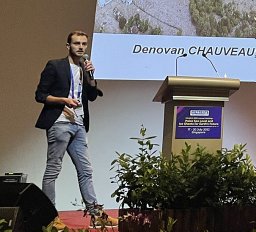 Denovan Chauveau合作论文数CNRS, Univ Brest2
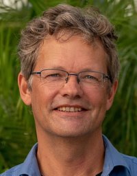 Eric Mijts合作论文数2
 Deirdre D Ryan合作论文数Dept Earth Sci, Univ Pisa2
 Rémy Canavesio合作论文数CNRS-LETG Caen – Geophen (UMR 6564), Université de Caen Normandie2
 Paola Tepsich合作论文数CIMA Res Fdn, Savona, Italy2
 James Hench合作论文数Department of Civil & Environmental Engineering, Pratt School of Engineering, Duke University2William J. D'Andrea合作论文数Department of Geological Sciences;Brown University;Department of Geological Sciences, Brown University2
 Lluis Gomez-Pujol合作论文数2
 Antonio Parodi合作论文数CIMA Research Foundation2R. M. Sandstrom合作论文数1l molini合作论文数1a comellas合作论文数1C. N. Bianchi合作论文数1Gianfranco Mazza合作论文数1Luis Alberto Cusati合作论文数1
 Gaetano Sabato合作论文数1Alok Kushabaha合作论文数1Franck Lerouvreur合作论文数1
 Alfio Marco Borzi合作论文数1
 Ciro Cerrone合作论文数1Andrea Pezzotta合作论文数1
 Daniel Schürholz合作论文数Max Planck Institute for Marine Microbiology1Mattia Ghilardi合作论文数Faculty of Biology and Chemistry, University of Bremen1
 Markus Benninghoff合作论文数1
 Juan David Osorio-Cano合作论文数Dept Geosci & Environm, Univ Nacl Colombia1




