The integrity of the Baseline Surface Radiation Network (BSRN) radiation monthly averages are assessed by investigating the impact on monthly means due to the frequency of data gaps caused by missing or discarded high time resolution data. The monthly statistics, especially means, are considered to be important and useful values for climate research, model performance evaluations and for assessing the quality of satellite (time- and space-averaged) data products. The study investigates the spread in different algorithms that have been applied for the computation of monthly means from 1-min values.The paper reveals that the computation of monthly means from 1-min observations distinctly depends on the method utilized to account for the missing data. The intra-method difference generally increases with an increasing fraction of missing data. We found that a substantial fraction of the radiation fluxes observed at BSRN sites is either missing or flagged as questionable. The percentage of missing data is 4.4%, 13.0%, and 6.5% for global radiation, direct shortwave radiation, and downwelling longwave radiation, respectively. Most flagged data in the shortwave are due to nighttime instrumental noise and can reasonably be set to zero after correcting for thermal offsets in the daytime data. The study demonstrates that the handling of flagged data clearly impacts on monthly mean estimates obtained with different methods. We showed that the spread of monthly shortwave fluxes is generally clearly higher than for downwelling longwave radiation.Overall, BSRN observations provide sufficient accuracy and completeness for reliable estimates of monthly mean values. However, the value of future data could be further increased by reducing the frequency of data gaps and the number of outliers. It is shown that two independent methods for accounting for the diurnal and seasonal variations in the missing data permit consistent monthly means to within less than 1 W m−2 in most cases. The authors suggest using a standardized method for the computation of monthly means which addresses diurnal variations in the missing data in order to avoid a mismatch of future published monthly mean radiation fluxes from BSRN.The application of robust statistics would probably lead to less biased results for data records with frequent gaps and/or flagged data and outliers. The currently applied empirical methods should, therefore, be completed by the development of robust methods.
The AERONET-based Surface Reflectance Validation Network (ASRVN) is an operational processing system developed for validation of satellite derived surface reflectance products at regional and global scales. The ASRVN receives 50×50km2 subsets of MODIS data centered at AERONET sites along with AERONET aerosol and water vapor data, and performs an atmospheric correction. The ASRVN produces surface bidirectional reflectance factor (BRF), albedo, parameters of the Ross-Thick Li-Sparse (RTLS) BRF model, as well as Hemispherical-Directional Reflectance Factor (HDRF), which is required for comparison with the ground-based measurements. This paper presents a comparison of ASRVN HDRF with the ground-based HDRF measurements collected during 2001–2008 over a bright calibration Railroad Valley, Nevada site as part of the MODIS land validation program. The ground measurements were conducted by the Remote Sensing Group (RSG) at the University of Arizona using an ASD spectrometer. The study reveals a good agreement between ASRVN and RSG HDRF for both MODIS Terra and Aqua with rmse~0.01–0.025 in the 500m MODIS land bands B1–B7. Obtained rmse is below uncertainties due to the spatial and seasonal variability of the bright calibration 1km2 area. While two MODIS instruments have a similar rmse in the visible bands, MODIS Aqua has a better agreement (lower rmse) with the ground data than MODIS Terra at wavelengths 0.87–2.1μm. An independent overall good agreement of two MODIS instruments with the ground data indicates that the relative calibration of MODIS Terra and Aqua at medium-to-bright reflectance levels for the stated time period is significantly better than uncertainties of the ASRVN and ground data.
Downwelling and upwelling shortwave and longwave radiation components from six active polar sites, taking part of the Baseline Surface Radiation Network (BSRN), were selected for the period of the last International Polar Year (March 2007 to March 2009), and included in the BSRN-IPY dataset, along with metadata and supplementary data for some of the stations. Two sites, located at Svalbard archipelago (Ny Ålesund) and Alaska (Barrow), represent Arctic sea-level conditions. Four Antarctic stations represent both sea-level (Dronning Maud Land and Cosmonaut Sea) and high-elevation conditions (South Pole and East Antarctic Plateau). The BSRN-IPY dataset content and quality are discussed. The dataset is now available at doi:10.1594/PANGAEA.737668, and can be used for free after accepting the BSRN data release guidelines. The dataset has been summarized as monthly averages and subject to further evaluation according to strict criteria not previously applied.
Recent measurements demonstrate that the "background" stratospheric aerosol layer is persistently variable rather than constant, even in the absence of major volcanic eruptions. Several independent data sets show that stratospheric aerosols have increased in abundance since 2000. Near-global satellite aerosol data imply a negative radiative forcing due to stratospheric aerosol changes over this period of about -0.1 watt per square meter, reducing the recent global warming that would otherwise have occurred. Observations from earlier periods are limited but suggest an additional negative radiative forcing of about -0.1 watt per square meter from 1960 to 1990. Climate model projections neglecting these changes would continue to overestimate the radiative forcing and global warming in coming decades if these aerosols remain present at current values or increase.
The surface radiation budget (SRB) is modulated by smoke aerosols that attenuate solar and emit thermal infrared radiation. Direct radiative impacts of smoke depend on several factors that lead to large uncertainties in assessing how wildfires influence climate. To quantify the impact of smoke on the SRB, evaluations of the longwave (LW) as well as the shortwave (SW) radiative forcing efficiencies (RFElw and RFEsw) are needed. Radiative forcing efficiency (RFE) is defined as the change in net irradiance per unit increase in aerosol optical depth at 500 nm (AOD(500)). An opportunity to evaluate RFElw and RFEsw of smoke presented itself on 6-7 September 2010, when a wildfire burned west of Boulder, Colorado. Smoke passed over sites where SRB, atmospheric state, and AOD measurements were being made. Values of RFE were derived empirically from coincident SRB and AOD measurements made over a range of Sun angles. RFEsw ranged between -65 and -194 Wm(-2) AOD(500)(-1) as solar zenith angles decreased from 73 degrees to 34 degrees (at solar noon). RFElw averaged similar to 10 (+/- 7) Wm(-2) AOD(500)(-1) throughout the daylight hours. During the event, the diurnally integrated value of net RFE was -51.5 Wm(-2) AOD(500)(-1), revealing the dominance of SW cooling over LW warming attributed to the smoke. In response, the surface under the smoke plume cooled by 2 degrees-5 degrees C during the day, depending on the smoke's opacity. No evaluation of nighttime effects were possible, although very slight warming may have occurred owing to thermal emissions from the plume.
GLOB 4 W m 2 1.5So µ 1.2 + 100 W m 2 SWDIFF 4 W m 2 0.95So µ 1.2 + 50 W m 2 SWDIR 4 W m 2 So µ SWUP 4 W m 2 1.2So µ 1.2 + 50 W m 2 LWDOWN 40 W m 2 700 W m 2 LWUP 40 W m 2 900 W m 2
The Arctic climate is modulated, in part, by atmospheric aerosols that affect the distribution of radiant energy passing through the atmosphere. Aerosols affect the surface‐atmosphere radiation balance directly through interactions with solar and terrestrial radiation and indirectly through interactions with cloud particles. Better quantification of the radiative forcing by different types of aerosol is needed to improve predictions of future climate. During April 2009, the airborne campaign Pan‐Arctic Measurements and Arctic Regional Climate Model Inter‐comparison Project (PAM‐ARCMIP) was conducted. The mission was organized by Alfred Wegener Institute for Polar and Marine Research of Germany and utilized their research aircraft, Polar‐5. The goal was to obtain a snapshot of surface and atmospheric conditions over the central Arctic prior to the onset of the melt season. Characterizing aerosols was one objective of the campaign. Standard Sun photometric procedures were adopted to quantify aerosol optical depth AOD, providing a three‐dimensional view of the aerosol, which was primarily haze from anthropogenic sources. Independent, in situ measurements of particle size distribution and light extinction, derived from airborne lidar, are used to corroborate inferences made using the AOD results. During April 2009, from the European to the Alaskan Arctic, from sub‐Arctic latitudes to near the pole, the atmosphere was variably hazy with total column AOD at 500 nm ranging from ∼0.12 to >0.35, values that are anomalously high compared with previous years. The haze, transported primarily from Eurasian industrial regions, was concentrated within and just above the surface‐based temperature inversion layer. Extinction, as measured using an onboard lidar system, was also greatest at low levels, where particles tended to be slightly larger than at upper levels. Black carbon (BC) (soot) was observed at all levels sampled, but at moderate to low concentrations compared with historical records. BC was highest near the North Pole, suggesting there had been an accumulation of soot within the Arctic vortex. Few, optically thick elevated aerosol layers were observed along the flight track, although independent lidar observations reveal evidence of the passage of volcanic plumes, which may have contributed to abnormally high values of AOD above 4 km. Enhanced opacity at higher altitudes during the campaign is attributed to an accumulation of industrial pollutants in the upper troposphere in combination with volcanic aerosol resulting from the March–April 2009 eruptions of Mount Redoubt in Alaska. The presence of Arctic haze during April 2009 is estimated to have reduced the net shortwave irradiance by ∼2–5 W m−2, resulting in a slight cooling of the surface.
We conduct analyses of all‐sky and clear‐sky surface downwelling shortwave radiation and bulk cloud properties using data from several Department of Energy Atmospheric Radiation Measurement (ARM) Program and National Oceanic and Atmospheric Administration Surface Radiation (SURFRAD) network sites spanning the years 1995 through 2007. Five ARM sites are aggregated to study downwelling shortwave tendencies on global circulation model grid scales, and then six SURFRAD sites plus the central ARM site are aggregated to study the wider scale of the continental United States. We show that widespread brightening has occurred over the continental United States as represented by these measurements over the 12 years of the study, averaging about 8 W m−2/decade for the all‐sky shortwave and 5 W m−2/decade for the clear‐sky shortwave. This all‐sky increase is substantially greater than the 2 W m−2/decade previously reported over much more of the globe as represented by data from the Global Energy Balance Archive spanning 1986–2000 and is more than twice the magnitude of the corresponding 1986–2000 2–3 W m−2/decade increase in downwelling longwave. Our results show that changes in dry aerosols and/or direct aerosol effects alone cannot explain the observed changes in surface shortwave (SW) radiation, but it is likely that changes in cloudiness play a significant role. These SW increases are accompanied by decreasing tendencies in cloudiness, and an increasing tendency in the clear‐sky SW diffuse/direct ratio that is often associated with atmospheric turbidity. However, given the many local influences, evidence presented here suggests that the determination of the causes of decadal changes in the downwelling solar radiation at the surface are better studied locally and regionally, rather than on a global or continental scale.
As a fast developing country covering a large territory, China is experiencing rapid environmental changes. High concentrations of aerosols with diverse properties are emitted in the region, providing a unique opportunity for understanding the impact of environmental changes on climate. Until very recently, few observational studies were conducted in the source regions. The East Asian Study of Tropospheric Aerosols: An International Regional Experiment (EAST‐AIRE) attempts to characterize the physical, optical and chemical properties of the aerosols and their effects on climate over China. This study presents some preliminary results using continuous high‐quality measurements of aerosol, cloud and radiative quantities made at the first EAST‐AIRE baseline station at Xianghe, about 70 km east of Beijing over a period of one year (September 2004 to September 2005). It was found that the region is often covered by a thick layer of haze (with a yearly mean aerosol optical depth equal to 0.82 at 500 nm and maximum greater than 4) due primarily to anthropogenic emissions. An abrupt “cleanup” of the haze often took place in a matter of one day or less because of the passage of cold fronts. The mean single scattering albedo is approximately 0.9 but has strong day‐to‐day variations with maximum monthly averages occurring during the summer. Large aerosol loading and strong absorption lead to a very large aerosol radiative effect at the surface (the annual 24‐hour mean values equals 24 W m−2), but a much smaller aerosol radiative effect at the top of the atmosphere (one tenth of the surface value). The boundary atmosphere is thus heated dramatically during the daytime, which may affect atmospheric stability and cloud formation. In comparison, the cloud radiative effect at the surface is only moderately higher (−41 W m−2) than the aerosol radiative effect at the surface.
Aerosols in the atmosphere affect the Earth's radiation budget in complicated ways, depending on their physical and optical characteristics and how they interact with solar and terrestrial radiation or affect cloud nucleation. While the Arctic atmosphere is generally very clean, spring incursions of haze and dust from Eurasia are known to perturb the surface radiation balance. Recent analyses (based on "Radiative impact of boreal smoke in the Arctic: Observed and modeled", Stone, et al., to be referred to throughout this ms as Stone2008) also reveal that smoke plumes from boreal forest fires can have significant effects during summer. Once aloft, upper-level winds can transport this smoke long distances. In late June and July 2004 fires raged across eastern Alaska and the Yukon and the resulting smoke was advected across the Arctic, reaching as far as Europe. The long-range transport was tracked using a dispersion model combined with various in situ measurements along its path, all showing enhancements in aerosol opacity. The measurements made at Barrow, Alaska, documented just a portion of the transport and the radiative impact of smoke. The comprehensive measuring systems in place near Barrow (NOAA/GMD and DoE/ARM) presented a unique opportunity to characterize the smoke aerosol both physically and optically, and therefore permit quantification of the upwelling radiance (outgoing shortwave radiance - OSR, 0.28 to 4.0 μm) as observed by NASA satellites: Clouds and the Earth's Radiant Energy System (CERES) 5, coupled with data from Moderate Resolution Imaging Spectroradiometer (MODIS).
The AErosol RObotic NETwork (AERONET) estimates of instantaneous solar broadband fluxes (F) at surface have been validated through comparison with ground‐based measurements of broadband fluxes at Mauna Loa Observatory (MLO) and by the Baseline Surface Radiation (BSRN) and the Solar Radiation Networks (SolRad‐Net) during the period 1999–2005 and 1999–2006, respectively. The uncertainties in the calculated aerosol radiative forcing (ΔF) and radiative forcing efficiency (ΔFeff) at the bottom of the atmosphere were also assessed. The stations have been selected attempting to cover different aerosols influences and hence radiative properties: urban‐industrial, biomass burning, mineral dust, background continental, maritime aerosols and free troposphere. The AERONET solar downward fluxes at surface agree with ground‐based measurements in all situations, with a correlation higher than 99% whereas the relation of observed to modeled fluxes ranges from 0.98 to 1.02. Globally an overestimation of 9 ± 12 Wm−2 of solar measurements was found, whereas for MLO (clear atmosphere) the differences decrease noticeably up to 2 ± 10 Wm−2. The highest dispersion between AERONET estimates and measurements was observed in locations dominated by mineral dust and mixed aerosols types. In these locations, the F and ΔF uncertainties have shown a modest increase of the differences for high aerosol load, contrary to ΔFeff which are strongly affected by low aerosol load. Overall the discrepancies clustered within 9 ± 12 Wm−2 for ΔF and 28 ± 30 Wm−2 per unit of aerosol optical depth, τ, at 0.55 μm for ΔFeff, where the latter is given for τ(0.44 μm) ≥ 0.4. The error distributions have not shown any significant tendency with other aerosol radiative properties as well as size and shape particles.
The "filling-in" (FI) of Fraunhofer lines, often referred to as the Ring effect, was examined using measurements of near ultraviolet sunlight scattered from the zenith sky above Boulder, Colorado during July and August 2005. The FI of the 344.1 nm Fe I line was directly determined by comparing direct sun and cloud-free zenith sky spectra recorded on the same day. The results, obtained over solar zenith angles (SZA) from 20° to 70°, are compared to the predictions of a simple rotational Raman Scattering (RRS) spectral model. The measured FI was found to be up to 70% greater than that predicted by first-order molecular scattering with a much stronger SZA dependence. Simultaneously measured aerosol optical depths and Monte Carlo calculations show that the combination of aerosol scattering and second-order molecular scattering can account for these differences, and potentially explain the contradictory SZA dependences in previously published measurements of FI. These two scattering processes also introduce a wavelength dependence to FI that complicates the fitting of diffuse sunlight observations in differential optical absorption spectroscopy (DOAS). A simple correction to improve DOAS retrievals by removing this wavelength dependence is described.
Trend analyses were performed on several indicators of Arctic haze using data from sites located in the North American, Norwegian, Finnish and Russian Arctic for the spring months of March and April. Concentrations of nonseasalt (nss) SO4= in the Canadian, Norwegian and Finnish Arctic were found to have decreased by 30–70% from the early 1990s to present. The magnitude of the decrease depended on location. The trend in nss SO4= at Barrow, Alaska from 1997 to present, is unclear. Measurements at Barrow of light scattering by aerosols show a decrease of about 50% between the early 1980s and the mid-1990s for both March and April. Restricting the analysis to the more recent period of 1997 to present indicates an increase in scattering of about 50% during March. Aerosol NO3- measured at Alert, Canada has increased by about 50% between the early 1990s and 2003. Nss K+ and light absorption, indicators of forest fires, have a seasonal maximum during the winter and spring and minimum during the summer and fall at both Alert and Barrow. Based on these data, the impact of summertime forest fire emissions on low-altitude surface sites within the Arctic is relatively small compared to winter/spring emissions. Key uncertainties about the impact of long range transport of pollution to the Arctic remain including the certainty of the recent detected trends; sources, transport and trends of soot; and radiative effects due to complex interactions between aerosols, clouds and radiation in the Arctic.
The Arctic region is sensitive to incursions of aerosols that affect its radiation balance, directly through interactions with solar and terrestrial radiation and indirectly as cloud condensation nuclei. During spring 2002 dust was transported from the Gobi desert passing over instrumented field sites near Barrow, Alaska, providing the opportunity to measure the dust properties. Empirical determinations of the direct radiative forcing by dust were used to corroborate simulations made using the Moderate Resolution Transmittance radiative transfer code, MODTRAN™5. During sunlit periods, dust cools the surface while warming those layers in which it resides, increasing atmospheric stability. At night, dust layers tend to cool while the surface warms slightly due to infrared emissions from the dust layer.
The Arctic climate is modulated, in part, by the presence of aerosols that affect the horizontal and vertical distribution of radiant energy passing through the atmosphere. Aerosols affect the surface‐atmosphere radiation balance directly through interactions with solar and terrestrial radiation and indirectly through interactions with cloud particles. During summer 2004 forest fires destroyed vast areas of boreal forest in Alaska and western Canada, releasing smoke into the atmosphere. Smoke aerosol passing over instrumented field sites near Barrow, Alaska, was monitored to determine its physical and optical properties and its impact on the surface radiation budget. Empirical determinations of the direct aerosol radiative forcing (DARF) by the smoke were used to corroborate simulations made using the Moderate Resolution Transmittance radiative transfer model, MODTRAN™5. DARF is defined as the change in net shortwave irradiance per unit of aerosol optical depth (AOD). DARF, varying with solar angle and surface type, was evaluated at the surface, at the top of the atmosphere (TOA), and within the intervening layers of the atmosphere. The TOA results are compared with fluxes derived from coincident satellite retrievals made using the Clouds and the Earth's Radiant Energy System (CERES) radiance data. Smoke tends to reduce the net shortwave irradiance at the surface while increasing it within layers in which it resides. Over the Arctic tundra during summer, a layer of smoke having AOD = 0.5 at 500 nm produces a diurnally averaged DARF of about −40 W m −2 at the surface and −20 W m −2 at TOA, while the layer itself tends to warm at a rate of ≈1 K d −1 . The tendency of smoke to cool the surface while heating the layer above may lead to increased atmospheric stability and suppress cloud formation. Radiative forcing at the top of the atmosphere is especially sensitive to small changes in surface albedo, evidenced in both the model results and satellite retrievals. TOA net shortwave flux decreases when smoke is present over dark surfaces and tends to increase if the underlying surface is bright. For example, at solar noon during midsummer at Barrow, a layer of smoke having AOD(500) = 0.5 will reduce the net shortwave flux at TOA by ≈30 W m −2 over the ocean while at the same time increasing it by 20 W m −2 over an adjacent area of melting sea ice. For smoke aerosol, the sensitivity of DARF to changing surface albedo (assuming a solar zenith angle of 50°) is about +15 W m −2 AOD −1 for every increase in surface albedo of 0.10. Throughout the Arctic summer, surface and TOA cooling and a tendency toward warming in the intervening atmospheric layers are the dominant radiative impacts of boreal smoke over the ocean and tundra areas, but the radiative forcing at TOA is positive over regions covered by ice or snow. Enhanced differential cooling/heating of ocean, ice, and snow due to the presence of smoke in the atmosphere may affect regional circulation patterns by perturbing diabatic processes. Should the frequency and intensity of boreal fires increase in the future because of global warming, the more persistent presence of smoke in the atmosphere may be manifest as a negative feedback at the surface. In addition, there will likely be indirect radiative impacts of the smoke as it influences cloudiness, which in turn further modulates the Arctic radiation budget.
Column aerosol optical depth (AOD) and surface shortwave irradiance (SSI) measurements relevant to computation of the aerosol surface radiative forcing (ΔF) and forcing efficiency (β) were taken as part of Aerosol Characterization Experiment‐Asia (ACE‐Asia) at the Gosan surface site in Korea in April 2001. We compare the AOD and SSI derived from three different types of Sun photometers and three sets of radiometers. We also estimate the ΔF and β using two methods and quantify the observational uncertainties of these parameters. A comparison of the AOD at 500 nm shows that the three Sun photometers generally agreed within 0.014 (mean), 0.0142 (bias), and 0.0298 (root mean square) for coincident observations. Over the course of the comparison, the mean differences between the SSI measurements were 1.6, 11.7, and 10.1 Wm−2 for direct, diffuse and global irradiances, respectively. However, for both the AOD and the SSI comparisons, relatively high instantaneous differences between the instruments were apparent on days with heavy dust at the surface. The mean β and associated deviations, which were estimated by the combinations of different instrument‐derived AODs and SSIs, for simultaneous observation data at a 60° solar zenith angle are −79.50 ± 3.92 and −82.57 ± 5.70 Wm−2/τ500 for globalshaded (sum of direct and diffuse irradiances) and globalunshaded (measured by the unshaded pyranometer) irradiances, respectively. The uncertainties in β associated with uncertainties in the AOD and SSI (in parentheses) for globalshaded and globalunshaded irradiance are about 8.6% and 3.2% (10.7%), respectively. A 2% difference between the measured global irradiances for a given 9 days was translated into an uncertainty of 19% in ΔF. This difference in ΔF between instruments caused a 14% deviation in β.
Variations in solar radiation incident at Earth's surface profoundly affect the human and terrestrial environment. A decline in solar radiation at land surfaces has become apparent in many observational records up to 1990, a phenomenon known as global dimming. Newly available surface observations from 1990 to the present, primarily from the Northern Hemisphere, show that the dimming did not persist into the 1990s. Instead, a widespread brightening has been observed since the late 1980s. This reversal is reconcilable with changes in cloudiness and atmospheric transmission and may substantially affect surface climate, the hydrological cycle, glaciers, and ecosystems.
 Charles N. Long合作论文数Pacific Northwest National Laboratory13
 B. A. Bodhaine合作论文数12Robert S. Stone合作论文数11Donald W. Nelson合作论文数9John J Deluisi合作论文数9
 Susan Solomon合作论文数Department of Earth, Atmospheric and Planetary Sciences, Massachusetts Institute of Technology;Department of Chemistry, Massachusetts Institute of Technology8T. Stoffel合作论文数8
 John Daniel合作论文数Chemical Sciences Laboratory, National Oceanic and Atmospheric Administration8Rolf Philipona合作论文数MeteoSwiss, Aerological Station8
 Robert Portmann合作论文数NOAA Chemical Sciences Laboratory8Joel M Harris合作论文数7
 Martin Wild合作论文数Institut für Atmosphäre und Klima, Department of Environmental Systems Science, ETH Zürich7I. Reda合作论文数6Elisabeth (Betsy) Andrews合作论文数Cooperative Institute for Research in Environmental Sciences, University of Colorado Boulder6
 Atsumu Ohmura合作论文数Department of Environmental Systems Science, Institute for Atmospheric and Climate Science, ETH Zurich6
 Joseph Michalsky合作论文数6Gail P. Anderson合作论文数5
 Chunsil Yoon合作论文数4Rd Cess合作论文数4JA Ogren合作论文数National Oceanic and Atmospheric Administration, Climate Monitoring and Diagnostics Laboratory;Affiliate Faculty, Department of Atmospheric Sciences, Colorado State University4
 Brent N Holben合作论文数Goddard Space Flight Center, National Aeronautics and Space Administration4
 David J. Hofmann合作论文数Global Monitoring Division, National Oceanic and Atmospheric Administration4
 Bruce W. Forgan合作论文数4
 Russell Schnell合作论文数Cooperative Institute for Research in Environmental Sciences, University of Colorado4Eric P Shettle合作论文数4
 A. Jefferson合作论文数4K Loukachine合作论文数3JG Won合作论文数3C. S. Eubank合作论文数3r dolce合作论文数3S. Nemesure合作论文数3AO Langford合作论文数3d mathias合作论文数3R. J. Zamora合作论文数3H Gilgen合作论文数3
 Andreas Roesch合作论文数LCA Research Group, Agroscope;Corresponding author.;LCA Research Group, Agroscope3John R Hickey合作论文数3R. W. Sanders合作论文数3
 Paul Johnston合作论文数3
 Sang-Woo Kim合作论文数Seoul National University3
 Michael Trainer合作论文数Chemical Sciences Laboratory, National Oceanic and Atmospheric Administration;Earth System Research Laboratory, National Oceanic and Atmospheric Administration3
 Martial Haeffelin合作论文数CNRS;Institut Pierre Simon Laplace3
 Crystal Barker Schaaf合作论文数Department of Environmental, Earth, and Ocean Sciences, School for the Environment, University of Massachusetts Boston3
 John Augustine合作论文数3Komhyr Walter D合作论文数3
 Gert Konig-Langlo合作论文数3
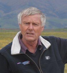 Richard Lloyd McKenzie合作论文数Producer Price Index Section;Australian Bureau of Statistics;Producer Price Index Section, Australian Bureau of Statistics3
 A.D.A. Hansen合作论文数Lawrence Berkeley Laboratory, University of California3




