Posljednjih desetljeća svjedoci smo sve bržih i intenzivnijih klimatskih promjena. Promjene klime u mediteranskom dijelu Republike Hrvatske posebno su se očitovale povećanom učestalošću požara na otvorenom prostoru koji su imali izrazito negativan utjecaj na tlo, kvalitetu vode i krajolik. Izravne posljedice požara otvorena prostora su promjene u vegetaciji te fizikalnim, kemijskim i mikrobiološkim karakteristikama tla. Neizravne posljedice su narušavanje krajolika, pojava erozije vjetrom i vodom, kao i klizišta sa svim posljedicama na okoliš koje ti procesi nose sa sobom. U Republici Hrvatskoj najveća opasnost od požara je na području Sredozemlja s gotovo 119.420 požara na otvorenom prostoru u razdoblju od 1996. do 2022. godine. Odstupanja od navedenog broja požara na ovom području dogodila su se u vlažnoj 2014. s 1.686 i kataklizmičkoj sušnoj 2017. s ekstremnom pojavom od 6.906 otvorenih požara. Zbog nedostatka izvora pitke vode, većina požara u priobalju gasi se morskom vodom, što (ne)izravno ubrzava pogoršanje fizikalnih i kemijskih značajki tla. Ekstremno suha klimatska razdoblja u ljetnim mjesecima, uz pojavu sve intenzivnijih vjetrova s jednu stranu i drastičan pad ruralnog stanovništva s drugu stranu sugeriraju da će požari otvorena prostora postati sve veći problem u bližoj budućnosti. Najučinkovitija metoda za sprječavanje nastanka požara i posljedično neželjenih promjena u okolišu jest preventivna provedba agrotehničkih postupaka (agrošumarstvo, akumulacija vode, pravilno gospodarenje biljnim ostacima na napuštenim poljoprivrednim i šumskim površinama) u jesen godine u kojoj je izbio požar ili u rano proljeće sljedeće godine prije sezone požara. Nažalost, problem požara otvorena prostora na donositeljima odluka i politika nestaje odmah na kraju protupožarne sezone. Zbog klimatskih promjena i napuštanja stanovništva u ruralnim područjima požari će se javljati u Republici Hrvatskoj na zemljopisnim dužinama i širinama gdje su prije 20 godina rijetko bilježeni.
Početkom šezdesetih prošlog stoljeća pokrenut je projekt izrade Osnovne pedološke karte bivše države Južnih Slavena. Za tu svrhu kadrovi vodećih instituta – Instituta za pedologiju i tehnologiju tla u Zagrebu i Zavoda za agropedologiju u Sarajevu izdaju priručnik: Kovačević, P., Jakšić V.: Priručnik za terenska pedološka istraživanja, Sarajevo, 1964. godine. Tako se otvara put projektu Osnovna pedološka karta (OPK) Jugoslavije 1:50 000. Metodika je utvrdila izradu karte s prikazom kontura kartografskih jedinica na u ono doba raspoloživoj topografskoj osnovi – “specijalki” mjerila 1:50 000 po Parizu. Mi, danas na zalasku, u ono doba na početku karijere, pamtimo kontroverze akademskog kruga zajedničke Yu-države. Poslije starta projekta OPK, usklađenim pritiskom akademski krugovi sa sveučilišta/univerziteta, koji su se osjetili zaobiđenim, upućuju kritike svih vrsta… traže i iznuđuju iscrpljujuću raspravu o klasifikaciji. Poslije promjena Ustava 1974. god. i decentralizacije kao procesa iznuđenih gibanjima k demokratizaciji, projekt se nastavlja za interes i o trošku republika. U opticaj se nameću još dvije promjene i dopune klasifikacije istih autora (Škorić, Filipovski, Ćirić). Kako su pojedinačne sekcije tiskane svake godine, na kraju projekta dobivena je bogata dokumentacija, ali s nekoliko promjena u nazivu istog tla, što od početka otežava primjenu, osim uskom krugu specijalista – prije nego je zaživjela u krugu korisnika, OPK postaje nekovrsni “mrtvi kapital”, a monografije tala izdaju se… na engleskom jeziku!!! U Hrvatskoj je projekt zbrzano okončan poslije 22 godine rada 1986. g. kao Osnovna pedološka karta Hrvatske mjerila 1:50 000. Nova znanja rasvijetlila su položaj tla u ekosustavu i radikalno promijenila paradigmu o tlu čija je uloga daleko šira od proizvodnje hrane i drvne mase. Učinci i uloge (krivo nazvane – funkcije) tla su: proizvodne (poljoprivreda, šumarstvo); ekološko-regulacijske (emisija plinova staklenika, hidrološki ciklus); prostorne (gospodarske, urbane, prometnice, zbrinjavanje otpada…); kulturne (krajobraz i domoljublje/patriotizam), teološke… U tom svjetlu održivo gospodarenje tlom i zaštita tla postaje pitanje koje prerasta okvire poljoprivrede i šumarstva gdje su se znanja o tlu prikupljala i vidi mjesto u primijenjenim životnim znanostima (applied life sciences). Sveučilišta Europe BOKU i Prag već su preimenovana u sveučilišta primijenjenih životnih znanosti – universities of applied life sciences. Svijet se mijenja, a naši prostori zaokupljeni starim pitanjima. Svim posebnostima država nastalih iz Yu-države usprkos, u nastalim okolnostima smatram nužnim sačuvati dragocjenu bazu podataka prikupljenih u projektu OPK 1:50 000. Valja dovršiti projekt, u njemu izvršiti neophodne inovacije, kako bi se dobila nova baza podataka o tlima, iz koje će se suvremenim računalnim tehnikama izrađivati karte odgovarajućeg mjerila za potrebe različitih korisnika u matičnim državama, Europi i globalno.
The Russian-Ukrainian war triggered a tsunami that dramatically impacted the world economy, geopolitics, and food security. Due to the extreme humanitarian situation, the effects on the environment have been overlooked. However, due to the intense fighting, the impacts will be dramatic and produce an environmental disaster. The war is already affecting areas beyond Ukraine (explosions in Russia and Moldova territory). This discussion paper aims to shed light on the potential effect of this vast conflict on the ecosystems and their services. Although the war is still ongoing, there is evidence of severe air pollution and greenhouse gas emissions resulting from the intense fights. Also, warfare activities were conducted in the vicinity of the Zaporizhzhia nuclear power plant (the biggest in Europe) and Chernobyl, increasing the fear of radiation leaks. The biodiversity is being drastically affected due to intense deforestation and habitat destruction with potential implications for wildlife. Bombing, trench and tunnel excavations will likely negatively impact soil degradation and landscape morphology. This assumes particular importance since Ukraine has some of the most fertile soils globally (Chernozem), affecting food production. Water availability and quality are likely to be affected due to infrastructure destruction and the transport of pollutants to water reserves. The ecosystem services supplied will likely be strongly damaged since deforestation will decrease the capacity of the ecosystems to regulate air pollution or climate. Soil degradation will hamper food production, and landscape aesthetics, cultural heritage and social cohesion destruction drastically affects cultural services. Finally, the impacts on human health are already tremendous. However, it can be even higher due to exposure to high levels of contamination and sanitary conditions degradation. The war is still ongoing, and there is considerable uncertainty regarding the impacts. However, we may expect a dramatic effect on the total environment.
Rješenje je pod stopama, u kojoj Winiwalter (2015) navodi
Ferdo Bašić, Ivica Kisić, Milan Mesić, Ivan Turšić, Željka Zgorelec, Aleksandra Perčin, Ivana Šestak, Darija Bilandžija, Igor Bogunović
Tlo krša (s vodom i zrakom) kao dio „ekološkog trojstva“ i sastavnica osjetljivih i ranjivih terestričkih ekosustava, među kojima agro- i silviekosutava u središtu su pažnje u Međunarodnom desetljeću tla 2015 ̶ 2014. Tla na vapnencu i dolomitu kao najrasprostranjenijim stijenama krša nastaju otapanjem kalcijeva i magnezijeva karbonata i nakupljanjem netopivog ostatka, koji je u te stijene uklopljen u vrijeme njihova nastanka. Sporost toga procesa oslikava podatak da tvorba sloja tla 1 cm debljine, uz uvjet da nema erozije traje 8 000-10 000 godina. Stoga je razumljivo da je zaštita toga blaga od erozije ključno pitanje opstanka tla i terestričkih ekosustava na sredozemnom kršu. U projektu izravnog mjerenja erozije feralitičnih tala Etiopijske visoravni (4 godine) i pseudogleja središnje Hrvatske (20 godina) provjerili smo pouzdanost i upotrebljivost najpoznatije prognostičke metode – Univerzalne jednadžbe erozije – USLE Wishmeiera i Smitha (1978). Rezultati su nas ohrabrili pa smo tu metodu koristili i u ovom radu, premda krš ima posebnosti koje otežavaju sve prognoze erozije. Općenito se u svijetu i EU koristi isključivo revidirana ili dopunjena (R)USLE, koja, uz sve nedostatke, kojih uostalom nije lišena niti jedna prognostička metoda, predstavlja solidnu osnovu za izradu smjernica održivog gospodarenja tlom, a revizija te metode je poželjna. Rezultati istraživanja nedvojbeno pokazuju da na području Južnojadranske poljoprivredne podregije uzgoj oraničnih usjeva – širokorednih (okopavina) i gustog sklopa dolazi u obzir samo na tlima na ravnom terenu, dakle u krškim poljima, riječnim dolinama, docima i ponikvama (vrtačama), odnosno na prirodnim ili izgrađenim terasama.
The aim of investigation is to analyse and classify the state of agricultural land affected by naturalbiophysical, that is, soil and terrain-slope, handicaps on its overall agro-ecological suitability for agricultural use. For the classification of land for suitability with respect to sustainable use and efficient protection, the following actual criteria were selected: soil texture, soil drainage and terrainslope. For identifying the relatively homogeneous areas, the Ward hierarchical cluster method was used. According to our estimates, Lithuanian agricultural land with unfavourable soil texture, poorly soil drainage and steep slopes covers an area of 33.59, 4.76 and 1.03% of total agricultural area, respectively. On the basis of functional classification of state of agro-ecological conditions of Lithuania, two orders of suitability (S-suitable, N-not suitable) and five land suitability classes were identified and delineated: S1 (highly suitable) included 10 district municipalities, S2 (moderately suitable) included 12 district municipalities, S3 (marginally suitable) included 15 district municipalities, N1 (currently not suitable) included 10 district municipalities and N2 (permanently not suitable) included 4 district municipalities. S3 occupies the largest (29.80%) share of the Lithuanian territory and N2 the least (5.66%). The land suitable for agriculture means with suitability classes S1, S2 and S3 was found on an area of 2,960,562 ha, which is 81.6% of the total land. In addition, soil texture was the most important factor causing differences in the classes of suitability. On the basis of natural limiting factors from an agronomic and eco-environmental perspective, the optimal sustainable development in agrosphere and a balanced-practical concept of land management and proper land use policy is presented. It is a reasonable base for agroecological regionalisation of Lithuania.
UDK 631.4(497.6) The diversity of soils and climate in the Neretva and Trebišnjica River Basin spreads from the lower, higher, high to very high zone over 2,000 meters above sea level. The most important agricultural land is in river valleys and karst poljes of belonging zones. Ameliorative systems are mostly out of function while actual systems are comprised of very intensive farming; vegetable growing, modern fruit plantations on the open field and protected areas (greenhouses), but also of the low-intensity farming system in a mountainous area. The current climate changes obviously are not a temporary phenomenon, but are a specific one; there are no more “dry” or “rainy years” as it was in the past -now we have both in the same year. In spring, the soil needs quick and efficient drainage of the sufficient water by drainage system, but in dry – vegetation period, compensation of water deficiency by irrigation is needed. Therefore, today's generation of decision-makers and users of soil as a public treasure cannot avoid the question as to which soil/land areas and at which way to focus investments. We propose the construction of multi-purpose water accumulation, to collect (excess) precipitation in autumn-winter season for irrigation in dry summer vegetation period, but it is necessary to focus land management on (pedo) biological properties and activity.
In the last two decades (1990-2012), as part of a mercury monitoring programme, earthworms and soils have been collected from four locations in the vicinity of a natural gas production and treatment plant near the village of Molve, Croatia. The aim of this study was to determine the concentration of mercury in the collected samples, monitor its changes over a longer period of time and determine the bioaccumulation of total mercury in earthworms (Eisenia fetida) from the soil. Total mercury concentrations in earthworms from the surroundings of four boreholes (Molve 9-12) ranged within 0.195-1.050, 0.129-1.0, 0.229-1.236 and 0.223-0.799 μg g-1 dry weight, while total mercury concentrations in different soil types at the same locations within 0.055-0.350, 0.035-0.250, 0.031-0.240 and 0.071-0.475 μg Hg g-1 of soil. The calculated mercury bioaccumulation factor ranged between 0.9 and 17.5. Mercury levels in soil and earthworms, as a tool for soil pollution assessment, suggested low mercury exposure and risks for human health in the monitored area.
Within soil degradation processes soil erosion is on the first place, as consequence of improper land man-agement, first of all soil tillage system and practices. Results of 10 years (1995-2004) of our investigation (investigation endure now 21st year) show guidelines in tillage practices. At first; traditional tillage practiced in this agricultural region up/down the slope on Stagnogley on slopes of 9 % and more is unsustainable in growing of row crops-maize and soybean, because of disastrous or extreme soil erosion. But, in growing of crops of high density, like wheat this practice is sustainable. On the other side, No-tillage and contour tillage resulted in much lower water erosion in comparison with up/down the slope tillage. At the beginning of experiment in the first two years No-tillage as system was not sustainable. Stabilization of yields of growing crops on the level which is statistically the same or higher than on other tillage treatments on notillage plot started after ten years of no-tillage practice. These investigations suggest the conclusion that high density crops like winter wheat, spring barley and oilseed rape are relatively suitable crops for growing under reduced tillage systems. Soybean tolerates no-till practices in climatically favourable years, but with higher risk in dry years. Maize was shown as a very risky crop without tillage even in climatically average years. We agree with assertion of Solbrig [1] that no tillage is a process, a new philosophy and way of thinking in arable farming of Europe, and not a technology.
In the long-term field trial on an arable dystric Stagnosols, winter wheat (Triticum aestivum L.) grain yield, nitrogen use efficiency (NUE) and nitrate nitrogen (NO3--N) in lysimeter water were compared under treatments of 0, 100, 150, 200, 250 and 300 kg/ha of mineral nitrogen (N) during the growth years 1996/97, 1999/00, 2002/03 and 2005/06. Year properties significantly influenced N availability resulting in different responses of grain yield and NUE under variable treatments. Grain yield showed strong significant correlation with the rainfall accumulated from March to May (r = 0.77). In the case of a dry year 2003, winter wheat yield and NUE were adversely influenced by unfavourable climatic conditions. The optimal response of yield and NUE to increasing mineral N rates was found at the amount of 150-200 kg N/ha. Very strong significant correlation between the total amount of leached NO3--N and NUE was found for periods 1999/00 and 2005/06 where, in terms of increasing N levels, lower NUE conditioned higher NO3--N leaching (r = 0.91 and r = 0.94, respectively). According to the shallow depth of groundwater and installation of drainage systems, there is still a risk of freshwater contamination by nitrates if the N rates higher than 200 kg/ha were applied.
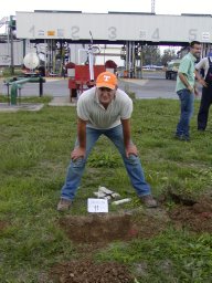 Kisic Ivica合作论文数87
 Milan Mesic合作论文数Faculty of Agriculture, University of Zagreb75
 Željka Zgorelec合作论文数Faculty of Agriculture, University of Zagreb36I. Vukovic Brinar合作论文数Department of Nephrology, Arterial, Hypertension, Dialysis and Transplantation, University Clinical Hospital Zagreb19A. Butorac合作论文数16anđelko butorac合作论文数15Aleksandra Jurisic合作论文数15Krunoslav Sajko合作论文数14Stjepan Husnjak合作论文数Soil Science Department;Faculty of Agriculture;University of Zagreb;Faculty of Agriculture, University of Zagreb9Othmar Nestroy合作论文数7Ivan Turšić合作论文数7mijo sabolic合作论文数6Franjo Tomić合作论文数6
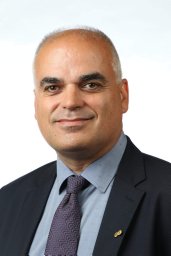 Vladislav Brkic合作论文数Fac Min Geol & Petr Engn, Univ Zagreb6
 Ivan Gaspar合作论文数Vodafone Chair Mobile Commun Syst, Tech Univ Dresden6Sanja Mesic合作论文数6
 Josip Butorac合作论文数5Vladimira Vađić合作论文数5
 Igor Bogunovic合作论文数4
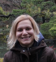 Darija Bilandzija合作论文数Fac Agr, Univ Zagreb4Silva Žužul合作论文数Institute for Medical Research and Occupational Health4M. Berdin合作论文数4Davor Romic合作论文数Faculty of Agriculture, University of Zagreb4N. Vuletić合作论文数4
 Ivana Sestak合作论文数Queen Mary School of Medicine and Dentistry, University of London4Boris Veronek合作论文数4matko bogunovic合作论文数3
 h custovic合作论文数University of Sarajevo3
 Miroslav Tratnik合作论文数3Jasminka Butorac合作论文数Faculty of Agriculture;University of Zagreb;Department of Field Crops Forages and Grassland;Faculty of Agriculture, University of Zagreb3
 Goran Durn合作论文数Faculty of Mining, Geology and Petroleum Engineering, University of Zagreb3Babić Mladen合作论文数2Zvonko Mustapić合作论文数2Milan Šipka合作论文数2
 Paul Tabbush合作论文数2Walter J. Fitz合作论文数2Branka Jelavić合作论文数2Nikola Mirošević合作论文数2T Filipan合作论文数2Lidija Bertovic合作论文数2davorin hrsto合作论文数2
 Aleksandra Percin合作论文数Faculty of Agriculture, University of Zagreb2Ksenija Zaninović合作论文数2
 Zdravko Spiric合作论文数OIKON Ltd. Institute for Applied Ecology2Cacković Mirjana合作论文数2Repmann Frank合作论文数2
 Jakov Dulčić合作论文数Laboratory of Ichtyology and Coastal Fishery, Institute of Oceanography and Fisheries2Vadic Zeljka合作论文数2




