The presence of subterranean holes creates a capillary barrier in an unsaturated environment. This phenomenon has been referred to as "Drift Shadow" and indicates a region that is sheltered from the downward percolating water. If the lateral hydraulic conductivity is insufficient to divert the water, fully saturated conditions are reached locally, and seepage occurs as the capillary barrier fails. Natural heterogeneities in hydrological properties can reduce the probability of seepage only if the flux is largely diverted around the drift. Previous numerical studies have been performed investigating various aspects of capillary barrier performance in engineered or naturally layered systems. Many authors examined the impact of heterogeneity on the distribution and rate of water seepage across a capillary barrier and into a drift, but the seepage exclusion problem has not been formally analyzed for fractured formations, in which the physical processes governing seepage in porous media also represent key factors. This paper analyzes the effect that a fracture network can have on the drift shadow. In a fractured environment, the effectiveness of the capillary barrier is determined by the capability of individual fractures to hold water by capillary forces and by the permeability and connectivity of the fracture network, which allow water to be diverted around the drift. The orientation of any individual fracture in relation to the opening, the discreteness and the anisotropy of the fracture network are all geometric factors affecting seepage, because they have a relevant influence on the hydraulic properties in the immediate vicinity of the drift wall.
Commonly measured water quality parameters were compared to heat as tracers of stream water exchange with ground water. Temperature, specific conductance, and chloride were sampled at various frequencies in the stream and adjacent wells over a 2‐year period. Strong seasonal variations in stream water were observed for temperature and specific conductance. In observation wells where the temperature response correlated to stream water, chloride and specific conductance values were similar to stream water values as well, indicating significant stream water exchange with ground water. At sites where ground water temperature fluctuations were negligible, chloride and/or specific conductance values did not correlate to stream water values, indicating that ground water was not significantly influenced by exchange with stream water. Best‐fit simulation modeling was performed at two sites to derive temperature‐based estimates of hydraulic conductivities of the alluvial sediments between the stream and wells. These estimates were used in solute transport simulations for a comparison of measured and simulated values for chloride and specific conductance. Simulation results showed that hydraulic conductivities vary seasonally and annually. This variability was a result of seasonal changes in temperature‐dependent hydraulic conductivity and scouring or clogging of the streambed. Specific conductance fits were good, while chloride data were difficult to fit due to the infrequent (quarterly) stream water chloride measurements during the study period. Combined analyses of temperature, chloride, and specific conductance led to improved quantification of the spatial and temporal variability of stream water exchange with shallow ground water in an alluvial system.
The Gardner and van Genuchten–Mualem models of relative permeability are widely used in analytical and numerical solutions to flow problems, respectively. Comparison of analytical and numerical solutions therefore requires defining some correspondence between the Gardner and van Genuchten–Mualem models. In this paper, we introduce generalized conversion formulae that reconcile these two models in the midrange of saturation. In general, we find that the Gardner parameter αG is related to the van Genuchten parameters αvG and n as αG ≈ 1.3αvGn. The performance of the proposed conversion formulae is poor when n is much smaller than 2.
The presence of an unsaturated region beneath a streambed during groundwater pumping near streams can reduce the pumping capacity, change flow paths, and alter the types of biological transformations in the streambed sediments. A three‐dimensional, multiphase flow model of two horizontal collector wells along the Russian River near Forestville, California, was developed to investigate the impact of varying the ratio of the aquifer to streambed permeability on (1) the formation of an unsaturated region beneath the stream, (2) the pumping capacity, (3) stream water fluxes through the streambed, and (4) stream water traveltimes to the collector wells. The aquifer to streambed permeability ratio at which the unsaturated region was initially observed ranged from 10 to 100. The size of the unsaturated region beneath the streambed increased as the aquifer to streambed permeability ratio increased. The simulations also indicated that for a particular aquifer permeability, decreasing the streambed permeability by only a factor of 2–3 from the permeability where desaturation initially occurred resulted in reducing the pumping capacity. In some cases, the stream water fluxes increased as the streambed permeability decreased. However, the stream water residence times increased and the fraction of stream water that reached that the wells decreased as the streambed permeability decreased, indicating that a higher streambed flux does not necessarily correlate to greater recharge of stream water around the wells.
An understanding of the hydraulic properties of the aquifer and the depth distribution of salts is critical for evaluating the potential of ground water for conjunctive water use and for maintaining suitable ground water quality in agricultural regions where ground water is used extensively for irrigation and drinking water. The electrical conductivity profiles recorded in a well using the flowing fluid electric conductivity (FEC) logging method can be analyzed to estimate interval-specific hydraulic conductivity and estimates of the salinity concentration with depth. However, operating irrigation wells commonly allow limited access, and the traditional equipment used for FEC logging cannot fit through the small access pipe intersecting the well. A modified, miniaturized FEC logging technique was developed for use in wells with limited access. In addition, a new method for injecting water over the entire screened interval of the well reduces the time required to perform FEC logging.
We have carried out numerical simulations of three‐dimensional nonisothermal flow around an in situ heat‐based flow sensor to investigate how formation heterogeneities can affect the interpretation of ground water flow velocities from this instrument. The flow sensor operates by constant heating of a 0.75‐m‐long, 5‐cm‐diameter cylindrical probe, which contains 30 thermistors in contact with the formation. The temperature evolution at each thermistor can be inverted to obtain an estimate of the ground water flow velocity vector using the standard interpretive method, which assumes that the formation is homogeneous. Analysis of data from heat‐based flow sensors installed in a sand aquifer at the Former Fort Ord Army Base near Monterey, California, suggested an unexpected component of downward flow. The magnitudes of the vertical velocities were expected to be much less than those of the horizontal velocities at this site because the sensors were installed just above a clay aquitard. Numerical simulations were conducted to examine how differences in thermal conductivities may lead to spurious indications of vertical flow velocities. We found that a decrease in the thermal conductivity near the bottom of the sensor can perturb the temperature profiles along the instrument in such a manner that analyses assuming homogeneous thermal conductivity could indicate a vertical flow component even though flow is actually horizontal. This work demonstrates how modeling can be used to simulate instrument response to formation heterogeneity and shows that caution must be used in interpreting data from such devices.
Temperature is routinely collected as a water quality parameter, but only recently utilized as an environmental tracer of stream exchanges with ground water (Stonestrom and Constantz, 2003). In this paper, water levels and seasonal temperatures were used to estimate streambed hydraulic conductivities and water fluxes. Temperatures and water levels were analyzed from 3 observation wells near the Russian River RBF facility, north of Forestville, Sonoma County, CA. In addition, 9 shallow piezometers were installed in 3 cross-sections across the stream near a pair of collector wells at the RBF facility. Hydraulic conductivities and fluxes were estimated by matching simulated ground-water temperatures to the observed ground-water temperatures with an inverse modeling approach. Using temperature measurements in the shallow piezometers from 0.1 to 1.0 m below the channel, estimates of infiltration indicated a distinct area of streambed clogging near one of the RBF collector wells. For the deeper observation wells, temperature probes were located at depths between 3.5 m to 7.1 m below the channel. Estimated conductivities varied over an order of magnitude, with anisotropies of 5 (horizontal to vertical hydraulic conductivity) generally providing the best fit to observed temperatures.
This report details the work done between June 13 andSeptember 30, 2006 by Lawrence Berkeley National Laboratory (LBNL)scientists to assist Fermi National Accelerator Laboratory (Fermilab)staff in understanding tritium transport at the Neutrino at the MainInjector (NuMI) facility. As a byproduct of beamline operation, thefacility produces (among other components) tritium in engineeredmaterials and the surrounding rock formation. Once the tritium isgenerated, it may be contained at the source location, migrate to otherregions within the facility, or be released to theenvironment.
Several theoretical studies have indicated that the presence of subsurface cavities in the vadose zone results in complete or partial diversion of flow around cavities. As a result, the region immediately below the cavities is partially shielded from the downward flux. This shadowing effect of cavities can be exploited in the design of dry subsurface storage facilities as an additional barrier to contain waste within or around the cavities. However, empirical evidence that supports these theories is lacking. This study is motivated by the inherent difficulty to make direct observation of the shadow zone as it occurs under very dry conditions. To aid future field and laboratory scale investigations of the shadow zone, we performed rigorous theoretical scrutiny of the conditions that result in the shadowing effect. We formulated relative permeability and saturation based criteria to identify the boundaries of the shadow zone. Analytical and numerical tools were used to develop dimensionless scaling laws that define the size of the shadow zone. Moreover, we analyzed the effect of natural perturbations (heterogeneity and fracturing) on the integrity of the shadow zone. The results will be used in selecting study sites; identifying observation locations and methods; and designing active tests to test the concept of shadow zone.
A drift shadow is an area immediately beneath an underground void that, in theory, will be relatively drier than the surrounding rock mass. Numerical and analytical models of water flow through unsaturated rock predict the existence of a drift shadow, but field tests confirming its existence have yet to be performed. Proving the existence of drift shadows and understanding their hydrologic and transport characteristics could provide a better understanding of how contaminants move in the subsurface if released from waste emplacement drifts such as the proposed nuclear waste repository at Yucca Mountain, Nevada. We describe the field program that will be used to investigate the existence of a drift shadow and the corresponding hydrological process at the Hazel-Atlas silica-sand mine located at the Black Diamond Mines Regional Preserve in Antioch, California. The location and configuration of this mine makes it an excellent site to observe and measure drift shadow characteristics. The mine is located in a porous sandstone unit of the Domengine Formation, an approximately 230 meter thick series of interbedded Eocene-age shales, coals, and massive-bedded sandstones. The mining method used at the mine required the development of two parallel drifts, one above the other, driven along the strike of the mined sandstone stratum. This configuration provides the opportunity to introduce water into the rock mass in the upper drift and to observe and measure its flow around the underlying drift. The passive and active hydrologic tests to be performed are described. In the passive method, cores will be obtained in a radial pattern around a drift and will be sectioned and analyzed for in-situ water content and chemical constituents. With the active hydrologic test, water will be introduced into the upper drift of the two parallel drifts and the flow of the water will be tracked as it passes near the bottom drift. Tensiometers, electrical resistance probes, neutron probes, and ground penetrating radar may be used to monitor the change in moisture content and potential over time as water is released.
MINIATURIZATION OF THE FLOWING FLUID ELECTRIC CONDUCTIVITY LOGGING TECHNIQUE Grace W. Su 1 , Nigel W.T. Quinn 1 , Paul J. Cook 1 , and William Shipp 2 Earth Sciences Division Lawrence Berkeley National Laboratory University of California Berkeley, CA 94720 U.S. Bureau of Reclamation 1849 C Street, NW, W-6332 Washington, DC 20240 October 2005
This report presents a continuation from Oldenburg et al. (2002) of analysis of the hydrogeology, In-Situ Permeable Flow Sensor (ISPFS) results, aquifer response, and changes in the trichloroethylene (TCE) groundwater plume at Operational Unit 1 (OU 1) adjacent to the former Fritzsche Army Airfield at the former Fort Ord Army Base, located on Monterey Bay in northern Monterey County. Fuels and solvents were burned on a portion of OU 1 called the Fire Drill Area (FDA) during airport fire suppression training between 1962 and 1985. This activity resulted in soil and groundwater contamination in the unconfined A-aquifer. In the late 1980's, soil excavation and bioremediation were successful in remediating soil contamination at the site. Shortly thereafter, a groundwater pump, treat, and recharge system commenced operation. This system has been largely successful at remediating groundwater contamination at the head of the groundwater plume. However, a trichloroethylene (TCE) groundwater plume extends approximately 3000 ft (900 m) to the northwest away from the FDA. In the analyses presented here, we augment our prior work (Oldenburg et al., 2002) with new information including treatment-system totalizer data, recent water-level and chemistry data, and data collected from new wells to discern trends in contaminant migration and groundwater flow that may be useful for ongoing remediation efforts. Some conclusions from the prior study have been modified based on these new analyses, and these are pointed out clearly in this report.
Field observations at the Russian River Bank Filtration Facility in Sonoma County, California indicate that an unsaturated region exists below the streambed near two adjacent groundwater pumping wells located along the riverbank. Understanding the conditions that give rise to unsaturated flow below the streambed is critical for improving and optimizing riverbank well pumping operations. To investigate the development of an unsaturated region below a perennial river near pumping wells, a three-dimensional model was developed using the multi-phase subsurface flow model, TOUGH2. The model is based on the region around the two pumping wells in the Russian River Bank Filtration Facility. The pumping wells consist of 9 perforated pipes that are projected horizontally into the aquifer at a depth of approximately 20 m below the land surface. A grid was developed for the TOUGH2 model with finer resolution near the wells to represent individual pipes. The effect of varying the pumping operation and the streambed permeability on the extent of the unsaturated region was investigated with the TOUGH2 model. The formation remained saturated below the streambed when only one of the wells was pumped at a rate of 1600 m 3 /hr, but an unsaturated region developed below the streambed when the two wells each pumped at a rate of 1600 m 3 /hr. This unsaturated region was deeper when the permeability of the streambed was lower than the aquifer material compared to when the streambed and aquifer permeabilities were the same. Water treatment by bank filtration may not be as effective when a large unsaturated region develops below the streambed.
Current methods do not allow for sampling of in situ water from unsaturated fractures in low‐moisture environments. A novel cryogenic coring technique based on a previously developed method is used to collect in situ water in unsaturated fractures. This method uses liquid nitrogen as the drilling fluid, which can freeze the fracture water in place while coring. Laboratory experiments are conducted to demonstrate that water in an unsaturated fracture can be frozen and collected using cryogenic coring.
Liquid flow through unsaturated fractures often proceeds as fingers or preferential flow paths. During the invasion of liquid fingers into an initially dry, nonhorizontal fracture, fingers may drain, forming a narrow thread of liquid called a rivulet that connects to a wider portion of liquid at the advancing front, defined as a blob. Experimental studies using idealized fractures were performed to investigate the effects of wettability, surface roughness, and aperture size on several important features of gravity‐driven flow in fractures: liquid drainage, blob migration, and rivulet flow. The experiments demonstrate that the critical length of the blob before drainage occurred was significantly longer on surfaces with intermediate wettability and on surfaces with roughness on the order of 100 μm than on a smooth, flat water‐wetting surface. However, drainage did not occur on surfaces with smaller‐scale roughness on the order of 10 μm. Blob velocities were also measured and were always less than the saturated gravity‐driven flow velocity, even when a liquid with a static contact angle of zero was used. This reduction in velocity was attributed to contact angle hysteresis. Rivulet widths measured as a function of flow rate between glass and acrylic parallel plates were generally larger on the acrylic plates than the glass plates for a particular flow rate, demonstrating the sensitivity of rivulet flow to wettability. In addition, the cubic law overpredicted the measured rivulet widths, except for the widths measured between the acrylic plates at 20°. The effect of aperture variability on rivulet flow was also examined. At a critical aperture ranging between 0.25 and 0.37 mm, the liquid in the rivulet did not completely span the aperture, forming two streamlets of liquid on either side of the fracture.
Well water temperatures are often collected simultaneously with water levels; however, temperature data are generally considered only as a water quality parameter and are not utilized as an environmental tracer. In this paper, water levels and seasonal temperatures are used to estimate hydraulic conductivities in a stream-aquifer system. To demonstrate this method, temperatures and water levels are analyzed from six observation wells along an example study site, the Russian River in Sonoma County, California. The range in seasonal ground water temperatures in these wells varied from <0.2 degrees C in two wells to approximately 8 degrees C in the other four wells from June to October 2000. The temperature probes in the six wells are located at depths between 3.5 and 7.1 m relative to the river channel. Hydraulic conductivities are estimated by matching simulated ground water temperatures to the observed ground water temperatures. An anisotropy of 5 (horizontal to vertical hydraulic conductivity) generally gives the best fit to the observed temperatures. Estimated conductivities vary over an order of magnitude in the six locations analyzed. In some locations, a change in the observed temperature profile occurred during the study, most likely due to deposition of fine-grained sediment and organic matter plugging the streambed. A reasonable fit to this change in the temperature profile is obtained by decreasing the hydraulic conductivity in the simulations. This study demonstrates that seasonal ground water temperatures monitored in observation wells provide an effective means of estimating hydraulic conductivities in alluvial aquifers.
 Jim Constantz合作论文数12
 Karsten Pruess合作论文数Earth Sciences Division, Lawrence Berkeley National Laboratory5
 Curtis M. Oldenburg合作论文数Lawrence Berkeley National Laboratory, University of California4
 John Nimmo合作论文数US Geological Survey4
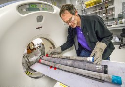 Timothy J. Kneafsey合作论文数Lawrence Berkeley National Laboratory4
 Jil T. Geller合作论文数4Preston D. Jordan合作论文数4J. Jasperse合作论文数3Paul F. Daley合作论文数3Marisa H. Cox合作论文数3
 Teamrat A. Ghezzehei合作论文数Earth Sciences Division;Lawrence Berkeley National Laboratory;Earth Sciences Division, Lawrence Berkeley National Laboratory3
 C. E. Hatch合作论文数3Paul J. Cook合作论文数2
 Quanlin Zhou合作论文数Lawrence Berkeley National Laboratory, University of California2Donald Seymour合作论文数2Barry M. Freifeld合作论文数Lawrence Berkeley Natl Lab, Univ Calif Berkeley2
 James Robert Hunt (James R. Hunt)合作论文数Department of Civil and Environmental Engineering, University of California, Berkeley2William Shipp合作论文数2mark steven conrad合作论文数1c e hatch合作论文数1James Jasperse合作论文数1Jr Hunt合作论文数1Chris J. Delaney合作论文数1Stefan Finsterle合作论文数1N.W.T. Quinn合作论文数University of California1B. Mack Kennedy合作论文数1Maria Ines Dragila合作论文数1Rohit Salve合作论文数1
 Kris Zacny合作论文数Honeybee Robotics Spacecraft Mechanisms Corporation1
 Claudia Cherubini合作论文数University of Ferrara1Nigel W. T. Quinn合作论文数University of California1




