We developed a very high sensitivity ultra-wideband radar operating at 200 MHz and optimized signal processor to map internal layers close to the bed. We used the radar to perform measurements with a large antenna array to collect data during the 2019–2020 field season in Antarctica. We processed and analyzed these data to generate detailed maps of internal layers to assist with selecting a drill site. The paper provides a brief summary of the radar system and field program. We also provide an overview of the algorithm, results, and their interpretation.
Ice sounding and mapping internal layers with radars over large areas is an effective way to obtain data to understand and model ice dynamics. To map the bottom most layers and determine the ice-bed topography of more than 3-km Greenland ice with fine resolution, we developed a 180 - 340 MHz ultrawide band (UWB) dual-polarized ice sounding radar. The radar was deployed as a part of the East Greenland Ice-core Project (EGRIP) in summer 2019. It is configured as a 12-channel multiple-input-multiple-output (MIMO) system. We designed and built a dual-polarized tightly coupled antenna-array. This paper presents the radar design, antenna performance and sample results from the data collected in the field.
Two surface-based multi-channel radar systems, operating in the VHF and UHF bands, were designed, developed and deployed to the East Greenland Ice-coring Project (EGRIP) site in Summer 2018 for ice sheet sounding and imaging. Both radar systems, sharing the same digital waveform generator and digitizer, were installed and operated inside a tracked vehicle. The VHF system operates over the frequency range of 170-230 MHz with a peak transmit power of 600 W. The radar is equipped with an 8-m long monopole array. The UHF system operates from 600 to 900 MHz with a peak transmit power of 800 W, and is equipped with a large and lightweight 16 m × 17 m antenna array arranged in a Mill's Cross configuration. In this paper, we will present the design of the two radar systems and the radar data collected from EGRIP.
The Antarctic Roadmap Challenges (ARC) project identified critical requirements to deliver high priority Antarctic research in the 21st century. The ARC project addressed the challenges of enabling technologies, facilitating access, providing logistics and infrastructure, and capitalizing on international co-operation. Technological requirements include: i) innovative automated in situ observing systems, sensors and interoperable platforms (including power demands), ii) realistic and holistic numerical models, iii) enhanced remote sensing and sensors, iv) expanded sample collection and retrieval technologies, and v) greater cyber-infrastructure to process 'big data' collection, transmission and analyses while promoting data accessibility. These technologies must be widely available, performance and reliability must be improved and technologies used elsewhere must be applied to the Antarctic. Considerable Antarctic research is field-based, making access to vital geographical targets essential. Future research will require continent- and ocean-wide environmentally responsible access to coastal and interior Antarctica and the Southern Ocean. Year-round access is indispensable. The cost of future Antarctic science is great but there are opportunities for all to participate commensurate with national resources, expertise and interests. The scope of future Antarctic research will necessitate enhanced and inventive interdisciplinary and international collaborations. The full promise of Antarctic science will only be realized if nations act together.
In this paper, we present the development of a multi-channel VHF/UHF ultra-wideband airborne radar sounder and imager for measurements of polar ice sheets. The radar was developed at the Center for Remote Sensing of Ice Sheets (CReSIS) for operation onboard the German Alfred Wegener Institute (AWI) Basler BT-67 aircraft. The system operates from 150 to 600 MHz corresponding to a vertical resolution of 33 cm in free space. The radar is equipped with three 4-m long 8-element antenna subarrays installed under the fuselage and both wings to support 8 transmit and 24 receive channels. The radar waveform from each transmit channel can be configured individually to enable real-time transmit beamforming for wide-swath ice bed imaging of up to 10 km wide. The radar system was deployed to Greenland in the spring of 2016 as a part of the joint AWI/CReSIS test campaign to conduct measurements over glaciers. Sample radar data from this field campaign are presented to illustrate the capability of the radar.
Abstract. We investigate the propagation of seismic waves in anisotropic ice. Two effects are important: (i) sudden changes in crystal orientation fabric (COF) lead to englacial reflections; (ii) the anisotropic fabric induces an angle dependency on the seismic velocities and, thus, recorded travel times. Velocities calculated from the polycrystal elasticity tensor derived for the anisotropic fabric from measured COF eigenvalues of the EDML ice core, Antarctica, show good agreement with the velocity trend determined from vertical seismic profiling. The agreement of the absolute velocity values, however, depends on the choice of the monocrystal elasticity tensor used for the calculation of the polycrystal properties. We make use of abrupt changes in COF as a common reflection mechanism for seismic and radar data below the firn–ice transition to determine COF-induced reflections in either data set by joint comparison with ice-core data. Our results highlight the possibility to complement regional radar surveys with local, surface-based seismic experiments to separate isochrones in radar data from other mechanisms. This is important for the reconnaissance of future ice-core drill sites, where accurate isochrone (i.e. non-COF) layer integrity allows for synchronization with other cores, as well as studies of ice dynamics considering non-homogeneous ice viscosity from preferred crystal orientations.
Antarctic and Southern Ocean science is vital to understanding natural variability, the processes that govern global change and the role of humans in the Earth and climate system. The potential for new knowledge to be gained from future Antarctic science is substantial. Therefore, the international Antarctic community came together to 'scan the horizon' to identify the highest priority scientific questions that researchers should aspire to answer in the next two decades and beyond. Wide consultation was a fundamental principle for the development of a collective, international view of the most important future directions in Antarctic science. From the many possibilities, the horizon scan identified 80 key scientific questions through structured debate, discussion, revision and voting. Questions were clustered into seven topics: i) Antarctic atmosphere and global connections, ii) Southern Ocean and sea ice in a warming world, iii) ice sheet and sea level, iv) the dynamic Earth, v) life on the precipice, vi) near-Earth space and beyond, and vii) human presence in Antarctica. Answering the questions identified by the horizon scan will require innovative experimental designs, novel applications of technology, invention of next-generation field and laboratory approaches, and expanded observing systems and networks. Unbiased, non-contaminating procedures will be required to retrieve the requisite air, biota, sediment, rock, ice and water samples. Sustained year-round access to Antarctica and the Southern Ocean will be essential to increase winter-time measurements. Improved models are needed that represent Antarctica and the Southern Ocean in the Earth System, and provide predictions at spatial and temporal resolutions useful for decision making. A co-ordinated portfolio of cross-disciplinary science, based on new models of international collaboration, will be essential as no scientist, programme or nation can realize these aspirations alone.
This study focuses on the present-day surface elevation of the Greenland and Antarctic ice sheets. Based on 3 years of CryoSat-2 data acquisition we derived new elevation models (DEMs) as well as elevation change maps and volume change estimates for both ice sheets. Here we present the new DEMs and their corresponding error maps. The accuracy of the derived DEMs for Greenland and Antarctica is similar to those of previous DEMs obtained by satellite-based laser and radar altimeters. Comparisons with ICESat data show that 80% of the CryoSat-2 DEMs have an uncertainty of less than 3 m ± 15 m. The surface elevation change rates between January 2011 and January 2014 are presented for both ice sheets. We compared our results to elevation change rates obtained from ICESat data covering the time period from 2003 to 2009. The comparison reveals that in West Antarctica the volume loss has increased by a factor of 3. It also shows an anomalous thickening in Dronning Maud Land, East Antarctica which represents a known large-scale accumulation event. This anomaly partly compensates for the observed increased volume loss of the Antarctic Peninsula and West Antarctica. For Greenland we find a volume loss increased by a factor of 2.5 compared to the ICESat period with large negative elevation changes concentrated at the west and southeast coasts. The combined volume change of Greenland and Antarctica for the observation period is estimated to be −503 ± 107 km3 yr−1. Greenland contributes nearly 75% to the total volume change with −375 ± 24 km3 yr−1.
Abstract This study aims to demonstrate that deep ice cores can be synchronized using internal horizons in the ice between the drill sites revealed by airborne radio-echo sounding (RES) over a distance of >1000km, despite significant variations in glaciological parameters, such as accumulation rate between the sites. In 2002/03 a profile between the Kohnen station and Dome Fuji deep ice-core drill sites, Antarctica, was completed using airborne RES. The survey reveals several continuous internal horizons in the RES section over a length of 1217 km. The layers allow direct comparison of the deep ice cores drilled at the two stations. In particular, the counterpart of a visible layer observed in the Kohnen station (EDML) ice core at 1054 m depth has been identified in the Dome Fuji ice core at 575 m depth using internal RES horizons. Thus the two ice cores can be synchronized, i.e. the ice at 1560 m depth (at the bottom of the 2003 EDML drilling) is ∼49ka old according to the Dome Fuji age/depth scale, using the traced internal layers presented in this study.
There is currently no doubt about the existence of a widespread hydrological network under the Antarctic Ice Sheet, which lubricates the ice base and thus leads to increased ice velocities. Consequently, ice models should incorporate basal hydrology to obtain meaningful results for future ice dynamics and their contribution to global sea level rise. Here, we introduce the balanced water layer concept, covering two prominent subglacial hydrological features for ice sheet modeling on a continental scale: the evolution of subglacial lakes and balance water fluxes. We couple it to the thermomechanical ice-flow model RIMBAY and apply it to a synthetic model domain. In our experiments we demonstrate the dynamic generation of subglacial lakes and their impact on the velocity field of the overlaying ice sheet, resulting in a negative ice mass balance. Furthermore, we introduce an elementary parametrization of the water flux–basal sliding coupling and reveal the predominance of the ice loss through the resulting ice streams against the stabilizing influence of less hydrologically active areas. We point out that established balance flux schemes quantify these effects only partially as their ability to store subglacial water is lacking.
The recovery of a 1.5 million yr long ice core from Antarctica represents a keystone of our understanding of Quaternary climate, the progression of glaciation over this time period and the role of greenhouse gas cycles in this progression. Here we tackle the question of where such ice may still be found in the Antarctic ice sheet. We can show that such old ice is most likely to exist in the plateau area of the East Antarctic ice sheet (EAIS) without stratigraphic disturbance and should be able to be recovered after careful pre-site selection studies. Based on a simple ice and heat flow model and glaciological observations, we conclude that positions in the vicinity of major domes and saddle position on the East Antarctic Plateau will most likely have such old ice in store and represent the best study areas for dedicated reconnaissance studies in the near future. In contrast to previous ice core drill site selections, however, we strongly suggest significantly reduced ice thickness to avoid bottom melting. For example for the geothermal heat flux and accumulation conditions at Dome C, an ice thickness lower than but close to about 2500 m would be required to find 1.5 Myr old ice (i.e., more than 700 m less than at the current EPICA Dome C drill site). Within this constraint, the resolution of an Oldest-Ice record and the distance of such old ice to the bedrock should be maximized to avoid ice flow disturbances, for example, by finding locations with minimum geothermal heat flux. As the geothermal heat flux is largely unknown for the EAIS, this parameter has to be carefully determined beforehand. In addition, detailed bedrock topography and ice flow history has to be reconstructed for candidates of an Oldest-Ice ice coring site. Finally, we argue strongly for rapid access drilling before any full, deep ice coring activity commences to bring datable samples to the surface and to allow an age check of the oldest ice.
Tectonometamorphic zones were defined within the lower Paleozoic basement of the NW Argentine Andes in a transitional zone between two Andean segments of different geotectonic evolution. In the Cambrian, the Pacific edge of Gondwana changed from a passive to an active continental margin. This event began with folding of a Vendian/Eocambrian sediment wedge (Puncoviscana Formation and equivalents). The effects can be traced progressively over all structural levels with exposed depth increasing from north to south. Phenomena of a second deformation are of different nature and age but mostly characterized by shear belts causing large-scale crustal imbrication. In the lower tectonic levels this phase coincides with subduction-related magmatism of Ordovician age. A flat subduction slab is supposed, somewhat steeper in the northern than in the southern segment. The following anatectic-granitic magmatism and weak deformation in the Devonian may have marked a new change to passive margin conditions.
 Hans Oerter合作论文数32
 Hajo Eicken合作论文数International Arctic Research Center, University of Alaska Fairbanks29Frank Wilhelms合作论文数Alfred-Wegener-Institut fur Polar - und Meeresforschung Bremerhaven28
 Hubertus Fischer合作论文数Physics Institute, Faculty of Science, University of Bern17
 Dorthe Dahl-Jensen合作论文数Centre For Earth Observation Science, University of Manitoba;Clayton H. Riddell Faculty of Environment, Earth, and Resources, University of Manitoba;Niels Bohr Institute, University of Copenhagen17
 Daniel Steinhage合作论文数15Uwe Nixdorf合作论文数14
 Sigfús Jóhann Johnsen合作论文数University of Copenhagen10
 Eric Wolff合作论文数Department of Earth Sciences, University of Cambridge10
 Wilfried Jokat合作论文数Institute for Polar and Marine Research10Sepp Kipfstuhl合作论文数9Olaf Eisen合作论文数Hiljem töötas9
 Siva Prasad Gogineni合作论文数Department of Aerospace Engineering and Mechanics, College of Engineering, The University of Alabama;Department of Electrical and Computer Engineering, College of Engineering, The University of Alabama8Josef Kipfstuhl合作论文数8
 Rolf Weller合作论文数8
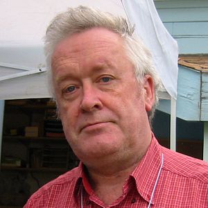 Hans Von Storch合作论文数Institute for Coastal Systems, Helmholtz-Zentrum Hereon;Meteorological Institute, University of Hamburg;Faculty of Social Sciences, University of Hamburg8
 Jérôme Chappellaz合作论文数Environmental Engineering Institute, School of Architecture, Civil and Environmental Engineering, Ecole Polytechnique Fédérale de Lausanne;Centre National De La Recherche Scientifique7mj schwab合作论文数6
 Thomas Stocker合作论文数Oeschger Centre for Climate Change Research, University of Bern6
 Valerie Masson-Delmotte合作论文数Climate Research Division, CEA, LSCE6
 Jan-Gunnar Winther合作论文数UiT Norges Arktiske Universitet;Norwegian Polar Institute6Jfw Negendank合作论文数5F. Traufetter合作论文数5
 Jim White合作论文数College of Arts and Sciences, University of North Carolina at Chapel Hill5
 Uwe Meyer合作论文数5
 Jean Jouzel合作论文数Laboratoire des Sciences du Climat et de L'Environnement5Niels S. Gundestrup合作论文数5
 Robert Mulvaney合作论文数5
 Diedrich Fritzsche合作论文数Alfred Wegener Institute for Polar and Marine Research5vladimir ya lipenkov合作论文数5
 Jakob Schwander合作论文数Physics Institute, Faculty of Science, University of Bern5H. Gebrande合作论文数5p kaufmann合作论文数4Wolfgang Graf合作论文数4
 Baijun Yan (闫柏军)合作论文数School of Metallurgical and Ecological Engineering, University of Science and Technology Beijing4A. Pape合作论文数4
 Christoph Mayer合作论文数Kommission für Glaziologie, Bayerische Akademie der Wissenschaften4
 Ilia Rodushkin合作论文数Analytica AB4Reinhard Nmn Brandt合作论文数4
 Amnon Marinov合作论文数4
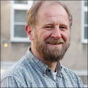 JP Steffensen合作论文数Physics of Ice, Climate and Earth, Niels Bohr Institute, University of Copenhagen4
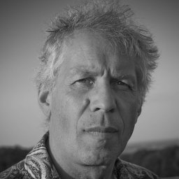 Hannes Grobe合作论文数Alfred-Wegener-Institute for Polar and Marine Research4
 Sebastian Gerland合作论文数4Dietmar Kolb合作论文数4J. P. Steffensen合作论文数4
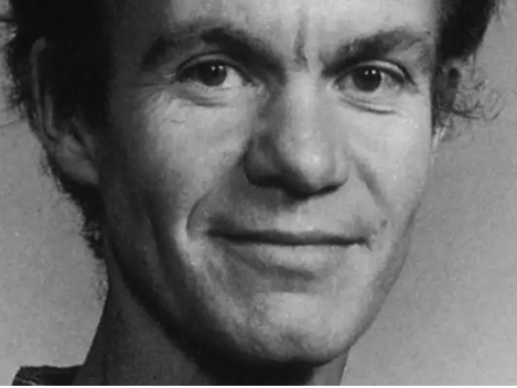 Niels Reeh合作论文数De Nationale Geologiske Undersøgelser for Danmark og Grønland;Danmarks Tekniske Universitet4Yoav Kashiv合作论文数4F. Jung-Rothenhäusler合作论文数4Fidan Göktas合作论文数4




