The Vestnesa Ridge at 79 degrees N in the Arctic Fram Strait is known for sub-surface methane hydrate reservoirs and numerous gas emitting pockmarks, with associated microbial and faunal communities on its eastern flank. The expedition MSM95 in 2020 found the first evidence of active methane seepage on the north-western flank of the Vestnesa Ridge in water depths of 1200 to 1375 m. Subsequent investigations during the PS136, MSM108 and PS143/1 expeditions with towed camera, Remotely Operated Vehicle and trawl sampling confirmed the MSM95 early indications. Here we report the first faunal assemblage description of the discovered active methane seep field, named H oe nir seep field. In-situ image analyses of the methane seep field and its active and inactive areas showed a regional community comprising 47 megafaunal taxa. The presence of obligate seep-associated faunal taxa, such as the tube-building siboglinid polychaetes and oligochaetes were interpreted as indicative of active methane seepage in the area. The most frequent taxon observed, ophiuroids in the genus Ophiocten L & uuml;tken, 1855, occurred in high densities with up to 80 ind. per m2 in inactive areas but was absent from the seafloor closer than a few meters from bacterial mat or tubeworm forests. The fauna seen in the H oe nir seep field shares most faunal elements with seep fields previously studied on the eastern flank of the Vestnesa Ridge and on the nearby Svyatagor Ridge. For taxonomic identifications of fauna associated with the methane seepage, 95 specimens of 43 selected taxa, mostly ophiuroids, polychaetes and amphipods, were COI barcoded.
The expansion of offshore renewable energy developments (ORED) has prompted increasing concerns regarding their potential impacts on the marine environment and repercussions for ecosystem functions. A comparative assessment of benthic invertebrate communities associated with natural versus artificial hard substrates could provide insights for assessing ecological changes following the installation of such structures. This study evaluated the ecological functionality of offshore wind turbine foundations, scour protection layers, and geogenic natural reefs through a trait-based approach. The analysis focused on two regions (which we called 'Belgium' and 'Borkum') selected based on the availability of high-resolution invertebrate taxonomic data, comprising natural and artificial substrates at nearby geographical locations. Taxonomic data were sourced from the BISAR database, while functional trait data were compiled through an extensive review of the scientific literature. A total of six functional traits, encompassing 29 modalities, were assessed. The resulting data were analysed to determine both taxonomic and functional differences between artificial and natural hard substrates. Functional analyses were performed using a combination of functional diversity indices and latent variable models to elucidate underlying patterns in trait distribution and community functioning. The results constitute evidence, demonstrating that geogenic natural habitats support higher levels of biodiversity and harbour functionally distinct communities when compared to artificial structures. Analyses of functional diversity indices revealed significant differences in functional evenness and divergence between natural reef communities and those associated with artificial structures. These differences illustrate that natural rocks exhibit greater functional resilience to environmental disturbances. Furthermore, the majority of trait modalities exhibited significant responses to at least one substrate type, and several taxa displayed effect sizes that were positively or negatively correlated with specific habitat types, indicating substrate-driven shifts in community functional composition. Given the pronounced differences in biodiversity and functional attributes between natural and artificial hard substrates, enhancing the ecological sustainability of ORED requires a shift towards ecologically informed design. Artificial structures could potentially be engineered to mimic the multidimensional and heterogeneous properties of natural substrates, facilitating the establishment of more resilient benthic communities. These results have conservation and management implications when planning the introduction of such structures over local and regional scales.
Benthic megafauna communities in the Arctic Ocean play a vital role in deep-sea ecosystem functioning by influencing the local biogeochemistry and the global carbon cycle. Their community structure is largely driven by phytodetrital fluxes from the surface ocean, increasing their susceptibility to environmental change. This study assessed short-term variability in benthic megafauna community composition, taxonomically and functionally, across three stations (N3, HG-IV, S3) situated within the lower bathyal zone (similar to 2500 m) at the LTER HAUSGARTEN site, in relation to environmental parameters such as biogenic sediment components and habitat features. The analysis was based on image data and sediment samples collected in consecutive years from 2016 to 2021. Additionally, long-term changes in the density of four selected taxa were examined by comparing two periods: 2002/2004-2015 (literature-based) and 2016-2021 (this study). Over the six-year period, the community structure showed considerable temporal variability, primarily driven by changes in the density of the opportunistic sea cucumber Elpidia heckeri. Environmental parameters explained spatial variation across stations more effectively than temporal variation across years. Long-term analyses revealed a general decline in density of the selected taxa, with average density decreases ranging from 28% for a crinoid to 93% for a soft coral. These findings highlight the dynamic nature of Arctic benthic megafauna communities and their complex responses to local environmental change. The pronounced temporal fluctuations and substantial population declines underscore the urgent need to extend time-series studies both temporally and spatially to enable accurate predictions of the future state of Arctic deep-sea ecosystems.
During the initial 25 years of operation, the Long Term Ecological Research (LTER) observatory HAUSGARTEN has facilitated the generation and collection of a huge array of data and data types from the Fram Strait, Arctic. These data have supported 200+ primarily environmental, biological and climate studies related publications, as well as provided input data for climate prediction models and a host of other large data investigations in topics ranging from surface/seawater gas exchange to deep sea meiofauna abundances in the vicinity of food falls.These data are hugely valuable for future trans disciplinary studies on ecosystem functioning and response to environmental change, as well as providing input to other future studies, such as temporal faunal abundance or distribution studies. To better support future research endeavours there has been a progressive drive across the environmental research community to permanently archive and make environmental research data freely available to researchers, the public and legislators environmental research data globally. The site of the LTER observatory HAUSGARTEN, at the Arctic - Atlantic intersection renders it a site of particular interest during the ongoing global environmental changes.In this paper we introduce the open access long term storage archives which are the repositories for much of the LTER observatory HAUSGARTEN monitoring and experimental results, and introduce some of the new and novel ways such archived data can now be accessed readily by individuals not directly involved in data collection.
Soft-sediment habitats support diverse benthic communities and demersal fish populations, but are facing growing anthropogenic pressures, leading to shifts in predator-prey dynamics. For example, populations of small predators such as the oceanic Lusitanian solenette Buglossidium luteum have rapidly increased, with potential impacts on the benthic food web. Stomach content analyses offer a direct way to uncover trophic relationships, but traditional morphological methods can lead to under-representation of certain taxa and an under-estimation of the diet range of small predatory flatfish. Here, we utilized an integrative approach, combining DNA metabarcoding and morphological identification of solenette gut contents collected in the south-eastern North Sea. These observations were further correlated with benthic infauna data of the respective sampling stations. The diet of solenette in the south-eastern North Sea was characterized by a high diversity with a total of 164 different taxa with a clear emphasis on crustaceans and polychaetes across all benthic assemblages in the studied area. However, there was a strong spatial differentiation in prey composition, highlighting solenette as highly opportunistic benthic feeders. DNA metabarcoding detected more prey taxa than morphology alone, highlighting its superior resolution and ability to reveal hidden diet components. The displayed flexibility in the diet of solenette likely contributes to the ongoing success of this flatfish in northern European seas. Consequently, along with warming sea temperatures and the mesopredator release caused by decades of fishing activities, this small benthic predator may exert considerable predation pressure on benthic infaunal communities of the North Sea, with so far unpredictable implications.
Benthic organisms are important ecological receptors, playing fundamental roles across seafloor ecosystems, delivering some of the most important functions in the marine environment. Some of these key benthic functions include nutrient cycling, food provision for higher trophic levels, and carbon storage. Over the past 6 years, benthic monitoring has faced growing complexity, driven by diminishing funding and the constraints imposed by the COVID-19 pandemic. These challenges underscore the pressing need to recognize the enduring value of benthic time series in supporting monitoring, management, and modelling efforts. These long-term data sets have been critical to advance our current understanding into the areas of cumulative effects, conservation, management of Marine Protected Areas (MPAs), development of indicators, and assessment of climate-driven changes in marine ecosystems. Ongoing expert group discussions consistently affirm both the relevance and necessity of continuing to collect these vital data sets. However, the focus on emerging technologies and so-called 'cutting-edge' approaches sometimes leads to the undervaluation and compromising some of these long-term series. We contend that a comprehensive understanding of benthic ecology, essential for robust marine management, reliable numerical analysis, and taxonomic consistency, cannot be achieved without the continuity provided by long-term data. Such time series are indispensable for tracking patterns of change and assessing responses across diverse human activities and seafloor ecosystems. While our research has concentrated on soft sediment environments, many of the key principles and recommendations outlined here are broadly applicable to other ecosystem types.
Global accelerated changes impact deep-sea ecosystems, as particularly the current global warming trend is amplified in the Arctic. Studies on temporal dynamics of the deep-sea benthic fauna and its response to environmental change are scarce, and the long-term observatory HAUSGARTEN is the only one in the Arctic. In the present study, we investigated spatio-temporal variability over a decade (from 2010 to 2021) of macrobenthos from different depths (from 1200 to 5500 m) at HAUSGARTEN by assessing community structure (species composition and diversity), functional composition (functional trait composition and diversity), and linking biological variability to environmental drivers. Our findings provide evidence that a) benthic communities are spatially different along the bathymetric gradient, b) long-term trends of benthic communities were subtle, but response of species and functional metrics to the warm water anomaly in 2015-2017 reveal high sensitivity to episodic climate forcing, c) depth and food availability were the primary drivers of macrobenthic spatial and temporal variability and d) communities of deeper habitats (>4000 m) have a low and temporally more variable functional richness, diversity and redundancy in contrast to shallower bathyal communities. Our study indicates that deep-sea macrobenthos, particularly that deeper than 4000 m, might be more sensitive to species loss and regime shifts in the future, as the fauna strongly depends on the prevailing food conditions modulated by atlantification or marine heat waves, and have a lower capacity than shallower bathyal communities to maintain ecological functioning against environmental changes.
Located in the Fram Strait, the only deep-water connection between the Central Arctic Ocean (CAO) and the World Oceans, the long-term HAUSGARTEN (HG) observatory monitors potential range shifts of boreal and Arctic species. In order to understand potential future shifts, species inventories with consistent identifications are required. Based on 10 years of box corer and epibenthic sled sampling, a total of 2198 individuals were examined, yielding 19 species, 15 of which occurred below 500 m and constitute the study focus. A comprehensive catalogue with simplified traditional and digital identification keys for 64 species of the order Cumacea (Crustacea: Peracarida) from the deep Arctic Ocean is presented. Cumacean species diversity peaked between 1200 and 1500 m (n = 10). Bathymetric or geographic distribution was extended for three species (Eudorella emarginata, Leucon (Leucon) nasica, Hemilamprops uniplicatus). The deepest recorded species Leucon (Leucon) acutirostris (3511 m) and Diastylis polaris (2913 m) were sampled in central HG. No species occurred exclusively below 2000 m. Instead, all species of this study occurred at a wide range of depths and were mostly widespread, boreal and typical Arctic species. Modelled species accumulation curve suggested that the presented cumacean species list is most likely complete for the Arctic deep sea. Some morphological findings challenge selected species validity, especially in the families Diastylidae and Leuconidae. Additionally, we present the first highresolution images of rarely sampled, intact adult males of the species D. polaris, Campylaspis costata and Leucon (Leucon) spinulosus. Our results, together with the low taxa uniqueness in the CAO, support applying the provided identification keys to the entire deep Arctic Ocean.
Understanding the effects of artificial structures in marine landscapes is required for ecosystem-based management. Global demand for oil and gas and accelerated commitments to renewable energy development has led to the proliferation of marine artificial structures. Investigating the cumulative effects of these structures on marine ecosystems requires data on the benthic community over large geographical and long-time scales. It is imperative to share the data collected by many stakeholders in an integrated information system to benefit science, industry and policy. BISAR is the first data product containing harmonised and quality-checked international data on benthos from artificial structures in the North Sea. BISAR was compiled from environmental impact assessment studies and scientific projects (3864 samples, 890 taxa). Data derive from 34 artificial structures and surrounding soft sediments (years: 2003 to 2019). Structures include offshore wind turbines, oil and gas platforms and a research platform. Data from a geogenic reef, allow comparison of natural and artificial reef communities. We aim to host future BISAR data dynamically in the CRITTERBASE web portal.
In response to climate change, the expansion of renewable energies leads to an increasing number of offshore wind farms in the North Sea. This comes along with an increase in (artificial) hard substrates in a mainly soft-bottom dominated marine area with so far largely unknown consequences for the underlying ecosystem functioning. We used a large combined dataset (both hard- and soft-substrate data) to model the secondary production of fouling communities on turbine foundations and of soft-bottom fauna inside and outside offshore wind farms (OWF) in the southern North Sea (Belgium, the Netherlands, Germany). We demonstrate that (1) a large amount of energy is channelled through fouling fauna on turbines (i.e., secondary production of fouling communities was on average 80 times higher than of soft-substrate communities), (2) 71 % of fouling production on turbines is released to the surrounding sediment (annual release: -221 ± 825 gC m-2 y-1 (SD)), and that (3) local production of soft-bottom communities is elevated up to a distance of 150-250 m from turbines. Production impacted area (PIA) was determined from hard- and soft-substrate data independently: mechanistic modelling of hard-substrate production export showed a production increase of 5 % up to 150 m from the turbine and generalised additive mixed models (GAMMs) based on soft-bottom fauna data suggested an elevated production up to 250 m from turbines. Accordingly, on the scale of an OWF (distance between turbines ∼1000 m), the local production "halo" effect around turbines affects about 11 % of an OWF area (dependent on OWF configuration). The observed changes in benthic energy flow may lead to so far unknown changes at the ecosystem level from plankton communities to apex predators.
Over the past 2 decades, deep-sea nematode communities in the Arctic Ocean have undergone significant changes in structure and diversity, likely linked to shifting organic matter input and environmental conditions. Free-living nematodes were collected in 2000, 2004, 2009, 2014 and 2019 at 3 stations along a bathymetric transect (1300, 2500, 4000 m) at the Long-Term Ecological Research (LTER) observatory HAUSGARTEN, a region of the Arctic Ocean undergoing rapid environmental change. Nematodes were identified to genus level and their biomass size distribution was calculated. Sedimentary food indicators, i.e. chloroplastic pigments (phytodetritus) and bacterial abundance/biomass, were analysed as explanatory variables. Food availability changed over time, with initial chlorophyll a decline at shallower depths, followed by increasing total pigment concentrations and bacterial biomass at greater depths, especially at 4000 m. Nematode abundances declined significantly across all depths, most notably by similar to 75% at 1300 m. Multivariate analyses revealed progressive and significant shifts in community composition, influenced primarily by depth and with clear separation between early (2000) and late (2019) samples. Alpha diversity (EG(50), J', H'(log2)) declined over time, remaining highest at 1300 m. Beta diversity based on genus exchange ratios showed high genus turnover (29-77%) and changes in dominance (12-55%), suggesting a combination of immigration and replacement of rare genera. Our findings indicate that long-term warming in surface waters and an accompanying shift in productivity are potentially reshaping deep-sea nematode communities, particularly at bathyal depths. This study highlights the value of sustained long-term time-series for understanding deep-sea benthic responses to climate change.
Stakeholders need scientific advice on the environmental impacts of offshore wind (OW) before the facilities are installed. The utility of conventional environmental monitoring methods as a basis for forecasting OW impacts is limited because they do not explain the causes of the observed effects. We propose a multistep approach, based on process-oriented hypothesis testing, targeted monitoring and numerical modeling, to answer key stakeholder questions about planning an OW facility: Q1—Where do we place future OW farms so that impacts on the ecosystem are minimized? Q2—Which species and ecosystem processes will be impacted and to what degree? Q3—Can we mitigate impacts and, if so, how? and Q4—What are the risks of placing an OW facility in one location vs. another? Hypothesis testing can be used to assess impacts of OW facilities on target species-ecological process. This knowledge is transferable and is broadly applicable, a priori, to assess suitable locations for OW (Q1). Hypothesis testing can be combined with monitoring methods to guide targeted monitoring. The knowledge generated can identify the species/habitats at risk (Q2), help selecting/developing mitigation measures (Q3), and be used as input parameters for models to forecast OW impacts at a large spatial scale (Q1; Q4).
Interest in the deep Arctic Ocean is rapidly increasing from governments, policy makers, industry, researchers, and conservation groups, accentuated by the growing accessibility of this remote region by surface vessel traffic. In this review, our goal is to provide an updated taxonomic inventory of benthic taxa known to occur in the deep Arctic Ocean and relate this inventory to habitat diversity. To achieve this goal, we collected data for Arctic metazoan deep-sea taxa from open-access databases, information facilities, and non-digitised scientific literature, limiting the collection to the area north of 66°N and below 500 m depth (excluding all shelf seas). Although notable progress has been made in understanding the deep Arctic using novel technologies and infrastructure, this data gathering shows that knowledge of deep-sea benthic Arctic communities remains very limited. Yet, through our compilation of habitat maps, we show that the Arctic contains a high diversity of geomorphological features, including slopes, deep basins, submarine canyons, ridges, and seamounts, as well as chemosynthesis-based and biogenic (biologically engineered) ecosystems. To analyse taxon richness and density, using both morphological and molecular data, we compiled 75,404 faunal records with 2,637 taxa. Phyla with the most records were the Arthropoda (21,405), Annelida (13,763) and Porifera (12,591); phyla with the most documented taxa were the Arthropoda (956), Annelida (566) and Mollusca (351). An overview of the dominant groups inhabiting the different geomorphological features highlights regions in the deep Arctic where data are particularly scarce and increased research efforts are needed, particularly the deep basins of the central Arctic Ocean. This scarcity of deep benthic Arctic biodiversity data creates a bottleneck for developing robust management and conservation measures in a rapidly changing region, leading to a call for international collaboration and shared data to ensure understanding and preservation of these fragile Arctic ecosystems.
Profound environmental changes, such as drastic sea-ice decline, leave large-scale ecological footprints on the distribution and composition of marine biota in the Arctic. Currently, the impact of such stressors is not sufficiently understood due to the lack of pan-Arctic data that allow for estimating ecological baselines as well as modelling current and forecast potential changes in benthic biodiversity and ecosystem functioning. Here, we introduce the PAN-Arctic data collection of benthic BIOtas (PANABIO) and discuss its timeliness, potential, and details of its further development. The data collection contains individual datasets with records (presence, counts, abundance, or biomass) of benthic fauna, usually at genus level or species level, which were identified in field samples obtained at point-referenced locations (stations) by means of grabs, towed gear, or seabed imaging. The data cover the entire pan-Arctic realm, i.e. the central Arctic Ocean, Chukchi Sea, East Siberian Sea, Laptev Sea, Kara Sea, Barents Sea (including the White Sea), Svalbard waters, Greenland Sea, Norwegian Sea, Canadian Archipelago, Beaufort Sea, and Bering Sea as well as some adjacent sub-Arctic regions (Sea of Japan, Gulf of Okhotsk). Currently (as of 14 December 2023), PANABIO includes 27 datasets with a total of 126 388 records of 2978 taxa collected from 11 555 samples taken at 10 596 stations during 1095 cruises between 1800 and 2014. These numbers will increase with more data becoming available over time through contributions from PANABIO users. The data collection is available in a PostgreSQL-based data warehouse that can be accessed and queried through an open-access front-end web service at https://critterbase.awi.de/panabio (last access: 27 February 2024). A snapshot of the current data collection and its 27 individual datasets is also available from the data publisher PANGAEA (https://doi.org/10.1594/PANGAEA.963640, Piepenburg et al., 2023).
Thousands of artificial (‘human-made’) structures are present in the marine environment, many at or approaching end-of-life and requiring urgent decisions regarding their decommissioning. No consensus has been reached on which decommissioning option(s) result in optimal environmental and societal outcomes, in part, owing to a paucity of evidence from real-world decommissioning case studies. To address this significant challenge, we asked a worldwide panel of scientists to provide their expert opinion. They were asked to identify and characterise the ecosystem effects of artificial structures in the sea, their causes and consequences, and to identify which, if any, should be retained following decommissioning. Experts considered that most of the pressures driving ecological and societal effects from marine artificial structures (MAS) were of medium severity, occur frequently, and are dependent on spatial scale with local-scale effects of greater magnitude than regional effects. The duration of many effects following decommissioning were considered to be relatively short, in the order of days. Overall, environmental effects of structures were considered marginally undesirable, while societal effects marginally desirable. Experts therefore indicated that any decision to leave MAS in place at end-of-life to be more beneficial to society than the natural environment. However, some individual environmental effects were considered desirable and worthy of retention, especially in certain geographic locations, where structures can support improved trophic linkages, increases in tourism, habitat provision, and population size, and provide stability in population dynamics. The expert analysis consensus that the effects of MAS are both negative and positive for the environment and society, gives no strong support for policy change whether removal or retention is favoured until further empirical evidence is available to justify change to the status quo. The combination of desirable and undesirable effects associated with MAS present a significant challenge for policy- and decision-makers in their justification to implement decommissioning options. Decisions may need to be decided on a case-by-case basis accounting for the trade-off in costs and benefits at a local level.
Marine sublittoral sandbanks are essential offshore feeding grounds for larger crustaceans, fish and seabirds. In the southern North Sea, sandbanks are characterized by considerable natural sediment dynamics and are subject to chronic bottom trawling. However, except for the Dogger Bank, sandbanks in the southeastern North Sea have been only poorly investigated until now. We used an extensive, multi-annual dataset covering ongoing national monitoring programmes, environmental impact assessments, and basic research studies to analyse benthic communities on sublittoral sandbanks, evaluating their ecological value against the backdrop of similar seafloor habitats in this region. The analysis revealed complex spatial structuring of sandy seafloor habitats of the southeastern North Sea. Different infauna clusters were identified and could be specified by their composition of characteristic species. The sandbanks shared common structural features in their infauna community composition although they were not necessarily characterized by particularly high biodiversity compared to other sandy habitats. A close association of one of the main bioturbators in the southern North Sea, the sea urchin Echinocardium cordatum, with sandbanks was detected, which may promote the sediment-bound biogeochemical activity in this particular seafloor habitat. This would corroborate the status of sandbanks as sites of high ecological value calling for consideration in marine conservation.
Introduction Any measure of ecological stability scales with the spatial and temporal extent of the data on which it is based. The magnitude of stabilization effects at increasing spatial scale is determined by the degree of synchrony between local and regional species populations. Methods We applied two recently developed approaches to quantify these stabilizing effects to time series records from three aquatic monitoring data sets differing in environmental context and organism type. Results and Discussion We found that the amount and general patterns of stabilization with increasing spatial scale only varied slightly across the investigated species groups and systems. In all three data sets, the relative contribution of stabilizing effects via asynchronous dynamics across space was higher than compensatory dynamics due to differences in biomass fluctuations across species and populations. When relating the stabilizing effects of individual species and sites to species and site-specific characteristics as well as community composition and aspects of spatial biomass distribution patterns, however, we found that the effects of single species and sites showed large differences and were highly context dependent, i.e., dominant species can but did not necessarily have highly stabilizing or destabilizing effects on overall community biomass. The sign and magnitude of individual contributions depended on community structure and the spatial distribution of biomass and species in space. Our study therefore provides new insights into the mechanistic understanding of ecological stability patterns across scales in natural species communities.
At the end of their operational life time offshore wind farms need to be decommissioned. How and to what extent the removal of the underwater structures impairs the ecosystem that developed during the operational phase of the wind farm is not known. So, decision makers face a knowledge gap, making the consideration of such ecological impacts challenging when planning decommissioning. This study evaluates how complete or partial decommissioning of foundation structure and scour protection layer impacts local epibenthic macrofauna biodiversity. We assessed three decommissioning alternatives (one for complete and two for partial removal) regarding their impact on epibenthic macrofauna species richness. The results imply that leaving the scour protection layer in situ will preserve a considerable number of species while cutting of the foundation structure above seabed will be beneficial for the fauna of such foundation structures where no scour protection is installed. These results should be taken with a grain of salt, as the current data base is rather limited. Data need to be improved substantially to allow for reliable statements and sound advice regarding the ecological impact of offshore wind farm decommissioning.
Data on marine biota exist in many formats and sources, such as published literature, data repositories, and unpublished material. Due to this heterogeneity, information is difficult to find, access and combine, severely impeding its reuse for further scientific analysis and its long-term availability for future generations. To address this challenge, we present CRITTERBASE, a publicly accessible data warehouse and interactive portal that currently hosts quality-controlled and taxonomically standardized presence/absence, abundance, and biomass data for 18,644 samples and 3,664 benthic taxa (2,824 of which at species level). These samples were collected by grabs, underwater imaging or trawls in Arctic, North Sea and Antarctic regions between the years 1800 and 2014. Data were collated from literature, unpublished data, own research and online repositories. All metadata and links to primary sources are included. We envision CRITTERBASE becoming a valuable and continuously expanding tool for a wide range of usages, such as studies of spatio-temporal biodiversity patterns, impacts and risks of climate change or the evidence-based design of marine protection policies.
The Central Arctic Ocean is one of the most oligotrophic oceans on Earth because of its sea-ice cover and short productive season. Nonetheless, across the peaks of extinct volcanic seamounts of the Langseth Ridge (87°N, 61°E), we observe a surprisingly dense benthic biomass. Bacteriosponges are the most abundant fauna within this community, with a mass of 460 g C m −2 and an estimated carbon demand of around 110 g C m −2 yr −1 , despite export fluxes from regional primary productivity only sufficient to provide <1% of this required carbon. Observed sponge distribution, bulk and compound-specific isotope data of fatty acids suggest that the sponge microbiome taps into refractory dissolved and particulate organic matter, including remnants of an extinct seep community. The metabolic profile of bacteriosponge fatty acids and expressed genes indicate that autotrophic symbionts contribute significantly to carbon assimilation. We suggest that this hotspot ecosystem is unique to the Central Arctic and associated with extinct seep biota, once fueled by degassing of the volcanic mounts.
 Lars Gutow合作论文数Institute for Polar and Marine Research36
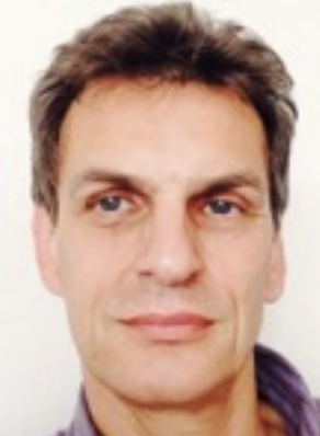 Thomas Brey合作论文数Alfred Wegener Institute for Polar and Marine Research;Helmholtz Institute for Functional Marine Biodiversity, University Oldenburg30Roland Krone合作论文数23
 Steven Degraer合作论文数Ghent University;Biology Department;Marine Biology Section;Biology Department, Ghent University22
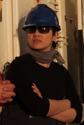 Silvana NR Birchenough合作论文数The Centre for Environment, Fisheries and Aquaculture Science (Cefas), Pakefield Road, Lowestoft, Suffolk NR33 OHT, UK22Manuela Gusky合作论文数18
 Joop W.P. Coolen合作论文数Wageningen Marine Res17
 Jan Beermann合作论文数Helmholtz Ctr Polar & Marine Res, Alfred Wegener Inst15Urszula Janas合作论文数University of Gdańsk Institute of Oceanography13Jan Vanaverbeke合作论文数Ghent University;Biology Department;Marine Biology Section;Biology Department, Ghent University13
 Alexander Schroeder合作论文数12
 Jan M Holstein合作论文数Institute for Chemistry and Biology of the Marine Environment, University of Oldenburg12
 A. B. Gill合作论文数Institute of Water & Environment12
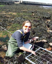 Katharina Teschke合作论文数Helmholtz Centre for Polar and Marine Research, Alfred Wegener Institute11Pål Buhl-Mortensen合作论文数11
 Lene Buhl-Mortensen合作论文数Centre for the Study of the Sciences and Humanities Norway, University of Bergen10
 Arjen Richard Boon合作论文数Department of Marine Ecology, Netherlands Institute for Sea Research10Dan Wilhelmsson合作论文数9
 Autun Purser合作论文数Jacobs University9
 Jean-Claude Dauvin合作论文数Département de Biologie et des Sciences de la Terre, University of Caen Normandy;Institut National des Sciences de L'Univers9Børge Holte合作论文数9
 Melanie Bergmann合作论文数Alfred Wegener Institute for Polar and Marine Research9Margaret F. J. Dolan合作论文数Department of Earth and Ocean Sciences;National University of Ireland;Department of Earth and Ocean Sciences, National University of Ireland8
 J. Derweduwen合作论文数7Liis Rostin合作论文数7
 Alexa Wrede合作论文数Helmholtz Ctr Hereon7Kerckhof Francis合作论文数7
 Jan Reubens合作论文数Marine Biology Research Group, Ghent University7Ilse De Mesel合作论文数7
 Anne Helene S. Tandberg合作论文数University Museum of Tromsø, University of Tromsø6
 Gert Van Hoey合作论文数Alcatel Bell - Network Strategy Group6Radosław Brzana合作论文数5
 Aurore Raoux合作论文数5
 Timm Schoening合作论文数Biodata Min. Group, Bielefeld Univ.;c;Biodata Min. Group, Bielefeld Univ.5
 Dario Fiorentino合作论文数Biozentrum Grindel &Zoological Museum, University of Hamburg;Biozentrum Grindel & Zoological Museum, University of Hamburg5
 Georg Martin合作论文数Estonian Marine Institute, University of Tartu5
 Henning Reiss合作论文数Department for Marine Research, Senckenberg Institute5
 Michael L. Zettler合作论文数5
 Julian Gutt合作论文数Helmholtz Centre for Polar and Marine Research, Alfred Wegener Institute5
 Thomas A. Wilding合作论文数Dunstaffnage Marine Laboratory5Gwenola de Roton合作论文数4Clement Garcia合作论文数Centre for Environment, Fisheries and Aquaculture Science (Cefas), Pakefield Road, Lowestoft, NR330HT, United Kingdom4christian mohn合作论文数4andreas schmidt合作论文数4
 Mehdi Shojaei合作论文数Faculty of Natural Resources and Marine Sciences, Tarbiat Modares University4Lozach Sophie合作论文数4Coates Delphine A合作论文数4
 Zoe Louise Hutchison合作论文数4Mike Robertson合作论文数4




