Abstract The development of harmonized, standardized, and integrated environmental observation systems is a key challenge in Earth system science. Such capability is essential for advancing the interdisciplinary research needed to improve understanding of the Earth system and support global sustainability. The Integrated European Long‐Term Ecosystem, Critical Zone and Socio‐ecological Research Infrastructure (eLTER RI) is a recently developed pan‐European network of in situ research sites that facilitates the collection long‐term, comprehensive observation, analysis, and modeling of environmental and ecosystem change. This initiative focuses on Europe's primary ecosystems, encompassing the atmosphere, geosphere, hydrosphere, biosphere, and their socio‐ecological interactions with the anthroposphere. A fundamental prerequisite for effective environmental monitoring and observation is a standardized and harmonized design that facilitates consistent and comparable environmental data across diverse spatial and temporal scales. The objective of this paper is to introduce the eLTER Framework of Standard Observations (eLTER SO) as a harmonized conceptual and operational standard for long‐term, integrated in situ environmental observations, and to demonstrate how it supports consistent cross‐sphere monitoring and international collaboration in environmental research. The eLTER SO delineates essential ecosystem variables, their measurement methods, and protocols. These Standard Observations (SOs) constitute the conceptual foundation of eLTER RI and provide a basis for overcoming existing disciplinary barriers to the international harmonization of environmental research and a foundation for cross‐sphere observation concepts. The eLTER SO combines the scientific‐academic perspective, as known from “classical” Essential Variable concepts, with the operational perspective required for the establishment and long‐term operation of in situ observatories.
This study examines the lithium isotope (delta 7Li) geochemistry of waters flowing through andesitic rocks in order to better constrain the dissolved lithium dynamic in a tropical volcanic island context. We report the first measurements of delta 7Li for eleven of the main rivers in Guadeloupe and four thermal springs on the slopes of La Soufrie`re volcano. These results have important implications for characterizing the mean riverine flux of lithium coming from the weathering of continental volcanic rocks, understanding the global oceanic budget of lithium, and finally, for interpreting the delta 7Li of past seawater. We have measured a large range of delta 7Li values (3.0-31.6%o) that we explained by different water-rock interaction processes at the scale of this small island. The rivers affected by hydrothermal inputs are the most concentrated and isotopically lighter (delta 7Li from 3.0-12.3%o). This is partly attributed to the leaching and dissolution of clay-rich, hydrothermally-altered rocks which are presumed to have low delta 7Li value and to the discharge from the hot-springs on La Soufrie`re volcano. The rivers not impacted by hydrothermal inputs are more diluted and isotopically heavier (delta 7Li from 16.0-31.6%o), highlighting two distinct weathering processes in the regolith: the precipitation and dissolution of secondary minerals. In the youngest part of the island, the rivers are characterized by high delta 7Li values, emphasizing that dissolved lithium is mainly controlled by the dissolution of primary andesitic minerals and the incorporation of 6Li into secondary minerals. In the oldest part of the island, the rivers have lower delta 7Li values, which are partly attributed to a low delta 7Li source from the dissolution of secondary minerals in the regolith. We also show a positive correlation between delta 7Li in river waters and the chemical weathering rates (CWR), related to the weatherable primary minerals content in watersheds. We note that this content is linked to rock age, precipitation, regolith type/thickness and geomorphologic parameters such as elevation and slope.
The use of marine sedimentary uranium isotopes (δ238U) to investigate past variability in the redox state of the ocean–atmosphere system rests on a robust quantification of the riverine U isotope flux, the dominant U input to the ocean. However, there is no consensus on the relative importance of lithology versus fractionation during weathering in controlling the riverine U isotope flux to the ocean. Here we report the riverine dissolved and solid uranium isotope composition from fourteen of the world’s largest rivers, integrating lithologies and processes relevant at the global scale, which we compare with data from the literature. The riverine dissolved δ238U ranges from −0.47 to 0.08‰, while the solids range from −0.65 to −0.24‰. Collectively, our results indicate a dominant control by weathering processes on the global riverine U isotope flux, with the notable exception of the Mackenzie Basin. No relationship emerges between riverine dissolved U isotope and lithological tracers. Whilst river solid U isotope variability reflects different relative contributions from erosion of silicate versus organic-rich sedimentary rocks, most large rivers lie close to the silicate erosion end member, and mass balance calculations indicate that silicate rock weathering can explain the total riverine U isotope flux. In this view, elemental and isotope partitioning of U between the riverine dissolved and solid loads suggests a dominant control by weathering processes that fractionate U isotopes. This interpretation is supported by the relationship between the fraction of U remaining in solution following secondary mineral formation during weathering and riverine U isotope signatures. Finally, a complex pattern emerges between climate and U isotope fractionation and weathering intensity. However, based on data collected so far, the U isotope system appears analogous to lithium isotopes, whereby moderate weathering intensity leads to the largest shift in river dissolved load δ238U values under optimal conditions for U incorporation into secondary minerals.
High-frequency river chemistry monitoring is crucial for capturing transient hydro-geochemical variations and ensuring water security, yet its implementation is limited by logistical and budgetary constraints. Here we present a machine learning-based framework that integrates continuous, low-cost physico-chemical proxies with sparse ‘anchoring’ solute measurements to reconstruct hourly-scale variations in major dissolved metals and nutrients. Validated across three contrasting catchments, we demonstrate that daily to semi-weekly sampling suffice to achieve accurate reconstructions (NSE > 0.75), though sampling demand varies considerably across hydrological regimes. Prediction of nutrients (e.g. NO₃⁻ and K⁺) may require more frequent anchoring observations under stormflow conditions. Reconstruction accuracy is sustained even under multi-week voids in anchoring observations, demonstrating resilience to commonplace logistical disruptions. We complement this framework with a novel gap imputation method based on Singular Spectrum Analysis to address missing data in proxy time series, which outperforms traditional gap-filling approaches. Our results support a scalable, low-maintenance strategy that enables a >95% reduction in operational costs and carbon emissions associated with high-frequency monitoring; and provide a transferable, hydrological regime-specific roadmap for optimizing field sampling that minimizes logistical burden while maintaining reconstruction accuracy.
The French OZCAR critical zone network offers the opportunity to conduct multi-site studies and to explore the critical zone functioning under contrasted climate, geology, vegetation and land use. In this study, an integrated modeling of the water cycle is performed with the ecohydrological model EcH2O-iso in three long-term observatories: (1) the Naizin watershed characterized by an oceanic climate, a metamorphic bedrock and an intensive agriculture (north-west of France, AgrHyS observatory); (2) the Aurade watershed, a watershed with a warmer semi-continental oceanic climate, a sedimentary geological substratum and a crop cover with a wheat-sunflower rotation (south-west of France, Aurade observatory) and; (3) the Strengbach watershed characterized by a mountain climate, a granitic bedrock, and a beech-spruce forest cover (north-east of France, OHGE observatory).Modeling robustness is evaluated by taking advantage of the large database for critical zone sciences including stream flow, water level in piezometers, and evapotranspiration fluxes measured from climatological stations and flux-towers located in the watersheds. Our comparative study brings these general outcomes: (1) the long term CZ evolution controlling the regolith thickness strongly impacts the total water storage in watersheds; (2) the Quaternary geomorphological evolution influences the current hydrological partitioning and the separation of hydrologically active and inactive water storage; (3) Both internal watershed characteristics and external forcings, such as current atmospheric forcing and recent land use need to be considered to infer stream persistence and to understand hydrological diversity; and (4) the observed hydrological diversity cannot be fully understood without considering a continuum of time scales in CZ evolution. Overall, this work illustrates the strength of critical zone networks, allowing a new level of multi-site and comparative studies that are crossing several observatories and encompassing a wide diversity of geology and climate.
Agropastoral activities have impacted the habitable part of our planet-the "Critical Zone"-for thousands of years, triggering a major increase in soil erosion in mountain environments. Understanding and quantifying the impact of these activities on soil is central to the well-being of our societies. Here, we investigate the isotope ratios of the trace element lithium in detrital sediments of Lake Bourget, European Alps, and provide a reconstruction of the impact of human activities on the evolution of alpine soil during the Holocene. We demonstrate that during the Early Holocene, soil formation was altered by the development of pastoralism followed by tillage. This led to three major erosive surges (3.8 to 3.0, 2.8 to 1.6, and 1.6 ky cal BP to modern times), thinning soils down to a state close to that of their early development 10,000 y ago. The detailed study of the lithium detrital signal reveals the appearance of an altitudinal decoupling in the response of the Critical Zone in the Alps following the development of the agropastoral activities during the Iron Age. The onset of agropastoral activities disrupted the balance between soil formation and erosion, leading to erosion rates 3 to 10 times faster than soil production since the end of the Ice Age.
Introduction . Chemical weathering is the transformation of rocks into soils, a process that not only consumes atmospheric CO 2 but also releases nutrients from rock minerals and makes them available for life, creating the critical zone, the habitable part of the planet. Forest ecosystem services are limited by water and nutrient stresses. While the water, carbon, and nitrogen cycles have been and continue to be the subject of numerous studies, not enough attention has been paid to essential mineral nutrients including Ca, Mg, K, and P, whose ultimate origin can only be rock weathering. Chemical weathering is controlled by a number of factors including climate, landscape position, parent material, precipitation rates of secondary minerals, ecosystem productivity, and residence time of water in the critical zone. In this study, we investigate, under the favorable conditions of a tropical rain forest, the relationships among critical zone architecture, landscape position, hydrological flow path and river water chemistry. Study site. The Quiock stream site is a small monitored catchment (8 ha) in the island of Basse Terre, French West Indies, part of the ObsErA Observatory, OZCAR critical zone observatory network (https://www.ozcar-ri.org). The whole catchment is underlain by 1 Myr old volcanic rocks and the rainfalls exceed 3500 mm/yr. Located in the National Parc of Guadeloupe, the catchment is covered by a primary rain forest. The Quiock stream is characterized by a 50 m-wide knickzone located 200 m upstream to the catchment outlet, indicating a transient river profile where the upper reaches are non-equilibrated. Geophysical investigations have revealed that the weathered mantle or saprolite is deep, reaching 40 m (Pasquet et al. 2022). Analytical tools . We measured different elemental and isotopic tracers along the Quiock river from the spring to the catchment outlet and in various compartments of the system (soil, rain, vegetation, rocks). We were particularly interested in Strontium (Sr) and Uranium (U) isotopes as tracers of bedrock weathering vs. atmospheric inputs for mineral nutrients to ecosystems. Results . The study shows that the chemistry of the river changes along the 700 m length from spring to mouth, indicating the contribution of waters with different origins. Sr isotopes vary from 87 Sr/ 86 Sr = 0.709 in the headwaters to 0.7055 at mouth. U isotopes increase from ( 234 U/ 238 U) = 1.15 in the headwaters to 1.30 at mouth. Upstream of the knickzone, most of the nutrients measured in the river are originating from marine aerosols in rainwater. Below the knickzone, nutrients are enriched and display a clear bedrock origin, despite the thickness of the weathered zone. Discussion . U and Sr isotopes in the river water define a mixing line between a seawater-like endmember and a volcanic rock endmember. This mixing line allows us to calculate at each sampling location how much of the Sr, U and the other major nutrients are released by rock weathering and how much are added to the ecosystem by the dissolution of atmospheric marine aerosols. These results were compared with water flow lines simulated by a steady-state groundwater numerical model developed for the Quiock catchment. Modflow was used to solve the groundwater flow equations and Modpath to determine the flow lines (Abhervé et al. 2023). The hydrological model clearly shows a strong vertical partitioning of water and nutrients between the weathered zone and the bedrock, controlled by a hydraulic conductivity that is 150 times higher in the saprolite. While only 4% of the water, characterized by long residence time, circulates through the unweathered bedrock,this small fraction interacts with fresh minerals and releases nutrients. The model shows that the spatial distribution of water and nutrient fluxes is controlled by the surface topography, in particular the knickzone. Indeed, the ability of groundwater flowpaths to cross the weathered zone-bedrock interface and to discharge into the river is mainly controlled by the change in the hydraulic gradient associated with the knickzone. This study therefore shows that even in deep mantle zones, the shape of the landscape controls groundwater flow paths and creates hot spots of weathering and nutrient release that can benefit and sustain ecosystem productivity.
Silicate weathering plays an important role in sequestering CO2 over geological time scales. Physical erosion is an important process of mineral surface production, significantly promoting efficient chemical weathering. Landslides, in particular, contribute to physical erosion by generating debris avalanches, thereby accelerating the chemical weathering rate. On the one hand, this enhanced silicate weathering contributes to CO2 drawdown. On the other hand, the oxidation of sulfide minerals exposed by landslides produces H2SO4. H2SO4 weathers carbonate minerals and releases CO2 to the atmosphere, a faster weathering process than silicate dissolution. It is a consensus that landslide erosion favors chemical weathering, however, it still remains unclear to what extent it impacts chemical weathering fluxes, and resultant CO2 consumption rate or emission rate. Réunion Island, characterized by volcanic basalt composition, is a well-known hotspot of physical and chemical erosion (Louvat and Allègre, 1997) with particularly intense bedrock landslides and river incision (Garcin et al., 2005; Rault et al., 2022). It is a very high standing volcanic island with erosion rates exceeding most active mountain ranges due to the strong interaction between volcanic rocks and climate (Gayer et al., 2019). These characteristics of Réunion Island make it an excellent natural lab to study the relationships between erosion and weathering. In this study, we use stream water chemistry and discharge time series to calculate the decennial chemical weathering rates of the main catchments across Réunion Island. Our analysis unveils a substantial contribution not only from basalt dissolution in the stable area but also from hydrothermal activity and landslides to the chemical weathering flux, which results in high CO2 consumption rates. Notably, streams impacted by thermal springs and landslides show different relationships between runoff and chemical weathering rates. In addition, extreme precipitation events promote landslide weathering, instead of high average rainfall. We were able to quantify the effect of landslides on chemical weathering. For the Salazie basin, we find that the landslides contribute to chemical weathering rates up to 62 t/km²/a, accounting for 73% of the chemical weathering in the basin although landslides only affect about 1/5 of its total surface area. This corresponds to an annual CO2 consumption rate of 2.9 × 10⁶ mol/km²/a, approximately 4 times higher than the CO2 consumption attributed to basalt weathering in landslide-free nearby areas, establishing landslide-enhanced-weathering as a significant carbon sink. Our study illuminates some of the mechanisms coupling physical and chemical weathering processes at the Earth’s surface and the impact on the climate.
Quantifying the rates at which carbonate rocks are denuded, the balance between chemical weathering and physical erosion, and their responsiveness to climate, vegetation, and tectonic activity is crucial for revealing feedback mechanisms in the carbon cycle and the dynamics of karst landscapes that provide vital services to humans. However, no existing method effectively partitions denudation into erosion and weathering fluxes. To estimate total denudation rates in carbonate terrains across spatial scales from soil to entire watersheds, we adapted a previously established framework that utilizes cosmogenic meteoric 10Be as an atmospheric flux tracer together with stable 9Be released during rock weathering. We employed the new method to the limestone-rich French Jura Mountains. By analyzing water, soil, sediment, travertine, and bedrock for 10Be/9Be ratios, as well as major and trace elements, stable carbon isotopes, and radiogenic strontium, we were able to quantify the contributions of beryllium from both primary and secondary carbonate phases and its release during the weathering of carbonate bedrock versus silicate impurities. We determined the partitioning of beryllium between solids and solutions and calculated rates of catchment-wide denudation (from sediment) and point source denudation (from soil), along with weathering and erosion rates. Our findings suggest that the average denudation rates range from 300 to 500 t/km2/yr, with denudation primarily driven by weathering intensity (W/D) ratios exceeding 0.92. These rates are consistent within a factor of two when compared to decadal-scale denudation rates derived from combined suspended and dissolved fluxes, underscoring the substantial potential of this method for Earth surface research in karst landscapes.
R & eacute;union Island, a volcanic basaltic island situated in the Indian Ocean, is a well-known hotspot of weathering and erosion with particularly intense bedrock landslides. We estimated the contribution of large landslides to the dissolved load in the main rivers across R & eacute;union Island using a mixing model, suggesting a significant enhancement of chemical weathering associated with landslides. Landslides can contribute to a decadal chemical weathering flux of up to 69 t/km2/yr, accounting for 82% of the weathering flux in one of R & eacute;union's basins. Overall, chemical weathering in R & eacute;union Island is predominantly driven by landslides, accounting for approximately 60% of the weathering flux. Notably, landslide-associated weathering can be promoted by intense precipitation events. We propose that large landslides on R & eacute;union Island favor the exposure of both fresh and hydrothermal minerals to water, thereby promoting chemical weathering. Since these hydrothermal minerals were formed by fluid-rock reactions at an earlier stage of the volcano's evolution, our results highlight the cannibalistic nature of weathering in R & eacute;union Island. As a consequence, river chemistry tends to overestimate present-day chemical weathering rates and associated CO2 consumption in R & eacute;union Island. We expect this conclusion to hold true for other volcanic settings as well. Further work on the weathering of basaltic rocks based on river chemistry should therefore take into account the geomorphological evolution of volcanic edifices, the only truly integrated approach to assess the climatic impact of the emplacement of volcanic rocks on Earth.
The Orgeval Long-term Research Observatory, part of the French critical zone network (OZCAR RI), is a 104 km² agricultural catchment, located 70 km east of Paris, in France. The Orgeval catchment is representative of intensive agriculture (80 % of its total area), the main land use in the Seine river basin. For more than 50 years, both quantity and quality of water are monitored throughout the catchment, from sub-hourly to yearly time scales. This rich dataset allows improving the understanding of critical zone structure and reactivity, in a holistic and interdisciplinary approach. Specific basic and applied research topics relate to extreme hydrological events, agricultural tile drainage, land use planning, and more generally the evolution of agricultural activities facing climate change and urban growth. The Orgeval research observatory is a unique testbed to investigate the functioning and evolution of the Critical Zone. Multidisciplinary approaches are implemented thanks to collaborations between research institutes and universities, combining knowledge and methods from different disciplines, such as hydrology, ecology, biogeochemistry, geophysics and socioeconomics. Created in 1962, the observatory was initially devoted to study floods and weathering research questions. Since then, is evolved towards other societal and environmental topics. Initiated in 1975, lots of monitoring and research was dedicated to diffuse agricultural pollution, especially nitrates, which contributed to a better understanding of the interactions between agricultural activities and surface and groundwater quality. Since the 2000’s, research questions opened to pesticides and biology and biodiversity. The Orgeval observatory is also highly adapted to develop technological innovations, such as in situ biochemical monitoring. A multi-scale observation strategy is implemented in both space and time, ranging from local (with more than 80 monitoring sites) to regional scale, and from time-lapse campaigns to high-frequency measurements (from 1 Hz for geophysics to 1 h or 1 week for chemistry), most often with a long-term approach. The main measurements include: Water level and water discharge : at the outlet of each sub-catchment. groundwater level : in piezometers in the riverbanks and in the aquifers. Precipitation : in addition to Météo-France stations. Main weather variables : air temperature, humidity, and radiation. Soil moisture : from the soil surface to a depth of 1.5 meters. Water quality : dissolved organic and inorganic carbon, dissolved gases (O 2 , CO 2 , Rn), major and trace ions, nutrients, but also water, carbon or strontium stable isotopes. This includes the RiverLab prototype, installed in June 2015 at the outlet of Avenelles sub-catchment for high-frequency measurement (every 30 minutes) of the river's chemical composition. Organic and inorganic contaminants : pesticides but also metals and microplastics in surface and groundwater. Ecotoxicological and ecological indices : ecological assessment. Surface and groundwater temperature : using heat as a tracer of surface-groundwater exchanges. Hydrogeophysics : ERT, GPR, seismic, especially in the riparian areas. Borehole core samples and logging : lithofacies description and characterization. Water level and water discharge : at the outlet of each sub-catchment. groundwater level : in piezometers in the riverbanks and in the aquifers. Precipitation : in addition to Météo-France stations. Main weather variables : air temperature, humidity, and radiation. Soil moisture : from the soil surface to a depth of 1.5 meters. Water quality : dissolved organic and inorganic carbon, dissolved gases (O 2 , CO 2 , Rn), major and trace ions, nutrients, but also water, carbon or strontium stable isotopes. This includes the RiverLab prototype, installed in June 2015 at the outlet of Avenelles sub-catchment for high-frequency measurement (every 30 minutes) of the river's chemical composition. Organic and inorganic contaminants : pesticides but also metals and microplastics in surface and groundwater. Ecotoxicological and ecological indices : ecological assessment. Surface and groundwater temperature : using heat as a tracer of surface-groundwater exchanges. Hydrogeophysics : ERT, GPR, seismic, especially in the riparian areas. Borehole core samples and logging : lithofacies description and characterization. All these data support the development and use of numerical models, for scientific questions but also for environmental impact assessment and territorial management. This catchment is used to develop and/or validate numerical methodologies at the headwater catchment scale, in parallel to larger scale modeling (typically for the Seine river basin)
We measured the long-term physical denudation of the Ogooue River catchment using Be-10 produced in situ by cosmic rays. These measurements are averaged over 25-200 ka (average 40 ka), depending on the physical denudation rate. The denudation rate of the Ogooue River catchment is slow (38 t/km(2)/a, 15 m/Ma), slightly higher than in Equatorial West Africa (from Senegal to Angola, 26 t/km(2)/a, 10 m/Ma). Physical denudation and chemical weathering fall within the same order of magnitude. Thus, although low, there is substantial chemical weathering compared to physical denudation, that likely contributes over 30 % of the total denudation. Denudation rates are spatially variable (from 10 to 60 t/km(2)/a) within the large Ogooue River catchment. Over the long term, physical denudation and chemical weathering roughly match, except in the Bateke Plateaux area, because the plateaus are made up of already weathered detrital material and therefore their modern flux of solutes is very low (similar to 9.5 t/km(2)/a). The spatial distribution is similar to the one described in the work of Moquet et al. (2021) on the basis of solute fluxes, i.e. the southern part of the catchment is denuding twice as fast as the northern part. We show here that the whole picture did not vary much since 100 ka, as shown by both methods which give consistent results. Faster denudation in the southern part of the catchment may be related to more uplift than in the northern part caused by the southern African "superswell".
 Julien Bouchez合作论文数Institut de Physique du Globe de Paris, French National Centre for Scientific Research100
 Pascale Louvat合作论文数65
 Damien Calmels合作论文数Institut de Physique du Globe de Paris, Université Paris 743
 Claude J. Allegre合作论文数Institut de Physique du Globe41
 Celine Dessert合作论文数Observatoire Volcanologique et Sismologique de Guadeloupe (OVSG) IPGP, UMR CNRS 7154, Le Houëlmont, 97113 Gourbeyre, Guadeloupe (FWI), France37
 Mathieu Dellinger合作论文数CNRS, Univ Savoie Mt Blanc29
 Christian France-Lanord合作论文数Centre de Recherches Pétrographiques et Géochimiques, Université de Lorraine29B. Dupre合作论文数26Peter B. Sak合作论文数Department of Geology, Dickinson College25
 Eric Lajeunesse合作论文数Institut de Physique du Globe de Paris, Sorbonne Paris Cité20
 François Métivier合作论文数Laboratoire de dynamique des fluides géologiques IPGP/ParisVII UMR CNRS 7579, Institut de Physique du Globe de Paris19
 Paul Floury合作论文数Institut de Physique du Globe de Paris18
 Susan L. Brantley合作论文数Department of Geosciences, College of Earth and Mineral Sciences, The Pennsylvania State University18
 Jiubin Chen (陈玖斌)合作论文数School of Earth System Science, Tianjin University17
 Pierre Sabatier合作论文数EDYTEM Laboratory of Environment Dynamics and Territories of the Mountain, Université Savoie Mont Blanc17
 Laurence Maurice合作论文数Laboratoire des Mécanismes de Transfert en Géologie - Institut de Recherche pour le Développement -, Université de Toulouse Paul Sabatier16
 Valier Galy合作论文数Department of Marine Chemistry and Geochemistry, Woods Hole Oceanographic Institution16
 Lin Ma (马林)合作论文数Guangzhou Institute of Geochemistry, Chinese Academy of Science15
 Benjamin Chetelat (本杰明)合作论文数School of Earth System Science, Tianjin University15
 Heather L Buss合作论文数State College, Pennsylvania State University15
 Damien Lemarchand合作论文数Laboratoire de Magnétisme et Applications, Université de Rouen15
 Bob Hilton合作论文数Department of Earth Sciences, University of Oxford;St Peter's College, University of Oxford14
 Edward Tipper合作论文数Department of Earth Sciences, University of Cambridge14
 Albert Galy合作论文数Centre de Recherches Pétrographiques et Géochimiques, Université de Lorraine14
 Romain Millot合作论文数BRGM13Isabelle Braud合作论文数13Eric Gayer合作论文数13Gourgiotis, A.合作论文数12
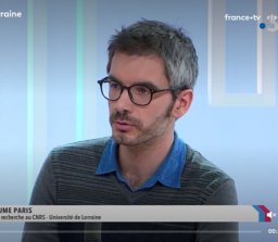 Guillaume Paris合作论文数Department of Geological and Planetary Sciences, California Institute of Technology12Louis Francois合作论文数Institut d'Astrophysique, Université de Liège12
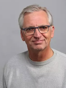 Friedhelm Von Blanckenburg合作论文数Department of Earth Sciences, Institute of Geological Sciences, Freie Universitat Berlin12
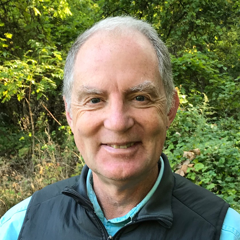 Louis A. Derry合作论文数Earth and Atmospheric Sciences, College of Engineering, Cornell University11Bernard Dupré合作论文数11
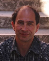 Bernard Bourdon合作论文数Institute of Isotope Geochemistry and Mineral Resources, ETH Zurich10
 Fabien Arnaud合作论文数Université de Savoie;Campus Savoie Technolac;Campus Savoie Technolac, Université de Savoie10Jacques Schott合作论文数9
 Sétareh Denise Rad合作论文数9
 Hella Wittmann-Oelze合作论文数GFZ Helmholtz Centre for Geosciences9
 Ophelie Fovet合作论文数9
 Patrick Meunier合作论文数Department of Earth Sciences;University of Cambridge;Department of Earth Sciences, University of Cambridge9Patrick Ansart合作论文数8Arnaud Blanchouin合作论文数8
 Sylvain Pasquet合作论文数Institut de Physique du globe de Paris, Université Paris Cité8
 Marc F. Benedetti合作论文数Institut de Physique du Globe de Paris, Université Paris Cité8
 Jean-Sebastien Moquet合作论文数8
 Marie-Claire Pierret合作论文数8
 Clement Narteau合作论文数Geological Fluid Dynamics Laboratory, Institut de Physique du Globe de Paris8Gérard Manhès合作论文数8
 Laurent Longuevergne合作论文数Jackson School of Geosciences, The University of Texas at Austin8




