Galactic binaries are expected to be the most numerous long-lived sources in the Laser Interferometer Space Antenna (LISA) data stream and are commonly modeled as quasi-circular, nearly monochromatic systems. In this work we present , a fast time-domain eccentric Galactic-binary waveform package for LISA. The package combines a post-Newtonian-accurate quasi-Keplerian eccentric source model with a time-domain LISA response, evaluating the signal on the retarded one-way links and then constructing time-delay interferometry observables. Its modular implementation allows the user to switch between different levels of orbital description, ranging from Newtonian closed eccentric orbits and relativistically precessing eccentric orbits incorporating the 1PN-accurate periastron advance, to precessing and shrinking eccentric orbits that additionally account for gravitational radiation reaction at leading quadrupolar order. The framework also provides an automatic evolution mode, in which the appropriate level of orbital dynamics is selected based on a pre-defined mismatch tolerance. We employ this framework to quantify the regimes in which orbital eccentricity renders the commonly adopted quasi-circular approximation for Galactic binaries inadequate.
Slope instabilities pose serious risks to infrastructure and communities in mountainous regions. Understanding their internal structure and time-dependent dynamics is vital for effective hazard assessment and mitigation. The Cuolm da Vi instability in central Switzerland, one of the largest slow-moving instabilities in the Alps, offers an ideal setting for field-based slope instability research. We present the motivation, design, and implementation of a novel large-scale multi-sensor seismic network to study the subsurface structure and deformation dynamics of Cuolm da Vi across an unprecedented range of spatial and temporal scales: from decimetres to kilometres and milliseconds to years. The sensor network includes a hexagonal grid of more than 1,000 seismic nodes primarily deployed for high-resolution 3D characterization. This temporary nodal array was complemented with a trenched 6.5km fibre-optic configuration, which covers the most unstable parts of Cuolm da Vi using a multi-directional cable layout, suited for Distributed Acoustic and Strain Sensing measurements (DAS & DSS). Data acquisition spanned two years so far, including controlled-source experiments and continuous seismic and strain sensing campaigns. Initial data screening demonstrates the network's potential to facilitate imaging of the internal structure and monitoring of seasonal subsurface instability processes. Our study shows the feasibility of dense long-term seismic monitoring in challenging Alpine terrain using nodal and distributed fibre-optic sensing techniques, opening new opportunities for slope instability research and hazard assessment.
Distributed Acoustic Sensing (DAS) measures dynamic strain along a fiber-optic cable, offering a robust, densely-sampled alternative to traditional seismic sensors. To ensure good ground-to-cable coupling, cables are typically buried in a shallow trench. Unburied surface deployments are attractive for rapid-response terrestrial applications as well as extraterrestrial missions, such as on the Moon, where burial is impractical. However, unburied DAS often suffers from severely degraded signal quality, due to poor strain transfer from ground to cable. The physical mechanism responsible remains unknown. Here, we identify bending stress relief as a mechanism that can explain this loss: suspended cable segments accommodate ground strain by bending rather than by stretching or compressing, reducing the measurable axial strain that reaches the fiber. We develop the first analytical and numerical model of unburied DAS coupling, representing the draped cable as a series of suspended segments between discrete ground contact points, to explain and quantify the bending stress relief mechanism. Our analysis reveals a dimensionless parameter, Theta, set by the ratio of the cable's initial gravity-induced sag to its radius, which governs the strain transfer efficiency. Once a segment's sag exceeds a quarter of the cable's radius, ground displacement starts to be absorbed by bending rather than being transferred as measurable axial strain. This framework predicts how mechanical properties, cable dimensions, pretension, and gravity affect strain transfer efficiency and provides quantitative guidelines for optimizing cable design and deployment strategies on both Earth and the Moon.
High-end seismic imaging, formulated as an inverse problem, requires accounting for anelastic effects and computing the gradient of a data misfit function. When using second-order displacement wave equations with a time-domain finite-difference scheme, memory requirements can be reduced by employing three memory variables, either displacement or force-based, per relaxation mechanism. We present a formulation using force memory variables, which correspond to the divergence of stress memory variables. This approach minimizes storage demands during gradient computation and is therefore advantageous for seismic imaging. However, total stresses and tractions cannot be directly recovered from force memory variables, complicating the implementation of traction-dependent boundary conditions.We then derive a set of boundary conditions that separately incorporate elastic and anelastic (viscous) stresses, based on a comparison of the weak forms of the force and displacement memory variable formulations. We propose a summation-by-parts with simultaneous approximation terms (SBP-SAT) finite-difference scheme to model variable topography and bathymetry, incorporating an acoustic/elastic interface, in a curvilinear coordinate system. Stability is ensured by adding SAT to the time-evolution equations of both the displacement fields and the memory variables. This results in a dual-consistent and stable numerical scheme.We validate the numerical implementation by comparing it with a spectral element method applied to a simple elastic model. We then present a 3D simulation using an anelastic and anisotropic model representing the Mont Blanc region.
Understanding the internal structure and geometry of large-scale gravitational slope instabilities is crucial for hazard assessment and risk mitigation in mountainous regions. This study presents a high-resolution 2D and 3D seismic first-arrival traveltime tomography analysis of the Cuolm da Vi (CdV) slope instability, one of the largest active mass movements in the Alps. To achieve this, we conducted an extensive seismic survey, deploying over 1000 autonomous nodes across a 0.7 km2 area and acquiring data from 144 controlled-source shots. Our resulting 2D and 3D tomographic models reveal significant subsurface heterogeneities, including extensive low-velocity zones up to depths of 200 metres, indicative of severe rock mass disintegration. Additionally, strong lateral velocity variations persist throughout the unstable zone, further corroborating its structural complexity. Our findings align with previous studies that suggest toppling as the dominant deformation mechanism. The comparison between 2D and 3D velocity models highlights the critical role of out-of-plane effects, such as observed lateral ray bending, emphasizing the importance of 3D imaging for accurate characterization of complex instability structures. The 2D and 3D velocity models provide important constraints for estimating the total unstable rock volume and serve as a foundation for future geotechnical analyses and hazard assessments. This study also demonstrates the feasibility and effectiveness of large-scale nodal seismic deployments in alpine terrains, paving the way for further applications in monitoring and characterizing deep-seated slope instabilities.
We present LunarLeaper, a robotic explorer concept in response to the ESA 2023 Small Missions call. Pits, volcanic collapse features with near-vertical walls, have been identified across the lunar and Martian surface. These pits are high priority exploration destinations because some, referred to as skylights, might provide access to subsurface lava tube systems. Lava tubes are of particular interest for future human exploration as they offer protection from harmful radiation, micrometeorites and provide temperate and more stable thermal environments compared to the lunar surface. We propose to use a small legged robot (ETH SpaceHopper,
Slope instabilities, further destabilized by global warming and extreme weather conditions, pose increasing risks to life and property. Hence, understanding these potentially destructive phenomena is crucial to mitigate associated losses. Established approaches like remote sensing and radar-based observations yield important information on surface displacement. However, seismic imaging and monitoring techniques offer complementary insights into subsurface structures, physical properties and internal time-dependent processes that drive the slope instability evolution. The ‘Cuolm da Vi’ slope near Sedrun in Central Switzerland is one of the largest mass movements in the Alps (100-200 million m3) and is moving by up to 20cm/year. Even though it currently does not pose an immediate threat, the surface displacement of the slope instability is closely monitored. Yet, knowledge about its internal structure is limited such as, for example, the vertical extent of the unstable section which is suspected to reach several hundred meters in depth. The main objective of our project is to gain new insights into the slope instability structure and evolution. Furthermore, we aim to extend this towards innovative seismic strategies for the characterization and monitoring of large-scale mass movements in general. In summer 2022, we deployed an extensive seismic sensor network at Cuolm da Vi covering an area of approximately 0.6 km2. This network consisted of over 1'000 autonomous nodes arranged in a hexagonal grid pattern. In addition, we installed a 6-kilometer-long fiber-optic cable, targeted for long-term Distributed Acoustic Sensing (DAS) and Distributed Strain Sensing (DSS) measurements. This unique multi-sensor geophysical network enables us to investigate the unstable slope with an unprecedented level of spatial and temporal resolution, allowing us to monitor time-dependent changes over a broad spectrum of scales in space and time. During 2022 and 2023, we collected an extensive data set, including extended periods of continuous acquisition using the nodal, DAS, and DSS systems. During the summer 2022 acquisition period, we conducted a controlled-source seismic experiment to characterize the 3D subsurface structure using seismic imaging techniques. Recordings of 163 dynamite shots by the 1’000 node array resulted in more than 30’000 P-wave first-arrival travel-time picks. Using 3D travel-time tomography, we established a first 3D subsurface P-wave velocity model of the Cuolm da Vi body. The resultant tomograms exhibit strong lateral and vertical velocity contrasts, which correlate at the surface with mapped tectonic features and identified instable sections. Furthermore, velocity anomalies within the slope instability volume indicate significant structural and/or geological variations in space. In combination with the other seismic and geotechnical information, the 3D seismic velocity model allows us to, for example, revise hazard scenarios.
Acoustic Cloning enables cloning the complete acoustic scattering behavior of unknown objects in a two-step process: in the first step, an object is insonified for a range of angles using temporally broadband sources while the response is recorded on a circular aperture enclosing the object. The scattering Green’s functions (GFs) of the object are retrieved from the recorded responses by multi-dimensional deconvolution. In the second step, the object is removed and reproduced holographically for arbitrary, previously unseen, broadband incident wavefields. At the heart of each acoustic clone are the scattering GFs of the object for radiation conditions. In the reproduction step, these scattering GFs enable real-time extrapolation of arbitrary incident wavefields by acting as the kernel of a Kirchhoff–Helmholtz (KH) integral. Extrapolated to a set of monopole and dipole sources, the GFs allow reproducing the scattered wavefield without the object being present. These scattering GFs can thus be regarded as a surface-based Digital Twin (SBDT) of the scattering object. We present examples of real, experimentally acquired SBDTs and show that they can be probed both numerically and experimentally. The SBDTs open new avenues for inclusion and manipulation of complex real acoustic scatterers in real or numerical scattering environments.
We present LunarLeaper, a robotic explorer concept in response to the ESA 2023 Small Missions call. Pits, volcanic collapse features with near-vertical walls, have been identified across the lunar and Martian surface. These pits are high priority exploration destinations because some, referred to as skylights, might provide access to subsurface lava tube systems. Lava tubes are of particular interest for future human exploration as they offer protection from harmful radiation, micrometeorites and provide temperate and more stable thermal environments compared to the lunar surface. We propose to use a small legged robot (ETH SpaceHopper, <10 kg), to access and investigate the pit edge, using its ability to access complex and steep terrain more safely than a wheeled rover. LunarLeaper will land in Marius Hills within a few 100 m of the pit and traverse across the lateral extent of the hypothesized subsurface lava tube. On its traverse it will take measurements with a ground penetrating radar and a gravimeter, measurements that will allow us to survey the subsurface structure and detect and map lava tube geometry if present. The robot will approach the pit edges and acquire high resolution images of the pit walls containing uniquely exposed layers of the geophysically mapped lava flows and regolith layers. These images will allow not only scientific advances of lunar volcanism and regolith formation, but also enable assessment of the stability of the pit structure and its use as a possible lunar base. The mission is expected to last 1 lunar day. The robot could be delivered to the surface by a small lander, as they are currently developed and planned by various national and commercial agencies and hop off the landing platform without the need for a robotic arm. It is highly flexible in accommodation and can thus make full use of the new international lunar ecosystem.
Summary We present a novel cost-effective land acquisition and processing strategy that does not require dense sensor arrays nor active sources for Rayleigh wave dispersion curve estimation and subsequent near-surface characterization. The proposed approach consists of using the divergence D of the seismic wavefield, which is insensitive to the Love wave component but closely related the horizontal acceleration of particle motion H induced by Rayleigh waves. We show that the H/D spectral ratio yields a direct estimate of the desired dispersion curve(s). The method does not rely on travel time analysis and applies to waves originating from any directions therefore is particularly attractive to process Rayleigh wave dominated ambient noise. How to collect the divergence in practice is discussed and we emphasize limitations when using closely spaced sensors for divergence measurements by finite-difference. We propose an alternative sensing technique based on the Distributed-Acoustic-Sensing technology interrogating horizontally coiled fiber-optic at the surface to obtain high-fidelity, low-noise, broadband divergence data, therefore potentially enabling deeper and more detailed sub-surface characterization. The proposed method is validated with synthetic data and field data show promising avenues.
Mitigating the energy requirements of artificial intelligence requires novel physical substrates for computation. Phononic metamaterials have vanishingly low power dissipation and hence are a prime candidate for green, always-on computers. However, their use in machine learning applications has not been explored due to the complexity of their design process. Current phononic metamaterials are restricted to simple geometries (e.g., periodic and tapered) and hence do not possess sufficient expressivity to encode machine learning tasks. A non-periodic phononic metamaterial, directly from data samples, that can distinguish between pairs of spoken words in the presence of a simple readout nonlinearity is designed and fabricated, hence demonstrating that phononic metamaterials are a viable avenue towards zero-power smart devices. Elastic neural networks composed of phononic metamaterials respond differently to different spoken commands, passively solving a speech classification problem. Their design harnesses the vanishingly low power dissipation of elastic waves, combined with the high expressivity and efficient simulation of metamaterials. This capability can be leveraged to build smart sensors that detect events without standby power consumption.image
The space-based Laser Interferometry Space Antenna (LISA) is a gravitational waves observatory currently under development. It comprises three spacecraft, each traveling in a heliocentric orbit that is weakly eccentric and inclined. Gravitational waves comprise two polarization components. They will be detected by conducting interferometric Doppler measurements between the LISA spacecraft. Among other factors, the signal strength of the Doppler measurements will depend on the location of the GW source, the GW polarization angle, and the orbits of the spacecraft. Thus, the signal strength of the Doppler measurements will vary over time. For given spacecraft orbits, we derive bounds on the signal strength that are functions of the source location. These bounds are simple, explicit expressions, and we refer to them as the directional pre-sensitivity. Using the directional pre-sensitivity, we construct a metric for the relative change in the signal strength depending on the source location and the spacecraft orbits. We illustrate how this formalism can be used to assess the signal strength for several examples of chosen orbits.
Distributed Acoustic Sensing (DAS) captures the longitudinal strain fluctuations along fiber optic cables. With locally straight cables, the measurement is closely related to the horizontal gradient of the horizontal velocity fields ∂xVx which could alternatively be obtained by differencing closely spaced conventional point sensors such as geophones and seismometers. The latter approach however often suffers from instrument and deployment perturbations as well as finite-difference bias and we discuss the advantage of using DAS to obtain higher fidelity gradients over a larger operating bandwidth, both spatially and temporally. We then introduce the potential of DAS to extract the divergence (∂xVx+∂yVy) of the seismic wavefield by interrogating horizontally coiled fiber. This results in an omni-directional measurement that is closely related to near-surface pressure fluctuations which, we demonstrate, is insensitive to Love waves but closely related the horizontal acceleration of particle motion H induced by Rayleigh waves. Such a wavefield separation is attractive for local ground-roll attenuation and reflection imaging with reduced field effort. We finally show that the H/D spectral ratio provides a local estimate of the Rayleigh wave dispersion curve(s). The proposed method does not rely on travel time analysis and applies to waves originating from any directions, therefore it is particularly suitable to process Rayleigh wave dominated ambient noise, as illustrated with a real data example collected in urban environment (Zurich, Switzerland). In brief, we propose a novel land acquisition and processing strategy that does not require dense sensor arrays nor active sources for cost-effective near-surface characterization.
We present a technique to automatically classify the wave type of seismic phases that are recorded on a single six-component recording station (measuring both three components of translational and rotational ground motion) at the Earth's surface. We make use of the fact that each wave type leaves a unique 'fingerprint' in the six-component motion of the sensor (i.e. the motion is unique for each wave type). This fingerprint can be extracted by performing an eigenanalysis of the data covariance matrix, similar to conventional three-component polarization analysis. To assign a wave type to the fingerprint extracted from the data, we compare it to analytically derived six-component polarization models that are valid for pure-state plane wave arrivals. For efficient classification, we make use of the supervised machine learning method of support vector machines that is trained using data-independent, analytically derived six-component polarization models. This enables the rapid classification of seismic phases in a fully automated fashion, even for large data volumes, such as encountered in land-seismic exploration or ambient noise seismology. Once the wave-type is known, additional wave parameters (velocity, directionality and ellipticity) can be directly extracted from the six-component polarization states without the need to resort to expensive optimization algorithms. We illustrate the benefits of our approach on various real and synthetic data examples for applications such as automated phase picking, aliased ground-roll suppression in land-seismic exploration and the rapid close-to real-time extraction of surface wave dispersion curves from single-station recordings of ambient noise. Additionally, we argue that an initial step of wave type classification is necessary in order to successfully apply the common technique of extracting phase velocities from combined measurements of rotational and translational motion.
<p>We present a technique to automatically classify the wave type of seismic phases that are recorded on a single six-component recording station (measuring both three components of translational and rotational ground motion) at the earth's surface. We make use of the fact that each wave type leaves a unique 'fingerprint' in the six-component motion of the sensor. This fingerprint can be extracted by performing an eigenanalysis of the data covariance matrix, similar to conventional three-component polarization analysis. To assign a wave type to the fingerprint extracted from the data, we compare it to analytically derived six-component polarization models that are valid for pure-state plane wave arrivals. For efficient classification, we make use of the supervised machine learning method of support vector machines that is trained using data-independent, analytically-derived six-component polarization models. This enables the rapid classification of seismic phases in a fully automated fashion, even for large data volumes, such as encountered in land-seismic exploration or ambient noise seismology. Once the wave-type is known, additional wave parameters (velocity, directionality, and ellipticity) can be directly extracted from the six-component polarization states without the need to resort to expensive optimization algorithms.</p> <p>We illustrate the benefits of our approach on various real and synthetic data examples for applications such as automated phase picking, aliased ground-roll suppression in land-seismic exploration, and the rapid close-to real time extraction of surface wave dispersion curves from single-station recordings of ambient noise. Additionally, we argue that an initial step of wave type classification is necessary in order to successfully apply the common technique of extracting phase velocities from combined measurements of rotational and translational motion.</p>
We present a novel seismic acquisition and processing technique to efficiently evaluate the local dispersion curves of Rayleigh waves for subsequent inversion of shear velocities and near-surface characterization.The proposed approach consists of computing the ratio between the (time derivated) horizontal spectra H(f)=(∂tVx(f)2+∂tVy(f)2)1/2 and the pseudo-divergence spectra D(f), with D being the sum of the horizontal gradients of the horizontal components (i.e. D=∂xVx+∂yVy).The processing method itself is comparable to the commonly used H/V approach, except that the H/D spectral ratio provides a direct estimate of the frequency-dependent phase velocities cR(f) instead of the site frequency amplification(s). This is demonstrated using synthetic data.We describe how the D component can be obtained in practice, i.e. by finite-differencing closely spaced horizontal phones or potentially using Distributed-Acoustic-Sensing (DAS) and fibre-optic deployed at the surface. Some limitations about wavelength dependency and impact of Love waves are discussed, as well as potential mitigation measures.A field test on several hours of ambient noise data collected in Germany with multi-component geophones results in realistic values of Rayleigh wave velocities ranging from ~770 m/s at 10 Hz to ~500 m/ at 30 Hz. Thanks to the local and omni-directional nature of the estimation, the minimal number of required channels and the applicability to ambient noise, we believe that the proposed H/D method can be an attractive alternative to expensive array-based techniques.
Cloning refers to producing copies of objects that cannot be distinguished from the original based on their behavior or response. Here, we present a general methodology to clone objects that scatter acoustic waves and demonstrate it experimentally. We acquire digital twins and bring them back to life—a simple two-step process. First, we place the scattering object in a circular receiver aperture and insonify it from the outside using simple speakers. From the recorded data, which may be reverberative, we retrieve the object's scattering Green's functions for radiation conditions using a technique called multi-dimensional deconvolution. This process recovers the temporal and spatial bandwidth and removes the scattering interactions with the boundaries of the experimentation domain, if present. In the second step, the acoustic scatterer is removed and reconstructed holographically using the acquired scattering Green's functions. The hologram scatters arbitrary incident wavefields in real-time exactly like the original object. Low-latency feedback enables reproducing all orders of wave interactions between physical scatterers and the numerical hologram. The two-step process is demonstrated by cloning several rigid scatterers in a two-dimensional acoustic waveguide. Applications range from fully realistic digital scattering models to efficient meta-material experimentation. [Work supported by SNSF grant 197182.]
The seismometer Seismic Experiment for Interior Structure (SEIS) onboard the InSight lander was used to continuously record the seismicity on Mars from February 2019 to December 2022. To maximize the information that can be extracted from the seismic data, it is critical to identify and to suppress undesired features (e.g., environmental noise, scattered waves, seismic imprint of lander vibrations) and non-seismic noise (e.g., instrument related artifacts). We present an advanced polarization filtering workflow in the time-frequency domain to suppress undesired features and to enhance the signal-to-noise ratio of the SEIS recordings. We estimate time-frequency-dependent polarization attributes such as the ellipticity, directionality of the particle motion, and the degree of polarization to identify and filter out undesired data parts. After filtering in the time-frequency domain, the seismic data are transformed back to the time domain, yielding broadband waveform data that can be used for further seismological analysis. We illustrate the benefits of our filtering approach with three use cases. Firstly, we show how polarization filtered data can help to constrain the source mechanism of the sol 1,222 event, the largest marsquake detected so far. Using the proposed polarization filtering techniques, we are able to enhance the S-wave arrival by suppressing interfering randomly polarized scattered waves to successfully infer on the moment tensor of this event. Secondly, we show that polarization filters can be used to suppress instrument-related glitches and, thirdly, to remove the seismic imprint left by the vibrating lander (mechanical resonances of the lander). The NASA InSight mission brought a seismometer to the surface of Mars that continuously monitored ground vibrations at the landing site. The goal was to record vibrations caused by marsquakes. Since seismic waves from marsquakes travel through the planet, such recordings contain information that allows scientists to image the interior structure of Mars. The signals from most of the quakes recorded by InSight are faint due to their low magnitudes and the large epicentral distance. Additionally, the recordings are contaminated by noise from local winds and the harsh temperature conditions on Mars lead to sudden stress relaxations inside the seismometer that are visible as distinct pulses (so-called glitches) in the data stream. To accurately image the interior structure of the planet, it is of crucial importance to distinguish and separate such local, distorting signals from signals that originate from deeper parts of the planet. To do so, we make use of a method called polarization filtering, which is based on the analysis of the motion of the seismometer in three-dimensional space as a function of time and frequency. We show that this motion is distinct for environmental noise, glitches, and marsquake signals and exploit it to clean the data from local disturbances. InSight's Seismic Experiment for Interior Structure (SEIS) data are contaminated by various types of seismic and non-seismic noise componentsTime-frequency domain polarization filtering allows one to automatically identify and suppress undesired noise componentsPolarization-filtered waveform data enable a more stable moment tensor inversion and facilitate the interpretation of SEIS data
Landslides are a major natural hazard that can cause significant loss of life and property damage around the world. As global temperatures rise and weather extremes become more frequent, we can expect an increase in the hazard emanating from landslides too. In order to better understand and mitigate landslide risks, a variety of strategies have been developed to characterize and monitor landslide activity. Many established approaches provide valuable information about surface displacement and surface properties, but are not suited to inspect the subsurface parts of a landslide body. In contrast, seismic imaging and monitoring methods allow us to study subsurface structures, properties, and internal processes that control landslide behaviour.In our project, we develop novel seismic data acquisition and interpretation approaches to characterize and monitor one of the largest active unstable slopes in the Alps, the Cuolm da Vi landslide, with an unprecedented spatial resolution. We achieve this by combining an array of over 1’000 seismic nodes with fiber-optic based monitoring techniques such as Distributed Acoustic (DAS) and Strain Sensing (DSS).The deep-seated Cuolm da Vi landslide is located near Sedrun (Central Switzerland) and consists of approximately 100-200 million m3 of unstable rock reaching displacement rates up to 10-20 cm/yr with clear seasonal cycles. In summer 2022, we buried over 6 kilometres of fiber-optic cable in this alpine environment covering the most active part of the landslide with multiple cable orientations. Additionally, we deployed a nodal array of 1046 accelerometers in a hexagonal grid covering around 1km2 with a nominal spacing of 28 meters. Seismic data were acquired with the nodes and the DAS system continuously for four weeks. This time period included the blasting of 163 dynamite shots for calibration and active-source imaging purposes. In 2023, we plan to conduct data acquisition for longer periods using primarily fibre-optic based techniques with a focus on the temporal evolution of the landslide dynamics.Our first goal is to resolve the internal structure of the landslide based on the controlled-source data acquired in summer 2022 to construct, for example, a seismic velocity model. Based on the models derived from the active-source seismic data, we plan to exploit the continuous seismic recordings of ambient vibrations and potential seismic signals produced by the landslide activity to complement structural models and study the landslide dynamics. We will present our current results and discuss their implications for the next steps towards monitoring this landslide over time.
SUMMARY Finite-difference (FD) modelling of seismic waves in the vicinity of dipping interfaces gives rise to artefacts. Examples are phase and amplitude errors, as well as staircase diffractions. Such errors can be reduced in two general ways. In the first approach, the interface can be anti-aliased (i.e. with an anti-aliased step-function, or a lowpass filter). Alternatively, the interface may be replaced with an equivalent medium (i.e. using Schoenberg & Muir (SM) calculus or orthorhombic averaging). We test these strategies in acoustic, elastic isotropic, and elastic anisotropic settings. Computed FD solutions are compared to analytical solutions. We find that in acoustic media, anti-aliasing methods lead to the smallest errors. Conversely, in elastic media, the SM calculus provides the best accuracy. The downside of the SM calculus is that it requires an anisotropic FD solver even to model an interface between two isotropic materials. As a result, the computational cost increases compared to when using isotropic FD solvers. However, since coarser grid spacings can be used to represent the dipping interfaces, the two effects (an expensive FD solver on a coarser FD grid) equal out. Hence, the SM calculus can provide an efficient means to reduce errors, also in elastic isotropic media.
 Dirk-Jan Van Manen合作论文数Inst Geophys, Swiss Fed Inst Technol112
 Cedric Schmelzbach合作论文数Department of Geosciences, University of Potsdam58
 David Sollberger合作论文数Institute of Geophysics, ETH Zurich;david.sollberger@gmail.com;Institute of Geophysics, ETH Zurich46
 Lasse Amundsen合作论文数Statoil Research Centre43
 Fredrik Andersson合作论文数Department of Economics, Lund University;Center for Economic and Policy Research34
 Andrew Curtis合作论文数Earth and Planetary Science, School of GeoSciences, The University of Edinburgh29
 Stewart Greenhalgh合作论文数Institute of Geophysics, ETH Zürich27Theodor S. Becker合作论文数Inst Geophys, Eidgenoss Tech Hsch Zurich24julian edward kragh合作论文数23Nienke Brinkman合作论文数Institute of Geophysics, ETH Zürich18
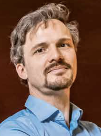 Simon C. Stähler合作论文数Eidgenössische Technische Hochschule Zürich18
 Pascal Edme合作论文数18Kurt Eggenberger合作论文数17Cédéric Van Renterghem合作论文数17
 Domenico Giardini合作论文数Institut für Geophysik, Eidgenossische Technische Hochschule Zurich;Department of Earth Sciences, Eidgenossische Technische Hochschule Zurich16
 Philippe Lognonné合作论文数Institut de Physique du Globe de Paris, Université Paris Cité16david fraser halliday合作论文数15Thomas Haag合作论文数Swiss Fed Inst Technol, Inst Geophys, CH-8092 Zurich, Switzerland15Nele Börsing合作论文数Swiss Fed Inst Technol, Inst Geophys, CH-8092 Zurich, Switzerland15Ali ÖZbek合作论文数15
 W. Bruce Banerdt合作论文数15K. Eggenberger合作论文数14
 Broggini Filippo合作论文数Center for Wave Phenomena, Colorado School of Mines14
 Klaus Holliger合作论文数Institute of Earth Sciences, Universite de Lausanne14F. Andersson合作论文数12Martin van Driel合作论文数Institute of Geophysics, ETH Zürich12
 Hansruedi Maurer合作论文数Institute of Geophysics, Department of Earth Sciences, Eidgenössische Technische Hochschule Zürich12
 Sharon Kedar合作论文数12
 Matthias Grott合作论文数11John F. Clinton合作论文数Department of Civil Engineering;California Institute of Technology;Department of Civil Engineering, California Institute of Technology11Brigitte Knapmeyer-Endrun合作论文数Univ Cologne, Bensberg Observ, Bergisch Gladbach, Germany10Everhard Muyzert合作论文数10Jens Wittsten合作论文数10Amir Khan合作论文数9
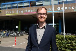 Erik F. M. Koene合作论文数Institute of Geophysics, ETH Zurich9Christoph Bärlocher合作论文数Swiss Fed Inst Technol, Inst Geophys, CH-8092 Zurich, Switzerland9
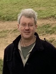 Tom Pike合作论文数Optical and Semiconductor Devices, Department of Electrical and Electronic Engineering, Faculty of Engineering, Imperial College London9
 Raphaël F. Garcia合作论文数University Paul Sabatier Toulouse III9Remco Muijs合作论文数9
 Henrik Rasmus Thomsen合作论文数Department of Civil, Environmental, and Geomatic Engineering, ETH Zürich8
 Anna Horleston合作论文数Sch Earth Sci, Univ Bristol8
 Vasmel Marlies合作论文数Institute of Geophysics, ETH Zurich8
 Tilman Spohn合作论文数Institut für Planetenforschung, DLR8
 Pierre Delage合作论文数École des Ponts ParisTech8Kenneth Hurst合作论文数7
 Patrick Paitz合作论文数ETHZ7
 Xun Li合作论文数Colorado Sch Mines, Ctr Wave Phenomena, Golden, CO 80401 USA7
 Marc Serra-Garcia合作论文数Department of Mechanical and Process Engineering, Swiss Federal Institute of Technology (ETH),7Tage Rosten合作论文数7




