Saline lakes are hypersensitive to changes in their water balance and therefore show amplified responses to climatic and land-use changes in their catchment. Despite often dramatic ecological impacts, saline lakes rank low on policy agendas as they are assumed to support few ecosystem services and low levels of biodiversity. Here, we challenge this view and evaluate ecosystem services and threatened species in 85 saline lakes distributed across the globe. We show that saline lakes support, additionally to threatened aquatic biota, a diverse range of red-listed terrestrial species that contribute together with a large beta diversity to their conservation value. Further, our results highlight that saline lakes provide a number of culturally and economically important ecosystem services but several of them are 'hidden' and difficult to quantify. We conclude our analysis with best-practice recommendations for sustainable management of saline lakes. Their local adaptation and implementation will be key for safeguarding biodiversity and ecosystem services of these valuable and highly sensitive ecosystems.
Methane oxidation has been observed in a wide range of aquatic environments worldwide, and measurements are rare in tropical floodplains. The Amazon floodplain is one of the largest tropical wetlands with seasonally flooded forests representing up to 80
River obstructions are a subject of global concern due to their impact on river connectivity and aquatic ecosystems. However, detecting and quantifying these structures, especially small and undocumented ones, remains a major challenge due to limitations in existing data sets and detection methods. This study focuses on improving the global detection of river obstructions and revealing their spatial distribution patterns. We developed a deep-learning-based detection framework combined with manual validation, resulting in the Deep Learning-Global River Obstructions Database, which comprises 50,061 river obstructions identified globally. This represents a 64% increase over previous estimates, which were based solely on manual identification. Spatial analyses reveal strong correlations between obstruction density and factors such as Gross Domestic Product, agricultural expansion, urbanization, and river morphology. By enhancing the precision and comprehensiveness of river obstruction data, our open-source data set provides a solid foundation for accurate assessment of global river connectivity, basin-to-continental-scale hydrological modeling, and impact assessments.
Saline lakes are hypersensitive to changes in their water balance and therefore show amplified responses to climatic and land-use changes in their catchment. However, despite the resulting, often dramatic ecological consequences, saline lakes rank low on policy agendas as they are assumed to support few ecosystem services and low levels of biodiversity. Here, we challenge this view and evaluate ecosystem services and threatened species in 84 saline lakes distributed across the globe. We found that saline lakes harbour not only threatened aquatic biota but also a diverse range of red-listed terrestrial species that critically rely on the lakes’ existence. Further, our results highlight that saline lakes support, irrespective of their salinity, a number of culturally and economically important ecosystem services. We conclude our analysis with best-practice recommendations for sustainable management of saline lakes. Their local adaptation and implementation will be key for safeguarding biodiversity and ecosystem services of these valuable but highly sensitive ecosystems.
Wildfires have increased in size, frequency, and intensity in arid regions of the western United States because of human activity, changing land use, and rising temperature. Fire can degrade water quality, reshape aquatic habitat, and increase the risk of high discharge and erosion. Drawing from patterns in montane dry forest, chaparral, and desert ecosystems, we developed a conceptual framework describing how interactions and feedbacks among material accumulation, combustion of fuels, and hydrologic transport influence the effects of fire on streams. Accumulation and flammability of fuels shift in opposition along gradients of aridity, influencing the materials available for transport. Hydrologic transport of combustion products and materials accumulated after fire can propagate the effects of fire to unburned stream-riparian corridors, and episodic precipitation characteristic of arid lands can cause lags, spatial heterogeneity, and feedbacks in response. Resolving uncertainty in fire effects on arid catchments will require monitoring across hydroclimatic gradients and episodic precipitation.
In 2023, an unprecedented drought and heat wave severely affected Amazon waters, leading to high mortality of fishes and river dolphins. Five of 10 lakes monitored had exceptionally high daytime water temperatures (over 37°C), with one large lake reaching up to 41°C in the entire approximately 2-meter-deep water column and up to 13°C of diel variation. Modeling showed that high solar radiation, reduced water depth and wind speed, and turbid waters were the main drivers of the high temperatures. This extreme heating of Amazon waters follows a long-term increase of 0.6°C/decade revealed by satellite estimates across the region's lakes between 1990 and 2023. With ongoing climate change, temperatures that approach or exceed thermal tolerances for aquatic life are likely to become more common in tropical aquatic systems.
Recent studies highlight the critical role of methane emissions from tropical wetlands in driving the accelerated atmospheric CH4 growth rate observed in the last decade. The Amazon lowland region, where up to 30% of the area can be seasonally flooded, is one of the largest natural methane sources. The total methane flux estimates for the Amazon basin from top-down and bottom-up approaches converge at 31–46 TgCH₄/year. However, understanding methane emission trends and interannual variability—such as inundation extent and seasonality—requires improved attribution of emissions to specific wetland types and habitats. In this study, we present a refined bottom-up estimate of methane fluxes for the lowland Amazon that addresses key challenges to regionalizing fluxes in the basin: i) the large seasonal variation in inundated areas and habitats, ii) the diversity of aquatic ecosystems across the Amazon, and iii) the spatiotemporal variability of methane fluxes. We link local methane flux measurements collected during more than 20 years of field campaigns to specific river and wetland types and incorporate seasonal variability in inundation extent using dynamic remote sensing products (i.e. open water data from the Global Surface Water for lakes, Global River Width from Landsat (GRWL) for rivers, and wetland inundation extent from the High-Resolution Surface WAterFraction (SWAF-HR, based on SMOS L-band imagery) for the Amazon basin, and (4) GIEMS-D15 (merge of multiple satellites) for the remaining portions of South America). Wetland types (herbaceous and woody vegetation) were obtained from the JERS-1 L-band based classification of Hess et al. (2015) for the Amazon Basin and ESA-CCI land cover for the rest of South America. The magnitude and seasonal variability of our bottom-up fluxes are evaluated against fluxes derived from atmospheric CH4 mole fraction measurements at two Amazonian sites, whose footprints go beyond the Amazon Basin. While our product successfully captures the seasonal variability at both sites, it underestimates the overall magnitude of emissions compared to other estimates, even when accounting for emissions from flooded forest tree stems. Our findings represent an important improvement of bottom-up estimates representing the diversity of wetland habitats and processes driving methane emissions, but further work is needed to understand the mismatch with other methane emissions products.
Lakes are important sentinels of climate change and may contribute over 30% of natural methane (CH4) emissions; however, no earth system model (ESM) has represented lake CH4 dynamics. To fill this gap, we refined a process-based lake biogeochemical model to simulate global lake CH4 emissions, including representation of lake bathymetry, oxic methane production (OMP), the effect of water level on ebullition, new non-linear CH4 oxidation kinetics, and the coupling of sediment carbon pools with in-lake primary production and terrigenous carbon loadings. We compiled a lake CH4 data set for model validation. The model shows promising performance in capturing the seasonal and inter-annual variabilities of CH4 emissions at 10 representative lakes for different lake types and the variations in mean annual CH4 emissions among 106 lakes across the globe. The model reproduces the variations of the observed surface CH4 diffusion and ebullition along the gradients of lake latitude, depth, and surface area. The results suggest that OMP could play an important role in surface CH4 diffusion, and its relative importance is higher in less productive and/or deeper lakes. The model performance is improved for capturing CH4 outgassing events in non-floodplain lakes and the seasonal variability of CH4 ebullition in floodplain lakes by representing the effect of water level on ebullition. The model can be integrated into ESMs to constrain global lake CH4 emissions and climate-CH4 feedback.
Limnology and Oceanography BulletinEarly View Viewpoint Communicating Science Through Press Releases to News Media: The Case Study of What Is Controlling the Fabled Water Clarity of Lake Tahoe Sudeep Chandra, Sudeep Chandra [email protected] orcid.org/0000-0003-1724-5154 Global Water Center, University of Nevada, Reno, NV, USASearch for more papers by this authorHans W. Paerl, Hans W. Paerl orcid.org/0000-0003-2211-1011 Institute of Marine Sciences, University of North Carolina at Chapel Hill, Morehead City, NC, USASearch for more papers by this authorJohn Melack, John Melack orcid.org/0000-0003-0619-841X Bren School of Environmental Science and Management, University of California, Santa Barbara, Santa Barbara, CA, USASearch for more papers by this authorConnie Lovejoy, Connie Lovejoy orcid.org/0000-0001-8027-2281 Département de Biologie, Québec Océan, Université Laval, Québec, QC, CanadaSearch for more papers by this authorJohn C. Priscu, John C. Priscu Montana State University, Bozeman, MT, USASearch for more papers by this authorZach Bess, Zach Bess Ecology Evolution and Conservation Biology Graduate Program, University of Nevada, Reno, NV, USASearch for more papers by this authorJohn Coil, John Coil JC Oil Environmental Consulting, Davis, CA, USASearch for more papers by this authorCharles R. Goldman, Charles R. Goldman Tahoe Research Group, University of California, Davis, Emeritus Davis, CA, USASearch for more papers by this authorMichael T. Brett, Michael T. Brett orcid.org/0000-0001-5065-2144 Department of Civil and Environmental Engineering, University of Washington, Seattle, WA, USASearch for more papers by this authorErin Suenaga, Erin Suenaga Global Water Center, University of Nevada, Reno, NV, USASearch for more papers by this authorVeronica Nava, Veronica Nava orcid.org/0000-0002-2770-1937 Department of Earth and Environmental Sciences, University of Milano-Bicocca, Milano, MI, ItalySearch for more papers by this author Sudeep Chandra, Sudeep Chandra [email protected] orcid.org/0000-0003-1724-5154 Global Water Center, University of Nevada, Reno, NV, USASearch for more papers by this authorHans W. Paerl, Hans W. Paerl orcid.org/0000-0003-2211-1011 Institute of Marine Sciences, University of North Carolina at Chapel Hill, Morehead City, NC, USASearch for more papers by this authorJohn Melack, John Melack orcid.org/0000-0003-0619-841X Bren School of Environmental Science and Management, University of California, Santa Barbara, Santa Barbara, CA, USASearch for more papers by this authorConnie Lovejoy, Connie Lovejoy orcid.org/0000-0001-8027-2281 Département de Biologie, Québec Océan, Université Laval, Québec, QC, CanadaSearch for more papers by this authorJohn C. Priscu, John C. Priscu Montana State University, Bozeman, MT, USASearch for more papers by this authorZach Bess, Zach Bess Ecology Evolution and Conservation Biology Graduate Program, University of Nevada, Reno, NV, USASearch for more papers by this authorJohn Coil, John Coil JC Oil Environmental Consulting, Davis, CA, USASearch for more papers by this authorCharles R. Goldman, Charles R. Goldman Tahoe Research Group, University of California, Davis, Emeritus Davis, CA, USASearch for more papers by this authorMichael T. Brett, Michael T. Brett orcid.org/0000-0001-5065-2144 Department of Civil and Environmental Engineering, University of Washington, Seattle, WA, USASearch for more papers by this authorErin Suenaga, Erin Suenaga Global Water Center, University of Nevada, Reno, NV, USASearch for more papers by this authorVeronica Nava, Veronica Nava orcid.org/0000-0002-2770-1937 Department of Earth and Environmental Sciences, University of Milano-Bicocca, Milano, MI, ItalySearch for more papers by this author First published: 30 December 2023 https://doi.org/10.1002/lob.10624 The opinions expressed in Bulletin Viewpoints are those of the authors and contributors, and do not necessarily reflect those of ASLO, its editors or affiliates, or the organization to which the authors are affiliated. Read the full textAboutPDF ToolsRequest permissionExport citationAdd to favoritesTrack citation ShareShare Give accessShare full text accessShare full-text accessPlease review our Terms and Conditions of Use and check box below to share full-text version of article.I have read and accept the Wiley Online Library Terms and Conditions of UseShareable LinkUse the link below to share a full-text version of this article with your friends and colleagues. Learn more.Copy URL Share a linkShare onEmailFacebookTwitterLinkedInRedditWechat References Autzen, C. 2014. Press releases—The new trend in science communication. J. Sci. Commun. 13: C02. doi:10.22323/2.13030302. 10.22323/2.13030302 Google Scholar Bess, Z., S. Chandra, E. Suenaga, S. Kelson, and A. Heyvaert. 2021. Zooplankton influences on phytoplankton, water clarity, and nutrients in Lake Tahoe. Aquat. Sci. 83: 26. doi:10.1007/s00027-020-00772-6. 10.1007/s00027-020-00772-6 CASWeb of Science®Google Scholar Naranjo, R. C., P. Work, A. Heyvaert, G. Schladow, A. Cortes, S. Watanabe, L. Tanaka, and S. Elci. 2022. Seasonal and long-term clarity trend assessment of Lake Tahoe, California–Nevada. USGS Numbered Series 2022–5070. 2022–5070 U.S. Geological Survey. Google Scholar U.S. Geological Survey. 2021. USGS water data for the nation. Google Scholar Watanabe, S., and G. Schladow. 2023. Lake Tahoe historic Secchi depth. doi:10.6073/PASTA/651F53D1340FC0131E05274672762F63. Google Scholar Wulfeck, A. 2023. Lake Tahoe's clarity is the best it's been in 40 years. Available from. Foxweather.com, https://www.foxweather.com/weather-news/nevada-california-quality-water-sensor. Google Scholar Early ViewOnline Version of Record before inclusion in an issue ReferencesRelatedInformation
Increased occurrence, size, and intensity of fire result in significant but variable changes to hydrology and material retention in watersheds with concomitant effects on stream biogeochemistry. In arid regions, seasonal and episodic precipitation results in intermittency in flows connecting watersheds to recipient streams that can delay the effects of fire on stream chemistry. We investigated how the spatial extent of fire within watersheds interacts with variability in amount and timing of precipitation to influence stream chemistry of three forested, montane watersheds in a monsoonal climate and four coastal, chaparral watersheds in a Mediterranean climate. We applied state-space models to estimate effects of precipitation, fire, and their interaction on stream chemistry up to five years following fire using 15 + years of monthly observations. Precipitation alone diluted specific conductance and flushed nitrate and phosphate to Mediterranean streams. Fire had positive and negative effects on specific conductance in both climates, whereas ammonium and nitrate concentrations increased following fire in Mediterranean streams. Fire and precipitation had positive interactive effects on specific conductance in monsoonal streams and on ammonium in Mediterranean streams. In most cases, the effects of fire and its interaction with precipitation persisted or were lagged 2–5 years. These results suggest that precipitation influences the timing and intensity of the effects of fire on stream solute dynamics in aridland watersheds, but these responses vary by climate, solute, and watershed characteristics. Time series models were applied to data from long-term monitoring that included observations before and after fire, yielding estimated effects of fire on aridland stream chemistry. This statistical approach captured effects of local-scale temporal variation, including delayed responses to fire, and may be used to reduce uncertainty in predicted responses of water quality under changing fire and precipitation regimes of arid lands.
The grassland ecosystems of Xilingol, China, characteristically part of the vast Eurasian steppe, are currently facing two challenges: natural variations and anthropogenic stress, which are leading to significant degradation. This article harnesses a sequence of high-resolution (30 m) land cover and greenness trend maps derived from multiyear Landsat imagery to describe these ecologically critical shifts over a landscape spanning more than 200 000 km 2 . By leveraging random forest models complemented with phenological patterns, we streamlined the generation of land cover maps, securing overall accuracies upwards of 94% across eight categorical classifications, as substantiated by rigorous validation. Between 1985 and 2000, there were significant changes in the landscape, such as an increase in farmland of about 4.0 × 10 3 km 2 , mostly at the expense of natural grasslands and wetlands. Throughout the study period, an ongoing trend is the noticeable shrinkage of water bodies with the biggest reduction of wetlands reported between 1995 and 2015. Open-pit mining regions began to increase with the start of the 21st century, and from 1985 to the present, urbanization drove the growth of impervious surfaces. These maps offer powerful visual representations of major land use changes, capturing the expansion of surface mining, the retreat of wetland areas, and the growth of urban areas. Therefore, our findings compose an essential part in the documentation and comprehension of the details of wetland reduction, cropland intensification, surface water decline, and rapid urban growth, providing crucial information to conservationists and policymakers working toward sustainable ecosystem management.
Hydrodynamic influences of inundated forests and floating plants, common on floodplains, include modifying exchange flows and thermal structure. This study added algorithms to represent these plants in a three-dimensional hydrodynamic model, applied the model to a tropical floodplain, and validated the results with high resolution field measurements. The simulations reproduced temporal and spatial variation of thermal structures in vegetated and open water areas and demonstrated that vertical and horizontal temperature gradients were enhanced in the presence of vegetation. The study extends research findings obtained from laboratory experiments to in-situ situations and to vegetation not represented in the laboratory. The results are relevant to lateral and vertical exchanges of dissolved gases and solutes, and indicate that loss of inundated forests could lead to enhanced lateral exchange.
Floodplain lakes are widespread and ecologically important throughout tropical river systems, however data are rare that describe how temporal variations in hydrological, meteorological and optical conditions moderate stratification and mixing in these shallow lakes. Using time series measurements of meteorology and water-column temperatures from 17 several day campaigns spanning two hydrological years in a representative Amazon floodplain lake, we calculated surface energy fluxes and thermal stratification, and applied and evaluated a 3-dimensional hydrodynamic model. The model successfully simulated diel cycles in thermal structure characterized by buoyancy frequency, depth of the actively mixing layer, and other terms associated with the surface energy budget. Diurnal heating with strong stratification and nocturnal mixing were common; despite considerable heat loss at night, the strong stratification during the day meant that mixing only infrequently extended to the bottom at night. Simulations indicated that the diurnal thermocline up and downwelled creating lake-wide differences in near-surface temperatures and mixing depths. Infrequent full mixing creates conditions conducive to anoxia in these shallow lakes given their warm temperatures. Diel thermal structure in a tropical floodplain lake was characterized by high-resolution field measurements over two hydrological years State and process evaluation show that diel and seasonal stratification and mixing were simulated well by a 3-D hydrodynamic model Diurnal heating with strong stratification and nocturnal mixing were common while mixing to the bottom was intermittent
The CO( 2)flux (FCO2) from lakes to the atmosphere is a large component of the global carbon cycle anddepends on the air-water CO2concentration gradient (Delta CO2) and the gas transfer velocity (k). Both Delta CO2 and k can vary on multiple timescales and understanding their contributions toFCO(2)is important for explaining var-iability influxes and developing optimal sampling designs. We measuredFCO2 and Delta CO(2 )and derivedkforone full ice-free period in 18 lakes usingfloating chambers and estimated the contributions of Delta CO2 and k to FCO2 variability. Generally, kcontributed more than Delta CO2to short-term (1-9d) FCO2 variability. With in creased temporal period, the contribution of k to FCO2 variability decreased, and in some lakes resulted in Delta CO2 contrib-uting more thank to FCO2 variability over the full ice-free period. Increased contribution of Delta CO2 to FCO2 vari-ability over time occurred across all lakes but was most apparent in large-volume southern-boreal lakes and indeeper (>2m) parts of lakes, whereaskwas linked to FCO(2 )variability in shallow waters. Accordingly, knowing the variability of bothk and Delta CO(2 )over time and space is needed for accurate modeling of F CO2 from these vari-ables. We conclude that priority in FCO(2 )assessments should be given to direct measurements of FCO2 at multiplesites when possible, or otherwise from spatially distributed measurements of Delta CO(2 )combined with k- models that incorporate spatial variability of lake thermal structure and meteorology.
Abstract Lakes are sentinels of global changes and integrators of processes in watersheds. Changes of lake water quality can be observed in shifts in lake color, however, the prevalence of shifts and trends in color and relevant factors remain elusive. Here, a comprehensive examination of color in 2,550 Chinese lakes from 1984 to 2021 revealed that color in 68% of the lakes shifted toward shorter visual wavelengths. Lakes in the Tibetan Plateau had larger declines in wavelength than lakes in other areas. The factors associated with reduced visual wavelengths varied in different ecoregions. A warmer and wetter climate in deep lakes in western China is associated with shifts toward blue. Increased vegetation in watershed and decreased wind are associated with green‐yellow shifting to green‐cyan color in shallow lakes of eastern China. Our study highlights the heterogeneous controls of climate and humans on changing patterns of lake colors.
Floodplains lakes are abundant in the Amazon basin and are important methane sources to the atmosphere. Existing biogeochemical models require modifications and inclusion of hydrodynamic processes operative in shallow, warm waters to be applied to these aquatic ecosystems. We modified a 1-dimensional process-based, lake biogeochemical model and combined a 3-dimensional hydrodynamic model to suit Amazon floodplains. We evaluated the combined model's performance simulating methane concentrations and fluxes and several related processes in the open lake and an embayment of a well-studied Amazon lake. Parameters for calibration were selected through sensitivity tests using a machine learning-based algorithm, classification, and regression trees. Comparison between simulated and measured fluxes indicate generally good agreement in seasonal patterns and magnitudes. Comparisons of near-surface concentrations varied with no clear patterns. Simulations of methane concentrations at near-surface and near-bottom, and diffusive emissions are most sensitive to carbon mineralization rate, Q10 factors for methanogenesis and oxidation, and methane oxidation potential. Modeled rates of planktonic photosynthesis were generally lower than measurements, though simulated planktonic respiration was often similar to measurements. Simulated rates of methane oxidation were considerably lower, with a few exceptions, than measurements of methane oxidation in oxic water of the lake. Improvements of results of the linked hydrodynamic-biogeochemical model will result from inclusion of advective transport, use of parameter values appropriate for tropical waters, especially for methane oxidation and photosynthesis, and addition of changes in hydrostatic pressure to model of ebullition. Methane emissions from lakes are large, highly variable and without adequate measurements, especially in tropical regions. The combination of mechanistic models with results from intensive field data provides one way to improve understanding of the processes and sources of variability. Riverine floodplain lakes, as occur in the Amazon basin, constitute extensive aquatic ecosystems and are important methane sources to the atmosphere. Though tropical lakes typically experience muted seasonal variations in climate, strong diel changes occur, and floodplain lakes have additional biogeochemical and ecological variability caused by changes in water level, connectivity to rivers and optical properties. We modified a one-dimensional process-based, lake biogeochemical model and combined a 3-dimensional hydrodynamic model to be applicable to Amazon floodplains and similar shallow, warm waters. The combined model simulated well methane processes and fluxes based on evaluation using observations in a representative central Amazon floodplain lake with measurements of meteorological variables, water temperatures and ecological conditions, and methane emissions over the seasonal hydrological phases with large differences in water levels. Methane fluxes from Amazon floodplains lakes simulated with biogeochemical model combined with hydrodynamic modelSeasonal patterns and magnitudes of simulated and measured fluxes are generally in good agreementMethane concentrations and diffusive emissions are sensitive to carbon mineralization and methane production and oxidation
Lowman, H.E.; Hirsch, M.E.; Brzezinski, M.A., and Melack, J.M., 2023. Examining the potential of sandy marine sediments surrounding giant kelp forests to provide recycled nutrients for growth. Journal of Coastal Research, 39(3), 442–454. Charlotte (North Carolina), ISSN 0749-0208. Permeable marine sediments are biogeochemically active and may contribute dissolved nutrients to support primary production in coastal regions. This study examined the potential of permeable marine sediments near giant kelp forests in the Santa Barbara Channel, California as a source of ammonium (NH4+) to the overlying water column to support the observed growth of kelp during summer months when nitrate availability is low. Several nearshore sites located in coastal California in <20 m water depth were sampled for porewater nutrient concentrations, flushing rates, and nutrient fluxes in addition to diel fluctuations in nutrient concentrations of the overlying water column. Time-series analyses of porewater temperatures indicate that porewater flushed to a depth of 15 cm approximately every two hours, and mean NH4+ concentrations of porewater at these depths was 40 µM. The results of flow-through bioreactor incubations indicate that the top 2 cm of sediment are a net source of dissolved nitrogen to the overlying water column and are capable of supplying from 0.05 to 0.90 mmol NH4+ m–2 day–1. Diel water sampling demonstrates that kelp forests may be exposed to NH4+ concentrations greater than 1 µM for multiple hours (four–eight) over a day. These measured reservoirs and exchange rates of NH4+ suggest sandy marine sediments provide a significant source of nitrogen to the water column and may help meet the nitrogen demand by giant kelp during summer in the Santa Barbara Channel.
Given the influence of aquatic plants on methane production and emission and the challenges of regional upscaling, advances in remote sensing capabilities for mapping wetland vegetation and inundation are reviewed. Sensors used for remote sensing have varied imaging mode (passive or active), wavelength range (visible to microwave), platform (aircraft or satellite-borne), and spatial and temporal resolutions. Green and senescent vegetation, some vegetation assemblages and foliar chemistry can be detected from spectral curves in visible and infrared wavelengths. Backscattered signals from synthetic aperture radar (SAR) sensors can detect flooding beneath plant canopies, identify structural features of vegetation and penetrate cloud cover. Lidar permits mapping of topography and vertical structure of vegetation. A comprehensive, global dataset of areal coverage of major wetland types and their variability relevant to methane emissions does not exist, and regional datasets provide only broad categories of aquatic plants and limited information on seasonal variations in areal extent or inundation. Validated SAR-based maps for the Amazon basin offer areal estimates of seasonally flooded forests, seasonally flooded savannas and other interfluvial wetlands, herbaceous plants on riverine floodplains and peatlands. Other large regions for which areal estimates are available include the Pantanal (South America), Congo basin and Sudd (Africa), China, Europe, the continental U.S., and northern wetlands in Canada, Alaska and Russia. Active efforts to map the extent and changes in vegetation and inundation promise advances in understanding the role of aquatic plants in methane biogeochemistry and fluxes, though significant research needs exist.
 Sally Macintyre合作论文数Department of Ecology, Evolution and Marine Biology, University of California, Santa Barbara;Marine Science Institute, University of California, Santa Barbara46
 James O. Sickman合作论文数Department of Environmental Sciences, University of California42
 Bruce R. Forsberg合作论文数Instituto Nacional de Pesquisas da Amazônia42
 Laura Hess合作论文数Earth Research Institute, University of California, Santa Barbara38
 Evlyn Márcia Leão de Moraes Novo合作论文数Divisao de Sensoriamento Remoto - DSR, Instituto Nacional de Pesquisas Espaciais - INPE33
 A. Leydecker合作论文数26
 Robert Jellison合作论文数24
 Stephen K. Hamilton合作论文数W. K. Kellogg Biological Station, Michigan State University23Pedro M. Barbosa合作论文数21
 Claudio Barbosa合作论文数Instituto Nacional Pesquisas Espaciais20
 Thomas Dunne合作论文数Bren School of Environmental Science and Management, University of California, Santa Barbara17
 Douglas E. Alsdorf合作论文数School of Earth Sciences, College of Arts and Sciences, The Ohio State University/Byrd Polar and Climate Research Center, College of Arts and Sciences, The Ohio State University15
 Joshua P. Schimel合作论文数Department of Ecology, Evolution, and Marine Biology, University of California, Santa Barbara/Centre d'Ecologie Fonctionnelle & Evolutive, Centre Nationale de la Recherche Scientifique/University of Alaska Fairbanks13
 Steven Sadro合作论文数Department of Ecology, Evolution, and Marine Biology, University of California13
 Mark Williams合作论文数Institute of Arctic and Alpine Research, University of Colorado Boulder;Department of Geography, University of Colorado Boulder12
 Wang Yong合作论文数School of Resources and Environment, University of Electronic Science and Technology of China11
 Frank Davis合作论文数Bren School of Environmental Science& Management, University of California, Santa Barbara11SJ Sippel合作论文数10
 Thomas R Fisher合作论文数Horn Point Laboratory, Center for Environmental Science, University of Maryland10
 R. Edward Beighley合作论文数Department of Civil and Environmental Engineering, College of Engineering, Northeastern University;College of Science, Northeastern University10
 Amy E. Miller合作论文数Institute for Computational Earth System Science, University of California10
 Alicia Cortés合作论文数UC Davis Tahoe Environm Res Ctr9
 Ayan Santos Fleischmann合作论文数Instituto de Pesquisas Hidráulicas (IPH),, Universidade Federal do Rio Grande do Sul (UFRGS),9
 Daniele Kasper合作论文数Instituto de Ciências Biológicas, Universidade Federal de Minas Gerais9
 Thomas Meixner合作论文数Department of Hydrology and Water Resources, University of Arizona9Mary Gastil合作论文数9Diana L. Engle合作论文数9
 Peter M. Homyak合作论文数Department of Environmental Sciences;University of California;Department of Environmental Sciences, University of California , Riverside9
 Thiago Sanna Freire Silva合作论文数Department of Geography, University of Victoria9
 Rodrigo Cauduro Dias De Paiva合作论文数Instituto de Pesquisas Hidraulicas, UFRGS9J. H. Amaral合作论文数8EM AIZEN合作论文数8
 Luana Santamaria Basso合作论文数Gen Coordinat Earth Sci, Natl Inst Space Res8
 Blair Goodridge合作论文数8
 Bill McDowell合作论文数NH Water Resources Research Center, University of New Hampshire;Department of Natural Resources and the Environment, College of Life Sciences and Agriculture, University of New Hampshire8
 Michael R. Williams合作论文数8
 Alexandre Kemenes合作论文数8V B Aizen合作论文数8
 Conrado Rudorff合作论文数FM Global8Joao H. F. Amaral合作论文数7
 Mark Brzezinski合作论文数University of California Santa Barbara7
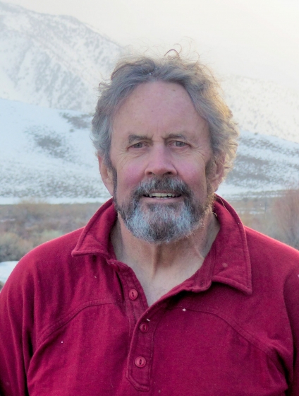 Jeff Dozier合作论文数Bren School of Environmental Science and Management, University of California, Santa Barbara7
 Luiz Eduardo Oliveira E Cruz De Aragão合作论文数Instituto Nacional de Pesquisas Espaciais7
 Luciana V. Gatti合作论文数Centro de Ciência do Sistema Terrestre, Instituto Nacional de Pesquisas Espaciais7
 Paul Bates合作论文数Fathom Global;School of Geographical Sciences, University of Bristol7WALLACE ANDREW P合作论文数6Kevin Skeen合作论文数6
 Ronghua Ma (马荣华)合作论文数中国科学院大学中国科学院南京地理与湖泊研究所6
 David Bastviken合作论文数Department of Thematic Studies, Linkoping University6




