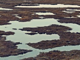
We present a new data set from the Marcell Experimental Forest (MEF) that compiles water isotope measurements from multiple research catchments, some of which have been studied since the 1960s. The MEF is located in northern Minnesota, USA, and is home to heavily studied and monitored forests, streams, bogs, and fens. Peat‐forming systems (bogs and fens) are an important component of the MEF landscape and have a profound impact on the water cycle in these catchments. Within the last decade, analysis of stable isotopes of water (expressed as δD and δ 18 O) has been implemented to characterize the different components of the water budget, and to allow researchers to look at catchment and peatland‐specific hydrologic effects in the watershed. This δD and δ 18 O data set of natural waters from MEF catchments is primarily composed of measurements from three peatlands (S1, S2, S6) during an 11‐year period. More recently collection and analysis were expanded to also include samples from the Spruce and Peatland Responses Under Changing Environments (SPRUCE) project in the S1 bog, peatlands S3, S4, S5, as well as nearby lakes. We establish a local meteoric water line by analyzing the isotopic composition of precipitation, which fills a void in regional meteoric water lines for Minnesota. Furthermore, we establish baseline isotopic composition for bog outlet streams, bog porewater, aquifer groundwater, overland flow, subsurface stormflow, and snowpack, as well as runoff from the SPRUCE experimental chambers. These data are publicly available and will be expanded upon in the future.
We conducted a modern process study on Sphagnum magellanicum from southern Patagonian peat bogs to improve our understanding of environmental controls on the carbon and water (hydrogen and oxygen) isotope compositions of peat mosses. We found that moisture availability gradients in peat bogs, measured by Sphagnum water content, could explain the intra-site variability in both Sphagnum cellulose δ13C and δ18O. Also, there was a site-specific significant negative correlation between cellulose δ13C and δ18O across microtopographical gradient. This new finding suggests that Sphagnum moisture availability influences cellulose δ13C via water film effect on discrimination against 13CO2 and, similarly, can imprint on cellulose δ18O via evaporative enrichment of 18O in metabolic leaf water. Sphagnum leaf wax n-alkane δ13C also responded to the water film effect as cellulose did, but n-alkane δ2H appears less sensitive than cellulose δ18O to the moisture availability gradient likely because hydrogen isotopes have a more complex biochemical fractionation pathway and a smaller kinetic fractionation during leaf water evaporation. Furthermore, we used long strands of Sphagnum to explore if isotopic signals in moss strand increments were sensitive to recent growing season conditions. We demonstrated that rapidly growing Sphagnum strand increments could document the isotopic composition of precipitation and moisture conditions at sub-annual scale. Altogether, these findings highlight the sensitivity of stable isotopes in Sphagnum to environmental conditions. On the basis of these results, we propose that paired measurements of carbon and water isotopes in Sphagnum cellulose or leaf wax biomarker provide an improved approach in peat-based paleoclimate reconstructions.
Glacial−interglacial variations in CO 2 and methane in polar ice cores have been attributed, in part, to changes in global wetland extent, but the wetland distribution before the Last Glacial Maximum (LGM, 21 ka to 18 ka) remains virtually unknown. We present a study of global peatland extent and carbon (C) stocks through the last glacial cycle (130 ka to present) using a newly compiled database of 1,063 detailed stratigraphic records of peat deposits buried by mineral sediments, as well as a global peatland model. Quantitative agreement between modeling and observations shows extensive peat accumulation before the LGM in northern latitudes (>40°N), particularly during warmer periods including the last interglacial (130 ka to 116 ka, MIS 5e) and the interstadial (57 ka to 29 ka, MIS 3). During cooling periods of glacial advance and permafrost formation, the burial of northern peatlands by glaciers and mineral sediments decreased active peatland extent, thickness, and modeled C stocks by 70 to 90% from warmer times. Tropical peatland extent and C stocks show little temporal variation throughout the study period. While the increased burial of northern peats was correlated with cooling periods, the burial of tropical peat was predominately driven by changes in sea level and regional hydrology. Peat burial by mineral sediments represents a mechanism for long-term terrestrial C storage in the Earth system. These results show that northern peatlands accumulate significant C stocks during warmer times, indicating their potential for C sequestration during the warming Anthropocene.
The Antarctic Peninsula (AP) climate is characterized by a high degree of variability, which poses a problem when attempting to put modern change in the context of natural variation. Therefore, novel methods are required to disentangle sometimes conflicting climate records from the region. In recent years, the development of Antarctic moss-cellulose isotopes as a proxy for summer terrestrial growing conditions has become more widespread, with the isotopes Δ13C and δ18O reflecting moss productivity and peatbank moisture conditions, respectively. Here, we used a combined Δ13C and δ18O isotope analysis of moss Chorisodontium aciphyllum cellulose from a peatbank located on Litchfield Island in the western AP to document changes in climate over the last 1700 years. High Δ13C values (>15‰) indicate warm and productive conditions on Litchfield Island from 1600 to 1350 cal yr BP (350 to 600 AD) and over the last 100 years. The δ18O record shows two distinct intervals of dry conditions at 1350–1000 cal yr BP (600–950 AD) and at 500–0 cal yr BP (1450–1950 AD). Our record indicates that terrestrial ecosystems in the AP have responded to regional climate driven by atmospheric circulation, such as the southern annular mode (SAM) and, to a lesser extent, changes in ocean circulation.
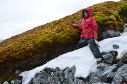
The western Antarctic Peninsula experienced rapid warming in the second half of the 20th century, which has increased vascular plant abundance and moss productivity. To better understand long-term ecological responses, we used paleoecological and microclimate data to investigate dynamics of late Holocene peatbank development and landscape influences. In peatbank cores from three locations on Litchfield Island (64 degrees 46'S; 64 degrees 06'W) high-resolution plant macrofossil and geochemical analysis show contrasting ecological and environmental changes. Two peatbanks on the southwest- and west-facing slopes of two separate hills are about 500 years old in contrast to a north-facing peatbank that is 2700 years old. The period from 1350 to 450 calibrated years before present (cal yr BP) at the north-facing peatbank had low accumulation (0.25 mm yr(-1), 36 g OM m(-2) yr(-1)), which we interpret as a period of low temperature and increased snow cover. Microclimate differences were amplified by this regional climate cooling, causing the delayed peat initiation on non-equator-facing slopes. Over the last 500 years, the north-facing peatbank had an accumulation rate (0.7 mm yr(-1), 76 g OM m(-2) yr(-1)) that was lower than the southwest- and west-facing peatbanks (1-1.4 mm yr(-1), 97-110 g OM m(-2) yr(-1)). Microclimate data suggest that slope aspect on Litchfield Island influences soil temperature, snow cover, and water availability that in turn affect growing-season lengths and peat accumulation. Plant macrofossils preserved in the north- and west-facing peatbanks show a centennial-scale pattern of fluctuation in relative abundance of dry-adapted Polytrichum strictum and wetter Chorisodontium aciphyllum mosses. Our results suggest that moss communities responded to external environmental influence, particularly those affecting moisture conditions, while topography and resultant microclimate differences had a strong influence on peat accumulation. (C) 2017 Elsevier Ltd. All rights reserved.
Peatlands, wetlands with > 30 cm of organic sediment, cover more than 3 x 10⁶ km2 of the earth surface and have been accumulating carbon and sediments throughout the Holocene. The location of peatland formation and accumulation has been dynamic over time, as peat formation in areas like Alaska and the West Siberian Lowlands preceded peat formation in Fennoscandia and Eastern North America due to more favorable climate for peat formation. Using the geographic distribution of peatlands in the past can indicate general climatic conditions, including hydroclimate, given that the underlying geology is well understood. Peatlands form under a variety of climatic conditions and landscape positions but do not persist under arid conditions, instead requiring either humid conditions or cold temperatures. However, peatlands may have existed in the past in areas not currently suitable for peatland formation and persistence, but where peats can be found at depth within the sediment column. Here we map the locations of histic paleosols, relict peat, and buried peats since the Last Glacial Maximum using a compilation of sites from previous studies. We compare these records of past peatland distribution to present-day peatland distribution. We evaluate regional differences in timing of peatland development in these buried peatlands to the development of extant peatlands. Finally, we compare the timing of past peatland extent to the to modeled paleoclimate during the Quaternary. In addition to implications for paleoclimate, these past peatlands are not well accounted for in present-day soil carbon stocks but could be an important component of deep soil carbon pools.
 Zicheng Yu (于子成)合作论文数Department of Earth and Environmental Sciences, Lehigh University6
 Julie Loisel合作论文数Département de Géographie, Université du Québec à Montréal5
 Zhengyu Xia (夏正宇)合作论文数School of Geographical Sciences, Northeast Normal University4
 Terri Lacourse合作论文数3
 Sarah Finkelstein合作论文数Department of Earth Sciences, Faculty of Arts and Science, University of Toronto3
 Nils Broothaerts合作论文数Department of Earth and Environmental Sciences, KU Leuven3
 Richard J. Payne合作论文数3
 Peter Kuhry合作论文数Department of Physical Geography, Faculty of Science, Stockholm University3
 Julie Talbot合作论文数3
 Victor Brovkin合作论文数Climate-Biosphere Interactions Group, Max Planck Institute for Meteorology3
 Thomas Kleinen合作论文数School of Environmental Sciences, University of East Anglia3
 David W. Beilman合作论文数Department of Geography;University of California;Department of Geography, University of California3
 Bastiaan Notebaert合作论文数Corresponding author.3
 Charles Tarnocai合作论文数3
 René Dommain合作论文数3
 Graeme Swindles合作论文数School of Natural and Built Environment, Faculty of Engineering and Physical Science, Queen's University Belfast;Department of Earth Sciences, Carleton University3Outi Lähteenoja合作论文数3
 Gert Verstraeten合作论文数Faculty of Science, KU Leuven;Division of Geography and Tourism, KU Leuven3Miriam C. Jones合作论文数Department of Earth and Environmental Sciences;Lehigh University;Department of Earth and Environmental Sciences, Lehigh University3
 Guido Grosse合作论文数Permafrost Research Section, Alfred Wegener Institute Helmholtz Centre for Polar and Marine Research;Institute of Geosciences, University of Potsdam3
 Claire Treat合作论文数Department of Agroecology, Center for Landscape Research in Sustainable Agricultural Futures, Aarhus University3
 Jens Strauss合作论文数Department of Periglacial Research, Alfred Wegener Institute for Polar and Marine Research3
 Jack A. Hutchings合作论文数Dept Earth & Planetary Sci, Washington Univ2
 Geoffrey Hope合作论文数Research School of Pacific and Asian Studies, Australian National University2A. Britta K. Sannel合作论文数2
 Judith Z. Drexler合作论文数California Water Science Center, U.S. Geological Survey2B. Sannel合作论文数1
 Zhaojie Yu (于兆杰)合作论文数University of Chinese Academy of Sciences;Institute of Oceanography, Chinese Academy of Sciences1
 Yinsui Zheng合作论文数Dept Earth Environm & Planetary Sci, Brown Univ1
 April S. Dalton合作论文数Charles Univ Prague, Dept Phys Geog & Geoecol, Prague, Czech Republic1
 Carl Mitchell合作论文数Department of Geography & Planning, Faculty of Arts & Science, University of Toronto;Department of Physical & Environmental, University of Toronto Scarborough1
 Mark B. Green合作论文数Center for the Environment, Plymouth State University;Northern Research Station, US Forest Service;Center for the Environment, Plymouth State University1
 Yongsong Huang合作论文数Department of Geological Sciences, Brown University1
 Christopher Williams合作论文数Department of Geography, School of Geography, Clark University1
 Dorothy M Peteet合作论文数Goddard Institute for Space Studies, NASA;Paleoecology Division, New Core Lab, Lamont Doherty Earth Observatory of Columbia;Department of Earth and Environmental Sciences, Columbia University1
 Minna Valiranta合作论文数Department of Biological and Environmental Sciences, University of Helsinki1
 Natalie A. Griffiths合作论文数Department of Biological Sciences, University of Notre Dame1
 Thomas A. Douglas合作论文数U.S. Army Corps of Engineers- Engineer Research and Development Center Cold Regions Research and Engineering Laboratory1Martina Hattestrand合作论文数1
 Stephen Sebestyen合作论文数USDA Forest Service, Northern Research Station1
 Helena Alexanderson合作论文数Department of Physical Geography and Quaternary Geology, Stockholm University1




