Forage quality is crucial for determining livestock productivity as well as ecosystem health, and consequently is a critical parameter for sustainable rangeland management. However, most studies concentrate on forage amount alone, and it remains largely unknown to what extent climate, soil, and disturbance impact seasonal forage quality. Across spring, summer and autumn, we conducted a large-scale field study at 63 sites in the eastern Mongolian steppe, arguably the largest intact steppe region under traditional mobile land use. We performed exploratory multivariate analyses to check the correlation structure among forage indicators and environmental factors separately, and then used linear mixed models to assess the impact of season, and major environmental factors, i.e., precipitation, temperature, soil carbon-nitrogen (C-N) ratio, local disturbance, as well as the interaction between precipitation and disturbance on current standing biomass, and selected indicators of forage quality, i.e., community-weighted nitrogen content, crude protein (CP) yield, digestibility and water content of fresh biomass. Results showed a clear seasonal difference in all indicators except digestibility. Plant N contents at the community level declined significantly from 2.4% in spring to 2.1% in summer, then to 1.5% in autumn, while mean CP yield was 104 kg·ha-¹in summer and more than halved towards spring. Water content in fresh biomass was highest in summer (54%) and lowest in autumn (30%). Linear modeling revealed that higher precipitation was associated with greater CP yield, while higher disturbance lead to lower CP yield. Temperature was a significant positive predictor of total water content. Digestibility was not sensitive to any predictor tested. We highlight the importance of integrating forage quality and its seasonal dynamics into estimates of grassland carrying capacity.
Mongolian steppes are still under traditional land use by mobile pastoralism and remain relatively intact. Traditional ecological knowledge (TEK) has always played an essential role in herders' assessments of pasture conditions, and decision-making regarding their movements. In the last two decades, Mongolia's rapid socio-economic development resulted in dramatically increasing livestock numbers and expanding settlements, raising concerns about rangeland degradation associated with potential declines in herders' TEK.We compared quantitative and qualitative data from interviews on herders' TEK and standard ecological assessments to assess the level of congruence. In 2020, a total of 367 households across ten sampling sites were interviewed about pasture condition, TEK on forage and degradation indicator plants. For the same sites, we collected field-based data on plant species richness, composition and biomass, as well as remote sensing-derived biomass estimates.Our results highlight variance in TEK: even within the same sites, there were widely diverging perspectives on pasture condition and its trends, forage palatability and degradation indicator plants, suggesting that there is limited exchange among herders. Multivariate analyses showed that herders' assessments had a moderate association with field-based vegetation data, reinforcing that comprehensive evaluations of pasture conditions still require field-based assessments. These findings underscore the need for stronger communication between scientists and herders, as well as enhanced transfer of TEK regarding current and changing pasture conditions. Since TEK and its transmission play a key role in herders' movement decisions and are vital for future rangeland monitoring, capacity building is recommended to support the development of sustainable land use policies that uphold ecological integrity.
Increasing livestock numbers in Mongolian rangelands have raised concerns about overgrazing; however, quantifying degradation remains complex. Indicators like species richness, vegetation cover, biomass and remote sensing–based indices are widely used but often yield contradictory results with respect to degradation, hampering policy development.,In this study, we applied a multi-indicator approach combining field-based metrics (species richness, diversity, vegetation cover, forage quantity and quality, as well as soil nutrient contents) with a remote sensing–based indicator (NDVI) to assess changes in rangelands of Mongolia. We compared remote eastern steppes with more densely populated central Mongolian steppes, and added a temporal perspective using vegetation samples from the 1980s.,Species richness, above-ground biomass, and total vegetation cover did not show spatial differences. In contrast, Shannon diversity index, along with species composition, revealed clearer patterns. Eastern steppes were characterised by a higher diversity and abundances of good forage grasses Stipa krylovii and Leymus chinensis, whereas central steppes showed greater abundance of degradation indicators, like Artemisia adamsii and Carex duriuscula. Over the 40-year temporal scale, cover of S. krylovii had decreased, while cover of A. adamsii had increased. Remote sensing indicated greening from 2001 to 2024, especially in central regions. This may not capture shifts towards less palatable, and in some cases potentially toxic species.,Changes in plant community compositions may signal potentially irreversible transformations of steppe ecosystems. Our findings highlight the limitations of single indicators and emphasize the importance of integrating species composition and diversity metrics for more accurate assessments of rangeland condition.
Aims The Mongolian steppes, the world's largest intact grassland, have long supported nomadic pastoralism. Yet in recent decades, increasing livestock grazing and reduced herder mobility have driven pasture degradation, but its extent differs between major climate regimes and levels of human disturbance. The relative importance of abiotic factors versus land use impacts on plant diversity and palatability remains debated. Specifically, few studies have addressed the impact of herder mobility on vegetation patterns. We thus coupled vegetation and quantitative social survey data to examine how abiotic drivers, disturbance and herder household mobility relate to vegetation integrity.Location Eastern Mongolian steppe.Methods We conducted vegetation and herder household surveys at 11 study sites in the Eastern Mongolian steppe (275 vegetation plots and 249 herder households). These sites are classified into two groups with high and low human disturbance levels in terms of herder and livestock density, respectively. We (1) employed multivariate variation partitioning to investigate the relative importance of predictor groups macroclimate, soil chemistry, human disturbance and herder household mobility on plant species composition; (2) subsequently fitted generalized linear mixed models for evaluating effects of precipitation, grazing and herder household mobility on plant richness, vegetation cover and representation of palatable species. Moreover, we conducted indicator species analysis to identify plants indicating higher disturbance level.Results In terms of species composition, macroclimate played the most important role, followed by human disturbance and mobility, then soil chemistry. Importantly, mobility and its overlapping effect with macroclimate explained the most variance of plant community for sites with higher disturbance levels, while soil chemistry was more important at sites with lower disturbance levels. Between-season moving frequency was positively related to richness, diversity and the richness of palatable species. Locally intensified grazing reduced the share of palatable species cover. Overall, the negative impact of intensified grazing on total vegetation cover and the cover of palatable species was only pronounced at drier sites. Additionally, five common plant species were identified as reliable indicators of varying disturbance levels.Conclusions Our findings highlight the important role of herder household mobility in shaping plant species composition, in addition to climate, soil and human disturbance. Higher seasonal mobility promotes richness and diversity of vascular plants and richness of palatable species. Disturbance impact on vegetation cover at relatively drier steppes supports concern about pasture degradation at the transition zone between dry typical steppes and desert steppes. The representation of palatable species should be considered for assessing pasture quality.
Abstract. Growing numbers of biodiversity monitoring data recorded by camera trap devices are becoming increasingly difficult to manage and analyze. The WildLIVE platform is being developed to address these challenges by providing a comprehensive virtual research environment (VRE) that integrates citizen science, machine learning-based annotation, and geo-analysis functionality. Additionally, it serves as a centralized platform for FAIR (Findable, Accessible, Interoperable, and Reusable) data sharing. This paper presents the core concepts of the WildLIVE platform and its underlying data model, highlighting its potential to streamline biodiversity research and enhance data accessibility.
Biological invasions are one of the major drivers of biodiversity decline and have been shown to have far-reaching consequences for society and the economy. Preventing the introduction and spread of alien species represents the most effective solution to reducing their impacts on nature and human well-being. However, implementing effective solutions requires a good understanding of where the species are established and how biological invasions develop over time. Knowledge of the status and trends of biological invasions is thus key for guiding research efforts, informing stakeholders and policymakers, for targeted management efforts, and preparing for the future. However, information about the status and trends of alien species is scattered, patchy, and highly incomplete, making it difficult to assess. Published reports for individual regions and taxonomic groups are available, but large-scale overviews are scarce. A global assessment therefore requires a review of available knowledge with careful consideration of sampling and reporting biases. This paper provides a comprehensive global assessment of the status and trends of alien species for major taxonomic groups [Bacteria, Protozoa, Stramenopila, Alveolata, and Rhizaria (SAR), fungi, plants, and animals] for Intergovernmental Panel of Biodiversity and Ecosystem Services (IPBES) regions. The review provides irrefutable evidence that alien species have been introduced to all regions worldwide including Antarctica and have spread to even the most remote islands. The numbers of alien species are increasing within all taxa and across all regions, and are often even accelerating. Large knowledge gaps exist, particularly for taxonomic groups other than vascular plants and vertebrates, for regions in Africa and Central Asia, and for aquatic realms. In fact, for inconspicuous species, such as Bacteria, Protozoa, and to some degree SAR and fungi, we found records for very few species and regions. Observed status and trends are thus highly influenced by research effort. More generally, it is likely that all lists for alien species of any taxonomic group and region are incomplete. The reported species numbers therefore represent minima, and we can expect additions to all lists in the near future. We identified six key challenges which need to be addressed to reduce knowledge gaps and to improve our ability to assess trends and status of biological invasions.
Global biodiversity is changing at unprecedented rates during the Anthropocene. Whereas current biodiversity patterns can be observed directly, information from the recent past is far less easily retrieved yet urgently needed to understand present observations and predict future developments. For plants, herbaria offer such a unique glimpse into the past. Evaluation of plant specimens allows determining a wide range of attributes like species identity, morphological and phenological traits and even signs of biotic interactions. Specimen's labels convey data such as species identity (and identification history), date and locality of collection, as well as the surrounding biotic and abiotic environment. Current methodological developments in sensor technology and computer vision increasingly enable us to extract this information in a high throughput and automated way. Equally vast developments in data science allow to integrate data from other sources for much more comprehensive analyses than before. With millions of specimens already digitized and digitization schemes running in many institutions, we will be increasingly able to determine characteristics of species and link them via distribution records to large-scale climate change scenarios. This allows us to better predict species' threat levels, and to develop scenarios on the consequences of biodiversity change for ecosystem functioning. The present contribution reviews recent herbaria research and describes potential avenues with respect to Museomics and the Extended Specimen, and we propose Collectomics as a new framework to unravel, understand, and cope with the Anthropocene biodiversity change.
ABSTRACTAs climatic extremity intensifies, a fundamental rethink is needed to promote the sustainable use of freshwater resources. Both floods and droughts, including water scarcity, are exacerbating declines in river biodiversity and ecosystem services, with consequences for both people and nature. Although this is a global challenge, densely populated regions such as Europe, East Asia and North‐America, as well as the regions most affected by climate change, are particularly vulnerable. To date mitigation measures have mainly focused on individual, local‐scale targets, often neglecting hydrological connectivity within catchments and interactions among hydrology, biodiversity, climate change and human wellbeing. A comprehensive approach is needed to improve water infiltration, retention and groundwater recharge, thereby mitigating the impacts of heavy rainfall and floods as well as droughts and water scarcity. We propose a holistic catchment‐scale framework that combines mitigation measures including conventional civil engineering methods, nature‐based solutions and biodiversity conservation actions. This framework integrates legislation, substantial funding and a governance structure that transcends administrative and discipline boundaries, enabling coordinated actions across multiple spatial and temporal scales. It necessitates the collaboration of local and regional stakeholders including citizens, scientists and practitioners. A holistic vision for the sustainable management of freshwater resources could have synergistic effects that support biodiversity and mitigate climate change within functional ecosystems that deliver benefits to people.
Insect decline has been documented in an increasing number of studies, but attribution to potential drivers remains challenging. Climate change poses threats to insect biodiversity, and there is still little data on how climate change is already affecting insect communities. We present a resampling study on long-term trends in leafhopper and planthopper communities of dry grassland reserves in Germany, comparing samples from three sampling decades: 1960s, 2000s and 2010s. Diversity and abundance data were related to weather data and to information on conservation management. Insect communities changed significantly with respect to decade, season and seasonal precipitation but not with respect to mean seasonal temperature. Conservation management had limited effect. Specifically, wetter conditions resulted in significantly higher abundance and richness of insect communities. We infer that apparent decline of water availability in dry grasslands - among other drivers on landscape-level - plays a significant role in shaping communities of phytophagous insects in Central European cultural landscapes. Conservation management has to be adjusted to this development.
Evidence-based decision making is increasingly recognized as vital for improving the effectiveness of conservation interventions. However, its practical application in protected area (PA) management remains limited. Drawing on face-to-face interviews with PA managers from 116 PAs across Africa and Europe, we investigated the use of scientific evidence in conservation decisions and the social context under which the decisions are made. Our results revealed that most PA managers believe that there is a favorable social context, highlighting supportive community attitudes and their willingness to participate in conservation. We also found that while only about one-third of PA managers use scientific publications to inform their decisions, an overwhelming majority (85%) of PA managers rely primarily on personal experience. PA managers widely perceive the conservation interventions implemented by their respective PAs as highly effective, regardless of the type of intervention or the degree of scientific support behind it. They also recognize the trust, cooperation, and participation of local communities as crucial for the success of conservation interventions. Our study underlines that the influence of scientific evidence, particularly evidence from systematic research that has been published in peer-reviewed scientific journals, on PA-level decision making remains limited. Although the practical experience of PA managers is undeniably valuable, the underutilization of scientific evidence could undermine the effectiveness of PA managers' decisions and conservation interventions implemented by PAs. Fostering strong partnerships between researchers and PA managers (through co-designed research, mutual learning, and effective communication) can help mainstream evidence-based decision making in protected areas.
Arable fields and mesic meadows have been affected by intensifying agricultural management and nutrient input during the 20th century, but direct evidence for the long-term impact of intensification on plant nutrient contents remains scarce. Non-destructive novel spectroscopic methods can produce such data from herbarium specimens, making it possible to investigate how contents of leaf nutrient traits, especially nitrogen and phosphorus, changed over the last century, and what role habitat type and management practices play. We carried out a resurvey study of functional traits in arable field and mesic meadow communities. We used specimens from two German herbaria with a high coverage of their local floras: the herbaria Senckenberg G & ouml;rlitz and Senckenberg Haussknecht in Jena. Following specimen information, the same plant species were resampled in the field in 2022 at the same locations. We employed near-infrared spectroscopy to predict leaf nitrogen, phosphorus and carbon content of herbarium and field specimens. Nutrient content changes over time were compared with public records of regional P and N fertilization. Overall, 1270 specimens of 76 species from both herbarium and field were studied, the oldest from the 19th century. Leaf nitrogen and the leaf nitrogen:phosphorus ratio increased significantly through time, while leaf phosphorus and carbon content decreased significantly over time. Arable field species showed a stronger response in leaf phosphorus content and leaf nitrogen:phosphorus ratio than mesic meadow species. The total amount of nitrogen or phosphorus fertilizer applied per year on a regional scale was found to be significantly correlated with the respective leaf nutrient content levels. Synthesis: Our study shows a long-term increase of leaf nitrogen in the studied habitats, paralleling increased chemical fertilizer applications in Germany. Our data indicate a shift from predominantly N-limited towards more P-limited growth conditions. The stronger response of species from arable fields compared to species from mesic meadows could indicate a faster adjustment to environmental pressures. This study thus also serves to showcase the potential of the combination of herbarium collections and NIR spectroscopy.
Background Oases are azonal, highly productive, densely vegetated areas within drylands, often converted to agriculture, and characterized by significant biocultural diversity. Despite their importance, comprehensive information on the global distribution and biocultural diversity of oases has been lacking. Methods To address this gap, a detailed bibliographic search and random forest modeling were combined to create a global map of oases, with a focus on Asia and North Africa (ANA). Results In the ANA region, oases cover 1.5% of the dryland area and are populated by 150 million people, with an additional 268 million people living nearby and most likely being dependent on them. Globally, oases contain more than 8,200 vertebrate species, of which 13% are classified as threatened. However, less than 0.5% of their total area is currently under protection, making oases one of the least conserved ecosystems worldwide. These findings highlight the distinct biocultural, ecological, and geopolitical importance of oases, which are increasingly threatened by climate change and direct human impacts. Despite their significance, oases remain undervalued, emphasizing an urgent need for developing adaptative strategies to sustainably manage these pivotal ecosystems.
We developed the WildLIVE platform to enable curation, analysis and mobilization of data from high-throughput biodiversity monitoring for European and global cross-domain data space pro-grams. The platform implements “webby” FAIR Digital Objects leveraging on RO-Crate and FAIR Signposting to foster self-contained operation of machines on contained digital resources (machine actionability).
Background Herbaria are becoming increasingly important as archives of biodiversity, and play a central role in taxonomic and biogeographic studies. There is also an ongoing interest in functional traits and the way they mediate interactions between a plant species and its environment. Herbarium specimens allow tracking trait values over time, and thus, capturing consequences of anthropogenic activities such as eutrophication. Here, we present an open, reproducible, non-destructive workflow to collect leaf trait data from herbarium specimens using near-infrared spectroscopy (NIRS), and a proof of concept for the reliability of this approach. Results We carried out three experiments to test the suitability of non-destructive NIRS methods to predict leaf traits both for fresh and dried leaves: (1) With a fertilization experiment, we studied whether NIRS was able to capture changes in leaf N and leaf P during a fertilization experiment and we compared contents predicted by NIRS with results obtained from regular wet lab methods. Calibration models for leaf nitrogen and phosphorus contents had a quality of R 2 = 0.7 and 0.5, respectively. We fitted calibration models for NIRS readings on fresh and dried leaf samples, both of which produced equally precise predictions compared to results from wet lab analyses. (2) We tested the effect of herbarium conservation on NIRS readings by simulating them through the application of six treatments combining freezing, drying and pesticide spraying in a factorial scheme and comparing these with untreated samples. No consistent changes were observed in the spectra quality before and after the simulated herbarium conditions. (3) Finally, we studied the effect of specimen storage duration using specimens from a 2018 study which were re-analyzed and compared with spectra obtained in 2021. No consistent changes in spectra were observed after the storage period. Conclusions The results demonstrate the reliability of NIRS to measure leaf N and P on herbarium samples. Together with the calibration method and dataset presented here, they provide a toolset allowing researchers to study the development of leaf traits and their response to environmental changes over decades and even centuries in a fast and non-destructive manner.
Context There is an urgent need to stop the biodiversity loss in European agricultural landscapes. These landscapes, due to their fragmentation, include a lot of edges, many of them between habitats of different quality in terms of biodiversity. Objectives Here, we ask how plant species richness is distributed from the interior of protected semi-natural grassland into the interior of adjacent crop fields, and which species groups determine the observed patterns. Methods At grassland–crop field interfaces in two German landscapes, we sampled the vegetation along transects extending 32 m into both habitats. Based on theory, we fitted different models to visualize the species richness curve along transects and selected the best model via AIC. Results The best fitting model for all species was monotone over the interface with a minimum in the field and a maximum in the grassland. This shape was driven by the generalists, showing the same pattern, while grassland specialists showed a sigmoid curve with an increase only in the grassland. Arable specialists had a peak at the field edge and decreased towards the grassland. Curves for Ellenberg indicator values for moisture, nutrients and light showed the same shape as the overall species curve, yet with an inverse pattern for light. Conclusions This is the first study revealing gradual responses of plant species richness at the grassland–crop field interface with a high spatial resolution. As these adjacent habitats influence each other far into their neighbourhood, attention should be given when conserving biodiversity in agricultural landscapes, particularly in case of often small and scattered protected areas.
Download This Paper Open PDF in Browser Add Paper to My Library Share: Permalink Using these links will ensure access to this page indefinitely Copy URL Copy DOI
Aims: We introduce ReSurveyEurope - a new data source of resurveyed vegetation plots in Europe, compiled by a collaborative network of vegetation scientists. We describe the scope of this initiative, provide an overview of currently available data, governance, data contribution rules, and accessibility. In addition, we outline further steps, including potential research questions. Results: ReSurveyEurope includes resurveyed vegetation plots from all habitats. Version 1.0 of ReSurveyEurope contains 283,135 observations (i.e., individual surveys of each plot) from 79,190 plots sampled in 449 independent resurvey projects. Of these, 62,139 (78%) are permanent plots, that is, marked in situ, or located with GPS, which allow for high spatial accuracy in resurvey. The remaining 17,051 (22%) plots are from studies in which plots from the initial survey could not be exactly relocated. Four data sets, which together account for 28,470 (36%) plots, provide only presence/absence information on plant species, while the remaining 50,720 (64%) plots contain abundance information (e.g., percentage cover or cover-abundance classes such as variants of the Braun-Blanquet scale). The oldest plots were sampled in 1911 in the Swiss Alps, while most plots were sampled between 1950 and 2020. Conclusions: ReSurveyEurope is a new resource to address a wide range of research questions on fine-scale changes in European vegetation. The initiative is devoted to an inclusive and transparent governance and data usage approach, based on slightly adapted rules of the well-established European Vegetation Archive (EVA). ReSurvey:Europe data are ready for use, and proposals for analyses of the data set can be submitted at any time to the coordinators. Still, further data contributions are highly welcome.
ABSTRACT Plant responses to environmental heterogeneity depend on life‐history traits, which could relate to phenotypical and genetic characteristics. To elucidate this relationship, we examined the variation in population genetics and functional traits of short‐ and long‐lived Artemisia species that are co‐occurring in the steppes of Mongolia. Mongolian steppes represent stressful and water‐limited habitats, demanding phenotypic modifications in the short term and/or genetic adaptation in the long term. However, detailed knowledge is missing about both plant phenotypic and genetic differentiation, and their interrelationships in temperate grasslands. Here, we investigated 21 populations of the widely distributed subshrub Artemisia frigida and the herbaceous biennial Artemisia scoparia. Genetic variation was assessed with newly developed simple sequence repeats (SSRs) markers. Functional trait data were collected from each individual, and data on environmental variables was collected for each population. We detected significantly higher genetic diversity in the biennial species (HE = 0.86) compared with the perennial (HE = 0.79). For both species, the largest share of genetic variation was partitioned within populations (96%). Population genetic structure in the biennial A. scoparia was weak, while the perennial A. frigida showed some spatial genetic structure, which was impacted by geographical factors, soil nutrients, and precipitation amount. Morphology‐related functional traits (i.e., plant height) were predominantly associated with environmental variables rather than with genetic variation, whereas physiology‐related trait (i.e., specific leaf area [SLA]) was partly genetically determined.
 Isabell Hensen合作论文数37
 Henrik Von Wehrden合作论文数Center for Methods, Leuphana University Lueneburg;Sustainability Education and Transdisciplinary Research Institute, Leuphana University Lueneburg28Christiane M. Ritz合作论文数Institut fur Spezielle Botanik25
 Jürgen Dengler合作论文数Institute of Natural Resource Sciences, School of Life Sciences and Facility Management, Zurich University of Applied Sciences;Vegetation Ecology19
 Christoph Leuschner合作论文数Faculty of Biology, University of Gottingen17Georg Miehe合作论文数17
 Erik Welk合作论文数Institute of Biology, Geobotany and Botanical Garden, Martin-Luther-University Halle-Wittenberg17
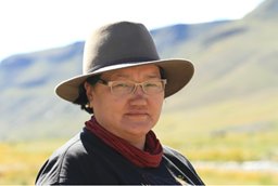 Oyuntsetseg Batlai合作论文数Dept Biol, Natl Univ Mongolia16I. Hensen合作论文数15
 Helge Bruelheide合作论文数Department of Geobotany and Botanical Garden, Institute of Biology, Faculty of Natural Sciences, Martin Luther University Halle-Wittenberg13Stefan Meyer合作论文数13Elke Seeber合作论文数12Munkhzul Oyunbileg合作论文数12Khurelpurev Oyundelger合作论文数Chair of Biodiversity of Higher Plants, Technical University Dresden12Frank Mueller合作论文数12Ute Jandt合作论文数Martin-Luther-Univ. Halle-Wittenberg, Martin-Luther-Universität Halle-Wittenberg12
 Viktoria Wagner合作论文数11
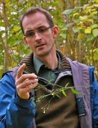 Florian Jansen合作论文数Dept. of Landscape Ecology, Ernst-Moritz-Arndt University11
 Benjamin Krause合作论文数10Ronnenberg Katrin合作论文数10Jiri Danihelka合作论文数Faculty of Science, Masaryk University Institute of Botany and Zoology10
 Anke Jentsch合作论文数Department of Disturbance Ecology and Vegetation Dynamics;Bayreuth University;Centre for Environmental Research;Centre for Environmental Research, Bayreuth University10Christine Römermann合作论文数Institute of Botany, University of Regensburg10
 Josep Peñuelas Reixach合作论文数Global Ecology Unit, Centre de Recerca Ecològica i d'Aplicacions Forestals, Universitat Autònoma de Barcelona9
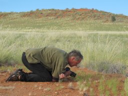 Norbert Jürgens合作论文数Botanical Institute;University of Cologne;Botanical Institute, University of Cologne9
 Meelis Pärtel合作论文数Institute of Ecology and Earth Sciences, Faculty of Science and Technology, University of Tartu9
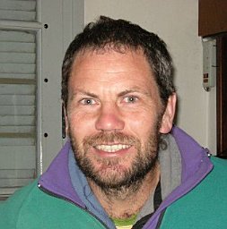 Daniel Renison合作论文数Cátedra de Ecología General, National University of Córdoba9
 Götzenberger Lars合作论文数Department of Botany, University of Tartu8
 Jan Lepš合作论文数Department of Botany, Faculty of Science, University of South Bohemia in Ceske Budejovice8Wolfgang Schmidt合作论文数8
 Yongping Yang (杨永平)合作论文数Xishuangbanna Tropical Botanical Garden, Chinese Academy of Sciences;University of Chinese Academy of Sciences8
 Milan Chytrý合作论文数Department of Botany and Zoology, Faculty of Science, Masaryk University8
 Robin Pakeman合作论文数School of Biological Science, University of Liverpool;The James Hutton Institute8
 Sylvia Haider合作论文数Department of Ecology and Ecosystem Management, Technische Universität München8Georg Zizka合作论文数Department of Botany and Molecular Evolution, Research Institute Senckenberg and Johann Wolfgang Goethe-University8Kiril Vassilev合作论文数Institute of Biodiversity and Ecosystem Research, Bulgarian Academy of Science7
 Yun Wang合作论文数7
 Jiménez-Alfaro Borja合作论文数7
 Robert K. Peet合作论文数Department of Biology, College of Arts and Sciences, University of North Carolina at Chapel Hill7
 Marco Schmidt合作论文数Department of Botany;Research Institute;Department of Botany, Research Institute7Sabine Miehe合作论文数7Francesco De Bello合作论文数Laboratoire d’Ecologie Alpine, Université Joseph Fourier7
 Susan K. Wiser合作论文数Landcare Research7
 Eszter Ruprecht合作论文数Department of Taxonomy and Ecology;Babeş-Bolyai University;Department of Taxonomy and Ecology, Babeş-Bolyai University7
 Aletta Bonn合作论文数Biodiversity and Macroecology Group;Department of Animal and Plant Sciences;University of Sheffield;Biodiversity and Macroecology Group, University of Sheffield7Sebastian Schuch合作论文数7
 Luisa Conti合作论文数Faculty of Environmental Sciences, Czech University of Life Sciences Prague6
 Thanh-Noi Phan合作论文数Dept Geog, Ludwig Maximilians Univ Munchen6
 Heidi Hirsch合作论文数6




