Many people use satellite images in their professional and everyday lives, and school curricula often require their use.Yet, the ways teachers actually use satellite images in the classroom is often limited, if they use them at all.The YCHANGE project trained teachers to use remote sensing data by themselves and to use it in their classrooms.The project partners created a remote sensing curriculum which suggests how teachers can develop their students' skills in this area of geography.This curriculum is based on existing research and school curricula.The project partners created and published sample learning units, and the project webpage also offered the possibility for teachers to publish studentcreated projects.YCHANGE training event participants in Switzerland and Germany filled out an online survey.Most participants said they improved their ability to read satellite images and use them in the classroom.However, participants' evaluation of the YCHANGE materials and training events was mixed.The study shows some differences among the Swiss language regions, and significant differences between Germany and Switzerland.For example, our training events introduced the participants to the web application BLIF.On average, the German participants liked BLIF, but the participants in Switzerland rated BLIF significantly worse.We therefore recommend that future research compare remote sensing, as well as other areas of geography education, among different countries and language regions.
Earth Science and Geography teacher preparation has developed to some degree along different lines, despite sharing many of the same issues, especially with regard to challenges in teacher education. The conference International Perspectives on Geography and Earth Science Teacher Education 2016 wanted to bring together educators from both sciences from around the world together to move the debate about these challenges forward. From the research presentations and the discussion during and after the conference, several issues emerged: (1) the importance of the two subjects not losing sight of each other; (2) the need to overcome language barriers; (3) the question of standards/objectives for geography teacher education (e.g. with regard to teachers' (P)CK); (4) media used in teacher education (including ways to improve them); (5) ways to improve learners' geography and earth science content knowledge; and (6) strategies to increase teachers' professionalism. We already suggest some specific steps teacher educators in the two fields can take to improve teacher education. Yet, it also became clear that more research and strengthening international collaborations are needed, as well as better communication of the results of these efforts to practitioners.
Since 2016 an international research process has been underway to design and develop an international geography assessment for implementation in lower secondary education settings. One of the crucial steps in this process is the development and validation of an assessment framework that models the content and cognitive dimensions of geography education to enable internationally valid, reliable, and fair measures of geographic constructs. This paper provides a rationale for an international assessment in geography and reports the findings of foundational research that produced the provisional assessment framework. Our methodology draws on the evidence-centered design to educational assessment development, which involves a sequential approach to domain analysis and modelling. The framework will guide the specifications for tasks and tests, evaluation procedures, and measurement models. The article concludes with a reiteration of the value of an international assessment and an outline of the activities moving forward.
In contrast to many of the former curricula, the new Curriculum 21 in Switzerland offers teachers considerable freedom in choosing spatial examples. As part of an educational design research project, this study investigates the reasoning behind pre-service teachers’ choices of spatial examples for their own teaching and coursework as well as their interests and wishes for how spatial examples should be chosen for initial teacher training courses. Students in one institution in Switzerland completed an online questionnaire at the end of the autumn term 2015 as well as the spring term 2016. The results indicate that several factors such as e.g. the students’ and pupils’ interest or being the location of current events are judged as more important than the curriculum both for the students’ own choices and for what they wanted the course spatial examples to focus on, although there are some differences between the two areas. Besides helping to understand pre-service teachers’ reasoning, the project’s results will also add new evidence that can help build a design process for initial teacher training courses in geography.
The concept "system" is fundamental to many disciplines. It has an especially prominent place in geography education, in which additionally, the spatial perspective is central. Empirically validated competency models dealing specifically with geographic systems-as well as adequate measurement instruments-are still lacking. Therefore, based on the theoretically-guided development of a Geographic System Competency (GSC) model, the aim was to build and evaluate such a measurement instrument, with the help of probabilistic measurement models. The competency model had three dimensions: (1) "comprehend and analyze systems", (2) "act towards systems" and (3) "spatial thinking", whereby dimension (2) was changed to "evaluating possibilities to act towards systems" after a thinking-aloud study. A Cognitive Lab (CogLab) and two quantitative studies (Q1 n = 110, Q2 n = 324) showed divergent results. Dimension (2) could not be identified in both quantitative studies. Whereas Dimensions (1) and (3) constituted separate dimensions in Q1, in Q2 the two-dimensional model did not fit significantly better than the one-dimensional model. Besides showing the close relationship between spatial and systemic thinking in geographic contexts, which are thus both needed in modeling GSC, the project highlights the need for more research in this central area of geography education.
Due to the importance of geospatial technologies (GST) in science, industry and everyday life, they are already included in many K-12 school curricula and the national educational standards for geography in Germany. Studies show, however, that the implementation in school practice as well as the full exploration of GST’s educational potential still lags behind. Based on these conditions, one GST programme combines the three pillars research, development of learning environments, and teacher training. All three areas are important not only to further explore the conditions of GST use and especially to evaluate whether and how GST use can contribute to the fostering of geographic competencies, but also to transmit the relevant results to classroom practice by providing teachers with the corresponding materials and training. Examples for each pillar discussed in this paper can give impulses for future (inter)national developments but also highlight some of the present challenges of GST classroom implementation.
Digital geo-information is already an important resource for many jobs and every day life. Through initiatives such as INSPIRE, its presence will grow even more in the years to come. Consequently, many curricula for secondary education mandate students to learn how to use geographic information systems (GIS), the key technological basis for dealing with digital geo-information. This paper reviews current research and theoretical considerations regarding the competencies needed for retrieving information with the help of GIS, as well as some of their cognitive foundations, as a basis for building a competency model.
Substantial GIS skills belong to the essential employability criteria in a wide range of fields that deal with integrating, managing, analysing and presenting spatial data. For this reason, GIS has become part of various German curricula for high school geography education recently. In many cases the teachers’ skills do not keep step with those developments. The process of training teachers to use GIS in the classroom is accompanied by many challenges. The situation is made even more complex by a not yet concluded discussion about which role GIS should play in geography education. However, there are also several chances. GIS is a possibility – especially for young teachers – to hone their professional profile, but it is also said to bring an added value to classroom practice and thus is a topic for all geography teachers in the context of lifelong learning. Based on an identification of open questions and current problems of integrating GIS into teacher education and in-service-training, this paper will point out areas where clarification and further research projects are still needed.
Zusammenfassung: Das Projekt „Die Erde verstehen lernen – Einsatz moderner Satellitenbildtechnologie zur Erdbeobachtung für Jugendliche“ (Space4Geography) verfolgt das Ziel, Jugendlichen das Anwendungspotenzial der Fernerkundung zur Beantwortung umweltund raumrelevanter Fragestellungen näherzubringen. Vor diesem Hintergrund wird eine webbasierte Lernplattform für den Einsatz im Geographieunterricht und verwandten Fächern entwickelt. In verschiedenen Lernmodulen sollen Schüler/-innen die Möglichkeit erhalten, auf Grundlage originaler, räumlich hochauflösender Fernerkundungsdaten und mit der webbasierten Fernerkundungssoftware „BLIF“ geographische Fragestellungen eigenständig zu bearbeiten. Hierzu werden RapidEyeund TerraSAR-X-Satellitenbilddaten für exemplarische Themenund Raumbeispiele bereitgestellt und für einen problemorientierten Unterricht in didaktische Kontexte eingebettet. Eine adaptive Umsetzung der Plattform soll individuelles Lernen unterstützen, indem Lerninhalt und Schwierigkeitsgrad über Nutzer-/Nutzungsprofile an die Kompetenzen, Bedürfnisse und Präferenzen des jeweiligen Lerners angepasst werden.
 Alexander Siegmund合作论文数14
 sascha wustenberg合作论文数University of Luxembourg4
 Daniel Volz合作论文数4
 Samuel Greiff合作论文数university of luxembourg3
 Rod Lane合作论文数Macquarie Sch Educ, Macquarie Univ2
 Terri Bourke合作论文数2
 Joachim Funke合作论文数Psychologisches Institut, Ruprecht-Karls-Universität Heidelberg2
 Joseph P Stoltman合作论文数2Michael Solem合作论文数Association of American Geographers2Vera Fuchsgruber合作论文数1marian blankman合作论文数1Marco Lupatini合作论文数1
 Nina Scholten合作论文数1
 Simone Naumann合作论文数1
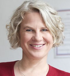 Yvonne Konstanze Behnke合作论文数Department of Geography Education, Humboldt-Universität zu Berlin1
 Sandra Sprenger合作论文数Dept Social Sci Math & Nat Sci, Univ Hamburg1Josef Lastovicka合作论文数1
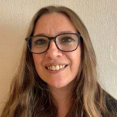 Clare Brooks合作论文数Faculty of Education, University of Cambridge;Centre for Science and Policy, University of Cambridge;Department of Education, University of Oxford1Wolf, N.合作论文数1Isabelle Kollar合作论文数1
 Joseph J. Kerski合作论文数1Chew Hung Chang合作论文数National Institute of Education, Nanyang Technological University,1
 Premysl Stych合作论文数1
 Sarah Bednarz合作论文数Dept Geog, Texas A&M Univ1
 Markus Jahn合作论文数1
 Svenja Brockmuller合作论文数1R. Ditter合作论文数1Sibylle Reinfried合作论文数1
 Michelle Haspel合作论文数1




