Previous mineral dust morphology models often struggle to replicate observed spectral lidar parameters, largely due to oversimplification. This study introduces a roughened irregular hexahedra model to better represent the irregular morphology of real dust particles. Numerical simulations were performed to evaluate how surface roughness impacts key optical properties, such as the lidar and depolarization ratios across different size parameter regimes. The present results demonstrate that incorporating surface roughness to an irregular hexahedral column particle significantly decreases the lidar ratio by up to 58.5%, whereas the depolarization ratio is increased by up to 58.8%, reducing discrepancies between model and lidar observations. These findings suggest that accounting for surface roughness is important for an improved aerosol classification and retrieval in remote sensing applications.
We are setting up a new scattering laboratory, the Optical Lab for Lidar Applications (OLALA) to measure the particle depolarization ratio of irregularly shaped mineral dust particles in the exact backscatter direction. For that, we will use size-segregated natural dust samples which will be observed at three wavelengths (355, 532 and 1064 nm) in order to assess the particle's size effect on the spectral slope of the depolarization ratio. The gained knowledge will be applied to a better understanding of particle's size in lidar field observations of mineral dust and to improve optical scattering models dealing with non-spherical particles at a scattering angle of 180°.
The small-scale variability of solar radiation including 3D radiative effects is poorly observed and understood. In this study, we characterise the transition of global solar horizontal irradiance from sunshine to cloud shadow and attribute the transition signature to 3D radiative effects. This analysis is based on 5 case days with shallow cumulus clouds at the ARM Southern Great Plains Central Observatory. Observations are conducted by PyrNet, a network of 60 autonomous pyranometer stations deployed during a field campaign in summer 2023. Complementary observations of cloud mask and shadow motion are derived from the Clouds Optically Gridded by Stereo (COGS) product. Concentrating on shallow cumulus clouds, we explore how geometrical effects and the macro- and microphysical properties of clouds affect the pattern of solar irradiance variation close to the cloud shadow edge. Individual cloud entities and cloud motion vectors are identified using COGS. We discovered that the amplitude of radiation enhancement can reach 20 % above the clear sky values. Significant influence factors are the size of the cloud gaps, the height of the cloud base and the geometry between the sun and the clouds. The distance from the cloud at which radiation enhancement remains significant depends on the effective radius of the cloud droplets, cloud optical depth, and solar zenith angle. Our findings underscore the necessity of accounting for these 3D effects in atmospheric modelling to enhance the representation of solar radiation processes and are a step towards the development of transition signature parametrisations for photovoltaic energy applications.
In this paper we discuss about the design, construction and working of two different experimental setups to measure the depolarization ratio of natural mineral dust samples in the laboratory in the exact back-scattering direction. The first setup involves a 50:50 beam splitter and the second setup involves a Faraday rotator to achieve the 180˚ backscattering angle. Both the experimental setups will be first tested at 532 nm wavelength. Later, the setup with better results will be extended to cover the full triple-wavelength (355, 532 and 1064 nm) capabilities for linear polarization and circular polarization, enabling ellipsometry measurements of mineral dust particles.
The current advanced geostationary imagers including the GOES-R ABI and MTG FCI instruments offer significant improvements in terms of spatio-temporal resolution compared to previous instruments, featuring pixel sizes for solar channels down to 500x500m2, and scan frequencies up to 1 per min. While these capabilities enable us to better resolve small-scale variability in clouds and radiation, our understanding of the practical benefits for monitoring cloud development and retrieving surface solar irradiance remains limited. One key reason is the limited representativity of many ground-based remote sensing observations serving as potential reference, which are point-like in nature. In contrast, satellite-derived quantities correspond to extended spatial domains. To improve our knowledge about the small-scale structure and variability of clouds and its influence on solar radiation, the Small-Scale Variability of Solar Radiation (S2VSR) campaign was conducted at the ARM Southern Great Plains (SGP) site in summer 2023. A unique sensor network consisting of 60 autonomous pyranometer stations developed at the Leibniz Institute for Tropospheric Research was deployed at the SGP site for a 12-week period. Stations were distributed across a 6x6 km2 domain centered around the ARM SGP Central Facility. Together with operational ARM measurements including cloud profiling and a stereo-photogrammetric 4D reconstruction of clouds, this campaign offers an unprecedented dataset for studying cloud-induced small-scale variability in solar irradiance, resolving fluctuations down to the second- and decameter-scale. In the present contribution, a preliminary analysis of the benefits of 500m-resolution retrievals based on the GOES-R ABI imager using the S2VSR data will be given. Specifically, the deviation of satellite retrievals of surface solar irradiance from single-site measurements caused by the limited representativity will be quantified. An estimate of the instantaneous retrieval uncertainty will be given for different cloud situations. Also, the effects of navigation accuracy and the impact of two different parallax correction strategies will be quantified.
An accurate representation of the radiation budget is essential for investigating the impact of clouds on the climate system, especially in the Arctic, an environment highly sensitive to complex and rapid environmental changes. In this study, we analyse a unique dataset of observations from the central Arctic made during the MOSAiC (Multidisciplinary drifting Observatory for the Study of Arctic Climate) expedition in conjunction with state-of-the-art satellite products from CERES (Clouds and the Earth's Radiant Energy System) to investigate the radiative effect of clouds and radiative closure at the surface and the top of the atmosphere (TOA). We perform a series of radiative transfer simulations using derived cloud macro- and microphysical properties as inputs to the simulations for the entire MOSAiC period, comparing our results to collocated satellite products and ice-floe observations. The radiative closure biases were generally within the instrumental uncertainty, indicating that the simulations are sufficiently accurate to reproduce the radiation budget during MOSAiC. Comparisons of the simulated radiation budget relative to CERES show similar values in the terrestrial flux but relatively large differences in the solar flux, which are attributed to a lower surface albedo and a possible underestimation of atmospheric opacity by CERES. While the simulation results were consistent with the observations, more detailed analyses reveal an overestimation of simulated cloud opacity for cases involving geometrically thick ice clouds. In the annual mean, we found that, during the MOSAiC expedition, the presence of clouds leads to a loss of 5.2 W m−2 of the atmosphere–surface system to space, while the surface gains 25.0 W m−2 and the atmosphere is cooled by 30.2 W m−2.
In the framework of the Multidisciplinary drifting Observatory for the Study of Arctic Climate Polarstern expedition, the Leibniz Institute for Tropospheric Research, Leipzig, Germany, operated the shipborne OCEANET-Atmosphere facility for cloud and aerosol observations throughout the whole year. OCEANET-Atmosphere comprises, amongst others, a multiwavelength Raman lidar, a microwave radiometer, and an optical disdrometer. A cloud radar was operated aboard Polarstern by the US Atmospheric Radiation Measurement program. These measurements were processed by applying the so-called Cloudnet methodology to derive cloud properties. To gain a comprehensive view of the clouds, lidar and cloud radar capabilities for low- and high-altitude observations were combined. Cloudnet offers a variety of products with a spatiotemporal resolution of 30 s and 30 m, such as the target classification, and liquid and ice microphysical properties. Additionally, a lidar-based low-level stratus retrieval was applied for cloud detection below the lowest range gate of the cloud radar. Based on the presented dataset, e.g., studies on cloud formation processes and their radiative impact, and model evaluation studies can be conducted.
Quantifying the role of clouds in the earth's radiation budget is essential for improving our understanding of the drivers and feedback mechanisms of climate change. This holds in particular for the Arctic, the region currently undergoing the most rapid changes. This region, however, also poses significant challenges to remote-sensing retrievals of clouds and radiative fluxes, introducing large uncertainties in current climate data records. In particular, low-level stratiform clouds are common in the Arctic but are, due to their low altitude, challenging to observe and characterize with remote-sensing techniques. The availability of reliable ground-based observations as reference is thus of high importance. In the present study, radiative transfer simulations using state-of-the-art ground-based remote sensing of clouds are contrasted with surface radiative flux measurements to assess their ability to constrain the cloud radiative effect. Cloud radar, lidar, and microwave radiometer observations from the PS106 cruise in the Arctic marginal sea ice zone in summer 2017 were used to derive cloud micro- and macrophysical properties by means of the instrument synergy approach of Cloudnet. Closure of surface radiative fluxes can only be achieved by a realistic representation of the low-level liquid-containing clouds in the radiative transfer simulations. The original, most likely erroneous, representation of these low-level clouds in the radiative transfer simulations led to errors in the cloud radiative effect of 54 W m−2. In total, the proposed method could be applied to 11 % of the observations. For the data, where the proposed method was utilized, the average relative error decreased from 109 % to 37 % for the simulated solar and from 18 % to 2.5 % for the simulated terrestrial downward radiative fluxes at the surface. The present study highlights the importance of jointly improving retrievals for low-level liquid-containing clouds which are frequently encountered in the high Arctic, together with observational capabilities both in terms of cloud remote sensing and radiative flux observations. Concrete suggestions for achieving these goals are provided.
For understanding Arctic climate change, it is critical to quantify and address uncertainties in climate data records on clouds and radiative fluxes derived from long-term passive satellite observations. A unique set of observations collected during the PS106 expedition of the research vessel Polarstern (28 May to 16 July 2017) by the OCEANET facility, is exploited here for this purpose and compared with the CERES SYN1deg ed. 4.1 satellite remote-sensing products. Mean cloud fraction (CF) of 86.7 % for CERES SYN1deg and 76.1 % for OCEANET were found for the entire cruise. The difference of CF between both data sets is due to different spatial resolution and momentary data gaps, which are a result of technical limitations of the set of shipborne instruments. A comparison of radiative fluxes during clear-sky (CS) conditions enables radiative closure (RC) for CERES SYN1deg products by means of independent radiative transfer simulations. Several challenges were encountered to accurately represent clouds in radiative transfer under cloudy conditions, especially for ice-containing clouds and low-level stratus (LLS) clouds. During LLS conditions, the OCEANET retrievals were particularly compromised by the altitude detection limit of 155 m of the cloud radar. Radiative fluxes from CERES SYN1deg show a good agreement with ship observations, having a bias (standard deviation) of −6.0 (14.6) and 23.1 (59.3) W m−2 for the downward longwave (LWD) and shortwave (SWD) fluxes, respectively. Based on CERES SYN1deg products, mean values of the radiation budget and the cloud radiative effect (CRE) were determined for the PS106 cruise track and the central Arctic region (70–90∘ N). For the period of study, the results indicate a strong influence of the SW flux in the radiation budget, which is reduced by clouds leading to a net surface CRE of −8.8 and −9.3 W m−2 along the PS106 cruise and for the entire Arctic, respectively. The similarity of local and regional CRE supports the consideration that the PS106 cloud observations can be representative of Arctic cloudiness during early summer.
The authors would like to make the following corrections about the published paper [...]
Given the important role of clouds in our planet’s climate system, it is crucial to further improve our understanding of their governing processes as well as the resulting spatio-temporal variability of their properties. This co-variability of different cloud optical properties is adequately represented through the well-established concept of cloud regimes. The focus of the present study lies on the creation of a cloud regime dataset over Europe, named “Cloud Regime dAtAset based on the CLAAS-2.1 climate data record” (CRAAS), in order to analyze their variability and their changes at different spatio-temporal scales. In addition, co-occurrences between the cloud regimes and large-scale weather patterns are investigated. The CLoud property dAtAset using Spinning Enhanced Visible and Infrared (SEVIRI) edition 2.1 (CLAAS-2.1) data record, which is produced by the Satellite Application Facility on Climate Monitoring (CM SAF), was used as the basis for the derivation of the cloud regimes over Europe for a 14-year period (2004–2017). In particular, the cloud optical thickness (COT) and cloud top pressure (CTP) products of CLAAS-2.1 were used in order to compute 2D histograms. Then, the k-means clustering algorithm was applied to the generated 2D histograms in order to derive the cloud regimes. Eight cloud regimes were identified, which, along with the geographical distribution of their frequency of occurrence, assisted in providing a detailed description of the climate of the cloud properties over Europe. The annual and diurnal variabilities of the eight cloud regimes were studied, and trends in their frequency of occurrence were also examined. Larger changes in the frequency of occurrence of the produced cloud regimes were found for a regime associated to alto- and nimbo-type clouds and for a regime connected to shallow cumulus clouds and fog (−0.65% and +0.70% for the time period of the study, respectively).
Community-based participatory research initiatives such as “hackAir”, “luftdaten.info”, “senseBox”, “CAPTOR”, “CurieuzeNeuzen Vlaanderen”, “communityAQ”, and “Healthy Air, Healthier Children” campaign among many others for mitigating short-lived climate pollutants (SLCPs) and improving air quality have reported progressive knowledge transfer results. These research initiatives provide the research community with the practical four-element state-of-the-art method for citizen science. For the preparation-, measurements-, data analysis-, and scientific support-elements that collectively present the novel knowledge transfer method, the Luft-Leipzig project results are presented. This research contributes to science by formulating a novel method for SLCP mitigation projects that employ citizen scientists. The Luft-Leipzig project results are presented to validate the four-element state-of-the-art method. The method is recommended for knowledge transfer purposes beyond the scope of mitigating short-lived climate pollutants (SLCPs) and improving air quality.
In den Atmosphärenwissenschaften spielt die Strahlungsbilanz der Erde eine wichtige Rolle für unser Verständnis des Klimasystems. Hier liefern ausgereifte Satellitenprodukte dekadische Klimazeitreihen mit einer so hohen Genauigkeit, dass z.B. Änderungen im Zusammenhang mit dem Klimawandel detektiert werden können. Dies gilt insbesondere auch für die solaren Strahlungsflüsse an der Erdoberfläche. Beim Vergleich dieser Satellitenprodukte mit instantanen Beobachtungen der Strahlung am Erdboden sind jedoch oft erhebliche Abweichungen feststellbar, die hauptsächlich durch kleinskalige Variabilität in der räumlichen Struktur von Wolken und ihrer Strahlungswirkung verursacht werden. Hier ist auch zu bedenken, dass Bodenbeobachtungen fast einer Punktmessung entsprechen, während Satellitenpixel eine Fläche in der Größenordnung von Quadratkilometern abtasten. Gleichzeitig basieren aktuelle Satellitenprodukte auf der Annahme des 1-dimensionalen Strahlungstransports, während 3D Strahlungseffekte bisher höchstens in Form empirischer Bias-Korrekturen Berücksichtigung finden. So steht eine Abschätzung der Größe systematischer Abweichungen in den Strahlungsflüssen durch 3D-Strahlungseffekte von Wolken auf globaler Skala aus. Solarenergie ist gleichzeitig eine wichtige Säule der Energiewende. Hier wird zum Beispiel Information für die Planung von Solarkraftwerken, die Netzintegration von Stromerzeugung aus Photovoltaik-Anlagen sowie das Lademanagement von Batteriespeichern benötigt, in Form möglichst genaue Vorhersagen der Solarstrahlung auf Zeitskalen von Minuten bis hin zu mehreren Tagen. Gerade für kurze Vorhersagehorizonte liefern dabei in naher Zukunft die Meteosat-Satelliten der 3. Generation deutlich verbesserte Beobachtungen. In dem Beitrag wird dargelegt, dass ein besseres Verständnis der kleinskaligen Variabilität von Solarstrahlung von Wolken für eine optimale Nutzung dieser Beobachtungen essentiell ist. Anhand von Beobachtungen mit einem räumlich engmaschigen Netzwerk von Pyranometern wird gezeigt, dass solche Netzwerke in Kombination mit 3D-Strahlungsmodellen einen wichtigen Beitrag hierzu leisten können. Diese Untersuchungen tragen nicht nur zu einem verbesserten Verständnis der Auswirkungen von kleinskaliger Wolkenvariabilität auf die Strahlungsbilanz bei, sondern auch der Grenzen von Kurzfristvorhersagen der Solarstrahlung.
The modification of an existing cloud property retrieval scheme for the Spinning Enhanced Visible and Infrared Imager (SEVIRI) instrument on board the geostationary Meteosat satellites is described to utilize its high-resolution visible (HRV) channel for increasing the spatial resolution of its physical outputs. This results in products with a nadir spatial resolution of 1×1 km2 compared to the standard 3×3 km2 resolution offered by the narrowband channels. This improvement thus greatly reduces the resolution gap between current geostationary and polar-orbiting meteorological satellite imagers. In the first processing step, cloudiness is determined from the HRV observations by a threshold-based cloud masking algorithm. Subsequently, a linear model that links the 0.6 µm, 0.8 µm, and HRV reflectances provides a physical constraint to incorporate the spatial high-frequency component of the HRV observations into the retrieval of cloud optical depth. The implementation of the method is described, including the ancillary datasets used. It is demonstrated that the omission of high-frequency variations in the cloud-absorbing 1.6 µm channel results in comparatively large uncertainties in the retrieved cloud effective radius, likely due to the mismatch in channel resolutions. A newly developed downscaling scheme for the 1.6 µm reflectance is therefore applied to mitigate the effects of this scale mismatch. Benefits of the increased spatial resolution of the resulting SEVIRI products are demonstrated for three example applications: (i) for a convective cloud field, it is shown that significantly better agreement between the distributions of cloud optical depth retrieved from SEVIRI and from collocated MODIS observations is achieved. (ii) The temporal evolution of cloud properties for a growing convective storm at standard and HRV spatial resolutions are compared, illustrating an improved contrast in growth signatures resulting from the use of the HRV channel. (iii) An example of surface solar irradiance, determined from the retrieved cloud properties, is shown, for which the HRV channel helps to better capture the large spatiotemporal variability induced by convective clouds. These results suggest that incorporating the HRV channel into the retrieval has potential for improving Meteosat-based cloud products for several application domains.
An advanced multiwavelength polarization Raman lidar was operated aboard the icebreaker Polarstern during the MOSAiC (Multidisciplinary drifting Observatory for the Study of Arctic Climate) expedition to continuously monitor aerosol and cloud layers in the central Arctic up to 30 km height. The expedition lasted from September 2019 to October 2020 and measurements were mostly taken between 85 and 88.5∘ N. The lidar was integrated into a complex remote-sensing infrastructure aboard the Polarstern. In this article, novel lidar techniques, innovative concepts to study aerosol–cloud interaction in the Arctic, and unique MOSAiC findings will be presented. The highlight of the lidar measurements was the detection of a 10 km deep wildfire smoke layer over the North Pole region between 7–8 km and 17–18 km height with an aerosol optical thickness (AOT) at 532 nm of around 0.1 (in October–November 2019) and 0.05 from December to March. The dual-wavelength Raman lidar technique allowed us to unambiguously identify smoke as the dominating aerosol type in the aerosol layer in the upper troposphere and lower stratosphere (UTLS). An additional contribution to the 532 nm AOT by volcanic sulfate aerosol (Raikoke eruption) was estimated to always be lower than 15 %. The optical and microphysical properties of the UTLS smoke layer are presented in an accompanying paper (Ohneiser et al., 2021). This smoke event offered the unique opportunity to study the influence of organic aerosol particles (serving as ice-nucleating particles, INPs) on cirrus formation in the upper troposphere. An example of a closure study is presented to explain our concept of investigating aerosol–cloud interaction in this field. The smoke particles were obviously able to control the evolution of the cirrus system and caused low ice crystal number concentration. After the discussion of two typical Arctic haze events, we present a case study of the evolution of a long-lasting mixed-phase cloud layer embedded in Arctic haze in the free troposphere. The recently introduced dual-field-of-view polarization lidar technique was applied, for the first time, to mixed-phase cloud observations in order to determine the microphysical properties of the water droplets. The mixed-phase cloud closure experiment (based on combined lidar and radar observations) indicated that the observed aerosol levels controlled the number concentrations of nucleated droplets and ice crystals.
The large number of unsolved questions concerning the interaction between aerosol particles and clouds and corresponding indirect effects on precipitation and radiative transfer demand new measurement strategies and systems to resolve the atmospheric processes involved. Obtaining synergistic information about cloud and aerosol properties from multi–instrument and hence multi–sensor observations is a key approach to overcome the current lack of knowledge. Motivated by these needs, the mobile multi–instrument platform Leipzig Aerosol and Cloud Remote Observations System LACROS was set-up in 2011 by Leibniz Institute for Tropospheric Research (TROPOS). LACROS nowadays is the central component of a sophisticated framework of synergistic state-of-the-art measurement techniques and methodologies, embedded into an environment of comprehensive data management. The current setup of LACROS comprises a set of state-of-the-art remote-sensing instruments such as a 35-GHz scanning polarimetric cloud radar, multi-wavelength polarization Raman lidars, Doppler lidar, micro rain radar, microwave radiometer, laser disdrometer, as well as sensors for direct and diffuse downwelling solar and terrestrial radiation. All instruments are installed within customized sea-freight containers. This ensures a highest-possible mobility of the whole set of instruments. LACROS is a central mobile exploratory platform of the European Union Aerosol, Clouds, and Trace Gases Research Infrastructure (ACTRIS, http://www.actris.net). A variety of ways for physical, remote, and virtual access to the LACROS capabilities are provided via the European Union project ATMO-ACCESS (https://www.atmo-access.eu). LACROS measurements focus on three main tasks: (1) Investigation of mixed-phase cloud processes by exploiting co‐located remote-sensing observations of microphysical properties and radiative effects of aerosols and clouds and their interactions. (2) Instrument validation and development of algorithms and new measurement techniques for cloud and aerosol microphysics retrievals such as, i.e., dual‐field‐of‐view lidar to derive cloud droplet size information, or retrievals of aerosol microphysical properties from combined lidar and Sun photometer measurements. (3) Field deployments in key regions of atmospheric research, where the processes under investigation are already naturally constrained and observations can ideally be combined with in-situ observations or model simulations. This contribution will present the current setup of LACROS and its recent deployments in Leipzig, the Netherlands, Cyprus and southern Chile, results of aerosol-cloud-interaction studies by means of both, case studies and multi-site long-term statistics, as well as an overview on the current and future involvement of LACROS in cal/val activities of new methods and satellite missions.
 Hartwig M. Deneke合作论文数27John Kalisch合作论文数20
 Martin Hieronymi合作论文数Technical University of Berlin17Patric Seifert合作论文数Leibniz Institute for Tropospheric Research16Ronny Engelmann合作论文数Leibniz Institute for Tropospheric Research16
 Carola Barrientos Velasco合作论文数12Hannes Griesche合作论文数12
 Susanne Crewell合作论文数Institut für Geophysik und Meteorologie, Mathematisch-Naturwissenschaftliche Fakultät, Universität zu Köln12
 Michael I. Mishchenko合作论文数Goddard Institute for Space Studies, National Aeronautics and Space Administration11Anja Hünerbein合作论文数11Jonas Witthuhn合作论文数Leibniz Inst Tropospher Res10Bumke Karl合作论文数10
 Manfred Wendisch合作论文数Leipzig Institute for Meteorology, University of Leipzig10
 Albert Ansmann合作论文数Leibniz Institute for Tropospheric Research;University of Leipzig9Holger Baars合作论文数9
 Dietrich Althausen合作论文数8Steffen Meyer合作论文数University of Kiel7
 Bernhard Pospichal合作论文数Meteorological Institute;University of Bonn;Meteorological Institute, University of Bonn7
 Bernd Heinold合作论文数7
 Sandro Dahlke合作论文数6Martin Radenz合作论文数Leibniz Inst Tropospher Res6
 Marion Maturilli合作论文数6
 Ulrich Löhnert合作论文数Institute of Geophysics and Meteorology, Faculty of Mathematics and Natural Sciences, University of Cologne6Ulla Wandinger合作论文数6Moritz Haarig合作论文数5
 Vasileios Barlakas合作论文数5
 Bjorn Stevens合作论文数Department of Climate Physics, Max Planck Institute for Meteorology;University of Hamburg5
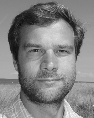 André Ehrlich合作论文数5
 Clemens Simmer合作论文数Meteorological Institute, University of Bonn5
 Johannes Quaas合作论文数Faculty of Physics and Earth System Sciences, University of Leipzig5
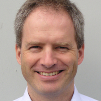 Bernhard Mayer合作论文数Meteorological Institute Munich, Faculty of Physics, Ludwig-Maximilians-Universitat Munchen;Department for Atmospheric Remote Sensing, Institute of Atmospheric Physics, DLR5
 Christof Lupkes合作论文数5
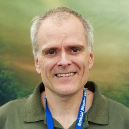 Greg McFarquhar合作论文数Cooperative Institute for Severe and High Impact Weather Research and Operations, University of Oklahoma;School of Meteorology, University of Oklahoma5
 Peter Leslie Croot (Peter L. Croot)合作论文数United Nations World Ocean Assessment;Department of Earth and Ocean Sciences, National University of Ireland, Galway5
 Sergey K. Gulev合作论文数Shirshov Institute of Oceanology, Russian Academy of Sciences;Sea-Air Interaction and Climate Laboratory, Russian Academy of Sciences5h kleta合作论文数4Jörg Schulz合作论文数4heike hauschildt合作论文数4
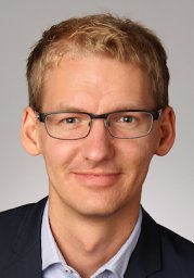 Akio Hansen合作论文数Meteorol Inst, Univ Hamburg4
 Cristofer Jimenez合作论文数4r scheirer合作论文数4Marlen Brückner合作论文数4Wiebke Schubotz合作论文数4
 Markus Hartmann合作论文数Leibniz Inst Tropospher Res4Julian Hofer合作论文数4
 Erlend Moster Knudsen合作论文数4
 Ina Tegen合作论文数Department Modelling of Atmospheric Processes, Leibniz Institute for Tropospheric Research4
 Ping Yang合作论文数Department of Atmospheric Sciences, College of Arts & Sciences, Texas A&M University;Department of Oceanography, Texas A&M University;Department of Physics & Astronomy, Texas A&M University4
 Alfred Wiedensohler合作论文数Department of Atmospheric Microphysics, Leibniz Institute for Tropospheric Research;Calibration Centre, Leibniz Institute for Tropospheric Research;Department of Experimental Aerosol and Cloud Microphysics, Leibniz Institute for Tropospheric Research4




