With the widespread use of area array detectors,multi-target tracking for video satellites has become of great significance.However,for multi-target tracking methods based on graph structure,in the construction of graphs,most of them extract clues from adjacent frames,ignoring the previous frame clues.In response to the above problems,an end-to-end graph network framework was proposed to construct the nodes,edges and global variables of the graph,using various clues such as motion features,appearance features,and topology information extracted from multiple frames.A key principle to realize this unified framework is to design compatible feature representations and graph network update mechanisms for different clues and different sources(trajectories and detection targets).The framework operated in a feed-forward fashion and trained on line.Being evaluated on the public datasets VISO,MOT16,MOT17 benchmarks,the multi-target tracking accuracy of 99.8%,48.8%and 51.8%was achieved respectively,which was better than other related multi-target tracking algorithms.And the ablation experiments were used to verify the improvement that each clue tracks multiple targets.The effectiveness of performance improvement will have a wide range of application scenarios in many fields such as smart transportation,smart cities,and military warfare in the future.
Human-induced dramatic loss and fragmentation of wetlands need further understanding through historical backtracking analysis at a geographical landscape scale. In this study, we investigated time-series wetlands maps from 1975, 1983, 1989, 2000, 2006, and 2013 derived from Landsat images based on the object-oriented classification of wetlands across the Sanjiang Plain north of the Wandashan Mountains. The spatial and temporal changes in the wetlands that occurred at different time periods and the Euclidean distances between artificial land-use types and natural land-cover areas were evaluated for their impact. Our results showed that wetland was the dominant landscape in 1975; however, arable land became the main land coverage in 2013 owing to severe changes in agricultural development over the past decades. The closer to arable land, the greater the wetland loss during the entire investigated period; agriculture activities were the dominant driving force for the degradation of wetlands based on landscape changes; secondary was the rapid expansion in building land use (i.e., human settlement, transportation, and establishment of irrigation canals). More specifically, the rapid loss of wetland areas over 1975–2000 was mainly owing to extensive agricultural reclamation. The mitigated loss of wetland areas over 2000–2013 was because of the protection and restored implementation of wetlands under governmental policies. The wetlands of the study area suffered severe human disturbance, and our analysis may help explain the loss process of wetlands, but more effective management and administration is still needed to address the issues around the balance between agricultural production and wetland protection for further sustainable development.
Floods occur frequently, impacting large areas, displacing thousands of people and causing great losses. Unmanned Aerial Vehicle (UAV) remote sensing is easy to obtain high‐resolution image that is immensely helpful to timely assess the flood situation and provide scientific decision‐making for emergency rescue. The important roles of UAV remote sensing have been widely recognized. However, the sudden onset of floods and lack of UAV resources deployed nearby have restricted rapid response of UAVs in emergency rescue. A UAV remote sensing observation network on a regional scale has been proposed to deal with these emergencies. However, how to build this UAV network and where to deploy UAV resources are still mysterious. In this study, the Maximum Covering Location Problem (MCLP) model was improved to distribute a series number of droneports in China. Finally, 81 droneports were selected from 268 potential facility points, which covered 61.84% risk of total demand area. Droneports have been allocated near flood‐prone areas and most floods in China can be monitored within 2 hours, which is critical for saving lives and reducing losses. The construction of UAV airport networks will surely contribute to an integrated disaster emergency observation system combining satellite, airplane, UAV, and ground observations in China.
We propose a fundamental theorem for eco-environmental surface modelling (FTEEM) in order to apply it into the fields of ecology and environmental science more easily after the fundamental theorem for Earth’s surface system modeling (FTESM). The Beijing-Tianjin-Hebei (BTH) region is taken as a case area to conduct empirical studies of algorithms for spatial upscaling, spatial downscaling, spatial interpolation, data fusion and model-data assimilation, which are based on high accuracy surface modelling (HASM), corresponding with corollaries of FTEEM. The case studies demonstrate how eco-environmental surface modelling is substantially improved when both extrinsic and intrinsic information are used along with an appropriate method of HASM. Compared with classic algorithms, the HASM-based algorithm for spatial upscaling reduced the root-mean-square error of the BTH elevation surface by 9 m. The HASM-based algorithm for spatial downscaling reduced the relative error of future scenarios of annual mean temperature by 16%. The HASM-based algorithm for spatial interpolation reduced the relative error of change trend of annual mean precipitation by 0.2%. The HASM-based algorithm for data fusion reduced the relative error of change trend of annual mean temperature by 70%. The HASM-based algorithm for model-data assimilation reduced the relative error of carbon stocks by 40%. We propose five theoretical challenges and three application problems of HASM that need to be addressed to improve FTEEM.
Super-resolution (SR) technology has shown great potential for improving the performance of the mapping and classification of multispectral satellite images. However, it is very challenging to solve ill-conditioned problems such as mapping for remote sensing images due to the presence of complicated ground features. In this paper, we address this problem by proposing a super-resolution reconstruction (SRR) mapping method called the mixed sparse representation non-convex high-order total variation (MSR-NCHOTV) method in order to accurately classify multispectral images and refine object classes. Firstly, MSR-NCHOTV is employed to reconstruct high-resolution images from low-resolution time-series images obtained from the Gaofen-4 (GF-4) geostationary orbit satellite. Secondly, a support vector machine (SVM) method was used to classify the results of SRR using the GF-4 geostationary orbit satellite images. Two sets of GF-4 satellite image data were used for experiments, and the MSR-NCHOTV SRR result obtained using these data was compared with the SRR results obtained using the bilinear interpolation (BI), projection onto convex sets (POCS), and iterative back projection (IBP) methods. The sharpness of the SRR results was evaluated using the gray-level variation between adjacent pixels, and the signal-to-noise ratio (SNR) of the SRR results was evaluated by using the measurement of high spatial resolution remote sensing images. For example, compared with the values obtained using the BI method, the average sharpness and SNR of the five bands obtained using the MSR-NCHOTV method were higher by 39.54% and 51.52%, respectively, and the overall accuracy (OA) and Kappa coefficient of the classification results obtained using the MSR-NCHOTV method were higher by 32.20% and 46.14%, respectively. These results showed that the MSR-NCHOTV method can effectively improve image clarity, enrich image texture details, enhance image quality, and improve image classification accuracy. Thus, the effectiveness and feasibility of using the proposed SRR method to improve the classification accuracy of remote sensing images was verified.
在高精度曲面建模方法和地球表层系统建模基本定理研究结果基础上,演绎提出了生态环境曲面建模基本定理.以京津冀地区为案例,对基于生态环境曲面建模基本定理的空间升尺度、空间降尺度、空间插值、数据融合和模型-数据同化等算法进行了实证研究,与传统算法精度进行了比较分析.结果表明,由于基于生态环境曲面建模基本定理的各种算法综合了外蕴量信息和内蕴量信息,同时运用了理论上完善的信息综合方法,使海拔高度曲面的升尺度均方根误差至少降低了9m,年平均气温未来情景的降尺度精度至少提高16%,年平均气温过去变化趋势的数据融合精度至少提高70%,年平均降雨量过去变化趋势的空间插值精度至少提高0.2%,碳储量的模型-数据同化精度提高了40%.文章最后讨论了生态曲面建模基本定理亟待解决的五大理论问题和四大应用基础问题.
Unmanned aerial vehicles (UAV) based remote sensing is an emerging and important data source. Recently, the use of UAVs for remote sensing applications has been rapidly growing owing to their greater availability and the miniaturization of sensors. UAVs are surpassing satellites and aircraft in remote sensing data supply for many local requirements. In comparison with satellite remote sensing data, most UAV remote sensing data is characterized by high resolution, small coverage area, and heterogeneous multi-sources. However, UAVs lack a unified space–time framework and standardized data process. This paper describes a UAV remote sensing data carrier that can be used as an e-commerce platform for data sharing among registered members and a mission planner for new data acquisition. To the best of our knowledge, the data carriers described herein, are the first of their kind. Through seamless docking with UAVs, the data carrier will form a national UAV network, capable of dynamically obtaining very-high-resolution UAV remote sensing images. In practice, a pilot retrieval system of UAV meta data has been developed to provide a catalogue of data product services.
Due to the fact that the traditional high dynamic range (HDR) imaging methods cannot be used for satellites, finding a way to generate HDR remote sensing images from the satellites has long been explored in the field of remote sensing imaging. In this article, a systematic method of synthesizing the HDR remote sensing images based on a new registration algorithm and virtual digital delay integration (TDI) technology is proposed. First, a series of original images are generated by the fast continuous shooting method through a push-broom spaceborne camera. Then, a new registration algorithm with high accuracy and high robustness is proposed in this article, which is used for image registration. Finally, an HDR multiframe image synthesis algorithm is used to generate high-quality and high signal-to-noise-ratio HDR images. This technology greatly improves the image information acquisition capabilities of digital TDI area scan cameras.
The existence of noise in hyperspectral ima-gery (HSI) seriously affects image quality. Noise removal is one of the most important and challenging tasks to complete before hyperspectral information extraction. Though many advances have been made in alleviating the effect of noise, problems, including a high correlation among bands and predefined structure of noise covariance, still prevent us from the effective implementation of hyperspectral denoising. In this letter, a new algorithm named the penalized linear discriminant analysis (PLDA) and noise adjusted principal components transformation (NAPCT) was proposed. PLDA was applied to search for the best noise covariance structure, while the NAPCT was employed to remove the noise. The results of the tests with both HJ-1A HSI and EO-1 Hyperion showed that the proposed PLDA-NAPCT method could remove the noise effectively and that it could preserve the spectral fidelity of the restored hyperspectral images. Specifically, the recovered spectral curves using the proposed method are visually more similar to the original image compared with the control methods; quantitative matrices, including the noise reduction ration and mean relative deviation, also showed that the PLDA-NAPCT produced less bias than the control methods. Furthermore, the PLDA-NAPCT method is sensor-independent, and it could be easily adapted for removing the noise from different sensors.
Forest plays an important role in global carbon, hydrological and atmospheric cycles and provides a wide range of valuable ecosystem services. Timely and accurate forest-type mapping is an essential topic for forest resource inventory supporting forest management, conservation biology and ecological restoration. Despite efforts and progress having been made in forest cover mapping using multi-source remotely sensed data, fine spatial, temporal and spectral resolution modeling for forest type distinction is still limited. In this paper, we proposed a novel spatial-temporal-spectral fusion framework through spatial-spectral fusion and spatial-temporal fusion. Addressing the shortcomings of the commonly-used spatial-spectral fusion model, we proposed a novel spatial-spectral fusion model called the Segmented Difference Value method (SEGDV) to generate fine spatial-spectra-resolution images by blending the China environment 1A series satellite (HJ-1A) multispectral image (Charge Coupled Device (CCD)) and Hyperspectral Imager (HSI). A Hierarchical Spatiotemporal Adaptive Fusion Model (HSTAFM) was used to conduct spatial-temporal fusion to generate the fine spatial-temporal-resolution image by blending the HJ-1A CCD and Moderate Resolution Imaging Spectroradiometer (MODIS) data. The spatial-spectral-temporal information was utilized simultaneously to distinguish various forest types. Experimental results of the classification comparison conducted in the Gan River source nature reserves showed that the proposed method could enhance spatial, temporal and spectral information effectively, and the fused dataset yielded the highest classification accuracy of 83.6% compared with the classification results derived from single Landsat-8 (69.95%), single spatial-spectral fusion (70.95%) and single spatial-temporal fusion (78.94%) images, thereby indicating that the proposed method could be valid and applicable in forest type classification.
Despite efforts and progress have been made in wetland mapping using multi-source remotely sensed data, a fine spatial and spectral resolution dynamic modeling of wetland coverage is limited. This research proposed a fusion model to generate fine-spatial-spectral-resolution images by blending multispectral images with fine spatial resolution and hyperspectral images with coarse spatial resolution. Applying the China Environment 1A series satellite (HJ-1A) CCD/HSI data, we showed that the proposed model produced reliable dataset that was not only able to capture spectral fidelity, but also could preserve spatial details. By integrating both fine spatial details and hyperspectral signatures, we further conducted a guided filtering based spectral-spatial mapping on the Poyang Lake wetland. Compared with the classification result of the CCD image, a significant higher classification accuracy of the synthetic fused image was achieved. Results also showed that the final guided-filtering based mapping result could remove potential misclassification biases and achieve higher accuracy than previous pixelwise classification methods Our study indicated a straightforward approach to blend multi-source remotely sensed data to generate reliable, high-quality dynamic dataset for wetland mapping and ecological modelling. The synthetic combination of spatial and hyperspectral details could improve our understanding of the significance of wetland ecosystem.
Aerosol particles can strongly affect both air quality and the radiation budget of the atmosphere. Above Beijing, the capital city of China, large amounts of aerosols within the atmospheric column have caused the deterioration of local air quality and have influenced radiative forcings at both the top and the bottom of the atmosphere (BOA and TOA). Observations of aerosol radiative forcing and its efficiency have been made using two sun-photometers in urban Beijing between 2013 and 2015, and have been analyzed alongside two air quality monitoring stations’ data by dividing air quality conditions into unpolluted, moderately polluted, and heavily polluted days. Daily average PM2.5 concentrations varied greatly in urban Beijing (5.5–485.0 µg/m3) and more than one-third of the analyzed period is classified as being polluted according to the national ambient air quality standards of China. The heavily polluted days had the largest bottom of atmosphere (BOA) and top of atmosphere (TOA) radiative forcings, but the smallest radiative forcing efficiencies, while the unpolluted days showed the opposite characteristics. On heavily polluted days, the averaged BOA aerosol radiative forcing occasionally exceeded −150 W/m2, which represents a value about three-times greater than that for unpolluted days. BOA aerosol radiative forcing was around two-to-three times as large as TOA aerosol radiative forcing under various air quality conditions, although both were mostly negative, suggesting that aerosols had different magnitudes of cooling effects at both the surface and the top of the atmosphere. Unpolluted days had the largest average values of aerosol radiative forcing efficiencies at BOA (and TOA) levels, which exceeded −190 W/m2 (−70 W/m2), compared with the lowest average values in heavily polluted days of around −120 W/m2 (−55 W/m2). These results suggest that the high concentrations of particulate matter pollution in the urban Beijing area had a strong cooling effect at both BOA and TOA levels.
Surfaces of mean annual temperature and mean annual precipitation during the period from 1951 to 2010 in Jiang-Xi province (Poyang Lake Basin) of China are simulated by means of a method for high accuracy surface modeling (HASM), using data from 106 weather observation stations scattered over and around Poyang Lake Basin. Methodologically, we analyzed errors of HASM by comparing with classical methods. The analysis indicated that HASM has a much higher accuracy than the classical methods. The simulation results from HASM show that mean annual temperature was respectively 17.05 degrees C and 17.46 degrees C in the periods from 1951 to 1980 (P1) and from 1981 to 2010 (P2). Mean annual precipitation was 1602 mm and 1718 mm, respectively in the P1 and P2. In other words, climate has become warmer and wetter in recent 60 years in general. The ecosystems are very sensitive to relatively small changes in surface meteorology. Warm temperate moist forest and subtropical moist forest were the dominant HLZ types, accounted for 94.99% of total area of Jiang-Xi province. The proportion of warm temperate moist forest decreased from 30.81% to 16.84%, while subtropical moist forest increased from 64.79% to 76.73%. The mean centers of the rare HLZ types, cool temperate wet forest, cool temperate rain forest and subtropical wet forest, moved respectively 291 km, 104 km and 122 km. Warm temperate wet forest and subtropical moist forest had a little shift, moved respectively 21 km and 17 km during the period from P1 to P2. (C) 2014 Elsevier B.V. All rights reserved.
Abstract. Earth surface systems are controlled by a combination of global and local factors, which cannot be understood without accounting for both the local and global components. The system dynamics cannot be recovered from the global or local controls alone. Ground forest inventory is able to accurately estimate forest carbon stocks at sample plots, but these sample plots are too sparse to support the spatial simulation of carbon stocks with required accuracy. Satellite observation is an important source of global information for the simulation of carbon stocks. Satellite remote-sensing can supply spatially continuous information about the surface of forest carbon stocks, which is impossible from ground-based investigations, but their description has considerable uncertainty. In this paper, we validated the Lund-Potsdam-Jena dynamic global vegetation model (LPJ), the Kriging method for spatial interpolation of ground sample plots and a satellite-observation-based approach as well as an approach for fusing the ground sample plots with satellite observations and an assimilation method for incorporating the ground sample plots into LPJ. The validation results indicated that both the data fusion and data assimilation approaches reduced the uncertainty of estimating carbon stocks. The data fusion had the lowest uncertainty by using an existing method for high accuracy surface modeling to fuse the ground sample plots with the satellite observations (HASM-SOA). The estimates produced with HASM-SOA were 26.1 and 28.4 % more accurate than the satellite-based approach and spatial interpolation of the sample plots, respectively. Forest carbon stocks of 7.08 Pg were estimated for China during the period from 2004 to 2008, an increase of 2.24 Pg from 1984 to 2008, using the preferred HASM-SOA method.
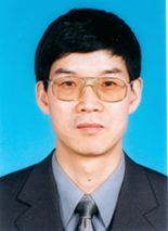 Tianxiang Yue (岳天祥)合作论文数Institute of Geographic Sciences and Natural Resources Research, Chinese Academy of Sciences;University of Chinese Academy of Sciences7
 Zhengping Du合作论文数5Mingwei Zhao合作论文数4
 Bing Xu (徐冰)合作论文数Department of Earth System Science, School of Science, Tsinghua University4
 Yifu Wang合作论文数3
 Lili Zhang合作论文数3
 Bin Chen (陈斌)合作论文数Division of Landscape Architecture, Faculty of Architecture, The University of Hong Kong3
 Huanyin Yue (岳焕印)合作论文数institute of Geographic Sciences and Natural Resources Research, Chinese Academy of Sciences3
 Xiaohan Liao (廖小罕)合作论文数中国科学院地理科学与资源研究所3
 Na Zhao (赵娜)合作论文数Institute of Hydroecology, Ministry of Water Resources of the People's Republic of China & Chinese Academy of Sciences3
 Feng Li (李锋)合作论文数School of Mechanical Engineering, Sichuan University3
 John P. Wilson合作论文数Spatial Sciences Institute, Dana and David Dornsife College of Letters, Arts and Sciences, University of Southern California3
 Yongzhong Tian (田永中)合作论文数School of Geographical Sciences, Southwest University3
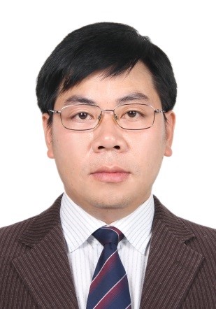 Zemeng Fan (范泽孟)合作论文数Institute of Geographic Sciences and Natural Resources Research, Chinese Academy of Sciences, Beijing3Chenliang Wang合作论文数3Xiaotian Lu (鲁啸天)合作论文数2
 Ufra Naseer合作论文数2wang wei (薇 王)合作论文数2Yinjun Song合作论文数2Saibo Li合作论文数2shengnan ma (马胜男)合作论文数2
 Xiaozhe Yin合作论文数Dept Prevent Med, Univ Southern Calif2Zong Wang合作论文数2Yimeng Jiao (焦毅蒙)合作论文数Institute of Geographic Sciences and Natural Resources Research, Chinese Academy of Sciences2
 Changqing Yan合作论文数Department of Information Engineering, Shandong University of Science and Technology, 271019 Taian, China2Miaomiao Zhao合作论文数2Zhengyi Bao合作论文数2
 Wei Zhou合作论文数2Shihai Wang合作论文数2Nan Zhang合作论文数2
 Huping Ye (叶虎平)合作论文数Institute of Geographic Sciences and Natural Resources Research, Chinese Academy of Sciences;University of Chinese Academy of Sciences2Ya-Peng Zhao (赵亚鹏)合作论文数2
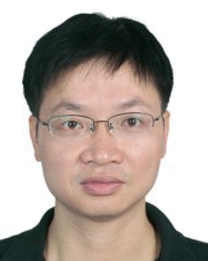 Yimin lu (卢毅敏)合作论文数2HongSheng Huang (黄宏胜)合作论文数2
 Dunjiang Song (宋敦江)合作论文数中国科学院科技政策与管理科学研究所2
 Xiao-Fang Sun合作论文数2
 Qiquan Li (李启权)合作论文数College of Resources, Sichuan Agricultural University2
 Yuzhu Wang (王玉柱)合作论文数School of Information Engineering, China University of Geosciences Beijing2
 Bin Zhang (张斌)合作论文数College of Resources & Environmental Sciences, Nanjing Agricultural University2
 Guy R. Larocque合作论文数Natural Resources Canada, Canadian Forest Service, Laurentian Forestry Centre, PO Box 3800, 1055 du P.E.P.S., Stn. Sainte-Foy, Quebec, QC G1V 4C7, Canada2
 Chuanfa Chen (陈传法)合作论文数School of Surveying and Mapping, Shandong University of Science and Technology2
 Wenjiao Shi合作论文数Institute of Geographic Sciences and Natural Resources Research, Chinese Academy of Sciences2Xiangyong Luo合作论文数1Bin Fan合作论文数1Mengdie Xie合作论文数1
 Bangcheng Zhan合作论文数1
 John Peter Wilson合作论文数Institute of Geographic Sciences and Natural Resources Research, Chinese Academy of Sciences;University of Chinese Academy of Sciences;Department of Computer Science, University of Sout1Xue Yang (杨雪)合作论文数1




