The overarching goal of SALDi (South African Land Degradation MonItor) is to implement novel, adaptive, and sustainable tools for assessing land degradation in multi-use landscapes in South Africa. This presentation demonstrates results from hyper-temporal Sentinel-1 and -2 timeseries concerning woody cover mapping in complex savanna systems, invasive slangbos bush encroachment in grassland areas and regional soil moisture retrievals. Validation has been performed by cross-comparisons, field trips and permanently installed soil moisture networks.
According to the National Water Act a landowner does not own the water under his land. The use of groundwater from private land for municipal domestic supply is therefore possible and promoted. The National Water Act allows the Department of Water Affairs the right to access private land for monitoring purposes, but this right is not extended to municipalities as Water Services Authorities. The National Water Act gives the municipality the right to claim a servitude over private land in order to realise a water use authorisation (i.e., after being licensed), but the municipalities must apply the Water Services Act in order to lay services on private properties. Some municipal ordinances (laws passed by a municipality or local authority) state that the only compensation required for the laying of any service, is that which is calculated based on the value of land under the servitude area. However, no legislation overtly allows a municipality to gain entry for groundwater exploration or drilling, prior to laying of the service. The problems encountered and the hurdles overcome in groundwater development from private land for municipal supply are discussed.
The need for spatially explicit thematic data is currently increasing in parallel to the development of observing, storing and processing capabilities. This requires an integrated data management structure in which human and institutional aspects play a key role as part of a Spatial Data Infrastructure (SDI). We focus in this study on the African continent to evaluate the status of its SDI implementation. Because assessing SDI at a continental scale in a traditional way (i.e. following methods developed for national assessments) requires financial resources and mechanisms only affordable to developed countries (e.g. European Union), alternative ways have been explored based on fourteen key SDI indicators that were validated by SDI experts in a previous study. Data was collected for each African country through the African leading SDI institution (UN Economic Commission for Africa) and through Internet searches. We found relatively weak scores of the fourteen SDI indicators for African countries compared to the rest of the World, but with notable differences within Africa. We discuss the implication of the lack of information available on the Internet to assess SDI status in Africa. We conclude that it is necessary to improve statistical information in most African countries. This requires an agreed-on geospatial data structure and organization between concerned institutions that is only achievable through a shared global vision on geospatial data governance. To this end, we suggest a few quick wins and several new mechanisms that would enhance the flow of SDI statistical information and improve data management structure in Africa.
The discovery of and access to capacity building resources are often essential to conduct environmental projects based on Earth Observation (EO) resources, whether they are Earth Observation products, methodological tools, techniques, organizations that impart training in these techniques or even projects that have shown practical achievements. Recognizing this opportunity and need, the European Commission through two FP7 projects jointly with the Group on Earth Observations (GEO) teamed up with the Committee on Earth observation Satellites (CEOS). The Global Earth Observation CApacity Building (GEOCAB) portal aims at compiling all current capacity building efforts on the use of EO data for societal benefits into an easily updateable and user-friendly portal. GEOCAB offers a faceted search to improve user discovery experience with a fully interactive world map with all inventoried projects and activities. This paper focuses on the conceptual framework used to implement the underlying platform. An ISO19115 metadata model associated with a terminological repository are the core elements that provide a semantic search application and an interoperable discovery service. The organization and the contribution of different user communities to ensure the management and the update of the content of GEOCAB are addressed.
The use of remote sensing and GIS techniques have been important tools for environmental monitoring, especially in areas where baseline information is lacking and or the terrain is such that data collection is time consuming and expensive.
The Western Cape Province of South Africa is a relatively water-scarce area as a result of the Mediterranean climate experienced. Due to the increased usage of groundwater, and the requirement to know how much water is available for use, it is imperative as a 1(st) step to establish an initial estimate of groundwater in storage. The storage capacity, namely, the total available storage of the different aquifers, and the storage yield of the fractured quartzitic Peninsula and Skurweberg Formation aquifers of the Table Mountain Group (TMG), are calculated with a spreadsheet and Geographic Information System (GIS) model. This model is based on the aquifer geometry and estimated values (based on measured data) for porosity and specific storage (calculated using the classic Jacob relation). The aquifer geometry is calculated from 1: 50 000 and 1: 250 000 geological contacts, faults and major fractures, with dips and aquifer formation thickness calculated through structural geology 1(st) principles using a Digital Elevation Model (DEM). Balanced geological cross-sections constructed through the model areas provide an important check for the aquifer top and bottom surface depth values produced by the GIS model. The storage modelling undertaken here forms part of the City of Cape Town TMG Aquifer Feasibility Study and Pilot Project, with modelling focusing on the 3 main groundwater target areas at Theewaterskloof (Nuweberg), Wemmershoek and Kogelberg-Steenbras. In the storage models, the Peninsula and Skurweberg Formation aquifers have confined pore volumes ranging from approximately 29 bn. to 173 bn. m(3) and 4 bn. to 26 bn. m(3), respectively (based on using different porosity values ranging from 2.5% to 15%). Using an average head decline of 1 m across the confined aquifer areas across all 3 groundwater exploration areas, and confined pore volumes based on a porosity of 5%, 6.9 Mm(3) and 1.1 Mm(3) of groundwater, from the Peninsula and Skurweberg Formation aquifers, respectively, is available. The aquifer storage model intentionally makes use of low, geologically reasonable values for porosity and aquifer compressibility, so as to provide minimum large-scale 1(st) estimates of potential yields; however, when new data become available these initial porosity and compressibility assumptions will probably be revised upward. The storage yield approach is also very conservative, as it does not take into account the annual replenishment of the aquifer, and constitutes the yield potential during drought conditions (zero recharge) from the confined portion of the aquifer only. The yield model therefore provides a quantitative perspective on the common public and decision-maker perception that groundwater abstraction from the deep confined Peninsula Formation aquifer will significantly dewater the system, with (often unspecified) adverse ecological consequences. Even where the regionally-averaged decline in hydraulic head approaches 20 m, the volume released by aquifer compression generally remains in the order of 0.24% of the total volume in slow circulation within the deep groundwater flow system. A vastly greater volume of groundwater is essentially non-extractable by any practical and/ or economical means.
The Western Cape province of South Africa is a water scarce area with a Mediterranean climate. The majority of rainfall occurs in the cold winter months and the area experiences hot and dry summers. Studies done to investigate various water supply and water demand management options for the City of Cape Town, concluded that the Table Mountain Group (TMG) aquifer has the potential of yielding high volumes (estimated at 70Mm/a) of good quality water, but that further research about this source as a potential augmentation supply to the City of Cape Town was necessary before extraction could commence. The aim of the study is to develop a spatial decision support system (SDSS) to be used by a hydrogeology project team, which includes hydrogeologists, environmentalists, ecologists, engineers and other stakeholders. The Table Mountain Group Aquifer (TMGA) SDSS is meant to be a decision support tool, but should also raise awareness about the use of spatial data and information and its capabilities for earth science and other multidisciplinary applications. By means of team discussions and interviews data, spatial analysis and data manipulation requirements were determined. Based on these requirements, four spatial analysis tools were developed. The spatial tool named “Borehole Analysis” analyses stratigraphic information obtained from existing boreholes and hydrogeological point data. The tool determines what groundwater use and monitoring has been undertaken in the area of interest. The “Topographic Analysis” tool identifies any topographical (e.g. rivers) and cadastral (e.g. farm boundaries) data within a certain distance from a possible borehole site. The “Sensitive Area Analysis” tool addresses queries with respect to sensitive areas, such as wetlands, statutory protected areas and private nature reserves. The “Image Classification” tool gives the team members an opportunity to use band ratios during image interpretation. The TMGA SDSS was developed using TNTmips v70, Extensible Markup Language (XML) and Spatial Manipulation Language (SML) and can be run on TNTAtlas v70, which is a free software. The TMGA SDSS enables the team members to have equal and ready access to data acquired by other members. This was found to support intraand interdisciplinary conversation and facilitate understanding of how the data is being (or could be) used. It also contributes to
The Table Mountain Group (TMG) Aquifer Feasibility Study and Pilot Project is a major hydrogeological project in the mountains fringing the eastern side of the Cape Town metropolitan area. An earlier study using a 30 m/spl times/30 m DEM demonstrated that the TMG topography is spatially and structurally well correlated with the patterns of fracture deformation, partly inherited from the break-up of the Gondwanaland supercontinent, in part produced by uplift and erosion under the present-day plate-tectonic stress regime. The advent of the SRTM datasets seems thus to be potentially a good source of high resolution DEM data for such applications, but the differences between radar derived and stereo optical data must be assessed. For example, and is shown, X Band radar data is sensitive to the height of vegetation. Although, not as important for this application, the absolute height accuracy of the X Band DEMs is also assessed via a corner reflector deployed during the mission, as well as other spot heights.
In Africa, natural resources are degrading, while being at the same time essential for maintaining or improving people's livelihood. The well-being of African communities is highly correlated to changes in local ecosystem services. Their vulnerability to degradation of natural resources is extremely high and resilience against natural changes (e.g. climate variability) and socio-economic changes (e.g. fluctuations in food markets) is low. Nowadays, it is widely accepted that reversing these trends and adapting to climate change require integrated responses tackling the underlying social, economic, political and institutional drivers of unsustainable use of natural resources. Integrated approaches intrinsically ask for cooperation, exchange of information and communication to better understand complex interactions and assess environmental issues. Understanding these interactions requires collecting and integrating various data describing physical, chemical, biological and socio-economic conditions. However, two common obstacles are currently preventing the implementation of such integrated approaches: (1) difficulties to find data, and (2) difficulties to integrate data. In response to these issues, this paper presents the Africa Discovery Broker, a web-based tool that enables users working in different domains to search through and access 32442 heterogeneous African geospatial resources (e.g. remote sensing, geospatial data, socio- economic data) coming from 17 international, regional, national and research projects repositories.
A thick, extensive fractured-rock (FR) aquifer system like the Table Mountain Group (TMG) in South Africa, provides unique opportunity for fundamental advances in understanding interactions between fluid flow and mechanical deformation, through analysis of the "hydromechanical" coupling in FR permeability, fluid transport and deep storage in fracture porosity. For the ~1 km thick Peninsula Aquifer in the TMG, present knowledge of skeletal- framework compressibility, the main unknown used in calculating specific storage, is based on published data from similar rocks elsewhere. The South African Water Research Commission recently obtained laboratory measurements of elastic properties of TMG borehole-core samples, but up-scaling from dry-sample measurements at ~10-cm scale to saturated rock volumes on 100- to 1000-m scale, is methodologically problematic. These problems are obviated by measuring directly the compaction of, and corresponding surface subsidence above, the pumped aquifer and using these field-experimental measurements to determine the framework compressibility and the specific storage. Historically, such aquifer-deformation measurements have used costly devices (borehole extensometers), but recent advances in GNSS technology (e.g., GPS), and also Interferometric Synthetic Aperture Radar (InSAR), now provide noninvasive methods of geospatial data collection, which can be used in conjunction with borehole hydrograph information to estimate the specific storage and hydraulic conductivity of the aquifers. This African project contributes to an international effort to develop the Global Geodetic Observation System (GGOS) towards a global-to-regional-scale monitoring of the full hydrological cycle. It supports capacity-building in space-geodetic data-processing, modelling of the hydrological cycle, and interpretation of observations in terms of terrestrial water storage.
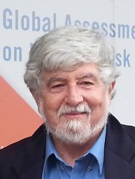 C. J. H. Hartnady合作论文数PRECAMBRIAN RES UNIT, UNIV CAPE TOWN4
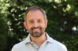 Gregory Giuliani合作论文数Institute for Environmental Sciences, Climatic Change and Climate Impacts, University of Geneva4
 Yaniss Guigoz合作论文数SALB Coordination Office;World Health Organisation;SALB Coordination Office, World Health Organisation4
 Pierre Lacroix合作论文数3
 Fabrizio Papeschi合作论文数2Cools Jan合作论文数2
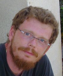 Mattia Santoro合作论文数2
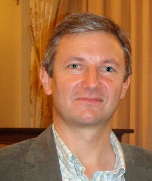 Eric Calais合作论文数Department of Geosciences, Ecole Normale Superieure;Institut Universitaire de France2alan r lehmann合作论文数1dylan blake合作论文数1K. Riemann合作论文数1Richard Wonnacott合作论文数1
 George Chirima合作论文数Agr Res Council Nat Resources & Engn1A. Hirner合作论文数1Tercia Strydom合作论文数1
 Mahlatse Kganyago合作论文数Sch Geog Archaeol & Environm Studies, Univ Witwatersrand1
 Marcel Urban合作论文数Department for Earth Observation, Friedrich Schiller University Jena1
 Christian Berger 0001合作论文数University of Gothenburg1
 Ursula Gessner合作论文数German Aerosp Ctr DLR, German Remote Sensing Data Ctr DFD1
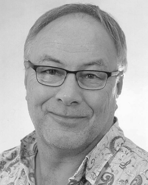 Jussi Baade合作论文数Institut für Geographie, Friedrich-Schiller-Universität Jena1
 Michael R. Inggs合作论文数Dept Elect Engn, Univ Cape Town1
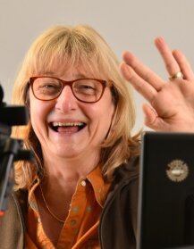 Christiane Schmullius合作论文数Department for Earth Observation, Institute of Geography, Friedrich-Schiller-University Jena;Faculty of Chemistry and Earth Sciences, Friedrich-Schiller-University Jena1R. Wonnacott合作论文数1Nancy D. Searby合作论文数1
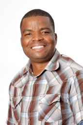 Abel Ramoelo合作论文数Earth Observation Research Group, Council for Scientific and Industrial Research (CSIR),1
 Izak Smit合作论文数Sci Serv, South African Natl Pk1Nicolas Ray合作论文数ALICE reseach team (LORIA1
 Jean-Christophe Desconnets合作论文数IRD US ESPACE, Maison de la télédétection, 500, avenue J.F. Breton, cedex 5, 34093 Montpellier, France1




