In the Yangtze River Basin, the birthplace of civilization in China, it is necessary to further discover and investigate ancient remains. The archaeological site prediction model is important for discovering and investigating archaeological sites. In this paper, we focused on the ancient city sites of the Neolithic and Bronze Age in the Jianghan region located along the middle reaches of the Yangtze River, annotated the specific locations and extents of 33 ancient city sites using the Google Earth Engine (GEE) cloud platform, and proposed a machine learning-based ancient city site prediction model that couples geographic element features and temporal spectral features. The results indicated that the ancient city sites were recognizable in different geographic elements and were separable in Sentinel-2 multispectral bands and spectral indices. The coupled time series spectral features could improve the ability of the model to recognize the regions with ancient city sites. Ultimately, the percentage of pixels with a high probability of prediction (greater than 0.57) within the extent of the ancient city sites reached 80.0% and enabled to obtain high probability regions for the distribution of the ancient city site. The proposed model can be used to predict the potential geographic locations of ancient city sites and identify key areas for future archaeological field survey work.
Documenting tangible cultural heritage using 3D modeling techniques is gradually becoming an indispensable component of archaeological practice. The 3D modeling techniques based on photogrammetry and LiDAR scanning enable high-accuracy and high-realistic reconstruction of archaeological sites, and have been proven a powerful tool for documenting archaeological excavations. However, dynamically documenting an ongoing excavation using these techniques is still considered tedious, time-consuming, expensive, and dependent on expertise. Moreover, the application of 3D modeling techniques in archaeological excavations still faces some technical challenges, such as modeling with multi-source and multi-scale data, fusing local models at different times into a whole, achieving fast modeling while GPU workstations are not available in the field, and evaluating the quality of 3D models. As a result, there are still very few archaeological teams deeply engaged in dynamic documentation with 3D modeling techniques, and traditional drawing sketches and taking photographs still dominate. In these senses, documenting the archaeological excavation at the Yunxian Man site (located in Hubei, China) is an invaluable opportunity for exploration and practice. Archaeologists determined to conduct dynamically documenting at the beginning of the 6th excavation project for the site, and established a rotation system to reconcile physical excavation with digital preservation. Through repeated practice and communication, we proposed a workflow and pursued several new methods to enhance the feasibility of dynamically documenting, and obtained 4D models of the ongoing archaeological excavations. In 2022, the Yunxian Man site unearthed the most intact fossil of hominin cranium from about one million years ago in the Eurasian continent, preserving important and scarce anatomical features of early humans in Asia. As the original taphonomic context of the fossil corroded away during physical excavations, the digital documentation consisting of 4D models serves as permanent original data source in subsequent archaeological research. Moreover, we obtained cross-scale 3D models from geographical environment to archaeological site, excavation area, and cultural remains, and all of these 3D models are in an actual, unified coordinate framework. Thus, we can contribute to multidisciplinary cross-collaborative research through data sharing. Considering that digital documentations serve a great value in archaeological research, this paper focuses on sharing the workflow and methods to facilitate digital preservation for more archaeological projects.
The Middle and lower reaches of the Yangtze River, constituting a region rich in metal resources, played an important role in the formation and early development of the Bronze Age civilization in China, mainly including mainly the southeastern part of Hubei Province, the northern part of Jiangxi Province and the southern part of Anhui Province. Geological surveys have revealed that this region, which stretches for 500 km along the Yangtze River, is rich in mines, and archaeological institutions have discovered a large number of Bronze Age mining and metallurgical sites in the region over the past three decades. This region is an important area for studying the rise and prosperity of the Chinese Bronze Age civilization. Therefore, exploring the production pattern of the bronze industry in the copper mining area in the middle and lower reaches of the Yangtze River, as well as the resource circulation network between this region and the northern part of China, has become a hot issue in Chinese archaeological research in recent years.From March to July 2023, Wuhan University and the Cultural Relics Bureau of Yangxin County formed a joint archaeological team to carry out an archaeological survey of mining and metallurgical sites in an independent geographic unit in the northern part of Yangxin County, Hubei Province, covering an area of 120 km2, 2 , and a total of 60 mining and metallurgical sites were discovered during the survey, and approximately two-thirds of the 60 sites exhibited the landscape with a more typical terrace- shaped site. In this study, we have carried out systematic archaeological exploration and drone mapping of the Youzhashan site, a typical terrace-shaped site in this region, and reconstructed the process of terrace-shaped site accumulation formation using materials from archaeological excavation, exploration and survey. In addition, scientific and technological tests were conducted on the metallurgical relics collected from the Youzhashan site, which revealed the occurrence e of copper smelting activities at the Youzhashan site, and we analyzed the processing system. In addition, the carbon samples excavated from the Youzhashan site were carbon dated to determine the exact date of the formation of the Youzhashan site.
The CORONA satellite image preserves the landscape from half a century ago, and has played a great role in landscape archaeology in many regions of the world. In recent years, with the rapid development of UAV (Unmanned Aerial Vehicle) Photogrammetry technology, Archaeologists can easily obtain the digital surface model (DSM)and Digital Ortho Map (DOM) of a site in the fieldwork. In the archaeological survey of bronze age sites in the middle of the Yangtze River project, we combined the UAV photogrammetry results with CORONA satellite photography, which can help us extract the surface landscape feature of the sites. This strategy has shown significant advantages in reconstructing the settlement layout, detecting the unknown linear features (such as walls, moats and canals) of sites and comparing the landscape between different sites.
Documenting tangible cultural heritage using 3D modeling techniques is gradually becoming an indispensable component of archaeological practice. The 3D modeling techniques enable highly realistic reproduction of sites and ruins and be proven as a powerful tool for documenting archaeological excavations. However, dynamic recording of an ongoing excavation using 3D modeling techniques is still considered tedious, time-consuming, expensive, and dependent on expertise. In these senses, documenting the archaeological excavation at the Yunxian Man site (located in Hubei, China) is an invaluable opportunity for exploration and practice. In 2022, in Yunxian Man site was unearthed the most intact fossil of hominin cranium from about one million years ago in the Eurasian continent, preserving important and scarce anatomical features of early humans in Asia. We performed dynamic documentation for the ongoing archaeological excavations and recorded the original taphonomic context of the cranium fossil using photogrammetric modeling and laser scanning. We focused on improving spatial resolution, time-resolved, and efficiency. This high-profile archaeological excavation project prompted us to pursue several new methods and an efficient workflow, which we present in this paper to provide a state-of-the-art practice.
曾侯子昃剑现藏于长江文明馆,剑格及剑首铸有铭文28字,器主很可能为一代曾侯.该剑面世后便有学者对其铭文进行了考释[1],其后又被著录于《商周青铜器铭文暨图像集成续编》中[2].不过以往曾国青铜器中从未见过独立的剑类器,流散的曾侯子昃剑真伪就易为人所疑.最近我们受长江文明馆委托,在对该剑进行目视观察的基础上,运用X射线探伤、体式显微镜拍照等方式对其进行了检测.在此对剑的形制、铭文、铸造工艺、年代等若干问题予以刊布和分析.
本文所指江汉地区属广义范畴,包括长江与汉水交汇形成的冲积平原,及其周邻的低山丘陵地带.本区虽与中原地区有桐柏山-大别山脉阻隔,但山系南麓的多条南北向水系成为联系两个地区的天然孔道.因此,自新石器时代以来,江汉地区就长期与中原地区保持着密切的文化关联.夏商时期在以二里头、二里冈文化为代表的中原文化强烈辐射之下,江汉地区的文化发展进程得以改变,同时彰显出了早期王朝国家对南方地区明显的政治经略意图.故而本区域夏商时期的文化面貌与聚落形态备受研究者关注.
Scholars often overlook stone artifacts in the Bronze Age, but they are important because they remained critical in daily life, agriculture, and other craft production as they were in the earlier Neolithic era, and the production and use of stone artifacts remained a complicated component of the fabric of Bronze Age society. To reveal the complexity of stone artifacts in Bronze Age, this study will use petrographic analysis and geological data to analyze the strategies people at the Bronze Age site of Panlongcheng used to manipulate stone. We conclude that the majority of raw material found at this site came from the foothills of the Dabie Mountain (Dabieshan) to the north of this site, and the choice of materials does not seem to have a strong connection with the function of stone tools.
The landscape of ancient sites has changed greatly with the passage of time. Among all of the factors, human activities and the change in natural environment are the main factors leading to the change in site landscape. The Panlongcheng site, which is located in Hubei Province, China, has a history of 3500 years with the most abundant relics in the Yangtze River Basin during the Shang Dynasty. As a near-water site, the landscape of the Panlongcheng site is greatly affected by water level changes and water conservancy activities. In this paper, by using spatial information technology, the data obtained from land and underwater archaeological exploration were integrated to restore landscapes of Panlongcheng sites in different periods. After removing modern artificial features and topsoil, the landscapes of the sites before the Shang Dynasty, in the Shang Dynasty and modern time were reconstructed. Combining historical records of water level changes, the landscape and water–land distribution of the Panlongcheng site were compared. The analysis results reflect the interaction between water level changes and human activities in this region for thousands of years, and support the archaeological findings in the near-water area of the Panlongcheng site, which provides a new idea for the landscape reconstruction and analysis of near-water sites.
Recent work at the early Shang period type site in Panlongcheng, Hubei Province, China, provides a new understanding of changes in the landscape and water environment over time. In the past few decades, the research at this site has obtained important results and shown progress in many aspects, but few scholars have discussed the geomorphological environment of Panlongcheng, especially the water environment. Researchers have long believed that the present-day environment and landscape of Panlongcheng are no different than during the early Shang period. However, recent archaeological discoveries indicate that there may still be some cultural remains underwater. Therefore, we used a combination of underwater surveys, drilling and digital mapping to expand our knowledge of the landscape of Panlongcheng during the early Shang period. This included mapping the lake basin using single-beam echo sounders and drilling to preliminarily observe the stratum and collect samples from underwater. We also conducted radiocarbon dating on the samples collected from the bottom of the lake. The results suggest that there might not have been a lake during the early Shang period. Therefore, the landscape and environment of Panlongcheng and other related issues should be reexamined. In addition, we hope the methods used in this study can provide a reference for related archaeological work in shallow water areas in inland China.
近年我们对盘龙城遗址杨家湾、小嘴地点考古发掘采集的炭样进行了碳十四测年.利用0xCal软件,并参考测年单位层位和出土遗物反映的相对年代关系,我们分地点进一步校正了这批碳十四测年数据.其中杨家湾地点起始年代最大概率密度落在公元前1490年,结束年代最大概率密度落在1230年;小嘴地点起始年代最大概率密度落在公元前1440年,结束年代最大概率密度落在1250年.本次碳十四测年工作为盘龙城遗址首次成系列的采样和检测,极大细化、补充了该遗址的碳十四测年数据,为构建盘龙城遗址的年代框架、探讨盘龙城与中原地区相关遗址之间的年代关系提供了新的资料.
本研究通过对盘龙城遗址小嘴出土铜冶金渣、坩埚、炉壁残块以及铜器的科学分析,确认了该区域在盘龙城四、五期时存在青铜熔铸活动,并可能延续至六、七期.小嘴发掘区出土坩埚为浅腹侈口型,使用当地高铁易熔黏土加粗砂制成,其形制有别于前人认定的盘龙城“熔铜陶缸”,与郑州商城铸铜遗址出土坩埚也存在差异.小嘴铜器合金类型以铜-锡-铅三元合金为主,兼有少量铜锡和铜铅合金,铜块中部分可能为原料或半成品.小嘴铜器的铅锡含量显著低于以往发表的盘龙城铜器分析结果,可能与两次分析的器物类型差异以及不同实验室间分析数据的系统差异有关,但也显示了盘龙城曾生产低铅、锡器物.综合小嘴与以往发表的盘龙城铜器数据,郑州与盘龙城两地间铜器成分差异不显著,两地是否存在金属工艺与铅锡使用模式上的不同仍需进一步研究.
本文在分析盘龙城遗址水下考古材料的基础上,从不同时期的地图及遥感影像中提取出水系变迁信息,对盘龙城遗址区域河湖水位变迁过程进行了梳理.本文指出商文化时期盘龙城遗址周边河湖水位大幅低于当今水位,明代晚期以来以堤防修筑和湖泊围垦为代表的人类活动改变了汉口以北地区的水系格局,直接导致与盘龙城遗址密切相关的府河、盘龙湖及破口湖水位显著抬升,最终造成了当代盘龙城遗址局部被河湖淹没的景象.
本文通过地质考古勘探和典型剖面的沉积物分析,利用GIS支持下的空间统计、粒度分析和土壤微结构分析的方法,揭示了商代盘龙城聚落主要分布于由网纹红土构成的低丘岗地和河湖相沉积物构成的临湖滩地两个主要的地貌单元上.商代之前河湖水位的下降使得临湖滩地充分暴露,为商代盘龙城聚落的兴起提供了基础条件,同时商代盘龙城居民对杨家湾一带岗地进行了大规模的整饬活动,以适应聚落发展的需要.此项研究成果初步表明盘龙城聚落的发展与地貌演化存在着密切关系.
利用历史地图、历史文献及考古材料,以汉口地区地貌变迁过程为切入点,对武汉市北郊的盘龙城遗址地理环境原貌进行了分析和重建,以此推出商文化时期盘龙湖及府河水位均大幅低于当前这一结论,并在此基础上对盘龙城遗址的布局形态及选址特点进行了全新的考量.
借助于数字化测量仪器,建立起遗址的三维测绘坐标系统对科学的开展田野考古工作及提升考古学研究水平具有重要意义.而RTK与全站仪作为两类数字化测量仪器在田野考古各个环节中展现出了不同的工作效能,本文认为RTK在通视条件较差的遗址地形测量和各类遗址布方工作中具有明显优势,而全站仪在对通视条件良好的遗址和部分特殊遗迹进行测量时仍发挥着难以替代的作用.
 Changping Zhang (张昌平)合作论文数School of History, Wuhan University4
 Wentai Lou (娄文台)合作论文数2Lu Chengqiu合作论文数2
 Wenyuan Niu (牛文渊)合作论文数School of History, Wuhan University2
 Xuan Wei (韦璇)合作论文数School of History, Wuhan University2
 Jindong Lu (路晋东)合作论文数School of Archaeology and Museology, Shanxi University2Xin Su合作论文数2
 Fan Zhang (张帆)合作论文数School of Navigation, Wuhan University of Technology2
 Yinghua Li (李英华)合作论文数School of History, Wuhan University2
 Qingwu Hu (胡庆武)合作论文数School of Remote Sensing and Information Engineering, Wuhan University2Song Xing (邢松)合作论文数Institute of Vertebrate Paleontolgy and Paleoanthropology, Chinese Academy of Sciences;University of Chinese Academy of Sciences2Luo Yunbing合作论文数1Hanyu Xiang合作论文数1Hong Yang合作论文数1Shaohua Wang合作论文数1Hang Liao (廖航)合作论文数1
 Yang Lu合作论文数1Xiaojia Tang合作论文数1Chen Hui (陈晖)合作论文数1Pengcheng Zhao (赵鹏程)合作论文数1Xudong Jiang合作论文数1
 Hui Wang (王辉)合作论文数中国社会科学院考古研究所1
 Hai Zhang (张海)合作论文数School of Archaeology and Museology, Peking University1
 Chunhai Li合作论文数1
 Siran Liu (刘思然)合作论文数Institute of Cultural Heritage and History of Science & Technology, University of Science and Technology Beijing1
 Xianfeng Huang (黄显峰)合作论文数College of Water Conservancy and Hydropower Engineering, Hohai University1
 Xiaohong Wu (吴小红)合作论文数School of Archaeology and Museology, Peking University1Mingyao Ai (艾明耀)合作论文数School of Remote Sensing and Information Engineering,Wuhan University,Wuhan ,China1Gao Xing合作论文数1
 Jianfeng Liu合作论文数and Department of Electrical Engineering, IMEC vzw1
 Zhuo Sun (孙卓)合作论文数School of History, Wuhan University1
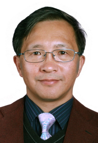 Xing Gao (高星)合作论文数Institute of Vertebrate Paleontology and Paleoanthropology, Chinese Academy of Sciences;University of Chinese Academy of Sciences1
 Jianli Chen (陈建立)合作论文数School of Archaeology and Museology, Faculty of Humanities, Peking University1
 Yang Li (李洋)合作论文数Wuhan University1
 Xuan Wang (王宣)合作论文数School of Remote Sensing and Information Engineering, Wuhan University;State Key Laboratory of infomation Engineering in Surveying, Mapping and Remote Sensing, Wuhan University;Wuhan Institute of Quantum Technology1Shuchun Yao (姚书春)合作论文数Nangjing Institute of Geography & Limnology, Chinese Academy of Sciences;University of Chinese Academy of Sciences1
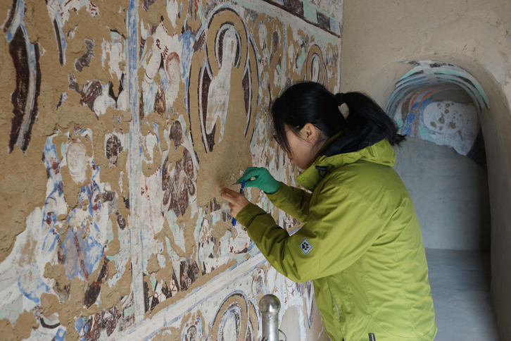 Yan Pan (潘岩)合作论文数School of Archaeology and Museology,Peking University1
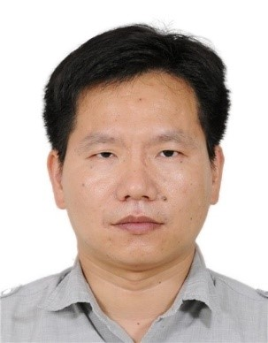 Sanyuan Zhu (朱三元)合作论文数State Key Laboratory of Advanced Environmental Technology, Guangzhou Institute of Geochemistry, The Chinese Academy of Sciences;University of Chinese Academy of Sciences1
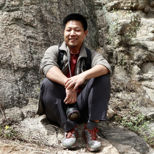 Kunlong Chen (陈坤龙 )合作论文数Institute of Cultural Heritage and History of Science & Technology, University of Science and Technology Beijing1




