We report the first paleoseismic evidence jointly documenting coseismic subsidence and tsunami inundation from the 1730 Chile earthquake (Mw >= 9) and its trans-Pacific tsunami. At Campiche, a former coastal lagoon in Chile's Metropolitan Region, multiproxy stratigraphic, sedimentological, and microfossil data reveal a laterally continuous tsunami sand sheet that extends similar to 2 km inland, sharply disrupts lagoonal mud, and shows an erosional lower contact, rip-up clasts, and mud drapes from waning flow. Accompanying shifts from freshwater to brackish-marine diatom assemblages and the sudden appearance of salt-tolerant plant remains record a persistent increase in tidal influence, indicating coseismic subsidence. Radiocarbon and luminescence ages constrain its deposition to 1698-1782 CE, consistent with historical accounts of the 1730 tsunami and the absence of any other comparable event in the written record. Campiche thus complements previously reported uplift-dominated mid-Holocene records by showing that infrequent, subsidence-generating shallow ruptures-not just deeper, uplift-producing earthquakes-are an integral component of central Chile's megathrust behavior. Remarkably, this paleoseismic archive, formed during a brief window within a similar to 4000-year marine-to-terrestrial transition and preserved in an emergent, semiarid, preservation-limited margin, suggests that similar evidence may exist in other unfavorable settings. Integration of the Campiche record with historical, geophysical, and geodetic data indicates that a shallow slip deficit of similar to 20 m may have accumulated since 1730, consistent with highly coupled shallow asperities, the recent shift from coastal stability to gradual subsidence, and proposed 200-650 yr recurrence intervals for large tsunamis. Taken together, these lines of evidence suggest that Chile's Metropolitan Region now lies within a plausible near-term window for another large tsunamigenic rupture. These findings underscore the need to integrate paleoseismic records and deep-shallow rupture interplay-including infrequent shallow Mw >= 9 events superimposed on more frequent Mw similar to 8 deeper earthquakes-into tsunami-hazard models for Chile and the wider Pacific.
The tsunami associated with the giant 9.5 M-w 1960 Chile earthquake deposited an extensive sand layer above organic-rich soils near Queule (39.3 degrees S, 73.2 degrees W), south-central Chile. Using the 1960 tsunami deposits, together with eye-witness observations and numerical simulations of tsunami inundation, we tested the tsunami inundation sensitivity of the site to different earthquake slip distributions. Stratigraphically below the 1960 deposit are two additional widespread sand layers interpreted as tsunami deposits with maximum ages of 4960-4520 and 5930-5740 cal BP. This >4500-year gap of tsunami deposits preserved in the stratigraphic record is inconsistent with written and geological records of large tsunamis in south-central Chile in 1575, 1837, and possibly 1737. We explain this discrepancy by: (1) poor preservation of tsunami deposits due to reduced accommodation space from relative sea-level fall during the late Holocene; (2) recently evolved coastal geomorphology that increased sediment availability for tsunami deposit formation in 1960; and/or (3) the possibility that the 1960 tsunami was significantly larger at this particular location than other tsunamis in the past >4500 years. Our research illustrates the complexities of reconstructing a complete stratigraphic record of past tsunamis from a single site for tsunami hazard assessment.
On September 16, 2015, a Mw 8.3 earthquake struck the north-central Chile coast, triggering a tsunami observed along 500 km of coastline, between Huasco (28.5 degrees S) and San Antonio (33.5 degrees S). This tsunami provided a unique opportunity to examine the nature of tsunami deposits in a semi-arid, siliciclastic environment where stratigraphic and sedimentological records of past tsunamis are difficult to distinguish. To improve our ability to identify such evidence, we targeted one of the few low-energy, organicrich depositional environments in north-central Chile: Pachingo marsh in Tongoy Bay (30.3 degrees S). We found sedimentary evidence of the 2015 and one previous tsunami as tabular sand sheets. Both deposits are composed of poorly to moderately sorted, gray-brown, fine-to medium-grained sand and are distinct from underlying and overlying organic-rich silt. Both sand beds thin (from similar to 20 cm to <1 cm) and fine landward, and show normal grading. The older sand bed is thicker and extends over 125 m further inland than the 2015 tsunami deposit. To model the relative size of the tsunamis that deposited each sand bed, we employed tsunami flow inversion. Our results show that the older sand bed was produced by higher flow speeds and depths than those in 2015. Anthropogenic evidence along with Cs-137 and Pb-210 dating constrains the age of the older tsunami to the last similar to 110 years. We suggest that the older sand bed was deposited by the large tsunami in 1922 CE sourced to the north of our study site. This deposit represents the first geologic evidence of a pre-2015 tsunami along the semi-arid north-central Chile coast and highlights the current and continuing tsunami hazard in the region. (C) 2021 The Authors. Published by Elsevier Ltd.
We present a comprehensive relative sea-level (RSL) database for north, central, and south-central Chile (18.5 degrees S - 43.6 degrees S) using a consistent, systematic, and internationally comparable approach. Despite its latitudinal extent, this coastline has received little rigorous or systematic attention and details of its RSL history remain largely unexplored. To address this knowledge gap, we re-evaluate the geological context and age of previously published sea-level indicators, providing 78 index points and 84 marine or terrestrial limiting points spanning from 11 ka to the present day. Many data points were originally collected for research in other fields and have not previously been examined for the information they provide on sea-level change. Additionally, we describe new sea-level data from four sites located between the Gulf of Arauco and Valdivia. By compiling RSL histories for 11 different regions, we summarise current knowledge of Chilean RSL. These histories indicate mid Holocene sea levels above present in all regions, but at highly contrasting elevations from similar to 30 m to <5 m. We compare the spatiotemporal distribution of sea-level data points with a suite of glacial isostatic adjustment models and place first-order constraints on the influence of tectonic processes over 10(3)-10(4) year timescales. While seven regions indicate uplift rates <1 m ka(-1), the remaining regions may experience substantially higher rates. In addition to enabling discussion of the factors driving sea-level change, our compilation provides a resource to assist attempts to understand the distribution of archaeological, palaeoclimatic, and palaeoseismic evidence in the coastal zone and highlights directions for future sea-level research in Chile. (C) 2020 Elsevier Ltd. All rights reserved.
The Arauco Peninsula (37°-38°S) in south-central Chile has been proposed as a possible barrier to the along-strike propagation of megathrust ruptures, separating historical earthquakes to the south (1960 AD 1837, 1737, and 1575) and north (2010 AD, 1835, 1751, 1657, and 1570) of the peninsula. However, the 2010 (Mw 8.8) earthquake propagated into the Arauco Peninsula, re-rupturing part of the megathrust that had ruptured only 50 years earlier during the largest subduction zone earthquake in the instrumental record (Mw 9.5). To better understand long-term slip variability in the Arauco Peninsula region, we analyzed four coastal sedimentary sections from two sites (Tirúa, 38.3°S and Quidico, 38.1°S) located within the overlap of the 2010 and 1960 ruptures to reconstruct a ∼600-year record of coseismic land-level change and tsunami inundation. Stratigraphic, lithologic, and diatom results show variable coseismic land-level change coincident with tsunami inundation of the Tirúa and Quidico marshes that is consistent with regional historical accounts of coseismic subsidence during earthquakes along the Valdivia portion of the subduction zone (1960 AD and 1575) and coseismic uplift during earthquakes along the Maule portion of the subduction zone (2010 AD, 1835, 1751). In addition, we document variable coseismic land-level change associated with three new prehistoric earthquakes and accompanying tsunamis in 1470–1570 AD, 1425–1455, and 270–410. The mixed record of coseismic subsidence and uplift that we document illustrates the variability of down-dip and lateral slip distribution at the overlap of the 2010 and 1960 ruptures, showing that ruptures have repeatedly propagated into, but not through the Arauco Peninsula and suggesting the area has persisted as a long-term impediment to slip through at least seven of the last megathrust earthquakes (∼600 years).
The stratigraphy within coastal river valleys in south-central Chile clarifies and extends the region’s history of large, earthquakes and accompanying tsunamis. Our site at Quidico (38.1°S, 73.3°W) is located in an overlap zone between ruptures of magnitude 8–9 earthquakes in 1960 and 2010, and, therefore, records tsunamis originating from subduction-zone ruptures north and south of the city of Concepción. Hand-dug pits and cores in a 3-m-thick sequence of freshwater peat in an abandoned meander (a little-examined depositional environment for tsunami deposits) and exposures along the Quidico River show five sand beds that extend as much as 1.2 km inland. Evidence for deposition of the beds by tsunamis includes tabular sand beds that are laterally extensive (>100 m), well sorted, fine upward, have sharp lower contacts, and contain diatom assemblages dominated by brackish and marine taxa. Using eyewitness accounts of tsunami inundation, 137 Cs analyses, and 14 C dating, we matched the upper four sand beds with historical tsunamis in 2010, 1960, 1835, and 1751. The oldest prehistoric bed dates to 1445–1490 CE and correlates with lacustrine and coastal records of similar-aged earthquakes and tsunamis in south-central Chile.
The ∼500-year historical record of seismicity along the central Chile coast (30–34°S) is characterized by a series of ∼M 8.0–8.5 earthquakes followed by low tsunamis (<4 m) occurring on the megathrust about every 80 years. One exception is the AD 1730 great earthquake (M 9.0–9.5) and high tsunami (>10 m), but the frequency of such large events is unknown. We extend the seismic history of central Chile through a study of a lowland stratigraphic sequence along the metropolitan coast north of Valparaíso (33°S). At this site, higher relative sea level during the mid Holocene created a tidal marsh and the accommodation space necessary for sediment that preserves earthquake and tsunami evidence. Within this 2600-yr-long sequence, we traced six laterally continuous sand beds probably deposited by high tsunamis. Plant remains that underlie the sand beds were radiocarbon dated to 6200, 5600, 5000, 4400, 3800, and 3700 cal yr BP. Sediment properties and diatom assemblages of the sand beds—for example, anomalous marine planktonic diatoms and upward fining of silt-sized diatom valves—point to a marine sediment source and high-energy deposition. Grain-size analysis shows a strong similarity between inferred tsunami deposits and modern coastal sediment. Upward fining sequences characteristic of suspension deposition are present in five of the six sand beds. Despite the lack of significant lithologic changes between the sedimentary units under- and overlying tsunami deposits, we infer that the increase in freshwater siliceous microfossils in overlying units records coseismic uplift concurrent with the deposition of five of the sand beds. During our mid-Holocene window of evidence preservation, the mean recurrence interval of earthquakes and tsunamis is ∼500 years. Our findings imply that the frequency of historical earthquakes in central Chile is not representative of the greatest earthquakes and tsunamis that the central Chilean subduction zone has produced.
Records of complete earthquake cycles are rare. Analysis of historical nautical charts and modern GPS data that record a full earthquake cycle in Chile show that great earthquakes can create small amounts of permanent uplift.
Individual great earthquakes are posited to release the elastic strain energy that has accumulated over centuries by the gradual movement of tectonic plates(1,2). However, knowledge of plate deformation during a complete seismic cycle-two successive great earthquakes and the intervening interseismic period-remains incomplete(3). A complete seismic cycle began in south-central Chile in 1835 with an earthquake of about magnitude 8.5 (refs 4,5) and ended in 2010 with a magnitude 8.8 earthquake(6). During the first earthquake, an uplift of Isla Santa Maria by 2.4 to 3m was documented(4,5). In the second earthquake, the island was uplifted(7) by 1.8 m. Here we use nautical surveys made in 1804, after the earthquake in 1835 and in 1886, together with modern echo sounder surveys and GPS measurements made immediately before and after the 2010 earthquake, to quantify vertical deformation through the complete seismic cycle. We find that in the period between the two earthquakes, Isla Santa Maria subsided by about 1.4 m. We simulate the patterns of vertical deformation with a finite-element model and find that they agree broadly with predictions from elastic rebound theory(2). However, comparison with geomorphic and geologic records of millennial coastline emergence(8,9) reveal that 10-20% of the vertical uplift could be permanent.
The U.S. Geological Survey makes probabilistic seismic hazard maps and engineering design maps for building codes, emergency planning, risk management, and many other applications. The methodology considers all known earthquake sources with their associated magnitude and rate distributions. Specific faults can be modeled if slip-rate or recurrence information is available. Otherwise, areal sources are developed from earthquake catalogs or GPS data. Sources are combined with ground-motion estimates to compute the hazard. The current maps for Alaska were developed in 2007, and included modeled sources for the Alaska-Aleutian megathrust, a few crustal faults, and areal seismicity sources. The megathrust was modeled as a segmented dipping plane with segmentation largely derived from the slip patches of past earthquakes. Some megathrust deformation is aseismic, so recurrence was estimated from seismic history rather than plate rates. Crustal faults included the Fairweather-Queen Charlotte system, the Denali–Totschunda system, the Castle Mountain fault, two faults on Kodiak Island, and the Transition fault, with recurrence estimated from geologic data. Areal seismicity sources were developed for Benioff-zone earthquakes and for crustal earthquakes not associated with modeled faults. We review the current state of knowledge in Alaska from a seismic-hazard perspective, in anticipation of future updates of the maps. Updated source models will consider revised seismicity catalogs, new information on crustal faults, new GPS data, and new thinking on megathrust recurrence, segmentation, and geometry. Revised ground-motion models will provide up-to-date shaking estimates for crustal earthquakes and subduction earthquakes in Alaska.
A combination of geological and historical records from south-central Chile provides a means to address general questions about the stability of megathrust rupture patches and the range of variation expected among earthquakes and tsunamis along a particular stretch of a subduction zone. The Tirua River estuary (38.3 degrees S) records four large tsunamis and coseismic land-level changes over the past 450 years within the overlapping rupture zones of the great subduction-zone earthquakes of A.D. 1960 (M-w 9.5) and 2010 (M-w 8.8). Sand layers 2 km up the Tirua River represent the 2010 and 1960 tsunamis and two historical tsunamis, most likely in A. D. 1751 and 1575. Differing land-level changes during these earthquakes likely denote differences in the spatial distribution of slip on the megathrust in both the strike and dip directions within the overlapping rupture zone, with the uplift at Tirua in 1751 and 2010 probably caused by slip extending farther landward and to greater depth than in 1575 and 1960, which showed subsidence or little change.
Splay faults are thrusts that emerge from the plate boundaries of subduction zones. Such structures have been mapped at several convergent margins and their activity commonly ascribed to large megathrust earthquakes. However, the behavior of splay faults during the earthquake cycle is poorly constrained because typically these structures are located offshore and are difficult to access. Here we use geologic mapping combined with space and land geodesy, as well as offshore sonar data, to document surface-fault ruptures and coastal uplift at Isla Santa Maria in south-central Chile (37 degrees S) caused by the 27 February 2010 Maule earthquake (M-w 8.8). During the earthquake, the island was tilted parallel to the margin, and normal faults ruptured the surface and adjacent ocean bottom. We associate tilt and crestal normal faulting with growth of an anticline above a blind reverse fault rooted in the Nazca-South America plate boundary, which slipped during the Maule earthquake. The splay fault system has formed in an area of reduced coseismic plate-boundary slip, suggesting that anelastic deformation in the upper plate may have restrained the 2010 megathrust rupture. Surface fault breaks were accompanied by prominent discharge of fluids. Our field observations support the notion that splay faulting may frequently complement and influence the rupture of subduction-zone earthquakes.
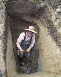 Marco Cisternas合作论文数Escuela de Ciencias del Mar, Pontificio Universidad Catolica de Valparaiso18
 Lisa L Ely合作论文数15
 Tina Dura合作论文数Virginia Polytechnic Institute, State University11
 Charles Mueller合作论文数10
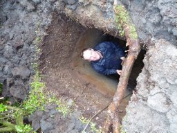 Daniel Melnick合作论文数Department 3 Geodynamik Telegrafenberg, GeoForschungsZentrum Potsdam10
 Arthur Frankel合作论文数Lamont-Doherty Geological Observatory;Department of Geological Sciences;Columbia University;Department of Geological Sciences, Columbia University7Stephen C. Harmsen合作论文数6
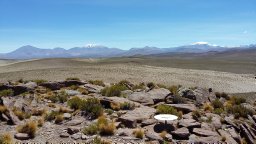 Moreno Marcos合作论文数GFZ Helmholtz Centre Potsdam, German Research Centre for Geosciences5Oliver S. Boyd合作论文数University of Colorado at Boulder5Jessica Pilarczyk合作论文数5
 Benjamin Horton合作论文数Asian School of the Environment, College of Science, Nanyang Technological University;Earth Observatory of Singapore, Nanyang Technological University5
 Mark D. Petersen合作论文数U.S. Geological Survey5Cyntia E. Mizobe合作论文数Inst Geog, Pontificia Univ Catolica Valparaiso4Breanyn Tiel Macinnes合作论文数4
 Alan Nelson合作论文数U.S. Geological Survey Golden4Charles G. Bufe合作论文数4
 Jessica M. DePaolis合作论文数3
 Hermann Fritz合作论文数School of Civil and Environmental Engineering, College of Engineering, Georgia Institute of Technology3john filson合作论文数2
 Isabel Hong合作论文数Department of Earth Sciences, Simon Fraser University2
 Daria L. Nikitina合作论文数2
 Matias Carvajal合作论文数Programa Doctorado Ciencias Geol, Univ Concepcion2
 Julius Jara-Munoz合作论文数Univ Potsdam, Inst Geosci, Potsdam, Germany2E. V. Leyendecker合作论文数2
 Kathleen M. Haller合作论文数2David M. Perkins合作论文数2Chris H. Cramer合作论文数2Russell L. Wheeler合作论文数2Kenneth S. Rukstales合作论文数2Gino Figueroa合作论文数1Alexander Dolcimascolo合作论文数1David Bruce合作论文数1Pedro Matos-Llavona合作论文数1
 Pippa Whitehouse合作论文数Department of Geography, Faculty of Social Sciences & Health, Durham University1
 Shaoyang Li合作论文数1
 Bridgette E Garrett合作论文数1Andrew Parnell合作论文数Department of Physics and Astronomy, Faculty of Science, The University of Sheffield1
 Juan Carlos Baez合作论文数Universidad de Concepcion1
 Fred Pollitz合作论文数United States Geological Survey1
 Hui Tang合作论文数techno1
 Michael Bevis合作论文数School of Earth Sciences, College of Arts and Sciences, The Ohio State University1
 Joanne Bourgeois合作论文数1
 Robert Weiss合作论文数Department of Geology and Geophysics, Texas A&M University1
 Benjamin C. Gill合作论文数Virginia Polytechnic Institute and State University, State University1
 Angeles Moreno合作论文数Departamento de Ingeniería Eléctrica;Universidad Carlos III de Madrid;Departamento de Ingeniería Eléctrica, Universidad Carlos III de Madrid1
 Lorena Rebolledo合作论文数Center for Oceanographic Research in the eastern South Pacific (FONDAP-COPAS),, University of Concepción1
 Jeanne L. Hardebeck (Jeanne Hardebeck)合作论文数United States Geological Survey1
 D. Reide Corbett合作论文数Department of Oceanography;Florida State University;Department of Oceanography, Florida State University1
 Mahdi Motagh合作论文数GeoForschungsZentrum Potsdam (GFZ) Telegrafenberg1




