Different perspectives of risk and approaches to risk assessment exist, which complicate communication, methodological advances and management across disciplines. To help building bridges, we have developed, tested and applied a generalized mathematical framework for risk assessment in a unique community effort, involving researchers from various fields. We present the derivation of the risk equation, which is tailored to civil and environmental engineering risk assessment of spatially-distributed and dynamic systems. We start off with a general framing and then refine individual parts of the equation as much as needed. The individual terms of the unified risk equation explicitly relate to concepts of frequency, intensity, duration, exposure, vulnerability and asset worth. Our approach takes a new perspective on facilitating communication across disciplines by exploiting mathematical formalism: filling our equation with life enforces a clear definition of the relevant terms and thereby helps in ‘translating’ between different terminology in the involved disciplines. For the sake of clarity and accessibility, we keep the framework simple in terms of additive effects and neglect failure cascades or nonlinear multi-hazard impact functions. Hence, while the framework is not designed to provide a one-fits-all-mathematical solution, it can help carve out the specific properties of a system that potentially violate these assumptions, and this is very valuable when talking risk assessment across disciplines. We demonstrate the utility of our proposed framework with ten selected examples from various domains, ranging from groundwater protection through seismic risk assessment to reliability analysis of critical infrastructure. The structured discussion between all involved researchers has greatly improved mutual understanding, which makes us confident that the proposed framework can serve as a catalyst for interdisciplinary advances in communicating and treating risk.
Alluvial wetlands are vital river components and crucial nodes of the carbon cycle, yet the response of their surface soil carbon pools to anthropogenically regulated hydrological rhythms is not fully understood. Surface soil samples were collected from the alluvial wetlands of the lower Yellow River (LYR) during three distinct hydrological seasons preceding and following a Water and Sediment Regulation Scheme (WSRS) event. The gradient acid hydrolysis method was used for carbon fractionation (labile carbon (LP-C) and recalcitrant carbon (RP-C) fractions) in soil, and water and soil physicochemical parameters were monitored to assess the effects of anthropogenic hydrological regulation on surface soil carbon content and stability within alluvial wetlands. Results indicated that total carbon and LP-C concentrations in the alluvial wetland soil reached their highest levels during the WSRS-imposed high-flow periods, with 13.75 +/- 2.47 g/kg and 7.34 +/- 3.18 g/kg, respectively. Further correlation analysis indicated that alterations in hydrologic conditions under WSRS primarily influence the composition and stability of soil carbon by modulating suspended sediment (SS) input fluxes and soil environmental characteristics. In light of these findings, under the scenario of increasingly intense anthropogenic regulation of hydrological rhythms, enhancing SS deposition, restoring wetland vegetation, and reducing soil respiration represent potential pathways to improve carbon pool capacity in alluvial wetlands. This study highlights the important role of anthropogenic hydrological regulation in wetland carbon storage and cycling processes, providing valuable insights for the river carbon budget of regulated river systems under changing environments.
Allowing fish to migrate freely is a primary goal for conserving migratory fish species and more generally for entire fish communities. In recent years, substantial effort has been invested in developing, constructing, and improving fish passage facilities to help migratory species navigate barriers in river ecosystems. With continuously growing capacities of computers, numerical simulations have become standard tools to hydraulically optimize such fishways. However, the information obtained by three-dimensional (3d) simulations is merely leveraged and rarely subject to thorough analysis. This study features a 3d hydrodynamic numerical model of a vertical slot fishway (VSF) to explore the relevance of the 3d-velocity information, which is not available from depth (2d) or cross section-averaged (1d) simulations for ecohydraulic assessments. A multiphase solver within the OpenFOAM software is used to investigate the advantages of 3d information compared to depth-averaged models. Specifically, vertical velocity profiles provide insights into near-bottom and near-wall regions where fish could pass, even when a depth-averaged model would suggest that the mean velocity is too high for fish passage. In addition, hydrodynamic variations in turbulent kinetic energy patterns show that even in steady flow conditions, there are high temporal variations of flow velocity patterns, which provide instantaneously changing opportunities for fish to migrate through slots. Also, resting zones were identified within pools of the VSF, which represent valuable features for a fishway that might otherwise cause exhaustion of fish after passing a couple of pools. Thus, design improvements with 3d simulations may also embrace the optimization of such resting zones.
Climate change affects ecological processes that govern species distribution patterns at different spatio-temporal scales. To aid in habitat restoration aimed at increasing biodiversity, numerous habitat models were developed and employed in the past. In this study, a fuzzy logic-based habitat model, coupling a fuzzy inference system and a hydrological-hydrodynamic model, is proposed to identify the baseline conditions of suitable habitat for juvenile fish. The main objective is to map and predict the current and future habitat suitability for Labeo Rohita in the data-scarce Loktak Lake, India. To predict future habitat suitability, climate change scenarios defined by the Intergovernmental Panel for Climate Change (IPCC) were used for the years 2041-2060 and 2081-2100 under two different scenarios of Shared Socio-Economic Pathways (SSP) SSP1-2.6 and SSP5-8.5. These future scenarios were used as input data for a model chain, containing a hydrological SWAT model, a hydrodynamic Delft3D model and the fuzzy-logic habitat model. This model chain considers consequences of climate change and explores the combined effects of changes in water temperature, dissolved oxygen and water depth on the habitat suitability. The model results show current habitat suitability with 9.0 km2 of the lake surface with very high suitability, 51.2 km2 with high suitability, 80.7 km2 with medium suitability, and 14.9 km2 with low suitability. In the SSP1-2.6 and SSP5-8.5 scenarios, it is predicted that the habitat suitability decreases. Specifically, medium habitat areas of 26.7 km2 and 79.5 km2 will be transformed in to low-suitability areas by 2100, for SSP1-2.6 and SSP5-8.5, respectively. These results show the impact of climate change, in combination with economic development, including future land use changes. Hence, pathways for ecologically sustainable management of fish habitat in lakes are necessary to steer habitat quality in the future.
Water availability is not uniformly distributed, and water is not available on demand in many areas of the world. Thus, artificial storage of water is essential for the sustainable management of water resources. However, reservoirs are transport-limited systems due to low flow velocities, resulting in sedimentation. Additionally, global change amplifies sedimentation because of altered hydrological conditions and sediment production of river basins. Preparedness for global change necessitates decades-long forecasting of these complex phenomena, which is computationally challenging. Sediment depositions reduce not only the available storage volume over time but may create severe safety issues, such as blockage of bottom outlets or increased flood risk. Therefore, it is essential to understand not only the trapping efficiency of a reservoir and its temporal variations but also the spatial distribution of expected sediment accumulations. To generate these insights, long-term predictions based on three-dimensional (3d) hydro-morphological models considering the changing climate are required. The Banja reservoir, located in southeast Albania, was investigated in this study to investigate the effects of global change on reservoir sedimentation. Simulations were performed up to 90 years into the future to model characteristic sedimentation stages and to test for differences between several emission scenarios, combined with socioeconomic and climate scenarios. A 3d numerical model simulated hydrodynamics, suspended sediment transport, and sedimentation processes, considering the Devoll River as the main tributary and three smaller tributaries. To enable long-term simulations, an adaptive grid with a spatial resolution of 50 m x 50 m in the x- and y-direction, respectively, as well as up to 10 cells in the z-direction was used. Due to an implicit time discretization a time step of 5,400 seconds was chosen to achieve reasonable computational times. The model results showed a decrease in the trapping efficiency by 2100 for all scenarios, which is associated with storage loss over time. In the high and medium emission scenarios, the reservoir experiences a substantial loss of storage volume due to increasing sediment yields. The model also showed the formation of a delta at the head of the reservoir and the progressive movement of the delta further into the reservoir. These spatial and temporal insights into future sediment deposition patterns are crucial for developing sustainable management strategies to account for global change.
Engineers, geomorphologists, and ecologists acknowledge the need for temporally and spatially resolved measurements of sediment clogging (also known as colmation) in permeable gravel-bed rivers due to its adverse impacts on water and habitat quality. In this paper, we present a novel method for non-destructive, real-time measurements of pore-scale sediment deposition and monitoring of clogging by using wire-mesh sensors (WMSs) embedded in spheres, forming a smart gravel bed (GravelSens). The measuring principle is based on one-by-one voltage excitation of transmitter electrodes, followed by simultaneous measurements of the resulting current by receiver electrodes at each crossing measuring pores. The currents are then linked to the conductive component of fluid impedance. The measurement performance of the developed sensor is validated by applying the Maxwell Garnett and parallel models to sensor data and comparing the results to data obtained by gamma ray computed tomography (CT). GravelSens is tested and validated under varying filling conditions of different particle sizes ranging from sand to fine gravel. The close agreement between GravelSens and CT measurements indicates the technology’s applicability in sediment–water research while also suggesting its potential for other solid–liquid two-phase flows. This pore-scale measurement and visualization system offers the capability to monitor clogging and de-clogging dynamics within pore spaces up to 10,000 Hz, making it the first laboratory equipment capable of performing such in situ measurements without radiation. Thus, GravelSens is a major improvement over existing methods and holds promise for advancing the understanding of flow–sediment–ecology interactions.
Global biodiversity is largely dependent on aquatic habitats. The state of fish habitats and the health of the aquatic ecosystem as a whole are important indicators of environmental quality. In recent years, the implications of human interference and climate change on aquatic environments have gained significant attention. Hydrological modifications driven on by anthropogenic activities are steadily degrading flow conditions and threatening the abundance of fish in the geographic region, while simultaneously having an impact on the health of the watershed. Therefore, the integrated hydrological-hydrodynamic-habitat modelling under diverse flow regimes can be used to assess the eco-sustainability and habitat suitability of the fish species. This article categorizes the habitat variables of fish into three groups: eco-hydrological, hydrodynamic-water quality, and eco-biological. This categorization facilitates an understanding of the mechanisms by which each factor affects fish and their habitats. The study, as the first of its kind, provides an extensive review of eco-hydrological models, hydrodynamic-water quality models, and habitat models, along with their relevant influencing components. It proposes a scientific framework for evaluating the potential hazards of aquatic habitat degradation, with an emphasis on data-scarce regions. This strategy could potentially establish a scientific basis for the preservation and restoration of aquatic ecosystems.
The hyporheic zone of rivers hosts critical exchange processes between surface and subsurface water, governed by the sedimentary characteristics of the riverbed and the hydraulic conditions. In-situ measurements of riverbed characteristics are key to quantifying these ecologically relevant exchange processes, including interstitial dissolved oxygen and riverbed permeability. However, such analysis is challenging because these quantities change in space and time, have different units, and little data amounts. This is why we ran extended statistical analyses on a large database with years-long observations. Statistical significance of the hyporheic parameters served for testing two hypotheses. Notably, we hypothesize that (1) riverbed permeability governs the transport of oxygen-rich surface water into the hyporheic zone; and (2) interstitial dissolved oxygen saturation (IDOS) in the hyporheic zone varies with morphological units. The results based on measurements from 17 rivers and a nature-like fishway show that IDOS, a critical parameter for ecosystem health, is not normally distributed. This prohibits common analysis techniques such as ANOVA or Pearson correlation. To enable comparisons of non-normally distributed IDOS, we use Spearman rank correlation and Kruskal Wallis tests. These tests support the first hypothesis with a statistically significant confidence (p < 0.05) and a Spearman correlation of r(s) = 0.54 between IDOS and a novel, non-dimensional permeability proxy. To test the second hypothesis, we compute a non-dimensional halving depth, which expresses the sediment depth where IDOS values halves in relation to the nearest-surface value. The tests show that the distributions of the halving depths do not significantly differ between morphological units of glides, riffles, and pools. In addition, temporal dependence emerged as a critical parameter to explain the variance in IDOS measurements, which could be related to discharge variations, drought conditions. In conclusion, this study identifies a significant influence of sediment permeability on IDOS in the hyporheic zone, and suggests evidence for increased climatic extremes to severely affect the ecological integrity of fluvial ecosystems.
Rivers are critical corridors for the movement of energy, matter, and organisms and essential for maintaining ecological balance, economic activities, and recreation. This connectivity in rivers, describing the flow of mass and energy across multiple spatio-temporal scales, is crucial for ecosystem resilience and function. As in many other disciplines, the literature on river connectivity has rapidly expanded in the last decade, posing considerable challenges for human reviewers. In this context, AI technologies based on Natural Language Processing (NLP) have been gaining attention with potential promises of support for literature reviews by enabling efficient analysis of large volumes of textual data. This study uses Latent Dirichlet Allocation (LDA) and the Generative Pretrained Transformer version 4.0 (GPT-4) to assist in a review of river connectivity and the results are critically evaluated in terms of accuracy and reasoning. Eighteen prevalent topics were identified from more than two thousand publication abstracts, ranging from ecological assessment and population dynamics to sediment analysis and hyporheic exchange. GPT-4 summaries show mismatches compared with expert-generated summaries, lack of conceptual insights, and the fabrication of nonexistent terminology. Vetting the logical coherence of an expert review against the AI-based review suggests that the most productive support of GPT-4 lies writing improvements and corrections like spell checks. Finally, this meta-analysis of literature on river connectivity demonstrates the power and caveats associated with current AI tools for review and calls for domain-training, fine tuning, as well as prompt optimization, for achieving nuanced syntheses in water resources research.
Reservoir sedimentation poses a significant challenge to water resource management. Improving the lifespan and productivity of reservoirs requires appropriate sediment management strategies, among which flushing operations have become more prevalent in practice. Numerical modeling offers a cost-effective approach to assessing the performance of different flushing operations. However, calibrating highly parametrized morphological models remains a complex task due to inherent uncertainties associated with sediment transport processes and model parameters. Traditional calibration methods require laborious manual adjustments and expert knowledge, hindering calibration accuracy and efficiency and becoming impractical when dealing with several uncertain parameters. A solution is to use optimization techniques that enable an objective evaluation of the model behavior by expediting the calibration procedure and reducing the issue of subjectivity. In this paper, we investigate bed level changes as a result of a flushing event in the Bodendorf reservoir in Austria by using a three-dimensional numerical model coupled with an optimization algorithm for automatic calibration. Three different sediment transport formulae (Meyer-Peter and Müller, van Rijn, and Wu) are employed and modified during the calibration, along with the roughness parameter, active layer thickness, volume fraction of sediments in bed, and the hiding-exposure parameter. The simulated bed levels compared to the measurements are assessed by several statistical metrics in different cross-sections. According to the goodness-of-fit indicators, the models using the formulae of van Rijn and Wu outperform the model calculated by the Meyer-Peter and Müller formula regarding bed patterns and the volume of flushed sediments.
Water quality analysis is a vital component of the water resources management and has to be undertaken promptly to make sure environmental regulations are being followed and to eliminate any pollution that could harm the ecosystem. The main objective of this study to retrieve and map the water quality parameters from Sentinel-2 and ResourceSat-2 [Linear Imaging Self-Scanning Sensor (LISS)-IV] multi-spectral satellite data, using Support Vector Machines (SVM), Random Forests (RF), and Multi-Linear regression (MLR) models. This study represents the first attempt to demonstrate the applicability and performance of high-spatial resolution ResourceSat-2 remote sensing satellite's LISS-4 sensor, which operates in three spectral bands in the Visible and Near Infrared Region (VNIR), to predict water quality. Spectral bands of each satellite were used as independent parameter to generate the algorithms for pH, Dissolved Oxygen (DO), Total Suspended Solids (TSS) and Total Dissolved Solids (TDS). The model performance was evaluated based on coefficient of determination (R2), Mean Absolute Error (MAE), Mean Absolute Percentage Error (MAPE), and the Root Mean Square Error (RMSE) statistical indices. The result of this study indicates that the SVM yielded the highest accuracy followed by the RF and MLR. The R2, MAE, MAPE and RMSE ranged between 0.78 and 0.99, 0.049-0.24, 0.01-10.9 % and 0.05-0.28 respectively for all the four SVM models across both the sensors. Based on the spatial trend Sentinel-2 was found to be slightly superior to the ResourceSat-2 (LISS-IV) for the estimation of water quality parameters owing to its superior spectral and radiometric resolution, nevertheless ResourceSat-2 (LISS-IV) has its own advantage in terms of high spatial resolution. The results of this study highlight the high potential of machine learning models in conjunction with multispectral satellite images to manage water quality.
Calibration of a hydrological model is a challenging task, especially in basins that are data scarce. With the incorporation of regional information and integration with satellite data, the parameters of hydrological models can be estimated for a basin with scant or no discharge records. The main objective of this study is to calibrate and validate a hydrological model based on a limited amount of in-situ measured and remote sensing satellite datasets in a data-sparse region. Multiple techniques were applied for the model calibration: (1) stage-discharge curves using a spatial proximity approach, (2) Simplified Surface Energy Balance actual evapotranspiration, (3) river discharge using a physical similarity regionalization approach, and (4) a new hybrid approach by integrating remote sensing datasets along with field measured river bathymetry data to estimate the river discharge. To demonstrate the methodology, we employed the widely used Soil and Water Assessment Tool (SWAT) hydrological model in Manipur River Basin, India. The sensitivity, calibration, and validation of the SWAT model were carried out by using the Sequential Uncertainty Fitting Technique. During calibration, the coefficient of determination (R-2) and the Kling Gupta Efficiency (KGE) were found to be in the range of 0.46-0.81 and 0.41-0.83, whereas during validation R-2 and KGE were found to be in the range of 0.40-0.79 and 0.53-0.77 for the four different techniques. Among all the four techniques applied in this study, calibration based on (i) stage-discharge curve using spatial proximity approach and (ii) new hybrid approach by integrating remote sensing datasets and river bathymetry were found as the better approaches as indicated by the statistical indices. The performance evaluation of the model through a new hybrid approach by integrating remote sensing and in-situ measured datasets for rivers with narrow width represents a promising technique for use in a data sparse region.
The application of computational fluid dynamics (CFD) in the numerical modeling of fish passes and free surface ecohydraulics has considerably increased in recent years, as a result of the improved flexibility in analyzing complex cases and detailed outputs. Many numerical models build on the assumption that the vertical velocity component is by far smaller compared to horizontal velocities. Hence, such studies use two-dimensional numerical modeling only, intending to reduce computing time and costs. However, it has been demonstrated that particularly at fine grid scales, discrepancies in modeled and observed velocities arise when the vertical velocity component is neglected. To address this shortcoming, this study features a comparison between physical lab experiments and three-dimensional (3d) numerical modeling results, showing the importance of considering the 3d-velocity field. The multiphase solver interFoam of the open-source CFD software suite OpenFOAM is used for a 3d-numerical study of an urban river stretch, including a full-scale vertical slot fish pass and a flood bypass in the form of an overflow weir.
Study region: Loktak Lake catchment, north-eastern Himalayan ranges, IndiaStudy focus: Assessing the potential synergistic impact of land use land cover (LULC) and climate change on water resources is crucial for watershed management especially in the data-scarce vulnerable wetlands. Using the SWAT hydrological model, the current study seeks to quantify the combined impacts of LULC and climate change on the water balance parameters of the Loktak Lake catchment. This study simulates the hydrological regime of the Loktak Lake catchment based on future climate and changes to LULC dynamics using four GCM models in combination with SWAT models under two alternative scenarios.New hydrological insights for the region: The findings showed that under the SSP 126 and SSP 585 scenarios, the annual mean temperature is anticipated to increase by a maximum of 1.7°C and 3.74°C, respectively, by the 2050 s and 2090 s, while the annual precipitation similarly shown a rising trend for both the scenarios for the mid and far future. The mean annual streamflow is projected to increase by 48.84 cumecs (31.65 %) and 57 cumecs (36.89 %) by the 2050 s and 2090 s decades, respectively, while the water yield will rise by 200.65 mm (30.25 %) and 216.1 mm (32.57 %) in comparable decades. The outcomes of this study might provide a scientific foundation for ecological protection as well as water resource management and development in response to the potential future risk due to climate change in the Loktak Lake catchment.
The application of remote sensing can aid the decision makers and the researchers in the field of water resources for the effective monitoring of water quality in a water sparse region. The monitoring of water quality in a wetland dominated by the heterogeneous biomass becomes more intricate. This research study was carried out in Loktak Lake, a Ramsar site nestled in the Indo-Myanmar range between the time intervals February 2022 to December 2022. In order to carry out this study, high and very high resolution multispectral satellite imageries were used. The physical water quality parameters namely electrical conductivity, total suspended solids, pH, turbidity, and nitrates were considered for the assessment. The results of this study clearly indicate a strong correlation between the field-measured parameters and reflectance. The prediction algorithms were generally the best fit to derive the water quality parameters. The model performance indices indicates good performance of the model with correlation coefficient greater than 0.80. The outcomes of this study emphasize the use of high and very high multi-spectral satellite imageries for the monitoring of water bodies with complex dynamics.
Riverbed clogging is key to assessing vertical connectivity in the hyporheic zone and is often quantified using single‐parameter or qualitative approaches. However, clogging is driven by multiple, interacting physical and bio‐geochemical parameters, which do not allow for a conclusive assessment of hyporheic connectivity with single‐parameter approaches. In addition, existing qualitative assessments lack transparency and repeatability. This study introduces a Multi‐Parameter Approach to quantify Clogging and vertical hyporheic connectivity (MultiPAC), which builds on standardized measurements of physical (grain size characteristics, porosity, hydraulic conductivity) and bio‐geochemical (interstitial dissolved oxygen) parameters. We apply MultiPAC at three gravel‐bed rivers and show how the set of parameters provides a representative appreciation of physical riverbed clogging, thus quantifying vertical hyporheic connectivity. However, more parameters are required to fully characterize biological clogging. In addition, MultiPAC locates clogged layers in the hyporheic zone through multi‐parameter vertical profiles over the riverbed depth. The discussion outlines the relevance of MultiPAC to guide field surveys.
Abstract Three‐dimensional (3d) numerical models are state‐of‐the‐art for investigating complex hydrodynamic flow patterns in reservoirs and lakes. Such full‐complexity models are computationally demanding and their calibration is challenging regarding time, subjective decision‐making, and measurement data availability. In addition, physically unrealistic model assumptions or combinations of calibration parameters may remain undetected and lead to overfitting. In this study, we investigate if and how so‐called Bayesian calibration aids in characterizing faulty model setups driven by measurement data and calibration parameter combinations. Bayesian calibration builds on recent developments in machine learning and uses a Gaussian process emulator as a surrogate model, which runs considerably faster than a 3d numerical model. We Bayesian‐calibrate a Delft3D‐FLOW model of a pump‐storage reservoir as a function of the background horizontal eddy viscosity and diffusivity, and initial water temperature profile. We consider three scenarios with varying degrees of faulty assumptions and different uses of flow velocity and water temperature measurements. One of the scenarios forces completely unrealistic, rapid lake stratification and still yields similarly good calibration accuracy as more correct scenarios regarding global statistics, such as the root‐mean‐square error. An uncertainty assessment resulting from the Bayesian calibration indicates that the completely unrealistic scenario forces fast lake stratification through highly uncertain mixing‐related model parameters. Thus, Bayesian calibration describes the quality of calibration and correctness of model assumptions through geometric characteristics of posterior distributions. For instance, most likely calibration parameter values (posterior distribution maxima) at the calibration range limit or with widespread uncertainty characterize poor model assumptions and calibration.
Understanding the complexity of the siltation process and sediment resuspension in shallow reservoirs is vital in maintaining the reservoir functionality and implementing sustainable sediment management strategies. The geometry of reservoirs plays an indispensable role in the appearance of various flow structures inside the basin and, consequently, the pattern of the morphological evolution. In this study, a three-dimensional numerical model, coupled with optimization algorithms, is used to investigate the morphological bed changes in two symmetric shallow reservoirs having hexagon and lozenge shapes. This work aims to evaluate the applicability, efficiency, and accuracy of the automatic calibration routine, which can be a suitable replacement for the time-consuming and subjective method of manual model calibration. In this regard, two sensitive parameters (i.e., roughness height and sediment active layer thickness) are assessed. The goodness-of-fit between the calculated bed levels and the measured topography from physical models are presented by different statistical metrics. From the results, it can be concluded that the automatically calibrated models are in reasonable agreement with the observations. Employing a suitable optimization algorithm, which finds the best possible combination of investigated parameters, can considerably reduce the model calibration time and user intervention.
Modeling reservoir sedimentation is particularly challenging due to the simultaneous simulation of shallow shores, tributary deltas, and deep waters. The shallow upstream parts of reservoirs, where deltaic avulsion and erosion processes occur, compete with the validity of modeling assumptions used to simulate the deposition of fine sediments in deep waters. We investigate how complex numerical models can be calibrated to accurately predict reservoir sedimentation in the presence of competing model simplifications and identify the importance of calibration parameters for prioritization in measurement campaigns. This study applies Bayesian calibration, a supervised learning technique using surrogate-assisted Bayesian inversion with a Gaussian Process Emulator to calibrate a two-dimensional (2d) hydro-morphodynamic model for simulating sedimentation processes in a reservoir in Albania. Four calibration parameters were fitted to obtain the statistically best possible simulation of bed level changes between 2016 and 2019 through two differently constraining data scenarios. One scenario included measurements from the entire upstream half of the reservoir. Another scenario only included measurements in the geospatially valid range of the numerical model. Model accuracy parameters, Bayesian model evidence, and the variability of the four calibration parameters indicate that Bayesian calibration only converges toward physically meaningful parameter combinations when the calibration nodes are in the valid range of the numerical model. The Bayesian approach also allowed for a comparison of multiple parameters and found that the dry bulk density of the deposited sediments is the most important factor for calibration.
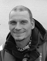 Markus Noack合作论文数Fac Architecture & Civil Engn, Karlsruhe Univ Appl Sci44
 Stefan Haun合作论文数Inst Modelling Hydraul & Environm Syst, Univ Stuttgart41
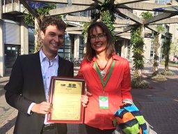 Sabine U Gerbersdorf合作论文数Institute of Hydraulic Engineering, University Stuttgart21
 Sebastian Schwindt合作论文数Inst Modelling Hydraul & Environm Syst, Univ Stuttgart20
 Felix Beckers合作论文数Inst Modelling Hydraul & Environm Syst, Univ Stuttgart13
 Kristina Terheiden合作论文数12
 Moritz Thom合作论文数10
 Bakimchandra Oinam合作论文数9
 Beatriz Negreiros合作论文数8
 M. A. Mayar合作论文数8
 Vicky Anand合作论文数National Institute of Technology Manipur8
 Kilian Mouris合作论文数University of Stuttgart7
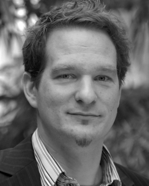 Wolfgang Nowak合作论文数Institut fur Wasserbau;Universitat Stuttgart;Institut fur Wasserbau, Universitat Stuttgart7G. Schmid合作论文数6Lydia Seitz合作论文数5
 Matthias Kramer合作论文数School of Engineering & Information Technology, The University of New South Wales Canberra5Matthias Schneider合作论文数5
 Sergey Oladyshkin合作论文数Institute of Hydraulic Engineering (LH2), University of Stuttgart5Alcides Aybar Galdos合作论文数4L. Seitz合作论文数4Vahid Shoarinezhad合作论文数4
 Reza Ahmadian合作论文数4
 Jan Bliefernicht合作论文数4Fritz Neuschitzer合作论文数3
 angeli doliente cabaltica合作论文数3Ianina Kopecki合作论文数3Joerg Franke合作论文数3
 Gudrun Hillebrand合作论文数3johannes ortlepp合作论文数3Tobias Gebler合作论文数3Kaan Koca合作论文数3
 Heidrun Steinmetz合作论文数3
 Bettina N. Bockelmann-Evans合作论文数3
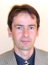 Holger Class合作论文数Lehrstuhl für Hydromechanik und Hydrosystemmodellierung, Universität Stuttgart Institut für Wasserbau3
 Roger Falconer (罗杰·亚历山大·福尔克纳)合作论文数School of Engineering, Cardiff University3e fenrich合作论文数2Hans-B. Horlacher合作论文数2Hilmar Hofmann合作论文数2Hj Vollmers合作论文数2Reinhard Klumpp合作论文数2Xi Cheng合作论文数2
 Najibullah Sadid合作论文数2
 Shailesh Kumar Singh合作论文数2
 Maria Herminia Pesci合作论文数2
 Benedikt Mester合作论文数2Manuel Krauss合作论文数2michael sinsbeck合作论文数2Martin Stahl合作论文数2Jin Zhang合作论文数2




