Current agricultural practices in Europe are increasingly aggravating societal and environmental safety concerns. This creates social and regulatory pressures on farmers, which can lead to declining material and social status of farmers, farmer discontent, and anti -regulation protests. These tensions are rooted in conflicting value systems for agricultural development, which can range from productivist pathways (i.e. valuing production above all else) to increasing multifunctionality pathways (i.e. valuing agriculture for its contribution to multiple economic, environmental and societal needs). It is largely unknown to what degree individual farms and agricultural landscapes are transitioning towards increasing productivism or multifunctionality in practice. Here, we mapped landscape changes and interviewed farmers (n = 274) to examine the diversity of agricultural development pathways in 17 study sites across Europe over the last 20 years (2000 -2020). We also assessed the associations between the development pathways and farmers ' perceptions of socio-economic outcomes, namely job satisfaction, societal valuation, and economic performance. Farm -level development was largely aligned with productivist pathways, while landscape -level changes aligned more closely with an increasing multifunctionality pathway. Farmers on pathways of increasing multifunctionality did not perceive improved outcomes on livelihood indicators as compared to productivist farmers. Furthermore, farms on increasing multifunctionality pathways were concentrated in sites with very high management intensities that face strong pressure from environmental regulations, as well as low -intensity, mountainous sites, where opportunities for intensification are limited. These results suggest that current pathways that increase multifunctionality arise mostly by necessity. Successful agricultural transformation will therefore require policy to create enabling environments that provide socioeconomic benefits for farmers to increase multifunctionality, and a civil society and market conditions that value sustainable agriculture.
Farming in Europe has been the scene of several important socio-economic and environmental developments and crises throughout the last century. Therefore, an understanding of the historical driving forces of farm change helps identifying potentials for navigating future pathways of agricultural development. However, long-term driving forces have so far been studied, e.g. in anecdotal local case studies or in systematic literature reviews, which often lack context dependency. In this study, we bridged local and continental scales by conducting 123 oral history interviews (OHIs) with elderly farmers across 13 study sites in 10 European countries. We applied a driving forces framework to systematically analyse the OHIs. We find that the most prevalent driving forces were the introduction of new technologies, developments in agricultural markets that pushed farmers for farm size enlargement and technological optimisation, agricultural policies, but also cultural aspects such as cooperation and intergenerational arrangements. However, we find considerable heterogeneity in the specific influence of individual driving forces across the study sites, implying that generic assumptions about the dynamics and impacts of European agricultural change drivers hold limited explanatory power on the local scale. Our results suggest that site-specific factors and their historical development will need to be considered when addressing the future of agriculture in Europe in a scientific or policy context.
Farming systems in marginal or less favored areas of Europe have faced a multitude of challenges as a response to so-called “mega-trends”. A typical response has been land abandonment. The focus of this paper is on the farming systems of the Greek islands of Lesvos and Lemnos. These neighboring islands are geographically very similar but differ greatly in their farming systems, resulting in different responses to the same megatrends. While land abandonment is widespread in the small-scale olive groves of Lesvos, on Lemnos specialization towards animal and dairy products is more common. We performed land cover analysis and interviews with farmers in both areas, in two complementing rounds: one more quantitative that recorded recent changes and farmer rationales and a more qualitative one that investigated longer term trends and decision-making patterns. The analysis revealed that, among others, land ownership and inheritance patterns matter in both areas in different ways, leading to diverse trajectories. On Lemnos, as part of the traditional mixed-farming system (Mandra), land leasing is dominant, separating land users and landowners. Interviews also reveal the different symbolic capital, as olive trees on Lesvos are considered a family asset and not just a land use, something that cannot be said of the leased grazing lands on Lemnos. The market value of the different products is important, but the different trajectories also demonstrate how the rationales behind the responses to mega-trends can guide which trajectories will be dominant in the area. This article highlights the complexity and mix of local drivers and global trends that drive abandonment at both farm and the landscape scales and guides the formulation and application of agricultural policies and public resources for improved management of marginal areas.
Landscape products link to low-input practices and traditional ecological knowledge, and have multiple functions supporting human well-being and sustainability. Here we explore seven landscape products worldwide to identify these multiple functions in the context of food commodification and landscape sustainability. We show that a landscape products lens can improve food systems by fostering sustainability strategies and standards that are place-sensitive, and as such can mitigate conflicts related to food production, social justice and the environment. Co-management strategies and information policies, such as certification, labelling, product information and raising of awareness could accelerate, incentivize and catalyse actions to support landscape products in the context of sustainability strategies.
This chapter investigates changes in land use intensity in a crop-livestock farming system on Lemnos Island through the combination of land use/land cover (LULC) types extracted from black and white (B&W) aerial images, statistics, and qualitative data. Combining quantitative and qualitative data, different insights of land use and landscape changes are assessed. The steps are: first, the timeline of historical changes was compiled; then, remote sensing was used to assess land cover changes and conversions that represent changes in intensity, and this information was complemented by participatory mapping with local farmers. Land use trajectories revealed that extensification is the basic trend from 1960 to 2002. Intensification coexists in at the same time, as grasslands convert to crops. There is a distinct pattern between periods: extensification seems to be the main process of change from 1960 to 1980 affecting mainly the hilly uplands as more remote and marginal areas are being converted from crops to grasslands or are abandoned, whereas intensification is the main trend for the next 20 years mainly in the lowlands as modernized agriculture (irrigated fields, land aggregation, machinery use) replaces more extensive land uses and traditional landscape elements such as tree hedges. The role of complementarity is very important. Conclusively, this case study shows that in some farming systems land use intensity changes cannot be represented through simple dichotomist differentiations.
It has been shown that the COVID-19 pandemic affected some agricultural systems more than others, and even within geographic regions, not all farms were affected to the same extent. To build resilience of agricultural systems to future shocks, it is key to understand which farms were affected and why. In this study, we examined farmers’ perceived robustness to COVID-19, a key resilience capacity. We conducted standardized farmer interviews (n = 257) in 15 case study areas across Europe, covering a large range of socio-ecological contexts and farm types. Interviews targeted perceived livelihood impacts of the COVID-19 pandemic on productivity, sales, price, labor availability, and supply chains in 2020, as well as farm(er) characteristics and farm management. Our study corroborates earlier evidence that most farms were not or only slightly affected by the first wave(s) of the pandemic in 2020, and that impacts varied widely by study region. However, a significant minority of farmers across Europe reported that the pandemic was “the worst crisis in a lifetime” (3%) or “the worst crisis in a decade” (7%). Statistical analysis showed that more specialized and intensive farms were more likely to have perceived negative impacts. From a societal perspective, this suggests that highly specialized, intensive farms face higher vulnerability to shocks that affect regional to global supply chains. Supporting farmers in the diversification of their production systems while decreasing dependence on service suppliers and supply chain actors may increase their robustness to future disruptions.
The management of agroecosystems affects biodiversity at all levels from genetic to food-web complexity. Low-input farming systems support higher levels of genetic, species and habitat diversity than high-input, industrial ones. In Greece, as in other Mediterranean countries, the role of traditional farming practices has been underlined in studies concerning conservation in agricultural landscapes. With this study, we aim to provide evidence for the potential of semi-extensive farming for biodiversity conservation at landscape-scale, focusing on Lemnos, a medium-sized island in the North Aegean. Evidence was gathered by species- and community-level local-scale surveys on various trophic levels (vascular plants, arthropods, birds). The surveys took place in 2018 and 2019 in 25 sampling areas comprising 106 plots of 100 m2 (vascular plants, arthropods) and 57 points where bird species were recorded. The plots were classified into three landscape types: mosaic agriculture, mixed rangelands and uniform rangelands. The relevés of Lemnos farmlands were assigned to plant communities of 18 phytosociological alliances, grouped into 12 classes. The most abundant arthropods were Coleoptera, Chilopoda, and Hymenoptera, followed by Opiliones and Isopoda, while 133 different bird species were recorded in total, including the recording for the first time on the island of five species. Farming on Lemnos is rather extensive compared to most agricultural landscapes of Europe. Our approach has demonstrated that, given the geographic characteristics of the area, the measured data reveal very high biodiversity. Our explorative findings suggest that moderate seasonal grazing, the mixed habitat mosaic with ecotones, fallow and stubble fields at the landscape scale, and the small size of fields, the kinds of crop, and farm-scale crop diversification, like mixed cultivation and crop rotation, are key practices supporting this diversity. These explorative findings are considered as a first step providing the baseline for future assessments. A wider effort, for systematic evaluation of the impacts of farming practices to biodiversity, is required, as part of a subsidized agri-environmental scheme and/or through a market-oriented product certification system for the area.
The agricultural landscape of Mediterranean islands has transformed radically over the last 60 years. The results differ, due to the interplay of macro, national, and local factors for each setting. In this study, some of these trajectories of change are examined for the island of Lemnos in Greece, using remote sensing and oral history techniques. The first aim is to present the changes in and of the agricultural landscape of Lemnos, applying quantitative and qualitative methods, in order to capture different aspects of those changes. The second aim is to identify the socio-economic factors that underlie landscape changes or lack of, using local knowledge and perception of the landscape. Land cover maps were produced by aerial photographs using additional texture features, for 1960, 1980, and 2002, through object-oriented image analysis (OBIA). Interviews and a workshop with local actors were used to validate and understand different change trajectories, and to identify the factors behind these changes. Results show that although grasslands have increased, revealing a process of extensification of agriculture in the study area, change has affected a small proportion of the landscape. This process is backed by information revealed through qualitative methods, as migration of labor power in the 1960s and mechanization of the agricultural sector in the late 1970s and early 1980s have been the main factors of the transformation of the agricultural sector in Lemnos, resulting in bigger mixed crop-livestock farms and the abandonment of marginal areas. The results of these processes are discussed in the context of agricultural change in the Mediterranean.
 Kizos Thanasis (Athanasios)合作论文数Department of Geography, University of the Aegean8
 Franziska Mohr合作论文数Institute of Geography, University of Bern4
 Maria Garcia Martin合作论文数Swiss Federal Institute for Forest, Snow and Landscape Research4
 Julian Helfenstein合作论文数Swiss Fed Inst Technol, Inst Agr Sci, CH-8315 Lindau, Switzerland4
 Peter Verburg合作论文数Institute for Environmental Studies, Faculty of Science, Vrije Universiteit Amsterdam4Rebecca Swart合作论文数3
 Niels Debonne合作论文数Land Change Science Research Unit, Swiss Federal Research Institute WSL3
 Anita Zarina合作论文数Dept Geog, Univ Latvia3
 Jozef Hernik合作论文数Faculty of Environmental Engineering and Land Surveying, University of Agriculture in Krakow3
 Christian Levers合作论文数Geography Department, Humboldt-Universität zu Berlin3
 Angela Lausch合作论文数Umweltforschungszentrum Leipzig-Halle GmbH3
 Matthias Bürgi合作论文数Department Land Use Dynamics, Swiss Federal Institute of Forest3
 Vasco Diogo合作论文数3
 Robert Pazur合作论文数Institute of Geography, Slovak Academy of Sciences3
 Felix Herzog合作论文数Agroscope3
 T. D. WILLIAMS合作论文数2
 Gerardo Moreno Marcos合作论文数Department of Plant Biology, Ecology and Earth Science, University of Extremadura2
 Claudine Thenail合作论文数2
 Wenche Dramstad合作论文数Norwegian Institute of Land Inventory2Tim G. Williams合作论文数1
 Irene Holm Sørensen合作论文数1konstantinos kosmas合作论文数1Nicholas M Georgiadis合作论文数1
 Kalliopi Avanidou合作论文数1Sofia Dervisoglou合作论文数1
 Anna Edlinger合作论文数Dept Plant & Microbial Biol, Univ Zurich1George Dimitropoulos合作论文数1José Muñoz-Rojas合作论文数1Orestis Kairis合作论文数1
 Tomasz Salata合作论文数Dept Land Management & Landscape Architecture, Agr Univ Krakow1
 Cristina Quintas-Soriano合作论文数Dept Biol Sci, Idaho State Univ1
 Lynn Huntsinger合作论文数Department of Environmental Science, Policy and Management, College of Natural Resources, University of California, Berkeley1
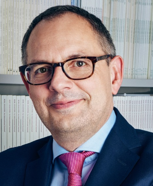 Michael Siegrist合作论文数Department of Health Sciences and Technology, ETH Zürich;Institute of Science, Technology and Policy, ETH Zürich1
 Maria-Jose Ibarrola-Rivas合作论文数Center for Energy and Environmental Sciences, University of Groningen;Center for Energy and Environmental Sciences, University of Groningen1
 Karl Zimmerer合作论文数Department of Geography, College of Earth and Mineral Sciences, Pennsylvania State University1Stefan Meyer合作论文数1
 D׳Ambrosio Ugo合作论文数Laboratori de Botànica, Universitat de Barcelona;Institut Botànic de Barcelona (IBB-CSIC-ICUB), Passeig del Migdia s.n., Parc de Montjuïc, 08038 Barcelona, Catalonia, Spain.;Institut Botànic de Barcelona (IBB-CSIC-ICUB),, Universitat de Barcelona1
 Tobias Plieninger合作论文数Faculty of Organic Agricultural Sciences, Universität Kassel;Department of Agricultural Economics and Rural Development, Georg-August-Universität Göttingen1
 David Abson合作论文数Social-Ecological Systems Institute, Leuphana Universität Lüneburg1
 M. Panitsa合作论文数1Beatrice Schüpbach合作论文数1D. Perdikis合作论文数UMDNJ/New Jersey Medical School1
 Christos Vasilakos合作论文数Environmental Research Laboratory Institute of Nuclear Technology-Radiation Protection, NCRS “Demokritos”,1
 Maria Fernandez-Gimenez合作论文数Department of Forest and Rangeland Stewardship, Warner College of Natural Resources, Colorado State University;Center for Collaborative Conservation, Colorado State University1
 Wendy Fjellstad合作论文数Department of botany, University of Oslo1
 Marianne Penker合作论文数Department of Economics and Social Sciences, University of Natural Resources and Applied Life Sciences1Jaan Liira合作论文数1Penelope J. Bebeli合作论文数1
 Erwin Bergmeier合作论文数Albrecht von Haller Institute of Plant Sciences, Georg-August University of Göttingen1




