Dubrovnik, the Croatian and the world cultural monument of the highest category, that has been included in UNESCO's World Heritage List since 1979, is placed in seismic very active area. Throughout the history, the buildings in the city suffered a large amount of damage caused by natural disasters and by human action. The most critical of all these causes were earthquakes. Monitoring of the displacements in vertical direction in order to determine possible deformations of the historical centre of the Old City of Dubrovnik started with project network making in 1982. A comprehensive analysis of deformations has been made using PANDA scientific software. In 1995 and 1996 the larger Dubrovnik area was hit by more than 150 earthquakes of VII and VIII degrees on the MCS scale. Series of aftershocks that followed lasted for more than two years. In the course of this period more than 3000 earthquakes were registered. The region around Dubrovnik is very active in seismically-tectonic sense. The main cause of earthquakes are tectonic movements of the Adriatic micro-plate which pushes forward parts of the Adriatic structural unit. In this paper the report on geodetic measurements during the eighties and nineties in the past century will be made. The results of the analysis will show the need for further research, i.e. geodetic observations of the historical centre and much wider area around the city of Dubrovnik. Further observations must be expanded with the precise horizontal, GNSS and gravimetric measurements. The research should be done in an interdisciplinary way. The reconstruction plan for the previously established network, as well as the plan for the future research work will be presented in this paper.
Croatian land administration system faces a great crossroad because it demands for a single maintenance solution of digital cadastral plans converted from an analogue to a digital form a few years back. Joint Information System of Land Books and Cadastre is currently under development. For the cadastral system transformation compliance with international standards is very important. Furthermore, introduction of the new geodetic datum and the new cartographic projections adopted in 2004 is still in its implementation phase. At the same time, Croatia is in the process of being admitted into full European Union membership (expected accession date is July 1, 2013). This chapter examines compatibility of the Croatian land administration system with the Land Administration Domain Model (LADM). Possibility of LADM adoption in the Republic of Croatia is evident from comparison of LADM literature and the current situation of the Croatian land administration system. This chapter proposes a national LADM profile for the Republic of Croatia. Interconnections between classes of the Croatian land administration system and linkage possibilities of these classes with LADM are presented through relevant examples.
U radu je dan prikaz Drugog hrvatskog kongresa o katastru održanog u Zagrebu od 24. do 26. listopada 2001. pod pokroviteljstvom Vlade Republike Hrvatske, a u organizaciji Hrvatskog geodetskog drustva.
Determination of construction displacements and deformations are an important parameter in assessing the condition and safety of the construction in its exploitation. Also, we get confirmation whether a structure is consistent with project solutions. Constant development of surveying instruments enables us to deal with more complex and demanding tasks that are facing engineering geodesy. Surveying instruments can measure, not only static and very slow displacements of the constructions, but also and faster (dynamic) displacements. In order to determine the accuracy, limitation and possibilities of surveying instruments, dynamic displacements of the constructions were simulated at the testing field. Surveying instruments were measuring simulated dynamic displacements with predefined frequency (up to 7.5 Hz) and amplitude of oscillation. Achieved results from the testing field, as well as results of the measurements from the roof construction of sports hall "Arena Zagreb" are presented in the paper.
The estimation of large infrastructural structures, such as bridges among others, has mainly been confined to estimation of their construction value. The estimation procedure of a real, i.e. objective value implies estimation of a larger number of attributes except the ones that represent construction value of a structure, such as: location, namely location potential, traffic, sociological, ecological and other parameters that represent a set of attributes affecting market value, i.e. usability of infrastructural structures. This paper deals with devising decision rules that define this market value, i.e. usability, as well as with reducing core of attributes, based on which actual value estimation of bridges is carried out through implementation of rough sets theory. The implementation of this theory facilitates the objective formulation of artificial intelligence rules that define parameters referring to determining the value of bridges, as well as to reducing the decision rules that lead to the estimation of their optimal value.
Highways are public roads, whose function is to integrate Croatia in the European transport system, link the regions of Croatia and facilitate transit traffic. They are public property for general use, owned by the Republic of Croatia, and they cannot be the subject of acquisition or other proprietary rights of any kind. Today, there are two types of highway record-keeping. The first is conducted by leading companies authorised to manage highways in order to develop a highway database, or create a highway register. The second is conducted by land-management systems; the Cadastre and Land Registry. They are the official public registers for keeping records of land plots, buildings and other structures, and their ownership. Procedures that need to be implemented in the second type of record-keeping often get "stuck" in practice. Based on the problems identified in this model and an analysis of the state of record-keeping, a proposal for a new model for highway records in the Cadastre and Land Registry is given. Keywords: highways; building plot; expropriation; record; Cadastre; Land Registry
Highways are publ ic roads, whose function is to integrate Croatia in the European transport system, l ink the regions of Croatia and faci l i tate transit traffic. They are publ ic property for general use, owned by the Republ ic of Croatia, and they cannot be the subject of acquisition or other proprietary rights of any kind. Today, there are two types of highway record-keeping. The first is conducted by leading companies authorised to manage highways in order to develop a highway database, or create a highway register. The second is conducted by land-management systems; the Cadastre and Land Registry. They are the official publ ic registers for keeping records of land plots, bui ld ings and other structures, and their ownership. Procedures that need to be implemented in the second type of record-keeping often get "stuck" in practice. Based on the problems identified in this model and an analysis of the state of record-keeping, a proposal for a new model for highway records in the Cadastre and Land Registry is given.
The problems of registering public roads with official national registers - land cadastres and deed books - are presented. A public road is defined as a public good and the procedure to be followed to register it in accordance with applicable regulations is analyzed, together with obligations to be assumed by participants in the process. An emphasis is placed on all difficulties that prevent proper implementation of current procedures, and recommendations are given as to changes that have to be made to make the system more efficient.
This paper analyzes the complexity of tunnel surveying. Sources of errors which are shown herein are those that occur in the measurement of horizontal lines, with special emphasis on the influence of lateral refraction. Since the atmosphere is not a homogeneous medium, therefore it follows the curve which is not mathematically defined, but is dependent on the distance from the visor line of the cause of refraction and changes in temperature and air pressure. In this study, there are several processed measurements under different atmospheric conditions and a visor line distance from the tunnel wall, which is in fact, the cause of refraction. Finally, the measurement results are shown together with the model which meets the stringent criteria for performing tunnel surveying.
Rinaldo Paar defended his PhD thesis Geospatial Databases of Objects in the Highway Management System of the Republic of Croatia at the Faculty of Geodesy, University of Zagreb on 29 June 2010. His thesis supervisor was Prof. Dr. Zdravko Kapović. The Examining Committee comprised Prof. Dr. Gorana Novaković, Prof. Dr. Zdravko Kapović, Prof. Dr. Marko Džapo (all of the Faculty of Geodesy) and Prof. Dr. Zlatko Šavor and Prof. Dr. Ljudevit Herceg of the Faculty of Civil Engineering, University of Zagreb.
U elaboratu se opisuje probno opterecenje, odnosno određivanje vertikalnih pomaka željeznickog mosta Sava Jakusevac geodetskim metodama. Geodetski radovi na mostu sastojali su se u određivanju vertikalnih pomaka na znacajnim mjestima pri razlicitim shemama opterecenja konstrukcije. Vertikalni pomaci pri statickom opterecenju određivani su metodom trigonometrijskog nivelmana.
 Rinaldo Paar合作论文数27
 Ante Marendić合作论文数Dept Appl Geodesy, Univ Zagreb21
 Sinisa Mastelic Ivic合作论文数Geodetski Fak, Sveucilista Zagrebu14
 Miodrag Roic合作论文数13
 Vlado Cetl合作论文数Faculty of Geodesy10Marijan Ratkajec合作论文数7
 Stanislav Frange合作论文数7
 Hrvoje Matijevic合作论文数7gorana novakovic合作论文数6marko džapo合作论文数6Bostjan Kovacic合作论文数4Nataša Šabić Grgić合作论文数3Kresimir Babic合作论文数3
 Loris Redovnikovic合作论文数Fac Geodesy, Univ Zagreb3
 Hrvoje Tomić合作论文数Fac Geodesy, Univ Zagreb3
 Ilija Grgic合作论文数State Geodet Adm3
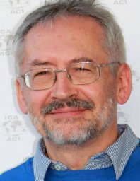 Miljenko Lapaine合作论文数University of Zagreb3samir ahmetovic合作论文数2
 Baldo Stancic合作论文数Fac Geodesy, Univ Zagreb2
 Rok Kamnik合作论文数Fac Civil Engn Transportat Engn & Architecture, Univ Maribor2
 Thomas Wunderlich合作论文数Department of Civil, Geo and Environmental Engineering, Technische Universitat Munchen2
 Damir Medak合作论文数University of Zagreb;Faculty of Geodesy;Department of Geomatics;Faculty of Geodesy, University of Zagreb2Miroslav Premrov合作论文数2Miroslav Kuburic合作论文数1
 Mario Mađer合作论文数Fac Geodesy, Univ Zagreb1
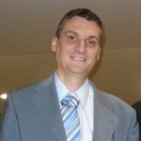 Nikola Vučić合作论文数State Geodetic Administration1
 Goran Cirovic合作论文数1




