The continental ice sheet, particularly that of Antarctica, is recognized as a critical component of the global climate system, with its subglacial topography understood to exert a fundamental control on ice dynamics and stability. However, the sparse and uneven distribution of measurement-derived data across the continent presents substantial challenges to achieving high-resolution and reliable bed topography reconstructions. Although a range of reconstruction approaches have been proposed to generate detailed terrain, their performance remains constrained in regions with large spacing between radar survey lines, often resulting in artifacts or structural inconsistencies. To address this, a novel deep learning framework integrating terrain inpainting and super-resolution strategies is proposed, termed InpaintSR. Large-scale terrain structures are first recovered through low-resolution inpainting guided by geomorphological priors and spatial continuity, and then refined through a super-resolution process to enhance local details via high-resolution texture learning. When validated in the Gamburtsev Subglacial Mountains and Princess Elizabeth Land, InpaintSR is demonstrated to preserve geomorphic integrity and reconstruct fine-scale landforms more effectively than existing approaches. By adopting this method, a 250m resolution subglacial digital elevation model of PEL, the highest-resolution product yet developed for the region, was generated. With this product, the irregular morphology of Qilin Subglacial Lake is clearly delineated, and a series of previously unmapped canyon systems is newly revealed.
Heat flow is an important parameter reflecting the thermal structure of the Earth's interior and a key indicator of geothermal resource potential. Mexico lies at the tectonic intersection of the Pacific Ring of Fire and holds potential for geothermal energy exploration. Existing studies primarily use traditional interpolation methods, magnetic data inversion, or similarity methods for regional heat flow estimation. However, these approaches are limited by sparse and unevenly distributed data as well as crustal complexities, resulting in difficulties in capturing detailed spatial heterogeneity of heat flow. To accurately predict the surface heat flow distribution in the Mexico region, this study proposes an integrated framework combining two-stage feature selection and a cascaded machine learning model. First, a compact and informative feature set was constructed using a two-stage selection process that integrates correlation analysis and modeling-based evaluation. The selected features include lithosphere-asthenosphere boundary (LAB) depth, gravity mean curvature, 230 km shear wave velocity, 300 km shear wave velocity, topography (elevation), distance to ridge, and distance to volcano. Subsequently, an initial heat flow prediction was generated using a Random Forest (RF) model based on this feature set. Finally, both the initial prediction and the selected features were jointly input into an Extreme Gradient Boosting (XGBoost) model for further learning, resulting in a more accurate heat flow estimation. A 0.5 degrees x 0.5 degrees resolution heat flow distribution map of Mexico was generated based on key geological features. The map reveals that Mexico's heat flow exhibits a spatial distribution characterized by high values in the west and low values in the east, with extreme values located along volcanic belts. High heat flow concentrates in central-southern Mexico and the Gulf of California coast; low values occur along the south Pacific coast, southern Gulf of Mexico, and Yucatan Peninsula.
Heat flow is a key parameter for revealing the Earth's internal structure and the distribution of geothermal resources, playing a crucial role in geoscientific research and resource assessment. Current heat flow prediction typically relies on statistical regression or machine learning methods, which model and estimate heat flow by uncovering its relationships with geological and geophysical features. However, the existing studies still face two core challenges: first, key modeling features generally suffer from low spatial resolution at the global scale, which limits the resolution of heat flow predictions; second, current machine learning methods often exhibit insufficient feature extraction and generalization capabilities under limited data conditions. To address these issues, various high-resolution geological feature data were systematically integrated and analyzed, and a geographic-climatic proximity feature combination (GeoClimaProx) was proposed to balance effectiveness with accessibility. In addition, the tabular prior-data fitted network (TabPFN), an advanced tabular foundation model characterized by strong feature extraction and generalization capabilities, is introduced to enhance the performance of continental heat flow prediction. To validate the effectiveness of the proposed approach, comparative experiments were conducted at multiple spatial resolutions. The results demonstrate that GeoClimaProx outperforms traditional feature combinations, contributing to improved accuracy and spatial resolution in heat flow prediction, and TabPFN exhibits superior generalization ability and higher predictive accuracy across various spatial resolutions and training data sizes. GeoClimaProx and TabPFN provide a novel technical pathway for accurate heat flow prediction using only easily accessible surface observations and tectonic distance features. Based on them, the first 0.2 degrees resolution heat flow map covering global continental regions is constructed, improving the spatial resolution of heat flow modeling, which means the beginning of fine-scale modeling of continental heat flow at the global scale. The code, datasets, and resulting data products are publicly available at https://github.com/zhang152267/GCHF to facilitate reproducibility.
The ongoing accumulation of radio-echo sounding (RES) measurements in Antarctica in recent years has significantly expanded our understanding of subglacial structures. The effective use of RES-collected data construct accurate Antarctic subglacial topography has emerged as a vital component of contemporary polar research. Various methods, including conventional interpolation, inversion techniques, and even deep learning methods, have been used to recreate Antarctic bed topography. However, these bed topographies are often plagued by over-smoothing, loss of small-scale features, low precision, and instability. The Siamese topographic generation model (STGM) is proposed here to address the above mentioned issues. After being trained on ArcticDEM, this model can generate Antarctic subglacial topography with stability and accuracy by merging the advantages of deep learning-based generative models, Siamese networks, kernel prediction, and deformable convolutions. In terms of evaluation, both quantitative and qualitative comparisons with current Antarctic subglacial digital elevation models demonstrate that our method can generate topographical features, such as mountains, ice streams, and valleys, with high precision and minimal artifacts. In quantitative validation, our model achieves over 20% improvement in both Mean Absolute Error (MAE) and Root Mean Square Error (RMSE) compared to the previously best-performing method (GEI), surpassing existing models in terms of accuracy and detail. Moreover, an error analysis specifically focusing on the effect of varying track intervals has been conducted, offering a benchmark for future investigations into the influence of track density on model errors. Finally, using STGM based on the RES data, the subglacial topography of Princess Elizabeth Land has also been successfully generated. In this area, the topography generated by STGM at a resolution of 500 m clearly depicts subglacial lakes and valleys, revealing the complexity and diversity of the subglacial topography.
Tongue diagnosis is one of the critical clinical diagnostic methods of Traditional Chinese Medicine, which has a long history. Tongue crack, as a clinical manifestation of tongue diagnosis, is closely related to diseases associated with the spleen and stomach. Hitherto, there have been several studies on tongue crack, among which, however, there are limited works focused on pixel-level classification, ending up with low segmentation accuracy. To solve this problem, a network called DSPR-DoubleU-Net is proposed by integrating the Position Attention Module (PAM), the Spatial Pyramid Pooling module (SPP), the residual structure, the Style-based Recalibration Module (SRM) and the DoubleU-Net, so that the network can extract richer contextual information. Several experiments are conducted on our constructed dataset which contains 351 sets of cracked tongue and non-cracked tongue images to demonstrate the network's effectiveness. The result shows that the proposed network can not only classify the cracked tongue and non-cracked tongue at the image level accurately but also segment the crack's edges more precisely than the other excellent general-purpose segmentation networks and state-of-the-art crack segmentation networks.
Heat flow is an essential indicator of Earth’s internal thermal evolution and is critical in tectonic activity analysis and geothermal resource evaluation. However, global heat flow measurements are sparse and unevenly distributed, posing significant challenges for accurate prediction. Existing methods aim to predict heat flow distribution by modeling the relationship between other geological features and heat flow. However, they fail to fully capture the spatial relationships among neighboring geographic features, thereby limiting the effective utilization of spatial information. To address these limitations, this study introduces an innovative approach that integrates computer vision techniques into heat flow prediction, proposing a feature mapping method and developing an end-to-end framework named DeepHFMap. Geological features and heat flow sequences are transformed into image-like structures based on latitude and longitude coordinates, with heat flow values from nearby target points incorporated as prompts to guide the model’s learning process, thereby enhancing the model’s understanding of spatial relationships. An encoder-decoder architecture integrated with a channel attention mechanism is used to optimize feature extraction and weighting, significantly improving prediction accuracy and robustness. Experimental results in the United States, Asia, and Europe demonstrate that DeepHFMap significantly outperforms existing methods, effectively capturing spatial correlations among neighboring features and offering a novel solution for heat flow prediction under sparse measurement conditions. Furthermore, in regions with high, medium, and low heat flow, DeepHFMap reduces the Mean Absolute Error (MAE) by 0.92, 0.83, and 1.45, respectively, compared to the second-best performing method. The source codes are available for downloading at the https://github.com/zhang152267/DeepHFMap .
HyperSpectral Image (HSI) classification methods based on limited labeled samples have made significant progress in recent years. However, due to the specificity of hyperspectral images, redundant information and limited labeled samples pose great challenges for extracting highly discriminative features. In addition, owing to the uneven distribution of pixels in each category, how to strengthen the role of central pixels and attenuate the negative impact of surrounding pixels with different categories is also the key to improve the classification performance. To overcome the above limitations, an HSI classification method based on Multi-Scale Asymmetric Dense Network (MS-ADNet) is proposed. Firstly, a multi-scale sample construction module is proposed, which extracts multiple scale patches around each pixel and performs deconvolution and stitching to construct multiscale input samples that contain both detailed structural regions and large homogeneous regions. Next, an asymmetric densely connected structure is proposed to achieve kernel skeleton enhancement in joint spatial and spectral feature extraction, i.e., enhancement of features extracted from the central cross-skeleton portion of a square convolutional kernel, which effectively facilitates feature reuse. Moreover, to improve the discriminability of spectral features, a streamlined element spectral attention mechanism is proposed and placed at the front and back ends of the densely connected network. With only five samples per class used for network training, the proposed method achieves competitive classification results with overall accuracies of 77.66%, 84.54%, and 92.39% on the Indiana Pines, Pavia University, and Salinas datasets, respectively.
Background: As an important part of the tongue, the tongue coating is closely associated with different disorders and has major diagnostic benefits. This study aims to construct a neural network model that can perform complex tongue coating segmentation. This addresses the issue of tongue coating segmentation in intelligent tongue diagnosis automation. Method: This work proposes an improved TransUNet to segment the tongue coating. We introduced a transformer as a self-attention mechanism to capture the semantic information in the high-level features of the encoder. At the same time, the subtraction feature pyramid (SFP) and visual regional enhancer (VRE) were constructed to minimize the redundant information transmitted by skip connections and improve the spatial detail information in the low-level features of the encoder. Results: Comparative and ablation experimental findings indicate that our model has an accuracy of 96.36%, a precision of 96.26%, a dice of 96.76%, a recall of 97.43%, and an IoU of 93.81%. Unlike the reference model, our model achieves the best segmentation effect. Conclusion: The improved TransUNet proposed here can achieve precise segmentation of complex tongue images. This provides an effective technique for the automatic extraction in images of the tongue coating, contributing to the automation and accuracy of tongue diagnosis.
Hyperspectral images (HSIs) can reflect the spectral characteristics of objects in multiple bands, which can be used in various tasks, including classification, material detection and identification, and geological exploration. However, due to hardware limitations, spatial data have commonly been partially discarded to obtain more spectral information. Therefore, the enhancement of spatial resolution is often contemplated through the application of super-resolution algorithms. In view of this, this study proposes a diffusion model-assisted multi-scale spectral attention network (DMSANet) to increase the HSI resolution in the spatial dimension while preserving spectral information as much as possible. For the first time, a diffusion model is combined with deep networks to solve the HSI super-resolution problem, which enhances the spatial texture details of the output image using a layer-by-layer super-resolution mechanism of Markov chains. In addition, a multi-scale attention block that can integrate multiple receptive fields to extract spectral features of HSIs is designed, which enhances spectral information details. Extensive evaluations and comparisons on three benchmark datasets demonstrate that the proposed DMSANet can achieve superior performance compared with the existing methods.
Classification of transparent materials with various roughness types has been widely used in the field of computer vision. However, the surface roughness of a transparent material affects the extraction effect of classification features, thus affecting the performance of transparent material classification. In this study, a classification method of transparent materials with various surface roughness types and transparencies, which uses the microfacet shape factor, reflectivity, and transmissivity as classification characteristics, is proposed. First, a transparent material feature extraction method based on microfacet distribution function is proposed for the first time, and the microfacet shape factor, reflectivity, and transmissivity are extracted by our model as classification features. The microfacet distribution model ground glass unknown is combined with the time-of-flight imaging model to achieve an accurate classification of surfaces with various roughness types. Then, according to the nonlinear and discrete characteristics of data, an appropriate classifier is selected to realize the transparent material classification. The transparent material classification experiments are performed using four types of material appearances, and the proposed method is compared with the methods of Shim et al. and Lang et al. The average classification accuracy of the proposed method for the transparent materials with four material appearances is 92.62
Understanding subglacial bed topography is essential for learning about Antarctica in the geologic and glaciological fields. The primary method of investigating the Antarctic bed involves measuring the bed elevation by radio-echo sounding (RES) deployed on aircraft. Digital elevation models (DEMs) of the Antarctic bed generated by traditional interpolation methods usually lack resolution, precision, and roughness. To generate Antarctic bed DEMs by interpolating sparse RES bed elevation data, we use a two-stage coarse-to-fine fully convolutional neural network (CNN), which presents a deep generative elevation inpainting method that can extract, use in-depth features, and reconstruct the bed elevation conforming to the textural character of deglacial landscapes. Our method can generate a detailed and reasonable bed DEM with the full calculation of CNN and the training strategy of a generative adversarial network (GAN). The quantitative evaluation results show that a 250-m resolution elevation grid map with a 77-m mean absolute error (MAE) can be generated through elevation inpainting by sparse data with 4-km RES survey spacing in the Arctic test area. Our study also generates two realistic bed DEMs with a 250-m spatial resolution in the Gamburtsev Subglacial Mountains and Amundsen Sea Embayment. Compared with the existing Antarctic bed DEM products, BedMachine_Antarctica, DeepBedMap_DEM, and MB_DeepBedMap_DEM, our generated bed DEMs show more realistic terrain and elevation with low MAEs in test regions, which could better suit follow-up glaciological research. The code of this work will be available at https://github.com/Hecian/GEI_2022 for the sake of reproducibility.
目的:基于数字图像处理技术探讨针刺治疗阈下抑郁的舌象变化及临床疗效.方法:选择就诊于北京中医药大学第三附属医院门诊的阈下抑郁患者50例,最终共48例完成观察(脱落2例),采用自身前后对照的方法,给予颐神调气法针刺治疗,留针30 min,隔日1次,共治疗4周.采用TFDA-1型舌诊仪采集患者治疗前后的舌象,分析舌色、舌苔在RGB、Lab、HSV 3种颜色空间下的9种特征的变化规律,并通过评测蒙哥马利抑郁量表(montgomery depression scale,MADRS)的评分观察针刺的临床疗效.结果:治疗4周后,舌色分析显示:在不同颜色空间中,舌色R、a、S、V值较治疗前明显升高(P<0.05),提示舌色在针刺治疗后明显红润、明亮;舌苔分析显示:在不同颜色空间中,舌苔R、a、H、S、V值治疗后明显升高(P<0.05),提示经治疗后舌苔由厚变薄,舌苔颜色无明显变化;蒙哥马利抑郁量表评分显著低于治疗前(P<0.01),有效率为81.25%.结论:针刺治疗阈下抑郁具有良好的临床疗效,并可通过分析治疗前后舌色、舌苔客观化指标的明显变化得到验证.
Weakly supervised video anomaly detection (WS-VAD) is often formulated as a multiple instance learning (MIL) problem. Snippet-level anomaly scores can be predicted using only video-level annotations, but most MIL approaches focus on improving the performance of the feature learning network and ignore the method design of the preprocessing stage. MIL-based methods usually preprocess videos of different lengths into a predefined number of snippets for later anomaly identification. This is impractical for real-world videos of varying lengths when the duration of anomalous events is unknown in training. Data with different temporal resolutions generated by this division confuses the network and leads to limited detection capability. To address this issue, we propose a novel WS-VAD method. First, a temporal resolution feature mapping module (TRFM) improves the network's learning ability for input data with different temporal resolutions by mapping the temporal resolution information into the feature learning space. We also introduce a gated recurrent unit (GRU)-based multi-scale temporal feature learning module (MS-GRU), combining GRUs with multi-scale convolutional structures and fusing features recursively at different time scales. This module exploits the ability of GRUs to extract temporal information and compensates for the fact that GRUs only extract single-scale temporal dependence. In addition, we propose the Adaptive-k module to optimize the original Top-k loss and increase flexibility in training by using the optimal number of anomalous segments k generated according to the different inputs. This approach is fully applicable to real-world videos of various lengths. Experimental results show that our model boosts the detection accuracy for data with enormous differences in temporal resolution and obtains state-of-the-art frame-level AUC performance on three real-world surveillance datasets: UCF-Crime, ShanghaiTech and XD-violence datasets.
Highly transparent material classification can play an important role in the field of computer vision to classify glass or plastics for recycling and for home service robots to recognize transparent material. In these areas, there is a need to classify materials that are more than 73% transparent, but current transparent material classification methods cannot classify materials with full transparency levels. This paper proposes a highly transparent material classification method based on the refractive index, reflectivity, and transmissivity features from an imaging model of a time-of-flight (ToF) camera as the classification feature. First, we use the ToF camera to collect the depth and light intensity of the transparent material, as well as the scene information. The acquisition depth is distorted owing to the material characteristics of transparent materials. Second, we estimate the refractive index, reflectance, and transmittance from the depth distortion and IR (infrared rays) image. Finally, we choose a classifier that conforms to the nonlinear characteristics of the data to achieve transparent material classification. The method’s classification accuracy reached 94.1% in an experiment, indicating that our method considers the unique phenomenon of highly transparent materials reflecting against the background, incorporates this phenomenon into the ToF distance model, it can extract material features that express the characteristics of highly transparent materials, making it applicable to the classification of transparent materials at all levels of transparency.
The classification of materials is a research hotspot. These methods generally focus on the classification of flat materials and do not consider the influence of polishing and convex surfaces. We develop a classification algorithm of polishing and convex surface objects, and derive the photon accumulation point spread function (PAPSF) of material from the imaging model of a binocular pulsed time-of-flight (ToF) camera as the classification feature, which consists of depth distortion, the indirect reflection photon cumulant and the indirect reflection photon cumulant. We design a one-versus-all support vector machine (SVM) classifier to classify materials of polishing and convex surfaces objects. We conduct classification experiments on four plastics and four metal materials with a similar appearance. Our method in flat and raw material classification has the same classification accuracy as the latest method based on a continuous-wave- modulation ToF camera, but also our method achieved accuracies of 91.0% in flat and polishing material classification, 93.0% in different convex surface and fixed polishing material classification, 91.5% in fixed convex surface and different polishing material classification and 90.2% in polishing and convex surface material classification.
Bed topography and roughness play important roles in numerous ice-sheet analyses. Although the coverage of ice-penetrating radar measurements has vastly increased over recent decades, significant data gaps remain in certain areas of subglacial topography and need interpolation. However, the bed topography generated by interpolation such as kriging and mass conservation is generally smooth at small scales, lacking topographic features important for sub-kilometer roughness. DeepBedMap, a deep learning method combined with multiple surface observation inputs, can generate high-resolution (250 m) bed topography with realistic bed roughness but produces some unrealistic artifacts and higher bed elevation values in certain regions, which could bias ice-sheet models. To address these issues, we present MB_DeepBedMap, a multi-branch deep learning method to generate more realistic bed topography. The model improves upon DeepBedMap by separating inputs into two groups using a multi-branch network structure according to their characteristics, rather than fusing all inputs at an early stage, to reduce artifacts in the generated topography caused by earlier fusion of inputs. A direct upsampling branch preserves large-scale subglacial landforms while generating high-resolution bed topography. We use MB_DeepBedMap to generate a high-resolution (250 m) bed elevation grid product of Antarctica, MB_DeepBedMap_DEM, which can be used in high-resolution ice-sheet modeling studies. Moreover, we test the performance of MB_DeepBedMap model in Thwaites Glacier, Gamburtsev Subglacial Mountains, and several other regions, by comparing the qualitative topographic features and quantitative errors of MB_DeepBedMap, BEDMAP2, BedMachine Antarctica, and DeepBedMap. The results show that MB_DeepBedMap can provide more realistic small-scale topographic features and roughness compared to BEDMAP2, BedMachine Antarctica, and DeepBedMap.
Hyperspectral images (HSIs) contain spatial features and rich spectral features that provide them with great advantages in target classification and make it easy to improve image classification accuracy. Convolutional neural networks (CNNs) have shown good performance in HSI classification. However, blindly increasing the depth of the CNNs may lead to overfitting. A HSI classification method based on a dense multi-scale residual network is proposed to address these two problems. The proposed framework obtains the spectral-spatial characteristics of HSIs through an improved multi-scale residual network. Then, three cascaded multi-scale residual modules form a deep network. The dense connection module is used to stack feature maps from all previous layers to form the concatenate feature map rather than fusing pixels of these feature maps and further achieve the purpose of improving classification accuracy and reducing the time consumption of the network. A series of experiments show that the proposed method achieves good experimental results on three widely used hyperspectral datasets and a new hyperspectral dataset (Farmland distribution dataset, FDD).
Hyperspectral image (HSI) classification is a procedure of interest in remote sensing. HSIs contain complex spectral and spatial information, so classification tasks remain difficult. Although current deep-learning models have made significant progress in HSI classification, dealing with spectral and spatial information still requires careful investigation. To better manage spectral and spatial information and improve classification accuracy, we introduce a multiscale residual weakly dense network with an attention mechanism. First, we designed two residual weakly dense (Res-WDens) branches to extract spectral and spatial feature information and then applied the Concat method to fuse the two kinds of information. We also designed a plug-and-play hybrid attention module to refine the fused information so the network could focus on the essential spectral and spatial features. Finally, considering the relevance of spectral and spatial information, a dual-channel multiscale feature extraction module was used to extract the spectral-spatial multiscale information of HSIs. The overall accuracies of our proposed method reached 99.76%, 99.97%, and 100% on three publicly available datasets. A series of experiments demonstrated that our method is comparable to current state-of-the-art methods. (C) 2022 Society of Photo-Optical Instrumentation Engineers (SPIE)
在创新性教学理念下,从培养有创新意识、有个性、有特长的新型人才角度出发,完成了嵌入式系统实验课程建设,包括多层次的实验教学内容设计、灵活多样的实验教学平台建设、多元化的教学模式设置,以及全过程教学评价体系构建.改革后的实验课程充分调动了学生学习的积极性,提高了学生的创新实践能力,并为相关课程的教学改革提供了清晰、丰富、有价值的参考.
Antarctica bed Digital Elevation Model (250 m spatial resolution) in GeoTiff format, using Antarctic Polar Stereographic Projection (EPSG:3031).
 Xinfeng Zhang (张新峰)合作论文数Information Department, Beijing University of Technology31
 Shinan Lang (稂时楠)合作论文数Faculty of Information Technology, Beijing University of Technology27
 Lansun Shen (沈兰荪)合作论文数Signal & Information Processing Lab,Beijing University of Technology27
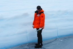 Cui Xiangbin合作论文数Department of Earth Science, Zhejiang University13
 Xurong Gao合作论文数11Changjiang Liu合作论文数11Nan SHENG (盛楠)合作论文数10Shaobin HU (胡绍斌)合作论文数9
 Changyan Qiu合作论文数9Yize Cui合作论文数9Jiaqi Liu合作论文数Beijing Univ Technol, Coll Informat & Commun Engn, Beijing 100124, Peoples R China8
 Baoguo Wei (卫保国)合作论文数School of Electronics and Information, Northwestern Polytechnical University8
 Dan Liu合作论文数7XiaoZhao Xu合作论文数7
 Jin Xie (谢晋)合作论文数School of Intelligence Science and Technology, Nanjing University7Changfei Zhan (詹昌飞)合作论文数6Jingxian Yang合作论文数6Meiling Cao (曹美玲)合作论文数6
 Fuxing Wan合作论文数5
 Zijun Yao 0004合作论文数5Qiang Wu (吴强)合作论文数Beijing University of Technology5Xueyan Wang合作论文数4Xinran Kong合作论文数4Guangqin Hu (胡广芹)合作论文数Beijing University of Technology4
 Ben Xu合作论文数3Song GUO (郭松)合作论文数3LinLin Zhang (张琳琳)合作论文数3
 Li Zhuo (卓力)合作论文数Faculty of Information Technology, Beijing University of Technology;College of Metropolitan Transportation, Beijing University of Technology3Shuai Wen (文帅)合作论文数3
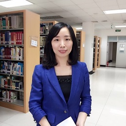 Jing Guan (关静)合作论文数School of Traditional Chinese Medicine, Beijing University of Chinese Medicine3
 Xiaomin Liu (刘晓民)合作论文数Beijing University of Technology3Kaiqi He (何楷祺)合作论文数2
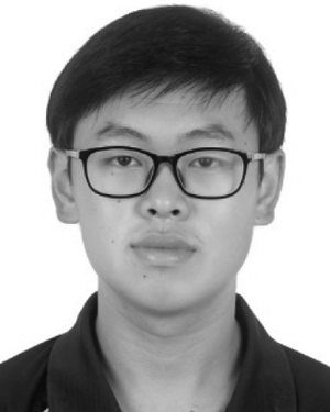 Yanliang He合作论文数2Yazhen Wang合作论文数2Jizhong Zhang合作论文数2Jie MA (马杰)合作论文数2XiaoYing Dong (董晓英)合作论文数2HuaMin Chen (陈华敏)合作论文数2
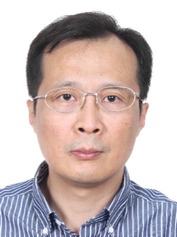 Bo Sun (孙波)合作论文数Institute of Soil Science, Chinese Academy of Sciences2Huijuan Lv合作论文数2Meijuan Ma合作论文数2
 Martin Siegert合作论文数University of Exeter;The Grantham Institute for Climate Change, Faculty of Natural Sciences, Imperial College London;School of Geosciences, University of Edinburgh2Yue He (何岳)合作论文数2Kai Song (宋恺)合作论文数2
 Kebin Jia (贾克斌)合作论文数Faculty of Information Technology, Beijing University of Technology2Yanqing Wang合作论文数Nanchang University, Nanchang University2
 Xiaojun Liu (刘小军)合作论文数Aerospace Information Research Institute, Chinese Academy of Sciences2
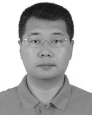 Jingxue Guo合作论文数2




