Saft America, inc. Space and Defense Division (SDD), located in Cockeysville, Maryland, is the world leader in providing state of the art lithium ion systems for the demanding defense and space markets. Saft has been manufacturing batteries at its facility in Cockeysville for over 26 years. The major focus of the facility today is large format high power lithium ion cells and battery systems for defense applications. Saft SDD has been developing lithium ion cells and batteries since 1993. Recent efforts have focused on the industrialization of the technology for use in military hybrid vehicles. Since 2004 Saft SDD has been developing US based manufacturing capability of the entire cell and battery manufacturing processes. This effort is focused under the ManTech program with TARDEC. Overall goals of the program are aimed at improving the technology readiness to support the production of military hybrid vehicles, with areas of focus on improved performance, reliability, manufacturability, and overall cost. Efforts to date have yielded improvements in performance, reliability, and cost. Advances have been realized for improving the power and cold temperature performance of the high power cells. Power in excess of 20kW/kg has been realized. The improved power performance from the cells improves their use in hybrid vehicles by improving the overall energy efficiency of energy storage. Power efficiencies in excess of 95% have been demonstrated for typical hybrid vehicle duty cycles. Operation at temperature less than -40°C has also been tested. Operational improvements and design activities, with an emphasis on manufacturability, have led to a lean production operation for the electrode, cell, and battery manufacturing activities. These efforts have led to a dramatic reduction in cell cost since 2004. These products are offered as complete battery systems, fully design and manufactured and Saft SDD.
Saft America, inc. Space and Defense Division (SDD), located in Cockeysville, Maryland, is the world leader in providing state of the art Li-ion systems for the demanding defense and space markets. Recent efforts have focused on the industrialization of the technology. Since 2004 Saft SDD has been developing a higher volume manufacturing capability of the entire cell and battery manufacturing processes. This effort is focused under two ManTech programs. The Army ManTech Program with TARDEC focuses on high power batteries for use in military ground vehicles. The USAF ManTech Program with AFRL focuses on ultra high power cells for use in aviation batteries. The goals of both programs are to industrialize the high performance technology so that they are available to the military as reliable products at an affordable cost, while improving the technology. Efforts to date have yielded improvements in performance, reliability, and cost. Advances have been realized for improving the power and cold temperature performance of the high power cells. Power in excess of 20kW/kg has been realized. The improved power performance from the cells improves the overall efficiency of the energy storage system. Power efficiencies in excess of 95% have been demonstrated for typical military hybrid vehicle duty cycles of 150A continuous cycling. This high power efficiency allows for low heat generation in a large battery system, with less than 800W of heat generation for a 400V hybrid vehicle battery pack. Storage and operation at demanding temperature extremes has also been developed and industrialized. Operation at temperature less than -40°C has also been successfully demonstrated and high temperature stability has also been improved. Plant operational improvements and design activities, with an emphasis on manufacturability, have led to a lean production operation for the electrode, cell, and battery manufacturing activities. These efforts have led to a dramatic reduction in cell cost since 2004, resulting in a large cost avoidance to the military.
The collision of ships with whales can result in serious injury or death of the animal.This is particularly concerning for endangered species such as the North Atlantic right whale.Although speed reduction policies have been developed and implemented, simple considerations suggest that other factors, such as ship mass and prow shape, should also be taken into account.An R package called whalestrike has been developed to address such issues.It was used by Kelley et al. (2021) in the development of a biomechanically based criterion for the lethality of ship strikes, but this was just a starting point.The next step, and goal of the present paper, is to introduce the model code to a broader community, encouraging its use and development by diverse researchers and policy makers.
Oceanographic field experiments often employ a suite of instrument types, each reporting data in a different format. Many of these formats are complex and difficult to decode. Manufacturers usually provide software for accessing data produced by their instruments, but it is usually proprietary and closed-source, making it difficult for researchers to analyse their data in novel ways or to combine data from multiple instruments. The oce package (Kelley, Richards, & Layton, 2021) addresses such issues in the R language1 with functions that handle dozens of data formats. It also has facilities for the specialized calculations and data displays that are particular to oceanography. Since oce is written in the R language (Ihaka & Gentleman, 1996; R Core Team, 2021), it forms a link to a vast array of general tools that oceanographers use in their work (Kelley, 2018).
This paper describes argodata, an R package that makes it easier to work with data acquired in the International Argo Program, which provides over two decades of oceanographic measurements from around the world. Although Argo data are publicly available in NetCDF format and several software packages are available to assist in locating and downloading relevant Argo data, the multidimensional arrays used can be difficult to understand for non-oceanographers, particulary for the expanding arrays of biogeochemical variables measured by Argo floats. Given the increasing use of Argo data in other disciplines, we built a minimal interface to the data set that uses the data frame as the primary data structure. This approach allows users to leverage the rich ecosystem of R packages that manipulate data frames (e.g., the tidyverse) and associated instructional resources.
Studies of ship strikes on whales often focus on large vessels (>20 m), with attention to their speeds and the resulting risk of lethality. Smaller coastal vessels also co-occur with whales, resulting in collisions that merit study. To cast light on injuries caused by vessels of all sizes, we used knowledge of right whale anatomy and Newtonian mechanics to construct simple models that predict the mechanical stresses experienced by whales during collisions. By comparing our predictions with published models and with data from ship strikes on various whale species, we developed a model for lethal injury as a function of several vessel and whale properties, finding that collisions that create stresses in excess of 0.241 MPa were likely to cause lethal injuries to large whales. Furthermore, this model has revealed that (1) vessels of all sizes can yield stresses higher than this critical level, and (2) large vessels produce stresses much larger than this even when travelling at reduced speeds (i.e., 10 knots). The model is fast enough to power an interactive GUI-based tool (in R) and flexible enough to simulate strikes by vessels of different masses and speeds upon whales of different species, sizes, and physical conditions.
An R package named argoFloats has been developed to facilitate identifying, downloading, caching, and analyzing oceanographic data collected by Argo profiling floats. The analysis phase benefits from close connections between argoFloats and the oce package, which is likely to be familiar to those who already use R for the analysis of oceanographic data of other kinds. This paper outlines how to use argoFloats to accomplish some everyday tasks that are particular to Argo data, ranging from downloading data and finding subsets to handling quality control and producing a variety of diagnostic plots. The benefits of the R environment are sketched in the examples, and also in some notes on the future of the argoFloats package.
The oce package makes it easy to read, summarize and plot data from a variety of Oceanographic instruments, isolating the researcher from the quirky data formats that are common in this eld. It also provides functions for working with basic seawater properties such as the equation of state, and with derived quantities such as the buoyancy frequency. Although simple enough to be used in a teaching context, oce is powerful enough for a research setting. These things are illustrated here, in the context of some practical examples. Worked examples are provided, in order to help readers take early steps towards using the oce package in their research.
To address a need for science-based advice on issues of resource exploration, two oceanographic moorings were placed on the abyssal slope of northwest Flemish Cap from July 2013 to July 2014. These yielded some of the first long-term moored measurements of velocity, temperature, and salinity in the region. Hydrographic and lowered-ADCP measurements made during mooring deployment and recovery reveal that the deep Labrador Current flows approximately along isobaths between water depths of 1,200 and 2,200 m. However, these snapshots differ significantly, with stronger currents observed during the deployment survey. The mooring data, obtained near the 1,500 m isobath, reveal a complex temporal variation of the current. The velocity spectrum is dominated by a peak at a period of approximately 21 days, with power increasing with depth in the water column and varying through the year. In other boundary-current studies, variations in the several-week band have been attributed to baroclinic topographic Rossby waves, but with just two widely spaced moorings, we cannot infer the wave number and test for such waves using the dispersion relationship. However, an indirect estimate of wave number can be made by examining the variation of spectral power with depth, and doing this yields results that are reasonably consistent with a linear theory of baroclinic topographic Rossby waves for water of constant stratification over a planar slope. This agreement is somewhat surprising, given the simplicity of the theory and the complexity of the domain, but it appears to offer a clear indication of the importance of baroclinic vorticity dynamics in this region.
Laser-based spectroscopic techniques, such as cavity ring-down spectroscopy (CRDS), provide a new, cost effective and more widely available approach to measure the oxygen isotope ratio in water molecules, (H2O)-O-18/(H2O)-O-16 (delta O-18), and are used increasingly to measure O-18 in the world's oceans. Here, we present results from an interlaboratory comparison designed to evaluate the quality of CRDS-derived measurements, and their consistency with values measured by isotope ratio mass spectrometry (IRMS). We also discuss the influence of salt on instrument performance and sample throughput for the analysis of seawater samples. This study compared measurements of delta O-18 from natural samples with a wide range of salinities (0, 29.4, and 34.6) performed by four independent labs: two using CRDS and two using IRMS. We also compared delta O-18 measurements of Northeast Atlantic Deep Water collected in 2013, 2012, 2009, and 1995 from the AR7W repeat hydrography transect across the Labrador Sea. The within-lab precision of ocean-based CRDS measurements is seen to approach 0.03 parts per thousand, which is better than the manufacturer's typically stated analytical precision (around +/- 0.05 parts per thousand), and comparable to that achievable with IRMS. The interlaboratory differences of measurements (highest-lowest) reported by the four labs is taken as an indicator of overall accuracy, and is estimated conservatively as being<0.1 parts per thousand, with the potential to approach 0.05 parts per thousand. Overall, these results show that CRDS based O-18 measurements of seawater can be equivalent to high-quality measurements by IRMS.
Laser‐based spectroscopic techniques, such as cavity ring‐down spectroscopy (CRDS), provide a new, cost effective and more widely available approach to measure the oxygen isotope ratio in water molecules, 18 O/ 16 O (δ 18 O), and are used increasingly to measure δ 18 O in the world's oceans. Here, we present results from an interlaboratory comparison designed to evaluate the quality of CRDS‐derived measurements, and their consistency with values measured by isotope ratio mass spectrometry (IRMS). We also discuss the influence of salt on instrument performance and sample throughput for the analysis of seawater samples. This study compared measurements of δ 18 O from natural samples with a wide range of salinities (0, 29.4, and 34.6) performed by four independent labs: two using CRDS and two using IRMS. We also compared δ 18 O measurements of Northeast Atlantic Deep Water collected in 2013, 2012, 2009, and 1995 from the AR7W repeat hydrography transect across the Labrador Sea. The within‐lab precision of ocean‐based CRDS measurements is seen to approach 0.03‰, which is better than the manufacturer's typically stated analytical precision (around +/− 0.05‰), and comparable to that achievable with IRMS. The interlaboratory differences of measurements (highest‐lowest) reported by the four labs is taken as an indicator of overall accuracy, and is estimated conservatively as being < 0.1‰, with the potential to approach 0.05‰. Overall, these results show that CRDS based 18 O measurements of seawater can be equivalent to high‐quality measurements by IRMS.
Double-diffusive convection (DDC) is a phenomenon that can occur in fluids in which buoyancy is affected by two constituents that diffuse at different rates. Many readers of Oceanography magazine will be at least somewhat familiar with the topic of oceanic DDC, probably in the form of “salt fingers” (SF), a variety that can arise when surface waters are warmer and more saline than waters below, as is the case in broad reaches of the ocean, especially in the subtropics. A second variety, called the "diffusive layering" (DL) mode, requires that the warmer water lie below the cooler water, a common situation at high latitudes. In addition, both SF and DL can exist at the boundaries between interleaving water masses, a situation that can occur anywhere that lateral gradients of temperature and salinity occur. Thus, many areas of the ocean appear to be susceptible to DDC, and observations suggest that DDC is commonly present in such regions, especially if background turbulence is relatively low. This would be a mere curiosity but for the fact that the divergence of DDC-mediated fluxes may be large enough to have significant effects on the background system.
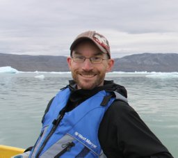 Clark Richards合作论文数12
 Daniel Bourgault合作论文数Institut des Sciences de le Mer de Rimouski, Université du Québec à Rimouski8
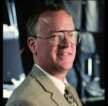 Marlon Lewis (马龙·刘易斯)合作论文数Department of Oceanography, Faculty of Science, Dalhousie University5
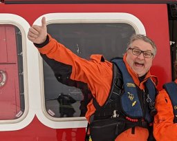 Peter S Galbraith合作论文数Direction des Sciences Océaniques;Ministère des Pêches et des Océans;Institut Maurice;Ministère des Pêches et des Océans, Institut Maurice-Lamontagne5Brian D. May合作论文数5
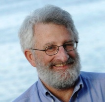 John Cullen合作论文数Department of Oceanography, Faculty of Science, Dalhousie University3Kamen Nechev合作论文数3Chantelle Layton合作论文数2
 Elizabeth Kerrigan合作论文数Dalhousie Univ2Jaimie Harbin合作论文数2W. Abdi合作论文数2
 Peter Bandettini合作论文数Laboratory of Brain and Cognition, National Institute of Mental Health2
 Susanne Craig合作论文数Department of Physics and Applied Physics, University of Strathclyde2David Brickman合作论文数2Claire Normandeau合作论文数2
 Rasmus Birn合作论文数Department of Psychiatry, School of Medicine and Public Health, University of Wisconsin–Madison;Department of Medical Physics, School of Medicine and Public Health, University of Wisconsin–Madison2
 Jennifer L. Mckay合作论文数2Douglas W. R. Wallace合作论文数2
 Peter Schlosser合作论文数Global Institute of Sustainability and Innovation, Arizona State University2
 Ziad S. Saad合作论文数NIMH, NIH2
 Christina Schallenberg合作论文数Department of Oceanography;Dalhousie University;Department of Oceanography, Dalhousie University2u neumeier合作论文数1E Hunke合作论文数1J. M. Hamilton合作论文数1Anita Bhattacharyya合作论文数1K. R. Thompson合作论文数1
 Dewey W. Dunnington合作论文数Dalhousie Univ1
 Mary-Louise Timmermans合作论文数Department of Earth & Planetary, Yale University1
 Moo K. Chung合作论文数Department of Biostatistics & Medical Informatics, University of Wisconsin-Madison;Waisman Laboratory for Brain Imaging and Behavior, University of Wisconsin-Madison1
 Peter Winsor合作论文数School of Fisheries and Ocean Sciences, University of Alaska Fairbanks1Jones, B.合作论文数1
 Don Perovich合作论文数Thayer School of Engineering, Dartmouth College1
 Shubha Sathyendranath合作论文数Remote Sensing Group, Plymouth Marine Laboratory1Jason H. Middleton合作论文数Scripps Institution of Oceanography, La Jolla, CA 92093, U.S.A.1
 Jennifer M. Jackson合作论文数Seismological Laboratory, Division of Geological and Planetary Sciences, California Institute of Technology1
 Richard J. Davidson合作论文数Center for Healthy Minds, Waisman Center, College of Letters & Science, University of Wisconsin-Madison;Department of Psychology, School of Medicine, University of Wisconsin-Madison;Healthy Minds Innovations, Inc.1
 John M. Toole (John Toole)合作论文数Department Physical Oceanography, Woods Hole Oceanographic Institution1Rich Pawlowicz合作论文数Department of Earth, Ocean and Atmospheric Sciences, Faculty of Science, The University of British Columbia1
 Robert C. Newton合作论文数PTX Lab, Department of Earth and Space Sciences, University of California, Los Angeles1
 Ilker Fer合作论文数Bjerknes Centre for Climate Research1
 Tammi L. Richardson合作论文数Marine Science Program, University of South Carolina1
 Jennifer Hutchings合作论文数1
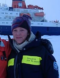 Sally A. Walker合作论文数The Robert Wood Johnson Pharmaceutical Research Institute1
 Daniel Rudnick合作论文数Scripps Institution of Oceanography, University of California, San Diego1M. D. Blokhina合作论文数1
 Blair J.W. Greenan合作论文数1
 Eddy Carmack合作论文数Fisheries and Oceans Canada1
 Scott Ferguson合作论文数Derriford Hospital, University of Dundee1
 Tetjana Ross合作论文数Department of Oceanography, Dalhousie University1




