Ecosystems are changing rapidly because of climate change, and this will have increasing social effects around the globe. We suggest that common social responses to rising novelty are often counterproductive, and we advocate for strategies that also allow for acceptance and adaptation to changes in nature.
Ecological restoration practitioners should have access to relevant science on which to base their plans, and restoration researchers should ground their science in real-world needs — but the gap between science and practice frustrates this integration. Organizations are working to bridge that gap, and practitioners and researchers want to work together, yet specifically what each group needs to effectively collaborate is less clear. We hosted two in-person workshops that brought together ecological restoration practitioners and researchers to investigate the collaboration needs of practitioners and researchers. We conducted two facilitated dialogue-based exercises at RE3 (Reclaim, Restore, Rewild) 2023 conference in Quebec City, Quebec, and two at the Society for Ecological Restoration North American Conference 2024 in Vancouver, British Columbia. We analyzed responses from both events using qualitative coding and extracted six themes (connections, engagement, targets, resources, data and uncertainty) and 23 sub-themes that informed three core needs shared by both researchers and practitioners. The first core need was communication, particularly around project experiences and failures. The second need was tools, suggesting the current landscape of collaborative platforms is insufficient. The third need was greater engagement with adaptive management and goal setting in restoration science and practice. We synthesize the findings from four collaborative exercises and identify future areas to build bridges between restoration research and practice, such as co-training workshops on funding opportunities, which could lead to co-designed actions with mutual value for researchers, practitioners and Indigenous and local communities.
Disturbance is a key driver of heterogeneity in mountain landscapes. Historically, the montane ecoregion (i.e., lower elevations where the climate is typically warmer and drier) in Jasper National Park experienced a mixed-severity fire regime with short fire return intervals. However, fire suppression over the previous century has altered the fire return interval, resulting in a significant increase of homogenous forest cover. These changes contributed to an extensive mountain pine beetle (MPB; Dendroctonus ponderosae) outbreak in the park over the previous decade, which impacted up to 90
Anthropogenic activity has irreparably altered the ecological fabric of Earth. The emergence of ecological novelty from diverse drivers of change is an increasingly challenging dimension of ecosystem restoration. At the same time, the restorationist's tool kit continues to grow, including a variety of powerful and increasingly prevalent technologies. Thus, ecosystem restoration finds itself at the center of intersecting challenges. How should we respond to increasingly common emergence of environmental system states with little or no historical precedent, whilst considering the appropriate deployment of potentially consequential and largely untested interventions that may give rise to organisms, system states, and/or processes that are likewise without historical precedent? We use the term bionovelty to encapsulate these intersecting themes and examine the implications of bionovelty for ecological restoration.
The objective of this article is to present a novel GIS plugin for classifying and georeferencing high‐resolution oblique imagery with the intention of creating landcover datasets for spatial analysis. The Mountain Image Analysis Suite (MIAS) is a newly released plugin for the open‐source software, QGIS. MIAS was developed with images from Mountain Legacy Project, the world's largest systematic collection of high‐resolution mountain images. It works with both grayscale and color imagery, including historical images that predate aerial and satellite imagery. MIAS encompasses four tools for classifying and georeferencing oblique images. The plugin accesses pretrained deep learning models from a PyTorch‐based segmentation network to automate the classification of landcover in oblique images. Monoplotting is accomplished through the construction of a virtual photograph simulating the view from the camera using a shaded relief model. Once the virtual photograph is produced, the user aligns the classified image to the virtual photograph using a set of control points. This allows the creation of a classified and georeferenced raster representing the landcover for the area visible in the original oblique image. Similar workflows to the one contained in MIAS have been used for landcover mapping with oblique images to a high level of accuracy. However, MIAS is the first piece of software to bring all stages of image analysis into a single platform. MIAS has many applications across diverse fields such as mountain research, ecological restoration, community‐based mapping, environmental planning, and more.
Information on restoration science and practice is dispersed across large numbers of scientific papers, reports, books, and other resources, and there is a lack of synthetic approaches and of linkages between ecological theory and practice. With recent calls for scaling up ecological restoration, there is an urgent need for improving the effectiveness of restoration ecology by presenting existing knowledge in an organized and accessible form. Practitioners benefit from knowing which theories explain patterns and processes in a specific ecosystem, and scientists need an overview of empirical evidence supporting current theories. Strengthening links between restoration practice and science benefits both areas. Based on a new approach used for organizing and assessing hypotheses in invasion biology, we suggest the development of an interactive online platform that promotes the integration of restoration science and practice by (1) presenting an overview of restoration ecology; (2) mapping theoretical work relevant for ecological restoration; (3) displaying direct links to relevant publications; and (4) providing summaries of empirical evidence for ecological theories in specific settings. This online knowledge base should be developed in an open process, bringing together the restoration community with experts in semantic web and natural language processing, library scientists, web designers, and other specialists. The platform should become an evolving, searchable, openly accessible, and intuitively organized tool for future ecological restoration.
Abstract Repeat photography offers distinctive insights into ecological change, with ground‐based oblique photographs often predating early aerial images by decades. However, the oblique angle of the photographs presents challenges for extracting and analyzing ecological information using traditional remote sensing approaches. Several innovative methods have been developed for analyzing repeat photographs, but none offer a comprehensive end‐to‐end workflow incorporating image classification and georeferencing to produce quantifiable landcover data. In this paper, we provide an overview of two new tools, an automated deep learning classifier and intuitive georeferencing tool, and describe how they are used to derive landcover data from 19 images associated with the Mountain Legacy Project, a research team that works with the world's largest collection of systematic high‐resolution historic mountain photographs. We then combined these data to produce a contemporary landcover map for a study area in Jasper National Park, Canada. We assessed georeferencing accuracy by calculating the root‐mean‐square error and mean displacement for a subset of the images, which was 4.6 and 3.7 m, respectively. Overall classification accuracy of the landcover map produced from oblique images was 68%, which was comparable to landcover data produced from aerial imagery using a conventional classification method. The new workflow advances the use of repeat photographs for yielding quantitative landcover data. It has several advantages over existing methods including the ability to produce quick and consistent image classifications with little human input, and accurately georeference and combine these data to generate landcover maps for large areas.
Ecologists, particularly restoration ecologists, were early to recognise the challenges of historically unprecedented combinations of species and abiotic conditions brought about by human intervention. However, to date, this ecological understanding has paid limited attention to sociocultural considerations. We propose the concept of novel natures to combine ecological and social dimensions in the perception and evaluation of novelty in nature, and to assist conservation and restoration decision-making in a time of rapid environmental change.
In the Anthropocene it is widely recognized that we need to embrace the concept of sustainable transitions. Strangely, ecological restoration is entirely decoupled from the concept of sustainability transitions. We argue that alongside radical changes in socio-technical systems that define sustainability transitions there will also be a need to conduct extensive ecological restoration. Indeed, that would in and of itself represent a major transition – normalizing ecological restoration where ecosystems that are degraded are restored. We are considering actions needed to have ecological restoration become a part of the radical change that defines sustainability transitions including: Learn and refine as we do restoration; Embrace bold and creative ideas; Adopt a design and systems-thinking approach; View restoration as a complement than a safety net; Work with nature; Create
Much has been achieved by research into ecological restoration as a nature-based solution to the destruction of ecosystems, particularly in Canada. We conducted a national-level synthesis of Canadian restoration ecology research to understand strengths and gaps. This synthesis answers the following questions: Who is studying restoration? What ecosystem types are studied? Where is restoration studied? Which themes has restoration research focused on? Why is restoration happening? And how is restoration monitored and evaluated? We employed systematic searching for this review. Our results show that restoration research is conducted mainly by academics. Forest, peatland, grassland, and lake ecosystem types were the most commonly studied. There was a concentration of research in four provinces (Ontario, Quebec, Alberta, and British Columbia). Research into restoration has changed its thematic focus over time from reforestation to climate change. Legislation was the most common reason given for restoration. Restoration research frequently documented results of less than 5 years of monitoring and included one category of response variable (e.g., plant response but not animal response). Future research could investigate the outcomes of restoration prompted by legislation. At the dawn of the UN Decade on Ecosystem Restoration, this work demonstrates Canada's momentum and provides a model for synthesis in other countries.
The Society for Ecological Restoration (SER) published the second edition of its International Principles and Standards for the Practice of Ecological Restoration in 2019. We conducted a pan‐Canadian study using semi‐structured interviews with restoration professionals to explore the extent to which restoration practitioners are aware of the document and use it. Overall, we found that direct uptake of the document by practitioners was lower than expected, with approximately 37.7% of all participants that were both aware of and consulting the publication for guidance in their practice of ecological restoration. This is due in part to low awareness of the document itself, with only a small majority (56.5%) of interviewees being aware of it. Other reasons listed by practitioners such as the structure of the publication, its added value, and its suitability for on‐the‐ground work revealed why some individuals aware of the existence of the document still failed to consult it. Here, we present a more nuanced assessment of these observations and share our findings with the ecological restoration community to address this disconnection. With intensifying pressures to achieve restoration success internationally, SER's guidance is critical. We analyze why it seems guidance from SER is not being taken up as fully as it might, and ways in which future versions may be improved.
Restoration EcologyVolume 31, Issue 4 e13921 BOOK REVIEW Wild by Design: The Rise of Ecological Restoration. Laura Martin (2022) Harvard University Press, Cambridge, MA, U.S.A., 336 pages, $39.95 (hardcover), ISBN 9780674979420 (hardback). Eric S. Higgs, Corresponding Author Eric S. Higgs [email protected] School of Environmental Studies, University of Victoria, 3800 Finnerty Road, Victoria, British Columbia, V8P 5C2 Canada Address correspondence to E. S. Higgs, email [email protected]Search for more papers by this author Eric S. Higgs, Corresponding Author Eric S. Higgs [email protected] School of Environmental Studies, University of Victoria, 3800 Finnerty Road, Victoria, British Columbia, V8P 5C2 Canada Address correspondence to E. S. Higgs, email [email protected]Search for more papers by this author First published: 03 May 2023 https://doi.org/10.1111/rec.13921 Coordinating Editor: Stuart Allison Read the full textAboutPDF ToolsRequest permissionExport citationAdd to favoritesTrack citation ShareShare Give accessShare full text accessShare full-text accessPlease review our Terms and Conditions of Use and check box below to share full-text version of article.I have read and accept the Wiley Online Library Terms and Conditions of UseShareable LinkUse the link below to share a full-text version of this article with your friends and colleagues. Learn more.Copy URL No abstract is available for this article. Volume31, Issue4May 2023e13921 Restoration Ecology - Message to authors, reviewers, editorial board During this time of mass disruption, be advised that we appreciate there will be a slower pace for all. Restoration Ecology understands that reviews and decisions may be delayed; responses from authors may be delayed. There are no consequences for delays. We ask all to be patient. The EIC and Managing Editor work remotely as is (in different countries) so we already work from ‘home’. We are attempting to add this message to our communications (not as easy because the Editors don’t have total editing rights) and reduce the normal reminder emails to reflect this uncertain time. If you receive our normal email correspondence reminding you of deadlines, we are waiving these and asking only that you let us know, if possible, of delays exceeding a month. Stephen Murphy, EIC RelatedInformation
AbstractLinks between proglacial lakes and glacier dynamics are poorly understood but are necessary to predict how mountain glaciers will react to a warmer, wetter climate, where such lakes are expected to increase both in number and volume. Here, we examine a long-term (~120 year) record of terminus retreat, thinning and surface velocities from in-situ and remote sensing observations at the terminus of Kaskawulsh Glacier, Yukon, Canada, and determine the impact of a local proglacial hydrological reorganisation on glacier dynamics. After an initial deceleration during the late 1990s, terminus velocities increased at a rate of 3 m a−2from 2000–12, while proglacial Slims Lake area increased simultaneously. The rapid drainage of the lake in May 2016 substantially altered the velocity profile, decreasing annual velocities by 48% within 3 km of the terminus between 2015 and 2021, at an average rate of ~ 12.5 m a−2. A key cause of the rapid drop in glacier motion was a reduction in flotation of the lower part of the glacier terminus after lake drainage. This has important implications for glacier dynamics and provides one of the first assessments of the impacts of a rapid proglacial lake drainage event on local terminus velocities.
Restoring degraded ecosystems is an urgent policy priority to regain ecological integrity, advance sustainable land use management, and mitigate climate change. This study examined current legislation and policies supporting forest landscape restoration (FLR) in Canada to assess its capacity to advance restoration planning and efforts. First, a literature review was performed to assess the policy dimension of FLR globally and across Canada. Then, a Canada-wide policy scan using national databases was conducted. While published research on ecological restoration has increased exponentially in Canada and globally since the early 1990s, our results showed that the policy dimensions of FLR remain largely under documented in the scientific literature, despite their key role in implementing effective restoration measures on the ground. Our analyses have identified over 200 policy instruments and show that Canada has developed science-based FLR policies and best practices driven by five main types of land use and extraction activities: (1) mining and oil and gas activities; (2) sustainable forest management; (3) environmental impact assessment; (4) protected areas and parks; and (5) protection and conservation of species at risk. Moreover, FLR policies have been recently added to the national climate change mitigation agenda as part of the nature-based solutions and the net-zero emission strategy. Although a pioneer in restoration, we argue that Canada can take a more targeted and proactive approach in advancing its restoration agenda in order to cope with a changing climate and increased societal demands for ecosystem services and Indigenous rights. Considering the multifunctional values of the landscape, the science–policy interface is critical to transform policy aspirations into realizable and quantifiable targets in conjunction with other land-use objectives and values.
Horizon scanning is increasingly used in conservation to systematically explore emerging policy and management issues. We present the results of a horizon scan of issues likely to impact management of Canadian protected and conserved areas over the next 5–10 years. Eighty-eight individuals participated, representing a broad community of academics, government and nongovernment organizations, and foundations, including policymakers and managers of protected and conserved areas. This community initially identified 187 issues, which were subsequently triaged to 15 horizon issues by a group of 33 experts using a modified Delphi technique. Results were organized under four broad categories: ( i) emerging effects of climate change in protected and conserved areas design, planning, and management (i.e., large-scale ecosystem changes, species translocation, fire regimes, ecological integrity, and snow patterns); ( ii) Indigenous governance and knowledge systems (i.e., Indigenous governance and Indigenous knowledge and Western science); ( iii) integrated conservation approaches across landscapes and seascapes (i.e., connectivity conservation, integrating ecosystem values and services, freshwater planning); and ( iv) early responses to emerging cumulative, underestimated, and novel threats (i.e., management of cumulative impacts, declining insect biomass, increasing anthropogenic noise, synthetic biology). Overall, the scan identified several emerging issues that require immediate attention to effectively reduce threats, respond to opportunities, and enhance preparedness and capacity to react.
Pacific chorus frog (Pseudacris regilla) populations have persisted despite urban and rural development throughout the species' range; yet it is possible thatP. regilla, like other anurans with which it historically co-occurred, will become extirpated from cities and suburbs if urbanization intensifies as predicted. An improved understanding of the conditions that enable this species to persist in developed landscapes is needed to identify and conserve suitable habitats. We investigated species-habitat relationships forP. regillain a mixed urban-rural landscape in southwestern British Columbia, Canada, to identify potential criteria for habitat suitability. We conducted repeat auditory surveys of chorusing males at 52 potential breeding wetlands and modeled occupancy at 26 of these sites using local and landscape variables representing competing hypotheses and spatial scales of influence. The models that best explainedP. regillaoccupancy included a combination of terrestrial habitat and connectivity factors and the presence of non-native predators. We found that the proportion of impervious cover within 250 m of a wetland had the strongest negative impact on occupancy. Our findings suggest that availability of terrestrial habitat adjacent to breeding sites is the primary driver of species presence in the developed landscape. Conservation efforts should seek to limit impervious cover to less than 20% within a 250-m buffer around breeding wetlands. Further, restored and created wetlands in urban and rural areas may be more likely to supportP. regillaif they are designed with a seasonal hydroperiod that excludes non-native aquatic predators and are placed in an area of high pond density.
An amendment to this paper has been published and can be accessed via a link at the top of the paper.
 Richard J Hobbs合作论文数School of Biological Sciences, University of Western Australia26
 Jim Harris合作论文数Cranfield Environment Centre, Cranfield University12
 Stephen Murphy合作论文数11
 Jeanine Rhemtulla合作论文数Department of Forest & Conservation Sciences, Faculty of Forestry, The University of British Columbia7
 Katharine Suding合作论文数Department of Ecology and Evolutionary Biology, College of Arts and Sciences, University of Colorado Boulder;Institute of Arctic and Alpine Research, University of Colorado Boulder7
 Hall Carol合作论文数university of victoria6
 Tina Heger合作论文数Department of Ecology and Ecosystem Management, Technische Universität München (TUM),6
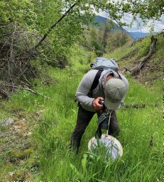 Brian M. Starzomski合作论文数Department of Botany6Andrew Light合作论文数5
 Trant Andrew J合作论文数University of Victoria, Acadia University5
 Nancy Shackelford合作论文数School of Plant Biology, University of Western Australia (M090),5
 Laurie Yung合作论文数5
 Erika S. Zavaleta合作论文数Department of Ecology and Evolutionary Biology, Division of Physical and Biological Sciences, University of California5
 Stephen T. Jackson合作论文数Department of Botany, College of Agriculture, Life Sciences and Natural Resources, University of Wyoming;Department of the Interior Southwest Climate Science Center, U.S. Geological Survey4
 Line Rochefort合作论文数Department of Plant Sciences, Universite Laval4David N. Cole合作论文数Rocky Mountain Research Station, Forest Service, U. S. Department of Agriculture4
 Steven Cooke合作论文数Department of Biology, Carleton University;Institute of Environmental and Interdisciplinary Science, Carleton University4
 F Stuart Chapin, III (Terry)合作论文数Institute of Arctic Biology, University of Alaska Fairbanks;Department of Biology and Wildlife, University of Alaska Fairbanks;Institute of Sustainable Places, Cardiff University4
 Constance I. Millar合作论文数Pacific Southwest Research Station, U.S. Forest Service4Peter Landres合作论文数4Kathy Tonnessen合作论文数4
 Nathan Stephenson合作论文数Western Ecological Research Center, U.S. Geological Survey4David M. Graber合作论文数4
 David J. Parsons合作论文数4
 Allen Thompson合作论文数Department of Philosophy and Religion, Clemson University4
 Gregory H. Aplet合作论文数United States Department of Agriculture Forest Service4James Tricker合作论文数3Sonia A Voicescu合作论文数Hlth Canada, Environm & Radiat Hlth Sci Directorate, Consumer & Clin Radiat Protect Bur, 775 Brookfield Rd, Ottawa, ON K1A 1C1, Canada3
 Kelly L. Hondula合作论文数National Socio-Environmental Synthesis Center, University of Maryland3Schwartz Katrina Z S合作论文数3
 Peter S. White合作论文数Department of Biology, College of Arts and Sciences, The University of North Carolina at Chapel Hill3
 Margaret A. Palmer合作论文数College of Agriculture and Natural Resources, University of Maryland;National Socio-Environmental Synthesis Center3
 Alan Randall合作论文数Department of Agricultural, Environmental, and Development Economics, College of Food, Agricultural, and Environmental Sciences, The Ohio State University3
 Stephen Woodley合作论文数World Commission on Protected Areas, International Union for Conservation of Nature3
 Matthew C. LaFevor合作论文数3John M. Randall合作论文数3
 Matthew E. Baker合作论文数School of Natural Resources and Environment, University of Michigan3
 Trevor C. Lantz合作论文数Department of Biological Sciences, University of Alberta3Don Brothwell合作论文数3
 Jason T. Fisher合作论文数Alberta Research Council;Sustainable Ecosystems Unit;Ecological Conservation Management Program;Ecological Conservation Management Program, Alberta Research Council3
 John J. Gutrich合作论文数Environmental Science, Hawaii Pacific University3
 Brendon M. H. Larson合作论文数Department of Botany;University of Toronto;Department of Botany, University of Toronto3
 Alexandra Branzan Albu合作论文数Department of Electrical & Computer Engineering, Faculty of Engineering, University of Victoria3Alina C. Fisher合作论文数2
 Hyeone Park合作论文数Faculty of Forestry, University of British Columbia2Peter Bridgewater合作论文数Centre for Heritage and Museum Studies, Australian National University2Keith Bowers合作论文数2
 Christopher Stockdale合作论文数Natural Resources Canada, Canadian Forest Service, Northern Forestry Centre, Edmonton, AB, T6H 3E5, Canada.2
 Kevin M. Yeager合作论文数2




