In the research of robot systems, path planning and obstacle avoidance are important research directions, especially in unknown dynamic environments where flexibility and rapid decision makings are required. In this paper, a state attention network (SAN) was developed to extract features to represent the interaction between an intelligent robot and its obstacles. An auxiliary actor discriminator (AAD) was developed to calculate the probability of a collision. Goal-directed and gap-based navigation strategies were proposed to guide robotic exploration. The proposed policy was trained through simulated scenarios and updated by the Soft Actor-Critic (SAC) algorithm. The robot executed the action depending on the AAD output. Heuristic knowledge (HK) was developed to prevent blind exploration of the robot. Compared to other methods, adopting our approach in robot systems can help robots converge towards an optimal action strategy. Furthermore, it enables them to explore paths in unknown environments with fewer moving steps (showing a decrease of 33.9%) and achieve higher average rewards (showning an increase of 29.15%).
In the context of precision agriculture, real-time monitoring of maize seeding parameters is of great significance for evaluating seeding situations and ensuring seeding quality. At present, seeding monitoring mainly uses the through beam photoelectric (TBP) method, which is susceptible to dust and can only be used at the upper part of the seed tube, affecting monitoring accuracy. For this purpose, this study developed a maize seeding parameter monitoring system based on near-infrared diffusion emission-diffuse reflectance (NIRDE-DR), which utilizes the diffusion emission effect of NIR rays to form a three-dimensional monitoring area for maize seeds without missed monitoring. When maize seeds with uneven surfaces enter the monitoring area, the diffuse reflectance effect of the seeds on NIR rays is utilized to change the electrical signal of the monitoring system, and the recognition of falling seeds is achieved by processing the electrical signal. NIRDE-DR takes advantage of the small size of dust particles, which are difficult to form a reflective area, effectively avoiding dust interference. Therefore, it can perform high-precision monitoring at the end of the seed tube. The NIR spectrum of coated maize seeds was measured, and the NIR wavenumber with the lowest absorbance and strongest reflection ability of maize seeds was determined as the target wavenumber of the monitoring system. The impact of the horizontal distance from the monitoring surface to the inner wall of the seed tube (HD) on seeding monitoring was clarified. The value of HD in the developed seeding parameter monitoring system was determined, so that when the NIR rays are emitted into the seed tube, they can cover the entire cross-section of the end of the seed tube without being reflected by dust, avoiding missed monitoring and false monitoring. A signal shielding filtering algorithm based on sawtooth wave shielding was proposed. In regard to the characteristic of high-frequency sawtooth wave in the signal generated by seeds passing through the monitoring area, the first rising edge of the signal is used as the seed recognition signal. By analyzing the duration of high-frequency sawtooth wave and the interval between adjacent seeds, the shielding time of the interference signal is determined to achieve effective noise reduction. Performance evaluation test in the bench results showed that NIRDE-DR has a better recognition effect on maize seeds than TBP. Performance evaluation test in the field showed that at a seeding speed of 6-14 km/h, the maximum monitoring error of the developed system for seeding quantity was 7.98 %, and the maximum monitoring error for seeding qualified rate was 7.69 %. The developed seeding parameter monitoring system has good performance, providing a reference for the advancement of seeding parameter monitoring technology at the end of the seed tube.
Climate change, driven by increasing greenhouse gas emissions, disrupts weather patterns, affecting food production and security. Concurrently, water scarcity, intensified by climate and human activities, intensifies pressures on agriculture, risking reduced harvests and heightened food insecurity. Efficient irrigation is vital for modern agriculture, yet current systems often waste water. The soil water cycle, involving plant transpiration, is essential for bio-geophysical processes in ecosystems. Crop models and simulations are instrumental in optimizing irrigation strategies by simulating crop growth under different conditions. The GreenLab model is an organ-scale Functional-Structural Plant Model (FSPM) that simulates plant growth using a discrete dynamic system, incorporating both functional and structural aspects of physiological processes. In this study, we introduce water balance equations to simulate soil evaporation and irrigation using differential equations, considering field capacity and wilting points, and combine it with GreenLab. Hence, we can simulate the interactions and feedbacks between the plant functioning and water resources. The model's computational experiments demonstrate the effects of different irrigation conditions on water levels and plant architecture, highlighting the importance of efficient irrigation for plant growth and biomass production. The ‘GreenLab’ model, developed for simulating crop growth, is being enhanced to include irrigation effects, offering a more comprehensive tool for optimizing irrigation strategies and contributing to sustainable agriculture during water scarcity and climate change.
We propose an improved version of the YOLOv8 model that enhances real-time agricultural pest detection performance by integrating feature distillation and relation distillation. Feature distillation focuses on transferring intermediate feature maps from the teacher model to the student model, enriching the student's intermediate representation capabilities. Additionally, relation distillation maintains the relative relationships between feature channels, further boosting the model's generalization ability and detection accuracy. In this process, the teacher model constructs a relationship graph between feature channels and conveys this structural information to the student model. This approach not only emphasizes the semantic information of the intermediate features but also incorporates the geometric relationships between channel-level features, enabling the student model to better understand and preserve the inherent structure of the data. Experimental results on the large-scale agricultural pest dataset IP102 demonstrate that this model significantly improves detection accuracy and robustness compared to the traditional YOLOv8 model. The strategy of combining feature and relation distillation showcases its practicality and potential for wide application in agricultural pest detection tasks.
A novel heading angle detection and compensation method is presented with the aim of addressing the navigation and localization accuracy challenges that unmanned robots encounter in their daily inspection jobs, thereby significantly raising the bar for smart port building and promoting the development of ports of superior quality. The Extended Kalman Filter (EKF) algorithm and a Global Navigation Satellite System (GNSS)/ Inertial Navigation System (INS)/Magnetometer combination navigation technology form the basis of this strategy. The suggested deviation detection and compensating method greatly enhances the navigation system’s performance when compared to the conventional EKF algorithm. Furthermore, we improved the navigation system’s ability to adapt to complex surroundings and sudden changes by adding the Particle Swarm Optimization (PSO) algorithm to the process. This allowed us to further optimize the system parameters based on the original innovation. This development is critical to enhancing unmanned robot navigation accuracy at smart ports and providing robust technical support for the growth of port automation and intelligence.
The planning, construction, and maintenance of sand-breaking systems around highway in Taklimakan SandSea mainly depend on expert's empirical knowledge, and face the problems of time-consuming management, unpredictable system performance, and few available data. This work proposes a management and control method of sand-breaking systems that follows artificial system, computational experiments, and parallel execution (ACP) theory. Expert knowledge was extracted to develop artificial sand-breaking system. conditional tabular generative adversarial network (CTGAN) was developed to achieve data augmentation. Computational experiments were implemented to evaluate artificial system performance by predicting whether the system can reach the set age limit. Using fuzzy control, the real sand-breaking system and the artificial one can learn from each other in parallel execution to provide decision support for sand-breaking system management. This approach provides a human-machine hybrid parallel intelligence system for complex sand-breaking systems management.
A large number of farms in developing countries are smallholder farms. In China, this trend is expected to persist for the foreseeable future. However, smallholder farmers in China face several challenges, including excessive fertilizer use for higher yields, low levels of education, aging and limited credit information. Moreover, they are struggling with a digital divide, which hampers their agricultural productivity and limits their economic and social integration. Agricultural services based on information and communication technology (ICT) can bridge the digital gap, but are hindered by complexity and cost. Aiming at serving the numerous smallholders and building a sustainable digital ecosystem, this paper presents a distributed agriculture service system that provides decision support to farmers by considering both social and physical information. The system is lightweight, low cost and intelligent, managing personnel, plots, crops and equipment using technologies such as wireless sensor networks, cloud computing and distributed systems architecture. Services include crop planning, production guidance, equipment control, etc. User terminals include computers, mobile applications and Applets. A case study on fruit production in a typical solar greenhouse illustrates the system's functionality. The distributed agricultural services system can well support smallholder farmers and promote sustainable agriculture.
Waste management practices of solid dairy manures were evaluated under controlled conditions to study gas transport and emission inside manure piles. Three applied stresses and three moisture contents were tested to represent manure conditions managed at various pile depths. A Fourier-transform infrared spectroscopy monitor measured concentrations of greenhouses gases [methane, carbon dioxide, and nitrous oxide] and ammonia as part of gas flux rate calculations. Results showed that carbon dioxide dominated the greenhouse gas emissions under all test conditions. Gas transfer, primarily diffusion, was facilitated by manure with high mechanical strength and high permeability. Gas emission rates reduced dramatically when moisture content increased in manure with high water holding capacity, while compaction treatments did not as strongly affect the gas emission rates. Results provide fundamental insights into management strategies for reducing gas emissions from solid dairy manure.
Minimal invasion is an important trend in surgery. However, the endoscope, as one of the key devices for monitoring the process of minimally invasive surgery, is limited by its size and working space it operates in, which result in a considerably narrow field of view. In particular, when a surgical instrument enters through the tool channel, the instrument occupies most of the area in an endoscopic image. This hampers the surgeon’s field of view and has a negative impact on the surgery. This study proposes a novel method for removing the occlusion caused by surgical instruments in endoscopic images by making foreground occlusions on endoscopic images transparent using image restoration and interframe information filling. Compared with unprocessed images, this method can provide a clearer field of view that is necessary for minimally invasive endoscopic surgeries and improve the quality of surgeries. Clinical endoscopic images are used to verify the feasibility of the proposed method, and the results show that the proposed method improves the visual effect of endoscopic images by removing surgical-instrument occlusions. This demonstrates the considerable potential of the proposed method for use in clinical applications.
In order to promote the construction of smart ports and the high-quality development of ports, a method for detecting and compensating the yaw angle turn of the GNSS/INS integrated navigation system based on the Extended Kalman Filter (EKF) algorithm is proposed to address the insufficient accuracy of navigation positioning in the daily inspection tasks of unmanned robots in ports. The new observation state model is created by adding the heading angle data received from the steering detection and compensation to the nonlinear filtering model that was previously used to simulate the combined navigation system. Experimental verification is done to confirm the combined GNSS/INS/ magnetometer navigation system. The findings demonstrate that the algorithm presented in this research, when compared to the traditional EKF algorithm, may greatly enhance the final heading angle output and, consequently, the accuracy of the heading angle of the combined navigation system.
In order to promote the construction of smart ports and the high-quality development of ports, a method for detecting and compensating the yaw angle turn of the GNSS/INS integrated navigation system based on the Extended Kalman Filter (EKF) algorithm is proposed to address the insufficient accuracy of navigation positioning in the daily inspection tasks of unmanned robots in ports. The new observation state model is created by adding the heading angle data received from the steering detection and compensation to the nonlinear filtering model that was previously used to simulate the combined navigation system. Experimental verification is done to confirm the combined GNSS/INS/ magnetometer navigation system. The findings demonstrate that the algorithm presented in this research, when compared to the traditional EKF algorithm, may greatly enhance the final heading angle output and, consequently, the accuracy of the heading angle of the combined navigation system.
Cotton diseases cause low cotton production and fiber quality. Disease detection methods based on deep learning can integrate feature extraction and improve identification accuracy. We present an automatic cotton disease detection method to improve the identification accuracy of cotton disease. Cotton images are collected using a quadruped robot. ConvNeXt integrates the convolution neural network architecture with intrinsic superiority of transformer. The multiscale spatial pyramid attention (MSPA) module can help ConvNeXt concentrate on important regions of feature maps. ConvNeXt with the MSPA module shows the best recognition results of 97.2%, 99.7% and 100.0% on one competition dataset and two cotton datasets, respectively, with little increase in inference time. It indicates that the proposed model performs well in recognition accuracy with fast detection speed.
Accurate plant density information is important for crop yield and quality. In general, human has to estimate plant density either in field or with accessory equipment, which is time-consuming and inaccurate. In this work, multi-object tracking method based on tracking-by-detection strategy was developed to automatically count cotton seedlings. Videos were collected 0.5 m above cotton seedlings, and analyzed to train object detection model and evaluate counting accuracy with a separate dataset (TAMU2015-ID). An advanced anchor-free object detection model was developed using CenterNet to detect cotton seedling and extract its identity embedding. The localization and identity information were fused based on Deep SORT for data association. The object detection model outperformed Faster R-CNN model with an F1 score of 0.982 (IOU0.5) and 0.937 (IOU0.8), and an average precision of 0.9901 (IOU0.5) and 0.8998 (IOU0.8). The counting results were fitted to ground truth with a R2 of 0.967 and RMSE of 0.394. We evaluated the method on TAMU2015-ID to get a R2 of 0.99 and RMSE of 0.8.
Robots play an important role in modern agriculture, however, few studies have been focusing on the robot mapping approach. Most used Simultaneous Localization and Mapping (SLAM) method usually depends on expert knowledge, which is costly and time consuming. In addition, it’s hard to plan agricultural robots’routes when experts are absent. An active mapping method was proposed using Wavefront Frontier Detector (WFD) and Rapidly-exploring Random Trees (RRT) to select exploration points based on Gmapping algorithm. In this method, 2D LIDAR data were analyzed to select active exploration point, develop Gmapping algorithm, and manage local navigation. A wheeled mobile robot (45 cm * 37 cm * 30 cm) with LIDAR was used in real simulation scene to verify the method’s stability and feasibility. The results showed that the wheeled mobile robot can map the field with an explored region rate of 98.97%.
Using Taklimakan desert highway and its sand-breaking system as the research object for complex system management and control, the ACP-based parallel intelligence theory to deal with the problems of the difficulty in modeling, analyzing, and predicting of sand-breaking system was applied, to realize the intelligent decision support for sand-breaking system management and control, support the sustainable development of aeolian environment.The expert experience knowledge to construct the artificial desert highway sand-breaking system was extracted by simulating physical process.The sand-control efficiency index of the artificial system was calculated using equations, then evaluated and modified by comparing and learning with the actual system.Using parallel intelligent theory, the artificial system and the actual system can learn from each other to provide decision support for sand control.
The concept of "autonomous greenhouse" hints the automatic setting of control target, and giving orders on facilities to reach these targets (set point). Information and communication technologies are widely used, but how to integrate common sense or knowledge in decision-making is still challenging. Semi-autonomous greenhouse control is to set rules with joint advantages of experienced grower and powerful machinery, with the support of knowledge graph and semantic analysis. The contribution of each side is dependent on the intelligence level of computers, the availability of data, etc. In this work, the hybrid system between human and machinery is shown with the temperature control in greenhouse. The target is set mainly by expert knowledge, while the temperature controlled by vent opening is decided by an algorithm. Result shows that the target is better reached compared to that of the experience-based approach. This example shows the feasibility of human-machine hybrid intelligence system for greenhouse environment control. Although this approach is tested for temperature control, it can be extended to control multiple factors simultaneously (temperature, light intensity, humidity, etc.) by driving multiple facilities (heating, lightening, venting, etc.).
A Cyranose 320 (eNose) and a Fast Gas Chromatograph (CG) analyser (zNoseTM) were used to measure the headspace odour of solid samples from dairy operations. The measurements of both sensors were trained by Levenberg-Marquardt Back-propagation Neural Network (LMBNN) to match human assessments. A trained human panel was used to assess the odours based on hedonic tone method and provide the model targets. A multi-sensor data fusion approach was developed and applied to integrate the eNose and zNose readings for higher predictive accuracy compared to each sensor alone. Principle Component Analysis, Forward Selection, and Gamma Test were applied to reduce the model input dimensions. Measurement fusion models and information fusion model approaches were applied. The information fusion prediction models were shown to be more accurate than all other models, including single instrument models. The information fusion model based on eNose with Gamma Test data reduction thorn zNose showed the best results of all cases in validation mean square error (0.34 odour units), R value (0.92), probability of the prediction falling within 10% of the target (96%), and probability of the prediction falling within 5% of the target (63%). (C) 2020 IAgrE. Published by Elsevier Ltd. All rights reserved.
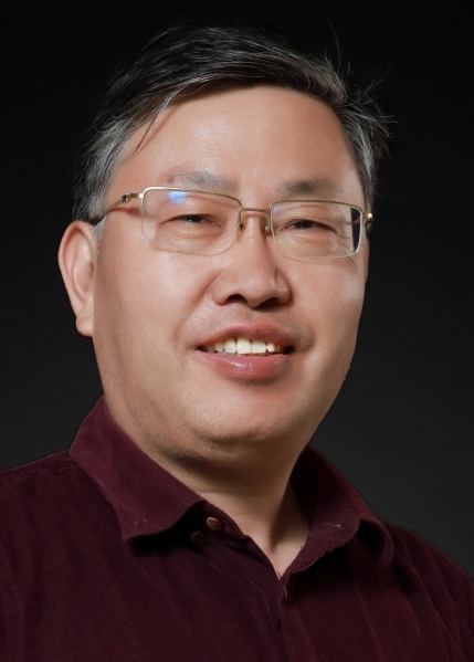 Longhua Ma (马龙华)合作论文数NingboTech University10
 Mengzhen Kang (康孟珍)合作论文数State Key Laboratory of Management and Control for Complex Systems, Institute of Automation, Chinese Academy of Sciences;School of Artificial Intelligence, University of Chinese Academy of Sciences6
 Hongye Su (苏宏业)合作论文数College of Control Science and Engineering, Zhejiang University;Institute of Cyber-Systems and Control, Zhejiang University4
 Paul Heinemann合作论文数4
 Tao Yu合作论文数3
 Yuhang Huang合作论文数3
 Jing Hua合作论文数3
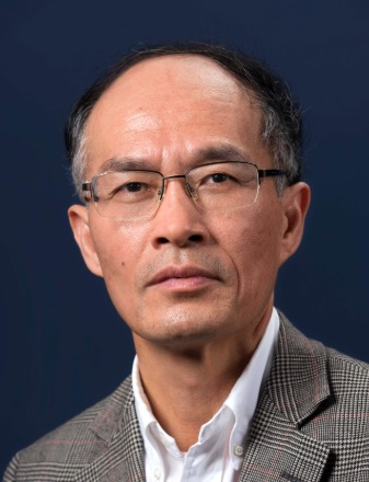 Feiyue Wang (王飞跃)合作论文数The State Key Laboratory for Management and Control of Complex Systems, Institute of Automation, Chinese Academy of Sciences;University of Chinese Academy of Sciences3LI Liangde (李亮德)合作论文数2Haitong PANG (庞海通)合作论文数2
 Wang Haoyu合作论文数2
 Yuchen Weng合作论文数2
 Xing-Rong Fan合作论文数2
 Qingjie Wang (王庆杰)合作论文数College of Engineering, China Agricultural University2
 Jin He (何进)合作论文数College of Engineering, China Agricultural University2
 Hongwen Li (李洪文)合作论文数College of Engineering, China Agricultural University2Eileen Fabian Wheeler合作论文数1
 Wenxin Chen合作论文数1Wu Zhengyang (吴正阳)合作论文数1
 Dongsheng Xie合作论文数School of Medical Technology, Beijing Institute of Technology1
 Guanzhong Tian合作论文数Zhejiang Univ, Inst Cyber Syst & Control, Hangzhou 310027, Peoples R China1Xinya Song合作论文数1
 Changsheng Li (李长胜)合作论文数School of Future Technologies, Beijing Institute of Technology1
 Xiujuan Wang (王秀娟)合作论文数Key Lab of Submarine Geosciences and Prospecting Techniques, MOE, China, Ocean University of China1Zhao Yangfan合作论文数1Wang Kaifeng合作论文数1
 Caiyun Lu (卢彩云)合作论文数College of Engineering, China Agricultural University1
 Xingguang Duan (段星光)合作论文数School of Mechatronics Engineering, Beijing Institute of Technology1
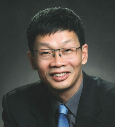 Haiying Liu (刘海鹰)合作论文数Peking University People's Hospital1
 Ming Xu (徐明)合作论文数Graduate School, Peking University Health Science Center;Peking University Third Hospital1
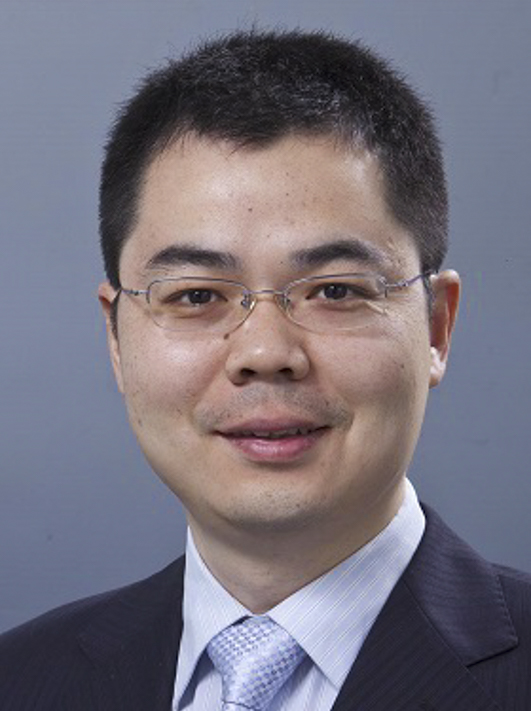 Lei Xie (谢磊)合作论文数College of Control Science and Engineering, Zhejiang University1
 Philippe De Reffye合作论文数Cirad1
 Jiaqiang Lei (雷加强)合作论文数Xinjiang Institute of Ecology and Geography, Chinese Academy of Sciences1Ruicheng Du (杜瑞成)合作论文数Shandong University of Technology1
 Tom L Richard合作论文数Department of Agricultural and Biological Engineering, Pennsylvania State University1




