Understanding stream-groundwater connectivity in response to climate variability is critical for water resource management and ecosystem resilience. Groundwater influx moderates stream temperature and is important for cold-water adapted species such as salmonids. As climate change alters precipitation, temperature, and snowpack conditions, groundwater could help sustain thermal refugia in streams. However, monitoring groundwater connectivity remains challenging, particularly in ungauged, snow dominated, headwater streams, limiting our understanding of stream-groundwater connectivity responses to climatic variability of which the increase of meteorological drought is of particular concern across many regions. In this study we explore the use of diel air-water temperature amplitude ratios to assess groundwater connectivity in central Idaho headwater streams from 2017 to 2024, with the objective to evaluate the influence of the 2021 extreme meteorological drought. We analyzed stream and air temperature patterns via amplitude ratios, and applied a Wilcoxon signed rank test to compare years across 12 stream sites. We applied a linear mixed effects model to estimate the effects of snowmelt timing, rate, runoff, and spring SPEI on amplitude ratios. Results indicate that groundwater connectivity increased in some streams during the 2021 drought, while others remained stable or declined. Additionally, some streams exhibited stronger groundwater connectivity and reduced atmospheric coupling during low snow years, while others maintained consistent thermal dynamics. Streams with greater groundwater connectivity also had lower maximum summer temperatures. These patterns suggest that streams with greater groundwater connectivity may buffer thermal extremes, like the 2021 drought, that are becoming increasingly more common. Further research is needed to explore how hillslope hydrologic dynamics, such as how transpiration and topography mediate snowmelt partitioning, shape stream thermal regimes and long-term habitat suitability.
Blowing snow modulates the evolution of snow over Arctic sea ice through redistribution and sublimation. Here, we present the first multi-year pan-Arctic observational estimates of blowing snow occurrence, properties, and associated fluxes based on NASA Ice, Cloud and land Elevation Satellite 2 (ICESat-2) satellite observations for five cold seasons (November through April 2018-2023). On average, ICESat-2 detects blowing snow 19 % of the time over sea ice, with localized frequencies reaching up to 35 % in the Central Arctic, where blowing snow heights (optical depths) reach 150 m (0.20). We find that blowing snow occurrence shows strong interannual variability related to large-scale climate variability, particularly the Arctic Oscillation (AO). During positive AO phases, blowing snow occurrence increases substantially, with up to a two-fold increase in the Central Arctic. Blowing snow occurrence, height, and optical depth all exhibit a strong dependence on wind speed, increasing by more than five-fold between 4 and 15 ms-1. ICESat-2 blowing snow sublimation estimates average 1.63 cm snow-water-equivalent (SWE) per cold season, thus removing 14 % of pan-Arctic snowfall. In the Central Arctic, the offset is 18 %-24 %. These values are consistent with simulations from the high-resolution SnowModel-LG (1.66 cm SWE) and a simpler, threshold-based model (2.07 cm SWE). Interannual variability in snowfall and sublimation can be 1-2 cm SWE, though not always in phase, resulting in snowfall removals that range from 9 % to 20 %. Critically, these findings provide satellite-based constraints on blowing snow processes over sea ice and underscore the importance of blowing snow sublimation in the Arctic snow budget.
Moose ( Alces alces ) are a cold-adapted species that may be vulnerable to overheating at relatively low temperatures in winter. Moose have two main strategies for thermal regulation: shifting activity patterns and selecting habitat that provides thermal refuge. In this study, we compared how moose use these two strategies in response to winter temperature across their latitudinal range. First, we used hidden Markov models to delineate encamped and traveling movement states for five populations of global positioning system-collared moose in relation to time of day, temperature, and snow depth. Next, we used step-selection functions to determine influential covariates of encamped locations. As air temperatures and snow depths increased, moose from all populations were more likely to remain in an encamped, relatively stationary state. All moose became less diurnal and more nocturnal at high temperatures, although the magnitude of changes in activity varied by population. Encamped northern moose selected shrubby habitat that presents foraging opportunities, whereas encamped southern moose selected for coniferous forest that provides poor forage but offers shade in southern regions. The only moose population to select for lower temperatures also experienced the warmest winter on record during our study period, which may explain this population’s low overall activity rates. Our results indicate that moose along their southern range extent are responding to elevated mid-winter temperatures by initially altering activity patterns and subsequently selecting for potential thermal refugia at the expense of foraging habitat, while northern moose were unlikely to shift habitat selection based on temperature unless faced with an anomalously warm winter. As climate change is implicated in range contraction and population declines, our findings suggest that high winter temperatures may be causing moose to not only reduce overall activity but also to forgo preferred foraging habitat in favor of prioritizing thermal refuge, thus forcing a trade-off between nutrition and thermoregulation.
Pregnant polar bears ( Ursus maritimus) excavate maternal dens in seasonal snowdrifts during fall along Alaska's Beaufort Sea coast to shelter their altricial young during birth and development. With recent sea ice decreases, bears are denning more frequently on land. Each year, the weather and blowing-snow conditions control the creation of snowdrifts across the landscape. Therefore, available snowdrift den habitat can vary widely from one year to the next, depending on the late fall and early winter air temperature, snowfall, and wind speed and direction. We implemented a physics-based, spatiotemporal, polar bear snowdrift den habitat model (SnowDens3D) across the eastern Alaska Beaufort Sea coast (an area of approximately 17,000 km2). High-resolution (2.0 m) topography data were provided by the ArcticDEM, and daily meteorological forcings were provided by NASA's MERRA-2 reanalysis. In many areas across the Arctic Alaska simulation domain, the raw ArcticDEM data contained physically unrealistic topographic anomalies (bumps and depressions) of similar magnitude (+/- 1.5 m) to the topographic variations that underlie potential den habitat (height differences of approximately 1.5 m). To create an ArcticDEM dataset for this den habitat model, considerable pre-processing of the ArcticDEM data was required; we implemented numerous filters to remove the topographic anomalies while preserving those topographic features capable of creating snowdrifts deep enough to provide viable polar bear den habitat. A 21-year (2000-2020) SnowDens-3D simulation was performed, and model outputs were compared with 91 historical polar bear den locations. The year-specific simulations identified viable den habitat for 98% of the observed den locations. The interannual variation in den habitat area over the 21-year period ranged by approximately a factor of three from the minimum year (2001; 554 km2) to the maximum year (2017; 1,566 km2). The ability to identify viable polar bear snowdrift den habitat in near-real time, as demonstrated here, will help wildlife managers and industry personnel identify potential polar bear maternity den sites and minimize disturbance to occupied dens.
ABSTRACT Habitat selection and movement are key mechanisms by which animals can respond to and potentially cope with highly variable environmental conditions. Optimal responses likely vary, however, depending on the severity and scope of conditions. We tested this hypothesis using a facultative migrant species, the Great Gray Owl (Strix nebulosa), which exhibits high inter‐ and intra‐individual variation in the timing, direction, and distance of winter movements. Specifically, we evaluated whether episodic, spatiotemporally variable “locked‐pasture” snow conditions, which restrict access to subnivean food, prompted shifts in habitat selection or long‐distance movements by owls. We quantified the movement of 42 owls using global positioning system (GPS) data within the Greater Yellowstone Ecosystem, USA, during 2017–2022. We used a novel ecological application of SnowModel, a snow evolution modeling system, to estimate fine‐scale, physical snow properties likely to influence access to prey. Variables included snow depth, snow crusts produced by wind, and ice crusts produced by melt‐freeze and rain‐on‐snow events. Owls avoided heterogeneously distributed wind crusts via local shifts in habitat selection. More homogenous ice crusts elicited long‐distance movements away from affected home ranges. Finally, owls employed both proximate shifts in habitat selection and long‐distance movements to avoid deeper snow. Ultimately, owls exhibited behavioral flexibility in response to limiting snow conditions that can vary in terms of severity, spatial extent, and duration. Such behavioral responses determine species distribution, with implications for population and community dynamics in spatiotemporally variable systems. Understanding the effects of, and responses to, environmental controls is increasingly important given the scope of on‐going global change.
For non-hibernating species within temperate climates, survival during severe winter weather often depends on individuals’ behavioral response and available refugia. Identifying refugia habitat that sustains populations during adverse winter conditions can be difficult and complex. This study provides an example of how modeled, biologically relevant snow and weather information can help identify important relationships between habitat selection and dynamic winter landscapes using greater sage-grouse ( Centrocercus urophasianus , hereafter “sage-grouse”) as a model species. We evaluated whether sage-grouse responded to weather conditions in two ways: through (1) positive selection for refugia habitat to minimize adverse weather exposure, or (2) lowered activity level to minimize thermoregulation and locomotion expense. Our results suggested that sage-grouse respond to winter weather conditions by seeking refugia rather than changing daily activity levels. During periods of lower wind chill temperatures and greater wind speeds, sage-grouse selected areas with sheltered aspects and greater sagebrush ( Artemisia spp.) cover. Broadly, sage-grouse selected winter home ranges in sagebrush shrublands characterized by higher wind chill temperatures, greater wind speeds, and greater blizzarding conditions. However, within these home ranges, sage-grouse specifically selected habitats with greater above-snow sagebrush cover, lower wind speeds, and lower blizzarding conditions. Our study underscores the importance of examining habitat selection at narrower temporal scales than entire seasons and demonstrates the value of incorporating targeted weather variables that wholistically synthesize winter conditions. This research allows identification of refugia habitat that sustain populations during winter disproportionate to their spatial extent or frequency of use, facilitating more targeted management and conservation efforts.
Multidisciplinary drifting Observatory for the Study of Arctic Climate (MOSAiC) observations span an entire annual cycle of Arctic snow and sea ice cover. However, the measurements of atmospheric and ocean forcing, as well as distributed measurements of snow and ice properties, were occasionally interrupted for logistical reasons. The most prolonged interruption happened during the onset of the summer melt season. Here we introduce and apply a novel data-model fusion system that can assimilate relevant observational data in a collection of modeling tools (SnowModel-LG and HIGHTSI) to provide continuous high-temporal-resolution (3-hourly) time series of snow and sea ice parameters over the entire annual cycle. We used this system to analyze differences between the three main ice types found in the MOSAiC Central Observatory: relatively deformed second-year ice, second-year ice with extensive smooth refrozen melt pond surfaces, and first-year ice. Since SnowModel-LG and HIGHTSI were used in a 1-D configuration, we used a sea ice dynamics term D to parameterize the redistribution of snow to newly created ridges and leads. D correlated highly with the sea ice deformation (R2 = 59 %, N=33) in the vicinity of the observatory, and deformation appears to explain as much as 15 % of all winter snow water equivalent. In addition, we show, in separate simulations for level ice, that snow bedforms with thin snow in the bedform troughs largely control the ice growth. Here, the mean snow depth minus 1 standard deviation was required to simulate realistic sea ice thickness using HIGHTSI; we surmise that this accounts for the control of relatively thin snow on local ice growth. Despite different initial sea ice thickness and freeze-up dates, the sea ice thickness of level ice across all ice types became similar by early winter. Our simulations suggest that the mean (spatially distributed) MOSAiC snowmelt onset began in late May but was interrupted by a snowfall event and was delayed by 3 weeks until mid- June. The level ice started to melt in the last week of June. Depending on the sea ice topography, the ice was snow-free by late June and early July.
Blowing snow plays a key role in the surface mass and energy budgets of polar regions and can be a significant source of water vapor to the atmosphere. In this study, we optimize the algorithm for detecting blowing snow from NASA's Ice, Cloud, and land Elevation Satellite 2 (ICESat-2) satellite for use over Arctic sea ice. We analyze six months (November 2019 through April 2020) of observations from the Multidisciplinary drifting Observatory for the Study of Arctic Climate (MOSAiC) campaign together with 612 nearly coincident (within 100 km) ICESat-2 overpasses to evaluate the ICESat-2 detection algorithm and inferred blowing snow properties. Both ICESat-2 and MOSAiC suggest a blowing snow occurrence frequency of 17% during the period of study. Blowing snow particle number and inferred from ICESat-2 show broad agreement with in situ observations made at 10 m above the surface during MOSAiC but are often well below observations made at 8 cm. Within a 100 km radius around the MOSAiC observatory, we find a cumulative blowing snow sublimation of 2.38 cm snow-water-equivalent (SWE), comparable to MOSAiC (2.56 cm SWE) and SnowModel-LG (2.35 cm SWE) estimates. This suggests that blowing snow sublimation removed 22%-33% of snowfall during MOSAiC. Across the central Arctic, ICESat-2 and SnowModel-LG indicate blowing snow occurrence frequencies as high as 18%-25%, with cumulative blowing snow sublimation fluxes (1.74-1.79 cm SWE) removing 16%-17% of snowfall. These findings highlight the importance of blowing snow sublimation for the Arctic snow on sea ice budget.
The contribution of Greenland Ice Sheet meltwater runoff to global sea-level rise is accelerating due to increased melting of its bare-ice ablation zone. There is growing evidence, however, that climate models overestimate runoff from this critical area of the ice sheet. Climate models traditionally assume that all bare-ice runoff enters the ocean, unlike porous firn, in which some meltwater is retained and/or refrozen. We used field measurements and numerical modeling to reveal that extensive retention and refreezing also occurs in bare glacier ice. We found that, from 2009 to 2018, meltwater refreezing in bare, porous glacier ice reduced runoff by an estimated 11-17 Gt a-1 in southwest Greenland alone, equivalent to 9-15% of this sector's annual meltwater runoff simulated by climate models. This mass retention explains evidence from prior studies of runoff overestimation on bare ice by current generation climate models and may represent an overlooked buffer on projected runoff increases. Inclusion of bare-ice retention and refreezing processes in climate models therefore has immediate potential to improve forecasts of ice sheet runoff and its contribution to sea-level rise.
SnowModel-LG reconstructs snow depth and density over sea ice, explicitly resolving important snow sinks like blowing snow sublimation, static surface sublimation and melt, but not snow-ice formation. To examine snow sinks on level sea ice, we coupled SnowModel-LG with HIGHTSI, a 1-D thermodynamic sea-ice model, to create SMLG_HS. SMLG_HS simulations of snow depth and level ice thickness were evaluated against high-resolution airborne observations from the western Arctic, highlighting the importance of snow mass redistribution processes, i.e. snow's tendency to leave level ice and accumulate over deformed ice due to wind-induced redistribution. Not accounting for snow mass redistribution, SMLG_HS overestimates snow depth on level ice, resulting in underestimation of level ice thickness and overestimation of snow-ice thickness. Our case study shows that snow depth on level ice needs to be reduced by 40% to simulate both snow depth and level ice thickness realistically in the western Arctic in April 2017. An independent analysis of snow volume distribution between level and deformed sea ice using airborne radar observations supported the model results and revealed a linear relationship that enables estimating the amount of snow remaining on level ice at the end of winter based on the amount of ice deformation.
SnowModel, a spatially distributed snow-evolution modeling system, was parallelized using Coarray Fortran for high-performance computing architectures to allow high-resolution (1 m to hundreds of meters) simulations over large regional- to continental-scale domains. In the parallel algorithm, the model domain was split into smaller rectangular sub-domains that are distributed over multiple processor cores using one-dimensional decomposition. All the memory allocations from the original code were reduced to the size of the local sub-domains, allowing each core to perform fewer computations and requiring less memory for each process. Most of the subroutines in SnowModel were simple to parallelize; however, there were certain physical processes, including blowing snow redistribution and components within the solar radiation and wind models, that required non-trivial parallelization using halo-exchange patterns. To validate the parallel algorithm and assess parallel scaling characteristics, high-resolution (100 m grid) simulations were performed over several western United States domains and over the contiguous United States (CONUS) for a year. The CONUS scaling experiment had approximately 70 % parallel efficiency; runtime decreased by a factor of 1.9 running on 1800 cores relative to 648 cores (the minimum number of cores that could be used to run such a large domain because of memory and time limitations). CONUS 100 m simulations were performed for 21 years (2000–2021) using 46 238 and 28 260 grid cells in the x and y dimensions, respectively. Each year was simulated using 1800 cores and took approximately 5 h to run.
Global warming is occurring at an accelerated rate in the Arctic compared to other parts of the planet with sea-ice declines being among the most striking manifestations of Arctic climate-related changes. Impacts of ongoing Arctic environmental change have been documented for biota throughout marine ecosystems from protists to top predators. Ice-dependent species with specific habitat needs are particularly vulnerable to the ongoing changes. The ringed seal (Pusa hispida) is an ice-associated Arctic endemic species that gives birth and rests in snow caves built in drifts of snow over holes in the sea ice created and maintained by these seals. In this study we create a snow-on-sea-ice reproductive lair habitat model for ringed seals in the Svalbard Archipelago (Norway), a hot-spot of Arctic warming. We use SnowModel, a physics-based snow distribution and evolution simulation system, as the core for a lair habitat model. The model quantifies snow depth and blowing snow fluxes and also relates these variables to snow availability for seal lair habitat. This was accomplished by developing an ecologically informed snow variable that quantifies potential seal lair habitat availability as a function of blowing snow fluxes. Model simulations were performed for the period September 1987 – August 2021 (34 years) on a 500 m × 500 m grid using a daily time-step. Field observations of snow depth and gridded analyses of sea-ice concentration and near-surface (+10 m) atmospheric forcing (air temperature, relative humidity, precipitation, and wind speed and direction) were incorporated within the model simulations. The results show that both snow depth and potential seal lair habitat have been decreasing in Svalbard for the last two decades. If current trends continue, as expected, ringed seal lair habitat will cease to exist across much of the Svalbard Archipelago in the next decade, putting this important Arctic species at risk of regional extirpation.
AbstractAs Arctic sea ice and its overlying snow cover thin, more light penetrates into the ice and upper ocean, shifting the phenology of algal growth within the bottom of sea ice, with cascading impacts on higher trophic levels of the Arctic marine ecosystem. While field data or autonomous observatories provide direct measurements of the coupled sea ice‐algal system, they are limited in space and time. Satellite observations of key sea ice variables that control the amount of light penetrating through sea ice offer the possibility to map the under‐ice light field across the entire Arctic basin. This study provides the first satellite‐based estimates of potential sea ice‐associated algal bloom onset dates since the launch of CryoSat‐2 and explores how a changing snowpack may have shifted bloom onset timings over the last four decades.
In order to study potential impacts arising from climate change, future projections of numerical model output often must be calibrated to be comparable to observations. Rather than calibrating the data values themselves, we propose a novel statistical calibration method for extremes that assumes there exists a linear relationship between parameters associated with model output and parameters associated with observations. This approach allows us to capture uncertainty in both parameter estimates and the linear calibration, which we achieve via bootstrap. To focus on extreme behavior, we assume both model output and observations have distributions composed of a mixture model combining a Weibull distribution with a generalized Pareto distribution for the tail. A simulation study shows good coverage rates. We apply the method to project future daily-averaged river runoff at the Purgatoire River in southeastern Colorado.
The Arctic poses many challenges for Earth system and snow physics models, which are commonly unable to simulate crucial Arctic snowpack processes,such as vapour gradients and rain-on-snow-induced ice layers. These limitations raise concerns about the current understanding of Arctic warming and its impact on biodiversity, livelihoods, permafrost, and the global carbon budget. Recognizing that models are shaped by human choices, 18 Arctic researchers were interviewed to delve into the decision-making process behind model construction. Although data availability, issues of scale, internal model consistency, and historical and numerical model legacies were cited as obstacles to developing an Arctic snowpack model, no opinion was unanimous. Divergences were not merely scientific disagreements about the Arctic snowpack but reflected the broader research context. Inadequate and insufficient resources, partly driven by short-term priorities dominating research landscapes, impeded progress. Nevertheless, modellers were found to be both adaptable to shifting strategic research priorities - an adaptability demonstrated by the fact that interdisciplinary collaborations were the key motivation for model development - and anchored in the past. This anchoring and non-epistemic values led to diverging opinions about whether existing models were "good enough" and whether investing time and effort to build a new model was a useful strategy when addressing pressing research challenges. Moving forward, we recommend that both stakeholders and modellers be involved in future snow model intercomparison projects in order to drive developments that address snow model limitations currently impeding progress in various disciplines. We also argue for more transparency about the contextual factors that shape research decisions. Otherwise, the reality of our scientific process will remain hidden, limiting the changes necessary to our research practice.
We examined snow sinks caused by snow and sea ice interactions (snow-ice formation and sub-parcel snow mass redistribution) on level sea ice in the Arctic. We coupled SnowModel-LG, a modeling system adapted for snow depth and density reconstruction over sea ice, with HIGHTSI, a 1-D thermodynamic sea ice model, to create SMLG_HS. Pan-Arctic model simulations spanned from 1 August 1980 through 31 July 2022. Evaluation of SMLG_HS against snow depth, snow-ice, and sea ice thickness observations highlighted the importance of snow mass changes due to snow redistribution processes. Without accounting for these processes, snow on level ice was overestimated, resulting in underestimation of level ice thickness and overestimation of snow-ice thickness. We show that snow depth on level ice needs to be reduced by 40 % to simulate both snow and level ice thicknesses realistically. Guided by this result, we re-evaluated snow-ice formation. Our findings suggest that, on average over the whole Arctic, snow sinks on level sea ice can reduce snow depth by 3.5 % and increase snow density by 2.3 %.
Abstract Snow conditions are changing rapidly across our planet, which has important implications for wildlife managers. In Alaska, USA, the later arrival of snow is challenging wildlife managers' ability to conduct aerial fall (autumn) moose (Alces alces) surveys. Complete snow cover is required to reliably detect and count moose using visual observation from an aircraft. With inadequate snow to help generate high‐quality moose survey data, it is difficult for managers to determine if they are effectively meeting population goals and optimizing hunting opportunities. We quantified past relationships and projected future trends between snow conditions and moose survey success across 7 different moose management areas in Alaska using 32 years (1987–2019) of moose survey data and modeled snow data. We found that modeled mean snow depth was 15 cm (SD = 11) when moose surveys were initiated, and snow depths were greater in years when surveys were completed compared to years when surveys were canceled. Further, we found that mean snow depth toward the beginning of the survey season (1 November) was the best predictor of whether a survey was completed in any given year. Based on modeled conditions, the trend in mean snow depth on 1 November declined from 1980 to 2020 in 5 out of 7 survey areas. These findings, coupled with future projections, indicated that by 2055, the delayed onset of adequate snow accumulation in the fall will prevent the completion of moose surveys over roughly 60% of Alaska's managed moose areas at this time of the year. Our findings can be used by wildlife managers to guide decisions related to the future reliability of aerial fall moose surveys and help to identify timelines for development of alternate measurement and monitoring methods.
We examined the effect of snow-ice formation on SnowModel-LG snow depth and density products. We coupled SnowModel-LG, a modeling system adapted for snow depth and density reconstruction over sea ice, with HIGHTSI, a 1-D thermodynamic sea ice model, to create SnowModel-LG_HS. Pan-Arctic model simulations spanned from 1 August 1980 through 31 July 2022. In SnowModel-LG_HS, domain average snow depth decreased by 20%, and snow density increased by 2% when compared to SnowModel-LG, with largest differences in the Atlantic sector. Averaged across the CryoSat-2 era (2011–2022), domain average April sea ice thickness retrievals from CryoSat-2 decreased by 7.7% when snow-ice was accounted for. Evaluation of SnowModel-LG HS against snow depth, snow-ice, and sea ice thickness observations highlighted the importance of snow redistribution over deformed sea ice. The findings suggest that neglecting snow and sea ice interactions in models can lead to substantial overestimation of snow depth over level ice.
 Christopher A. Hiemstra合作论文数Department of Geography;University of lowa;Department of Geography, University of lowa45
 Sebastian H. Mernild合作论文数Nansen Environmental and Remote Sensing Center34
 Matthew Sturm合作论文数College of Natural Science and Mathematics, University of Alaska Fairbanks30
 Kelly Elder合作论文数Institute for Computational Earth System Science;University of California , Santa Barbara;Institute for Computational Earth System Science, University of California , Santa Barbara24
 Roger Pielke Jr.合作论文数Center for Science and Technology Policy Research, University of Colorado Boulder;American Enterprise Institute;University College London;Risk Frontiers;Institute of Energy Economics18
 Adele K. Reinking合作论文数Cooperat Inst Res Atmosphere, Colorado State Univ18
 Ioanna Merkouriadi合作论文数Arctic Res Ctr, Finnish Meteorol Inst16
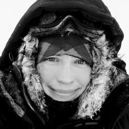 Polona Itkin合作论文数Dept Phys & Technol, UiT Arctic Univ Norway12
 Bent Hasholt合作论文数12
 Julienne Stroeve合作论文数Centre for Polar Observation and Modelling, University College London12
 Polashenski Chris M合作论文数Dartmouth Coll11
 Sebastian Gerland合作论文数11
 John E. Strack合作论文数10
 Prugh Laura R合作论文数School of Environmental and Forest Sciences, University of Washington9
 Anja Rosel合作论文数9Natalie T. Boelman合作论文数Columbia University Lamont-Doherty Earth Observatory9
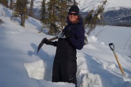 Stine Højlund Pedersen合作论文数Cooperat Inst Res Atmosphere, Colorado State Univ8
 Jacob C. Yde合作论文数Department of Earth Sciences, University of Aarhus8
 Jan-Gunnar Winther合作论文数UiT Norges Arktiske Universitet;Norwegian Polar Institute8
 Oddbjørn Bruland合作论文数8
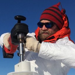 Marc Oggier合作论文数Int Arctic Res Ctr, Univ Alaska7
 Michel Tsamados合作论文数Earth Sciences, Faculty of Mathematical & Physical Sciences, University College London7
 Konrad Steffen合作论文数Department of Geography, College of Arts and Sciences, University of Colorado Boulder7
 Stefan Hendricks合作论文数Alfred Wegener Inst Polar & Marine Res7Knut Sand合作论文数7
 Donald Cline合作论文数7
 Martin Schneebeli合作论文数WSL Institute for Snow;Avalanche Research;WSL Institute for Snow|Avalanche Research7
 Todd Brinkman合作论文数Institute of Arctic Biology, University of Alaska Fairbanks7
 Robbie Mallett合作论文数UCL, Ctr Polar Observat & Modelling6
 Peter John Mahoney合作论文数6
 Mark Hebblewhite合作论文数Ungulate Ecology Lab, W.A. Franke College of Forestry & Conservation,6
 Mats A. Granskog合作论文数Division of Geophysics, University of Helsinki6
 Roger A. Pielke合作论文数Center for Science and Technology Policy Research6
 Chris Derksen合作论文数Climate Research Division, Environment and Climate Change Canada6
 Jens Hesselbjerg Christensen合作论文数Niels Bohr Institute, University of Copenhagen6
 Gunnar Spreen合作论文数University of Hamburg;Institute of Oceanography;Institute of Oceanography, University of Hamburg6
 Graham A. Sexstone合作论文数6
 Niels M. Schmidt合作论文数Centre for Integrated Population Ecology, www.cipe.dk6
 Vishnu Nandan合作论文数University of Calgary5
 Robert Ricker合作论文数5
 Jeremy Wilkinson合作论文数5
 Dmitry Divine合作论文数Scientific Research Department, Norwegian Polar Institute5
 David Clow合作论文数Colorado Water Science Center, United States Geological Survey5
 Henry Huntington合作论文数Huntington Consulting5
 Jon Holmgren合作论文数5
 Mikkel P Tamstorf合作论文数NERI Frederiksborgvej5Jennifer King合作论文数4april n cheuvront合作论文数4Robert Graham合作论文数4




