Abstract The Orbiting Carbon Observatory‐2 and ‐3 (collectively termed “OCO‐2/3,” hereafter) missions, together, provide precise and accurate global data records that contribute to a better understanding of the variability in atmospheric carbon dioxide (CO 2 ). The retrieval algorithm used to process the satellite data, Atmospheric Carbon Observations from Space (ACOS), continues to be updated. The latest v11.2 OCO‐2 and v11 OCO‐3 data releases include significant improvements compared to past data versions. The Total Carbon Column Observing Network (TCCON), a network of ground‐based Fourier Transform Spectrometers (FTS), has historically, been the validation data source for OCO‐2/3. The COllaborative Carbon Column Observing Network (COCCON), an emerging network of ground‐based portable Fourier Transform Infrared Spectrometers (EM27/SUN), aids satellite validation efforts by providing observations in geographic locations where there are no TCCON measurements being made. This study provides the first global comparison between the OCO‐2/3 data sets and the COCCON observations. Currently, the COCCON data set, most useful for global analysis, is version 1 (v1), which our analysis shows is typically lower than the satellites by ∼0.50–1.00 ppm, with scatter against OCO‐2/3 roughly similar to TCCON versus OCO‐2/3. This analysis includes comparisons of results from the latest v2.x COCCON data version for the sites with the data available. Comparisons with the v2.x COCCON data version generally show improved comparisons against OCO‐2/3. Our analysis illustrates the ways in which the COCCON data set, used globally, regionally, or in specific locations, can provide insight into the quality of satellite observations of atmospheric CO 2 .
The Orbiting Carbon Observatory-2 and -3 (collectively termed "OCO-2/3," hereafter) missions, together, provide precise and accurate global data records that contribute to a better understanding of the variability in atmospheric carbon dioxide (CO2). The retrieval algorithm used to process the satellite data, Atmospheric Carbon Observations from Space (ACOS), continues to be updated. The latest v11.2 OCO-2 and v11 OCO-3 data releases include significant improvements compared to past data versions. The Total Carbon Column Observing Network (TCCON), a network of ground-based Fourier Transform Spectrometers (FTS), has historically, been the validation data source for OCO-2/3. The COllaborative Carbon Column Observing Network (COCCON), an emerging network of ground-based portable Fourier Transform Infrared Spectrometers (EM27/SUN), aids satellite validation efforts by providing observations in geographic locations where there are no TCCON measurements being made. This study provides the first global comparison between the OCO-2/3 data sets and the COCCON observations. Currently, the COCCON data set, most useful for global analysis, is version 1 (v1), which our analysis shows is typically lower than the satellites by similar to 0.50-1.00 ppm, with scatter against OCO-2/3 roughly similar to TCCON versus OCO-2/3. This analysis includes comparisons of results from the latest v2.x COCCON data version for the sites with the data available. Comparisons with the v2.x COCCON data version generally show improved comparisons against OCO-2/3. Our analysis illustrates the ways in which the COCCON data set, used globally, regionally, or in specific locations, can provide insight into the quality of satellite observations of atmospheric CO2.
Carbon dioxide (CO2) is the primary greenhouse gas emitted into the atmosphere due to anthropogenic activities. While it is naturally present as a part of Earth’s carbon cycle, human activities impact the ability of natural sinks to reduce CO2 from the atmosphere and thus alter the carbon cycle. It thus becomes pertinent to focus on the long-term monitoring of atmospheric CO2 and the ability to make precise, accurate, and continuous CO2 measurements.The Orbiting Carbon Observatory-2 (OCO-2) was launched in 2014. It is NASA’s first Earth-orbiting satellite dedicated to making observations of CO2 in the atmosphere and measuring its column-averaged dry-air mole fraction (XCO2). The primary goal of the OCO-2 mission is to provide XCO2 measurements with sufficient precision and accuracy alongside quantifying its seasonal and interannual variability. While OCO-2 provides global coverage and consistently measures at high latitudes, the remote sensing measurement of CO2 from space can be challenging. This is because the goal is to resolve inter-annual CO2 deviations to subcontinental scales, alongside capturing the known seasonal cycle and trends. Further, the XCO2 data is susceptible to location- and surface-property-dependent biases that must be corrected. Thus, validation of the XCO2 data from OCO-2 becomes necessary to ensure a high degree of retrieval accuracy on a global scale.This study uses the new and improved OCO-2 V11.1 dataset and compares coincident XCO2 measurements against three independent datasets. The Total Carbon Column Observing Network (TCCON) is a network of solar-viewing ground-based Fourier Transform Spectrometers and the primary validation source for XCO2 from OCO-2. TCCON measurements are unaffected by surface properties and are minimally sensitive to aerosols. The COllaborative Carbon Column Observing Network (COCCON) is a network of portable ground-based Fourier Transform Infrared spectrometers that are less expensive than full TCCON sites and have lower spectral resolution, but are similarly insensitive to surface properties and aerosols. Comparison of coincident OCO-2 measurements against selected TCCON and COCCON sites indicate that the absolute average bias values are close to 0 ppm for TCCON and less than 0.7 ppm for COCCON in the Land Nadir/Glint and Target mode observations.Finally, we compare coincident OCO-2 measurements to the airborne Atmospheric Tomography Mission (ATom) when ATom conducted around-the-world flights in each of the four seasons between 2016 and 2018. This study bridges the gap between satellite, ground-based, and airborne XCO2 measurements and aids the improvement of the OCO-2 XCO2 data product. Further, it provides the latest validation analysis for OCO-2, providing the most up-to-date information on biases and uncertainty in the OCO-2 data.
The COllaborative Carbon Column Observing Network has become a reliable source of high-quality ground-based remote sensing network data that provide column-averaged dry-air mole fractions of carbon dioxide (XCO2), methane (XCH4), and carbon monoxide (XCO). The fiducial reference measurements of these gases from the COCCON complement the TCCON and NDACC-IRWG data. This study shows the application of COCCON data for the validation of existing greenhouse gas satellite products. This study includes the validation of XCH4 and XCO products from the European Copernicus Sentinel-5 Precursor (S5P) mission, XCO2 products from the American Orbiting Carbon Observatory-2 (OCO-2) mission, and XCO2 and XCH4 products from the Japanese Greenhouse gases Observing SATellite (GOSAT). A total of 27 datasets contributed to this study; some of these were collected in the framework of campaign activities and covered only a short time period. In addition, several permanent stations provided long-term observations. The random uncertainties in the validation results, specifically for S5P with a lot of coincidences pairs, are found to be similar to the comparison with the TCCON. The comparison results of OCO-2 land nadir and land glint observation modes to the COCCON on a global scale, despite limited coincidences, are very promising. The stations can, therefore, expand on the coverage of the already existing ground-based reference remote sensing sites from the TCCON and the NDACC network. The COCCON data can be used for future satellite and model validation studies and carbon cycle studies.
Quantifying changes in global and regional tropospheric ozone is critical for understanding global atmospheric chemistry and its impact on air quality and climate. Satellites now provide multi-decadal records of daily global ozone profiles, but previous studies have found large disagreements in satellite-based ozone trends, including in trends from different products based on the same spectral radiances. In light of these disagreements, it is critical to quantify to what degree the observed trend is attributable to measurement error for each product by comparing satellite-retrieved ozone to long-term measurements from ozonesondes. NASA's TRopospheric Ozone and its Precursors from Earth System Sounding (TROPESS) project provides satellite retrievals of ozone from a suite of instruments, including Cross-track Infrared Sounder (CrIS), Atmospheric Infrared Sounder (AIRS), and multispectral combinations such as AIRS and Ozone Monitoring Instrument (OMI) (joint AIRS+OMI) using a common algorithm. We compare these products to ozonesondes and find that the evolution of global tropospheric ozone satellite-sonde biases for TROPESS CrIS (0.21 +/- 3.6 % decade-1, 2016-2021), AIRS (-0.41 +/- 0.57 % decade-1, 2002-2022), and joint AIRS+OMI (1.1 +/- 1.0 % decade-1, 2004-2022) are less than the magnitude of trends in global tropospheric ozone reported by the Tropospheric Ozone Assessment Report Phase 1 (TOAR-I). We further quantify the bias in regional trends, which tend to be higher but with a smaller number of sondes, which can impact the satellite-sonde bias and trend. Our work represents an important basis for the utility of using satellite data to quantify changes in atmospheric composition in future studies.
We present an analysis of ozone data products retrieved from multiple satellite observations. Specifically, we highlight data from the TRopospheric Ozone and its Precursors from Earth System Sounding (TROPESS) project which is a NASA effort that provides retrievals of atmospheric ozone utilizing radiances from a variety of different satellite instruments. The multispectral retrievals of ozone utilize the Multi-Spectra, Multi-Species, Multi-Sensors Retrievals of Trace Gases (MUSES) retrieval framework to produce consistent estimations of ozone from different satellite radiances. TROPESS ozone data products are retrieved from the Atmospheric Infrared Sounder (AIRS), the Ozone Monitoring Instrument (OMI), the Cross-track Infrared Sounder (CrIS) instruments, and combinations of these satellites. Trends in ozone are presented and evaluated using records dating from 2002 to the present. Trends are investigated globally and regionally, and validated against ozonesonde measurements. We find that the magnitude of ozone vertical profiles and columns agree between satellites to a high degree, but we are still investigating the trends seen in the different data sets. We investigate the causes of these differences between satellites, including instrument type and vertical sensitivity of the retrievals. We show ongoing work investigating comparisons between the TROPESS ozone data products, chemical reanalysis products using the MOMO-Chem framework, other satellite products, and ground-based observations, as well as trends in ozone precursors.
The vertical distribution of ozone plays an important role in atmospheric chemistry, climate change, air pollution, and human health. Over the 21st century, spaceborne remote-sensing methods and instrumentation have evolved to better determine this distribution. We quantify the ability of ozone retrievals to characterize this distribution through a sequential combination of thermal infrared (TIR) and ultraviolet (UV) spectral radiances, harnessing co-located TIR measurements from the Cross-track Infrared Sounder (CrIS) on board the Suomi National Polar-orbiting Partnership (NPP) and UV measurements from the TROPOspheric Monitoring Instrument (TROPOMI), which is on the Sentinel 5-Precursor (S5P) satellite. Using the MUlti-SpEctra, MUlti-SpEcies, MUlti-SEnsors (MUSES) algorithm, the sequential combination of TIR and UV measurements, which follows retrievals from each instrument separately, moderately improves the ability of satellites to characterize global ozone profiles over the use of each instrument/band individually. The CrIS retrievals enhanced by TROPOMI radiances in the Huggins band (325–335 nm) show good agreement with independent datasets both in the troposphere and in the stratosphere in spite of calibration issues in the TROPOMI UV. Improved performance is characterized in the stratosphere from CrIS-TROPOMI, firstly through a modest increase in the degrees of freedom for signal (DFS; often between 0.1–0.2) and secondly through comparisons with the Microwave Limb Sounder (MLS), where a global multi-month-long comparison shows a mean difference ∼×10 lower than either CrIS or TROPOMI individually and R2 values 3 % higher. In the troposphere, CrIS-TROPOMI and CrIS show similar degrees of freedom for signal, with about 2 globally, but these are higher in the tropics partitioned equally between the lower and upper troposphere. CrIS-TROPOMI validation with ozonesondes shows improved performance over CrIS-only validation, with a difference in the tropospheric-column bias of between 30 % and 200 % depending on the season. Cross-comparisons with satellite instruments and reanalysis datasets show similar performances in terms of correlations and biases. These results demonstrate that CrIS and CrIS-TROPOMI retrievals have the potential to improve global satellite ozone retrievals, especially with future developments. If spectral accuracy is improved in future TROPOMI calibration, the degrees of freedom for signal in the stratosphere could double when using bands 1 and 2 of TROPOMI (270–330 nm), while tropospheric degrees of freedom for signal could increase by 25 %.
<p>The Orbiting Carbon Observatory-2 (OCO-2), launched in 2014, is NASA&#8217;s first satellite dedicated to measure sources and sinks of carbon dioxide (CO<sub>2</sub>) in Earth&#8217;s atmosphere on regional scales. Since 2019, measurements from the Orbiting Carbon Observatory-3 (OCO-3) have complemented OCO-2&#8217;s data record. In addition, OCO-3&#8217;s Snapshot Area Mapping (SAM) mode observations over emission hotspots like cities, power plants, and volcanoes provide a novel data set for carbon cycle studies on local scales. Data from both instruments are analyzed with the Atmospheric Carbon Observations from Space (ACOS) retrieval algorithm to estimate column-average dry-air mole fractions of carbon dioxide (XCO<sub>2</sub>) in Earth&#8217;s atmosphere. Evaluating these space-based estimates of XCO<sub>2</sub> against independent validation data sets provides information about the quality, potential biases, and errors in the OCO-2/3 data record. Here, we present comparisons of the ACOS V10 XCO<sub>2</sub> from OCO-3 and the new and improved ACOS V11 XCO2 from OCO-2 against ground-based measurements from the Total Carbon Column Observing Network (TCCON).</p> <p>For both instruments, the root-mean-square error (RMSE) is below 1 ppm for all observational modes when compared to collocated TCCON observations. The OCO-3 V10.4 data version, an improvement over the initial vEarly data version, reduces an XCO<sub>2</sub> time-dependent bias that was present in the previous OCO-3 data record. Consequently, data from both instruments does not indicate any significant time-dependent bias over the span of several years. Further, we evaluate differences between OCO-3 and TCCON related to different local overpass times. On average, OCO-3&#8217;s equator crossing time occurs about 20 minutes earlier every day. Comparisons against TCCON indicate no significant local time of day bias in the OCO-3 XCO<sub>2</sub> data, however, comparisons over individual TCCON sites indicate a dependence which provides insight into potential airmass and viewing geometry related biases. The improved OCO-2 V11 data version reduces the mean bias against TCCON to ~0.15ppm from previously ~0.4ppm in V10. We find the largest reduction in RMSE over ocean due to an improved ocean glint surface treatment in V11. Both OCO data products are of comparable quality and are an improvement over earlier OCO data versions. Finally, we analyze how well OCO-2 captures the mean seasonal cycle amplitudes and growth rates over selected TCCON sites.</p>
<p>We present an update on the status of the tropospheric ozone data products retrieved from satellite observations. Specifically, we will highlight data from the TRopospheric Ozone and its Precursors from Earth System Sounding (TROPESS) project which is a NASA effort that provides retrievals of atmospheric ozone utilizing radiances from a variety of different satellite instruments. The TROPESS project provides ozone data that provides additional data that can used with record established by the Tropospheric Emission Spectrometer (TES) which flew on NASA&#8217;s Aura satellite. The new multispectral retrievals of ozone utilize the (Multi-Spectra, Multi-Species, Multi-Sensors Retrievals of Trace Gases (MUSES) retrieval framework to produce consistent estimations of ozone from different satellite radiances. TROPESS ozone data products include those using data from the Atmospheric Infrared Sounder (AIRS), the Ozone Monitoring Instrument (OMI) and the Cross-track Infrared Sounder (CrIS) instruments. The TROPESS joint-satellite data products provide ozone retrievals with vertical sensitivity similar to that seen in TES observations and allow a continuation of the TES ozone data record. Utilizing satellite instruments that observe with wide swaths will provide much broader spatial sampling than TES was able to provide.</p> <p>The TROPESS team is currently processing ozone data records using radiances from CrIS, AIRS, OMI, TROPOMI and retrievals using combinations of the different satellites. All of the TROPESS products are being validated through comparisons to ozonesondes as well as comparisons to chemical reanalysis products. We will provide an update on the results from these comparisons as well highlighting the differences in vertical sensitivity and spatial sampling of the different products. We will highlight the differences in the sensitivity of the retrievals to ozone in the troposphere and validation of the satellite retrievals at those pressure levels. We will show statistical analysis for the errors in the satellite retrievals and their comparisons to the ozonesondes.</p> <p>Lastly, we will present results showing the time record of the different ozone products, including showing how the comparisons to models and ozonesondes change with time. Utilizing the AIRS and OMI instrument data will allow us to examine the tropospheric ozone data record going back to 2005 and we will share results of how the TROPESS products can contribute to determining trends in tropospheric ozone.</p>
<p>Carbon dioxide (CO<sub>2</sub>) is the primary greenhouse gas emitted from anthropogenic activities. Although it is naturally present as a part of Earth&#8217;s carbon-cycle, human activities influence the ability of natural sinks to reduce CO<sub>2</sub> from the atmosphere, thus altering the carbon-cycle and necessitating the long-term monitoring of atmospheric CO<sub>2</sub>. Precise, accurate and continuous measurements of CO<sub>2</sub> are important to this end.</p> <p>The Orbiting Carbon Observatory-2 (OCO-2) was launched in 2014. It is NASA&#8217;s first Earth-orbiting satellite dedicated to making observations of CO<sub>2</sub> in the atmosphere and measuring its column-averaged dry-air mole fraction (X<sub>CO2</sub>). The primary goal of the OCO-2 mission is to provide X<sub>CO2</sub> measurements with sufficient precision and accuracy alongside quantifying its seasonal and interannual variability. In this study, we use the new and improved OCO-2 B11 data set.</p> <p>In the past, the space-based X<sub>CO2</sub> measurements from OCO-2 data have been validated against independent data sets such as the Total Carbon Column Observing Network (TCCON). In this study, we use independent measurements from the COllaborative Carbon Column Observing Network (COCCON) to identify potential biases and errors in the B11 data version and establish its robustness for use by the science community. COCCON uses portable Fourier-Transform InfraRed (FTIR) spectrometers (EM27/SUN) to measure greenhouse gases at several global sites. &#160;</p> <p>Comparison of OCO-2 measurements against COCCON sites indicate similar temporal trends in X<sub>CO2</sub> variability, with OCO-2 typically reporting higher values. Further, we evaluate the differences between the B11 OCO-2 and COCCON data sets. Finally, we analyze how OCO-2&#8217;s B11 version compares to selected COCCON and TCCON sites&#8217; measurements in terms of capturing the seasonal cycle and growth rate of X<sub>CO2</sub>.</p>
In this paper, we compare Orbiting Carbon Observatory 2 (OCO-2) measurements of column-averaged dry-air mole fractions (DMF) of CO2 (XCO2) and its urban–rural differences against ground-based remote sensing data measured by the Munich Urban Carbon Column network (MUCCnet). Since April 2020, OCO-2 has regularly conducted target observations in Munich, Germany. Its target-mode data provide high-resolution XCO2 within a 15 km × 20 km target field of view that is greatly suited for carbon emission studies from space in cities and agglomerated areas. OCO-2 detects urban XCO2 with a root mean square different (RMSD) of less than 1 ppm when compared to the MUCCnet reference site. OCO-2 target XCO2 is biased high against the ground-based measurements. The close proximity of MUCCnet's five fully automated remote sensing sites enables us to compare spaceborne and ground-based XCO2 in three urban areas of Munich separately (center, north, and west) by dividing the target field into three smaller comparison domains. Due to this more constrained collocation, we observe improved agreement between spaceborne and ground-based XCO2 in all three comparison domains. For the first time, XCO2 gradients within one OCO-2 target field of view are evaluated against ground-based measurements. We compare XCO2 gradients in the OCO-2 target observations to gradients captured by collocated MUCCnet sites. Generally, OCO-2 detects elevated XCO2 in the same regions as the ground-based monitoring network. More than 90 % of the observed spaceborne gradients have the same orientation as the XCO2 gradients measured by MUCCnet. During our study, urban–rural enhancements are found to be in the range of 0.1 to 1 ppm. The low urban–rural gradients of typically well below 1 ppm in Munich during our study allow us to test OCO-2's lower detection limits for intra-urban XCO2 gradients. Urban XCO2 gradients recorded by the OCO-2 instruments and MUCCnet are strongly correlated (R2=0.68) with each other and have an RMSD of 0.32 ppm. A case study, which includes a comparison of one OCO-2 target overpass to WRF-GHG modeled XCO2, reveals a similar distribution of enhanced CO2 column abundances in Munich. In this study, we address OCO-2's capability to detect small-scale spatial XCO2 differences within one target observation. Our results suggest OCO-2's potential to assess anthropogenic emissions from space.
While initial plans for measuring carbon dioxide from space hoped for 1-2 ppm levels of accuracy (bias) and precision in the CO2 column mean dry air mole fraction (XCO2), in the past few years it has become clear that accuracies better than 0.5 ppm are required for most current science applications. These include measuring continental (1000+ km) and regional scale (100s of km) surface fluxes of CO2 at monthly-average timescales. Considering the 400+ ppm background, this translates to an accuracy of roughly 0.1%, an incredibly challenging target to hit. Improvements in both instrument calibration and retrieval algorithms have led to significant improvements in satellite XCO2 accuracies over the past decade. The Atmospheric Carbon Observations from Space (ACOS) retrieval algorithm, including post-retrieval filtering and bias correction, has demonstrated unprecedented accuracy with our latest algorithm version as applied to the Orbiting Carbon Observatory-2 (OCO-2) satellite sensor. This presentation will discuss the performance of the v10 XCO2 product by comparisons to TCCON and models, and showcase its performance with some recent examples, from the potential to infer large-scale fluxes to its performance on individual power plants. The v10 product yields better agreement with TCCON over land and ocean, plus reduced biases over tropical oceans and desert areas as compared to a median of multiple global carbon inversion models, allowing better accuracy and faith in inferred regional-scale fluxes. More specifically, OCO-2 has single sounding precision of ~0.8 ppm over land and ~0.5 ppm over water, and RMS biases of 0.5-0.7 ppm over both land and water. Given the six-year and growing length of the OCO-2 data record, this also enables new studies on carbon interannual variability, while at the same time allowing identification of more subtle and temporally-dependent errors. Finally, we will discuss the prospects of future improvements in the next planned version (v11), and the long-term prospects of greenhouse gas retrievals in the coming years.
The Orbiting Carbon Observatory 3 (OCO-3) was installed on the International Space Station (ISS) in May 2019 and will continue the observation of global CO2 and solar-induced chlorophyll fluorescence (SIF) observations using the flight spare instrument from OCO-2. This talk will focus on the science data products, early operations, abd a few highlights from early mission data. The low-inclination ISS orbit lets OCO-3 sample the tropics and sub-tropics across the full range of daylight hours with dense observations at northern and southern mid-latitudes (+/- 52º). The combination of these dense CO2 and SIF measurements provides continuity of data for global flux estimates as well as a unique opportunity to address key deficiencies in our understanding of the global carbon cycle. The instrument utilizes an agile, 2-axis pointing mechanism (PMA), providing the capability to look towards the bright reflection from the ocean and validation targets. The PMA also allows for the collection of dense datasets over 80km by 80km areas called snapshot area maps (SAMs). The in-orbit check out of the instrument was conducted through July 2019. In this phase the engineering team verified the performance of all systems, the calibration team began collecting the needed calibration data, and the mission operations team verified the performance of all measurement modes and the mission operations planning tools. Since August 2019, OCO-3 has been collecting routine nadir, glint, target, and SAM data. Target mode observations over surface-based Total Carbon Column Observing Network (TCCON) sites help to identify and minimize potential instrument biases in the OCO-3 data. Other validation activities include direct comparisons to XCO2 estimates from OCO-2 and comparisons to predictions from near-real-time models. These comparisons will be discussed and early results will be presented. In addition, several hundred SAMs have been collected over (mega-)cities, powerplants, volcanos, and other terrestrial carbon focus areas. The steadily growing number of SAM observations provides a unique dataset for scientific studies on local scales. We discuss the potential of these observations, alone and in conjunction with simultaneous observations from other space-based sensors, to yield greater insights into carbon cycle science.
Given the importance of tropospheric ozone as a greenhouse gas and a hazardous pollutant that impacts human health and ecosystems, it is critical to quantify and understand long-term changes in its abundance. Satellite records are beginning to approach the length needed to assess variability and trends in tropospheric ozone, yet an intercomparison of time series from different instruments shows substantial differences in the net change in ozone over the past decade. We discuss our efforts to produce Earth Science Data Records of tropospheric ozone and quantify uncertainties and biases in these records. We also discuss the role of changes in the magnitude and distribution of precursor emissions and in downward transport of ozone from the stratosphere in determining tropospheric ozone abundances over the past 15 years.
Abstract. Seasonal CO2 exchange in the Boreal Forest plays an important role in the global carbon budget and in driving interannual variability in seasonal cycles of atmospheric CO2. Satellite-based observations from polar orbiting satellites like the Orbiting Carbon Observatory-2 (OCO-2) offer an opportunity to characterize Boreal Forest seasonal cycles across longitudes with a spatially and temporally rich dataset, but data quality controls and biases still require vetting at high latitudes. With the objective of improving data availability at northern, terrestrial high latitudes, this study evaluates quality control methods and biases of OCO-2 retrievals of atmospheric column-averaged dry-air mole fractions of CO2 (XCO2) in Boreal Forest regions. In addition to the standard quality control filters recommended for ACOS B8 (B8 QC) and ACOS B9 (B9 QC) OCO-2 retrievals, a third set of quality control filters were specifically tailored to Boreal Forest observations (Boreal QC) with the goal of increasing data availability at high latitudes without sacrificing data quality. Ground-based reference measurements of XCO2 include observations from two sites in the Total Carbon Column Observing Network (TCCON) at East Trout Lake, Saskatchewan, Canada and Sodankylä, Finland. OCO-2 retrievals were also compared to ground-based observations from two Bruker EM27/SUN FTS at Fairbanks, Alaska, United States. EM27/SUN spectrometers that were deployed in Fairbanks were carefully monitored for instrument performance and were bias corrected to TCCON using observations at the Caltech TCCON site. The B9 QC were found to pass approximately twice as many OCO-2 retrievals over land north of 50° N than the B8 QC, and the Boreal QC were found to pass approximately twice as many retrievals in May, August, and September as the B9 QC. While Boreal QC results in a substantial increase in passable retrievals this is accompanied by increases in the standard deviations in biases at Boreal Forest sites from ∼ 1.4 ppm with B9 QC to ∼ 1.6 ppm with Boreal QC. Total average biases for coincident OCO-2 retrievals at the three sites considered did not consistently increase or decrease with different QC methods, and instead responses to changes in QC varied according to site and satellite viewing geometries. Regardless of the quality control method used, seasonal variability in biases was observed, and this variability was more pronounced at the TCCON sites than when comparing to EM27/SUN observations in Fairbanks. Monthly average biases generally varied between −1 ppm and +1 ppm at the three sites considered, with more negative biases in spring (MAM) and autumn (SO), but more positive biases in summer months (JJA). Monthly standard deviations in biases ranged from approximately 1.0 ppm to 2.0 ppm and do not exhibit strong seasonal dependence apart from exceptionally high standard deviation observed with all three QC methods at Sodankylä in June. There was no evidence found to suggest that seasonal variability in bias is a direct result of airmass dependence in ground-based retrievals or of proximity bias from coincidence criteria, but there were a number of retrieval parameters used as quality control filters that exhibit seasonality and could contribute to seasonal dependence in OCO-2 bias. Furthermore, it was found that OCO-2 retrievals of XCO2 without the standard OCO-2 bias correction exhibit almost no perceptible seasonal dependence in average monthly bias at these Boreal Forest sites, suggesting that seasonal variability in bias is introduced by the bias correction. Overall, we found that modified quality controls can allow for significant increases in passable OCO-2 retrievals with only marginal compromises in data quality, but seasonal dependence in biases still warrants further exploration.
Seasonal CO2 exchange in the boreal forest plays an important role in the global carbon budget and in driving interannual variability in seasonal cycles of atmospheric CO2. Satellite-based observations from polar orbiting satellites like the Orbiting Carbon Observatory-2 (OCO-2) offer an opportunity to characterize boreal forest seasonal cycles across longitudes with a spatially and temporally rich data set, but data quality controls and biases still require vetting at high latitudes. With the objective of improving data availability at northern, terrestrial high latitudes, this study evaluates quality control methods and biases of OCO-2 retrievals of atmospheric column-averaged dry air mole fractions of CO2 (XCO2) in boreal forest regions. In addition to the standard quality control (QC) filters recommended for the Atmospheric Carbon Observations from Space (ACOS) B8 (B8 QC) and ACOS B9 (B9 QC) OCO-2 retrievals, a third set of quality control filters were specifically tailored to boreal forest observations (boreal QC) with the goal of increasing data availability at high latitudes without sacrificing data quality. Ground-based reference measurements of XCO2 include observations from two sites in the Total Carbon Column Observing Network (TCCON) at East Trout Lake, Saskatchewan, Canada, and Sodankylä, Finland. OCO-2 retrievals were also compared to ground-based observations from two Bruker EM27/SUN Fourier transform infrared spectrometers (FTSs) at Fairbanks, Alaska, USA. The EM27/SUN spectrometers that were deployed in Fairbanks were carefully monitored for instrument performance and were bias corrected to TCCON using observations at the Caltech TCCON site. The B9 QC were found to pass approximately twice as many OCO-2 retrievals over land north of 50∘ N than the B8 QC, and the boreal QC were found to pass approximately twice as many retrievals in May, August, and September as the B9 QC. While boreal QC results in a substantial increase in passable retrievals, this is accompanied by increases in the standard deviations in biases at boreal forest sites from ∼1.4 parts per million (ppm) with B9 QC to ∼1.6 ppm with boreal QC. Total average biases for coincident OCO-2 retrievals at the three sites considered did not consistently increase or decrease with different QC methods, and instead, responses to changes in QC varied according to site and satellite viewing geometries. Regardless of the quality control method used, seasonal variability in biases was observed, and this variability was more pronounced at Sodankylä and East Trout Lake than at Fairbanks. Long-term coincident observations from TCCON, EM27/SUN, and satellites from multiple locations would be necessary to determine whether the reduced seasonal variability in bias at Fairbanks is due to geography or instrumentation. Monthly average biases generally varied between −1 and +1 ppm at the three sites considered, with more negative biases in spring (March, April, and May – MAM) and autumn (September and October – SO) but more positive biases in the summer months (June, July, and August – JJA). Monthly standard deviations in biases ranged from approximately 1.0 to 2.0 ppm and did not exhibit strong seasonal dependence, apart from exceptionally high standard deviation observed with all three QC methods at Sodankylä in June. There was no evidence found to suggest that seasonal variability in bias is a direct result of air mass dependence in ground-based retrievals or of proximity bias from coincidence criteria, but there were a number of retrieval parameters used as quality control filters that exhibit seasonality and could contribute to seasonal dependence in OCO-2 bias. Furthermore, it was found that OCO-2 retrievals of XCO2 without the standard OCO-2 bias correction exhibit almost no perceptible seasonal dependence in average monthly bias at these boreal forest sites, suggesting that seasonal variability in bias is introduced by the bias correction. Overall, we found that modified quality controls can allow for significant increases in passable OCO-2 retrievals with only marginal compromises in data quality, but seasonal dependence in biases still warrants further exploration.
NASA's Orbiting Carbon Observatory-3 (OCO-3) was installed on the International Space Station (ISS) on 10 May 2019. OCO-3 combines the flight spare spectrometer from the Orbiting Carbon Observatory-2 (OCO-2) mission, which has been in operation since 2014, with a new Pointing Mirror Assembly (PMA) that facilitates observations of non-nadir targets from the nadir-oriented ISS platform. The PMA is a new feature of OCO-3, which is being used to collect data in all science modes, including nadir (ND), sun-glint (GL), target (TG), and the new snapshot area mapping (SAM) mode. This work provides an initial assessment of the OCO-3 instrument and algorithm performance, highlighting results from the first 8 months of operations spanning August 2019 through March 2020. During the In-Orbit Checkout (IOC) phase, critical systems such as power and cooling were verified, after which the OCO-3 spectrometer and PMA were subjected to a series of rigorous tests. First light of the OCO-3 spectrometer was on 26 June 2019, with full science operations beginning on 6 August 2019. The OCO-3 spectrometer on-orbit performance is consistent with that seen during preflight testing. Signal to noise ratios are in the expected range needed for high quality retrievals of the column-averaged carbon dioxide (CO2) dry-air mole fraction (XCO2) and solar-induced chlorophyll fluorescence (SIF), which will be used to help quantify and constrain the global carbon cycle. The first public release of OCO-3 Level 2 (L2) data products, called "vEarly", is being distributed by NASA's Goddard Earth Sciences Data and Information Services Center (GES DISC). The intent of the vEarly product is to evaluate early mission performance, facilitate comparisons with OCO-2 products, and identify key areas to improve for the next data release. The vEarly XCO2 exhibits a root-mean-squared-error (RMSE) of similar or equal to 1, 1, 2 ppm versus a truth proxy for nadir-land, TG&SAM, and glint-water observations, respectively. The vEarly SIF shows a correlation with OCO-2 measurements of > 0.9 for highly coincident soundings. Overall, the Level 2 SIF and XCO2 products look very promising, with performance comparable to OCO-2. A follow-on version of the OCO-3 L2 product containing a number of refinements, e.g., instrument calibration, pointing accuracy, and retrieval algorithm tuning, is anticipated by early in 2021.
Despite numerous advances in continental-scale hydrologic modeling and improvements in global Land Surface Models, an accurate representation of regional water table depth (WTD) remains a challenge. Data assimilation of observations from the Gravity Recovery and Climate Experiment (GRACE) mission leads to improvements in the accuracy of hydrologic models, ultimately resulting in more reliable estimates of lumped water storage. However, the usually shallow groundwater compartment of many models presents a problem with GRACE assimilation techniques, as these satellite observations also represent changes in deeper soils and aquifers. To improve the accuracy of modeled groundwater estimates and allow the representation of WTD at finer spatial scales, we implemented a simple, yet novel approach to integrate GRACE data, by augmenting the Variable Infiltration Capacity (VIC) hydrologic model. First, the subsurface model structural representation was modified by incorporating an additional (fourth) soil layer of varying depth (up to 1000 m) in VIC as the bottom 'groundwater' layer. This addition allows the model to reproduce water storage variability not only in shallow soils but also in deeper groundwater, in order to allow integration of the full GRACE-observed variability. Second, a Direct Insertion scheme was developed that integrates the high temporal (daily) and spatial (similar to 6.94 km) resolution model outputs to match the GRACE resolution, performs the integration, and then disaggregates the updated model state after the assimilation step. Simulations were performed with and without Direct Insertion over the three largest river basins in California and including the Central Valley, in order to test the augmented model's ability to capture seasonal and inter-annual trends in the water table. This is the first-ever fusion of GRACE total water storage change observations with hydrologic simulations aiming at the determination of water table depth dynamics, at spatial scales potentially useful for local water management.
Abstract. We characterize the magnitude of seasonally and spatially varying biases in the National Aeronautics and Space Administration (NASA) Orbiting Carbon Observatory-2 (OCO-2) Version 8 (v8) and the Atmospheric CO2 Observations from Space (ACOS) Greenhouse Gas Observing SATellite (GOSAT) version 7.3 (v7.3) satellite CO2 retrievals by comparisons to measurements collected by the Total Carbon Column Observing Network (TCCON), Atmospheric Tomography (ATom) experiment, and National Oceanic and Atmospheric Administration (NOAA) Earth System Research Laboratory (ESRL) and U. S. Department of Energy (DOE) aircraft, and surface stations. Although the ACOS-GOSAT estimates of the column averaged carbon dioxide (CO2) dry air mole fraction (XCO2) have larger random errors than the OCO-2 XCO2 estimates, and the space-based estimates over land have larger random errors than those over ocean, the systematic errors are similar across both satellites and surface types, 0.6 ± 0.1 ppm. We find similar estimates of systematic error whether dynamic versus geometric coincidences or ESRL/DOE aircraft versus TCCON are used for validation (over land), once validation and co-location errors are accounted for. We also find that areas with sparse throughput of good quality data (due to quality flags and preprocessor selection) over land have ~double the error of regions of high-throughput of good quality data. We characterize both raw and bias-corrected results, finding that bias correction improves systematic errors by a factor of 2 for land observations and improves errors by ~ 0.2 ppm for ocean. We validate the lowermost tropospheric (LMT) product for OCO-2 and ACOS-GOSAT by comparison to aircraft and surface sites, finding systematic errors of ~ 1.1 ppm, while having 2–3 times the variability of XCO2. We characterize the time and distance scales of correlations for OCO-2 XCO2 errors, and find error correlations on scales of 0.3 degrees, 5–10 degrees, and 60 days. We find comparable scale lengths for the bias correction term. Assimilation of the OCO-2 bias correction term is used to estimate flux errors resulting from OCO-2 seasonal biases, finding annual flux errors on the order of 0.3 and 0.4 PgC/yr for Transcom-3 ocean and land regions, respectively.
 Annmarie Eldering合作论文数National Institute of Standards and Technology;Eldering Consulting, LLC23
 Brendan Fisher合作论文数Earth Science Section, Jet Propulsion Laboratory, California Institute of Technology17
 Chris O'Dell合作论文数Cooperative Institute for Research in the Atmosphere, Colorado State University16
 Kevin Bowman合作论文数Jet Propulsion Laboratory, California Institute of Technology15
 Kiel Matthäus合作论文数Department of Epileptology, University of Bonn14
 Michael Gunson合作论文数13
 Susan S. Kulawik合作论文数Earth and Space Sciences Division, Jet Propulsion Laboratory, Pasadena, California, USA12
 David Crisp合作论文数Jet Propulsion Laboratory, California Institute of Technology;NASA11
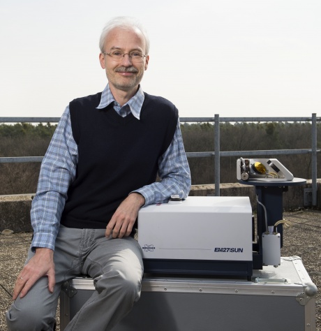 Frank Hase合作论文数Forschungszentrum Karlsruhe11
 Manvendra Dubey合作论文数Los Alamos National Laboratory;Physics Department, New Mexico Institute of Mining and Technology11
 Debra Wunch合作论文数Division of Geological and Planetary Sciences, California Institute of Technology10
 Vivienne Payne合作论文数Jet Propulsion Laboratory, California Institute of Technology;Orbiting Carbon Observatory 2;Orbiting Carbon Observatory 310
 Rigel Kivi合作论文数Greenhouse Gases and Satellite Methods group, Finnish Meteorological Institute10
 Joshua L. Laughner合作论文数Univ Calif Berkeley, Dept Chem, Berkeley, CA 94720 USA9
 Paul Wennberg合作论文数Ronald and Maxine Linde Center for Global Environmental Science, California Institute of Technology;Laboratory for the Study of Atmospheric Composition, California Institute of Technology9
 Robert Rosenberg合作论文数Jet Propulsion Laboratory, California Institute of Technology, Pasadena, CA, USA8Thomas E. Taylor合作论文数Northrop Grumman Corp8
 Mahesh Kumar Sha合作论文数Royal Belgian Inst Space Aeron BIRA IASB7
 Coleen Roehl合作论文数Division of Geological and Planetary Sciences, California Institute of Technology7Pauli Heikkinen合作论文数7Omaira García合作论文数Centro de Investigación Atmosférica de Izaña, Agencia Estatal de Meteorología7
 Christian Frankenberg合作论文数Division of Geological and Planetary Sciences, California Institute of Technology;Jet Propulsion Laboratory7
 Isamu Morino合作论文数Earth System Division, Satellite Observation Center, National Institute for Environmental Studies7Yao Te合作论文数6
 Kimberly Strong合作论文数Department of Physics, Faculty of Arts and Science, University of Toronto6
 John Worden合作论文数Jet Propulsion Laboratory, California Institute of Technology6
 Ralf Sussmann合作论文数6Thomas Blumenstock合作论文数Institute of Meteorology and Climate Research, Karlsruhe Institute of Technology6
 Thorsten Warneke合作论文数6
 Justus Notholt合作论文数Department of Physics, University of Bremen6
 Kazuyuki Miyazaki合作论文数Jet Propulsion Laboratory, California Institute of Technology6
 Helen M. Worden合作论文数Golorado State University;Atmospheric Chemistry Observations & Modeling Laboratory, National Center for Atmospheric Research, NASA6
 Shepard A. Clough合作论文数Atmospheric and Environmental Research , Inc6
 Mark W. Shephard合作论文数Environment and Climate Change Canada6
 Reinhard Beer合作论文数6Harrison Parker合作论文数Earth System Observations, Los Alamos National Laboratory5Markus Rettinger合作论文数5D. Fu合作论文数5Jessica L. Neu合作论文数5
 Nicholas M. Deutscher合作论文数School of Chemistry, University of Wollongong5Mingzhao Luo合作论文数5
 Laura Iraci合作论文数Earth Science Division, Ames Research Center, National Aeronautics and Space Administration5
 Dietrich G Feist合作论文数5
 Lukas Mandrake合作论文数Jet Propulsion Laboratory, California Institute of Technology5Pascal Jeseck合作论文数5Nicole Jacobs合作论文数4
 Qiansi Tu (涂倩思)合作论文数School of Mechanical Engineering, Tongji University4Eliezer Sepúlveda合作论文数4Richard A. M. Lee合作论文数4




