The Sacred Mountain and Holy Lakes located in the grand Yarlung Tsanpo Valley in the southern part of Ali Region,Tibet,that have been listed in the Preparation List of World Heritage Sites of Natural and Cultural Heritage include the Mount Gang Rinpoche,the Lake Mapam Yutso,the Lake Lana Tso.The four rivers originated in the vicinity are the Senge Kabab(the lion river),the langchen Kabab(the elephant river),the Macha Kabab(the peacock river),and the Tsangpo Kabab(the horse river),all which are the source of several world-famous rivers,such as the Indus River,the Ganges River,the Yarlung Tsanpo River and the Brahmaputra River.In the ancient tradition of China and India,the Gang Renboqi mountain and its surrounding lakes and rivers had extremely important symbolic meanings,and they were the geographical landmarks indicating the center of the cosmological world.In the historical period,there were four ancient divine worldviews being formed around the Sacred Mountain and Holy Lakes in Ali,Tibet.The first one is recognized by the local Bon religion of Zhangzhung culture in Ali area;the second one is the cosmological world center of anavatapta,which is recognized by Buddhism;the third one is the cosmological world center of Kunlun Mountain and Yao-chi,which is recognized by the ancient Chinese Book of Mountains and Seas;and the fourth one is the cosmological world center of Kailash(Kailasa),which was recognized by Hinduism.The four cosmography systems originated independently,formed their own special cognitive systems,and communicated and merged with other systems in history.The integration of the Kunlun Mountain cosmological world view and the Buddhist Anavatapta cosmological world view happened around 1 500 years ago,and the new world view had a wide range of impact on ancient Chinese cosmography.In 1720,this world view was projected on the surveyed map,and the ancient subjective cognition was finally located into the concrete geographical objects of the Sacred Mountains and Lakes.
通过对赣南地区历史地震资料系统地调查研究,以地域人文背景、史志记载情况等为切入点,综合考证历史地震记载的完整性,并在充分挖掘可用信息的基础上,对公元412年、1603年、1847年和1888年等历史地震事件进行了甄别和参数核定。研究表明,公元1500年之后赣南地区的地震记载相对较连续;区内地震活动呈自东南向西北逐渐减弱的趋势,且地震主要分布在NE或NNE向主干断裂附近,以及主干断裂与NW向断裂的交接复合地区;原地重复发生地震的频率相对较高。该结果可用于修定新版地震目录、开展重大建设项目工程场地的地震安全性评价及历史地震调查等工作中,为区域地震活动性研究、防震减灾规划决策等提供基础依据。
[目的/意义]随着大数据和人工智能技术的快速发展,智能驾驶汽车已经从理想变为现实.但是,智能驾驶离不开对地理定位与出行轨迹等个人信息的收集和处理,引发了人们对个人信息遭受泄露和滥用的担忧.[设计/方法]通过对域外相关立法、政策和实践进行文本梳理与比较分析可知,智能驾驶汽车个人信息保护的重点集中在权利配置、立法规划、司法救济、行政监管和行业自律等五个方面.[结论/发现]目前,在我国智能驾驶汽车个人信息保护领域,统一和细化的基础性法规付诸阙如,综合性的救济措施也尚未建立,从而严重阻碍了智能驾驶汽车的进一步发展.为了充分应对智能驾驶技术带来的个人信息和数据安全挑战,未来应当区分前置立法和事后救济,从国家立法、行政监管和行业自律等不同层面完善相应的法律制度和规则.
“塘泺”是北宋时期分布在冀中平原中部的巨大湖泊群,由大小数十个湖泊组成,东西绵延260 km,今天的白洋淀、文安洼、东淀、团泊洼、北大港,均属于“塘泺”的残余.本文在实地考察的基础上,综合集成历史文献记载、大比例尺地形图、ETM遥感数据、DEM数据、土壤调查数据、古地图数据,系统复原了北宋“塘泺”的空间分布范围与内部水系结构.研究表明,北宋“塘泺”的自然地理基础是分布在冀中凹陷带上以白洋淀、文安洼、团泊洼为代表的三大洼地,以及分布在这些洼地内的天然湖泊和河流.北宋朝廷出于军事防御目的,利用这些洼地和湖泊,开挖渠道,修筑堤坝,开辟水口,导引水源,调控水位,把位于今大清河以南的各条河流几乎全部导入了各区湖泊,把原有湖泊的水面尽量扩大,并将其串联成为相互连通的湖泊水面,从而形成了历史上冀中平原上最大的湖泊系统.
在大数据时代,个人信息保护的强化成为一种世界趋势,行政监管在其中发挥着越来越重要的作用.事实上,通过设立专门的监管机关、明确基本的监管目标和职责、制定详细的监管措施和程序协调规则等一系列手段,欧盟及其主要成员国、美国、日本、韩国和我国港澳台地区都已经建立了较为完备的个人信息保护监管体系.面对新兴科技的法律挑战与错综复杂的利益平衡需求,我国应当充分借鉴比较法上的有益经验,重点从主体、目标、措施和程序4个方面入手,积极探索建立个人信息保护的行政监管制度,从而形成对个人信息的全面保护.
China's Mu Us Desert, located in an energy-rich strategic base of the northwestern Loess Plateau, has acted as a crucial agro-pastoral transition zone for thousands of years. However, the area experienced notable climate and environmental change from 221 BCE to CE 907 (1128 years), which may have profoundly affected its landscape evolution up to modern times. To explore this process and associated driving mechanisms, we conducted a comprehensive study based on a dataset of 882 human archaeological sites (HASs), historical documents, and related environmental data of the Mu Us Desert and its surrounding area (MUDISA). We found that the MUDISA experienced large-scale immigration and an agricultural boom (790 HASs) during the Qin and Han dynasties (221 BCE-CE 220). This coincided with an ecologically favorable environment and may have potentially disturbed the desert's eco-environmental equilibrium. Coinciding with the deteriorating natural conditions, the MUDISA's animal husbandry replaced agriculture as the dominant subsistence economy during the era of disunity (CE 220-581, 33 HASs) and during the Sui and Tang dynasties (CE 581-907, 59 HASs). Although natural and political-economic factors together caused a sharp decline in number and scattering for HASs in the desert, people and livestock were widely distributed and maintained a high population level. This situation, coupled with the dry climate and fragile geographical environment, may have significantly accelerated the climate-driven desertification process from CE 220 to CE 907. This study highlights the long-term human-nature relationship and its impact on historical desertification in the Mu Us Desert, and may shed new light on historical environmental change in arid and/or semi-arid areas in northwest China and globally. (C) 2019 Elsevier B.V. All rights reserved.
东淀,是清代分布在京津冀平原上的一个湖泊群,由大小数十个湖泊组成.在明清时期的数百年间,东淀湖泊群经历了形成、扩张、收缩、消亡的过程,深刻影响了同时期周边地区人们的生产生活.文章依据历史文献记载,结合实地考察、遥感影像、GIS地理信息分析,系统复原了明清时期东淀湖泊群的演变过程.研究显示,东淀湖泊群的基本分布格局在明代中后期就已经存在,湖泊数量和分布范围在康熙三十九年至雍正四年时期达到鼎盛,乾隆中后期以后湖泊群逐渐淤积缩小,到光绪初年基本消亡.东淀湖泊群的形成与演变过程,与冀中凹陷带的低洼地势、大清河、永定河、子牙河的河道摆动、河流水沙特征、以及人类沿河筑堤、围湖造田活动密切相关.
通州是明清时期运河北端漕运枢纽城市.随着漕运的发展,通州城池自明初以来也日益扩展和完善.本文利用文献档案、古地图、实地考察和访谈等多种研究方法研究了通州城垣、护城河以及城内街巷分布和功能区布局,并重点论述了通州城的主要职能.明清通州城的发展演变与漕运有着密切的关系,古城城垣扩展受到仓储职能的较大影响,城池巧妙地利用运河水系集城防与漕运于一体,城市职能随着漕运发展而日渐扩充和完善.明清通州古城集中反映了北京地区的运河文化,是重要的运河文化遗产地,应加以深入研究并实施保护.
地名是人类覆盖在地球表面的一套地理符号系统,是一种特殊的文化景观.人类利用地名来确定方位、划定范围、区别地物的性质、宣示地物的归属,并在此基础上组织日常生产和生活.很难想象,如果地球表面没有了地名系统,人类社会可能会是一个怎样的混乱状况.
The Human Geography Discipline at Peking University (PKU) originated from the Economic Geography Discipline at the Geology and Geography Department which was established in 1955.The department is the first comprehensive teaching and research institute which has teaching,research,and practice activities in the Human Geography Discipline in China.Over the past 60 years,the Human Geography Discipline at PKU has been emphasizing the importance of both teaching and research,and giving profity to practice over theory.It has been experiencing a shift from focusing on the basic theory of the Human Geography Discipline to integrating both basic and applied research.Both an interdisciplinary way of research thinking and an interdisciplinary subject of human geography have been formed with a coordination between liberal arts,sciences and engineering.The Human Geography Discipline is operated together by the Department of Urban and Economic Geography,the Department of Urban and Regional Planning,and the Research Institute of Historical Geography.In the past 60 years,the Human Geography Discipline at PKU has achieved a series of well-recognized,innovative and high impact research outputs in both domestic and overseas in the fields of urbanization,urban system,urban and regional planning,land use assessment and planning,industrial location and regional industry evolvement,industrial clusters and innovation network,housing and real estate economy,scenic areas and world heritage,village and township development planning,urban social geography,time geography and behavior geography,historical geography,tourism geography research and planning,quantitative geography,transport geography and transport planning.These research outputs provide important scientific and technological supports to the national social and economic development,and have significant contributions to sustainable development of the society,the economic system and the urban-rural areas.In the future,the Human Geography Discipline at PKU will be engaged in servicing the national strategies and commit itself to pioneer the discipline development.It will continue to grow with a stress on communications and collaborations between disciplinary subjects.It will enhance its capability to serve the decision making for national strategy,and increase its reputation and influences in the field of human geography research in the world.
Based on the investigation on the spot, using historical records, archaeological investigation, ancient maps, aerial photographs and remote sensing images, this article has reconstructed and analyzed the urban mor-phology of ancient prefecture city, Guidefu (Shangqiu) in Henan, from the angle of urban historical geography. The research shows that the Guide City has a circular outer edge and a square inner edge, built in different peri-ods and had different functions, which means that the special form of Guide City“round outside but square in-side”in fact is the result of comprehensive effect of the natural environment and social environment, and the reflection of time changes, while it is not a simple product of“Feng-shui”thought. The changes of parts of the urban morphology of Guide City do not consistent with each other, the outer part of the city changed a lot while the inner city changed less, and the streets and blocks in the city are nearly the same as it was in Qing Dynasty. The urban morphology and scale of Guide City represent the general characteristics of prefecture cit-ies in Central China of Ming and Qing Dynasties, reflecting the characteristics of local culture and geographi-cal environment of Central China, typical and unique. The walls-gates-moat, the chessboard street pattern, land-mark building, such as Confucius' temple, and ancient residence distributed in dots and patches, constitute the main morphology of the ancient Guide City, and deserve special concern and protection. In the process of us-ing Guide City to develop local cultural industry, urban planners should have a profound understanding of ur-ban morphological characteristics, cultural landscape and the changing process of ancient city, in order to real-ize the combination of protection, development, and utilization in urban planning.
位于大运河北端的通州城土坝和石坝是明清时期朝廷专用漕运码头,在漕运史上曾经发挥巨大历史作用.本文首先探讨了京东运河水系变迁与通州城漕运码头的形成,详细介绍了曹运码头的功能设施、转运职能以及转运规模等,重点对漕运码头与运河漕运和京通二仓之间的关系等方面进行了详细的梳理和研究.通州漕运码头是体现通州城市形象的重要物质载体,也是北京地区重要的运河文化遗产,值得深入研究并加强保护.
毛乌素沙地及周边地区的环境问题,一直受到学术界的关注.明代延绥镇土地利用方式及规模对毛乌素沙地南缘的影响及其程度,也成为重要研究内容.从军地类型、分布及数量,可以看出万历时期延绥镇屯垦有巨大发展.运用历史地理学的历史文献研究等方法,揭示了延绥镇近边垦地的利用格局,探明了明万历末年延绥镇36城堡草场地与军垦地分布及数量.万历年间延绥镇近边地区景观的时空特征主要是军事和地理环境共同决定的.万历末至崇祯年间,由于连年战乱及自然灾害,延绥近边垦地的农业生产遭受了毁灭性的破坏,抛荒率基本在90%以上.明军垦的发展对此阶段毛乌素沙地南移的影响不大,自然原因可能是毛乌素沙漠变迁的根本原因.
搜集到1368-1911年苏沪浙地区风暴潮记录2119条,以此为基础,重建区域历史风暴潮发生的时间序列与空间分布.从年内分布情况看,苏沪浙地区历史风暴潮主要发生在6-10月,其中7-9月占80%,8月为全年最高值,占37%.68.56%的历史风暴潮发生在农历朔望日前后,其中发生在朔日前后(农历二十七至次月初四)的占35.57%,发生在望日前后(农历十三至十九)的占32.99%.小波分析结果显示:风暴潮年际变化时间序列存在54 a、30 a、17a周期.历史风暴潮引起的海侵多发生在沿海地区,苏北地区历史风暴潮海侵淹没界线达4m高程,长三角地区历史风暴潮海侵淹没界线达5m高程,杭州湾沿岸、浙东沿海地区则分别达5m和6m高程.
本文基于作者主持建设“世界文化地理”MOOC课程的实践思考,从MOOC课程的背景、内容、平台、教学设计、问题和数据分析等方面进行了梳理,阐述了作者近期对MOOC课程进行研究与思考所提出的教育观点。
研究清代陕蒙交界地区的土地利用问题,可以反映出该地区300多年以来人与环境之间的互动关系,具有重要意义.运用历史地理学的历史文献研究等方法,分析禁垦时期、限垦时期到放垦时期陕蒙交界区土地开垦的发展过程.结果表明:从动态的角度来看,清代陕蒙交界地区“南田北草”格局的分界线存在一个由“二边”—“大边”—康熙线—乾隆线—光绪线逐步北移的过程,但仍是“相对稳定”、“相对清晰”的.清代陕蒙交界地区“南田北草”格局分布及农业生产的发展,始终存在一个“理性垦殖”选择的过程,这是由特有的地理环境决定并受到当时政治经济形势的影响.
2013年12月6日,北京外语教学与研究出版社在北京大学图书馆举行了《北平历史地理》中文版的首发式.《北平历史地理》是著名历史地理学家侯仁之先生于1946-1949年留学英国利物浦大学地理系期间完成的博士论文.这篇英文论文,由于种种原因,一直没有在国内发表过,故学界内很少有人知道其中的具体内容.因此,有关侯仁之这篇64年前旧作的学术背景和研究内容、研究特色、学术价值,有必要做一点简要的介绍和说明.
Using 1844 different chorographies (regional descriptions) from the Ming Dynasty to the Republic Period and other related historical documents, 1180 records of dust storms on the North China Plain from 1464 to 1913 have been identified. These data are used to describe and analyse the temporal and spatial distribution of dust storms on the North China Plain during these years. Dust storms on the North China Plain occurred mainly in spring. Of all the identified dust storms, 72.85% occurred in the spring, 16.39% in winter, 8.71% in summer, and 2.05% in the fall. These storms occurred in cycles of 16–36 years. There was a negative correlation between the frequency of dust storms and the level of precipitation, and also a negative correlation between the frequency of dust storms and the frequency of spring or winter temperature departures. Spatially dust storms clustered in three fairly discrete northern, central, and southern districts. This spatial pattern was closely related to the movement of cold air systems in North China in winter or spring.
The surface water systems, which included local rivers and small lakes, were the very important elements in the complex of the old Peking city. The design and construction of old Peking city had successfully and organically combined the surface water systems with Chinese traditional ideology. The intimate relationship between nature and human society formed the unique oriental Shan-Shui (mountain and water) city, which was wonderfully expressed through the morphology of the Yuan Capital city. From the perspective of historical geography, to study the structure of the surface water systems of Peking city and their intimate relationships with the old cities will be helpful for the modern city’s future development.
This article researches the construction time, place, the builders, and the geographical significance of the Erbian Great Wall(or Chanxiaobian)and the Dabian Great Wall of the Yansui Fortification in the Ming Dynasty. The article draws a conclusion that was only the Erbian Great Wall was built under the supervision of General Yu Zijun. The construction time was from March to April in the ninth-year of Chenghua reign and from March to April in the next year. The Dabian Great Wall was firstly built by Wen Gui. The construction time of the Dabian Great Wall was from the September 2 in the seventeenth year of the Hongzhi reign to the December 22 in the next year, from the February 19 in to the April 1 in the second year of the Zhengde reign. Those great walls were mended based on the previous basis. The length of the Erbian Great Wall was 2013 Li (the Ming unit) and 195 steps, which equals to about 1183.4km. According to Jiu Bian Tu Shuo, the Dabian Great Wall was repaired too. The Dabian was 1087 Li, which equals to 639.2km. The construction process of the great walls of the Yansui Fortification directly reflects the development process of northwest frontier defence strategy of the Ming, and indirectly reflects the tensity of the frontier garrison cultivation. Also, it is significant in the research of environment changes along the zone of the North Shaanxi Great Walls.
 ShiGuang Shu (舒时光)合作论文数6
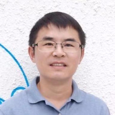 Yiyong Chen (陈义勇)合作论文数School of Architecture & Urban Planning, Shenzhen University3
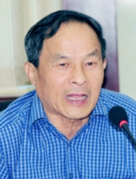 Zhengkai Xia (夏正楷)合作论文数College of Urban and Environmental Sciencess, Peking University3JIANG Wei-feng (姜卫峰)合作论文数2FuLai Xing (邢福来)合作论文数2XiBo Chen (陈喜波)合作论文数2
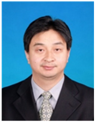 Chengzhong Wu (吴承忠)合作论文数School of Public Administration, University of International Business and Economics2Bengyu Wang合作论文数2
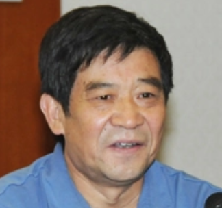 Yuqin Song (宋豫秦)合作论文数College of Environmental Sciences and Engineering, Peking University;China Center for Sustainable Development Research, Peking University2Zhang Di合作论文数1Hong-bo WANG (王洪波)合作论文数1Jing-yu JIA (贾敬禹)合作论文数1yi li (李羿)合作论文数1FeiFei Dong (董非非)合作论文数1HongLin Wu (武弘麟)合作论文数1KunShu Zhou (周昆叔)合作论文数1Jing Peng (彭静)合作论文数1
 Pengjun Zhao (赵鹏军)合作论文数Key Laboratory of Earth Surface System and Human-Earth Relations, Ministry of Natural Resources of China, School of Urban Planning and Design, Peking University1Jiang Wei-Feng合作论文数1
 Jian Lin (林坚)合作论文数School of Urban and Environmental Sciences, Peking University1
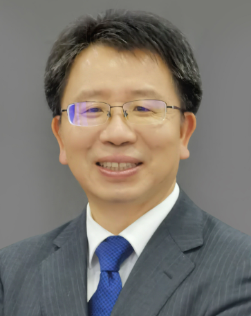 Canfei He (贺灿飞)合作论文数College of Urban and Environmental Sciences, Peking University1
 Bihu Wu (吴必虎)合作论文数School of Management, Shandong University1
 Duowen Mo (莫多闻)合作论文数College of Urban and Environmental Sciences, Peking University1
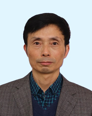 Yanguang Chen (陈彦光)合作论文数College of Environmental Sciences and Engineering, Peking University1
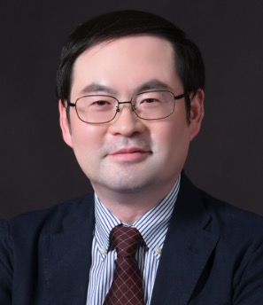 Yanwei Chai (柴彦威)合作论文数College of Urban and Environmental Studies, Peking University1
 Jian Feng (冯健)合作论文数College of Urban and Environmental Sciences, Peking University1Linlin Dai (戴林琳)合作论文数1Xiao Luo (罗潇)合作论文数1
 Guangzhong Cao (曹广忠)合作论文数College of Urban and Environmental Sciences, Peking University1
 Gang Zhang (张刚)合作论文数Peking University School and Hospital of Stomatology1
 Feng Song (宋峰)合作论文数College of Urban and Environmental Sciences, Peking University1
 Shengjun Zhu (朱晟君)合作论文数北京大学城市与环境学院1
 Changchun Feng (冯长春)合作论文数College of Urban and Environmental Sciences, Peking University1




